high elevations Coconut palms, pandanus trees, and breadfruit trees cover the landscape. Animal life is not found in abundance although, wild pigs, rats, and lizards can be seen from time to time. The ocean waters surrounding the island. The coral reef provides shelter to a large number of fish, sponge, and giant manta ray species. Climate data for Bora Bora Climate data for BoraBora Month Jan Feb Mar Apr May Jun Jul Aug Sep Oct Nov Dec Year Average high °C 30.2 30.8 30.5 30.3 29.5 28.6 28.1 28.1 28.6 29.1 29.4 29.6 29.3 (°F) Average low °C 25.1 25.3 25.5 25.5 25.1 24.2 23.8 23.8 24.0 24.3 24.6 24.8 24.7
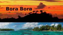
My dream destination is... FRENCH POLYNESIA The French Polynesia islands are located in the Pacific Ocean. It contains of many islands. The most famous are Tahiti, Bora Bora, Moorea. The islands are considered to be one of the most exotic places in the world; also known for its breathtaking beaches. The official language is French. SIGHTS Tahiti's volcano Rangiroa atoll Papetoai temple in Moorea Lagoon of Bora Bora Museums and botanical gardens in Tahiti Aquariums and zoos Tahitian dancing THINGS TO DO Jet skiing in Bora Bora Scuba diving in Tahiti Surfing in Tahiti Sailing in Bora Bora POLYNESIAN FOOD Known for its exotic fruits, fresh fish and vegetables, Strong influence from the French cuisine Seafood Restaurants in French Polynesia are from a wide variety of backgrounds including French,
Traveling Description Traveling is the movement of people or objects (conveyances) between relatively distant geographical locations. Travel may occur by human-powered transport such as walking or bycycling, or with vehicles, such as public transport, automobiles, trains and airplanes. Etymology The term "travel" originates from the Old French word travail. The term also covers all the activites performed during a travel (movement). A person who travels is spelled "traveler" in the United states, and "traveller" in the United Kingdom. Purpose and motivation Reason for traveling include recreation, tourism or vacationing, research travel for gathering information, for holiday to visit people, volunteer travel for charity, migration to begin life somewhere else, religious pilgrimages and mission trips, business travel, trade, commuting, and other reason, such as to obtain health care or fleeing war or for the enjoyment of traveling. Wo
Misso Keskkool New Zealand Precis Compiler: Maiki Joakit Instructor: Mailis Teppo Misso 2011 New Zealand is an island country in the south-western Pacific Ocean comprising two main landmasses (the North Island and the South Island), and numerous smaller islands, most notably Stewart Island/Rakiura and the Chatham Islands. The indigenous Mori language name for New Zealand is Aotearoa, commonly translated as land of the long white cloud. Population (1998): 3,801,000.New Zealand is notable for its geographic isolation; it is situated about 2,000 kilometres (1,200 mi) southeast of Australia across the Tasman Sea, and its closest neighbours to the north are New Caledonia, Fiji and Tonga. During
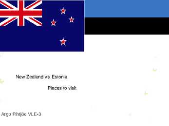
New Zealand vs Estonia Places to visit Argo Pihtjõe VLE-3 Some facts: Full name: Republic of Estonia Full name: New Zealand Population: 1.3 million (UN, 2010) Population: 4.3 million (UN, 2010) Capital: Tallinn Capital: Wellington Area: 45,227 sq km (17,462 sq miles) Area: 270,534 sq km (104,454 sq miles) Major languages: Estonian Major languages: English, Maori Major religion: Christianity Major religion: Christianity Life expectancy: 69 years (men), 79 Life expectancy: 79 years (men), 83 years (women) (UN) years (women) (UN) Monetary unit: euro Monetary unit: 1 New Zealand dollar Main exports: Machinery, textiles, wood ($NZ) = 100 cents products Main exports: Wool, food and dairy GNI per capita: US $14,060 (World products, wood and paper products Bank,
Alberta The capital of Alberta is Edmonton. The population is 3.7 million people and there are many nationalities. Besides English and French there are also immigrants from Scotland, Ireland, Wales, Germany, Ukraine and Scandinavia. In Edmonton and Calgary there are also historic Chinatowns, and Calgary has Canada's third largest Chinese community. Geographical features Alberta covers an area of 661,848 square kilometres, an area about 5% smaller than Texas or 20% larger than France. This makes it the fourth largest province after Quebec, Ontario, and British Columbia. To the south, the province borders on the 49th parallel north, separating it from the U.S. state of Montana, while on the north the 60th parallel north divides it from the Northwest Territories. To the east the 110th meridian west separates it from the province of Saskatchewan, while on the west its boundary with British Columbia follows the 120th meridian west south from the Northwest Territories at 60°N until it reac
CANADA Geography Canada is the world's second largest country in total area after Russia , since it covers nearly 10 million square kilometres, but is one of the most sparsely populated, with only about 34 million inhabitants. The majority of them live within 300 kilometres of Canada's southern border. Much of the rest of Canada is uninhabited or thinly populated, because the country has a rugged terrain and severe climate. Canada extends across the continent of North America, from Newfoundland on the Atlantic coast to British Columbia on the Pacific coast and northward into the Arctic Ocean. Canada shares land borders with the United States to the south and north-west. Canada is a land of great variety. Towering mountains, crystal-clear lakes, and lush, green forests make Canada's far west a beautiful region. Farther inland, fields of wheat and other grains cover Canada's vast prairies. Thes fertile farmlands contrast vividly with t
spirit and ghosts. The belief in a personal spirit was based on the Dreamtime stories that told the people that birth was the result of a spirit-child entering a woman's body. Or in some parts of the country, birth had been an act of the creators. The Aborigines considered some places to be sacred. In some parts of Australia the tribes called the places where initiation ceremonies were held, bora grounds. They were called Buna grounds in other parts of the country, but the sites were not randomly chosen and were used for thousands of years by the tribe. The bora ground itself was identified by two circles that were drawn on the ground or were formed by rocks or pebbles. The circles were connected by a path and other symbols were drawn into the earth or carved into trees near the grounds. These symbols were highly significant in ceremonies


Kõik kommentaarid