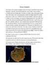
Volcanic eruption (summaries) 1. Volcanic eruption happens when various gases and lava are discharged from a volcanic vent. The most dangerous type of volcanic eruption is when freshly erupted magma is flowing. During the explosion, magma with rock fragments, flies into the air and then falls down. Magma, which have temperatures over 1200 degrees, may flow further than 40 km from the original disaster site. The lava destroys many building and plants also volcanic ash will harm humans when they breath it in. 2. The volcanic eruption of Mount Kelud on Java island blasted ash and debris 18 kilometers into the air. Eruption killed three people and forced 100,000 people to evacuate the area. Mount Kelud, what is 1,731 meter high, had been rumbling for several weeks and was under close observation. The disaster agency said that volcano had spewed millions of cubic meters of debris into the air. Breathing was painful,
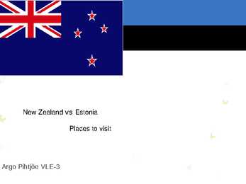
The beaches have a range of coloured sand from gold to white that look out onto the clear waters of the Tasman Sea. Top ten places to visit in New Zealand Queenstown Beautiful lake side town is surrounded by mountains and is one of New Zealands premier tourist destinations. The home of bungee jumping and jet boating. Queenstown is also one of the southern hemispheres premier skiing destinations Rotorua Famous for its volcanic activity. Every reserve has spectacular examples of geysers, boiling pools, hot springs, boiling mud, volcanic terraces, and craters. Mt Tarawera nearby volcano offers spectacular scenery including superb views inside the rim of the volcano Best area in the country to experience and learn about Maori Culture. Top ten places to visit in New Zealand Bay of Islands Bay of Islands is the finest maritime park in New Zealand.
Acid rain Priit Norak, 11A Acid rain is rain that has a higher than normal acid level. Causes of acid rain Power plants Exhaust from cars Burning oil or natural gas Volcanic eruptions Intense lighting How? Effects of acid rain Heart and lung problems Polluted water Dead fish and animals Destroyed forests Steel corrosioin Stone erosion How to reduce acid rain? Reduce CO2 emission from cars Use electric cars Use alternative energy sources Reduce the ammount of energy we use Public transport Spread knowledge! Let’s keep our Earth healthy!
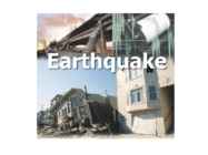
EARTHQUAKES What is earthquake? • the result of a sudden release of energy in the Earth's crust that creates seismic waves. • the earthquakes are measured by magnitudes • caused mostly by rupture of geological faults, but also by other events • such as volcanic activity, landslides, mine blasts, and nuclear tests • earthquakes manifest themselves by shaking and sometimes displacement of the ground Japan earthquake 2011 • 9.03 magnitude undersea megathrust earthquake • Triggered powerful tsunami waves • After the World War ll the most difficult crisis for Japan Luzon earthquake 1990 • 7.8 magnitude earthquake in Philippines How to be Prepared • Electricity, water, gas and telephones may not be working
white Symbols elk, purple heather flower, dipper Biggest rivers Glomma, Otra Famous for - 19th century, Hendrik Ibsen made Norway famous for plays Landscape rugged coastline, mountains, fjords Republic of Iceland Capital - Reykjavik Language Icelandic, fluent English Size 103,000 square kilometers Population 299,000 Flag - blue, red Scandinavian cross outlined in white Iceland is a volcanic island in the North Atlantic Ocean Nature volcanoes, lava fields, waterfalls, geysers and hot pools Kingdom of Denmark Capital - Copenhagen Language - Danish Size 43,094 square kilometers Population 5,564,219 Flag red,white Scandinavian cross Emblem 3 crowned lions Symbols swan, red clover, beech Denmark is called the home of the Vikings Famous writer H.C.Andersen, meremaid statue, football stadium, art galleries
New Zealand belongs to Polynesia, a large island group. The country consists of two main islands The North Island and the South Island and several dozen much smaller islands. The population is 4.1 million. New Zealand is a beautiful country of snowcapped mountains, green lowlands, beaches and many lakes and waterfalls. No place is more than 130 kilometres from the coast. Lakes, rivers, and waterfalls are found throughout New Zealand. Most of the lakes lie in the volcanic plateu of the North Island and in glacial valleys near the Southern Alps of the South Isaland. On both islands the rivers rise in the mountains and flow down to the sea. The rapid flow of New Zealand's rivers makes them important sources of hydroelectric power. New Zealand has hundreds of waterfalls. Sutherland falls on the South Island is the fifth highest waterfall in he world. New Zealand enjoys a temperate and moist climate, without extremes of heat or cold
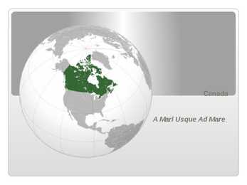
forest regions, including extensive boreal forest on the Canadian Shield Canada has more lakes than any other country, containing much of the world's fresh water Geography There are also freshwater glaciers in the Canadian Rockies and the Coast Mountains Canada is geologically active, having many earthquakes and potentially active volcanoes, notably Mount Meager, Mount Garibaldi, Mount Cayley, and the Mount Edziza volcanic complex The volcanic eruption of the Tseax Cone in 1775 was among Canada's worst natural disasters, killing 2,000 Nisga'a people and destroying their village in the Nass River valley of northern British Columbia The eruption produced a 22.5kilometre (14.0 mi) lava flow, and, according to Nisga'a legend, blocked the flow of the Nass River Canada has strong democratic traditions upheld through a parliamentary system within the construct of constitutional monarchy
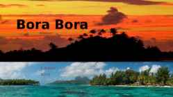
Agricultural practices produce sugar, vanilla, rum, and copra (used to extract coconut oil). Despite all of these activities, tourism is by far the leading economic contributor. The island has several hotels to cater to tourists, including twelve 4 and 5-store places like Club Med, for example. 3 Bora Bora experiences a tropical, humid climate with relatively stable temperatures year- round. The island is characterized by its volcanic rock mountains and raised coral beds found at high elevations. Coconut palms, pandanus trees, and breadfruit trees cover the landscape. Like most islands, animal life is not found in abundance although, wild pigs, rats, and lizards can be seen from time to time. The ocean waters surrounding the island. The coral reef provides shelter to a large number of fish, sponge, and giant manta ray species. 4 Considered to be one of the most spectacular tropical islands in the world, Bora Bora is an
Austraalia 1.Pinnamoe kujundavad valdavalt madalad lavamaad, tasandikud ja jäänukmäed. Põhjaosas on mäestik madalam ja laiem ning koosneb mitmest rööpsest ahelikust ja mägedevahelisest lavamaadest, lõunas ta aheneb ning koosneb mõnest massiivist. Lõunapoolseimas ja kõrgemais osas on alpiinset pinnamoodi. Austraalia madalaim punkt on Eyre’i järv ja kõrgeim mägi on Big Benivulkaan. 2.Pinnamood soodustab turistide tulekut, sest neil on mida vaadata seal. Tänu Austraalia kuivale sisealale on seal spetsialiseerutud ekstensiivsele lamba-, lihaveise- ja nisukasvatusele. Tihedama asustusega rannikualadel on spetsialiseerutud intensiivsele tehniliste kultuuride, köögi- ja puuvilja ning piimakarja kasvatamisele. Kuna riigis on vahemaad suured, siis on enim soositud õhutransport. Eluliselt tähtis on õhutransport hõredalt asustatud kesk- ja lääneosas. 3. Austraalia loodusvarad on boksiit, süsi, rauamaak, alumiin...
The clock chimes every 15 minutes and can be heard for a radius up to 5 miles. Stonehenge Location: southern England. Built 2000BC to 3000BC. Archaeologists think it was an ancient place of burial. Stonehenge had about 1 million visitors in 2012. It was added to the UNESCO's list of world heritage in 1986. Giant's Causeway Location: Northern Ireland. It developed 50 to 60 million years ago due to intense volcanic activity. It's the fourth greatest natural wonder in the UK. Most of the rocks are hexagonal, but some have four, five, seven or eight corners. The tallest are 12 metres tall. Snowdonia national park Location: north Wales. The highest mountain is Snowdon which is 1085 metres tall. The national park covers 2140 square kilometres. The park has about 6 million visitors every year. Windsor Castle Location: Berkshire. The original castle was built in the 11th century.
Käekäik Alates 1832, on Mauna Loa puhkenud 39 korda. Mauna Loa viimane purse toimus 24 märts - 15. aprill 1984. Viimastel vulkaanipursetel vulkaan ei põhjustanud surmajuhtumeid, kuid vulkaanipursked 1926 ja 1950 hävitasid külad ja linna Hilo. Mauna Loal on väga palju suuri ja ilusaid Hard rock( ehk kõvasi kaljusid ), mis ulatuvad ka meresügavustesse .Vaniadm jäänused Mauna Loal on võimalik leida huvitavaid kivimi vorme mida tuntakse nime all "Ninole Volcanic Series"(Ninole vulkaani seeria ). See on rida kõrgete seintega mägedest, mis koosnevad õhukeste kihtidena. Vastavalt USGS hinnangul purskas vulkaan keskmiselt 1 kord aastas iga 6 aasta järel. Mauna Loa on suurim aktiivne vulkaan maailmas. Observatooriumid Mauna Loa põhjaküljel asub Ühendriikide riikliku ookeani- ja atmosfääri uurimiskeskuse observatoorium, kus muude mõõtmiste kõrval on registreeritud ka atmosfääri süsihappegaasi kontsentratsiooni
Gran Canaria Gran Canaria is the second most populous island of the Canary Islands after Tenerife, and the third largest in area after Tenerife and Fuerteventura. Gran Canaria is located southeast of Tenerife and west of Fuerteventura. The island is of volcanic origin, mostly made of fissure vents. Gran Canaria is the second most populous island of the Canary Islands after Tenerife. Gran Canaria's surface area is 1,560 km² and its maximum altitude is 1,949 meters (Pico de Las Nieves). It has a round shape, with a diameter of approximately 50 km. About 80% of the volume of the island was formed during the Miocene period, between 14 and 9 million years ago. This is called the "Old Cycle" and is estimated to have lasted some 200,000 years and
before it begins to get to higher ground. Flooding is extremely dangerous and has the potential to wipe away an entire city, coastline or area, and cause extensive damage to life and property. It also has great erosive power and can be extremely destructive, even if it is a foot high. A tsunami (pronounced sue-nahm-ee) is a series of huge waves that can cause great devastation and loss of life when they strike a coast. Tsunamis are caused by an underwater earthquake, a volcanic eruption, an sub-marine rockslide, or, more rarely, by an asteroid or meteoroid crashing into in the water from space. Most tsunamis are caused by underwater earthquakes, but not all underwater earthquakes cause tsunamis - an earthquake has to be over about magnitude 6.75 on the Richter scale for it to cause a tsunami. About 90 percent of all tsunamis occur in the Pacific Ocean. Many tsunamis could be detected before they hit land, and the loss of
2.The three main things that alter the energy balance of the climate system are the changes in the atmospheric abundance of greenhouse gases and aerosols, in solar radiation and in land surface properties. 3.The two sources for the increased concentration of CO2 in the atmosphere are production, distribution and consumption of fossil fuels and as a by-product from cement production. 4.The two main sources of methane pollution are agriculture and fossil fuel use. 5.Volcanic aerosols are not included to the list because of their episodic nature. 6.The world's oceans absorb more than 80% of heat. 7.The total 20th-century rise is estimated to be 0.17 [0.12 to 0.22] m. 8.Arctic has seen twice the increase of global temperature rate. 9.Increased precipitation has been observed in eastern parts of North and South America, northern Europe and northern and central Asia. 10.Decreased precipitation has been observed in the Sahel, the Mediterranean, southern
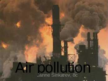
Air pollution Janne Sinkarev, 8c Air pollution · Natural sources such as: Dust,smoke, volcanic eruption and · What is it? also forest fire. · Air pollution is the introduction of · Anthropogenic sources such as: chemicals, particulate matter, or aerosol sprays, toxic biological materials that cause gases,rocketry and some more for harm or discomfort to humans or millitary use. Also chemicals and other living organisms, or dust. Also transport: cars, motor
such as James Cook in 1777 • Interestingly, there is no "B," in the local Tahitian language, so its actual name is Pora Pora, meaning "first born" Vaitape The largest city Population 4 927 Some supermarkets Many fruits are imported from Faaa Weather And Biodiversity Tropical, humid climate with relatively stable temperatures yearround Characterized by it’s volcanic rock mountains and raised coral beds found at high elevations Coconut palms, pandanus trees, and breadfruit trees cover the landscape. Animal life is not found in abundance although, wild pigs, rats, and lizards can be seen from time to time. The ocean waters surrounding the island. The coral reef provides shelter to a large number of fish, sponge, and giant manta ray species.
walls of water can cause widespread destruction when they crash ashore. WHAT CAUSES A TSUNAMI? These awe-inspiring waves are typically caused by large, undersea earthquakes at tectonic plate boundaries. When the ocean floor at a plate boundary rises or falls suddenly, it displaces the water above it and launches the rolling waves that will become a tsunami. WHAT CAUSES A TSUNAMI? Tsunamis may also be caused by underwater landslides or volcanic eruptions. They may even be launched, as they frequently were in Earth’s ancient past, by the impact of a large meteorite plunging into an ocean. TSUNAMI Can race up to 805 kilometers an hour. At that pace, they can cross the entire expanse of the Pacific Ocean in less than a day. And their long wavelengths mean they lose very little energy along the way. In deep ocean, tsunami waves may appear only a foot or so high
Disastrous- Disaster- katastroof katastroofiline Explosive- Explosion- plahvatus Explode- plahvatuslik plahvatama Extinct- väljasurnud Extinction- välja suremine Poisonous- Poison- mürgitus Poison- mürgitama mürgitatud Renewable- Renewal- uuendus Renew- uuendatav uuendamine Volcanic- Volcano- vulkaan vulkaaniline Inspected- Inspector- uurija Inspect- uurima kontrollitud Guarded- kaitstud Guard- valvur Guard- valvama Assisted- abistatud Assistant- abiline Assist- abistama Advised Advisor- nõuandja Advise- nõu andma Actress- näitleja Act- näitlema Instuctor- juhendaja Instruct- juhendama
Population. Climate The total area is 268,680 km² and the population is approximately 4,266,000. The density of population is about 16.1/km2. New Zealand's area is a bit smaller than Italy's or Japan's but bigger than England's. The biggest of New Zealand's islands is South Island. On the South Island there are 18 mountains that are higher than 3000m. The highest mountain is Cook mountain - it's 3754m high. North Island isn't as mountainous as South Island but it's volcanic. The highest mountain there is Ruapehu mountain - it's 2797m high and currently active. The landscape of New Zealand is very popular with making movies and TV- shows - for example the trilogy of "Lord of the Rings" and "The Last Samurai" are filmed there. The climate is temperate all over the country. The temperature rarely goes under 0°C or over 30° in populated areas. The weather on the west coast is moist and cool
America and the USA, with a summit elevation of 6,194 m above sea level as the same Death Valley in California with 86 m below sea level is the lowest point on the continent. Yellowstone National Park is one of the most visited natural attractions in the United States. Founded way back in 1872, Yellowstone is the oldest national park in the world and covers territory in three states, namely Idaho, Montana and Wyoming. The park is not only famous for its geysers and other volcanic attractions but also for its richness of wildlife including bears and herds of buffalos. Once inhabited the present United States from Coast to Coast original Native (Indian) Americans. Indians, the name commonly applied to the people found by Columbus in America. They introduced colonists to clothing such as moccasins and ponchos, as well as to cotton, which is used to make many clothes today. Much of early Indians' clothing was made from deer skins
New Zealand's coastline is packed with deep coves, bays, intricate harbours, long sounds, and steep fiords. Its territorial waters stretch from the sub-tropical through to the sub-antarctic. Both islands tend to have better swimming beaches on their eastern coasts and the further north you go. The west coasts of both islands are quite rugged with cliffs and more unsettled weather. There are however some suitable swimming and bathing beaches here, with iron (volcanic) sand beaches (black sand) being common on the North Island. The longest beach in New Zealand is the 90 mile beach, which is actually about 60 miles long. This beach is famous for its huge sand dunes and resembles the Sahara Desert in places. This beach occupies the north western coastline of the North Island. New Zealand also has some great surf breaks in both islands. The most famous break is situated west of Hamilton in a small town called Raglan. Raglan is known for its unusually
in the north). On the east and west coast, average high temperatures are generally in the low 20s °C (70s °F), while between the coasts the average summer high temperature ranges from 25 to 30 °C (75 to 85 °F) with occasional extreme heat in some interior locations exceeding 40 °C (104 °F). Canada is also geologically active, having many earthquakes and potentially active volcanoes, notably Mount Meager, Mount Garibaldi, Mount Cayley and the Mount Edziza volcanic complex. Economy Canada's main economic resources are minerals( nickel, uranium ), timber( the wood from its forests ), grain, petroleum and natural gas. Canada is one of the world's most important suppliers of agricultural products, with the Canadian Prairies one of the most important suppliers of wheat, canola and other grains. Canada is also one of the world's most important
pollution. CAUSES There are many different chemical substances that contribute to air pollution. These chemicals come from a variety of sources. Among the many types of air pollutants are nitrogen oxides, carbon monoxides, and organic compounds that can evaporate and enter the atmosphere. Air pollutants have sources that are both natural and human. Now, humans contribute substantially more to the air pollution problem. Forest fires, volcanic eruptions, wind erosion, pollen dispersal, evaporation of organic compounds, and natural radioactivity are all among the natural causes of air pollution. Usually, natural air pollution does not occur in abundance in particular locations. The pollution is spread around throughout the world, and as a result, poses little threat to the health of people and ecosystems. Though some pollution comes from these natural sources, most pollution is the result of human activity
meet. These circumstances combine to make an area that truly is like no other place on earth. Galapagos is comprised of 13 major islands, more than 120 smaller islets and rocks, and the surrounding ocean. The total land mass is almost 8,000 sq. km. Highest peak is Wolf Volcano reaching 1707m. The present islands are all younger than 4 million years and were formed separately from other land masses as a result of volcanic eruptions. The Galapagos were discovered in 1535 by Fray Toms de Berlanga, the Bishop of Panama. He was sailing from Panama to Peru when he accidentally discovered the islands. Islands became a favorite hideout for Pirates and the favorite location for whale hunters. After whales were locally cleared the whalers went there for tortoises, an estimated 200 000 or more adults had been removed. The island of Floreana was populated with a group of convicts' in October 1832
from your choice of scented candle Exotic, Vanilla or Rose. Includes the beautiful La Ric candle as take home gift in true Burj Al Arab style. Assawan Around the World Signature Massage Carefully selected techniques from traditional Shiatsu, Thai, Swedish and Balinese massages are combined to form 85 minutes of sheer bliss. Chakra Balancing Hot Stone Massage This holistic treatment begins as the body is massaged with aromatherapy oils using volcanic hot stones. Gentle stretching helps release deep-seated tension around the neck and shoulders and stones are positioned along the spine and on the energy points. Wellbeing Body Massage A classic Swedish Massage utilizes long, flowing strokes, using THÉMAÉ nourishing Baume des Quatre Thés. Organic Herbal Bag Massage Balinese Massage Aromatherapy Massage Thai Massage Ultimate Wellbeing for Life Program A completely integrated 12 week program including our Ultimate
Of all of the dioxins and furans, one, 2,3,7,8tetrachloropdibenzo dioxin (2,3,7,8 TCDD) is considered the most toxic. · PCBs were produced commercially in large quantities until production was stopped in 1977. . Emission sources Dioxins are mainly produced as unwanted byproducts of industrial processes and there is no intentional production or use. They can also to a small extent be formed naturally in forest fires or volcanic activity. Examples of activities resulting in dioxin emissions are waste incineration, burning fuels (wood, coal or oil), chlorine bleaching of pulp and paper and chlorinated pesticides manufacturing. Burning of many materials containing chlorine, such as plastics and wood treated with pentachlorophenol also produce dioxins. According to a study in the context of the Stockholm Convention, the main sources for emissions of dioxins to air in EU25 are Residential combustion (~ 30%)
in 1713, Newfoundland, Hudson Bay, and Nova Scotia (Acadia) were lost to England. During the Seven Years' War (17561763), England extended its conquest, and the British general James Wolfe won his famous victory over Gen. Louis Montcalm outside Quebec on Sept. 13, 1759. The Treaty of Paris in 1763 gave England control. Nature: Canada is also geologically active, having many earthquakes and potentially active volcanoes. The volcanic eruption of Tseax Cone in 1775 caused a catastrophic disaster, killing 2,000 Nisga'a people and the destruction of their village in the Nass River valley of northern British Columbia; the eruption produced a 22.5-kilometre (14.0 mi) lava flow, and according to legend of the Nisga'a people, it blocked the flow of the Nass River. As of 2008, there are 36 National Parks and six National Park Reserves.. The biggest natural parks are Banff National Park, Gros Morne National
I/you/he/she/we/they will not have been studying I/you/he/she/we/they won’t have been studying Will he have been working? Both the Future Perfect Simple and Future Perfect Continuous forms refer to the time which we look back at from a future point. 1.We use the Future Perfect to say that something will be ended, completed, or achieved by a particular point in the future. By the time we phone he’ll already have started. Let’s hope the volcanic eruption will have finished before we arrive on the island. By the time you get home I will have cleaned the house from top to bottom. In two years’ time I'll have finished this book, so I hope I will be able to join you on your trip around the world. Please don’t come too early tomorrow. I will have been working on my essay till late tonight, so I may want to sleep longer in the morning. 6 2
Kahju ulatus üle miljardi dollari. Plahvatusest tekkinud tuhapilv tegi tiiru ümber maakera 17 päevaga. 1980. aastal toimus veel viis väiksemat purset, mis paiskasid tuhapilvi peaaegu 10 km kõrgusele. Teadlaste hinnangul kulub vähemalt sada aastat, enne kui 18. mail 1980 tekkinud kraater täitub ja vähemalt paarsada, enne kui St. Helens saavutab oma endise kõrguse 2950 m üle merepinna. 1982. aastal rajati Mount St. Helens National Volcanic Monument ehk vulkaanipark, mida aastas külastab 7 miljonit külastajat. Piki mäekülgi looklevat teed piirab lopsakas mets, ent äkki on sametine rohelus nagu noaga ära lõigatud. Nii kaugele kui silm seletab, sirutuvad taevasse haralised surnud puutüved. Vaade on nii hingematvalt troostitu, et mõistus keeldub nähtut uskumast. Surmametsast välja pääsenut ootavad ees lööklaine poolt siledaks vormitud mäekuplid, kus orgudes on mingil kindlal kõrgusel puude ladvad maha niidetud
481.Walnuts- kreeka pähkel, pähklipuu 482.Variation- muutus, erinevus 483.Vary erinema, muutma 484.Waterfall- kosk, juga, kaskaad 485.Waterhole- veesilm 486.Waterproof - veekindlad 487.Wealthy jõukas, rikkas 488.Weatherproof - ilmastikukindel 489.Weed- umbrohi 490.Versatile plant- mitmekülgne taim 491.Wider area of concerns- laiemad huvid 492.Willow bark- paju puukoor 493.Windbreak- tuulevari 494.Windscreen- tuuletõke 495.Vista- vaade 496.Vivid värvikas 497.Void- tühistama 498.Volcanic material vulkaaniline materjal 499.Woodshed- puukuur 500.Working at grade palgaastmelt töötades Y 501.Yard-aed 502.Your own interpretation of- enda tõlgendus.....
Gulf coast and surrounded by a strip of marshes. The Cordilleras consist of rows of mountain ranges with the heights of up to 3000-5000 m. In Alaska the mountain ranges stretch in the west-east direction. 4 On the territory of the USA the mountain ranges stretch in the north-south direction. The first from the east are the Rocky Mountains. West of the Rockies lie vast plateaus and tablelands: the volcanic Columbia Plateau, the Great Basin, the Colorado Plateau. Further west is a narrow belt of the Cascade Mountains, and the Sierra Nevada Range Still further west lies an area of valleys. The forests cover 30% of the US. In the southern part of Alaska grow coniferous trees, notably spruces and firs. Around the Great Lakes and New England are mixed forests of pines, maples, elms, birches, oaks and beeches. Along the Gulf of Mexico grow magnolia, red and black gum, cypress and mangrove.
forest climate. Although it does not contain the diversity of species of a tropical rain forest, the island's west coast does have the oldest and tallest trees in Canada: western red cedars 1,300 years old and Douglas firs over 90 metres high. Canada, Kärt Kalvet 8a From British Columbia to just east of the Alberta border the land is young, with rugged mountains and high plateaus. Signs of geologically recent volcanic activity can be seen in Garibaldi Provincial Park in southern British Columbia and at Mount Edziza in the north. The Rocky Mountains, the Coast Mountains and other ranges, running north to south, posed major engineering problems for the builders of the transcontinental railways and highways. Canada's highest peaks, however, are not in the Rockies, but in the St. Elias Mountains, an extension of the Cordillera stretching north into the Yukon and Alaska. The highest point in
the Azores, while the Serra da Estrela on the mainland (the summit being 1,991 m (6,532 ft) above sea level) is an important seasonal attraction for skiers and winter sports enthusiasts. The archipelagos of Madeira and the Azores are scattered within the Atlantic Ocean: the Azores straddling the Mid-Atlantic Ridge on a tectonic triple junction, and Madeira along a range formed by in-plate hotspot geology (much like the Hawaiian Islands). Geologically, these islands were formed by volcanic and seismic events, although the last terrestrial volcanic eruption occurred in 195758 (Capelinhos) and minor earthquakes occur sporadically, usually of low intensity. Portugal's Exclusive Economic Zone, a sea zone over which the Portuguese have special rights over the exploration and use of marine resources, has 1,727,408 km 2. This is the 3rd largest Exclusive Economic Zone of the European Union and the 11th largest in the world. CLIMATE
lot of energy in summer. It uses submerged pipes as a heat sink for climate control systems. Lake-bottom water is a year-round local constant of about 4 °C. Geothermal Energy The centre of the Earth is around 6000 degrees Celsius - easily hot enough to melt rock. Even a few kilometres down, the temperature can be over 250 degrees Celsius. In general, the temperature rises one degree Celsius for every 36 metres you go down. In volcanic areas, molten rock can be very close to the surface. Sometimes we can use that heat.Geothermal energy has been used for thousands of years in some countries for cooking and heating. The name "geothermal" comes from two Greek words: "geo" means "Earth" and "thermal" means "heat". Geothermal power is cost effective, reliable, and environmentally friendly, but has previously been geographically limited to areas near tectonic plate boundaries. Recent technological advances have
the surface. Or, we can make use of the stable temperatures near the surface of the earth to heat and cool buildings. 13.2 Where is geothermal energy found? Most geothermal reservoirs are deep underground with no visible clues showing above ground. 43 Geothermal energy can sometimes find its way to the surface in the form of: · volcanoes and fumaroles (holes where volcanic gases are released) · hot springs and · geysers. Picture 13.2. Ring of fire The most active geothermal resources are usually found along major plate boundaries where earthquakes and volcanoes are concentrated. Most of the geothermal activity in the world occurs in an area called the Ring of Fire. This area rims the Pacific Ocean. When magma comes close to the surface it heats ground water found trapped in porous
Asthenosphere PACIFIC ' -t-~.'-...,-, EOIJATOR_ PLA ::..:..:T-=E,---+ ~_---..+----/ Plate Boundaries and Volcanoes .. Volcano Plate boundary Some Notable Volcanic Eruptions - - Direct ion of plate movement Date Locat ion 1500 s.c, Thira (Santorini), Greece A vo lc an o IS an op enmg 10 th e Earth's cru se o fte n capped by a co ne -shaped h ill or Aug. 24, A.D. 79 Vesuvius, Italy
= - so y a s k i n gS st o p r e s e ntth e i ro p i n i o ntso t h e Suggested AnswerKey -,tulnr;cs::d Answer Key TextA: NaturalBeauty;NaturalHeat;Cavesof Health;etc Tt'ri I TextB: ThermalWonderland;Volcanic Health;etc ,:'r - :n mineralcontentof thewater hashealingproperttes. ,, : - :=:cle visittheAinsworth HotSprings 44 forrelaxation and lrq-":ieuticpurposes. l" i , --,:_.:re darkandhumid. :i
= - so y a s k i n gS st o p r e s e ntth e i ro p i n i o ntso t h e Suggested AnswerKey -,tulnr;cs::d Answer Key TextA: NaturalBeauty;NaturalHeat;Cavesof Health;etc Tt'ri I TextB: ThermalWonderland;Volcanic Health;etc ,:'r - :n mineralcontentof thewater hashealingproperttes. ,, : - :=:cle visittheAinsworth HotSprings 44 forrelaxation and lrq-":ieuticpurposes. l" i , --,:_.:re darkandhumid. :i
= - so y a s k i n gS st o p r e s e ntth e i ro p i n i o ntso t h e Suggested AnswerKey -,tulnr;cs::d Answer Key TextA: NaturalBeauty;NaturalHeat;Cavesof Health;etc Tt'ri I TextB: ThermalWonderland;Volcanic Health;etc ,:'r - :n mineralcontentof thewater hashealingproperttes. ,, : - :=:cle visittheAinsworth HotSprings 44 forrelaxation and lrq-":ieuticpurposes. l" i , --,:_.:re darkandhumid. :i
= - so y a s k i n gS st o p r e s e ntth e i ro p i n i o ntso t h e Suggested AnswerKey -,tulnr;cs::d Answer Key TextA: NaturalBeauty;NaturalHeat;Cavesof Health;etc Tt'ri I TextB: ThermalWonderland;Volcanic Health;etc ,:'r - :n mineralcontentof thewater hashealingproperttes. ,, : - :=:cle visittheAinsworth HotSprings 44 forrelaxation and lrq-":ieuticpurposes. l" i , --,:_.:re darkandhumid. :i
We sat in front of Charlie's house for hours, as the sky darkened and rain plummeted around us in a sudden deluge. I tried to describe impossible things like the scent of creosote -- bitter, slightly resinous, but still pleasant -- the high, keening sound of the cicadas in July, the feathery barrenness of the trees, the very size of the sky, extending white-blue from horizon to horizon, barely interrupted by the low mountains covered with purple volcanic rock. The hardest thing to explain was why it was so beautiful to me -- to justify a beauty that didn't depend on the sparse, spiny vegetation that often looked half dead, a beauty that had more to do with the exposed shape of the land, with the shallow bowls of valleys between the craggy hills, and the way they held on to the sun. I found myself using my hands as I tried to describe it to him.