Leidsid 33 sarnast õppematerjali, mis on seotud failiga "The California Floristic Province hotspot". Need materjalid aitavad sul teemat sügavamalt mõista.
forest, california, threat, square, forests, province, hotspot, coastal, region, pine, redwood, species, here, alpine, plant, areas, there, levels, endemism, characteristic, these, regions, planet, living, massive, relative, such, desert, salamander, endangered, still, found, fact, ground, states, caused, farming, major, half, products, consumersThe flora of the Mediterranean Basin is dramatic. Its 22,500 endemic vascular plant species are more than four times the number found in all the rest of Europe; the hotspot also supports many endemic reptile species. As Europe's vacation destination, populations of threatened species are increasingly fragmented and isolated to make way for resort development and infrastructure. The Mediterranean monk-seal, the barbary macaque and the
TARTU VEERIKU KOOL New Guinea animals and plants Koostaja: Tauri-Viljar Vahesaar Juhendaja: Priit Pensa Tartu 2009 Table of content Introduction................................................................................................................................................3 The forests of New Guinea .......................................................................................................................5 The problem with trading wildlife.....................................................................................................6 Animals of the lowlands....................................................................................................................8 Reptiles...................................................................
Tallinna Inglise Kolledz Canada. The land of diversity. Tallinn 2006 Canada. If you had to use two words to describe Canada, they might be large and diverse. Canada is the second largest country in the world with a territory of about 10 million square kilometers and it is bordered by three oceans: the Arctic, the Pacific and the Atlantic Oceans. The population of Canada is about 31 million people. About 77% of the people live in cities which lie in a band about 100 miles wide above the border of the United States. The capital of Canada is Ottawa. Other large cities are Montreal, Toronto, Vancouver, Winnipeg and Quebec. Canada has two official languages English and French
Topic Canada Tallinn English College 2006 1. Introduction If you had to use two words to describe Canada, they might be large and diverse. Canada is the second largest country in the world with a territory of about 10 million square kilometers and it is bordered by three oceans: the Arctic, the Pacific and the Atlantic Oceans. The population of Canada is about 31 million people. About 77% of the people live in cities which lie in a band about 100 miles wide above the border of the United States. The capital of Canada is Ottawa. Other large cities are Montreal, Toronto, Vancouver, Winnipeg and Quebec. 2. Geographical position
England. There are two main languages in Canada: English and French. Canada's curreny is Canadian dollar (1 dollar=100 cents[Can$]). The highest peak of Canada is Mount Logan, 5959 metres. The lowest point is sea level. The longest river is the Mackenzie. The climate and geography of Canada vary greatly from temperate in the south to arctic in the north and from islands and plains in the east to mountains in the west. Location Canada is located in the northern-most region of North America. It's geographical position in co- ordinates is 83°N north, 42°N south, 53°W east, 141°W west. Canada borders with United States of America by land; Pacific Ocean, Arctic Ocean and Atlantic Ocean by coastline. Canada is one of the largest countries in the world, second only to Russia in territorial size. It has a total area of 9.9 million square kilometers. This includes 755,170 square kilometers of water. Toronto is the largest city in Canada with a population of 4
4 On the territory of the USA the mountain ranges stretch in the north-south direction. The first from the east are the Rocky Mountains. West of the Rockies lie vast plateaus and tablelands: the volcanic Columbia Plateau, the Great Basin, the Colorado Plateau. Further west is a narrow belt of the Cascade Mountains, and the Sierra Nevada Range Still further west lies an area of valleys. The forests cover 30% of the US. In the southern part of Alaska grow coniferous trees, notably spruces and firs. Around the Great Lakes and New England are mixed forests of pines, maples, elms, birches, oaks and beeches. Along the Gulf of Mexico grow magnolia, red and black gum, cypress and mangrove. Geographical Regions The territory of the United can be divided into eight regions: 1) New England; 2) the Mid-Atlantic region; 3) the South; 4) the Midwest; 5) the Southwest; 6) the Rocky
Arizona Arizona is a state in the southwestern region of the United States. It is also part of the Western United States and of the Mountain West states. It is the sixth largest and the 14th most populous of the 50 states. Its capital and largest city is Phoenix. Arizona is one of the Four Corners states. It borders with New Mexiko, Utah, Nevada, California, and Mexico, and one point in common with the southwestern corner of Colorado. Climate Southern Arizona is known for its desert climate, with very hot summers and mild winters. Northern Arizonafeatures forests of pine, Douglas fir, and spruce trees; the Colorado Plateau; some mountain ranges (such as the San Francisco Mountains); as well as large, deep canyons, with much more moderate summer temperatures and significant winter snowfalls
MIINA HÄRMA GYMNASIUM Deserts Saudi-Arabia Tartu 2007 Deserts In geography, a desert is a landscape form or region that receives very little precipitation. Generally, deserts are defined as areas that receive an average annual precipitation of less than 250 mm (10 inches). Deserts cover at least one-fourth of the Earth's land surface. Desert biomes can be classified according to several characteristics. There are four major types of deserts: · Hot and dry · Semiarid · Coastal · Cold Location
Nations, and a founding member of the Latin Union, the Organization of Ibero-American States, OECD, NATO, the Community of Portuguese Language Countries, the eurozone and the Schengen Agreement. II. Early History THE BEGINNING OF PORTUGAL The early history of Portugal is shared with the rest of the Iberian Peninsula. The name of Portugal derives from the Roman name Portus Cale. The region was settled by Pre-Celts and Celts, giving origin to peoples like the Gallaeci, Lusitanians, Celtici and Cynetes, visited by Phoenicians and Carthaginians, incorporated in the Roman Republic dominions as Lusitania and part of Gallaecia (both part of Hispania), after 45 BC until 298
an island but rather small for a continent. Australia is 1,800 miles from the mainland of Asia and almost half way round the world from Europe. More than 6,000 miles of ocean separate in from the America. Australia is the only continent except for Antarctica that lies all south of the equator. The natural zones of Australia are very various. There are deserts, semi deserts, grasslands, savannas, bushlands and rainforests. The wet forests occupy the narrow region in the east. Most of the animals, birds and insects live in that region, because there is enough food. The savannas which are grasslands with some trees are mostly in the west. Farther west are the bushlands. The real deserts occupy the centre of the Western Plateau. In the very south west there are thin forests of evergreens trees. Australia is the driest inhabited continent, the flattest, and has the oldest and least fertile soils.
Finland is a country of thousands of lakes and islands; 187,888 lakes (larger than 500 m²) and 179,584 islands to be precise. One of these lakes, Saimaa, is the fifth largest in Europe. The Finnish landscape is mostly flat with few hills and its highest point, the Halti at 1,324 metres, is found in the extreme north of Lapland at the border between Finland and Norway. The landscape is covered mostly (seventy-five percent of land area) by coniferous taiga forests and fens, with little arable land. The most common type of rock is granite. It is a ubiquitous part of the scenery, visible wherever there is no soil cover. Moraine or till is the most common type of soil, covered by a thin layer of humus of biological origin. The greater part of the islands are found in southwest in the Archipelago Sea, part of the archipelago of the Åland Islands, and along the southern coast in the Gulf of Finland.
Scotland after the end of the Devensian glaciation, the last ice age. Of the Stone Age, Bronze Age, and Iron Age civilization that existed in the territory, many artifacts remain, but few written records were left behind. The written history of Scotland largely begins with the arrival of the Roman Empire in Britain, when the Romans occupied what is now broadly England and Wales and the Scottish Lowlands, administering it as a Roman province called Britannia. To the north was territory not governed by the Romans -- Caledonia, by name. Its people were the Picts. From a classical historical viewpoint Scotland seemed a peripheral country, slow to gain advances filtering out from the Mediterranean fount of civilisation, but as knowledge of the past increases it has become apparent that some developments were earlier and more advanced than previously thought, and that the seaways were very important to Scottish history.
In longitude Canada extends from approximately 52° to 141° W, a distance that spans six time zones. In latitude it extends from approximately 42° to 83° N. With its vast Arctic and subarctic territories, Canada is often considered a country only of the far north; however, the peninsula of southern Ontario juts deeply south into the heartland of the United States, and its southernmost point, Middle Island in Lake Erie, is at the same latitude as northern California. The country also includes several major islands, including Baffin, Ellesmere, Victoria, Newfoundland, and Melville, and many small ones. Its border with the U.S., the longest border in the world not patrolled by military forces, extends 8,890 km. 3. Mountains, lowlands Canada's vast area means it has many varying types of terrain, much of which is mountainous. The Cordillera in the west, the Appalachians in the southeast, the
Western Australia , South Australia, The Australian Capital Territory and the Northern Territory). The Australian people are culturally the same as the Anglo Americans. There also live aborigines. Aborigines are the ancestors of the people. Like the US and Canada, Australia was an English speaking colony of Great Britain. Today Australia is a modern developed country with a diversified economy. Australia is an island continent of 7.7 million square kilometres, which makes it a little smaller than the USA. Located in south of Asia, between The Pacific and Indian Oceans, Australia is the World's driest continent. Although large areas of the centre are desert, Australia has a wide range of climate from tropical in the north to temperate in the south east, where it frequently snows in winter. Geographical position The coasts of Australia are surrounded by the Pacific Ocean, the Indian Ocean and the Southern Ocean.
This brought along the great gold rush. Thousands of people went to the new land to find fortune. Forty years later the gold was found in the west. The miners of the east had a very hard time, the water was scarce and the roads were bad. But then the railway was built. Many of people who came to Australia to find gold stayed on to do other kinds of work. The found that Australia has other riches too, such as coal, copper, ironore, nickel, natural gas and more. The forests had good timber. Along seashorepearls and tortoise shells could be gathered. Some needed to manufacture such things as butter, cheese, shoes and clothing. Geographical position Australia is located in southern hemisphere. It's the only continent except for Antarctica that is all south of equator. Sometimes Australia is called the Island Continent. There is a great reason why. It really is an island. It is
Tundra Tundra is the world's youngest biome. It was formed 10 000 years ago. Located at latitudes 55° to 70° North. Almost all tundras are located in the Northern Hemisphere, encircling arctic desert and extending south to the coniferous forests of the taiga. The ecotone (ecological boundary region) between the tundra and the forest is known as the tree line or timberline. Tundra comes from the Finnish word tunturi, meaning treeless plain. It is noted for its frost-moulded landscapes, extremely low temperatures, little precipitation, poor nutrients, and short growing seasons. Dead organic material functions as a nutrient pool. The two major nutrients are nitrogen and phosphorus
Australia Australia is the smallest continent in the world. It is 7.6 million square kilometres big. It is often called the island continent because it is rather small for a continent and very big for an island. There are only five countries bigger than Australia in the World. There are five states in the mainland. Tasmania is also considered as a state so there are six states. The Northern Territory and Canberra are also independent but they are not states. Canberra is the capital of Australia and it is
but can flourish wherever heat and rainfall are abundant. Today, palm oil is grown throughout Africa, Asia, North America, and South America, with 85% of all palm oil globally produced and exported from Indonesia and Malaysia; but most of the time not using sustainable measures. The industry is linked to major issues such as deforestation, habitat degradation, climate change, animal cruelty and indigenous rights abuses in the countries where it is produced, as the land and forests must be cleared for the development of the oil palm plantations. According to the World Wildlife Fund, an area the equivalent size of 300 football fields of rainforest is cleared each hour to make way for palm oil production. This large-scale deforestation is pushing many species to extinction, and findings show that if nothing hanges, species like the orangutan could become extinct in the wild within the next 5-10 years, and Sumatran tigers less than 3 years.
Australia Fact file: Australia comprises a land area of 7 686 850 square kilometres. Its population is about 21,3 million people. Australia's capital is Canberra. The national language is English. The official name of it is the Commonwealth of Australia. It's divided into six states and two territories: New South Wales, Queensland, South Australia, Western Australia, Tasmania, Victoria, Australian Capital Territory (ACT) and Northern Territory. Symbols: Australia had the British flag as their official flag until 1901, when the
Tallinn English College Topic The United States of America Tallinn 2007 1. Introduction The United States of America's territory is over 3.7 million square miles (over 9.6 million km²) and population more than 300 million people. The capital city is Washington D.C. Although the United States has no official language at the federal level, English is the de facto national language. English is the most common language for daily interaction among both native and non-native speakers. Spanish is the second language. The largest city is the New York City. The Government is Federal constitutional republic and the president is George W. Bush. 2
Published by World Climate 24-25 World Vegetation 26- 27 World Environment Copynght © 2005 World Forest Cover 28 by Meprxest. Inc. All nqhts reserved. Tropical Ra in Forests 29 World Population While everycare has been taken to trace and acknowledge copy Population Density 30-3 1
The Highest Peak on the mainland is 2228m high – Mt Kosciusko. One of the largest monoliths – Ayers Rock, also known as Uluru, can also be found in Australia. It’s located in the middle of the country. The monolith is 348 m high. The flat hot centre of Australia is called the outback. The Outback is more then two thirds of Australia, but less than 100 000 people live there. Between the Western Australian Shield and the Great Dividing Range is the Great Artesian Basin region. It is an area of vast plains. It includes three major basins: The Carpentaria, the Eyre and the Murray basins. Lake Eyre is one of the largest salt lakes and also the lowest point of the country (15 m below seal level). The permanent rivers can be found in eastern Australia, in southwestern Australia and in Tasmania .The biggest river is the Murray River. Approximately 3,370 km in length. It is fed by melting snows. Other rivers are seasonal.
countries than it produced. More and more imports have been needed because of growing petroleum demand and declining U.S. production 1906 Special theory of relativity written. Albert Einstein created a new era of physics when he unified mass, energy, magnetism, electricity, and light. One of the most significant events, if not the very most significant event, of the 20th century was Einstein's writing the formula of E=mc2: energy = mass times the square of the speed of light. This led to nuclear medicine - and a much longer life span, astrophysics, and commercial nuclear electric power 1942 Scientists produced nuclear energy in a sustained nuclear reaction. 1957 The first commercial nuclear power plant began operating. 1995 Nuclear power contributed about 20 percent of the nation's electricity. 5.1 Signficant Events in the History of Energy Uses 1781 The stagecoach was the worldwide standard for passenger travel. 1800
centuries, mutation produced a wide array of colours based on 2 different pigments. Eumelanin gives the blacks, browns and blues while phaeomelanin gives the reds, fawns and creams. A few other genes give further variations on those colours such silvers, colourpoints and solids/selfs. Mutations continue to occur and unexpected colours also turn up due to inbreeding where recessive genes, hidden for generations, start showing up. AMBER AND LIGHT AMBER During the 1990s, some purebred Norwegian Forest Cats in Sweden produced chocolate/lilac and cinnamon/fawn offspring. However, those colours are not found in the purebred Norwegian Forest Cat gene pool. Had the gene pool become polluted by someone, perhaps generations ago, breeding their Norwegian Forest Cat to another breed? Was it a spontaneous mutation? Crossing of those cats with known chocolate and cinnamon colour cats of other breeds ruled out chocolate/lilac and cinnamon/fawn genes. These cats were a totally new
Theoretical potential Wind power available in the atmosphere is much greater than current world energy consumption. The most comprehensive study to date found the potential of wind power on land and near-shore to be 72 TW, equivalent to 54,000 MToE (million tons of oil equivalent) per year, or over five times the world's current energy use in all forms. The potential takes into account only locations with mean annual wind speeds 6.9 m/s at 80 m. It assumes 6 turbines per square kilometer for 77 m diameter, 1.5 MW turbines on roughly 13% of the total global land area (though that land would also be available for other compatible uses such as farming). The authors acknowledge that many practical barriers would need to be overcome to reach this theoretical capacity. Advantages Wind energy is fueled by the wind, so it's a clean fuel source. Wind energy doesn't pollute the air like power plants that rely on combustion of fossil fuels, such as coal or natural gas
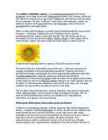
The sunflower (Helianthus annuus) is an annual(iga aastane) plant in the family Asteraceae, with a large flower head (inflorescence(õiekobar, õisik, õitseaeg, õidumine)). The stem(tüvi) of the flower can grow up to 3 metres tall, with the flower head reaching 30 cm in diameter. The term "sunflower" is also used to refer(nimetama, viitama, üle andma) to all plants of the genus(perekond, sugu) Helianthus, many of which are perennial(alaline, aastaringne) plants. What is usually called the flower is actually a head (formally(ametlikult) composite(liit-, komposiit- ; korvõieline, komposiit) flower) of numerous flowers (florets) crowded(täistuubitud, tunglev, rahvarohke) together. The outer flowers are the ray florets(pähik (õisiku osa) and can be yellow, maroon, orange, or other colors, and are sterile(steriilne, viljatu). The florets inside the circular head are called disc florets. Sunflower head displaying florets in spirals of 34 and 55 around the outside The florets wi
(d) increases; plants at later stages are large / plants in early stages are small; trees / shrubs. are woody, appear later in succession; 2 [9] 15. max 1 mark from following: 1 economic definition of sustainable; e.g. similar quantities of timber can be harvested year on year 2 grants for planting forests / management schemes; 3 planting to ensure sustainable harvest rate; max 3 marks for planting strategy: 4 trees not planted too closely together; 5 support young trees to prevent damage e.g. from grazing animals; 6 species planted that are suitable for prevailing conditions / native spp; 7 softwood sp. / conifers / named conifer / fast growing sp. planted; 8 deciduous broadleaved species around edges for aesthetic reasons;
has given the people a feeling of security. Since 1066, no enemy has crossed the Channel and invaded the country. 8 The Age of the Island Britain has not always been an island. It became one only after the end of the last ice age, by about 5000 BC. The temperature rose and the ice sheet melted, flooding the lower-lying land that is now under the North Sea and the English Channel. The improving climate changed the environment. Vast forests covered most of the lowlands and highlands, which were rich in various animals. Rivers teemed with fish. The island became a very comfortable place to live in. Albion The most ancient name for Britain was Albion which was first used by a Greek author in the 6th century BC. Though Celtic in origin, it was supposed by the Romans to come from Lat. albus (white), with reference to the chalk cliffs at Dover. White
primitive ingenuity and craft technology that is important to recognize. Since some of their materials cannot be original, these structures will have to pass the test of authenticity. In 51 BC, during the Gallic War, Caesar attested to the construction of narrow wooden bridges by Gallic builders over wide rivers as the Loire, Seine, and Allier of 600ft (200m) span, used by pedestrians and domestic animals. The stone vault probably first sprang forth in Anatolia and the Aegean region of Asia Minor (central and western Turkey) in the 2nd millennium BC for short spans in civic construction. The Mesopotamian civilizations introduced the first major development of brick vaulting in the royal palaces, and also probably the first important arch bridges in the 6th century BC. Roman bridges Figure 1 Ponte Saint-Martin (c 25 BC) near Torino (Italy). Shunsuke Baba, photographer
It is very important that you follow the instructions in this book so that you will use all the allotted time to your advantage. Vocabulary The first questions on this section will test your English vocabulary. There are 30 academic sentences, each containing an underlined word. You must choose the word that has the same meaning from among the four choices. Here's an example. YOU WILL SEE: The United States has instituted a set of forest conservation measures to maintain forest land. (A) accepted (B) published (C) established (D) suggested The word that is closest in meaning to the tested word, instituted, is choice (C). Further hints for vocabulary questions can be found in Chapter 2. Reading Comprehension Your ability to read and understand college level reading material is test on this part of the TOEFL. You will find five or six reading passages, each followed by four to seven questions. You must work quickly and efficiently. Here is a sample passage.
These are termed elle. Myosin is a negatively charged protein troponin I (MW 23,000), troponin C (MW with an isoelectric point of 5.3. Myosin is 18,000), and troponin T (MW 37,000). a large protein (approximately 500,000 Troponin C has the ability to bind calcium daltons) that contains six polypeptides. released from the sarcoplasmic reticulum, Myosin consists of an alpha helical tail (or troponin I can inhibit the interaction between rod) region that forms the backbone of the actin and myosin, and troponin T binds very thick filament and a globular head region that strongly to tropomyosin. The cooperative extends from the thick filament and interacts action of troponin and tropomyosin in with actin in the thin filament. The head response to calcium increases in the sarco- region of myosin also has ATPase activity, plasm regulates the interaction between actin
during the Khmer Rouge regime in Cambodia when a quarter of that country’s population was murdered. We only need to watch the daily news on television to realize that the madness has not abated, that is continuing into the twenty-first century. Another aspect of the collective dysfunction of the human mind is the unprecedented violence that humans are inflicting on other life-forms and the planet itself – the destruction of oxygen-producing forests and other plant and animal life; ill-treatment of animals in factory farms; and poisoning of rivers, oceans, and air. Driven by greed, ignorant of their connectedness to the whole, humans persist in behavior that, if continued unchecked, can only result in their own destruction. The collective manifestations of the insanity that lies at the heart of the human condition constitute the greater part of human history. It is to a large extent a history of madness
techniques used by the Stonehenge builders. *The Celts in Britain and their legacy The Cets lived in Britain in The Iron Age. They were warring tribes who were battleful amongst themselves as well as inter-tribal war. They were not centrally governed. The Celts brought iron working, iron ploughs and metal swords, horses, wheels and chariots - all these things gave them an instant superiority over the native tribes. The Celts built a number of hill forts throughout the region. The society was divided into warrior aristocracy, agricultural commons and the priests, the druids. *Caesar in Britain - Britain was very rich in minerals but that wasn't the main reason Caesar wanted to defeat it. He could clearly see that Britain was a threat to his latest and greatest conquest - France. He invaded Britain twice, in 55 and 54 BC. The first invasion was unsuccessful - it gained a beachhead on the coast of Kent but achieved little else. The second