Leidsid 33 sarnast õppematerjali, mis on seotud failiga "Mediterranean Basin". Need materjalid aitavad sul teemat sügavamalt mõista.
species, basin, hotspot, rest, region, plant, include, meters, forests, europe, extinct, protected, five, regions, west, north, around, thousand, islands, years, quercus, flora, than, four, times, found, reptile, isolated, resort, development, monk, lynx, endangered, among, original, extent, birds, mammals, density, since, afford, higher, levelsI. Portugal ABOUT Photo Location of Portugal (dark green) Portugal (Portuguese: Portugal, IPA: [putua]; officially the Portuguese Republic, Portuguese: República Portuguesa) is a country located in Southwestern Europe, on the Iberian Peninsula. It is the westernmost country of mainland Europe, and is bordered by the Atlantic Ocean to the west and south and by Spain to the north and east. The Atlantic archipelagos of the Azores and Madeira are Portuguese territory as well. The country is named
TARTU VEERIKU KOOL New Guinea animals and plants Koostaja: Tauri-Viljar Vahesaar Juhendaja: Priit Pensa Tartu 2009 Table of content Introduction................................................................................................................................................3 The forests of New Guinea .......................................................................................................................5 The problem with trading wildlife.....................................................................................................6 Animals of the lowlands....................................................................................................................8 Reptiles...................................................................
hunters. After whales were locally cleared the whalers went there for tortoises, an estimated 200 000 or more adults had been removed. The island of Floreana was populated with a group of convicts' in October 1832. Charls Darwin visited the island in 1835, he spent there 5 weeks. Nowadays five of the islands are populated with about 40 000 inhabitants. The name Island of Galapagos means island of tortoises. Every animal or plant had to cross about 1000 km of open ocean to arrive on Galapagos. Despite the trials of arrival, over 560 species of native plants, over 55 species of native land vertebrates and 1700 species of native insect are found on Galapagos. There are no large mammals, the key herbivores are reptiles, and the top predators are birds and snakes. Mammals on the Galapagos include two species of bat, two endemic rice rat species and its most famous mammals - the Galapagos sea lion and fur seal
Scotland ! Scotland (Gaelic: Alba) is a country in northwest Europe that occupies the northern third of the island of Great Britain. It is part of the United Kingdom, and shares a land border to the south with England. It is bounded by the North Sea to the east, the Atlantic Ocean to the north and west, and the North Channel and Irish Sea to the southwest. In addition to the mainland, Scotland consists of over 790 islands including the Northern Isles and the Hebrides.
Ireland is divided into four provinces: Connacht, Leinster, Munster and Ulster. Ireland's least arable land lies in the south-western and western counties. These areas are largely spectacularly mountainous and rocky, with beautiful green sights. Ireland is sometimes referred to as being part of the British Isles. However, notwithstanding the level of acceptance of the term within Northern Ireland, exception is taken by many Irish people to the extension of this nomenclature to include Ireland due to the perception that it implies an identity at odds with historical, cultural and political reality. For this reason, "Britain and Ireland" is sometimes used as a neutral way of alluding to the archipelago of which the two islands are the essential constituents. Another suggestion, although much less frequently used, is the Islands of the North Atlantic (IONA). Climate Overall, Ireland has a mild, but changeable, climate all year. The island is not noted for its extremes. The
Introduction The official name of the country is the United Kingdom. The United Kingdom is an island country. It consists of the island of Great Britain and Northern Ireland. Great Britain can be divided into three parts England, Wales and Scotland. Each of them has their own capital city. Glasgow in Scotland, Cardiff in Wales and London in England. The country is situated in the north-western Europe. The territory of the United Kingdom is about 244,000 square kilometres and about 60 million people live there. The UK contains a number of small islands. The largest islands that belong to the United Kingdom are the Isle of Man in the Irish Sea and the Isle of Wight which lies off of England's southern coast. The largest groups of islands are the Shetland Islands, the Orkney Islands and the Hebrides. Geographical Position The UK is situated in the Northern Hemisphere. The United
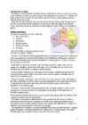
From the east by the Coral Sea and the Tasman Sea. Australia's coastline is about 37,000 km long. The Great Australian Bight washes the southern coast. The Gulf of Carpenteria and the Cape York Peninsula surround it in the south. 3. Relief Australia is the smallest continent in the world It is often called the island continent because is too big for an island but rather small for a continent. Australia is 1,800 miles from the mainland of Asia and almost half way round the world from Europe. More than 6,000 miles of ocean separate in from the America. Australia is the only continent except for Antarctica that lies all south of the equator. The natural zones of Australia are very various. There are deserts, semi deserts, grasslands, savannas, bushlands and rainforests. The wet forests occupy the narrow region in the east. Most of the animals, birds and insects live in that region, because there is enough food. The savannas which are grasslands with some trees are mostly in
The island of Tasmania is in the south-east of Australia. The capital of Tasmania is Hobart. The seas and oceans that wash the coasts of Australia are warm. The Coral Sea is the warmest that is why many corals live in the seas. The skeletons of these tiny organisms have formed a great belt of coral- called the Great Barrier Reef. Its is 2000 km long and 2-150 km wide. There are five distinguishable natural zones in Australia. In the very east there are wet forests that occupy the space between the Great Dividing Range and the eastern coast. The wet forests give place to beautiful grasslands with some trees called the savannas. Farther west the trees disappear and the bushlands begin. The real desert occupies the centre of the Western Plateau. In the very southwest there are thin forests of evergreen trees. Most of Australian trees are kinds of eucalyptus (or gum tree to Australians) and acacia (wattle of Australians)
..................................................................................................10 Introduction I chose finland because there are friendly people and beautiful nature. Finland is bigger than Estonia. There lives over 5 milj. people. Finland capital is Helsingi and there lives about 2 milj. people. Highest top is 1328m. Finland is bordersed with Sweden to the west, Russia to the east and Norway to the north. It is the eight largest city in Europe. Most Finns speak Finnish. The second language is Swedish. Finland is rated the sixth most peaceful country in the World. In Finland there are more than 60000 lakes. Capital: Helsinki Area: 338145km2 Population: 5200000 Language: Finnish, Swedish Currency: Euro (EUR) Goverment: Parliamentary republic
Tallinn English College Topic Great Britain 2007 1. Introduction The official name of Great Britain is `the United Kingdom of Great Britain and Northern Ireland (or short United Kingdom)' The population is about 60.4 million. The capital is London. Other biggest cities include Birmingham, Bristol, Portsmouth, Glasgow and Swansea. English is the main language of Great Britain, but Welsh is officially recognized in Wales and Gaelic in Scotland. 2. Geographical position The British Isles is the geographical term for a group of about 5000 islands off the coast of mainland Europe. The largest island is Great Britain, which is also the largest island in Europe. It consists of England, Wales and Scotland. The next largest island is
This brought along the great gold rush. Thousands of people went to the new land to find fortune. Forty years later the gold was found in the west. The miners of the east had a very hard time, the water was scarce and the roads were bad. But then the railway was built. Many of people who came to Australia to find gold stayed on to do other kinds of work. The found that Australia has other riches too, such as coal, copper, ironore, nickel, natural gas and more. The forests had good timber. Along seashorepearls and tortoise shells could be gathered. Some needed to manufacture such things as butter, cheese, shoes and clothing. Geographical position Australia is located in southern hemisphere. It's the only continent except for Antarctica that is all south of equator. Sometimes Australia is called the Island Continent. There is a great reason why. It really is an island. It is
Canada is a vast country, with a territory of 3.8 million square miles of land and fresh water it is the second biggest country in the world after Russia. Canada covers most of the northern part of North America. Canada has over 151,480 miles of coastline. Most of Canada's human population lives along its southern border. 3. Relief Canada's geography is very diverse. It has huge lakes, evergreen forests, prairies, meadows and beautiful mountains. There are thousands of miles of coastline with beaches, fjords and wild rivers flowing to the oceans. Canada is a country of wide open spaces and beautiful landscape where traveling visitors can unexpectedly bump into wild animals like bears or be struck by unusual sight like the scarecrows on the Cabot Trail. Canada is rich in natural
This fact, coupled with the grandeur of the landscape, has been central to the sense of Canadian national identity. 2. Geographical position Canada is the second largest country in the world after Russia. In the Arctic, Canada reaches almost as far north as Greenland. To the south it extends to the same latitude as southern France. The distance from Canada's west coast, the Pacific Ocean, to its east coast, the Atlantic Ocean, is farther than from North America to Europe. Canada's total land area includes thousands of adjacent islands, notably Newfoundland in the east and those of the Arctic Archipelago in the north. In longitude Canada extends from approximately 52° to 141° W, a distance that spans six time zones. In latitude it extends from approximately 42° to 83° N. With its vast Arctic and subarctic territories, Canada is often considered a country only of the far north; however, the peninsula of southern Ontario juts deeply south into the heartland
So, Australia is both a country and a continent. If you want to make clear that you are speaking about the country, you may call it the Commonwealth of Australia. It’s the official name of the country. Australia is the smallest continent, but one of the largest countries on Earth. It’s 6th largest country. Its area is about 7.6 million sq km. One third of it is occupied by deserts. It’s both the flattest and, except for Antarctica the driest. Neighbouring countries include Indonesia, East Timor and Papua New Guinea in the north, the Solomon Islands, Vanuatu in the northeast, and New Zealand in the southeast. Its capital is Canberra. Other big cities are Melbourne, Sydney, and Brisbane. National language in Australia is English. Monetary unit is Australian dollar. Their national holiday is on the 26th of January. In 1788 on the 26th of January the first fleet arrived at Botany Bay and established a penal colony near modern-day Sydney. Geographical Position
England. There are two main languages in Canada: English and French. Canada's curreny is Canadian dollar (1 dollar=100 cents[Can$]). The highest peak of Canada is Mount Logan, 5959 metres. The lowest point is sea level. The longest river is the Mackenzie. The climate and geography of Canada vary greatly from temperate in the south to arctic in the north and from islands and plains in the east to mountains in the west. Location Canada is located in the northern-most region of North America. It's geographical position in co- ordinates is 83°N north, 42°N south, 53°W east, 141°W west. Canada borders with United States of America by land; Pacific Ocean, Arctic Ocean and Atlantic Ocean by coastline. Canada is one of the largest countries in the world, second only to Russia in territorial size. It has a total area of 9.9 million square kilometers. This includes 755,170 square kilometers of water. Toronto is the largest city in Canada with a population of 4
but mostly in the United States, forming a zone, from 100 to 300 miles wide, running from the island of Newfoundland some 150 miles south-westward to central Alabama in the United States. The Rocky Mountains, often called the Rockies, are a broad mountain range in western North America. The Rocky Mountains stretch more than 4800 km. The Rocky Mountain System within the United States is a United States physiographic region. Though part of the Pacific Cordillera, they are not to be confused with the Pacific Coast Ranges which are located immediately adjacent to the Pacific coast. The Rocky Mountains are a great place for holidays for walking, climbing, fishing, hunting or skiing. The only big city in the Rockies is Denver. Lakes The Great Lakes are a group of five large lakes in North America. They are the largest group of fresh water lakes on Earth. They are sometimes called the inland seas. There are:
The Murray rises in the Australian Alps and flows north-west. It makes up much of the border of the New South Wales and Victoria. The Murray-Darling river system is one of the largest river systems in the world. There are predominantly dry salt lakes in the flat desert regions of the country lacking in organised drainage. The Australians can get most of their underground water from the Great Artesian Basin, which is the largest and deepest artesian basin in the world. Iti is near Lake Eyre, the Great Dividing Range and the Simpson Desert. An artesian well is a confined aquifer containing groundwater that will flow upwards through a well without the need for pumping. Water may even spurt out of the ground if the natural pressure is high enough. An aquifer provides the water for an artesian well. An aquifer is a layer of soft rock, like limestone or sandstone that absorbs water from an inlet path.
Melbourne is said to be the heart of Australian finance and the headquarters of industry giants. Victoria is more an industry than a tourist state. Queensland is known for its natural riches like huge coalfields, copper, silver, lead. Its capital city is Brisbane, which is the third largest city in Australia. Because it lies in the Northeast part of Australia, its climate is mainly tropical. South Australia is famous as it is the region of fruit farming, vineyards and olive groves. Only the southern coast is fertile, most of the state is arid. Its capital is Adelaide, which is known for the Adelaide circuit. Western Australia is the biggest state in Australia. It is rich in deserts, as the central part of the state is practically a desert in whole and nearly uninhabited. On the other hand, the desert is important for its resources and mining. Western Australian capital is Perth with a population of 1.5 million people.
Tallinn English College Topic Estonia Tallinn 2008 1. Introduction Estonia is a small country about the size of Switzerland, or New Hampshire and Massachussetts combined. Estonia is named after the people called "Ests" who lived in the region in the 1 st century AD. The Republic of Estonia is one of the three countries commonly known as the "Baltic States". The other Baltic States are Latvia and Lithuania. 2. Geographical position Estonia is situated in northeastern Europe. Estonia is bounded on the north by the Gulf of Finland, on the east by Russia, on the south by Latvia and on the west by the Baltic Sea. In the north it borders on Finland. The coastline of the Baltic
Gulf coast and surrounded by a strip of marshes. The Cordilleras consist of rows of mountain ranges with the heights of up to 3000-5000 m. In Alaska the mountain ranges stretch in the west-east direction. 4 On the territory of the USA the mountain ranges stretch in the north-south direction. The first from the east are the Rocky Mountains. West of the Rockies lie vast plateaus and tablelands: the volcanic Columbia Plateau, the Great Basin, the Colorado Plateau. Further west is a narrow belt of the Cascade Mountains, and the Sierra Nevada Range Still further west lies an area of valleys. The forests cover 30% of the US. In the southern part of Alaska grow coniferous trees, notably spruces and firs. Around the Great Lakes and New England are mixed forests of pines, maples, elms, birches, oaks and beeches. Along the Gulf of Mexico grow magnolia, red and black gum, cypress and mangrove. Geographical Regions
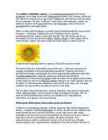
The sunflower (Helianthus annuus) is an annual(iga aastane) plant in the family Asteraceae, with a large flower head (inflorescence(õiekobar, õisik, õitseaeg, õidumine)). The stem(tüvi) of the flower can grow up to 3 metres tall, with the flower head reaching 30 cm in diameter. The term "sunflower" is also used to refer(nimetama, viitama, üle andma) to all plants of the genus(perekond, sugu) Helianthus, many of which are perennial(alaline, aastaringne) plants. What is usually called the flower is actually a head (formally(ametlikult) composite(liit-,
Feudalism, government reorganisation and the first legally defined towns (called burghs) began in this period. These institutions and the immigration of French and Anglo-French knights and churchmen facilitated a process of cultural osmosis, whereby the culture and language of the low-lying and coastal parts of the kingdom's original territory in the east became, like the newly acquired south-east, English-speaking, while the rest of the country retained the Gaelic language, apart from the Northern Isles of Orkney and Shetland, which remained under Norse rule until 1468. The Wallace Monument commemorates William Wallace, the 13th-century Scottish hero. The death of Alexander III in March 1286, followed by the death of his granddaughter Margaret, Maid of Norway, broke the succession line of Scotland's kings. This led to the intervention of Edward I of England, who manipulated this period
functionality of multicopy genes, concerted evolution is at play. indel events. We use the ITS sequences of the freshwater sponge However, homogenisation of all the gene variants is not always Ephydatia fluviatilis as an example, and describe intra-individual complete [2]. Divergent copies may interfere in obtaining heterogeneity in this species for the first time. Our method enables adequate results from phylogenetic [3] or phylogeographic to distinguish between individuals by compiling a specific profile analysis [4]. Therefore it is crucial to distinguish between real for each individual analysed. Comparing these profiles can help us
of these can vary considerably. Some technologies are already mature and economically competitive (e.g. geothermal and hydropower), others need additional development to become competitive without subsidies. This can be helped by improvements to sub-components, such as electric generators. The table shows an overview of costs of various renewable energy technologies. For comparison with the prices in the table, electricity production from a conventional coal-fired plant costs about 4¢/kWh. Though in some G8 nations the cost can be significantly higher at 7.88p (~15¢/kWh).Achieving further cost reductions as indicated in the table below requires further technology development, market deployment, an increase in production capacities to mass production levels,and of the establishment of an emissions trading scheme and/or carbon tax which would attribute a cost to each unit of carbon emitted; thus reflecting the true cost of energy
The highland regions are the Appalachians in the east and the Cordilleras in the west. The Appalachians run parallel to the Atlantic coast from the Gulf of Mexico to Canada; the highest peak is 2000 m high. The Cordilleras run along the Pacific coast with the Sierra Nevada in the south and the Rocky Mountains in the north; the highest peak is Mt. Whitney (4,540 m) in the Sierra Nevada. The Cordilleras are still an active region of the Earth. There are a number of active volcanoes there and often earthquakes shake the land. Hot springs and geysers are numerous in Yellowstone. Between the mountains there are many canyons. The most famous of them is probably the Grand Canyon. The highest peak in America is Mt. McKinley with its 6194m. The lowest point is the Death Valley - 86m. Between the mountains are the central lowlands called the prairie and eastern lowlands called the Mississippi valley.
..................................................17 Appendix 1...................................................................................................................................18 2 Introduction The aim of this research is to get know more about the Netherlands history and its geographical facts. This report is describing one of most the most beautiful countries in the Europe - Netherlands. Netherlands is famous for its windmills and flowers. Netherlands is also known unofficially as Holland. Government is constitutional monarchy of north-western Europe. Netherlands is bordered on the north and west by the North Sea, on the east by Germany and on the south by Belgium. The European portion of the Netherlands has a total area of 41,528 sq km of which 33,939 sq km is land surface. Country's capital and largest city is Amsterdam. Population is about 16 million.
Everest Nepal-Tibet 29,035 Asia Kosciu sk o Australia 7,3 10 Au stral ia Elb rus Russia 18,5 10 Europe Mc Kin ley Alask a, U.S. 20,320 N orth Am erica Aconcagua Argentina 22 ,834 South America Lowest Elevations Lo west P o in t Name Place Dep th Below Sea Lev el (ft
In the end, they were shocked to see how much money Jules' energy using habits cost compared to Les' habits. USES OF ENERGY The United States is a highly developed and industrialized society. We use a lot of energy - in our homes, in businesses, inindustry, and for traveling between all these different places. The industrial sector uses almost one-third of the total energy. The residential and commercial sectors combined use 39 percent of all energy. These two sectors include all 4 types of buildings, such as houses, offices, stores, restaurants, and places of worship. Energy used for transportation accounts for more than a quarter of all energy. Picture 2.1. Share of energy consumed by major selectors of the economy (2007) 2.1 Uses of energy in homes The ability to maintain desired temperatures is one of the most important accomplishments of modern technology
The name Petroleum covers both naturally occurring unprocessed crude oils and petroleum products that are made up of refined crude oil. A fossil fuel, it is formed when large quantities of dead organisms, usually zooplankton and algae, are buried underneath sedimentary rock and undergo intense heat and pressure. Petroleum is recovered mostly through oil drilling. This comes after the studies of structural geology (at the reservoir scale), sedimentary basin analysis, reservoir characterization (mainly in terms of porosity and permeable structures). It is refined and separated, most easily by boiling point, into a large number of consumer products, from petrol (or gasoline) and kerosene to asphalt and chemical reagents used to make plastics and pharmaceuticals. Petroleum is used in manufacturing a wide variety of materials, and it is estimated that the world consumes about 88 million barrels each day.
[A very low] does not. max 3 [3] 6. (a) (i) award both marks for correct answer 10 000 / 800 000 (× 100); 1.25 / 1.3 / 1(%); 2 (ii) R any reference to energy / light missing the plant reflected (off plant) / only certain wavelengths of light can be, absorbed / used; ora absorbed by / hits, non-photosynthetic parts; e.g. bark passes through leaf / misses chlorophyll / misses chloroplasts; some is heat that is used in evaporation / respiration; max 2 (iii) bacteria / named bacterium decomposer; (Nitrobacter, Nitrosomonas) 1
The current reading material summarises the main aspects covered by lectures and structurises the information channels for the future. The course supports the other Traderun courses, especially the course related to EU cooperation with Russia and Eastern Partnership Countries. 4 1. UKRAINE 1.1. General information 1.1.1. Country Profile Capital: Kyiv. Total area: 603,550 sq. km (the largest country in Europe by area that is physically within Europe entirely). Population: ~ 45 million (declining). Major cities and estimated population (Good news! Not all the business and capital concentrated in the capital): Kyiv (Kiev) 2.8 million, Kharkiv (Kharkov) 1.5 million, Lviv (Lvov) - 1.5 million, Donetsk 1 million, Dnipropetrovsk (Dnepropetrovsk) - 1 million, Odesa (Odessa) 1 million. Zaporizhzhya (Zaporozhye) 0.8 million.
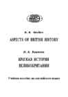
absolute monarchy into a constitutional monarchy, the origin of the English language, the rise and fall of the British Empire. The units contain an informative reading text on an important issue, preceded by preparatory discussion questions and followed by notes offering some additional information, and a vocabulary with relevant language notes. The main reading text is accompanied by comprehension, vocabulary and grammar exercises and discussion activities. Some of the units include reading passages. The book is intended for university and school students as well as other English learners wishing to acquire more knowledge about the country whose tongue became the world’s leading language, and which is considered as the Mother of Parliaments. 7 UNIT 1 THE ISLAND Pre-reading questions What is the name of the island group Britain belongs to? Where is it situated?
recognised formally as a social class 58. Peer/ nobleman- a nobleman; a member of one of the five degrees of the British nobility (duke, marquis, earl, viscount, baron) 59. Gentry- in a restricted sense, those between the nobility and the yeomanry, the landed people – lack hereditary titles – used to exercise extensive political influence at the local level 60. Middle classes- about 50-60% of the population, include industrialists, professionals, businesspeople (white-collar; salary) and shop-owners (self-employed). 61. Working class(es)- agricultural, mine and factory workers (blue-collar; wages). 62. Lower classes- Lower class (occasionally described as working class) are those employed in low-paying wage jobs with very little economic security. The term "lower class" also refers to persons with low income. The working class is sometimes separated into those who are employed but lacking financial
 annaabi.ee