Leidsid 33 sarnast õppematerjali, mis on seotud failiga "Iirimaa". Need materjalid aitavad sul teemat sügavamalt mõista.
land, ireland, there, irish, road, forests, peat, weather, republic, scale, economy, comee, part, burning, species, such, cause, language, patrick, green, class, still, whole, centuries, mostly, europe, computers, economic, boom, century, back, highest, capita, income, country, luxembourg, construction, plays, typical, again, final, coal, petroleumroad signs All speed limit signs in the Republic changed to the metric system in 2005. Some direction signs still show distance in miles so tourists often mix them up. There are usually about 10 signs or more on one post , and its really hard to see them when driving, so tourists disturb traffic quite often when slowing down to read the signs All the signs are multilingual ,due to high percentage of English speakers Forests Ireland has only about 8 % of his whole land covered with forests. Centuries ago people cut the forests and didn't think about the future so nowadays there is mostly peat ( turvas) which Ireland uses to produce energy. Economy Ireland had a big economic boom in the late 20'th century, but now the Republic of Ireland is ranked the second wealthiest per capita country in the European Union. Education in Ireland is free at all levels, including college. The construction sector, which is inherently cyclical in nature, now accounts for a significant
Ireland is the third largest island in Europe. It lies in between the Atlantic Ocean and the Irish Sea. Politically it is divided into a sovereign state, the Republic of Ireland, that covers about five-sixths of the island (south, east, west and north-west), and Northern Ireland, which is part of the United Kingdom, covering the northeastern sixth of the island.[1] The name 'Ireland' derives from the name Ériu (in modern Irish, Éire) with the addition of the Germanic word 'land'. The population of the island is just under 6 million (2006); just over 4.2 million in the Republic of Ireland[2] (1.6 million in Greater Dublin[3]) and just over 1.7 million in Northern Ireland[4] (0.6 million in Greater Belfast[5])). Politics Politically, Ireland is divided into:
Ireland Position Ireland is the third largest island in Europe, and the twentieth largest island in the world. It lies to the northwest of Continental Europe and is surrounded by hundreds of islands. To the east of Ireland, separated by the Irish Sea, is the island of Great Britain. Politically, the Republic of Ireland (also known simply as Ireland) covers five sixths of the island, with Northern Ireland, part of the United Kingdom, covering the remainder in the northeast. Climate Overall, Ireland has a mild, but changeable, Oceanic climate with few extremes. The warmest recorded air temperature was 33.3 °C at Kilkenny Castle, County Kilkenny on 26 June 1887, where as the lowest recorded temperature was 19.1 °C at Markree Castle, County Sligo on 16 January 1881. Inland areas are warmer in summer, and colder in winter there are usually around 40 days of below freezing
Swansea. English is the main language of Great Britain, but Welsh is officially recognized in Wales and Gaelic in Scotland. 2. Geographical position The British Isles is the geographical term for a group of about 5000 islands off the coast of mainland Europe. The largest island is Great Britain, which is also the largest island in Europe. It consists of England, Wales and Scotland. The next largest island is Ireland, which is made up of Northern Ireland and the Irish Republic. Britain and Northern Island together form the United Kingdom. When referring to Britain or Great Britain in everyday life, the names are used to mean the United Kingdom. The English Channel (and best known: the Strait of Dover) separate Britain from mainland Europe and its closest neighboring country France. 3. History Great Britain has a long and interesting history stretching back millennia's. The
..................................................................... 8 Population and Ethnicity..............................................................................................9 3 Introduction The official name of the country is the United Kingdom. The United Kingdom is an island country. It consists of the island of Great Britain and Northern Ireland. Great Britain can be divided into three parts England, Wales and Scotland. Each of them has their own capital city. Glasgow in Scotland, Cardiff in Wales and London in England. The country is situated in the north-western Europe. The territory of the United Kingdom is about 244,000 square kilometres and about 60 million people live there. The UK contains a number of small islands. The largest islands that belong to the United
Cities Muckanaghederdauhaulia - This is probably the longest place name in Ireland. it consists of 22 letters There is also a village in Ireland called '' Inch village'' outside the village there is a sign '' Inch 1 mile'' i couldn't find a picture of it from the internet so i created a sign myself to make it more clear, so that can be quite confusing for a foreigner The capital city , Dublin was founded by the Vikings in 841 Worth to mention The Titanic was built in Harland and Wolff yards in Belfast , which is nowadays part of the Northern Ireland , but back then in 1909 - 1912 (which is the time when Titanic was built ) it was still part of the Ireland
a second language. 5. Which British colonies became dominions? What was their status? Is the name dominion used for these countries nowadays? The first dominions were Canada (1867), Australia (1901), and New Zealand (1907) The name "dominion" is not used anymore. 6. Which organisation unites Britain and most of its former colonies nowadays? The Commonwealth unites Britain with its former colonies. Ireland 1. Who were the early inhabitants of Ireland? Seafarers, fisheremen and hunter-gatherers from mainland Europe arrived around 8000 BC 2. When was Christianity established in Ireland? 432 AD Saint Patrick arrived in Ireland and began converting the Irish to Christianity. Who is Ireland's patron saint? Saint Patrick is Ireland's patron saint. When is his feast day? His feast day is on 17 March 3. When did the English conquest of Ireland begin? Henry II, with permission from tha Pope, sought to conquer Ireland
The British Isles are shared by two separate and independent countries: the United Kingdom of Great Britain and Northern Ireland and the Republic of Ireland. All the islands have administrative ties with the mainland, except some islands which have their own legislative assemblies and systems of law, but the UK Government is responsible for their international relations and defence. Great Britain Across / 'krs / risti, läbi, põiki
The United Kingdom The United Kingdom consists of England, Scotland, Wales and North Ireland and it is situated in the Atlantic Ocean near the mainland of Europe. The population of the UK is 58.6 million and area is 244,110 sq km. Britain has a temperate humid climate. Its characteristic features are mild winters, warm summer, no temperature extremes, abundant rain all year round and frequent changes of weather. The mild climate is partly due to the warm Gulf Stream and partly to the south westerly winds. Occasional winds from the east in winter may bring cold and dry weather. The distribution of rainfall is influenced by the Atlantic Stream. The mountainous areas of the north and west have more rain than the lowlands of the south and east. Wales is located on a peninsula in central-west Britain. The entire area of Wales is about 20,779 km²
SOCIETY AND CULTURE OF ENGLISH-SPEAKING COUNTRIES Introduction 1. Nowadays, English is so widely spoken that it can hardly be considered "a one nation's" language. The main countries where English is spoken are: the U.K, the U.S, Canada, Australia, the Republic of Ireland, New Zealand, West Indies 2. There are approx. 300-400 million speakers of English in the world. English occupies the 3rd place by its number of speakers; it is right behind Mandarin and Spanish. 3. ESL (English as a Second Language) used in your own country (e.g. India) EFL (English as a Foreign Language) used in a foreign country ESP (English for Specific Purposes) used in business, airlines, hotels etc. 4
1) General facts The UK: * the United Kingdom of Great Britain and Northern Ireland was formed in 1801 * it covers 243,610 sq km * everybody from the UK is called British * the capital city is London * is made up of four constituent countries: England, Scotland, Wales and Northern Ireland which in turn are divided into counties * the flag is called the Union Jack which is a combination of the flags of England, Scotland and Northern Ireland * the population is about 60,000,000 people, the population density is 242 people/sq km * its coasts are washed by the Atlantic Ocean, the North Sea, the English Channel, the Celtic Sea, Saint George's Channel, and the Irish Sea. It is linked to France by the Channel Tunnel * the United Kingdom is a constitutional monarchy. The current monarch is Queen Elizabeth II, who is also the Queen and Head of State of fifteen other Commonwealth Realms, such as Canada, Australia, New Zealand and Jamaica.
Scotland ! Scotland (Gaelic: Alba) is a country in northwest Europe that occupies the northern third of the island of Great Britain. It is part of the United Kingdom, and shares a land border to the south with England. It is bounded by the North Sea to the east, the Atlantic Ocean to the north and west, and the North Channel and Irish Sea to the southwest. In addition to the mainland, Scotland consists of over 790 islands including the Northern Isles and the Hebrides. Edinburgh, the country's capital and second largest city, is one of Europe's largest financial centres. It was the hub of the Scottish Enlightenment of the 18th century, which saw Scotland become one of the commercial, intellectual and industrial powerhouses of Europe. Scotland's largest city is Glasgow, which was once one of the
1. The Queen’s official title. Elizabeth the Second, by the Grace of God, of the United Kingdom of Great Britain and Northern Ireland and of Her other Realms and Territories Queen, Head of the Commonwealth, Defender of the Faith. 2. The Queen’s working day. Starts after breakfast. Reads the newspapers which are prepared by the Press Secretary, and a report on the previous day’s proceedings in the Parliament and the letters she receives. Also phone calls. Once a month she attends the Privy Council in order to give Royal Assent to various items of government legislation.
James was a delicate boy and often suffered from headaches. That is why he could not go to school at the age when other children did. His mother taught him to read and his father taught him writing and arithmetic. He had very good memory and a natural love of work. He liked mathematics and was also fond of designing and making things. James was an observant and thoughtful boy. When James was able to go to school, he was sent to a private school. He learnt many subjects there. In his spare time James began to make experiments. He built a small electrical apparatus with which he gave his friends shocks that made them jump. When James was 18 he decided to become a professional instrument- maker. He could not find anyone to teach him, so he went to London. After a year James returned to Scotland where he became mathematical instrument maker to Glasgow University. He also made musical instruments organs, violins, flutes and guitars
The UK & London The United Kingdom (or the UK) is a short way of saying the United Kingdom of Great Britain and Norther Ireland. The UK is situated north-west of the European continent between the Atlantic Ocean and the North Sea. The UK consists of England, Wales, Scotland and Northern Ireland. Its highest point is Ben Nevis in Scotland followed by Snowdon in Wales. The Severn is the longest river in the United Kingdom. Other important rivers are the Trent, the Mersey, the Tyne, etc. Lough Neagh which lies in the centre of Northern Ireland is thr UK's largest freshwater lake. The climate in the UK is variable. The weather changes so frequently that it is difficult to forecast. It is not unusual for people to complain that the weathermen were wrong
The United Kingdom and London United Kingdom is a political name of the United Kingdom of Great Britain and Northern Ireland. These political names include the countries of England, Scotland and Wales. Every country has its own capital and language. The capital of England is London, the people there are english and the language spoken is English. In scotland live the scots, capital is Edingburg and the languages spoken are English and Scottish. The capital of Wales is Cardiff, the people tehre are welsh and the languages spoken are welsh and English. N. Ireland is the home for the Irish, the capital is Belfast and the language is Irish. The first inhabitants were Iberians and Celts who settled on the land and were often at war with each other
THE U.K Different Parts The United Kingdom is a short way of saying the United Kingdom of Great Britain and Northern Ireland. The UK is the political name for those countries which share a parliament in London. All of them were at one time independent kingdoms with their own monarch. Now they are all part of the same kingdom and share the same monarch. The UK consists of Northern Ireland, Scotland, England and Wales. The peoples of these countries are British subjects; they hold British passports and therefore their nationality is British. The british Isles is the geographical name for all the islands off the west coast of Europe. These islands also include The Republic of Ireland, which is politically independent of the Britsh government. Many people refer to the inhabitants of the British isles as 'the English', but England is only one of the countries
2.3 Results of the questionnaire 1...............................................................................................23 During the first questionnaire 30 students of the 9th and 10th class of Gymnasium were questioned about the British national symbols...........................................................................23 Surprisingly, according to the results, more than 50 percent of students are aware of the national flags of Great Britain, Scotland, Northern Ireland and Wales. As can be seen, quite a lot of children also know the name of the Great Britain flag. However, almost all of the students have no idea about other names of the British flags, as well as about the patron saints. In addition, almost 90 percent of students are also unaware about the national holidays..........23 All things considered, we see that there is a need for students to pay more attention to
The territory of Estonia covers 45,227 km² and is influenced by a temperate seasonal climate. The Estonians are a Finnic people closely related to the Finns, with the Estonian language sharing many similarities to Finnish. The modern name of Estonia is thought to originate from the Roman historian Tacitus, who in his book Germania (ca. AD 98) described a people called the Aestii. Similarly, ancient Scandinavian sagas refer to a land called Eistland, close to the German term Estland for the country. Early Latin and other ancient versions of the name are Estia and Hestia. Until the late 1930s, the name was often written as Esthonia in most English speaking countries. Estonia is a democratic parliamentary republic and is divided into fifteen counties. The capital and largest city is Tallinn. With a population of only 1.4 million, it is one of the least-populous members of the European Union. Estonia was
the largest of the British Isles. With a population of about 60.0 million people in mid-2009, it is the third most populous island in the world, after Java and Honsh. Great Britain is surrounded by over 1,000 smaller islands and islets. The island of Ireland lies to its west. Politically, Great Britain may also refer to the island itself together with a number of surrounding islands which comprise the territory of England, Scotland and Wales. All of the island is territory of the sovereign state of the United Kingdom of Great Britain and Northern Ireland, and most of the United Kingdom's territory is in Great Britain. Most of England, Scotland, and Wales are on the island of Great Britain, as are their respective capital
1. Ancient Britain: the Celtic tribes. 2000 years ago there was an Iron Age Celtic culture throughout the Br Isles. It seems that the Celts, who had been arriving from Europe from the 8th cent BC onward, intermingled with the peoples who were already there. The Celts were extremely talented people, creative and artistic. More than 1 Celtic tribe invaded Br. The descendants of ancient Celts live in Wales, Scotland, Cornwall and Ireland. They lived in primitive society. Druids priests, more powerful than chiefs. Acted like prophets. 2. Stonehenge From prehistoric period. Was built on Salisbury plain between 2500 and 1500 bc. One of the most famous and mysterious archaeological sites in the world. One of the mysteries is how it was built at all with the technology of the time. Another is its purpose. It appears to function as a kind on
The Iberians brought their metal-working skills and the first real civilization to Britain in the third millennium B.C and were overrun by various Celtic invasions that began in the 8th century. The Celts introduced their tribal organization and an early form of agriculture before they were forced westward by the Roman invasion. Forms of Celtic language are still spoken in Britain. Romans (with Julius Caesar in the head of them) first tried to occupy Britain in 55 B.C., but there was a rebellion in Gaul so they had to leave to fight against it. Next time they came in 43 A.D. and their leader was Emperor Claudius. Romans brought a lot with them. Their brought paved roads, the sites of important cities, the seeds of Christianity, the Roman law, Roman baths, language and advanced civilization. They also built Hadrian's Wall in 122 A.D. Romans occupied Britain for four centuries. The Roman way of life all vanished after the invasions from Northern Europe by the
Tallinn English College Topic Estonia Tallinn 2008 1. Introduction Estonia is a small country about the size of Switzerland, or New Hampshire and Massachussetts combined. Estonia is named after the people called "Ests" who lived in the region in the 1 st century AD. The Republic of Estonia is one of the three countries commonly known as the "Baltic States". The other Baltic States are Latvia and Lithuania. 2. Geographical position Estonia is situated in northeastern Europe. Estonia is bounded on the north by the Gulf of Finland, on the east by Russia, on the south by Latvia and on the west by the Baltic Sea. In the north it borders on Finland. The coastline of the Baltic Sea in Estonia is characterized by numerous gulfs and bays, the biggest of them
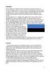
Estonia Topic Tallinn 2007 2 List of Contents page Facts and figures 3 Geography 3 Climate 3 Nature 4 History 5 Economy 6 Culture 6 Biggest towns 7 Language 8 3 Facts and figures The Republic of Estonia is a small country. Covering only 45, 228 sq km it is slightly bigger than Denmark, Belgium or Switzerland. Estonia's population is under 1.4 million. The official language is Estonian but since very many Russians live here Russian is also wide spread. The capital of Estonia is Tallinn. The currency used in Estonia is Eesti kroon. The Estonian national flag is blue-black-white. It was originally the flag of the Estonian Students' Society
Canada 8a Teacher: Merike Sisask Composer: Kärt Kalvet 2010 Canada, Kärt Kalvet 8a Canada General Information Canada is in North America. It's area is 9220970 sq km. Canada's population is 313.612.000 people. Canada is divided into 10 provinces and 3 territories. The capital of Canada is Ottawa. Canada has constitutional monarchy. The head of state in Canada's government is the Queen of England. There are two main languages in Canada: English and French. Canada's curreny is Canadian dollar (1 dollar=100 cents[Can$]). The highest peak of Canada is Mount Logan, 5959 metres. The lowest point is sea level. The longest river is the Mackenzie. The climate and geography of Canada vary greatly from temperate in the south to arctic in the north and from islands and plains in the east to mountains in the west. Location Canada is located in the northern-most region of North America
Estonia. Estonia, officially the Republic of Estonia is a country in Northern Europe. It is the smallest of the three Baltic countries. Estonia has land borders with Latvia (339 km) to the south and Russia (229 km) to the east. It is separated from Finland in the north by the narrow Gulf of Finland and from Sweden in the west by the Baltic Sea. Estonia has been a member of the European Union since May 1, 2004 and of the NATO since March 29, 2004. The area of Estonia is about 45000 square kilometres and the population is about 1.4 million people. The capital of Estonia is Tallinn and the official language is Estonian
Topic Australia Introduction Many people know Australia as the land down under because it is the only continent except for Antarctica that is all on the southern hemisphere. Its name means ,,Southland". The official name of the country is the Commonwealth of Australia. It's capital is Canberra. Australia is the sixth largest country in the world but the smallest continent. Australia has 6 states and 2 territories (New South Wales, Victoria, Tasmania, Queensland, Western Australia , South Australia, The Australian Capital Territory and the Northern Territory).
Today more and more disputes are caused by the enormous spread of the English language throughout the world. Some scholars claim that it has already become the first global language. And this statement isn't far from truth. But what does it mean to say that a language is a global language? Why is English the language which is usually cited in this connection? How did the situation arise? And could it change? Or is it the case that, once a language becomes a global language, it is there for ever? [1, pg.2] These are fascinating questions to explore, whether your first language is English or not. A global language is a language that is spoken internationally and is learned and spoken by a large number of people as a second language. A global language is characterized not only by the total number of speakers (native and second language speakers), but also by its geographical distribution, as well as use ininternational organizations and diplomatic relations. [4]
There is a great reason why. It really is an island. It is 2880 km from the mainland of Asia and is almost half way round the world from Europe. More than 9 600 km separates it from America. Australia lies between the Pacific and Indian oceans. The Timor Sea and the Arafura Sea separate Australia from Indonesia. In the north the coast is washed by Great Australian Bight and the Indian Ocean. In the northeast the Coral Sea washes the coasts and in the southeast there is the Tasman Sea which also separates Australia from New Zealand. The biggest island is Tasmania which is located to the south of the country. 3 Relief Australia is a flat and old continent. Its average height is 274 m above sea level. Its relief is pretty simple – plains cover the greater part of it. Basically one third of its area is covered by deserts and plains. Biggest deserts and plains are: the Great Sandy Desert, the Gibson
Tallinna Inglise Kolledz Estonia Topic Alice Tärk, 9b Tallinn 2007 FACTFILE Area: 45 228 sq km Poplulation: under 1.4 million Capital: Tallinn Language: Estonian Currency: Eesti kroon (EEK) Main religion: Lutheran National holiday: 24 February (anniversary of the republic) National flower: Cornflower National bird: Barn Swallow National stone: Limestone LOCATION The Republic of Estonia is the northernmost and smallest of the three Baltic States. It is located on the eastern shores of the Baltic Sea in the north east of Europe. To the east the country borders Russia. Latvia is the countries neighbour to the south. From the west the coast of Estonia is washed by the Baltic Sea and from the north by the Gulf of Finland. The length of the coastline is approximately 3 800 km. The longest distance from east to west is
History exam *Stonehenge - is a monument located in England. It is one of the most famous prehistoric sites in the world and is composed of earthworks surrounding a circular setting of large standing stones. The surrounding circular, earth bank and ditch, have been dated to about 3100 BC. Stonehenge was produced by a culture with no written language. Many aspects of Stonehenge remain subject to debate. There is little or no direct evidence for the construction techniques used by the Stonehenge builders. *The Celts in Britain and their legacy The Cets lived in Britain in The Iron Age. They were warring tribes who were battleful amongst themselves as well as inter-tribal war. They were not centrally governed. The Celts brought iron working, iron ploughs and metal swords, horses, wheels and chariots - all these things gave them an instant superiority over the native tribes
.................. 59 17.1 Where Do We Get Our Oil?..................................................................................... 59 17.2 What Fuels Are Made From Crude Oil?...................................................................60 17.3 How Does Oil Impact The Environment?................................................................60 3 ENERGY STORY Once upon a time, in a town not far away, there was an 8th grader who was afraid of the dark. Her name was Jules. She was also afraid of the quiet, and of the cold. So she always left on the lights, the TV, and stereo even when she had her I-Pod earbuds on. She took lots of very long, hot showers. She never walked anywhere, but got rides from her mom in a big SUV. She couldn't be happy unless she was using all the energy she possibly could for all the stuff around her. Her friend, Les, didn't like to use any energy at all
The Executive power in Australia is in the hands of the Commonwealth Government lead by the Prime Minister. Today the Prime Minister is John Howard, the leader of the Liberal Party. History Australia was once a part of the giant continent Gondwana. It included Africa, South America and Antarctica. First Australia and Antarctica split from Gondwana, then Australia broke away from Antarctica and began to move north. Aborigines arrived there about 50 000 years ago. They had occupied the whole continent by 30 000 years ago. At that time Tasmania was still part of the mainland. About 20 000 years ago the ice began to melt and the rising water level cut Tasmania off from the mainland. Traders from what is now Indonesia are thought to have been visiting Australia well before the 17th century. Chinese, Malaysian and Arab sea Captains may also have landed in Northern Australia after the 15 th century.