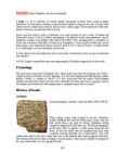
Leidsid 33 sarnast õppematerjali, mis on seotud failiga "The Great Wall of China". Need materjalid aitavad sul teemat sügavamalt mõista.
wall, part, china, wide, brick, build, keep, away, popular, tourist, section, approximately, 6700, years, base, average, height, miles, 1368, 1620, ming, ruled, built, towers, forts, construction, limestone, granite, areas, fired, again, importance, first, ment, later, nomadic, nowadays, original, pass, divided, sections, interesting, good, conditionLegend has it that one day, when the Danes were about to lose a bloody battle, the sky suddenly opened and a red flag with a white cross on it dropped down upon them from the heavens. This is allegedly how the Danes obtained their national flag, the Dannebrog in a battle against the Estonians. In the middle of the 14th century Denmark sold its possessions in Estonia to the German Teutonic Order. Toompea became the seat of the German-born gentry. A wall was built to separate the Upper Town and the Lower Town. In 1285 Tallinn joined the Hanseatic league and became a junction of trade between East and West. Tallinn is said to be built on salt, as it was an important trading commodity. In the 16th century Tallinn had a population of about 7,000 8,000 making it one of the biggest cities in northern Europe. In 1629 Sweden took control of the whole of Estonia. Though hard times
The Dog Fence When you think about the world's longest manmade structures, China and Great Britain (Stonehenge) spring to mind. Very rarely does the Australian continent get a mention, which is a shame, because the Dog Fence, or Dingo Fence, is the longest structures on earth. The Dingo Fence is a barrier that was built in Australia during the 1880s and finished in 1885.This fence was built only on one purpose: to stop dingoes (Australia’s wild dogs) from killing sheep. It is one of the longest structures on the planet, and the world's longest fence. it’s 3,307
restaurants, sport and cultural centres. Every five years national song and folk dance festivals take place in Tallinn. The yachting regatta of the 1980 Moscow Olympic Games was held at Pirita. History Tallinn means in English "Danish town". The place is believed to have been settled by Finno-Ugric people about 2500 BC. It was first marked on a map of the world by the Arab geographer al-Idrisi in 1154. The Estonians were the first to build a stronghold on the spot of the Toompea Hill, but the real Tallinn was built by the Danes who conquered the north of Estonia in 1219. Legend has it that one day, when the Danes were about to lose a bloody battle, the sky suddenly opened and a red flag with a white cross on it dropped down upon them from the heaven. This is how the Danes obtained their national flag. In 1346 the Danish king sold his Estonian lands to the Teutonic Order, who a year later resold them to the Livonian Order
Then it was called Reval for some time and finally Estonians started to call the town Tallinn from Taanilinn (Danish town) after the Danish conquest in the 13th century. The Knights of the Sword took Tallinn from the Danes in 1227 and made Toompea their fortress. In the middle of the 14th century Denmark sold its possessions in Estonia to the German Teutonic Order; Toompea became the seat of German-born gentry. A fortified wall was built between the Toompea (the Upper Town) and the Lower Town (inhabited by people of a lower social standing), as there were conflicts between the two. The doors and the gates of the wall were locked at night, a procedure which carried on until the end of the 19th century. Tallinn joined the German-dominated Hanseatic League in 1285 and became a junction of trade between East and West: furs, honey, leather and seal fat moved west,
The ancient City of London, to which the name originally belonged, still maintains its medieval boundaries, but the name "London" has long applied more to the whole metropolis that has grown up around it. London has been an important settlement for over two millenniums. It is also one of the world's leading business, financial and cultural centres and its influence in politics, education, entertainment and even fashion contribute to its status as a major global city. London is a major tourist attraction with four world heritage sites, several royal parks and numerous iconic landmarks such as the Houses of Parliament, Towe Bridge, the Tower of London, Westminster Abbey and the London Eye. 2. History Although there is some evidence of a permanent settlement before the Romans came in 43 A.D., it is more accepted by historians that the Romans were the first. The settlement was called Londinium.
general and the origin of the name "Lai". 3 Lai Street in general Lai Street is 520 m long and begins at a small green patch below the Toompea slope, where a graceful bronze statue of a Roe Deer by Jaan Koort (1883-1935), one of the best-known Estonian sculptors, has been standing for several decades. Lai Street stretches from Nunne Street to Pikk Street. Parallel with Pikk Street, Lai Street, too, ends at the Great Coast Gate (first mentioned 1359). Lai Street is very wide considering that it was laid out in the Middle Ages. This is because it sprang up on both sides of former city wall. Lai is quite a peaceful street with few shops. However, it has three museums and two theatres. The main entrance into St Olaf´s Church also faces the street. Several Lai Street houses have kept their Gothic appearance and even interiors, although we can also notice moderate Nordic Baroque, Neoclassicicm, Historicism and even Art Nouveau. The origin of the name "Lai"
Snowdonia and include Snowdon, which at 1085 m (3,560 ft) is the highest peak in Wales. Welsh flag has a red dragon on a white and green background. It is not represented on the Union Jack. England is 130 000 square kilometres. Its capital is London. The population is about 50 million people and growing because of immigration. England is bordered to the north by Scotland and to the west by Wales. It is closer to continental Europe than any other part of Britain, divided from France only by a 38 km sea gap. The Channel Tunnel, near Folkestone, directly links England to the European mainland. The English/French border is halfway along the tunnel. London is by far the largest English city and one of the largest and busiest cities in the world. Birmingham is the second largest. A number of other cities, mainly in central and northern England, are of substantial size and influence. These
London History The Romans AD 43- AD 410 The Romans finally invaded Britain in AD 43 from Kent. The Romans lead by Julius Caesar attempted to invade Britain twice before that in 55 and 54 BC but the invasions were unsuccessful. They made their way to the river Thames and sailed up it. The Romans knew it was important to control a crossing point at the river Thames, so they decided to build a settlement on the north bank. Although small settlements had been built on the banks of the Thames, the Romans were the ones who built the first city. They called their city Londinium. The Roman engineers noticed that the point where the swampy river narrowed would make an ideal crossing point, they built London Bridge. Less than 20 years later the native Iceni tribe, led by Queen Boudicca, rose up against the Romans in revenge for mistreatment and burnt Londinium to the ground
history of human settlement. Since ancient times, bridges have been the most visible testimony of the noble craft of engineers. A bridge can be defined in many ways, but Andrea Palladio, the great 16th century Italian architect and engineer, hit on the essence of bridge building when he said "...bridges should befit the spirit of the community by exhibiting commodiousness, firmness, and delight." In more practical terms, he went on to explain that the way to avoid having the bridge carried away by the violence of water was to make the bridge without fixing any posts in the water. Since the beginning of time, the goal of bridge builders has been to create as wide a span as possible which is commodious, firm, and occasionally delightful. Spanning greater distances is a distinct measure of engineering prowess. In terms of engineering, bridges are discussed by design or type (beam, arch, truss, cantilever,
damage. King Charles XI held a nationwide collection of donations in Sweden, the nobility of Estonia added their share and this enabled to restore the church in only two years. T ä h e p õ l d, Kadri. 2005. Giidi käsiraamat: Vanalinn. Tallinn: Ecce Revalia Legend Tallinn also had a Don Juan of its own once; his name was Otto Johann Thuve. He was an outgoing man, loved to eat and drink, and his title of nobility unlocked the hearts of many a woman for him. Before passing away, he repented of his sinful life and asked his kin to bury him next to the main portal of the church. All church-goers would then step over his gravestone and his sins would be redeemed. P o r g a s s a a r, Kristina; A l j a s, Eva-Grete; K u u s k e m a a, Jüri. Tallinn: Medieval capital. Tallinn: PhotoTour I Choir II Body III Vestry IV Chapel of the Freiherr von Güldenbandt V St. George's chapel VI The Fersen's sepulchar chapel VII Chancery of congregation room IX southwest chapel 1
called Britannia. Roman invasions and occupations of southern Scotland were a series of brief interludes. In 834 AD the general Gnaeus Julius Agricola defeated the Caledonians at the battle of Mons Graupius, and Roman forts were briefly set along the Gask Ridge close to the Highland line (none are known to have been constructed beyond that line). Three years after the battle the Roman armies had withdrawn to the Southern Uplands. They erected Hadrian's Wall to control tribes on both sides of the wall, and the Limes Britannicus became the northern border of the empire, although the army held the Antonine Wall in the Central Lowlands for two short periods--the last of these during the time of Emperor Septimius Severus from 208 until 210. The extent of Roman military occupation of any significant part of Scotland was limited to a total of about 40
being the Gulf of Finland, the Gulf of Riga and the Gulf of Pärnu. Bays include the Narva Bay, Matsalu Bay, Kolga Bay, Kunda Bay, Tallinn Bay etc. Estonia has over 1500 islands, the largest being Saaremaa and Hiiumaa, Muhu and Vormsi. Saaremaa and Muhumaa are connected to each other with a bridge. The best- known smalles islands are Naissaar, Aegna, Ruhnu, Kihnu, Väike-Pakri, Suur-Pakri etc. 3. Relief Lying in the north-western part of the East-European Plain, Estonia is mostly flat with an average elevation of about 50 metres above sea level. South-eastern and eastern parts of Estonia are higher than the western parts. The relief of the present-day landscape was shaped during the Ice Age. Ice sheet has carried large boulders and limestone blocks here, not to mention that the hilly terrain in Estonia was also shaped by the continental ice and the melting water. The land is rising 25 cm every one hundred years
south its coast is washed by the Gulf of Mexico. The coastline is even. There are no big islands belonging to the USA except the Hawaiian Islands which lie halfway the continents of America and Asia. The biggest peninsulas are the Florida Peninsula and Alaska. 4. Land Regions Mountains The Appalachian Mountains are a vast system of North American mountains, partly in Canada, but mostly in the United States, forming a zone, from 100 to 300 miles wide, running from the island of Newfoundland some 150 miles south-westward to central Alabama in the United States. The Rocky Mountains, often called the Rockies, are a broad mountain range in western North America. The Rocky Mountains stretch more than 4800 km. The Rocky Mountain System within the United States is a United States physiographic region. Though part of the Pacific Cordillera, they are not to be confused with the Pacific Coast Ranges which are located immediately
Complex Steel Structures? The adoption of three-dimensional (3D) design and construction tools have created a remarkable shift in the building industry. Intelligent 3D technology in the form of Building Information Modeling (BIM) not only promises to improve the notoriously inefficient construction process, but also opens the door for designing new geometric shapes, which until recently have been considered unbuildable. Steel has been extensively used to build some of the most challenging architectural icons of the 21st century, due to its low weight and high strength in both compression and tension. Therefore, the steel design and construction industry has been on the forefront of technical innovation. The purpose of this study is to determine how 3D and BIM are changing the design, fabrication and construction of complex steel structures. The thesis is qualitative in
The king of the animals in the Big Bend is the mountain lion or the Texas "panther". He lives off the deer and wild donkeys that come to the springs for water. There are also rabbits, coyotes, foxes and other small animals there. Other important national parks are the Grand Canyon, the Rocky Mountain National Park, the Olympic NP and the Kings Canyon NP. Washington, D. C. When the settlers of America broke away from Britain in 1776 and founded the United States, they decided to build a new capital city. It was George Washington who selected a patch of land for the capital at the mouth of the Potomac River. The task of planning was given to a French officer. He marked first the sites for the great parliament building the Capitol and the residence for the President the White House. Wide streets running north and south and east and west broke up from the Capitol and the White House
started during the days of the Industrial Revolution * the flag is of Wales bears a Red Dragon (it is not represented on the Union Jack) Northern Ireland: * the capital city is Belfast * 54% of people regard themselves as Protestants and 42% as Roman Catholics * the flag is called the Saint Patrick's Cross 2) History Prehistoric Britain, Roman Britain, Anglo-Saxon, Danish, Norman invasions (...-1066): Britain was part of the European land mass until the end of the last Ice Age. It became an island by about 6000 BC. From about 3000 to 2000 BC the British Isles were inhabited by a group of people called the Iberians. These Stone Age people lived in limestone caves, they used stone axes and fashioned antlers and bones into leather-working tools. Later groups of people from what are now Germany, the Netherlands and Brittany also settled in Briton.
Tallinn English College 2006 1. Introduction If you had to use two words to describe Canada, they might be large and diverse. Canada is the second largest country in the world with a territory of about 10 million square kilometers and it is bordered by three oceans: the Arctic, the Pacific and the Atlantic Oceans. The population of Canada is about 31 million people. About 77% of the people live in cities which lie in a band about 100 miles wide above the border of the United States. The capital of Canada is Ottawa. Other large cities are Montreal, Toronto, Vancouver, Winnipeg and Quebec. 2. Geographical position Canada is a huge country in the continent of North America. It is bordered with the Atlantic Ocean in the east, the Pacific Ocean in the west, the United States of America in the south and the Arctic Ocean in the north. Canada is a vast country, with a territory of 3.8 million
and thus was also the capital of the Holy Roman Empire. 4 Today, the city proper is home to about 1.3 million people, while its metropolitan area is estimated to have a population of over 1.9 million. Since 1992, the extensive historic centre of Prague has been included in the UNESCO list of World Heritage Sites, making the city one of the most popular tourist destinations in Europe, receiving more than 4.1 million international visitors annually, as of 2009. Figure1. IMPORTANT ABOUT CZECH REPUBLIC AND PRAGUE Czech Republic Ceská republika (Czech) Flag Coat of arms Motto: "Pravda vítzí" (Czech) "Truth prevails" Anthem: Kde domov mj? (Czech) "Where is my home?" 5
Tallinn 2006 Canada. If you had to use two words to describe Canada, they might be large and diverse. Canada is the second largest country in the world with a territory of about 10 million square kilometers and it is bordered by three oceans: the Arctic, the Pacific and the Atlantic Oceans. The population of Canada is about 31 million people. About 77% of the people live in cities which lie in a band about 100 miles wide above the border of the United States. The capital of Canada is Ottawa. Other large cities are Montreal, Toronto, Vancouver, Winnipeg and Quebec. Canada has two official languages English and French. It's interesting to know that about 61% of Canadians name English and 24% French their mother tongue. There are also many other languages spoken in Canada such as: Italian, Chinese, German, Polish, Ukrainian, Greek and Dutch. There are also many native languages such as Algonquian.
*Boadicea/Boudica At his death bed, Boudica's husband left half his possession to the emperor, expecting that this would protect his family. However, his property was confiscated. When Boudica, the queen of the Celts, protested, she was flogged and her daughters were raped. She swept trough Southern Britain with her tribe and tortured every Roman she met. A women having power seemed unnatural to the Romans. She fought back for 2 years, but finally took poison and died. *Hadrian's Wall It was built by the emperor Hadrian and it marked the Northen border of the Roman empire. Hadrian's Wall was built, beginning in 122, to keep Roman Britain safe from hostile attacks from the Picts. The wall stretched from the North Sea to the Irish Sea. In addition to the wall, the Romans built a system of small forts called milecastles. Sixteen larger forts holding from 500 to 1000 troops were built into the wall, with large gates on the north face
Ben Nevis, Snowdon, Ben Macdui 7. Stonehenge. Stonehenge was produced by a culture that left no written records. Built on Salisbury Plain, in Wiltshire, England some time between 5,000-4,300 years ago. One of the most famous megaliths in the world, dating from prehistoric times. Stonehenge consists of circles of stone arranged in complex patterns, and their origin is still being explored. Some of the stones come from over 200 miles away in Wales. There is little or no direct evidence revealing the construction techniques used by the Stonehenge builders. It was probably associated with sun-worship and other rites of prehistoric people. It appears to function as a kind of astronomical clock. Conceivable reports and implications about a secret government conspiracy, which seeks to hide the irrefutable evidence of extraterrestrial origins. 8. The Roman Conquest.
Where is it situated? What seas surround it? What kind of climate do you think Britain has? What is its surface like? What countries are situated on the islands? Which country are we going to study? Why? Location Land and climate affect life in every country. Britain is no exception. Britain is the largest island of the British Isles 1. It is just under 1,000 km long and just under 500 km across in its widest part. Britain is separated from the mainland of Europe by the North Sea on the east and the English Channel on the south – by only about 35 km of water at its closest point (the Strait of Dover 2). Most of the coastline is so broken by bays and inlets that no point on the island is more than 120 km from the sea. Climate and Surface Britain has a mild climate which is influenced by the Gulf Stream, an ocean
in the world that occupies an entire continent. The mainland covers an area of 7.7 million km² and it is about 3700 km from the most northern point to its most southern point and about 4000 km from east to west. There are also many different seas around Australia, like the Coral and the Tasman Seas in the west or the Timor and the Arafura Seas in the north, where the Indian and the Pacific Oceans meet. Because all seas and oceans near Australia are warm, surfing is a very popular hobby. Political subdivision Australia is divided into six states, which are: · New South Wales · Victoria · Queensland · South Australia · Western Australia · Tasmania New South Wales is the most populous state in Australia. Its capital is Sydney. Victoria is one of the most densely populated states in Australia. Its capital city is Melbourne and it was named after the British Prime Minister Lord Melbourne. Melbourne is said to be
region, because there is enough food. The savannas which are grasslands with some trees are mostly in the west. Farther west are the bushlands. The real deserts occupy the centre of the Western Plateau. In the very south west there are thin forests of evergreens trees. Australia is the driest inhabited continent, the flattest, and has the oldest and least fertile soils. Only the south-east and south-west corners of the continent have a temperate climate. The northern part of the country, with a tropical climate, has vegetation consisting of rainforest, woodland, grassland, mangrove swamps and desert. Climate is highly influenced by ocean currents, including the El Niño southern oscillation. 4. Land regions Mountains The Great Dividing Range runs along the Pacific ocean. These mountains are very old and much of worn down but the Australian Alps are the highest of them. The highest top Mount Kosciusko is 2228 metres above sea level
Queen of Iceni people of Eastern England, led an uprising against Roman forces Prasutagus(ruler) was first allowed to rule when romans conquered England, after his death, romans decided to rule Iceni and flogged Boudicca and raped her daughters 60-62 AD Iceni rebelled, Boudicca´s warriors defeated Roman Ninth Legion, destroied capital-Colchester Finally Boudicca was defetated, she poisoned herself to avoid capture Hadrian´s wall A defensive barrier builtin 122 AD by Roman emperor Hadrian to guard the northern part of Britain against barbarian invaders Most imposing frontier of Roman Empire, controlling peoples mobements Building took several years, builders kept changing minds about the size 119 km lenght, 5m high, 3m deep The Picts, Caledonia The painted ones, northern tribes, part of the Scots Inhabited an area known as eastern and th
seasons. It appears in number of novels. These days it is not only the interest of tourists but is also a gathering point of certain minority groups. It is now fenced off to protect it from damage. 3. The Roman conquest Julius Caesar's first raid was in 55 BC but the romans left. Ad 43- the Romans came to stay. The army established Roman rule in the south and SW of the country. The Romans started to introduce their laws to a new province of the Roman Empire and started to build good roads. Officials were appointed (governors, procurators to collect taxes, look after the estates and mines and se that the gold, silver, iron and lead were exported back to Rome). Introduced schools,a new language Latin, large farms (villas), baths. In AD 410 they had to leave . roman occupation lasted nearly 400 years. They left behind very little. Roman province of Britannia covered most of present-day England and Wales. 4. Latin influence on English
Tomus was used by the Latins with exactly the same meaning as volumen. Whether made from papyrus, parchment, or paper, scrolls were the dominant form of book in the Hellenistic, Roman, Chinese, and Hebrew cultures. The more modern codex book format form took over the Roman world by late antiquity, but the scroll format persisted much longer in Asia. Codex Woman holding a book (or wax tablets) in the form of the codex. Wall painting from Pompeii, before 79 AD. Papyrus scrolls were still dominant in the 1st century AD, as witnessed by the findings in Pompeii. The first written mention of the codex as a form of book is from Martial, in his Apophoreta CLXXXIV at the end of the century, where he praises its compactness. However the codex never gained much popularity in the pagan Hellenistic world, and only within the Christian community did it gain widespread use
established the first global empire, becoming one of the world's major economic, political and military powers. In addition, the Portuguese Empire was the longest-lived of the modern European colonial empires, spanning almost 600 years, from the capture of Ceuta in 1415 to the handover of Macau in 1999 and grant of sovereignty to East Timor in 2002. The empire spread throughout a vast number of territories that are now part of 53 different sovereign states. However, the country's international status was greatly reduced during the 19th century, especially following the Independence of Brazil, its largest colony. After the 1910 revolution deposed the monarchy, the democratic but unstable Portuguese First Republic was established, itself being superseded by the "Estado Novo" authoritarian regime. Democracy was restored after the Portuguese Colonia l War and the Carnation Revolution in 1974. POPULATION
Intended to bring attention to American Indian issues such as treaty rights, living standards, and inadequate housing. Huge media coverage "20-Point Program" · Present situation 1 Reservations situated west of the Mississippi 1% of the population Minority group, less privileged Social problems Self-awareness Mixture of old and new HOW GOVERNMENT ACTS NOW- gives natives money and near Las Vegas the right to own casinos to compensate injustice and taking away land. II First Settlements · Jamestown Colony (living conditions, population, plantations, import of slaves) First permanent English colony in North-America 214 settlers Searching for gold (none found) Strategically good location, James River Quite poor conditions. Starvation, diseases, lack of water, attacks of natives , fierce weather Tobacco plantations African slaves, working in tobacco harvest 1620 by Dutch boat. Also Englishmen (convicts and poor people)
........................ 59 17.1 Where Do We Get Our Oil?..................................................................................... 59 17.2 What Fuels Are Made From Crude Oil?...................................................................60 17.3 How Does Oil Impact The Environment?................................................................60 3 ENERGY STORY Once upon a time, in a town not far away, there was an 8th grader who was afraid of the dark. Her name was Jules. She was also afraid of the quiet, and of the cold. So she always left on the lights, the TV, and stereo even when she had her I-Pod earbuds on. She took lots of very long, hot showers. She never walked anywhere, but got rides from her mom in a big SUV. She couldn't be happy unless she was using all the energy she possibly could for all the stuff around her. Her friend, Les, didn't like to use any energy at all
" I hoped he didn't think so little of me as to believe I would give up that easily. "When did he buy it?" "He bought it in 1984, I think." "Did he buy it new?" "Well, no. I think it was new in the early sixties -- or late fifties at the earliest," he admitted sheepishly. "Ch -- Dad, I don't really know anything about cars. I wouldn't be able to fix it if anything went wrong, and I couldn't afford a mechanic..." "Really, Bella, the thing runs great. They don't build them like that anymore." The thing, I thought to myself... it had possibilities -- as a nickname, at the very least. "How cheap is cheap?" After all, that was the part I couldn't compromise on. "Well, honey, I kind of already bought it for you. As a homecoming gift." Charlie peeked sideways at me with a hopeful expression. Wow. Free. "You didn't need to do that, Dad. I was going to buy myself a car." "I don't mind. I want you to be happy here." He was looking ahead at the road when he said this
nobody else. You want your children to have good grades in school? Then practice Capitalist Niggerism because then you will not blame the teachers for failing your children or blame the nationwide testing services for using non-black questions in their testing. You will be in control because you will totally understand that everything that happens to your child at school is a result of the learning environment you have provided him or her at home. You want to succeed in creating wealth, join Wall Street. Don’t make excuses that Blacks don’t know how to invest their money. Go after the Caucasians. Use their guilt to your advantage. Another important point which I raised in this book concern the long study I have conducted regarding the economic behaviour of East Indians and Pakistanis. It is an economic doctrine I have christened the “Spider Web Doctrine,” because I believe we all understand how spiders behave. They build a web, and
as polyp. There are more than 300 varieties of coral, which is a ultimate dream of every shell- collector. There are undersea observations, glass-bottomed boats and water scopes for undersea viewing, as well as skin-diving equipment. The Great Barrier Reef is and ideal place for a sunny holiday. The relief: Australia is an old and low continent with simple relief. Plains cover the greater part of the land. Most of the rocks have turned into sand and there are big sand deserts on the Western Plateau. In the centre of Australia are lowlands which are covered with sedimentary rocks. Deserts cover most of the land in Australia. Most of the deserts lie in the central and north-western part of the country. The deserts in Australia occupy 18% of the continent. The biggest deserts are the Great Victory Desert, the Great Sandy Desert, the Tanami Desert, the