Legend has it that one day, when the Danes were about to lose a bloody battle, the sky suddenly opened and a red flag with a white cross on it dropped down upon them from the heavens. This is allegedly how the Danes obtained their national flag, the Dannebrog in a battle against the Estonians. In the middle of the 14th century Denmark sold its possessions in Estonia to the German Teutonic Order. Toompea became the seat of the German-born gentry. A wall was built to separate the Upper Town and the Lower Town. In 1285 Tallinn joined the Hanseatic league and became a junction of trade between East and West. Tallinn is said to be built on salt, as it was an important trading commodity. In the 16th century Tallinn had a population of about 7,000 8,000 making it one of the biggest cities in northern Europe. In 1629 Sweden took control of the whole of Estonia. Though hard times
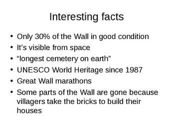
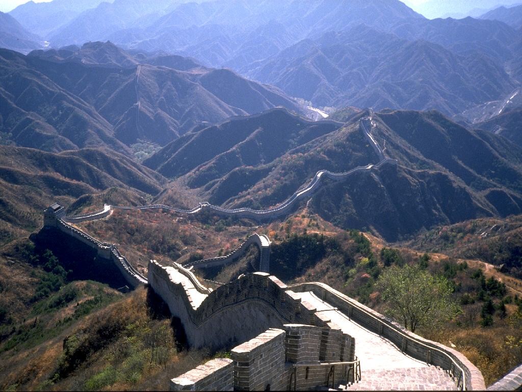
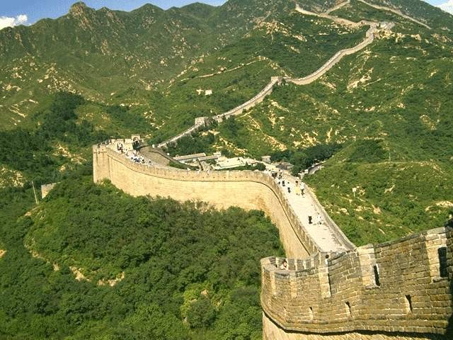
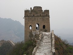
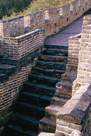
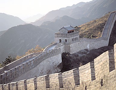
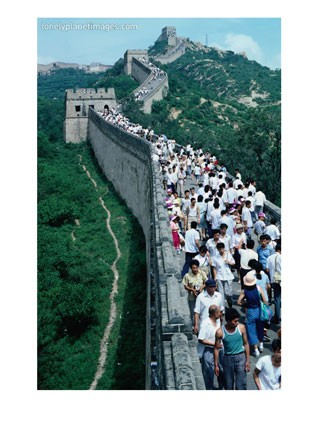
The Dog Fence When you think about the world's longest manmade structures, China and Great Britain (Stonehenge) spring to mind. Very rarely does the Australian continent get a mention, which is a shame, because the Dog Fence, or Dingo Fence, is the longest structures on earth. The Dingo Fence is a barrier that was built in Australia during the 1880s and finished in 1885.This fence was built only on one purpose: to stop dingoes (Australia’s wild dogs) from killing sheep. It is one of the longest structures on the planet, and the world's longest fence. it’s 3,307 miles long
the north of Estonia in 1219. Legend has it that one day, when the Danes were about to lose a bloody battle, the sky suddenly opened and a red flag with a white cross on it dropped down upon them from the heaven. This is how the Danes obtained their national flag. In 1346 the Danish king sold his Estonian lands to the Teutonic Order, who a year later resold them to the Livonian Order. The Germans renamed Tallinn and called it Reval. Toompea became the seat of the German-born gentry. A fortified wall was built between Toompea (the Upper Town) and the Lower Town, as there were conflicts between the two. The Lower Town was the home of simple people, the artisans and the merchants. The doors and gates in the wall were locked at night. Tallinn joined the German-dominated Hanseatic League in 1285 and became a junction of trade between East and West: furs, honey, leather and seal fat moved west, while salt, cloth, herring and wine moved east. Its geographical position was very favourable, with
It's the capital and main seaport of Estonia. Tallinn is a very beautiful city that lies on the Baltic Sea. It covers 158 square kilometres. The Mayor of Tallinn is Jüri Ratas. The population of our capital is about 400000 people. About 55% of them are Estonian, 37% Russians and the other 8% are from different nations. The people here are mostly engaged in industry- mainly the food industry (23%), trade (16%) and transport and communication (14%). History. Tallinn has a great history. It was first marked on a map of the world by the Arab geographer al-Idrisi in 1154, its name then being Kolyvan. In the 13 th- century chronicle of Henricus de Lettis the town was called Lyndanise. Then it was called Reval for some time and finally Estonians started to call the town Tallinn from Taanilinn (Danish town) after the Danish conquest in the 13th century. The Knights of the Sword took Tallinn from the Danes in 1227 and made Toompea their fortress
However disaster struck during the Black Death, when London lost nearly a third of its population. After the defeat of the Spanish Armada, stability in politics allowed the city to grow even more. In 1603, James VI of Scotland came to the throne of England, essentially uniting the two countries. An assassination attempt was made on him on the 5th of November in 1605, now known as the famous Gunpowder Plot. Plague caused more problems for London later in that century, culminating in the Great Plague. That was the last major outbreak in Europe, possibly thanks to the Great Fire of London in 1666. The fire broke out in the original City and quickly swept through London's wooden buildings, destroying large amounts of the city. Rebuilding took over ten years. Following London's growth in the 18th century, it became the worlds largest city from about 1831 to 1925. This growth was aided from 1836 by London's first railways, which put countryside towns within easy reach of the city
In the beginning there are also two introductory chapters about Lai Street in general and the origin of the name "Lai". 3 Lai Street in general Lai Street is 520 m long and begins at a small green patch below the Toompea slope, where a graceful bronze statue of a Roe Deer by Jaan Koort (1883-1935), one of the best-known Estonian sculptors, has been standing for several decades. Lai Street stretches from Nunne Street to Pikk Street. Parallel with Pikk Street, Lai Street, too, ends at the Great Coast Gate (first mentioned 1359). Lai Street is very wide considering that it was laid out in the Middle Ages. This is because it sprang up on both sides of former city wall. Lai is quite a peaceful street with few shops. However, it has three museums and two theatres. The main entrance into St Olaf´s Church also faces the street. Several Lai Street houses have kept their Gothic appearance and even interiors, although we can also notice moderate Nordic
These include: Manchester, Leeds, Liverpool, Newcastle, Sheffield, Bristol, Coventry, Leicester, Nottingham and Hull. England features mostly low hills and plains. the Lake District in the north- west features some of England's most beautiful landscapes, and includes Scafell Pike at 978 m, the highest point of England. There are also some important rivers in England and the most significant ones are Thames, Severn (the longest river in Great Britain) and Avon. The flag of England is a red cross on a white background. It is also on the Union Jack. Scotland is in the northern part of Britain. It covers a little less than 80000 square kilometres and this is about one third of Great Britain. The population of Scotland is about 5 million people. There are three official languages spoken there: English, Scots, Gaelic. Edinburgh, the country's capital and second largest city, is one of Europe's
They called their city Londinium. The Roman engineers noticed that the point where the swampy river narrowed would make an ideal crossing point, they built London Bridge. Less than 20 years later the native Iceni tribe, led by Queen Boudicca, rose up against the Romans in revenge for mistreatment and burnt Londinium to the ground. The well disciplined Roman army defeated her forces and Londinium was rebuilt. By AD 100 it had also become the capital of the Roman province. A massive wall was built to protect the city from further attacks. The Roman Empire came under increasing attack across Europe and in AD 410 they retreated. The Romans gave us a language based on Latin, the calendar, law and legal system, the census and also straight roads, central heating and concrete. Anglo- Saxons around AD 400 Anglo- Saxons were warrior farmers from Germany, Denmark and the Netherlands. Later in the 5th century, Anglo-Saxons settled just west of Londinium, around the Strand, and formed


Kõik kommentaarid