Warm up first. Stretching muscles when they're cold increases your risk of injury, including pulled muscles. Warm up by walking while gently pumping your arms, or do a favorite exercise at low intensity for five minutes. Better yet, stretch after you exercise -- when your muscles are warm and more receptive to stretching. Hold each stretch for at least 30 seconds. It takes time to lengthen tissues safely. Hold your stretches for at least 30 seconds -- and up to 60 seconds for a really tight muscle or problem area. That can seem like a long time, so keep an eye on the clock or your watch. Then repeat the stretch on the other side. For most muscle groups, a single stretch is often enough if you hold it long enough. Don't bounce. Bouncing as you stretch can cause small tears in the muscle. These tears leave scar tissue as the muscle heals, which tightens the muscle even further -- making you less flexible and
TALLINNA TEHNIKAÜLIKOOL Ärikorralduse instituut Ruslan Karpovits 050829 IATM Stretches and exercises in office Referaat Esitatud: 22.09.2008. Juhendajad: Ülo Kristjuhan Tallinn 2008 Stiff neck, back and wrist pain, poor circulation - these are just some of the health hazards that can come with having an office job. It doesn't have to be that way. Human bodies are made to move. It is recommended that a person break for 5-10 minutes for every hour spent at a workstation
yoga. Bodybalance is a motivating BLEND OF YOGA WITH TAI CHI AND PILATES provided with music for a thoroughly refreshing, holistic workout. Breathing control is a part of all the exercises, and instructors will always provide options for those just getting started. You'll strengthen your entire body and leave the class feeling calm and centered. Bodybalance is ideal for anyone and everyone. Now I will try to explain how Bodybalance training is going. A class is made up of 45 minutes of stretches, balances and toning exercises and is followed by 10 minutes of relaxation and meditation. Usually this class is started with Tai Chi warm up. Next it would be yoga pose sun salutions. After it would be done balances pose including the tree pose which is good for strength building. Then, hip stretches followed. The purpose of doing that is to unlock the stiffness in the lower body. After that, it is pilates meant for the abdominals and lower back muscles
Canada is a big country. It’s covering 9.9 million square kilometrs, making it the world’s second-largest country by land area. Canada stretches nearly a quarter of the way around the globe and covers six of the world’s 24 time zones. Canada has the longest coastline in the world, so it meets three oceans: the Pacific, the Atlantic and the Arctic. Canadians are multicultural. They are proud of the many cultures that exist side by side in their country. It has two official languages, English and French. The Canadian population is made up mainly of British and French origins. However Canada is not like Britain, or France, or the USA
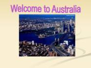
20 per cent of Second level Australians are Third level Fourth level Fifth level foreign born v Since 1945 more than six million people from across the world have come to Australia to live GEOGRAPHY v Sixth largest country in the world v Australia's coastline stretches almost 50,000 kilometres and is linked by over 10,000 beaches v The mainland is the largest island and the world's smallest, flattest continent v Australia is located between the Indian and South Pacific Oceans PLACES WHERE I WENT IN AUS Click to edit Master text style v PERTH Second level Third level ALBANY v Fourth level
Canada Geography It borders USA from the south and north-west, it stretches from the Atlantic to the Pacific and northward into the Arctic Ocean The area of Canada is about 9,984,670 km2 The biggest cities are Toronto, Montreal and Vancouver The population of Canada is about 35,344,962 The main languages in Canada are English and French History First settlers entered Canada through Beringia by way of the Bering land bridge Some of their cultures had collapsed by the time European explorers arrived in the late 15th and early 16th centuries
wedged between the Andes mountains and the Pacific Ocean. Chile's unusual, ribbon-like shape -- 4,300 kilometres long and on average 175 kilometres wide -- has given it a hugely varied climate, ranging from the world's driest desert -- the Atacama -- in the north, through a Mediterranean climate in the centre, to a snow-prone Alpine climate in the south, with glaciers, fjords and lakes. The Pacific forms the country's entire western border, with a coastline that stretches over 6,435 kilometres. Chile expanded in the late 19th century, when it incorporated its northern and southern regions. Southern Chile is rich in forests and grazing lands and features a string of volcanoes and lakes. The southern coast is a labyrinth of fjords, inlets, canals, twisting peninsulas, and islands. Prior to the coming of the Spanish in the 16th century, northern Chile was under Inca rule while the indigenous Araucanians inhabited central and southern Chile. Although Chile
Area Protected (km 2) 90,242 2 Area Protected (km ) in Categories I-IV* 28,751 Recorded extinctions since 1500. *Categories I-IV afford higher levels of protection. OVERVIEW The largest of the world's five Mediterranean-climate regions, the Mediterranean Basin stretches west to east from Portugal to Jordan and north to south from northern Italy to Morocco. Surrounding the Mediterranean Sea, the hotspot's 2,085,292 km² also include parts of Spain, France, the Balkan states, Greece, Turkey, Syria, Lebanon, Israel, Egypt, Libya, Tunisia and Algeria, as well as around five thousand islands scattered around the Mediterranean Sea. West of the mainland, the hotspot includes the Macaronesian Islands of the
Tallinn weathered plague and the Great Northern War and became part of Russia in 1710. In 1918, Estonia declared independence from Russia and fought a bitter war against Bolshevik Russia. Independence didn’t last long, however, and the fledgling nation fell first to the Nazis and then the Soviets during World War II. Despite all this conquering, Tallinn’s historic core has survived remarkably intact. Much of the 14th century city wall still stands, including a couple of stretches where you can climb the narrow spiral staircases of the towers and end up on the medieval catwalk. The Viru Gates, flanked by thin pointed towers from the 14th century, makes a nice entrance into Old Town. Dominating the town atop Toompea Hill is Toompea Castle and Pikk Hermann Tower. It was used as the center of government since 1229 and is now the site of Estonia’s parliament. Nearby stands the inappropriately named Maiden’s Tower that used to house a prison for prostitutes.
concentrated in the Quebec City- Windsor Corridor, the British Columbia Lower Mainland, and the Calgary-Edmonton Corridor. 80% of the population live within 150km of the US border; 90% lives within 300km of the US border. Most First Nations live in reservations in the southern part of the country. If you look at the map of the world, you will notice what a huge country Canada is. It is the second largest country in the world, xceeded only by Russia. From St. John`s to Victoria Canada stretches about 7000km. In fact, Canada`s east coast is closer to Europe than it is to Canada`s west coast. It also extends southward from the North Pole to the US border. Canada`s northen coast is washed by Arctic Ocean, eastern coast by the Atlantic Ocean and western coast by the Pacific Ocean. Canada is so big that it contains six time zones. This huge land mass has been divided by nature into 6 distinct geographical regions. Stretching across the north is the Artic region. On the east there is
British Columbia has a climate much like the climate of southern England. The capital is the charming city of Victoria on Vancouver Island. More than three-fourths of all the manufacturing that goes on in Canada is carried on in the provinces of Quebec and Ontario, much of it in the cities of Montreal and Toronto. Montreal is Canada's biggest city. Toronto is next in size. It is easy to Canada to send its products abroad. Novas Scotia stretches far out into the Atlantic. Ocean-going ships travel up the St. Lawrence River to Montreal. The St. Lawrence Seaway makes Toronto and other cities on the Great Lakes into inland seaports. The maple leave is the Canada's symbol. It is on the flag and in 1974-1976 it was situated on the coins.
Solomon Islands Geography The Solomon Islands lie northeast of Australia in the South Pacific Ocean. They are part of a long chain of archipelagos called Melanesia, which stretches from Papua New Guinea in the north to New Caledonia and Fiji in the south. Second largest in the Melanesian chain, the Solomon Islands archipelago covers approximately 310,000 square miles (803,000 square kilometers) of ocean and consists of 10,639 square miles (27,556 square kilometers) of land. There are a total of 992 islands in the Solomon Islands History When Spanish explorer Álvaro de Mendaña de Neira visited the Solomon Islands in
world's higher (vascular) plants grow on the island's productive soils. 3 Geography Papua New Guinea consists of over 600 islands and lies in the middle of the long chain of islands stretching from mainland South-East Asia. The mainland and larger islands are mountainous and rugged, divided by large fertile upland valleys. Fast- flowing rivers from the highlands descend to the coastal plains. A line of active volcanoes stretches along the north coast of the mainland and continues on the island of New Britain. To the north and south of this central mountain range on the main island lie vast stretches of mangrove swamps and coastal river deltas. /1/ Volcanoes and thermal pools are also found in the southeast of other islands. Papua New Guinea offers the greatest variety of terrestrial ecosystems in the South Pacific, including five types of lowland rainforest, 13 types of montane rainforest, five varieties of palm and
It was on the first of July, 1967, that four provinces of British North America joined together and formed the Dominion of Canada. Geographical facts. Canada occupies the northern portion of North America. It shares land borders with the United States to the south and with Alaska to the northwest. It shares territorial water boundaries with the United States, Greenland to the northeast, and Saint-Pierre and Miquelon (an overseas community of France) to the southeast. Canada stretches from the Atlantic Ocean in the east to the Pacific Ocean in the west. To the north lies the Arctic Ocean. The most densely populated part of the country is the Quebec City-Windsor Corridor in the east. This part is thinly soiled, rich in minerals, and dotted with lakes and rivers--over 60% of the world's lakes are in Canada. Canada is rich in lakes and rivers. The largest lake is the Great Bear Lake (31,153 km²)
· We identified three SNARE homologue genes (SNARE3, SNARE5 and SNARE6) from the wheat cultivar HD2329 + Lr28 using homology searches. · The phylogenetic tree shows that SNARE3 and SNARE5 belong to Qc II group and SNARE6 belong to Qb II group. · With the help of Modeller software 3-D structures were predicted for all the three SNARE genes. The -helical coiled coil structures were detected in all three models. · The model of the polypeptide encoded by SNARE6 seems to have two stretches of - helical coils, separated by a small turn and the two coils fold onto each other as a hairpin. · This is analogous to SNAREs called SNAPs (SNAP-25, SNAP-29, SNAP-47) which are referred to as the Qbc SNAREs, as they contain two SNARE domains (both Qb & Qc) in a single polypeptide chain and they fold upon each other during SNARE complex formation. · Therefore, during SNARE assembly, this single protein contributes two SNARE
September or early October. Aborigines The Aborigines probably came to Australia as modern human beings 40,000 to 60,000 years ago. Some people beleive that the Aborigines have existed on Australia for 120,000 to 150,000 years, but have not been able to find conclusive evidence to support their theories. It is not known from where the Aboriginals began their journey, but it is certain that people with some kind of water craft crossed the 100 - 160 kilometres stretches of water between the islands to the north; and reach the southern continent. This sea voyage is the earliest evidence of sea travel by prehistoric man. Religion The Aborigonal religion is based heavily on the Dreaming. The Dreaming is the Aboriginal creation story. Aborigines believe that at the beginning of time the world was a shapless mass of nothing, waitng to be transformed into what we see today
picnic spots, walking and jogging tracks, secluded spaces for sunbathing and easy put-ins for boats. The beach is popular with local surfers, as well as wedding parties. 10. Ninety Mile Beach, Northland-While the name Ninety Mile Beach is actually a misnomer (it's really only 55 miles long, and New Zealanders use kilometers rather than miles), it is justly a top tourist destination for its staggering beauty. With sand dunes reminiscent of a desert landscape, it stretches from just west of Kaitaia right to Cape Reinga, the northernmost tip of New Zealand. Golden sands and impressive breakers alongside the magical Aupouri Forest make this perhaps the most famous beach in New Zealand -- it's certainly the biggest. The long stretch of beach is best accessed from Ahipara township at the southernmost point of the beach. Follow Sandhill Road north with various access points dotted along the way.
on a cruise vacation to will appeal to the adventure junkie experience two Caribbean better than any of our best countries for the expense of destinations. Dive into the depths one. This dual-governed island of Hadicurari Beach to explore the nation offers chic dining and island's many shipwrecks, avoid the Aruban rattlesnake on an ATV dazzling stretches of sand on tour of the Arikok National Park, or the French side of Saint Martin, party hearty until the wee hours on and animated nightlife, buzzing a booze cruise. But you should be casinos, and some of the best prepared to pay for the adrenaline duty-free shopping of the rush, as Aruba is also one of the Caribbean in Dutch Sint pricier vacations on our list. Maarten. Consider visiting in
King's Park Capital of island-state Bay of Fires Tasmania. Winters are very cold. Population of about 200,000. Lavender Farm Remarkable Cave Coles Bay Warumbungle NP Crowdy Bay NP Cockatoo NP Crowdy Bay NP It's the world's largest coral reef (over 2000 km). It stretches along the east coast of Queensland. It's made up of over 2900 individual reefs very close to each other. Australians really love nature. They try to protect their nature and their animals. British Australian barbecue barbie kangaroo roo mosquito mozzie chicken chook candy lollie slippers thongs TV tellie girl sheila form year sheep jumbuck
Wall hõlmab ka iidse Hiina arhitektuur oskusi. Aastal 1987 Suur Hiina müür oli värvatud on UNESCO maailmapärandi nimekirjas. Lisaks Hiina müür on ka üks New Seven Wonders of the World. The Great Wall of China Asia, China The Great Wall of China is a series of stone fortifications built in China from the 5th century BC to the 16th century. The wall was built throughout several dynasties to protect the empire from Xiongnu attacks. The Great Wall of China stretches over approximately 6,700 kilometers, passing through Gansu Province, Ninxia Hui Autonomous Region, Shaanxi Province, Shanxi Province, Inner Mongolia, Hebei Province and Liaoning Province. It was once claimed the Great Wall is visible to human eyes from the moon. But it is proved to be just a myth as no astronaut has ever claimed they had seen the Great Wall of China from the moon. Three main passes of the Great Wall of China are Juyongguan, Jiayuguan and Shanhaiguan.
CANADA Canada is a vast country, second largest country of the world after Russia. It stretches from the Atlantic Ocean in the east to the Pacific Ocean in the west and to the Arctic Ocean in the North. Canada Covers most of the northern part of North America and its geography is very diverse. Canada's area is about 10 million square kilometers and its population is 31 000 000. Its capital is Ottowa and other main cities are Toronto, Montreal and Vancouver. Almost 75 % of canadians lives within 300 kilometer of the USA border, because the climate is softer in the South
Tundra The main seasons are winter and summer. The tundra is the world's coldest and driest biomes. The average annual temperature is -28° C. Nights can last for weeks when the sun barely rises during some months in the winter, and the temperature can drop to -70° C. During the summer the sun shines almost 24 hours a day. Summer are usually warm. Average summer temperatures range from 3° to 16°C. TaigaTaiga is the Russian word for forest and is the largest biome in the world. It stretches over Eurasia and North America. The taiga is located near the top of the world, just below the tundra biome. The winters in the taiga are very cold with only snowfall. The summers are warm, rainy, and humid. Some of the animals in the taiga hibernate in the winter, some fly south if they can, while some just cooperate with the environment. GrasslandsGrassland biomes can be found in the middle latitudes. They can have either moist continental climates or dry subtropical climates. There
Alberta, Saskatchewan, and Manitoba are Canada's Prairie Provinces. They are known for their rolling plains and extreme climate with long, cold winters and hot, dry summers. Much of the area is covered with farms producing large quantities of wheat and other grains. The region is also rich in oil and natural gas. The Prairie Provinces are not only characterized by their rolling plains but also the great Canadian Shield a rocky landscape with lakes, rivers and forests that stretches over almost half of Canada covers Northern Saskatchewan and Manitoba. Southwestern Alberta has the Rocky Mountains and some of the most spectacular scenery in the country. This region, which includes Ontario and Quebec, is not really the geographic centre of Canada. The region gets its name because, historically, it has been the centre of political and economic power in the country. Canada's capital city is Ottawa, Ontario. Central Canada is also
Estonia has many rivers but only nine of them are longer than 100km. The most important ones are Pärnu River and Emajõgi River Climate Estonia lies in the northern part of the temperate climate zone and in the transition zone between maritime and continental climate. Because Estonia is continuously warmed by the Gulf Stream it has a milder climate despite its northern latitude. Northern latitude means long summer daylight hours (the longest summer day stretches to 19 hours), and dark winters when daylight lasts sometimes only six hours. Being on the Baltic Sea the country is subjected to sea breezes and humidity. Estonia has a temperate climate, with four seasons of near-equal length. Summer is warm, while spring and autumn can be mild. Winter, which lasts from November to middel March, 4 can be very cold. The cold winter does not necessarily mean constant snow; in fact snowfalls
The Doggy Style sex position is an absolute classic and, like it or loathe it, it's one that's in every girl's sexual repertoire. She's on all fours. In order to hold her balance, she shifts her weight off her hands back towards her partner - she can use a rocking motion to get the rhythm she wants. He kneels directly behind her and holds her hips firmly to control the thrusts. The Nirvana The Nirvana sex position is a classic. When trying the Nirvana sex position, she lies on her back, stretches her legs out and holds onto the bedposts above her head. She keeps her legs together as he enters her with his thighs outside hers. With every thrust the pressure of her thighs intensifies the penetration effect and provides for a natural stimulation of the clitoris. Dangerously good. The Padlock She climbs onto a high piece of furniture (a washing machine is a winner...), sits on the edge and supports herself with arms behind her. He stands in front of her and she wraps her legs firmly
Baltic States. It is located on the eastern shores of the Baltic Sea in the north east of Europe. To the east the country borders Russia. Latvia is the countries neighbour to the south. From the west the coast of Estonia is washed by the Baltic Sea and from the north by the Gulf of Finland. The length of the coastline is approximately 3 800 km. The longest distance from east to west is 350 km, while north to south Estonia stretches 240 km. THE NAME The name EESTI was apparently derived from the word AISTI, the name given by ancient Germans to the peoples living northeast of the Vistula River. Tacitius, the Roman historian, was the first one to mention it (AESTI), while the Arab scholar alIdrisi was the first one to mark it on a map (as ASTLANDA). To the ancient Scandinavians the land was known as EISTLAND; to modern Scandinavians it is known as ESTLAND. Most contemporary languages use the Latin name ESTONIA
predominance. From time to time some stronger state seized the land of the neighbouring kingdoms & made them pay tribute or even ruled directly. The number of kingdoms & their boundaries were always changing. The greatest & most important kingdoms were Kent, Northumbria, Mercia & Wessex. King Offa of Mercia claimed ,,Kingship of the English". His power his shown by the border barrier he built between Mercia & Wales Offa's Dyke. It probably took 5000 men to build it. It stretches for about 180 km, was 7 metres high, the ditch in front of it 2 metres deep. By the beginning of the 9th cent. Wessex had become the strongest. Wessex never again lost its supremacy. In 829 King Egbert was acknowledged by Kent, Mercia & Northumbria. This was the beginning of the united kingdom. King Egbert became 1st King of England. The clergy, royal warriors & officials supported the king's power. He granted them land and the right to collect dues from the peasants & hold judgement over them
wide, 130km long) was dry for a hundred years until 1950. Lake Eyre is the lowest place in Australia. It is 16 meters below sea level. Other bigger lakes are Lake Disappointment, Lake Mackay, and Lake Carnegie in the western part. Lake Torrens, Lake Gairdner and Lake Eyre in the southern part. Rivers The biggest river is the Murray. The other biggest rivers are the Mitchel and the Flinders. Other rivers are short and have water only after rains. The Climate Australia stretches from the tropics to the temperature region. It is a hot and dry country. The northern part has a hot tropical climate with heavy rainfall. It has two seasons - wet summer and dry winter. The south and the east of Australia have warm summers and winters. The southeastern coast gets rains all year around. The southwest area has hot, dry summers and mild moist winters. In the west and in the outback the temperature is often 35 degrees in the summer months. The outback receives almost no rainfall
chickens and eggs, pigs, wheat and cotton. US farms also produce large amounts of hay, tobacco, turkeys, oranges, potatoes, tomatoes, apples, peanuts and sorghum. Farmers throughout the country rear dairy cattle for milk and other products. Much of the dairy production is concentrated in a belt that extends from Minnesota to New York. Midwestern states account for much of the nation's maize, soybeans and pig production. The nation's chief wheat-growing region stretches across the Great Plains. Most of the chickens are reared in the South. California and states in the South and Southwest produce almost all of the country's cotton. Farmers in other areas also produce poultry, eggs, fruit, vegetables, nuts and many other crops. The use of modern machinery and agricultural methods has helped make U.S. farms to be one of the most efficient in the world but it has also increased production costs. Many
wheat and cotton. US farms also produce large amounts of hay, tobacco, turkeys, oranges, potatoes, tomatoes, apples, peanuts and sorghum.Farmers throughout the country rear dairy cattle for milk and other products. Much of the dairy production is concentrated in a belt that extends from Minnesota to New York. Midwestern states account for much of the nation's maize, soybeans and pig production. The nation's chief wheat-growing region stretches across the Great Plains. Most of the chickens are reared in the South. California and states in the South and Southwest produce almost all of the country's cotton. Farmers in other areas also produce poultry, eggs, fruit, vegetables, nuts and many other crops.The use of modern machinery and agricultural methods has helped make U.S. farms to be one of the most efficient in the world but it has also increased production costs
" The same forces of erosion have uncovered some of the largest concentrations of dinosaur fossils in the world. Alberta is Canada's leading producer of petroleum. The sedimentary rocks underlying the Prairies have important deposits of oil, natural gas and potash. The Canadian Shield A huge inland sea called Hudson Bay extends into the heart of Canada, and wrapped around this bay is a rocky region called the Canadian Shield. Canada's largest geographical feature, it stretches east to Labrador, south to Kingston on Lake Ontario and northwest as far as the Arctic Ocean. The Shield is considered to be the nucleus of the North American continent and is made up of roots of ancient mountains. Its gneiss and granite rocks are 3.5 billion years old, three quarters the age of the Earth. Scraped by the advance and retreat of glaciers, the Shield has only a thin layer of soil that supports a boreal forest of spruce, fir, tamarack and pine.
rocks. Deserts cover most of the land in Australia. Most of the deserts lie in the central and north-western part of the country. The deserts in Australia occupy 18% of the continent. The biggest deserts are the Great Victory Desert, the Great Sandy Desert, the Tanami Desert, the Simpson Desert and the Gibson Desert. Although Australia is a low continent, there are a few mountain rangers there, too. The biggest is the Great Dividing Range. It stretches more than 3500 km from the north-eastern tip of Queensland, running the entire length of the eastern coastline through New South Wales, then into Victoria and turning west, before finally fading into the central plain at the Grampians in western Victoria. It consists of a complex of mountain ranges, plateaus, upland areas and escarpments. One part of the Great Dividing Range is the Australian Alps. It's highest point is Mount Kosciuszko, which is 2,228 metres high
Lai Street. In the beginning there are also two introductory chapters about Lai Street in general and the origin of the name "Lai". 3 Lai Street in general Lai Street is 520 m long and begins at a small green patch below the Toompea slope, where a graceful bronze statue of a Roe Deer by Jaan Koort (1883-1935), one of the best-known Estonian sculptors, has been standing for several decades. Lai Street stretches from Nunne Street to Pikk Street. Parallel with Pikk Street, Lai Street, too, ends at the Great Coast Gate (first mentioned 1359). Lai Street is very wide considering that it was laid out in the Middle Ages. This is because it sprang up on both sides of former city wall. Lai is quite a peaceful street with few shops. However, it has three museums and two theatres. The main entrance into St Olaf´s Church also faces the street. Several Lai Street houses have
At that time, known as the last great Ice Age, Australia was joined to New Guinea. Islands such as Java and Borneo were larger than today, sea passages between them narrower. This made it possible for the ancestors of the people now called Australian Aboriginals to reach Australia from lands to the north. It is not known from where the Aboriginals began their journey, but it is certain that people with some kind of water craft crossed the 100 - 160 kilometres stretches of water between the islands to the north; and reach the southern continent. This sea voyage is the earliest evidence of sea travel by prehistoric man. As the ice flows of the Ice Age began to melt, the sea level rose, isolating Australia, and making the sea passages too wide for crossing by the simple forms of watercraft available at the time. About 10,000 years ago, Tasmania became separated from the main land, isolating
bought about 600000 acres of land from a band of Aborigines. He decided to build a town there. Settlers began to move in and in 1851 gold was found. Goldseekers poured in and the town grew rapidly. The city developed into a major port and commercial centre. The landmarks to be mentioned in Melbourne are the City hall, Olympic park and Royal Botanic gardens. New South Wales. It is a picturesque state. It's got everything from the Blue Mountains to beautiful stretches of golden beaches. The Blue Mountains are part of the Great Dividing Range which runs up the east coast of Australia. Mount Kosciusko is in New South Wales. There are some permanent rivers in that state but they don't amount to much. It is the most populated state. It is and industrial state. Important minerals are found there lead, zinc and silver. They are now even more important than gold. Botany Bay is the most famous sightseeing there. The capital is Sydney
NT: It was not Cape town, where people only frowned when they saw a black boy and a white girl... but. (here he loved her) SSD-s that are based on REDUNDANCY OF ELEMENTS OF SPEECH are: (Here belong devices based on repetition) FRAMING FRAMING means repeating the same word, phrase or sentence at the beginning and at the end of a sentence or passage.In this way the repeated unit is emphasised. NT: the street, so soft and sunny. Here he comes. She smiles and stretches out her hands. ANADIPLOSIS ANADIPLOSIS means repeating a word or phrase at the end of the clause or sentence and at the beginning of the next one. NT: Such was life. Life without hope. NT: Three fishers went sailing out in the West. Out in the West, as the sun went down. ANAPHORA ANAPHORA means repeating a world, phrase or sentence at the beginning of several clauses or sentences in succession (happening one after another). NT: Heroes come and go. Heroes eat and drink. Heroes kiss women
All this frustrates the ranks of photographers, lined up with their tripods, trying to photograph a pristine and empty garden. The Chelsea Flower Show 2002 surpassed itself with wonderful gardens and horticultural displays. The innovations this year, especially the introduction of more small garden displays, brought freshness to a Show first held in 1912. In 2004, the Great Pavilion replaced the long-standing Marquee. The Pavilion, like a huge covered tent, stretches over 12,000 square meters (14,352 square yards) and is the most visible structure on the grounds. Owen calls it a "treasure trove of international horticulture, research, and great ideas." It is ringed by the various gardens and a cadre of vendors selling everything from curlicue gazebos to hand- painted Wellies, fern trowels, asparagus knives, and mistletoe cutters. If you've been looking around for two or three hours and feel in need of a spot of tea
by the following fragment: Sweet day, so cool, so calm, so bright! The bridal of the earth and sky; The dew shall weep thy fall tonight; For thou must die. (G.Herbert) In the following lines, S.T.Coleridge suggests the feeling of the menace of sharp, arid heat partly due to the short vowels: All in a hot and copper sky, The bloody Sun.... Rhyme Is a special kind of regular sound repetition occurring at the end of poetic lines or at other, symmetrically placed stretches of a poem. Rhyming words are often situated at a regular distance from each other. Rhyming has a twofold nature. As any sound repetititon, it plays an important role in sound orchestration. Being regularly repeated, it has marked rhytmical and compositional qualities. The rhyming words have either identical or similar sound combinations. Identity of sounds results in full rhymes, comprising the repetition of
farms including dairy cattle generally took its place. Warmer regions saw plantings of cotton and herds of beef cattle. In the early colonial south, raising tobacco and cotton was common, especially through the use of slave labour until the Civil War. In the northeast, slaves were used in agriculture until the early 19th century. In the Midwest, slavery was prohibited by the Freedom Ordinance of 1787. Nowadays less than 2% of the population is engaged in agriculture. Large stretches of level or gently rolling land, especially in the Midwest provide ideal conditions for large-scale agriculture. The farms have narrow specialization, are very well mechanized and have high productivity. Besides providing its own people with food, the US has sent much food to other countries. Dairy cattle are bred mainly in the eastern part, beef cattle in the prairies. Poultry farms are near big cities. Vegetables and potatoes are grown all over the country. Fruits are grown mainly in
5, ness. A comparison of two rods, one also exists in carbon, glass or Kevlar meaning that the aircraft must be aluminum, the other fiberglass (type composites, as any builder of fiber- built in such a way that in an extreme E, see Figure 1), shows that the fiber- glass landing gear legs can attest to. case it may bend, experiencing a glass rod stretches almost twice as However, since there is no pro- strong permanent set, but not quite much under the same tensile stress nounced yield point, elasticity exists fall apart. In 2024-T3 aluminum, the as aluminum does. Have you ever approximately all the way up to the ratio between the ultimate tensile watched those fiberglass sailplanes breaking point
"... Long vowels tend to sound more peaceful or more solemn than short ones, which tend to give an impression of quick movement, agitation or triviality" (M. Boulton). The predominance of long vowels and diphthongs is said to render the sense of slow pace or slowness, heaviness. RHYME (book, page 30-36.) - Rhyme (OE rim - "number") is a special kind of regular sound repetition occurring at the end of poetic lines or at other, symmetrically placed stretches of a poem. Rhyming words are often situated at a regular distance from each other. Rhyme has a twofold nature. As any sound repetition, it plays an important role in sound orchestration. Being regularly repeated throughout poetic lines, it has pronounced rhythmical (and compositional) qualities. In other words, rhyme is the most obvious regular sound pattern in poetry that helps to structure ideas by linking lines together through similarities in the sounds
orchestration. There have also been attempts to relate vowel sounds to the meaning they convey. · The sound [I] is said to produce the impression of lightness, airiness, brightness. · The length of vowels is also relevant--long vowels tend to sound more peaceful and solemn than short ones. Rhyme--is a special kind of regular sound repetition occurring at the end of poetic lines or at other, symmetrically placed stretches of a poem. Rhyming words are often situated at a regular distance from each other. Rhyme is the most obvious regular sound pattern in poetry that helps to structure ideas by linking lines together through similarities in the sounds of correlated words. Rhyming words have either similar or identical sound combinations. Full rhymes--repetition of the last stressed vowel and the following consonant (miss- kiss, mellow-yellow)
lated. On the contrary, a strategy of `further foreignization' would entail, at least, the translator's typographic interference (through bolds, italics, inverted commas) and, perhaps, a footnote explaining that the stretches of language are part of the original. Other times, Murphy no longer transcribes the culture-specific items, but merely paraphrases them, in order to preserve the fluency and intelligibility of her discourse.
impression of lightness, airiness, and brightness. The length of vowels is also relevant. "... Long vowels tend to sound more peaceful than short ones, which tend to give an impression of quick movement" (M. Boulton). The predominance of long vowels and diphthongs is said to render the sense of slow pace or slowness, heaviness. RHYME - is a special kind of regular sound repetition occurring at the end of poetic lines or at other, symmetrically placed stretches of a poem. Rhyming words are often situated at a regular distance from each other. Rhyme has a twofold nature, it plays an important role in sound orchestration. Rhyme is the most obvious regular sound pattern in poetry that helps to structure ideas by linking lines together through similarities in the sounds of correlated words. The rhyming words have either identical or similar sound combinations. Identity of sounds results in full
Full and Half-Kneeling Ideal Placement on One Line Tricep Rope Attachment Single-Leg Flexibility Assessment Down-Left Chop Ideal Placement Down-Left Chop Ideal Placement Turkish Get-Up Start and Finish of Two-Arm Single-Leg Deadlift RUNNING FASTER AND FASTER Hip Flexors Stretch Reverse Lunge Demonstration Untrained and Trained Start Positions Reverse Hyper(extension) on a Bench and Swiss Ball Enzyme Activity Graph Super Quad Stretch Pelvic Symmetry and Glute Flexibility Stretches Repositioning the Pelvis Pre-Workout Glute Activation Running by the Numbers Video Snapshots Diagram of Energetic Systems Taper Schedule 12-Weeks to 50k Schedules GETTING STRONGER How to Perform the Conventional Deadlift Brench-Press Plyometrics The Torture Twist The Sumo Deadlift The Sharapova Sit-Up: Janda Bench Pressing 854 Pounds: Set up Bench Pressing 854 Pounds: Technique FROM SWIMMING TO SWINGING Full Stroke The Cushion The Slot Impact Position
In the Act of Union of 1707, England and Scotland were formally united as the United Kingdom of Great Britain. The 1801 Act of Union formed the United Kingdom of Great Britain and Ireland. Since 1922, the United Kingdom of Great Britain and Northern Ireland. 5. They were renamed New York, New Jersey and Delaware. 6. The Strait of Gibraltar, the channel between the southern tip of the Iberian Peninsula and North Africa. Varying in width from 24 km to 40 km, it stretches east- west for some 60 km. Gibraltar, 5,86 sq. km, is still in British hands. 7. By 1645, for example, there were 40,000 white settlers and 6,000 black slaves in Barbados. By 1685 the balance had changed, with only 20,000 white settlers but 46,000 slaves. 8. About a century later the other ‘white’ colonies began to demand independence. Vocabulary 1
that the calpain/calpastatin system is the pre- its entirety. dominant driver of postmortem proteolysis Many recent studies on meat tenderness and aging tenderization. have confirmed the importance of the calpain While it is widely accepted that proteoly- system but have further indicated that aging sis of key myofibrillar proteins by the calpain tenderization is a highly complex process enzyme system is primarily responsible for that stretches beyond the explanation pro- increased tenderness during postmortem vided by the current calpain theory of post- storage (Koohmaraie et al. 1991; Uytterhaegen mortem tenderization. A growing body of et al. 1994; Goll et al. 2003; Koohmaraie and evidence suggests that multiple enzymes and Geesink 2006), it can be argued that calpains interdependent muscle factors may be neces- alone are not sufficient to fully explain post- sary to fully explain postmortem proteolysis
jaws, I realized I'd been given a gift with that phrase, Trust the Path, and I pass it on to you. It means that when you are lost and confused, you can trust the journey that you have chosen, or that has chosen you. It means others have been on the journey before you, the writer's journey, the storyteller's journey. You're not the first, you're not the last. Your experience of it is unique, your viewpoint has value, but you're also part of something, a long tradition that stretches back to the very beginnings of our race. T h e journey has it own wisdom, the story knows the way. Trust the journey. Trust the story. Trust the path. As Dante says, at the beginning of the Inferno, "In the midst of life's journey I found myself in a dark wood, for the right path was lost." I think we're all doing that, in our various ways, finding ourselves through the journey of our writing lives. Looking for our Selves in the dark wood
He was an absorbing lecturer, particularly in astronomy, and he collaborated on an arithmetic textbook with Horace Mann. But perhaps his most notable accomplishment was his writing more than 250 articles for scholarly magazines. Among them was the one that he penned in 1859 which covered barely three pages in the new Mathematical Monthly, but which constitutes the first published description of fractionating, or tomographic, cipher systems. The basis of these ciphers stretches back across the millennia to Polybius, the Greek historian of the second century B.C. who distributed the alphabet in what is even today sometimes called a "Polybius square," but more often a "checkerboard." Numbers at the side and top indicate the row and the column of a given letter. Similar systems have cropped up throughout cryptography. Some replace the alphabet by three symbols in groups of three (a = 111, b — 112, c — 113, d — 121, etc.),