Leidsid 33 sarnast õppematerjali, mis on seotud failiga "Ireland's nature". Need materjalid aitavad sul teemat sügavamalt mõista.
ireland, island, islands, aran, inis, lakes, mountain, valley, nature, north, river, stone, language, middle, mountains, animals, birds, west, country, western, europe, dublin, highest, longest, shannon, narrow, lined, both, sides, walls, comprise, located, mouth, galway, names, irish, south, rich, heritage, ferry, plane, gaelic, limestone, gently, olderIreland is the third largest island in Europe. It lies in between the Atlantic Ocean and the Irish Sea. Politically it is divided into a sovereign state, the Republic of Ireland, that covers about five-sixths of the island (south, east, west and north-west), and Northern Ireland, which is part of the United Kingdom, covering the northeastern sixth of the island.[1] The name 'Ireland' derives from the name Ériu (in modern Irish, Éire) with the addition of the Germanic word 'land'. The population of the island is just under 6 million (2006); just over 4.2 million in the Republic of Ireland[2] (1.6 million in Greater Dublin[3]) and just over 1.7 million in Northern Ireland[4] (0.6 million in Greater Belfast[5])). Politics Politically, Ireland is divided into: · The Republic of Ireland, with its capital Dublin.
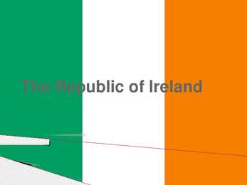
The Republic of Ireland General overview Territory: 27,097 sq miles Population: 4 million Capital: Dublin Patron Saint: St Patrick The second largest of the British Isles 60 million people outside Ireland claim Irish ancestry Landscape and climate Ireland is low in the middle and high at its edges. Not very high mountains; highest is Carrantuohill (1,040 m) in the southwest At Moher, you can look 200m straight down into the sea Green fields, full of flowers, wide and empty beaches All landscape types are represented Climate is damp Ireland is one of the wettest countries in Europe History St Patrick converted the Irish to Christianity
.......................................................................................................... 8 Population and Ethnicity..............................................................................................9 3 Introduction The official name of the country is the United Kingdom. The United Kingdom is an island country. It consists of the island of Great Britain and Northern Ireland. Great Britain can be divided into three parts England, Wales and Scotland. Each of them has their own capital city. Glasgow in Scotland, Cardiff in Wales and London in England. The country is situated in the north-western Europe. The territory of the United Kingdom is about 244,000 square kilometres and about 60 million people live there. The UK contains a number of small islands. The largest islands that belong to the United
Ireland Position Ireland is the third largest island in Europe, and the twentieth largest island in the world. It lies to the northwest of Continental Europe and is surrounded by hundreds of islands. To the east of Ireland, separated by the Irish Sea, is the island of Great Britain. Politically, the Republic of Ireland (also known simply as Ireland) covers five sixths of the island, with Northern Ireland, part of the United Kingdom, covering the remainder in the northeast. Climate Overall, Ireland has a mild, but changeable, Oceanic climate with few extremes. The warmest recorded air temperature was 33.3 °C at Kilkenny Castle, County Kilkenny on 26 June 1887, where as the lowest recorded temperature was 19.1 °C at Markree Castle, County Sligo on 16 January 1881. Inland areas are warmer in summer, and colder in winter there are usually around 40 days of below freezing
Table of contents 1. Introduction 2. Geographical position 3. Mountains, lowlands 4. Rivers, lakes 5. The territories and provinces 6. Towns, economy, agriculture 7. Climate 8. Animals, plantlife 9. Population 10. Sports 11. Culture 12. History 13. Political system, symbols 14. Conclusion 15. Materials 1. Introduction If you had to use two words to describe Canada, they might be large and diverse. Canada is the second largest country in the world, bordered by three oceans, and across the country, Canadians experience many different landscapes from rolling
................. 11 3 Introduction The United States of America is an enormous country. It is the third largest in the world after Russia and Canada. In the USA there are 50 states of which 48 lie together. The population of The USA is about 300 million people. The territory is about 10 million square kilometers. Its geography is very diverse ranging from moist rainforests to dry deserts and bald mountain peaks. There are two big mountain ranges, one of them is the Rocky Mountains and the other is The Appalachian Mountains. The Capital of The USA is Washington D.C. Other big and famous cities are New York, Los Angeles, Houston, Chicago and Las Vegas. The national anthem of the United States is "The Star-Spangled Banner", with lyrics written in 1814 by Francis Scott Key. There are 6 time zones. From east to west they are: Eastern Standard Time, which is 5
cultural diversity of different nations in Canada. All the communities living in the country are encouraged to remember their origins and hold their own ethnic events and national festivals. Cultural diversity makes Canada even more interesting. In spite of this, in recent years there is a strong movement in French-speaking Quebec to become an independent country. There are many different native people throughout Canada like the Crees, Mohawks, Troquois and Sioux. In the north of the country, the Inuit (Eskimos) now have a self-governing homeland called Nunavut, meaning our land. It is over two million square kilometers and it is inhabited by 17,500 Inuits. The national symbol of Canada is the maple leaf. The national tree is the maple. Canada is also the most tolerant societies in the world because only 13% of Canadians say that they would object their children marrying somebody of a different race, compared with 32% in the USA.
The United Kingdom The United Kingdom consists of England, Scotland, Wales and North Ireland and it is situated in the Atlantic Ocean near the mainland of Europe. The population of the UK is 58.6 million and area is 244,110 sq km. Britain has a temperate humid climate. Its characteristic features are mild winters, warm summer, no temperature extremes, abundant rain all year round and frequent changes of weather. The mild climate is partly due to the warm Gulf Stream and partly to the south westerly winds. Occasional winds from the east in winter may bring cold and dry weather
1) General facts The UK: * the United Kingdom of Great Britain and Northern Ireland was formed in 1801 * it covers 243,610 sq km * everybody from the UK is called British * the capital city is London * is made up of four constituent countries: England, Scotland, Wales and Northern Ireland which in turn are divided into counties * the flag is called the Union Jack which is a combination of the flags of England, Scotland and Northern Ireland * the population is about 60,000,000 people, the population density is 242 people/sq km * its coasts are washed by the Atlantic Ocean, the North Sea, the English Channel, the Celtic Sea, Saint George's Channel, and the Irish Sea. It is linked to France by the Channel Tunnel * the United Kingdom is a constitutional monarchy. The current monarch is Queen Elizabeth II, who is also the Queen and Head of State of fifteen other Commonwealth Realms, such as Canada, Australia, New Zealand and Jamaica.
The capital city is Washington D.C. Although the United States has no official language at the federal level, English is the de facto national language. English is the most common language for daily interaction among both native and non-native speakers. Spanish is the second language. The largest city is the New York City. The Government is Federal constitutional republic and the president is George W. Bush. 2. Geographical position The United States of America is located on the continent of North America. It has borders with two countries Mexico and Canada. There are also the Atlantic Ocean, the Pacific Ocean and the Gulf of Mexico surrounding the big country. There are 50 states in America. Most of the people live in towns. The biggest state is Alaska; next by size are California, Alaska and Montana. Six states - Maine, Vermont, New Hampshire, Connecticut, Rhode Island and Massachusetts are called New England. They are all small states in the USA that lie in the north- east
and it is bordered by three oceans: the Arctic, the Pacific and the Atlantic Oceans. The population of Canada is about 31 million people. About 77% of the people live in cities which lie in a band about 100 miles wide above the border of the United States. The capital of Canada is Ottawa. Other large cities are Montreal, Toronto, Vancouver, Winnipeg and Quebec. 2. Geographical position Canada is a huge country in the continent of North America. It is bordered with the Atlantic Ocean in the east, the Pacific Ocean in the west, the United States of America in the south and the Arctic Ocean in the north. Canada is a vast country, with a territory of 3.8 million square miles of land and fresh water it is the second biggest country in the world after Russia. Canada covers most of the northern part of North America. Canada has over 151,480 miles of coastline
Australia Australia is a country and also a continent. If someone wants to make clear, that he is speaking of the country, he may call it by its full name of Commonwealth of Australia. Australia's name means "southland."It is south of the equator. Sometimes it is also called the island continent because it is an island. There are about twenty million people in Australia.It is 1,800 miles from the mainland of Asia and almost half way round the world from Europe. More than 600 miles of ocean separate it from Americas. Since Australia is south of the equator, its seasons are just the opposite of ours. It has summer while we have winter, and the other way round. States and Territories. Australia consists of six states, two territories and eight external territories.
Its territory is about 9.4 million square kilometres and its population is more than 260 million people, 12% of them are the Afro-Americans. It is the world's third-largest country by size and by population. The population density is about 27 people per square kilometre. Most of the people live in towns. There are 50 states in America. The biggest of the state is Texas, next by size are California, Alaska and Montana. Six states - Maine, Vermont, New Hampshire, Connecticut ,Rhode Island and Massachusetts are called New England. They are all small states in the U.S. that lie in the north-east. The first colony of immigrants settled down in Virginia, in the eastern part of the U.S.A. The biggest cities are New York, Washington, Chicago, Los Angeles, San Francisco, etc. The flag of America was adopted on 14 th June 1777. It is called the "Stars and Stripes". It is said that Betsy Ross sewed the first flag. It features 13 horizontal red and
Western Australia , South Australia, The Australian Capital Territory and the Northern Territory). The Australian people are culturally the same as the Anglo Americans. There also live aborigines. Aborigines are the ancestors of the people. Like the US and Canada, Australia was an English speaking colony of Great Britain. Today Australia is a modern developed country with a diversified economy. Australia is an island continent of 7.7 million square kilometres, which makes it a little smaller than the USA. Located in south of Asia, between The Pacific and Indian Oceans, Australia is the World's driest continent. Although large areas of the centre are desert, Australia has a wide range of climate from tropical in the north to temperate in the south east, where it frequently snows in winter. Geographical position The coasts of Australia are surrounded by the Pacific Ocean, the Indian Ocean and the
Johan Mähar Tartu 2008 Contents p. 1. Introduction....................................................................................................1 2. Nature and geography.....................................................................................2 3. Position and size.............................................................................................2 4. Climate............................................................................................................3 5. Flora and fauna...............................................................................................4 6. Main fields of economy and industry............
The current coat of arms of Estonia is a golden shield which includes three slim, blue leopards (or lions) in the middle, with oak branches along the side of the shield. It originates from Denmark. It was officially adopted in 1925. Geography Estonia is the northernmost of the three Baltic States. It is located on the northern hemisphere on the eastern shores of the Baltic Sea in the north-east of Europe. It has land contact with Russia from the east and Latvia from the south. In the north The Gulf of Finland separates Estonia from Finland. The Gulf of Riga is situated to the south-west. Estonia has more than 1500 islands. The biggest ones are located to the west. The four biggest islands are Saaremaa, Hiiumaa, Vormsi and Muhu. The highest point in Estonia and also in the Baltic region is Suur Munamägi. It is 318. above sea level. Estonia is a country of a thousand lakes. The Largest one is Lake Peipsi which is also the fourth biggest freshwater lake in Europe
FACTFILE Area: 45 228 sq km Poplulation: under 1.4 million Capital: Tallinn Language: Estonian Currency: Eesti kroon (EEK) Main religion: Lutheran National holiday: 24 February (anniversary of the republic) National flower: Cornflower National bird: Barn Swallow National stone: Limestone LOCATION The Republic of Estonia is the northernmost and smallest of the three Baltic States. It is located on the eastern shores of the Baltic Sea in the north east of Europe. To the east the country borders Russia. Latvia is the countries neighbour to the south. From the west the coast of Estonia is washed by the Baltic Sea and from the north by the Gulf of Finland. The length of the coastline is approximately 3 800 km. The longest distance from east to west is 350 km, while north to south Estonia stretches 240 km. THE NAME The name EESTI was apparently derived from the word AISTI, the
Report of SCOTLAND Maiki Joakit 10. klass 2008 Etymology Scotland is from the Latin Scoti, the term applied to Gaels. The Late Latin word Scotia (land of the Gaels) was initially used to refer to Ireland. By the 11th century at the latest, Scotia was being used to refer to (Gaelic-speaking) Scotland north of the river Forth, alongside Albania or Albany, both derived from the Gaelic Alba. The use of the words Scots and Scotland to encompass all of what is now Scotland became common in the Late Middle Ages. History Repeated glaciations, which covered the entire land-mass of modern Scotland, have destroyed any traces of human habitation that may have existed before the Mesolithic period. It is believed that the first post-glacial
Tallinn English College Report of Canada 8a Teacher: Merike Sisask Composer: Kärt Kalvet 2010 Canada, Kärt Kalvet 8a Canada General Information Canada is in North America. It's area is 9220970 sq km. Canada's population is 313.612.000 people. Canada is divided into 10 provinces and 3 territories. The capital of Canada is Ottawa. Canada has constitutional monarchy. The head of state in Canada's government is the Queen of England. There are two main languages in Canada: English and French. Canada's curreny is Canadian dollar (1 dollar=100 cents[Can$]). The highest peak of Canada is Mount Logan, 5959 metres. The lowest point is sea level
If you want to make clear that you are speaking about the country, you may call it the Commonwealth of Australia. It’s the official name of the country. Australia is the smallest continent, but one of the largest countries on Earth. It’s 6th largest country. Its area is about 7.6 million sq km. One third of it is occupied by deserts. It’s both the flattest and, except for Antarctica the driest. Neighbouring countries include Indonesia, East Timor and Papua New Guinea in the north, the Solomon Islands, Vanuatu in the northeast, and New Zealand in the southeast. Its capital is Canberra. Other big cities are Melbourne, Sydney, and Brisbane. National language in Australia is English. Monetary unit is Australian dollar. Their national holiday is on the 26th of January. In 1788 on the 26th of January the first fleet arrived at Botany Bay and established a penal colony near modern-day Sydney. Geographical Position Australia is located in the Southern Hemisphere. It’s the
Topic Australia Tallinn English College 2006 Australia 1 . Introduction The name Australia is derived from the Latin Australis, meaning of the south. In land area, Australia is the sixth largest nation, its territory is 7,686,850 sq km and its population reaches today over 20,5 million people. It is the only nation to govern an entire continent and its outlying islands. Australia's capital is Canberra, the only city with its own territory. It was built in the early 1900s just to be the capital. The official language is English and the official name of Australia is the Commonwealth of Australia. Australia is located on the Southern Hemisphere (because of that Australia is also called "A land down under"). 2 . Geographical position
República Portuguesa) is a country located in Southwestern Europe, on the Iberian Peninsula. It is the westernmost country of mainland Europe, and is bordered by the Atlantic Ocean to the west and south and by Spain to the north and east. The Atlantic archipelagos of the Azores and Madeira are Portuguese territory as well. The country is named after its second largest city, Porto, whose Latin name was Portus Cale. SETTLEMENT The land within the borders of the current Portuguese Republic has been continuously settled since prehistoric times. In the 8th century most of the Iberian Peninsula was conquered by
пособия. Пособие предназначено для студентов гуманитарных специальностей. Подготовлено на факультете лингвистики. The book contains an overview of the most important events in British history – from the first documented invasions of the island to the formation and fall of the British colonial empire. A series of exercises will help to remember the subject matter, practise the vocabulary and contribute to skills work. The book is intended for the Humanities students. Вавилов Н.А., 2008 3 4 Contents 5 ПРЕДИСЛОВИЕ
wanted to defeat it. He could clearly see that Britain was a threat to his latest and greatest conquest - France. He invaded Britain twice, in 55 and 54 BC. The first invasion was unsuccessful - it gained a beachhead on the coast of Kent but achieved little else. The second was more successful, the Celts asked for truce. However it wasn't a victory he had imagined and Julius Caesar never returned to Britain after that. The island was left undisturbed for nearly a century. *The Roman occupation of Britain 43-410 and its legacy Britain was conquered by Emperor Claudius, the Roman rule in England lasted up to 410. The Romans left behind a huge legacy: many types of animals and plants were brought to Britain in Roman times. Roman introduced theire measurements, Christianity, reading and writing. Also, many words in English and Welsh have been borrowed from the Latin language. An important legacy of
Dead Sea Israel-Jo rdan 1,3 10 Asia Lak e Eyre Aust ralia 52 Aus trali a Cas p ia n Sea Rus sia - Azerbaijan 92 Europe Death Valley Califo rn ia, U.S. 282 North America Vald es Pen in su la Argentina 13 1 South America ' Estimated Copynght © 2005 by MapQue st. Inc All rig~ t s reserved -
fish shark goat whale These are words for places. They are common nouns. beach park Word File Here are more words for places: airport market cave mountain library church playground shop farm restaurant hill school Everfresh Co. hospital seashore hotel stadium house supermarket island temple mall zoo 10 These are words for things. They are common nouns.
A more complex form of the girder is the cantilever, where trussed and anchored ends of the girder support a central span. They were favoured for deep gorges or wide fast-flowing streams where false work, a temporary structure, usually of timber, erected to assist in the construc- tion of the permanent bridge, is impossible to build. The three principal types - beam, arch, and suspension - often were combined in a variety of ways to form composite structures, the type selected depending on the nature of the crossing, the span required, the materials at hand, and the type of load anticipated - pedestrian, vehicular, railroad, or a channel of water as in aqueducts. Primitive bridges Other than the clapper bridges of England and similar spans surviving in other countries, bridges dating from prehistoric periods are rare. Bridges of twisted vines and creepers found in India, Africa,
brown) instead of round (black). He gave it the name Barrington Dilution or Barrington Brown because it was discovered at the Quaker Oats Nutritional Laboratories in Barrington, Illinois. The first cat known to be homozygous for Barrington Brown was born at the Barrington Laboratories. This was a strangely colored light brown (rich caramel or perhaps cafe-au-lait) male kitten homozygous for Barrington Brown as well as having “standard chocolate dilution". The 2 gene systems were additive in nature and each expresses its effect as if the other were not present i.e. the end result is the sum of both Barrington Brown and "standard chocolate dilution" being expressed. Shaw's description of "rich caramel" (light tan) misled 1970s breeders to believe the emerging dilute modifier was the same as Barrington Brown. Don Shaw and Wayne Durdle investigated this gene in depth. Cats carrying the Barrington gene were donated by the Quaker Oats Nutritional Laboratory to the Feline Research
will make the tour more enjoyable for you. The city was founded in 1837. Its strategic location on Lake Michigan quickly made it the center of commerce for the Midwest section of the country. It is currently the third largest metropolitan area In the United States. The city's site is generally level, built mostly on glacial plain. The narrow Chicago River extends one mile inland from Lake Michigan, where it splits, dividing the city into North, West, and South sides. Chicago's weather is subject to rapid changes, but generally the climate is cold and windy in the winter, and hot and humid in the summer. Woman: What gave Chicago an advantage over other Midwest cities? YOU WILL SEE: (A) Its level site. (B) Its location on Lake Michigan. (C) Its large population. (D) Its location along the Chicago River. According to the minitalk, would be the correct choice. Remember that you will not have a written
Some of the things you will learn in THE CODEBREAKERS • How secret Japanese messages were decoded in Washington hours before Pearl Harbor. • How German codebreakers helped usher in the Russian Revolution. • How John F. Kennedy escaped capture in the Pacific because the Japanese failed to solve a simple cipher. • How codebreaking determined a presidential election, convicted an underworld syndicate head, won the battle of Midway, led to cruel Allied defeats in North Africa, and broke up a vast Nazi spy ring. • How one American became the world's most famous codebreaker, and another became the world's greatest. • How codes and codebreakers operate today within the secret agencies of the U.S. and Russia. • And incredibly much more. "For many evenings of gripping reading, no better choice can be made than this book." —Christian Science Monitor THE
MODULE 1 Greeting. Introducing oneself and the others. The alphabet. Spelling. The tenses. How to introduce yourself and others Formal introductions How to respond and reply to an May I introduce myself? I am John introduction Smith. How do you do. Allow me to introduce John Smith to Pleased to meet you. you. Standard introduction Nice to meet you. I'd like you to meet John Smith. Hello. I want you to meet John Smith. I'm so pleased to meet you. This is Jane Smith. I'm Jane Smith. My name's John Smith. Informal introduction Hi. John. Jane. Hello. Titles: Mr Mrs Miss Ms Ms is a modern form of address for women. It replaces the traditional forms of Mrs and Miss. Greetings Good morning/afternoon/evening! 'How are you?' Very often people expect you to s
summer el verano in summer en verano winter el invierno in winter en invierno autumn el otoño in autumn en otoño 12. Directions to the right a la derecha to the left a la izquierda straight ahead todo derecho north el norte northeast el noreste south el sur northwest el noroeste east el este southeast el sureste west el oeste southwest el suroeste 13. Colors & shapes red rojo / roja circle el círculo pink rosado / rosada square el cuadrado
APPENDIX K. USEFUL ADDRESSES. ABOUT THE AUTHOR ESTONIA AND THE ESTONIANS Estonia is situated on the southern shore of the Gulf of Finland, between the Baltic Sea and Lake Peipsi. The country is populated by Estonians who belong to the Western Finnish group of nations, a branch of the Finno-Ugric stem, and speak the Estonian language. Estonia is the northernmost of the Baltic States. From west to east the length of the country is 360 kilometres and the width, from north to south, is 255 kilometres. The area is 45,227 square kilometres of which more than 4,000 square kilometres are made up by islands and islets (over 1,000); there are more than 1,400 lakes that form nearly 5% of the total area. More than 40% of the entire area is woodland. The country is flat; the average elevation is 50 metres above sea level. The highest peak, Suur Munamägi rises to only 317 metres. High limestone features