Leidsid 33 sarnast õppematerjali, mis on seotud failiga "The geography of california". Need materjalid aitavad sul teemat sügavamalt mõista.
california, bird, wallpaper, flower, geography, mountain, quail, basin, lowest, north, highest, southern, making, prominent, nature, nickname, golden, redwood, tall, straight, feet, narrow, loose, crown, widely, distributed, game, known, hiking, friday, road, travelUSA: West Coast Kristiina Sekljutskaja 11A West Coast · The "West Coast", "Western Seaboard", or "Pacific Coastline" are terms for the westernmost coastal states of the United States. · It most often comprises California, Oregon and Washington. Arizona and Nevada, while not coastal states, are often included due to their proximity to the Pacific Coast and their economic and cultural ties to California · As of 2007, the estimated population of the West Coast ranged from approximately 5060 million, depending on which states are included in the estimate. · Major coastal cities on the West Coast include San Diego, Los Angeles, San Francisco, Seattle, Las Vegas. ·West Coast includes: ·Washington ·Oregon ·Arizona ·Nevada ·California Washington · Named after George Washington, the first President of the United States · Capital: Olympia
.....9 Materials.................................................................................................................... 11 3 Introduction The United States of America is an enormous country. It is the third largest in the world after Russia and Canada. In the USA there are 50 states of which 48 lie together. The population of The USA is about 300 million people. The territory is about 10 million square kilometers. Its geography is very diverse ranging from moist rainforests to dry deserts and bald mountain peaks. There are two big mountain ranges, one of them is the Rocky Mountains and the other is The Appalachian Mountains. The Capital of The USA is Washington D.C. Other big and famous cities are New York, Los Angeles, Houston, Chicago and Las Vegas. The national anthem of the United States is "The Star-Spangled Banner", with lyrics written in 1814 by Francis Scott Key. There are 6 time zones
Table of Contents 1.Alaska info...................................3.lk 2.Geography.....................................4.lk 3.Natural features......................5.lk 4.Climate...........................................6.lk 5.Pictures.........................................7.lk 6.Used Sources..............................8.lk Alaska info Alaska is the largest state in the United States by area. It is situated in the northwest extremity of the North American continent, with Canada to the east, the Arctic Ocean to the north, and the Pacific Ocean to the west and south, with Russia further west across the Bering Strait. Alaska is the least densely populated state of the U.S. 2 Alaska was purchased from Russia on March 30, 1867, for $7.2 million at approximately two cents per acre. The land went through several administrative changes before becoming an organized territory on May 11, 1912, and the 49th state of the U.S. on January 3, 1959
United States of America Table of Contents 1. Facts 2. Geography 3. Nature 4. History 5. Population 6. Government 7. Industry, economy 8. America's pop culture Facts Official Name: United States of America Capital City: Washington, D.C. Largest city: New York City Official languages: None at federal level National language: English Government: Federal constitutional republic President: Barack Obama ( Barack Hussein Obama II)
The capital city is Washington D.C. Although the United States has no official language at the federal level, English is the de facto national language. English is the most common language for daily interaction among both native and non-native speakers. Spanish is the second language. The largest city is the New York City. The Government is Federal constitutional republic and the president is George W. Bush. 2. Geographical position The United States of America is located on the continent of North America. It has borders with two countries Mexico and Canada. There are also the Atlantic Ocean, the Pacific Ocean and the Gulf of Mexico surrounding the big country. There are 50 states in America. Most of the people live in towns. The biggest state is Alaska; next by size are California, Alaska and Montana. Six states - Maine, Vermont, New Hampshire, Connecticut, Rhode Island and Massachusetts are called New England. They are all small states in the USA that lie in the north- east
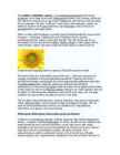
The sunflower (Helianthus annuus) is an annual(iga aastane) plant in the family Asteraceae, with a large flower head (inflorescence(õiekobar, õisik, õitseaeg, õidumine)). The stem(tüvi) of the flower can grow up to 3 metres tall, with the flower head reaching 30 cm in diameter. The term "sunflower" is also used to refer(nimetama, viitama, üle andma) to all plants of the genus(perekond, sugu) Helianthus, many of which are perennial(alaline, aastaringne) plants. What is usually called the flower is actually a head (formally(ametlikult) composite(liit-, komposiit- ; korvõieline, komposiit) flower) of numerous flowers (florets) crowded(täistuubitud, tunglev, rahvarohke) together. The outer flowers are the ray florets(pähik (õisiku osa) and can be yellow, maroon, orange, or other colors, and are sterile(steriilne, viljatu). The florets inside the circular head are called disc florets. Sunflower head displaying florets in spirals of 34 and 55 around the outside
Representatives. There are a hundred people in the Senate (two from each state) and 435 people in the House of Representatives. At the head of the Judicial branch is the Supreme Court, which has nine judges. The leading parties in America are the Democrats and the Republicans but there are also other parties. Location The United States of America is situated in the central part of the North American continent. Its western coast is washed by the Pacific Ocean and its eastern coast is washed by the Atlantic Ocean and in the south its coast is washed by the Gulf of Mexico. The coastline is even. There are no big islands belonging to the U.S. except the Hawaiian Islands which lie halfway the continents of America and Asia. The biggest peninsulas are the Florida Peninsula and Alaska. The United States of America has got three neighbours Mexico in the south, Canada in
Six of them represent the states and the last one is for the Commonwealth of Australia. The Southern Cross is in the right. It consists of five stars. The group of stars on the flag shows the geographical place of Australia which is in the southern hemisphere. The coat of arms was created in 1912. Before that coat of arms there was another that did not have so many things on it. On the coat of arms there is the national animal kangaroo. Emu is also there because it is a bird that is very interesting and it is only in Australia. They are standing on the golden wattle that is the national flower. In the top there is the star of the Commonwealth. Under it there is a shield with six parts each containing a representation of the badge of a state. From left the states are New South Wales, Victoria, Queensland and in the second row there are South Australia, Western Australia and Tasmania. The anthem of Australia is called `Advance Australia Fair'
white and represent the Thirteen Colonies. The 50 small, white stars represent the 50 U.S. states. The U.S. flag is commonly called ,,the Stars and Stripes". The Statue of Liberty, that is locatd in New York,is a gift from the France. The Libety Bell, that is a bronze bell that symbolizes freedom in the United States of America. It is located in Pennsylvania,U.S. Capital: Washington D.C Biggest city: New York National language: English Location U.S is located in North America, bordering both the North Atlantic Ocean and the North Pacific Ocean. United States neighbour countries are Canada and Mexico. The USA has the 8th longest coastline in the world at ~20 000 km. 62% of the perimeter of the USA is coastline. The USA's coastline is made up of beaches, cliffs, mangroves, and urban and developed areas, which make America very versatile country. Political division United States of America distributes into 50 states
the MoMa or the Met. While new Visitors regularly return to the sites, like the National September mainland singing praise for Maui, but 11 Memorial, are always popping the smart few just put down new roots up, the classics, like the Empire and pick up a Mai Tai. State Building, never get old. Montreal and Vancouver Why go: Here, it's as Why go: While it may not be as if Paris migrated to North grand as New York City or as America. Montreal boasts historic asMontreal, why Vancouver caught the attention of the elements of French culture with International Olympic Committee is a friendly Canadian feel. no mystery. This coastal Canadian Travelers adore the quaint city boasts a vast amount of outdoor cafés,bustling marketplaces an activities that beckon to adrenaline
groups, with substantial populations from Italy, Greece, former Yugoslavia, the Far East and Africa. There are 120 000 Aborigines. The density is 2.8 persons per km2. Climate Because of the country's great size, the climate in australia ranges from tropical regions of the Northern Territory to the cool temperate conditions in the southeast and Tasmania, where it often snows in winter. In the north, half the year is wet and half is dry. And its a popular place for winter holidays in the sun. Western has dry, hot, deser climate. Eastern has temperate, wet, and rainfall occurs all year round. Mountains, Rivers and Lakes The Great Barrier Reef, the world's largest coral reef, lies a short distance off the north-east coast and extends for over 2,000 kilometres. Mount Augustus, claimed to be the world's largest monolith, is located in Western Australia. At 2,228 metres,
Like the US and Canada, Australia was an English speaking colony of Great Britain. Today Australia is a modern developed country with a diversified economy. Australia is an island continent of 7.7 million square kilometres, which makes it a little smaller than the USA. Located in south of Asia, between The Pacific and Indian Oceans, Australia is the World's driest continent. Although large areas of the centre are desert, Australia has a wide range of climate from tropical in the north to temperate in the south east, where it frequently snows in winter. Geographical position The coasts of Australia are surrounded by the Pacific Ocean, the Indian Ocean and the Southern Ocean. Four seas are surrounding Australia, which are the Timor Sea and Arafura Sea in the north of Australia, the Coral Sea in the north-east of Australia and the Tasman Sea, near the island of Tasmania, in the south-east of Australia. Government
The Dutch navigator Janszoon was the first to find the South Land. He sighted the coast in 1606. Then Abel Tasman visited an island off the southern coast of Australia in 1642 and the island was named Tasmania after him. In 1770 British sailor James Cook came to Australia and landed in Botany Bay. He declared that Australia was very suitable for settlers. Britain had to send their convicts to the new country after loss in the American War of Independence to replace the North Atlantic colonies. In 1788 the First Fleet with eleven ships, with 1500 people on board were sent to Australia with Captain Phillip. They landed in Port Jackson on January 26th in 1788 and that day is now called Australia Day. It is the biggest day of celebration in the country and in observed as a public holiday in all the states and territories of Australia. During the 1850s, settlement was boosted by gold rushes. Gold was first found at Bayhurst in 1851.
million years old. Australia is often called `Down Under', because it lies in the Southern Hemisphere. As a result, its seasons are the opposite of ours. Australia, Tasmania and a number of smaller islands form the Commonwealth of Australia. Because of the country's great size, the climate in Australia ranges from tropical regions of the Northern Territory to the cool temperate conditions in the southeast and Tasmania, where it often snows in winter. In the north, half the year is `wet' and half is `dry'. From November to April heavy rain fills the rivers and makes enormous lakes where thousands of birds come for the summer. From May to October it is often sunny and dry for weeks, and it is a popular place for winter holidays in the sun. In the hot, flat centre of Australia, there is an area called the `outback'. It covers more than two-thirds of Australia, but its population is less than 100,000. In some places, it doesn't rain for years
covert anti-semitism. Jews were allowed to leave Russia for Israel, but many had the US as their real goal. Most had no knowledge of Yiddish or Hebrew or the Jewish religion. Immigration after 1985: the Soviet government under Mikhail Gorbachev allowed anyone to leave the Soviet Union. The major group of post-Soviet immigrants were the political refugees, persons who claim persecution or reasonable fear of persecution in Russia. Largest Russian communities today are in New York, California and Florida. 5. From where did the Indians come to America? *Native Americans aka. Indians, Red Indians, Redskins, American Indians, Amerindians, Namerind, First Nations people (Canada) *Origins of N-Am, theories = Bering Land Bridge theory = North American Indians are the people whose ancestors were living in North America when the Europeans discovered the Western Hemisphere. They often are called red men, or redskins, and they were named
The Rastafari movement was founded in Jamaica. This Back to Africa movement believes that Haile Selassie of Ethiopia was God incarnate, the returned black messiah, come to take the lost Twelve Tribes of Israel back to live with him in Holy Mount Zion in a world of perfect peace, love and harmony. Bob Marley, a convert to the faith, spread the message of Rastafari to the world. There are now estimated to be more than a million Rastafarians throughout the world. · National Bird -- Doctor Bird (Green-and-black Streamertail, Trochilus polytmus) · National Flower -- Lignum Vitae (Guaiacum officinale) · National Tree -- Blue Mahoe (Hibiscus elatus) · National Dish -- Ackee and Saltfish (dried salted Cod) · National Motto -- "Out of Many, One People." (Unity among many cultures and races.) Crime Crime, including violent crime, is a serious problem in Jamaica, particularly in Kingston.
Tallinn English College Report of Canada 8a Teacher: Merike Sisask Composer: Kärt Kalvet 2010 Canada, Kärt Kalvet 8a Canada General Information Canada is in North America. It's area is 9220970 sq km. Canada's population is 313.612.000 people. Canada is divided into 10 provinces and 3 territories. The capital of Canada is Ottawa. Canada has constitutional monarchy. The head of state in Canada's government is the Queen of England. There are two main languages in Canada: English and French. Canada's curreny is Canadian dollar (1 dollar=100 cents[Can$]). The highest peak of Canada is Mount Logan, 5959 metres. The lowest point is sea level
..............................................................9 Vital waterways for people and wildlife..............................................................................................10 2 Introduction If you were asked to show on a world map the regions with the most biodiversity, your finger would probably end up pointing at the Amazon, the Congo Basin or the island of Borneo. But I chose New Guinea, an island that represents no more than 1% of the world's landmass, an array of extraordinary animals and plants have also flourished, such as tree kangaroos and birds of paradise. Close to 10% of the world's vertebrates are concentrated here, while 7% of the world's higher (vascular) plants grow on the island's productive soils. 3 Geography
My written part consists of two parts: theoretical which focuses on national symbols, their history, flags as political instruments and British national symbols, namely – flags. The second part is a practical part: a survey, analysis of the survey and the results of the survey. 4 1. BRITISH NATIONAL SYMBOLS 1.1 Great Britain and British story Great Britain is an island in the North Atlantic off the north-west coast of continental Europe. With an area of 229,848 km2, it is the largest island of the British Isles, the largest island in Europe and the ninth-largest in the world. It is surrounded by over 1,000 smaller islands. The island is part of the United Kingdom of Great Britain and Northern Ireland, constituting most of its territory: most of England, Scotland, and Wales are on the island, with their respective capital cities, London, Edinburgh, and Cardiff
“It looks like the sandwich I sell at my store.” As is known, there are a number of regional words for this type of sandwich. What are they, and where are they used? There are quite a few other terms for the “submarine sandwich”, including: Heros – used in New York Grinder – used in New England Po' Boy and Poor boy – used in St. Louis and Louisiana Rocket – used in various areas Gatsby – used in Cape Town, South Africa Cosmo (Cosmopolitan) – used in North Central Pennsylvania near Williamsport Zepplin or Zep – used in eastern Pennsylvania Italian Sandwich or simply Italians – used in Maine Hoagie – used in Philadelphia Torpedo – used in New York and New Jersey Barb Mills – used in North Central Pennsylvania Blimpie – used in Hoboken, New Jersey Cheesesteak – used in Philadelphia Filled Roll / Salad Roll – used in New Zealand Sous-marin – used in Quebec (Canada) Spuckie – used in Boston, Massachusetts
Elb rus Russia 18,5 10 Europe Mc Kin ley Alask a, U.S. 20,320 N orth Am erica Aconcagua Argentina 22 ,834 South America Lowest Elevations Lo west P o in t Name Place Dep th Below Sea Lev el (ft .) Continen t Lake AssaI Djib outi 512 Afri ca Bentl ey Subgla cial T re nc h Antarctica 8,327* Antarctica
of that country can make right desicions on the right time. 6 The climate of the United States of America The land area of the contiguous United States is approximately 770 million hectares. Alaska, separated from the contiguous United States by Canada, is the largest state at 365 million acres (150 million hectares). Hawaii, occupying an archipelago in the central Pacific, southwest of North America, has just over 1.6 million hectares. There are many lakes in American for example Lake Michigan or Lake Hudson. There are also many rivers for example the longest river is Mississippi which is one of the longest rivers in the world. There are really big mountain ranges like the Rocky Mountains. Also there are several deserts like Arizona desert. In USA the climate is really multifarious. It includes most
MIINA HÄRMA GYMNASIUM Deserts Saudi-Arabia Tartu 2007 Deserts In geography, a desert is a landscape form or region that receives very little precipitation. Generally, deserts are defined as areas that receive an average annual precipitation of less than 250 mm (10 inches). Deserts cover at least one-fourth of the Earth's land surface. Desert biomes can be classified according to several characteristics. There are four major types of deserts: · Hot and dry · Semiarid · Coastal · Cold Location
If you want to make clear that you are speaking about the country, you may call it the Commonwealth of Australia. It’s the official name of the country. Australia is the smallest continent, but one of the largest countries on Earth. It’s 6th largest country. Its area is about 7.6 million sq km. One third of it is occupied by deserts. It’s both the flattest and, except for Antarctica the driest. Neighbouring countries include Indonesia, East Timor and Papua New Guinea in the north, the Solomon Islands, Vanuatu in the northeast, and New Zealand in the southeast. Its capital is Canberra. Other big cities are Melbourne, Sydney, and Brisbane. National language in Australia is English. Monetary unit is Australian dollar. Their national holiday is on the 26th of January. In 1788 on the 26th of January the first fleet arrived at Botany Bay and established a penal colony near modern-day Sydney. Geographical Position Australia is located in the Southern Hemisphere. It’s the
different, random directions, and cancel out each other. Magnets are different; the molecules in magnets are arranged so that the electrons spin in the same direction. This 22 arrangement of atoms creates two poles in a magnet, a North- seeking pole and a South- seeking pole. Picture 7.2. Bar magnet A magnet is labeled with North (N) and South (S) poles. The magnetic force in a magnet flows from the North pole to the South pole. This creates a magnetic field around a magnet. Have you ever held two magnets close to each other? They don't act like most objects. If you try to push the South poles together, they repel each other. Two North poles also repel each other. Turn one magnet around and the North (N) and the South (S) poles are attracted to each other. The magnets come together with a strong force. Just like protons and electrons, opposites attract.
It was built in the early 1900s just to be the capital. The official language is English and the official name of Australia is the Commonwealth of Australia. Australia is located on the Southern Hemisphere (because of that Australia is also called "A land down under"). 2 . Geographical position Australia is an island continent and it is located between the Indian and South Pacific oceans south east of Asia. From the north it is bordered by the Timor Sea and the Torres Strait. From the east by the Coral Sea and the Tasman Sea. Australia's coastline is about 37,000 km long. The Great Australian Bight washes the southern coast. The Gulf of Carpenteria and the Cape York Peninsula surround it in the south. 3. Relief Australia is the smallest continent in the world It is often called the island continent because is too big for an island but rather small for a continent
Wales, Germany, Ukraine and Scandinavia. In Edmonton and Calgary there are also historic Chinatowns, and Calgary has Canada's third largest Chinese community. Geographical features Alberta covers an area of 661,848 square kilometres, an area about 5% smaller than Texas or 20% larger than France. This makes it the fourth largest province after Quebec, Ontario, and British Columbia. To the south, the province borders on the 49th parallel north, separating it from the U.S. state of Montana, while on the north the 60th parallel north divides it from the Northwest Territories. To the east the 110th meridian west separates it from the province of Saskatchewan, while on the west its boundary with British Columbia follows the 120th meridian west south from the Northwest Territories at 60°N until it reaches the Continental Divide at the Rocky Mountains.
Johan Mähar Tartu 2008 Contents p. 1. Introduction....................................................................................................1 2. Nature and geography.....................................................................................2 3. Position and size.............................................................................................2 4. Climate............................................................................................................3 5. Flora and fauna...............................................................................................4 6. Main fields of economy and industry..........................
Tallinn 2008 1. Introduction Estonia is a small country about the size of Switzerland, or New Hampshire and Massachussetts combined. Estonia is named after the people called "Ests" who lived in the region in the 1 st century AD. The Republic of Estonia is one of the three countries commonly known as the "Baltic States". The other Baltic States are Latvia and Lithuania. 2. Geographical position Estonia is situated in northeastern Europe. Estonia is bounded on the north by the Gulf of Finland, on the east by Russia, on the south by Latvia and on the west by the Baltic Sea. In the north it borders on Finland. The coastline of the Baltic Sea in Estonia is characterized by numerous gulfs and bays, the biggest of them being the Gulf of Finland, the Gulf of Riga and the Gulf of Pärnu. Bays include the Narva Bay, Matsalu Bay, Kolga Bay, Kunda Bay, Tallinn Bay etc. Estonia has over 1500 islands, the largest being Saaremaa and Hiiumaa, Muhu and Vormsi.
6. Towns, economy, agriculture 7. Climate 8. Animals, plantlife 9. Population 10. Sports 11. Culture 12. History 13. Political system, symbols 14. Conclusion 15. Materials 1. Introduction If you had to use two words to describe Canada, they might be large and diverse. Canada is the second largest country in the world, bordered by three oceans, and across the country, Canadians experience many different landscapes from rolling plains and mountains to the cold tundra of the north. Despite Canada's great size, it is one of the world's most sparsely populated countries. This fact, coupled with the grandeur of the landscape, has been central to the sense of Canadian national identity. 2. Geographical position Canada is the second largest country in the world after Russia. In the Arctic, Canada reaches almost as far north as Greenland. To the south it extends to the same latitude as southern France. The distance from Canada's west coast, the Pacific Ocean, to its
The coat of arms features a kangaroo and an emu, golden whattle blossoms, a shield with the coats of arms of the six states of Australia and a star for the states and territories. Landforms Only 5% of the land is above 600 meters. Most of the land is empty. Most of the people live in the south and in east. 2/3 of Australia is a desert with hills and big saltlakes. The biggest deserts are the Great Sandy Desert, the Gibson Desert, the Simpson Desert, The Great Victoria Desert. The biggest mountain ranges are the Great Divining Range, the Australian Alps, the Blue Mountains and the New England Range. The outback is flat and hot centre of Australia. The nearest neighbor may be a hundred kilometers away. The nearest city may be more than one thousand kilometers away. Many people in this area live on sheep stations which are enormous farms. Uluru One of the most beautiful things in Australia is Uluru (Ayers Rock) in the outback. It is an enormous rock alone in the middle of the desert
and it is bordered by three oceans: the Arctic, the Pacific and the Atlantic Oceans. The population of Canada is about 31 million people. About 77% of the people live in cities which lie in a band about 100 miles wide above the border of the United States. The capital of Canada is Ottawa. Other large cities are Montreal, Toronto, Vancouver, Winnipeg and Quebec. 2. Geographical position Canada is a huge country in the continent of North America. It is bordered with the Atlantic Ocean in the east, the Pacific Ocean in the west, the United States of America in the south and the Arctic Ocean in the north. Canada is a vast country, with a territory of 3.8 million square miles of land and fresh water it is the second biggest country in the world after Russia. Canada covers most of the northern part of North America. Canada has over 151,480 miles of coastline
Scotland ! Scotland (Gaelic: Alba) is a country in northwest Europe that occupies the northern third of the island of Great Britain. It is part of the United Kingdom, and shares a land border to the south with England. It is bounded by the North Sea to the east, the Atlantic Ocean to the north and west, and the North Channel and Irish Sea to the southwest. In addition to the mainland, Scotland consists of over 790 islands including the Northern Isles and the Hebrides. Edinburgh, the country's capital and second largest city, is one of Europe's largest financial centres. It was the hub of the Scottish Enlightenment of the 18th century, which saw Scotland become one of the commercial, intellectual and industrial powerhouses of Europe. Scotland's largest city is Glasgow, which was once one of the