Leidsid 33 sarnast õppematerjali, mis on seotud failiga "Muhu saar". Need materjalid aitavad sul teemat sügavamalt mõista.
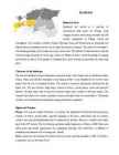
muhu, island, german, moon, wine, mohn, baltic, hiiumaa, islands, viirelaid, forms, parish, april, covers, density, geography, important, kuivastu, koguva, linked, ferry, virtsu, winter, road, same, waters, battle, sound, between, russian, naval, forces, famous, having, still, working, traditional, first, tourismHistorical Facts Straitland has served as a junction of international trade routes for Vikings. Long struggle of power with foreign intruders has left ancient strongholds in Valjala, Lihula and Soontagana. The churches in Muhu, Valjala, Mustjala, Karja and Kihelkonna are honorable and elderly because Straitland was the one to bring Christianity to Estonia. The castle of Kuressaare is still standing proudly, but in Lihula only ruins can be seen. The patterns of national dresses and the churches bring memories of secret sign cultures of Medieval Times. Good knowledge of singing and facility of speech of the people of Straitland have given Estonia a big number of writers and poets. Character of the landscape
The Estonian language words were written by J. V. Jannsen. It was officially adopted after the War of Independence in 1920.The same melody with different words is also Finland's national anthem. The current coat of arms of Estonia is a golden shield which includes three slim, blue leopards (or lions) in the middle, with oak branches along the side of the shield. It originates from Denmark. It was officially adopted in 1925. Geography Estonia is the northernmost of the three Baltic States. It is located on the northern hemisphere on the eastern shores of the Baltic Sea in the north-east of Europe. It has land contact with Russia from the east and Latvia from the south. In the north The Gulf of Finland separates Estonia from Finland. The Gulf of Riga is situated to the south-west. Estonia has more than 1500 islands. The biggest ones are located to the west. The four biggest islands are Saaremaa, Hiiumaa, Vormsi and Muhu.
Tallinn 2007 FACTFILE Area: 45 228 sq km Poplulation: under 1.4 million Capital: Tallinn Language: Estonian Currency: Eesti kroon (EEK) Main religion: Lutheran National holiday: 24 February (anniversary of the republic) National flower: Cornflower National bird: Barn Swallow National stone: Limestone LOCATION The Republic of Estonia is the northernmost and smallest of the three Baltic States. It is located on the eastern shores of the Baltic Sea in the north east of Europe. To the east the country borders Russia. Latvia is the countries neighbour to the south. From the west the coast of Estonia is washed by the Baltic Sea and from the north by the Gulf of Finland. The length of the coastline is approximately 3 800 km. The longest distance from east to west is 350 km, while north to south Estonia stretches 240 km. THE NAME The name EESTI was apparently derived from the word AISTI, the
Tallinn English College Topic Estonia Tallinn 2008 1. Introduction Estonia is a small country about the size of Switzerland, or New Hampshire and Massachussetts combined. Estonia is named after the people called "Ests" who lived in the region in the 1 st century AD. The Republic of Estonia is one of the three countries commonly known as the "Baltic States". The other Baltic States are Latvia and Lithuania. 2. Geographical position Estonia is situated in northeastern Europe. Estonia is bounded on the north by the Gulf of Finland, on the east by Russia, on the south by Latvia and on the west by the Baltic Sea. In the north it borders on Finland. The coastline of the Baltic Sea in Estonia is characterized by numerous gulfs and bays, the biggest of them being the Gulf of Finland, the Gulf of Riga and the Gulf of Pärnu. Bays include the
Võnnu Keskkool ESTONIA Referaat Autor: Klass : 9 Juhendaja: Võnnu 2013 Estonia officially the Republic of Estonia, is a state in the Baltic region of Northern Europe It is bordered to the north by the Gulf of Finland, to the west by the Baltic Sea, to the south by Latvia and to the east by Lake Peipus and Russia.Across the Baltic Sealies Sweden in the west and Finland in the north. The territory of Estonia covers 45,227km2 The Estonian climate resembles that of other countries on the Baltic littoral. On account of the country's proximity to the sea, the skies are often cloudy, and rain often falls in the spring and autumn, in the winter the rain turns to snow. The highest point in Estonia is Suur Munamäg It is in fact the highest point in the Baltic region Forest cover over one half of Estonia
The most significant was the transition to farming, which has remained at the core of Estonian economy and culture. From approximately the 1st to 5th centuries AD, resident farming was widely established, the population grew, and settlement expanded. Cultural influences from the Roman Empire reached Estonia, and this era is therefore also known as the Roman Iron Age. A more troubled and war-ridden middle Iron Age followed with external dangers coming both from the Baltic tribes, who attacked across the southern land border, and from overseas. Several Scandinavian sagas refer to campaigns against Estonia. Estonian pirates conducted similar raids in the Viking age and sacked and burned the Scandinavian capital of Sigtuna in 1187. By the early 13th century, Estonia was divided into eight large counties -- Saaremaa, Läänemaa, Rävala, Harju, Viru, Järva, Sakala, and Ugandi. Annual consultations were held by representatives of several
Kiili Gümnaasium Referaat Hiiumaa Kairo parts 8b klass Kiili 2011 Contents 1. Hiiumaa 2. Name 3. History 4. Transport 5. Kõpu lighthouse Hiiumaa Hiiumaa (Finnish, Hiidenmaa, German Dagö, Swedish Dagö, Danish Dagø) is the second largest island (989 km²) belonging to Estonia. It is located in the Baltic Sea .north of the island of Saaremaa ,a part of the West Estonian archipelago. Its largest town is Kärdla. Name Hiiumaa is the main island of Hiiu County, called Hiiumaa or Hiiu maakond in Estonian.
The summer temperatures are a little lower than the average of that latitude, but the winters are considerably warmer. As a part of the East-European Plain, the country has a rather flat surface. The highest and most topographically variagated region in Estonia is in the south-eastern part of the country. The Sakala Upland plains offer contrast to the hills of Ottepää, Karula and Haanja. At 318 metres, Suur Munamägi ('Great Egg Hill') is not only the highest point in Estonia, but of all the Baltic countries. The country has 3974 km of coastline, while the land border, in comparison, is only a mere 633 km. The coast varies from limestone cliff in the north to sandy beaches in the west. Most of Estonia's many islands belong to the West Estonian archipelago. The largest islands are Saaremaa with 2671 sq km, Hiiumaa with 989 sq km and Muhu with 200 sq km. The sea between these islands and the Mainland Väinameri is very shallow (less than five metres deep on average) and rich in shoals
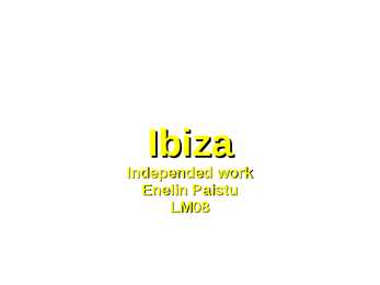
Ibiza Independed work Enelin Paistu LM08 Ibiza Ibiza is an island in the Mediterranean Sea 79km off the coast of the city of Valencia in Iberian Peninsula Spain. It is the third largest of the Balearic Islands, an autonomous community of Spain. With Formentera, it is one of the two Pine Islands or Pityuses. Its largest cities are Ibiza Town (Catalan:Vila d'Eivissa or simply Vila), Santa Eulària des Riu and Sant Antoni de Portmany. Eivissa is the official Catalan name (Catalan pronunciation:, locally. The name in Spanish is Ibiza . In British English, the name is usually pronounced in an approximation of the Spanish while in American English the pronunciation is more anglicized
Ireland is the third largest island in Europe. It lies in between the Atlantic Ocean and the Irish Sea. Politically it is divided into a sovereign state, the Republic of Ireland, that covers about five-sixths of the island (south, east, west and north-west), and Northern Ireland, which is part of the United Kingdom, covering the northeastern sixth of the island.[1] The name 'Ireland' derives from the name Ériu (in modern Irish, Éire) with the addition of the Germanic word 'land'. The population of the island is just under 6 million (2006); just over 4.2 million in the Republic of Ireland[2] (1.6 million in Greater Dublin[3]) and just over 1.7 million in Northern Ireland[4] (0.6 million in Greater Belfast[5])). Politics Politically, Ireland is divided into: · The Republic of Ireland, with its capital Dublin.
lowlands of the south and east. Wales is located on a peninsula in central-west Britain. The entire area of Wales is about 20,779 km². Wales borders by England to the east and by sea in the other three directions: the Welsh Channel to the south, St George's Channel to the west, and the Irish Sea to the north. There are many bays, peninsulas, cliffs and beaches, together Wales has almost 2000 km of coastline. There are several islands off the Welsh mainland, the largest being Anglesey in the northwest. About 3 million people live in Wales. The main population and industrial areas are in South Wales, consisting of the cities of Cardiff (also the capital), Swansea and Newport and surrounding areas. Much of Wales' beautiful and diverse landscape is mountainous. It has two major mountain systems: the Black Mountains and the Brecon Beacon in the south and the mountains of Snowdonia in the south
Czech), duke of Bohemia (r c 925-29), now the chief patron saint of the Czech people. Wenceslas was the 'Good King Wenceslas' of the well-known Christmas carol written in 1853 by English clergyman John Mason Neale. Neale, a scholar of eastern European church history, had read about St Wenceslas' legendary piety, and based his carol on the story of the duke's page finding strength and warmth by following in the footsteps of his master as they carried food, wine and firewood to a poor peasant on a freezing cold Boxing Day. The unfortunate Wenceslas was murdered by his own brother, Boleslav; the Chapel of St Wenceslas in St Vitus Cathedral is decorated with scenes from the saint's life. In 950 the German king Otto I conquered Bohemia and incorporated it into the Holy Roman Empire. By 993 Pemysl princes had forged a genuine Slav alliance, and ruled Bohemia on the Germans' behalf until 1212, when the pope granted Otakar I the right to rule as a king.
Tallinn is the capital and the largest city of Estonia. It lies on the northern coast of Estonia, along the Gulf of Finland. There are 33 cities and several town-parish towns in the country. In total, there are 47 linna, with "linn" in English meaning both "cities" and "towns". More than 70% of the population lives in towns. History • Estonia was settled near the end of the last glacial era, beginning from around 8500 BC. Before the German invasions in the 13th century proto-Estonians of the Ancient Estonia worshipped the spirits of nature. Since the Northern Crusades Estonia became a battleground for centuries where Denmark, Germany, Russia, Sweden and Poland fought their many wars over controlling the important geographical position of the country as a gateway between East and West. Being conquered by Danes and Germans in 1227, Estonia was ruled initially by Denmark in the north, by the Livonian
Estonia. Estonia, officially the Republic of Estonia is a country in Northern Europe. It is the smallest of the three Baltic countries. Estonia has land borders with Latvia (339 km) to the south and Russia (229 km) to the east. It is separated from Finland in the north by the narrow Gulf of Finland and from Sweden in the west by the Baltic Sea. Estonia has been a member of the European Union since May 1, 2004 and of the NATO since March 29, 2004. The area of Estonia is about 45000 square kilometres and the population is about 1.4 million people. The capital of Estonia is Tallinn and the official language is Estonian. The currency is Eesti kroon. The main religion is Lutheran. Anniversary of the republic is celebrated on February 20. The national flower is cornflower, national
Tallinn English College English Sergo Vainumäe 9A TALLINN Report Supervisor: Inge Välja Tallinn 2006 Order of contents: 1.Introduction 2.Toompea 3.Lower Town 4.Kadriorg and Pirita 5.Museums 1. Introduction Tallinn, the capital of Estonia, lies on the Baltic Sea. It is on almost the same latitude east St. Petersburg in Russia, Stockholm in Sweden and Stavanger in Norway, and covers 158 sq km. Tallinn was first marked on a map of the world by the Arab geographer al-Idrisi in 1154, its name then being Kolyvan (probably derived from the name Kalev). In the 13th-century Chronicle of Henricus de Lettis the town was called Lyndanise. Later came Reval (presumably after the old county
Rockies. The Rocky Mountains are the youngest and highest mountains in Canada. British Columbia is in the landform region called the Western Cordillera. ('Cordillera' means a system of mountain ranges). Between the mountain ranges are areas of high plateaus and deep trenches. Since the landscape is very rugged, most people live in the south and near the coast. Vancouver and Victoria are the largest cities in British Columbia. The region includes the Queen Charlotte Islands and Vancouver Island. All these islands are peaks of a mountain range that is partly covered by the Pacific Ocean. The St Elias Mountains in the Yukon include Canada's highest peak, Mount Logan. It towers 5,951 metres above sea level. Because the Coast Mountains are on the seashore, the coast of British Columbia has many long, narrow inlets called fiords. The fiords provide a water route to Canada's most valuable forests. These forests consist of red cedars, hemlocks, and other evergreen trees that grow on the
This was the time of the crystallization and the culmination of serfdom, when various socio- political and cultural undercurrents were also active, preparing the ground for the industrial society and the national-democratic movement in the second half of the 19th century. The 1710 of the corporations of knights and towns, until Alexander II (18551881), established the relationships between Estonia, Livonia and the Russian Empire. The Baltic Landesstaat reached its full development. The freedom of action in the new provinces was naturally granted to one of the most firm ideological pillars of the tsarist empire -- the Russian orthodox church; though as the Landeskirche in the Estonian and Livonian territories, the Lutheran church long maintained a de facto predominance. The most important organ of Baltic German local government was the Diet, consisting of all the noble families who had been `selected' in a list of the eligible
trading posts for several common types of tradable commodities at the time, ranging from gold to slaves, as they looked for a route to India and its spices, which were coveted in Europe. The Treaty of Tordesillas, intended to resolve the dispute that had been created following the return of Christopher Columbus, was signed on 7 June 1494, and divided the newly discovered lands outside Europe between Portugal and Spain along a meridian 370 leagues west of the Cape Verde islands (off the west coast of Africa). In 1498, Vasco da Gama reached India and brought economic prosperity to Portugal and its population of 1.7 million residents. In 1500, Pedro Álvares Cabral discovered Brazil and claimed it for Portugal. Ten years later, Afonso de Albuquerque conquered Goa in India, Ormuz in the Persian Strait, and Malacca, now a state in Malaysia. Thus, the Portuguese empire held dominion over commerce in the Indian Ocean and South Atlantic
Language: Finnish, Swedish Currency: Euro (EUR) Goverment: Parliamentary republic President: Tarja Halonen Prime Minister: Matti Vanhanen 1 Nature and geography Finland is a country of thousands of lakes and islands; 187,888 lakes (larger than 500 m²) and 179,584 islands to be precise. One of these lakes, Saimaa, is the fifth largest in Europe. The Finnish landscape is mostly flat with few hills and its highest point, the Halti at 1,324 metres, is found in the extreme north of Lapland at the border between Finland and Norway. The landscape is covered mostly (seventy-five percent of land area) by coniferous taiga forests and fens, with little arable land. The most common type of rock is granite. It is
Scotland ! Scotland (Gaelic: Alba) is a country in northwest Europe that occupies the northern third of the island of Great Britain. It is part of the United Kingdom, and shares a land border to the south with England. It is bounded by the North Sea to the east, the Atlantic Ocean to the north and west, and the North Channel and Irish Sea to the southwest. In addition to the mainland, Scotland consists of over 790 islands including the Northern Isles and the Hebrides. Edinburgh, the country's capital and second largest city, is one of Europe's largest financial centres. It was the hub of the Scottish Enlightenment of the 18th century, which saw Scotland become one of the commercial, intellectual and industrial powerhouses of Europe. Scotland's largest city is Glasgow, which was once one of the world's leading industrial metropolises, and now lies at the centre of the Greater Glasgow conurbation which
Commonwealth of Australia. It’s the official name of the country. Australia is the smallest continent, but one of the largest countries on Earth. It’s 6th largest country. Its area is about 7.6 million sq km. One third of it is occupied by deserts. It’s both the flattest and, except for Antarctica the driest. Neighbouring countries include Indonesia, East Timor and Papua New Guinea in the north, the Solomon Islands, Vanuatu in the northeast, and New Zealand in the southeast. Its capital is Canberra. Other big cities are Melbourne, Sydney, and Brisbane. National language in Australia is English. Monetary unit is Australian dollar. Their national holiday is on the 26th of January. In 1788 on the 26th of January the first fleet arrived at Botany Bay and established a penal colony near modern-day Sydney. Geographical Position Australia is located in the Southern Hemisphere. It’s the
3. Kiek in de Kök tower The cannon tower Kiek in de Kök was founded in 1475-1483. In 1696 the present name Kiek in de Kök was also mentioned, meaning "peek into the kitchen" in Low German. Compared to the other Tallinn towers Kiek in de Kök was predominant in its fire power, due to its 27 embrasures for cannons and 30 for handguns. The floors of the embrasures were initially stepped to
of the many that are so abundant in Estonia's folklore. It is the story of a poor girl who falls in love with the son of the village elder, and disguises herself as a choirboy in order to sneak into the castle. But, alas, the lord of the manor's son discovers the deception. He is overcome by jealous rage and orders his men to seal the girl inside the thick stone walls while still alive. Turned into an incarnation of undying love, the White Lady now appears every August, on the night of the full moon, in the Dome Church chapel window. Haapsalu is seven-and-a- quarter centuries old this year, and the townsfolk intend to make it a celebration to remember. The annual dance and light show dedicated to the Lady alone involves over 100 performers - and you'll have several chances to catch it over the four days of the event. Musical shows, dances and contests of strength and skill will be held all over town.
· The Germans built the Lihula Stronghold in 1242. In 12341251 Lihula was the center of the Diocese of SaareLääne. The Stronghold together with the settlement formed next to it was destroyed in the Livonian War (15581583). On the ruins if the stronghold there is a singing ground today and from here a beautiful view opens onto the surrounding area. · Kuressaare Bishop Stronghold is probably the bestpreserved medieval stronghold in all the Baltic States, being erected in the second half of the 13th century. In the center of the building from tooled dolomite bricks is a square courtyard, which is on the second and third floors surrounded by a closed cloister. There is an exposition of the Saaremaa Museum in the Stronghold that introduces the history and local nature of Saaremaa and Kuressaare. · Vilsandi National Park of international importance, belonging to the highest
Western Australia , South Australia, The Australian Capital Territory and the Northern Territory). The Australian people are culturally the same as the Anglo Americans. There also live aborigines. Aborigines are the ancestors of the people. Like the US and Canada, Australia was an English speaking colony of Great Britain. Today Australia is a modern developed country with a diversified economy. Australia is an island continent of 7.7 million square kilometres, which makes it a little smaller than the USA. Located in south of Asia, between The Pacific and Indian Oceans, Australia is the World's driest continent. Although large areas of the centre are desert, Australia has a wide range of climate from tropical in the north to temperate in the south east, where it frequently snows in winter. Geographical position The coasts of Australia are surrounded by the Pacific Ocean, the Indian Ocean and the
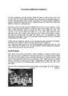
Estonia traditional costumes In Estonia traditional costume denotes mainly the festive peasant dress of the 19th century, which in its time referred besides social status also to national background, as the ruling class were mainly German at the time. The former peasant costume of regional variation has become today a national symbol and has turned due to its altered function into a national dress. Estonian country folk produced their clothing mainly from home-spun woollen or linen fabric: shirts and married women's head-wear was mostly made from linen, while various outer garments, gloves, stockings and socks, were made from wool. The majority of the clothes remained undyed for a long time: linen garments were
Topic Australia Tallinn English College 2006 Australia 1 . Introduction The name Australia is derived from the Latin Australis, meaning of the south. In land area, Australia is the sixth largest nation, its territory is 7,686,850 sq km and its population reaches today over 20,5 million people. It is the only nation to govern an entire continent and its outlying islands. Australia's capital is Canberra, the only city with its own territory. It was built in the early 1900s just to be the capital. The official language is English and the official name of Australia is the Commonwealth of Australia. Australia is located on the Southern Hemisphere (because of that Australia is also called "A land down under"). 2 . Geographical position
4. Who were settled in the province of Ulster by King James I? James I settled English and Scottish Protestants in Munster and Ulster. What has this resulted in? It has resulted in an amount of English people in Ireland. 5. What is meant by Home Rule? Home Rule was a movement that sought to repeal the Acts of Union 1800. The Home Rule Act, was meant to permit Ireland self-government within the UK. 6. Changes in the number of population since the 1840s. 1841: 6.5M in Ireland, 8.2M on the island 1901: 3.2M in Ireland, 5M on the island 1951: 3.0M in Ireland, 4.4M on the island 2011: 4.6M in Ireland, 6.4M on the island Causes of emigration from Ireland. The Irish Famine caused some 150,000 people to leave the island. The Great Famine (1845-52) killed roughly a million and prompted another million to emigrate. In 1890, 40 % of Irish people were living abroad "Exodus in reverse" has been used to describe Irish people returning to Ireland, especially from the US.
European Union since 1995, Finland was the only Nordic state to join the euro system at its initiation in January 1999. In the 21st century, the key features of Finland's modern welfare state are a high standard of education, equality promotion, and national social security system currently challenged by an aging population and the fluctuations of an exportdriven economy (Central Intelligence Agency, 2012, ISSN 15538133). 2.1.2 Geography Location: Northern Europe, bordering the Baltic Sea, Gulf of Bothnia, and Gulf of Finland, between Sweden and Russia Area: total: 338,145 km2 land: 303,815 km2 and water: 34,330 km2 Coastline: 1250 km Climate: cold temperate; potentially subarctic but comparatively mild because of moderating inf luence of the North Atlantic Current, Baltic Sea, and more than 60,000 lakes Terrain: mostly low, f lat to rolling plains interspersed with lakes and low hills
NEW ZEALAND Geography: New Zealand is situated midway between the Equator and the South pole in the southern Pacific Ocean. It consists of two large islands, North Island and South Island, plus several smaller ones of which Stewart Island is the largest. North and South Islands are separated by the 32km wide Cook Strait. The total land area is 270,535 sq Km, about the size of Italy, the United Kingdom or the US state of Colorado. North Island is volcanically active with three active volcanoes. South Island has the high snow covered mountain peaks and glaciers of the Southern Alps, a range running almost 500Km along the Island. The longest river is the Waikato on North Island (425 Km), the largest inland stretch of water is Lake Taupo also on North Island (607 sq Km) and the highest point is Mount Cook on South Island (3754 m). Over 75% of New Zealand is above 200m.
Introduction Estonia, officially the Republic of Estonia (Estonian: Eesti or Eesti Vabariik) is a country in the Baltic region of Northern Europe. It is bordered to the north by Finland across the Gulf of Finland, to the west by Sweden across the Baltic Sea, to the south by Latvia (343 km), and to the east by the Russian Federation (338,6 km). The territory of Estonia covers 45,227 km² and is influenced by a temperate seasonal climate. The Estonians are a Finnic people closely related to the Finns, with the Estonian language sharing many similarities to Finnish. The modern name of Estonia is thought to originate from the Roman historian Tacitus, who in his book Germania (ca. AD 98) described a people called the Aestii
Topic Estonia, Tallinn The Republic of Estonia is the northernmost of the three Baltic States on the eastern shore of the Baltic Sea. To the east Estonia borders on Russia and Lake Peipsi and on the south on Latvia. The area of Estonia is 45 100km2, its coastline is 774km long. The geography of the land is surprisingly varied. Islands make up 9,2 per cent of Estonian's total territory, the largest islands are Saaremaa, Hiiumaa and Vormsi. The highest point is Suur Munamägi, which is 317m high. Estonia has a surprisingly mild climate for an area so far north. Sea winds keep the weather from becoming very cold or hot. The population of Estonia is 1.5 million. Of this number 62 per cent are Estonians. Estonians speak the Estonian language, which is closely related to Finnish. Estonia's flag has three horizontal stripes. The blue stripe at the top of the flag represents the sky
other kinds of work. The found that Australia has other riches too, such as coal, copper, ironore, nickel, natural gas and more. The forests had good timber. Along seashorepearls and tortoise shells could be gathered. Some needed to manufacture such things as butter, cheese, shoes and clothing. Geographical position Australia is located in southern hemisphere. It's the only continent except for Antarctica that is all south of equator. Sometimes Australia is called the Island Continent. There is a great reason why. It really is an island. It is 2880 km from the mainland of asia and is almost half way round the world from Europe. More that 9600 km separate it from America. Australia lies between the Pacific and Indian oceans. The Timor sea and the Arafura sea separate Australia from Indonesia. In the north the coast is washed by Great Australian Bight and the Indian ocean. In the northeast the Coral sea washes