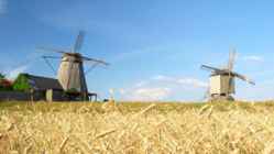
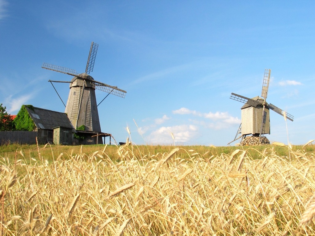
Historical Facts Straitland has served as a junction of international trade routes for Vikings. Long struggle of power with foreign intruders has left ancient strongholds in Valjala, Lihula and Soontagana. The churches in Muhu, Valjala, Mustjala, Karja and Kihelkonna are honorable and elderly because Straitland was the one to bring Christianity to Estonia. The castle of Kuressaare is still standing proudly, but in Lihula only ruins can be seen. The patterns of national dresses and the churches bring memories of secret sign cultures of Medieval Times. Good knowledge of singing and facility of speech of the people of Straitland have given Estonia a big number of writers and poets. Character of the landscape
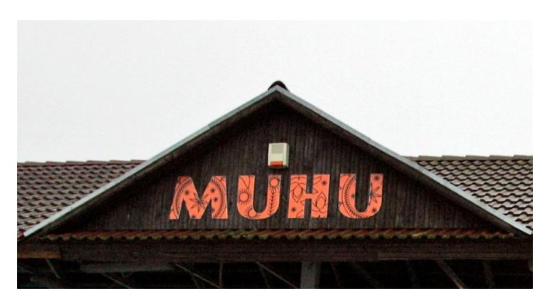
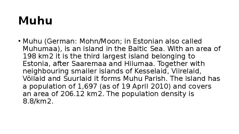
Geography Estonia is the northernmost of the three Baltic States. It is located on the northern hemisphere on the eastern shores of the Baltic Sea in the north-east of Europe. It has land contact with Russia from the east and Latvia from the south. In the north The Gulf of Finland separates Estonia from Finland. The Gulf of Riga is situated to the south-west. Estonia has more than 1500 islands. The biggest ones are located to the west. The four biggest islands are Saaremaa, Hiiumaa, Vormsi and Muhu. The highest point in Estonia and also in the Baltic region is Suur Munamägi. It is 318. above sea level. Estonia is a country of a thousand lakes. The Largest one is Lake Peipsi which is also the fourth biggest freshwater lake in Europe. Lake Peipsi and Lake Võrtsjärv are rich in fish. Estonia has many rivers but only nine of them are longer than 100km. The most important ones are Pärnu River and Emajõgi River Climate
Tallinna Inglise Kolledz Estonia Topic Alice Tärk, 9b Tallinn 2007 FACTFILE Area: 45 228 sq km Poplulation: under 1.4 million Capital: Tallinn Language: Estonian Currency: Eesti kroon (EEK) Main religion: Lutheran National holiday: 24 February (anniversary of the republic) National flower: Cornflower National bird: Barn Swallow National stone: Limestone LOCATION The Republic of Estonia is the northernmost and smallest of the three Baltic States. It is located on the eastern shores of the Baltic Sea in the north east of Europe. To the east the country borders Russia. Latvia is the countries neighbour to the south. From the west the coast of Estonia is washed by the Baltic Sea and from the north by the Gulf of Finland. The length of the coastline is approximately 3 800 km. The longest distance from east to west is 350 km, while north to south Estonia stretches 240 km. THE NAME
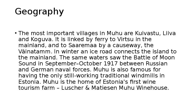
Estonia is bounded on the north by the Gulf of Finland, on the east by Russia, on the south by Latvia and on the west by the Baltic Sea. In the north it borders on Finland. The coastline of the Baltic Sea in Estonia is characterized by numerous gulfs and bays, the biggest of them being the Gulf of Finland, the Gulf of Riga and the Gulf of Pärnu. Bays include the Narva Bay, Matsalu Bay, Kolga Bay, Kunda Bay, Tallinn Bay etc. Estonia has over 1500 islands, the largest being Saaremaa and Hiiumaa, Muhu and Vormsi. Saaremaa and Muhumaa are connected to each other with a bridge. The best- known smalles islands are Naissaar, Aegna, Ruhnu, Kihnu, Väike-Pakri, Suur-Pakri etc. 3. Relief Lying in the north-western part of the East-European Plain, Estonia is mostly flat with an average elevation of about 50 metres above sea level. South-eastern and eastern parts of Estonia are higher than the western parts. The relief of the present-day landscape was shaped during the Ice Age
One can find rare species of fish such as the lake whitefish and the Peipsi smelt in Lake Peipsi. Võrtsjärv is famous for its catches of pike-perch and eel, which are regarded as a delicacy. There are also many rivers in Estonia, but only ten of them are longer than 100 kilometres. The most important rivers are the Pärnu River and the Emajõgi River. Estonia has more than 1 500islands. The largest of these is Saaremaa,. Saaremaa is followed in size by Hiiumaa, Muhu and Vormsi. The islands and the coastal areas of the mainland are interesting owing to the fact that they are on the migratory route for waterfowl. Twice a year - in the spring and autumn - several hundreds of thousands of birds are visitors in Estonia. The barnacle goose, the swan, the eider plus many more are protected species. The mild sea climate and the rather level landscape of the island, makes Saaremaa an area abundant in flora and fauna
Project ESTONIA MAP OF ESTONIA Southern Viljandimaa The southern part of Viljandi county catches the eye with its sublime scenery. The area today lies in the very heart of the historical Mulgimaa the home of hills, deep valleys and lakes brought together by a beauty spot Halliste primeval valley. According to several folk tales, it is also in these valleys, woods and bogs that Old Nick found refuge.The great variety displayed in the nature is also reflected in the local cultural heritage. At the beginning of the 19th century growing linen spread and became the basis of the legendary wealth of Mulgi farms. The ancient barn-dwellings and decaying manor houses are the mute witnesses of those times. The riches and cultural heritage of Mulgimaa owe to the diligence and tenacity of the local people. Village handicraftsmen and masters have always been honoured. Mulgikapsad (stewed sauerkraut with barley groats), Estonian cheesecakes and kama (a roasted me
Kiili Gümnaasium Referaat Hiiumaa Kairo parts 8b klass Kiili 2011 Contents 1. Hiiumaa 2. Name 3. History 4. Transport 5. Kõpu lighthouse Hiiumaa Hiiumaa (Finnish, Hiidenmaa, German Dagö, Swedish Dagö, Danish Dagø) is the second largest island (989 km²) belonging to Estonia. It is located in the Baltic Sea .north of the island of Saaremaa ,a part of the West Estonian archipelago. Its largest town is Kärdla. Name Hiiumaa is the main island of Hiiu County, called Hiiumaa or Hiiu maakond in Estonian. The Swedish and German name of the island is Dagö (day island),Dagø in Danish -- a calque of its ol
Haanja. At 318 metres, Suur Munamägi ('Great Egg Hill') is not only the highest point in Estonia, but of all the Baltic countries. The country has 3974 km of coastline, while the land border, in comparison, is only a mere 633 km. The coast varies from limestone cliff in the north to sandy beaches in the west. Most of Estonia's many islands belong to the West Estonian archipelago. The largest islands are Saaremaa with 2671 sq km, Hiiumaa with 989 sq km and Muhu with 200 sq km. The sea between these islands and the Mainland Väinameri is very shallow (less than five metres deep on average) and rich in shoals. The water of the Baltic Sea is brackish. Its average saltinity is only one fourth of that of the sea in general. Thus, most Estonian freshwater fish (about 30 species) also inhabit the sea. There are some 1450 lakes in Estonia (6.1% of its territory). The two largest of them are Lake


Kõik kommentaarid