Leidsid 33 sarnast õppematerjali, mis on seotud failiga "Inglismaast - PowerPoint ". Need materjalid aitavad sul teemat sügavamalt mõista.
land, england, rose, anthem, emblem, official, however, round, fall, total, coat, tudor, floral, around, wars, roses, whole, queen, following, often, considered, english, country, hope, heart, year, although, quite, variable, temperatures, rarely, below, rise, above, ethnic, groups, south, asian, black, mixed, race, chineseENGLAND England is a country that is part of the United Kingdom. It shares land borders with Scotland to the north and Wales to the west; it is surrounded by the Irish Sea, the Celtic Sea, the North Sea and the English Channel, it's linked to Frane by the Channel Tunnel. The total area of the country is more than 130000 sq km. Most of England is lowland, but there are upland regions in the north, south and south west. The climate is temperate, subject to frequent changes, with plentiful rainfall all year round, although the seasons are quite variable in temperature, it rarely falls below -5 or rises above +30 degrees. The longest river, the Severn, flows for 354km. England's capital London, is the largest metropolitan area in the United Kingdom, drawing
... Sports............................................................................................. .................................... Culture............................................................................................. .................................. Factfile Australia is the only country in the worlf that fills the whole continent. The continent is also called Australia, if you want to make clear that you are speaking about the country you may call it by its official name: Commonwealth of Australia. Australia is the smallest continent, but one of the largest countries in the world. Its area is about 7,6 million sq kilometers. Its population is about 20,0 million and most of the people live in bigger cities: Sydney (4.2 million), Melbourne (3.7 million), Brisbane (2 million) and in Canberra, Which is also the capital of Australia. National language in Australia is english and the monetary unit is Australian dollar
..........................23 During the first questionnaire 30 students of the 9th and 10th class of Gymnasium were questioned about the British national symbols...........................................................................23 Surprisingly, according to the results, more than 50 percent of students are aware of the national flags of Great Britain, Scotland, Northern Ireland and Wales. As can be seen, quite a lot of children also know the name of the Great Britain flag. However, almost all of the students have no idea about other names of the British flags, as well as about the patron saints. In addition, almost 90 percent of students are also unaware about the national holidays..........23 All things considered, we see that there is a need for students to pay more attention to Scotland, Northern Ireland and Wales and to learn more information concerning those parts of the United Kigdom.....................................................................
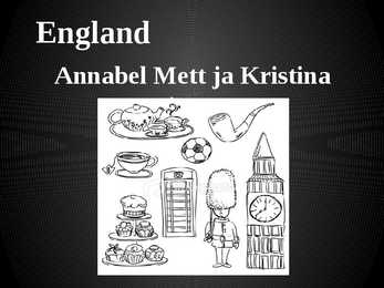
England Annabel Mett ja Kristina Smirnova 8.b Englands Geography · England is a part of the United Kingdom of Great Britain, its an island situated off the North West coast of Europe. · Bordered by Scotland in the north, the North Sea in the east, the England Channel in the south and Wales in the west. · Most of England is rolling hills. · Scafell Pike is the highest mountain in England with an elevation of 978 meters. Key Facts on England · Major Cities: London-Leeds-Liverpool-Manchester. · Capital: London with a population of 7,556,900. · Population: 51,446,000 inhabitants. · Geographic size: 130,395km². · National Anthem: None. God Save the Queen, Land of Hope and Glory. · Currency: Pound sterling (GBP). · Distribution: Males: 48,7% Females: 51,3% Climate of England · England has a temperate climate, with mild winters with temperatures not much lower than 0 C,
....................................................................................... 8 Economy...................................................................................................................... 8 Population and Ethnicity..............................................................................................9 3 Introduction The official name of the country is the United Kingdom. The United Kingdom is an island country. It consists of the island of Great Britain and Northern Ireland. Great Britain can be divided into three parts England, Wales and Scotland. Each of them has their own capital city. Glasgow in Scotland, Cardiff in Wales and London in England. The country is situated in the north-western Europe. The territory of the United Kingdom is about 244,000 square kilometres and about 60 million people live there.
The only large permanent lakes in Australia have been artificially created, as most of the natural lakes there are dry for months or years at a time. Lake Eyre is the largest lake in Australia and also the lowest point. One of the most beautiful things you can see in Australia is Uluru, also called Ayers Rock. It is an enormous rock in the middle of the desert in the Northern Territory. It is three kilometres long and nearly 2.5 kilometres high in total. It is 600 million years old, and it is the largest rock of its kind in the world. Uluru is a sacred place for the Aborigines. Thanks to Australia's isolation, it has plants and animals unlike anywhere else in the world. The kangaroo is the most well-known of them. They have strong back legs and tails, allowing them to travel at high speeds and jump very high and far. The koalas live in eucalyptus trees, sleeping for 18 hours and drinking almost nothing. Both of those animals have pouches for
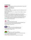
Wars. Engand and Scotland eventually became 1 contry 4. How many people approximately speak English? Approximately 600 million 5. Who (which tribes) gave the base of the English language?Germanic tribes- Anglo-Saxons. 6. Describe Wales.- Wales is a mountainous country on the western side of Great Britain. The national game of Wales is Rugby. Flag- Red dragon on a green and white field. They have their own language Cymraeg ( Welsh) . Anthem- Land Of My Fathers. Official animal- Dragon. There used to be a lot of coalmines. 7. What are the symbols of the 4 constituent countries? England- The three national symbols of England are St.George's cross; The red Rose and the Three Lions Crest; The oak is national tree; Northen Ireland- Shamrock; St.Patrick ;Scotland-thistle, St.Andrew 's cross . ; Wales-daffodil, leek, Prince of Wales's feathers; St.David, red dragon 8. How did the Romans influence Britain
etc. 3. Relief Lying in the north-western part of the East-European Plain, Estonia is mostly flat with an average elevation of about 50 metres above sea level. South-eastern and eastern parts of Estonia are higher than the western parts. The relief of the present-day landscape was shaped during the Ice Age. Ice sheet has carried large boulders and limestone blocks here, not to mention that the hilly terrain in Estonia was also shaped by the continental ice and the melting water. The land is rising 25 cm every one hundred years. In folklore, many features of the relief are explained by the activities of giants such as the legendary national hero Kalevipoeg. The Haanja and Otepää Uplands are particularly rich in Hills. It is here that You find Big Egg Hill, the highest point in the Baltic states with 318 metres above sea level. 4. Land regions The northern coast features a steep limestone bank, the Baltic glint, which is one
Starts after breakfast. Reads the newspapers which are prepared by the Press Secretary, and a report on the previous day’s proceedings in the Parliament and the letters she receives. Also phone calls. Once a month she attends the Privy Council in order to give Royal Assent to various items of government legislation. Discusses domestic matters with the Master of the Household. Towards the end of the day, there is always another pile of official papers and reports waiting to be read or acted upon. The business on constitutional monarchy never ends. 3. Who is the present heir to the throne? Speak about his education. Who are the 2nd and 3rd in line? Present heir is Prince Charles, The Prince of Wales. Has been an exchange student in Australia. Graduated from the university of Cambridge with BA (honors). 2nd and 3rd in line are Prince William of Wales and Prince Henry of Wales, respectively. 4
The United Kingdom The United Kingdom consists of England, Scotland, Wales and North Ireland and it is situated in the Atlantic Ocean near the mainland of Europe. The population of the UK is 58.6 million and area is 244,110 sq km. Britain has a temperate humid climate. Its characteristic features are mild winters, warm summer, no temperature extremes, abundant rain all year round and frequent changes of weather. The mild climate is partly due to the warm Gulf Stream and partly to the south westerly winds. Occasional winds from the east in winter may bring cold and dry weather. The distribution of rainfall is influenced by the Atlantic Stream. The mountainous areas of the north and west have more rain than the lowlands of the south and east. Wales is located on a peninsula in central-west Britain. The entire area of Wales is about 20,779 km²
Estonia. Estonia, officially the Republic of Estonia is a country in Northern Europe. It is the smallest of the three Baltic countries. Estonia has land borders with Latvia (339 km) to the south and Russia (229 km) to the east. It is separated from Finland in the north by the narrow Gulf of Finland and from Sweden in the west by the Baltic Sea. Estonia has been a member of the European Union since May 1, 2004 and of the NATO since March 29, 2004. The area of Estonia is about 45000 square kilometres and the population is about 1.4 million people. The capital of Estonia is Tallinn and the official language is Estonian
laws to a new province of the Roman Empire and started to build good roads. Officials were appointed (governors, procurators to collect taxes, look after the estates and mines and se that the gold, silver, iron and lead were exported back to Rome). Introduced schools,a new language Latin, large farms (villas), baths. In AD 410 they had to leave . roman occupation lasted nearly 400 years. They left behind very little. Roman province of Britannia covered most of present-day England and Wales. 4. Latin influence on English *The influence of Latin is noticeable also in the names of European cities: the Latin noun colonia (settlement, colony) may be found in numerous place-names: Lincoln, Colchester, Cologne ; from Latin word castrum (military camp) were derived English affixes -chester and -castle: Manchester, Lancaster, Newcastle; Latin word portus (seaport) in Portsmouth *-tor - person, doer, masculine form
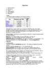
% (mid- Part Population (mid-2006) 2006) England 50,762,900 83.8 Scotland 5,116,900 8.4 Wales 2,965,900 4.9 Northern Ireland 1,741,600 2.9 United Kingdom 60,587,300 100 Although Britain is quite small in terms of land area (245,000 sq km), it has a large population of nearly 61 million, which ranks the 21st in the world (Britain is the 21st most populous state in the world) and the third largest in the European Union. The size of population is changing very slowly. Natural change is the difference between birth and death rates. It may be a natural increase or a natural decrease. Birth rate the number of babies born per 1,000 persons per year 12
The well-preserved village of Skara Brae on the Mainland of Orkney dates from this period. Neolithic habitation, burial and ritual sites are particularly common and well-preserved in the Northern Isles and Western Isles, where lack of trees led to most structures being built of local stone. Roman influence The written protohistory of Scotland began with the arrival of the Roman Empire in southern and central Great Britain, when the Romans occupied what is now England and Wales, administering it as a province called Britannia. Roman invasions and occupations of southern Scotland were a series of brief interludes. In 834 AD the general Gnaeus Julius Agricola defeated the Caledonians at the battle of Mons Graupius, and Roman forts were briefly set along the Gask Ridge close to the Highland line (none are known to have been constructed beyond that line). Three years after the battle the Roman armies had withdrawn to the Southern Uplands
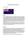
National Symbols of New Zealand New Zealand flag History The idea of the flag of New Zealand was first introduced in 1830, because of trading troubles. At that time, a trading ship built inNZ, Sir George Murray was seized in Sydney by Customs officials for sailing without a flag or register. Australia, which was the most important trading partner for NZ had British navigation laws which ruled that every ship must carry an official certificate detailing construction, ownership and nationality of the ship. The problem was that during that period of time, NZ was not yet a colony ofGreat Britan, thats why the NZ-built ships could not sail under a British flag or register. Without a flag to represent the new nation, trading ships and their valuable cargoes would continue to be seized (held by the Australian customs (toll) The Australians called for signing a legislation to remove any obstacles to New Zealand's
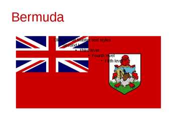
Bermuda (officially, the Bermuda Islands or the Somers Isles) is a British overseas territory in the North Atlantic Ocean Located off the east coast of the United States, it is situated around 1,770 kilometres northeast of Miami, Florida, and 1,350 kilometres south of Halifax , Nova Scotia, Canada. The nearest landmass is Cape Hatteras, North Carolina, about 1,030 kilometres west-northwest. It is the oldest and most populous remaining British overseas territory, settled by England a century before the Acts of Union created the United Kingdom of Great Britain. Bermuda's first capital, St. George's, was settled in 1612 and is the oldest continuously inhabited English town in the Americas. Although commonly referred to in the singular, the territory consists of approximately 138 islands, with a total area of 53.3 square kilometres. Compiling a list of these islands is often complicated, as many have more than one name (as does the entire archipelago,
England is a country that is part of the United Kingdom.It shares land borders with Scotland to the north and Wales to the west; the Irish sea is to the north west, theCeltic sea to the south west and the North Sea to the east, with the English Channel to the south separating it from continental Europe. The mainland of England consists of the central and southern part of the island of Great Britain in the North Atlantic but England also includes over 100 small isl such as the Isles of Scilly and the Isles of weight.The area now called England has been settled by people of various cultures for about 35,000 years, but it takes its name from the Angles, one of the Germanic tribes who settled during the 5th and 6th centuries. England became a unified state in AD 927, and since the Age of Discovery, which began during the 15th century, has had a significant cultural and legal impact on the wider world.
...................................................11 2 Australia Introduction Australia is the one and only country in the world which fills the whole continent. The continent it fills is called Australia too. So, Australia is both a country and a continent. If you want to make clear that you are speaking about the country, you may call it the Commonwealth of Australia. It’s the official name of the country. Australia is the smallest continent, but one of the largest countries on Earth. It’s 6th largest country. Its area is about 7.6 million sq km. One third of it is occupied by deserts. It’s both the flattest and, except for Antarctica the driest. Neighbouring countries include Indonesia, East Timor and Papua New Guinea in the north, the Solomon Islands, Vanuatu in the northeast, and New Zealand in the southeast. Its capital is Canberra
Canada Geography The geography of Canada is vast and diverse. Occupying most of the northern portion of North America, Canada is the world's second largest country in total area. The highest point in Canada is Mount Logan 6,050 m, which is in the Yukon. The two principal river systems are the Mackenzie and the St. Lawrence. The St. Lawrence, with its tributaries, is navigable for over 3,058 km. The largest lake situated entirely in Canada is Great Bear Lake at 31,328 km2 in the Northwest Territories. The largest lake which is at least partly in Canadian territory is Lake Superior Climate
THE U.K Different Parts The United Kingdom is a short way of saying the United Kingdom of Great Britain and Northern Ireland. The UK is the political name for those countries which share a parliament in London. All of them were at one time independent kingdoms with their own monarch. Now they are all part of the same kingdom and share the same monarch. The UK consists of Northern Ireland, Scotland, England and Wales. The peoples of these countries are British subjects; they hold British passports and therefore their nationality is British. The british Isles is the geographical name for all the islands off the west coast of Europe. These islands also include The Republic of Ireland, which is politically independent of the Britsh government. Many people refer to the inhabitants of the British isles as 'the English', but England is only one of the countries
audience.Sport is an important element in Scottish culture, with the country hosting many of its own national sporting competitions, and enjoying independent representation at many international sporting events such as the FIFA World Cup, the Cricket World Cup and the Commonwealth Games (although not the Olympic Games). Law Scotland retains Scots Law, its own unique legal system, based on Roman law, which combines features of both civil law and common law. The terms of union with England specified the retention of separate systems. The barristers being called advocates, and the judges of the high court for civil cases are also the judges for the high court for criminal cases. Scots Law differs from England's common law system. National symbols The Flag of Scotland, known as the Saltire or St. Andrew's Cross, dates (at least in legend) from the 9th century, and is thus the oldest national flag still in use. The Saltire now also forms part of the design of the Union Flag
coastline is approximately 3 800 km. The longest distance from east to west is 350 km, while north to south Estonia stretches 240 km. THE NAME The name EESTI was apparently derived from the word AISTI, the name given by ancient Germans to the peoples living northeast of the Vistula River. Tacitius, the Roman historian, was the first one to mention it (AESTI), while the Arab scholar alIdrisi was the first one to mark it on a map (as ASTLANDA). To the ancient Scandinavians the land was known as EISTLAND; to modern Scandinavians it is known as ESTLAND. Most contemporary languages use the Latin name ESTONIA. FLAG The Estonian blueblackandwhite national flag was originally the flag of the Estonian Student's Society, consecrated in Otepää Church in 1884. today there is a memorial plaque on the church wall commemorating the event. The Flag Museum attracts tourists who take an interest in the history of the flag.
New Zealand New Zealand is an island country. It is in the south-western Pacific Ocean comprising two main island, North- and the South Island with lots of smaller islands. New Zealand is notable for its geographic isolation. It's about 1,600 kilometers from Australia and its closest neighbours to the north are New Caledonia, Fiji and Tonga. New Zealand's total land area is 268,021 square kilometers. The country extends more than 1600 kilometers along its main,north - north-east axis and has about 15,000 kilometers of coastline. The South Island is the largest land mass of New Zealand and is divided along its lenght by the Southern Alps and the highest mountain Mount Cook is 3,754 meters high. There are 18 peaks over 3000 meters in the South Island. The highest North Island mountain is Mount Ruapehu and it is an active cone volcano
1) General facts The UK: * the United Kingdom of Great Britain and Northern Ireland was formed in 1801 * it covers 243,610 sq km * everybody from the UK is called British * the capital city is London * is made up of four constituent countries: England, Scotland, Wales and Northern Ireland which in turn are divided into counties * the flag is called the Union Jack which is a combination of the flags of England, Scotland and Northern Ireland * the population is about 60,000,000 people, the population density is 242 people/sq km * its coasts are washed by the Atlantic Ocean, the North Sea, the English Channel, the Celtic Sea, Saint George's Channel, and the Irish Sea. It is linked to France by the Channel Tunnel * the United Kingdom is a constitutional monarchy. The current monarch is Queen Elizabeth II, who is also the Queen and Head of State of fifteen other Commonwealth Realms, such as
Scotland ! Scotland (Gaelic: Alba) is a country in northwest Europe that occupies the northern third of the island of Great Britain. It is part of the United Kingdom, and shares a land border to the south with England. It is bounded by the North Sea to the east, the Atlantic Ocean to the north and west, and the North Channel and Irish Sea to the southwest. In addition to the mainland, Scotland consists of over 790 islands including the Northern Isles and the Hebrides. Edinburgh, the country's capital and second largest city, is one of Europe's largest financial centres. It was the hub of the Scottish Enlightenment of the 18th century, which saw Scotland become one of the commercial,
Main Sights England is known for its many world-famous sightseeings and people all around the world come to see them. Some of them are even like symbols of England. The most famous ones are: Stonehenge is one of the greatest national icons of Britain. That prehistoric monument is located in the plain of Salisbury, in the county of Wiltshire in the south-west of England. It is built of 150 enormous stones which are set in a purposive circular pattern. Stonehenge was probably built to mark the longest and shortest day of the year because it lies on the line of the midsummer sunrise and the midsummer sunset. That would have enabled people to keep a record of changing of seasons. Although it is still unclear who built it. Hadrian’s Wall is an ancient wall which was built in 2nd century by Hadrian, the emperor of
The population of The USA is about 300 million people. The territory is about 10 million square kilometers. Its geography is very diverse ranging from moist rainforests to dry deserts and bald mountain peaks. There are two big mountain ranges, one of them is the Rocky Mountains and the other is The Appalachian Mountains. The Capital of The USA is Washington D.C. Other big and famous cities are New York, Los Angeles, Houston, Chicago and Las Vegas. The national anthem of the United States is "The Star-Spangled Banner", with lyrics written in 1814 by Francis Scott Key. There are 6 time zones. From east to west they are: Eastern Standard Time, which is 5 hours behind Greenwich Time, Central Standard Time, Mountain Standard Time, which is 7 hours behind Greenwich Time, Pacific Standard Time. Alaska and Hawaii have their own time zones: Alaska Standard Time and Hawaii Standard Time. Geographical Position The USA lies in the Northern Hemisphere in North America
Tallinn 2007 2 List of Contents page Facts and figures 3 Geography 3 Climate 3 Nature 4 History 5 Economy 6 Culture 6 Biggest towns 7 Language 8 3 Facts and figures The Republic of Estonia is a small country. Covering only 45, 228 sq km it is slightly bigger than Denmark, Belgium or Switzerland. Estonia's population is under 1.4 million. The official language is Estonian but since very many Russians live here Russian is also wide spread. The capital of Estonia is Tallinn. The currency used in Estonia is Eesti kroon. The Estonian national flag is blue-black-white. It was originally the flag of the Estonian Students' Society. The flag was first consecrated in Otepää Church in 1884. For a while, during the Soviet occupation, the flag was banned but it was again seen in public in Tartu in May 1988.
This fact, coupled with the grandeur of the landscape, has been central to the sense of Canadian national identity. 2. Geographical position Canada is the second largest country in the world after Russia. In the Arctic, Canada reaches almost as far north as Greenland. To the south it extends to the same latitude as southern France. The distance from Canada's west coast, the Pacific Ocean, to its east coast, the Atlantic Ocean, is farther than from North America to Europe. Canada's total land area includes thousands of adjacent islands, notably Newfoundland in the east and those of the Arctic Archipelago in the north. In longitude Canada extends from approximately 52° to 141° W, a distance that spans six time zones. In latitude it extends from approximately 42° to 83° N. With its vast Arctic and subarctic territories, Canada is often considered a country only of the far north; however, the peninsula of southern Ontario juts deeply south into the heartland
Australia Fact file: Australia comprises a land area of 7 686 850 square kilometres. Its population is about 21,3 million people. Australia's capital is Canberra. The national language is English. The official name of it is the Commonwealth of Australia. It's divided into six states and two territories: New South Wales, Queensland, South Australia, Western Australia, Tasmania, Victoria, Australian Capital Territory (ACT) and Northern Territory. Symbols:
It is English because British settlers came to live in Australia in the past and they brought convicts with them who were also British. Symbols. The Australian Flag came into being after the federation of the Australian States into the Commonwealth of Australian on the first January, 1901. The Commonwealth Blue Ensign was selected as a result of a public competition (over 30 000 designs were submitted). In the upper left corner there is the Union Jack that is the national flag of England. It denotes Australia's historical links with Great Britain. Under the flag there is the Commonwealth star which has seven tips. Six of them represent the states and the last one is for the Commonwealth of Australia. The Southern Cross is in the right. It consists of five stars. The group of stars on the flag shows the geographical place of Australia which is in the southern hemisphere. The coat of arms was created in 1912. Before that coat of arms there was
Since 1992, the extensive historic centre of Prague has been included in the UNESCO list of World Heritage Sites, making the city one of the most popular tourist destinations in Europe, receiving more than 4.1 million international visitors annually, as of 2009. Figure1. IMPORTANT ABOUT CZECH REPUBLIC AND PRAGUE Czech Republic Ceská republika (Czech) Flag Coat of arms Motto: "Pravda vítzí" (Czech) "Truth prevails" Anthem: Kde domov mj? (Czech) "Where is my home?" 5 Figure2. European map. Location of Czech Republic (green) - on the European continent (light green & grey) - in the European Union (light green). Capital (and largest city) Prague (Praha). Official language(s) Czech, Slovak. Government Parliamentary republic. President Václav Klaus. Prime Minister Jan Fischer
пособия. Пособие предназначено для студентов гуманитарных специальностей. Подготовлено на факультете лингвистики. The book contains an overview of the most important events in British history – from the first documented invasions of the island to the formation and fall of the British colonial empire. A series of exercises will help to remember the subject matter, practise the vocabulary and contribute to skills work. The book is intended for the Humanities students. Вавилов Н.А., 2008 3 4 Contents 5 ПРЕДИСЛОВИЕ