Leidsid 33 sarnast õppematerjali, mis on seotud failiga "Niagara Falls". Need materjalid aitavad sul teemat sügavamalt mõista.
falls, niagara, waterfalls, horseshoe, between, rate, ontario, york, veil, island, located, present, erosion, approximately, aleks, straddle, border, canada, states, province, mostly, canadian, goat, other, luna, years, crest, caused, miles, feet, wide, changed, shape, through, process, evolving, arch, bend, inverted, characteristics, volume, approachingCanada's geography is very diverse. It has huge lakes, evergreen forests, prairies, meadows and beautiful mountains. There are thousands of miles of coastline with beaches, fjords and wild rivers flowing to the oceans. Canada is a country of wide open spaces and beautiful landscape where traveling visitors can unexpectedly bump into wild animals like bears or be struck by unusual sight like the scarecrows on the Cabot Trail. Canada is rich in natural wonders, one of them, the Niagara Falls between lakes Erie and Ontario, which is the second biggest waterfall in the world is one of the greatest attractions in the world. About twelve million tourists come to see the beauty of the falling waters on the border between the United States of America and Canada. The Horseshoe Falls, which lie in the territory of Canada, are much bigger and have more strength than the American Falls.
It has huge lakes, evergreen forests, prairies, meadows and beautiful mountains. There are thousands of miles of coastline with beaches, fjords and wild rivers flowing to the oceans. Canada is a country of wide open spaces and beautiful landscape where traveling visitors can unexpectedly bump into wild animals like bears or be struck by unusual sight like the scarecrows on the Cabot Trail. Canada is rich in natural wonders, one of them, the Niagara Falls between lakes Erie and Ontario, which is the second biggest waterfall in the world is one of the greatest attractions in the world. About twelve million tourists come to see the beauty of the falling waters on the border between the United States of America and Canada. The Horseshoe Falls, which lie in the territory of Canada, are much bigger and have more strength than the American Falls. People can enjoy the sight and the noise of the waters from boats which take them right next to the falls
Provinces, Central Canada, the Atlantic Provinces, and the North. The Pacific Region includes Canada's westernmost province, British Columbia. The region is known for its mild coastal climate, its forests, and its spectacular mountains, including the famous Rockies. The Rocky Mountains are the youngest and highest mountains in Canada. British Columbia is in the landform region called the Western Cordillera. ('Cordillera' means a system of mountain ranges). Between the mountain ranges are areas of high plateaus and deep trenches. Since the landscape is very rugged, most people live in the south and near the coast. Vancouver and Victoria are the largest cities in British Columbia. The region includes the Queen Charlotte Islands and Vancouver Island. All these islands are peaks of a mountain range that is partly covered by the Pacific Ocean. The St Elias Mountains in the Yukon include Canada's highest peak, Mount Logan
Parlament and Government. The monarchy is represented by the leutenantgovernor. The Frenchspeaking province of Canada (Quebec) is very different culturally. Since the 1960s there has been a strong movement to became an independent country (separatist movement). 80 % of Canada's French speaking people lives in Quebec. Canada has ten provinces and two territories (the capital of each is shown in parentheses): Alberta (Edmonton), British Columbia (Victoria), Prince Edwars Island (Charlottetown), Manitoba (Winnipeg), New Brunswick (Fredericton), Nova Scotia (Halifax), Nunavut (Iqaluit), Ontario (Toronto), Quebec (Quebec City), Saskatchewan (Regina), Newfoundland and Labrador (St. John's), Northwest Territories (Yellowknife) and Yukon Territory (Whitehorse). Geographically, Canada can be divided into five major regions: the Pacific Region, the Prairie Provinces, Central Canada, the Atlantic Provinces and the North. The Pacific Region includes Canada's westernmost
mountains. The three Prairie Provinces are known for their rolling plains and their extreme climate with long, cold winters and hot, dry summers. Part of the Rocky Mountains are in the there. A lot of the Prairie Provinces' area is covered with farms producing wheat and other grains. The region is rich in oil and natural gas. In fact, Canada is the second largest oil reserve holder in the world, after Saudi Arabia. Central Canada which includes Ontario and Quebec is not the geographical centre of Canada. It is called that because it has historically been the political and economic centre of the country. Central Canada is the most heavily populated and industrialised area. In there lie the Great Lakes the largest body of fresh water in the world. Some of the first settlements in Canada were, naturally, built around those areas. In the Atlantic Provinces, the most important activities include fishing and farming of all sorts
after Russia and Canada. In the USA there are 50 states of which 48 lie together. The population of The USA is about 300 million people. The territory is about 10 million square kilometers. Its geography is very diverse ranging from moist rainforests to dry deserts and bald mountain peaks. There are two big mountain ranges, one of them is the Rocky Mountains and the other is The Appalachian Mountains. The Capital of The USA is Washington D.C. Other big and famous cities are New York, Los Angeles, Houston, Chicago and Las Vegas. The national anthem of the United States is "The Star-Spangled Banner", with lyrics written in 1814 by Francis Scott Key. There are 6 time zones. From east to west they are: Eastern Standard Time, which is 5 hours behind Greenwich Time, Central Standard Time, Mountain Standard Time, which is 7 hours behind Greenwich Time, Pacific Standard Time. Alaska and Hawaii have their own time zones: Alaska Standard Time and Hawaii Standard Time.
Usa 1. Gross Domestic Products Gross Domestic Products of USA United States of America has the highest Gross Domestic Products nominal about 14.624 trillion US dollars according to World Bank. 2. Rhode Island Rhode Island is actually named Rhode Island and Providence Plantations and it makes the smallest state in the United States has the longest name. 3. Califrnia never rains It is believed that California is the state with the lowest rainfall in the world. For two years, California never rains. For those amazing and unique facts, California has been attracting so many tourists. Many people also adore this fact and this facts is often included in a song lyric. 4. President Grover Cleveland
Its territory is about 9.4 million square kilometres and its population is more than 260 million people, 12% of them are the Afro-Americans. It is the world's third-largest country by size and by population. The population density is about 27 people per square kilometre. Most of the people live in towns. There are 50 states in America. The biggest of the state is Texas, next by size are California, Alaska and Montana. Six states - Maine, Vermont, New Hampshire, Connecticut ,Rhode Island and Massachusetts are called New England. They are all small states in the U.S. that lie in the north-east. The first colony of immigrants settled down in Virginia, in the eastern part of the U.S.A. The biggest cities are New York, Washington, Chicago, Los Angeles, San Francisco, etc. The flag of America was adopted on 14 th June 1777. It is called the "Stars and Stripes". It is said that Betsy Ross sewed the first flag. It features 13 horizontal red and
2007 1. Introduction The United States of America's territory is over 3.7 million square miles (over 9.6 million km²) and population more than 300 million people. The capital city is Washington D.C. Although the United States has no official language at the federal level, English is the de facto national language. English is the most common language for daily interaction among both native and non-native speakers. Spanish is the second language. The largest city is the New York City. The Government is Federal constitutional republic and the president is George W. Bush. 2. Geographical position The United States of America is located on the continent of North America. It has borders with two countries Mexico and Canada. There are also the Atlantic Ocean, the Pacific Ocean and the Gulf of Mexico surrounding the big country. There are 50 states in America. Most of the people live in towns. The biggest state is Alaska; next by size are California, Alaska and Montana
Australia's capital is Canberra, the only city with its own territory. It was built in the early 1900s just to be the capital. The official language is English and the official name of Australia is the Commonwealth of Australia. Australia is located on the Southern Hemisphere (because of that Australia is also called "A land down under"). 2 . Geographical position Australia is an island continent and it is located between the Indian and South Pacific oceans south east of Asia. From the north it is bordered by the Timor Sea and the Torres Strait. From the east by the Coral Sea and the Tasman Sea. Australia's coastline is about 37,000 km long. The Great Australian Bight washes the southern coast. The Gulf of Carpenteria and the Cape York Peninsula surround it in the south. 3. Relief Australia is the smallest continent in the world It is often called the island continent because is too big for
In 1996, the top non-fuel minerals were gold with production of US$2.05 billion, copper US$1.47 billion, nickel US$1.45 billion, and zinc US$1.25 billion. There was also significant production of lead and iron. There are about 50 major gold mines in Canada and the country leads the world in technologies which extract gold from rock and soil. The nation is the world's largest producer of zinc and the fifth largest producer of lead. Among the provinces, Ontario is the top producer of non-fuel mineral resources, followed by Quebec, British Columbia, Saskatchewan, and Newfoundland. Each year Canadian companies spend over US$600 million to find or develop new mines and fuel supplies. However, environmental concerns and increased regulation have led many Canadian mining companies to shift exploration elsewhere. Latin America is becoming a favorite choice for Canadian mining companies.
Its territory is about 9.4 million square kilometres and its population is more than 260 million people, 12% of them are the Afro-Americans. It is the world's third-largest country by size and by population. The population density is about 27 people per square kilometre. Most of the people live in towns. There are 50 states in America. The biggest of the state is Texas, next by size are California, Alaska and Montana. Six states - Maine, Vermont, New Hampshire, Connecticut ,Rhode Island and Massachusetts are called New England. They are all small states in the U.S. that lie in the north-east. The first colony of immigrants settled down in Virginia, in the eastern part of the U.S.A. The biggest cities are New York, Washington, Chicago, Los Angeles, San Francisco, etc. The official language of the USA is English; Spanish is also widely spoken. The currency of the USA is the United States Dollar. Lakes and rivers
Canada's total land area includes thousands of adjacent islands, notably Newfoundland in the east and those of the Arctic Archipelago in the north. In longitude Canada extends from approximately 52° to 141° W, a distance that spans six time zones. In latitude it extends from approximately 42° to 83° N. With its vast Arctic and subarctic territories, Canada is often considered a country only of the far north; however, the peninsula of southern Ontario juts deeply south into the heartland of the United States, and its southernmost point, Middle Island in Lake Erie, is at the same latitude as northern California. The country also includes several major islands, including Baffin, Ellesmere, Victoria, Newfoundland, and Melville, and many small ones. Its border with the U.S., the longest border in the world not patrolled by military forces, extends 8,890 km. 3. Mountains, lowlands
world's most important denudations of Ordovician sedimetary rocks. Half of Estonia is covered with forests and 30 % is covered with wetlands. The areas which are higher and particularly rich in hills are the Haanja and Otepää Uplands in the southeastern part of Estonia. In Haanja Upland there is the highest top of Estonia, Big Egg Hill (318 m), which is the highest top of the Baltic states. There are over 1400 lakes in Estonia. Lake Peipsi, lying between Estonia and Russia, covers 3 555 sq km. It is the biggest in Estonia and the fourth biggest in Europe. The second largest lake is Lake Võrtsjärv (270 sq km), while the deepest id Rõuge Suurjärv (38 m). The longest rivers are the Võhandu (162 km) and Pärnu (144 km). The Emajõgi flows for 101 km and its drainage basin covers 9740 sq km. NATURE CONSERVATION AND PROTECTED AREAS In 2004 Estonia had 360 different protected areas, apart from 448
that go back that far. Many scientists now believe that some of the First Peoples may have been here for much longer than that. For a long time, scientists believed that the ancestors of all North American First Nations people crossed over on foot to North America from Asia at the end of the last ice age, about 12,000 years ago. At that time Asia and North America were joined, and what is now the bottom of the Bering Sea between Russia and Alaska was dry land, (a "land bridge) because sea levels were much lower than they are now. The earliest man-made artifacts tools or ornaments that archaeologists have found date from that time. The theory is that nomadic hunting people followed the big animals (moose, deer, elk, buffalo) for food, and eventually moved south and spread out as the ice sheets melted back. Then they evolved different cultures to suit different environments.
3. Using the climate diagram describe the climate of the region. Temperate deciduous forest -Well-defined seasons with a distinct winter characterize this forest biome. Moderate climate and a growing season of 140-200 days during 4-6 frost-free months distinguish temperate forests. Temperature varies from -15° C to 25° C. Precipitation (750-1500 mm) is distributed evenly throughout the year. Temperate grassland- Semiarid, continental climates of the middle latitudes typically have between 25 cm and 50 cm of precipitation a year. Much of this falls as snow, serving as reservoir of moisture for the beginning of the growing season. Warm to hot summers are experienced, depending on latitude. In the winter, grassland temperatures can be as low as -40° C, and in the summer it can be as high 20° C. There are two real seasons: a growing season and a dormant season. The growing season is when there is no frost and plants can grow (which lasts from 100 to 175 days)
for each energy consumption activity. The spreadsheet converted their energy consumption to show them the amount of money it costs for each energy consumption activity. In the end, they were shocked to see how much money Jules' energy using habits cost compared to Les' habits. USES OF ENERGY The United States is a highly developed and industrialized society. We use a lot of energy - in our homes, in businesses, inindustry, and for traveling between all these different places. The industrial sector uses almost one-third of the total energy. The residential and commercial sectors combined use 39 percent of all energy. These two sectors include all 4 types of buildings, such as houses, offices, stores, restaurants, and places of worship. Energy used for transportation accounts for more than a quarter of all energy. Picture 2.1
7 million people and there are many nationalities. Besides English and French there are also immigrants from Scotland, Ireland, Wales, Germany, Ukraine and Scandinavia. In Edmonton and Calgary there are also historic Chinatowns, and Calgary has Canada's third largest Chinese community. Geographical features Alberta covers an area of 661,848 square kilometres, an area about 5% smaller than Texas or 20% larger than France. This makes it the fourth largest province after Quebec, Ontario, and British Columbia. To the south, the province borders on the 49th parallel north, separating it from the U.S. state of Montana, while on the north the 60th parallel north divides it from the Northwest Territories. To the east the 110th meridian west separates it from the province of Saskatchewan, while on the west its boundary with British Columbia follows the 120th meridian west south from the Northwest Territories at 60°N until it reaches the Continental Divide at the Rocky Mountains.
Scotland ! Scotland (Gaelic: Alba) is a country in northwest Europe that occupies the northern third of the island of Great Britain. It is part of the United Kingdom, and shares a land border to the south with England. It is bounded by the North Sea to the east, the Atlantic Ocean to the north and west, and the North Channel and Irish Sea to the southwest. In addition to the mainland, Scotland consists of over 790 islands including the Northern Isles and the Hebrides. Edinburgh, the country's capital and second largest city, is one of Europe's largest financial centres. It was the
It is a bilingual and multicultural country, with both English and French as official languages. Geography: Covering most of the northern part of the North American continent and with an area larger than that of the United States, Canada has an extremely varied topography. In the east, the mountainous maritime provinces have an irregular coastline on the Gulf of St. Lawrence and the Atlantic. The St. Lawrence plain, covering most of southern Quebec and Ontario, and the interior continental plain, covering southern Manitoba and Saskatchewan and most of Alberta, are the principal cultivable areas. They are separated by a forested plateau rising from Lakes Superior and Huron. Westward toward the Pacific, most of British Columbia, the Yukon, and part of western Alberta are covered by parallel mountain ranges, including the Rockies. The Pacific border of the coast range is ragged with fjords and channels. The highest point
as crude bitumen. In Canada, bitumen is considered a sticky, black, tar-like form of crude oil which is so thick and heavy that it must be heated or diluted before it will flow. Venezuela also has large amounts of oil in the Orinoco oil sands, although the hydrocarbons trapped in them are more fluid than in Canada and are usually called extra heavy oil. These oil sands resources are called unconventional oil to distinguish them from oil which can be extracted using traditional oil well methods. Between them, Canada and Venezuela contain an estimated 3.6 trillion barrels (570×109 m3) of bitumen and extra-heavy oil, about twice the volume of the world's reserves of conventional oil. Petroleum is used mostly, by volume, for producing fuel oil and petrol, both important "primary energy" sources. 84 percent by volume of the hydrocarbons present in petroleum is converted into energy-rich fuels (petroleum-based fuels), including petrol,
In the autumn the leaves change color. During the winter months the trees lose their leaves. The animals adapt to the climate by hibernating in the winter and living off the land in the other three seasons. DesertDeserts cover about one fifth of the Earth's land surface. Deserts temperature ranges from 20 to 25° C. The extreme maximum temperature ranges from 43.5 to 49°. Hot and Dry Deserts usually have very little rainfall and concentrated rainfall in short periods between long rainless periods. Most Hot and Dry Deserts don't have very many plants. The only animals they have that can survive have the ability to burrow under ground. They only come out in the night when it is a little cooler. SavannaA savanna is a rolling grassland scattered with shrubs and isolated trees, which can be found between a tropical rainforest and desert biome. Savannas are also known as tropical grasslands. Savannas have warm temperature year round
The first inhabitants were hunters and fishers from the European mainland in 6000 BC. In 200 BC, the Celts arrived. 2. Christianity was established during the 5th century by Saint Patrick, who is also Ireland's patron saint. His feast day is on 17th of March, the day he died. 3. The English conquest of Ireland began in the 12th century by Henry II. 4. King James I settled English and Scottish Protestants in the province of Ulster. This has resulted in conflicts between the Irish Catholics and the "planted" Protestants. 5. Home Rule was the name given to the Movement of Independence in 1916. Ireland demanded independence, self-government and freedom from the UK. 6. During the 1840s, the population decreased deeply due to Great Famine, which caused death and emigration. Now, population is changing and Ireland has become an immigration country Irish people are coming back; immigration from other European countries. 7
daylight lasts sometimes only six hours. Being on the Baltic Sea the country is subjected to sea breezes and humidity. Estonia has a temperate climate, with four seasons of near-equal length. Summer is warm, while spring and autumn can be mild. Winter, which lasts from November to middel March, 4 can be very cold. The cold winter does not necessarily mean constant snow; in fact snowfalls are few and far between. When it falls it stays though, and there tends to be a layer of snow on the ground constantly. The deepest snow cover is usually in the south-eastern part of Estonia. Temperatures range from a summer average of 30°C to an average in winter of -8°C.The coldest month is considered to be February and the hottest July. There are about 160 to 181 rainy days a year. Rainfall is distributed throughout the year with the heaviest rainfall in August. Nature Waterbodies Estonia is a country of thousands of lakes
metal truss bridge to a less travelled road when it can no longer handle the traffic; the same probably holds true for other countries. This is within the functional tradition of some bridge types and should not be viewed as a negative factor in determining the integrity of a relocated structure. The definition of authenticity is in the process of being expanded to include intangible values such as a bridge that embodies the spirit or character of a people or place, as New York City is embodied in the Brooklyn Bridge, San Francisco in the Golden Gate, London in Tower Bridge, Sydney (Australia) in the Harbour Bridge, or Bosnia-Herzegovina in the recently destroyed Stari Most in Mostar. Bridges nominated for World Heritage listing also must have legal protection and management mechanisms to ensure their conservation. The existence of protective legislation at the national, provincial, or municipal level is therefore essential and must be clearly stated in the nomination
Western Australia , South Australia, The Australian Capital Territory and the Northern Territory). The Australian people are culturally the same as the Anglo Americans. There also live aborigines. Aborigines are the ancestors of the people. Like the US and Canada, Australia was an English speaking colony of Great Britain. Today Australia is a modern developed country with a diversified economy. Australia is an island continent of 7.7 million square kilometres, which makes it a little smaller than the USA. Located in south of Asia, between The Pacific and Indian Oceans, Australia is the World's driest continent. Although large areas of the centre are desert, Australia has a wide range of climate from tropical in the north to temperate in the south east, where it frequently snows in winter. Geographical position The coasts of Australia are surrounded by the Pacific Ocean, the Indian Ocean and the
Australia Australia is a country and also a continent. If someone wants to make clear, that he is speaking of the country, he may call it by its full name of Commonwealth of Australia. Australia's name means "southland."It is south of the equator. Sometimes it is also called the island continent because it is an island. There are about twenty million people in Australia.It is 1,800 miles from the mainland of Asia and almost half way round the world from Europe. More than 600 miles of ocean separate it from Americas. Since Australia is south of the equator, its seasons are just the opposite of ours. It has summer while we have winter, and the other way round. States and Territories. Australia consists of six states, two territories and eight external territories.
on it. The Greenland colony died out during the 15th century and the Viking adventures in Canada must have come to an end long before that time. The Colony of New France By 1600 French interest in Canada was renewed because of the beaver pelt trade and the fishing industry. First French colony was established in eastern Canada. Because of the French settlement the French established a claim to the Gulf of St. Lawrence area. An agreement was made between the King of France and a private fur-trading company that if the company brought settlers to New France then they would have a monopoly on the fur trade. Early attempts of colonization failed but the first permanent colony was established by a French nombleman and a mapmaker named Samuel de Champlain. Their first small community located in present-day New Brunswick which was called Acadia. There were really harsh climate conditions so they
Society and culture of english-sspeaking countries Introduction 1. The countries of the world where the English language is spoken. 2. Approximate number of mother tongue speakers of English approximately 350-400 million native speakers. Which place does English occupy in the world by its number of speakers?After which language? English occupies second place by its number of speakers after Mandarin Chinese. 3. What is the difference between English as a Second Language, English as a Foreign Language and English for Specific Purposes? Give examples of situations where they are used. English as a Second Language (ESL or TESL) is a traditional term for the use or study of the English language by non-native speakers in an English-speaking environment. That environment may be a country in which English is the mother tongue (e.g., Australia, the U.S.) or one in which English has an established role (e.g., India, Nigeria)
was ruled by various Hussite committees. In 1420 combined Hussite forces led by military 8 commander Jan Zizka successfully defended Prague against the first anti-Hussite crusade, launched by Sigismund, the Holy Roman emperor, during the Battle of Vítkov Hill. In the 1420s a split developed in the Hussite ranks between radical Taborites, who advocated total war on Catholics, and moderate Utraquists, who consisted mainly of nobles who were more concerned with transforming the Church. In 1434 the Utraquists agreed to accept Sigismund's rule in return for religious tolerance; the Taborites kept fighting, only to be defeated in the same year at the Battle of Lipany. Following Sigismund's death, George of Podbrady (Jií z Podbrad) ruled as Bohemia's one
3%. Modern technologies, such as geothermal energy, wind power, solar power, and ocean energy together provided some 0.8% of final energy consumption. While there are many large-scale renewable energy projects and production, renewable technologies are also suited to small off-grid applications, sometimes in rural and remote areas, where energy is often crucial in human development.Kenya has the world's highest household solar ownership rate with roughly 30,000 small (20100 watt) solar power systems sold per year. Some renewable energy technologies are criticised for being intermittent or unsightly, yet the market is growing for many forms of renewable energy. Climate change concerns coupled with high oil prices, peak oil and increasing government support are driving increasing renewable energy legislation, incentives and commercialization. New government spending, regulation, and policies
About 15% of Canada's people speak both English and French, the two official languages. There are also people of German, Italian, and descent. Eskimos and American Indians together make up about 2% of the population. Over three-quarters of Canada's people live in cities or towns. Provinces/territories Canada is divided into provinces and territories. There are 10 provinces and 3 territories. The provinces are Newfoundland, New Brunswick, Prince Edward Island, Nova Scotia, Quebec, Ontario, Alberta, Saskatchewan, Manitoba and British Columbia. Quebec Quebec differs greatly from the rest of Canada because of its French language and culture. About 80% of Quebec's people are of French descent. The official language is French. Quebec is the largest province in area and the second largest in population. Ontario Ontario has a larger population than any other province. About a third of Canada's people live there. About half of Ontario's people are of British or Irish descent
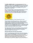
Sunflowers are native(pärit) to the Americas. The earliest known examples of a fully domesticated sunflower were found at the Olmec site of San Andrés dating some time before 2500 B.C.[1] The Incas used the sunflower as an image of their sun god. Gold images of the flower, as well as seeds, were taken back to Europe early in the 16th century. The Giant sunflower (Hlianthus giganteus) is native to Connecticut. They can grow to be between 3 and 12 feet tall. Their flower heads can be between 2 to 3 inches wide. They are most commonly found in valleys with wet meadows or swamps. The Giant sunflower grows between July and October. To grow well, sunflowers need full sun. They grow best in fertile, moist, well-drained soil with a lot of mulch. In commercial planting, seeds are planted 45 cm (1.5') apart and 2.5 cm (1") deep. Sunflower "whole seed" (fruit) is sold as snacks and can be processed into a peanut butter