Leidsid 33 sarnast õppematerjali, mis on seotud failiga "California state". Need materjalid aitavad sul teemat sügavamalt mõista.
california, land, official, gold, percent, year, animal, nickname, golden, song, travel, different, other, ethnic, groups, came, centuries, immigrants, already, than, years, occupation, handbook, bear, popular, designation, particularly, since, development, back, discovery, fields, seen, spring, throughout, angeles, merchant, total, direct, billioncovert anti-semitism. Jews were allowed to leave Russia for Israel, but many had the US as their real goal. Most had no knowledge of Yiddish or Hebrew or the Jewish religion. Immigration after 1985: the Soviet government under Mikhail Gorbachev allowed anyone to leave the Soviet Union. The major group of post-Soviet immigrants were the political refugees, persons who claim persecution or reasonable fear of persecution in Russia. Largest Russian communities today are in New York, California and Florida. 5. From where did the Indians come to America? *Native Americans aka. Indians, Red Indians, Redskins, American Indians, Amerindians, Namerind, First Nations people (Canada) *Origins of N-Am, theories = Bering Land Bridge theory = North American Indians are the people whose ancestors were living in North America when the Europeans discovered the Western Hemisphere. They often are called red men, or redskins, and they were named
Tallinn English College Topic The United States of America Tallinn 2007 1. Introduction The United States of America's territory is over 3.7 million square miles (over 9.6 million km²) and population more than 300 million people. The capital city is Washington D.C. Although the United States has no official language at the federal level, English is the de facto national language. English is the most common language for daily interaction among both native and non-native speakers. Spanish is the second language. The largest city is the New York City. The Government is Federal constitutional republic and the president is George W. Bush. 2. Geographical position The United States of America is located on the continent of North America. It has borders with two countries Mexico and Canada
It is a very developed country. Montreal is the largest city and it is called the Paris of North America because most of the people there speak French. The population of Canada is 28 million people. It is a very multicultural country. People from many different countries have come to live there. The natives are Eskimos and Indians. Eskimos have their own self-governing homeland called Nunavut. In Canada there are also 2 official languages English and French. One third of the population speaks French and the other two speak English. Many more languages are spoken in that country. 75% of the population lives within 300 km of the USA border. Political Structure. Canada is a constitutional monarchy and a Commonwealth Realm that formally recognizes Elizabeth II as Queen of Canada. Though the United Kingdom and Canada share the same Monarch, the Queen of the
notably spruces and firs. Around the Great Lakes and New England are mixed forests of pines, maples, elms, birches, oaks and beeches. Along the Gulf of Mexico grow magnolia, red and black gum, cypress and mangrove. Geographical Regions The territory of the United can be divided into eight regions: 1) New England; 2) the Mid-Atlantic region; 3) the South; 4) the Midwest; 5) the Southwest; 6) the Rocky Mountain region; 7) the Pacific Northwest and Alaska; 8) California and Hawaii. New England is highly industrial, but it also has many fields, woods and small towns. New England is the part of the United States that is most like "old" England. It includes six states: Maine, New Hampshire, Vermont, Massachusetts, Rhode Island, and Connecticut. The Mid-Atlantic region plays an important role in the United States. Its cities include Washington D. C., the nation's capital, and New York City, the nation's financial centre. The Mid-Atlantic region is densely populated
people live in towns. There are 50 states in America. The biggest of the state is Texas, next by size are California, Alaska and Montana. Six states - Maine, Vermont, New Hampshire, Connecticut ,Rhode Island and Massachusetts are called New England. They are all small states in the U.S. that lie in the north-east. The first colony of immigrants settled down in Virginia, in the eastern part of the U.S.A. The biggest cities are New York, Washington, Chicago, Los Angeles, San Francisco, etc. The official language of the USA is English; Spanish is also widely spoken. The currency of the USA is the United States Dollar. Lakes and rivers The Mississippi is the major river of North America and the United States. It flows from north-western Minnesota south to the Gulf of Mexico.The western tributaries are the Red River, the Arkansas and the Missouri. The eastern tributaries are the Tennessee and the Ohio
Spanish California Sten Endrik Mihkelsoo MM-14 California's contact with Europeans began in the mid 1530s when Cortez's men ventured to Baja California. Not until 1542 did Spaniards sail north to Alta California, and Juan Rodriguez Cabrillo's expedition of that year made landings as far north as modern Santa Barbara. The Spaniards, of course, were hardly the first to discover this land of wonder and extremes. The earliest Californians were adventurous Asians who made their way across the Bering Straits to Alaska thousands of years ago when a warmer climate and a now-vanished land bridge made such travel easier. These men and women and their descendants settled North and South America, spreading out to form the various nations and tribes whom the first European visitors to this hemisphere dubbed "Indians." The
that go back that far. Many scientists now believe that some of the First Peoples may have been here for much longer than that. For a long time, scientists believed that the ancestors of all North American First Nations people crossed over on foot to North America from Asia at the end of the last ice age, about 12,000 years ago. At that time Asia and North America were joined, and what is now the bottom of the Bering Sea between Russia and Alaska was dry land, (a "land bridge) because sea levels were much lower than they are now. The earliest man-made artifacts tools or ornaments that archaeologists have found date from that time. The theory is that nomadic hunting people followed the big animals (moose, deer, elk, buffalo) for food, and eventually moved south and spread out as the ice sheets melted back. Then they evolved different cultures to suit different environments.
S.A. The biggest cities are New York, Washington, Chicago, Los Angeles, San Francisco, etc. The flag of America was adopted on 14 th June 1777. It is called the "Stars and Stripes". It is said that Betsy Ross sewed the first flag. It features 13 horizontal red and white stripes (for the first colonies which formed the U.S.A.) and 50 stars on the blue background. Red means courage, blue justice and white innocence. There is a star for every state of the USA. The official language of the USA is English; Spanish is also widely spoken. The currency of the USA is the United States Dollar. The government of the USA is composed of three coordinate branches: the executive, legislative and the judicial. All the three branches are equal. The executive power is vested in the president, who holds office for a term of four year. At the moment George W. Bush is the president. The president is elected together with a vice-president
USA: West Coast Kristiina Sekljutskaja 11A West Coast · The "West Coast", "Western Seaboard", or "Pacific Coastline" are terms for the westernmost coastal states of the United States. · It most often comprises California, Oregon and Washington. Arizona and Nevada, while not coastal states, are often included due to their proximity to the Pacific Coast and their economic and cultural ties to California · As of 2007, the estimated population of the West Coast ranged from approximately 5060 million, depending on which states are included in the estimate. · Major coastal cities on the West Coast include San Diego, Los Angeles, San Francisco, Seattle, Las Vegas. ·West Coast includes: ·Washington ·Oregon ·Arizona ·Nevada ·California Washington · Named after George Washington, the first President of the United States · Capital: Olympia
death and emigration. Now, population is changing and Ireland has become an immigration country Irish people are coming back; immigration from other European countries. 7. Irish Free State was a dominion, which was established in 1921. Six counties of Northern Ireland remained in union with Britain. The Republic of Ireland was established in 1949 and was no longer ruled by the British monarch or part of the Commonwealth. 8. The official languages of Ireland are English and Irish. At present, less than half have the ability to speak Irish, though it is taught in schools as a compulsory subject. A small number of people use it outside the education system. 9. Irish language is related to other Celtic languages (Scottish, Gaelic, Welsh, Cornish, Manx, and Breton). The earliest sources were written in the Ogham alphabet. 10
I Native Americans · Origin of Native Americans Origin is debatable Siberia->Alaska Crossed the land bridge around 14,000 years ago "ice-free corridor" Hunters, searching for fresh grounds · Different tribes and their way of life In tents, dark skin, hair is long, black and straight, women-agriculture, men- hunting. bands(chief. Travelled together) and tribes land was owned by the tribe that occupied it. 200 different tribes Apache- "enemy"- hunted buffalos, oil and natural gas from their land Cherokee- largest tribe Cheyenne- from Minnesota and S & N Dakota. High system of laws
THE CAPITALIST NIGER Chika Onyeani ………………………Every African must internalise this book - period….DAA INTRODUCTION In October 1960, Nigeria received its independence from Britain. By then, Ghana the former Gold Coast had been independent for three years under the great Osagyefo Kwame Nkumah. It was a time for celebrating Africa’s coming of age, as more and more African countries received their independence either from Britain or France. It was especially a poignant time for Africa, as then British Prime Minister Harold McMillan articulated his now famous “winds of change” sweeping Africa. We had high hopes for
the east and the Rockies in the west. In the very middle of the continent is the Mississippi River. Almost all the rivers between the mountains flow into the Mississippi. Along the border with Canada, there are five big lakes, called ,,the Geat Lakes". Climate Pacific Ocean moderates west coast temperatures. Mild summers, cool winters, much rain on northwest coast. Warm and dry in summer, mild with some rain rest of the year on California coast. Inland Southwest mostly dry with warm summers and cold winters. Warm summers, cold winters, moderate precipitation on northeast and north-central but warmer. Alaska is extremely cold in winter and has spetacular glaciers. Hawaii is tropical. History Before Columbus came to the New World in 1492, the land were inhabited by Native Americans or Indians. After 1492, there was a struggle for land and domination in the New World. England defeated the Spanish navy in 1588
Many of them lived in small groups of about 20-50 people. Most of them were very peaceful people, who lived by hunting and collecting food. Other Native Americans lived in small villages, where they had farms. When Columbus reached the Caribbean in 1492 he thought that he had landed in the East Indies in Asia, so he called the people there "Indians". After that thousands of Europeans arrived and they tried to take the land away from the Native Americans, so there were many wars. Native Americans also died from the diseases that the Europeans brought. At first they had to move to the west. But soon the white moved further west into the lands where the Indians lived and there were again many battles. The American Civil War (18611865) was a civil war between the United States of America (the "Union") and the Southern slave states of the newly formed Confederate States of America under Jefferson Davis
etc. 3. Relief Lying in the north-western part of the East-European Plain, Estonia is mostly flat with an average elevation of about 50 metres above sea level. South-eastern and eastern parts of Estonia are higher than the western parts. The relief of the present-day landscape was shaped during the Ice Age. Ice sheet has carried large boulders and limestone blocks here, not to mention that the hilly terrain in Estonia was also shaped by the continental ice and the melting water. The land is rising 25 cm every one hundred years. In folklore, many features of the relief are explained by the activities of giants such as the legendary national hero Kalevipoeg. The Haanja and Otepää Uplands are particularly rich in Hills. It is here that You find Big Egg Hill, the highest point in the Baltic states with 318 metres above sea level. 4. Land regions The northern coast features a steep limestone bank, the Baltic glint, which is one
This fact, coupled with the grandeur of the landscape, has been central to the sense of Canadian national identity. 2. Geographical position Canada is the second largest country in the world after Russia. In the Arctic, Canada reaches almost as far north as Greenland. To the south it extends to the same latitude as southern France. The distance from Canada's west coast, the Pacific Ocean, to its east coast, the Atlantic Ocean, is farther than from North America to Europe. Canada's total land area includes thousands of adjacent islands, notably Newfoundland in the east and those of the Arctic Archipelago in the north. In longitude Canada extends from approximately 52° to 141° W, a distance that spans six time zones. In latitude it extends from approximately 42° to 83° N. With its vast Arctic and subarctic territories, Canada is often considered a country only of the far north; however, the peninsula of southern Ontario juts deeply south into the heartland
.............................................................................................5 Relief............................................................................................................................6 Climate ........................................................................................................................7 Plants............................................................................................................................7 Animal life................................................................................................................... 7 Natural Resources........................................................................................................ 8 Economy...................................................................................................................... 8 Population and Ethnicity.............................................................................................
MA: New York, Pennsylvania, New Jersey, Maryland, Delaware. S: Virginia, North Carolina, South Carolina, Georgia, Florida, Alabama, Mississippi, Louisiana, Missouri, Arkansas, Kentucky, Tennessee, West Virginia. MW: North Dakota, South Dakota, Nebraska, Illinois, Michigan, Kansas, Minnesota, Iowa, Indiana, Wisconsin, Ohio. SW: Arizona, New Mexico, Texas, Oklahoma. W: Washington, Oregon, California, Hawaii, Alaska, Montana, Idaho, Nevada, Colorado, Wyoming, Utah. 3. Compare the geography and population / settlement and cultural background in the following regions: (any two of the 6 regions) New England Middle Atlantic South Midwest Southwest West (ME, NH, VT, MA, (NY, PA, NJ, MD, (VA, NC, SC, GA, (ND, SD, NE, (AZ, NM, TX, (WA, OR, CA,
Nature to the Europeans - and the Indians detected this - was something of an obstacle, even an enemy. It was also a commodity: A forest was so many board feet of timber, a beaver colony so many pelts, a herd of buffalo so many robes and tongues. Even the Indians themselves were a resource - souls ripe for the Jesuit, Dominican, or Puritan plucking. It was the Europeans' cultural arrogance, coupled with their materialistic view of the land and its animal and plant beings, that the Indians found repellent. Europeans, in sum, were regarded as something mechanical - soulless creatures who wielded diabolically ingenious tools and weapons to accomplish mad ends. The Europeans brought with them not only a desire and will to conquer the new continent for all its material richness, but they also brought with them diseases that hit the Indians hard. Conflicts developed between the Native Americans and the Invaders, the latter
transition of Ireland into a fully sovereign republic. This state still exists today, and is still officially called Ireland. It is commonly known as the Republic of Ireland, to avoid confusion with the entire island. Some people use the term "Irish Republic", interchangeably with "Republic of Ireland", to refer to this modern state of Ireland. However, the original Irish Republic declared independence from the UK in 1919. 8. What are the official languages of Ireland? Irish (first official language) and English(second official language). English is the dominant language What is the situation of the Irish language at present? Irish is compulsory in all those schools that receive public money. In 2007, Irish was recognized as an official language of the EU. Road signs are usually bilingual. According to the 2011 Census, 41% of the population claim to be able to speak Irish 77,000 people speak Irish daily outside the education system 9
Native Americans Doris Luha 11.b Falling sea levels created the Bering land bridge that joined Siberia to Alaska, which began about 60,00025,000 years ago. The indigenous peoples of the Americas are the pre Columbian inhabitants of North and South America, their descendants and other ethnic groups who are identified with those peoples. There are over 500 recognized native American tribes in America. Agriculture and hunting There were four basic ways for people in ancient societies to find food: hunting and fishing, gathering, farming, and
state governments have three branches: executive, legislative, and judicial. The chief of the state is elected by governor, who typically holds for a four-year-term. The constitutions of the various states differ in some details, but generally follow the general laws. The government. Relief The country naturally presents a tremendous variety in physical features. The highest peak of US is Mt. McKinley in Alaska at ~6000 metrs, while part of Death Valley in California is 89 metres below sea level. At the western edge of the Atlantic coast plain, are almost unbroken mountains, stretching from the Maine into Alabama, called the Appalachian Mountains. These mountains contain coal and iron. The heart of the U.S is a vas plain named interior plains and are divided into two major parts: the wetter, eastern part is called the Central Plains and the western part the Great Plains, both with very good soil. To the west of the Great Plains is the Cordillera. It is a
- What is the capital of Australia? a. Sydney b. Melbourne c. Canberra - Which city is the oldest and largest? a. Canberra b. Sydney c. Darwin - Which is a popular Australian animal? a. bear b. kangaroo c. fox - Who are the Australian natives a. Eskimos b. Aborigines c. Indians - Who discovered Australia? a. Columbus b. Captain Cook c. Lewis and Clark - What is the official Language in Australia? a. English b. German c. Spain Australia is situated south of Asia, between the Pacific and the Indian Oceans. Australia is a continent, a country and an island at the same time. Australia is located in the southern hemisphere. OFFITIAL NAME : Commonwealth of Australia CAPITAL: Canberra TOTAL AREA: 7,700,000 sq.km POPULATION: 20 million people HEAD OF STATE: Queen Elizabeth II represented by Governor- General
inhabitants. The majority of them live within 300 kilometres of Canada's southern border. Much of the rest of Canada is uninhabited or thinly populated, because the country has a rugged terrain and severe climate. Canada extends across the continent of North America, from Newfoundland on the Atlantic coast to British Columbia on the Pacific coast and northward into the Arctic Ocean. Canada shares land borders with the United States to the south and north-west. Canada is a land of great variety. Towering mountains, crystal-clear lakes, and lush, green forests make Canada's far west a beautiful region. Farther inland, fields of wheat and other grains cover Canada's vast prairies. Thes fertile farmlands contrast vividly with the Arctic wastelands to the north. Most of the largest towns and industrial areas lie near the Great Lakes and the St Lawrence River in central Canada. In the east, fishing villages and sandy beaches dot the Atlantic coast
% (mid- Part Population (mid-2006) 2006) England 50,762,900 83.8 Scotland 5,116,900 8.4 Wales 2,965,900 4.9 Northern Ireland 1,741,600 2.9 United Kingdom 60,587,300 100 Although Britain is quite small in terms of land area (245,000 sq km), it has a large population of nearly 61 million, which ranks the 21st in the world (Britain is the 21st most populous state in the world) and the third largest in the European Union. The size of population is changing very slowly. Natural change is the difference between birth and death rates. It may be a natural increase or a natural decrease. Birth rate the number of babies born per 1,000 persons per year 12
Topic Australia Tallinn English College 2006 Australia 1 . Introduction The name Australia is derived from the Latin Australis, meaning of the south. In land area, Australia is the sixth largest nation, its territory is 7,686,850 sq km and its population reaches today over 20,5 million people. It is the only nation to govern an entire continent and its outlying islands. Australia's capital is Canberra, the only city with its own territory. It was built in the early 1900s just to be the capital. The official language is English and the official name of Australia is the Commonwealth of Australia.
Six of them represent the states and the last one is for the Commonwealth of Australia. The Southern Cross is in the right. It consists of five stars. The group of stars on the flag shows the geographical place of Australia which is in the southern hemisphere. The coat of arms was created in 1912. Before that coat of arms there was another that did not have so many things on it. On the coat of arms there is the national animal kangaroo. Emu is also there because it is a bird that is very interesting and it is only in Australia. They are standing on the golden wattle that is the national flower. In the top there is the star of the Commonwealth. Under it there is a shield with six parts each containing a representation of the badge of a state. From left the states are New South Wales, Victoria, Queensland and in the second row there are South Australia, Western Australia and Tasmania.
They called tehir landing place Plymouth, similary with the place they started their journey in Britain. These people are known as Pilgrim Fathers. The didn't want to live in England because they didn't agree with the church. The pilgrims had rough times also, but friendly Indians helped them. In 1621 the Pilgrims had a huge dinner to give thanks for the first food that they had grown themselves. That day became known as the Thanksgiving, and is celebrated every year in America. INDEPENDENCE WAR By the end of the 18th century, the whole of the Eastern coast of North America had been colonized, largely by the British, but also French and Spanish. There were very high taxes and people in Boston refused to pay them. So when the first cargoes of tea reached to Boston harbour, in 1773, all the tea was thrown into the water. It is known as Boston Tea Party. The British government was very angry and they began the war with the colonies.
The capital of Canada is Ottawa. Other large cities are Montreal, Toronto, Vancouver, Winnipeg and Quebec. 2. Geographical position Canada is a huge country in the continent of North America. It is bordered with the Atlantic Ocean in the east, the Pacific Ocean in the west, the United States of America in the south and the Arctic Ocean in the north. Canada is a vast country, with a territory of 3.8 million square miles of land and fresh water it is the second biggest country in the world after Russia. Canada covers most of the northern part of North America. Canada has over 151,480 miles of coastline. Most of Canada's human population lives along its southern border. 3. Relief Canada's geography is very diverse. It has huge lakes, evergreen forests, prairies, meadows and beautiful mountains
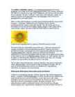
sterile(steriilne, viljatu). The florets inside the circular head are called disc florets. Sunflower head displaying florets in spirals of 34 and 55 around the outside The florets within this cluster(kobar, kimp, klaster, parv ; kobarasse kogunema) are arranged (korraldatud, ettekavatsetud)spirally(spiraalselt). Typically each floret is oriented(suunitlusega) toward(poole) the next by approximately(umbkaudu, ligikaudu) the golden angle(parima nurga alla), producing a pattern(muster, lõikeleht, seaduspärasus) of interconnecting spirals where the number of left spirals and the number of right spirals are successive Fibonacci numbers.(fibonacci arv/ rida) Typically, there are 34 spirals in 1 direction(suund, juhatamine, juhis) and 55 in the other; on a very large sunflower you may see 89 in one direction and 144 in the other. The disc florets mature(täiskasvanud ; valmima, kääritama ) into what are traditionally
Light bulbs are measured in watts. Air conditioners and hot water heaters are measured in BTUs, while energy used by cars is measured in gallons of fuel. They used a spreadsheet to figure out how much energy they consumed for each of their activities. Each of the lights, car miles, games, and other appliances was converted to a common unit of power consumption called kilowatt-hours. The spreadsheet was used to determine how many kilowatt-hours were used during each day, each week, and each year for each energy consumption activity. The spreadsheet converted their energy consumption to show them the amount of money it costs for each energy consumption activity. In the end, they were shocked to see how much money Jules' energy using habits cost compared to Les' habits. USES OF ENERGY The United States is a highly developed and industrialized society. We use a lot of energy - in our homes, in businesses, inindustry, and for traveling between all these different places.
Notions for The New World Native Americans Origin of Native Americans Nearly one-third of Native American genes come from west Eurasian people linked to the Middle East and Europe, rather than entirely from East Asians as previously thought, according to a newly sequenced genome. Native peoples of North and South America descended from ancestors who arrived via land bridges from East Asia, possibly in a single migration. Different tribes and their way of life The men were hunters, warriors, and protectors, while the women tended to the children, their homes, and farmed. It depended on the tribe when it came to artwork. In some tribes, the men would actually weave baskets and blankets. Natural foods were consumed and hunted. Deer, buffalo, fish, and various birds were the game of choice
and good weather in some places (like California). Many species became extinct soon after the first settlements. The U.S. climate is temperate in most areas, tropical in Hawaii and southern Florida, polar in Alaska, semiarid in the Great Plains, Mediterranean in coastal California and arid in the Great Basin. The droughts and floods are infrequent in America. In north Alaska was recorded the lowest temperature in U.S. -62.2 °C . The highest temperature was recorded in California in Death Valley when the temperature reached 57 °C. The hurricanes occur almost every year along the Atlantic seaboard and the Gulf of Mexico. Hurricanes can also strike Hawaii in the Pacific Ocean. In central portions of the U.S., tornadoes are more common than anywhere else on Earth. The Southwest has the worst droughts. One drought is thought to have lasted over 500 years and to have decimated the Anasazi people. Bald Eagle (National Bird )