Leidsid 33 sarnast õppematerjali, mis on seotud failiga "Washington state". Need materjalid aitavad sul teemat sügavamalt mõista.
states, north, west, seat, located, nation, seattle, county, pacific, region, east, south, columbia, ocean, lumber, include, ranks, first, named, president, river, built, center, rainforest, miles, service, oregon, idaho, canadian, province, british, accepted, olympia, census, date, leading, types, stands, douglas, pine, spruce, larch, apples, pearsUSA: West Coast Kristiina Sekljutskaja 11A West Coast · The "West Coast", "Western Seaboard", or "Pacific Coastline" are terms for the westernmost coastal states of the United States. · It most often comprises California, Oregon and Washington. Arizona and Nevada, while not coastal states, are often included due to their proximity to the Pacific Coast and their economic and cultural ties to California · As of 2007, the estimated population of the West Coast ranged from approximately 5060 million, depending on which states are included in the estimate. · Major coastal cities on the West Coast include San Diego, Los Angeles, San Francisco, Seattle, Las Vegas. ·West Coast includes: ·Washington ·Oregon ·Arizona ·Nevada ·California Washington · Named after George Washington, the first President of the United States · Capital: Olympia · Largest city: Seattle
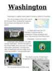
Washington Washington is a state in the Pacific Northwest region of the United States located north of Oregon, west of Idaho, and south of the Canadian province of British Columbia on the coast of the Pacific Ocean. It was named after George Washington, the first President of the United States, the state was made out of the western part of the Washington Territory, which had been ceded by Britain in 1846 in accordance with the Oregon Treaty in the settlement of the Oregon Boundary Dispute. It was admitted to the Union as the 42nd state in 1889. Olympia is the state capital of Washington. Washington is sometimes referred to as Washington State or the State of Washington to distinguish it from Washington, D.C., the capital of the U.S., which is often shortened to Washington.
Tallinn English College English Anita Kuprijanovits Form 8b THE UNITED STATES OF AMERICA Report Supervisor: Mare Kallas Tallinn 2009 Introduction Name: The United States of America Area: ~10 mln km2 Population: ~300 mln people Symbols: The American Flag- consists of 13 equal horizontal stripes of red alternating with white and represent the Thirteen Colonies. The 50 small, white stars represent the 50 U.S. states. The U.S. flag is commonly called ,,the Stars and Stripes". The Statue of Liberty, that is locatd in New York,is a gift from the France. The Libety Bell, that is a bronze bell that symbolizes freedom in the United States of America. It
Tallinn English College Topic The United States of America Tallinn 2007 1. Introduction The United States of America's territory is over 3.7 million square miles (over 9.6 million km²) and population more than 300 million people. The capital city is Washington D.C. Although the United States has no official language at the federal level, English is the de facto national language. English is the most common language for daily interaction among both native and non-native speakers. Spanish is the second language. The largest city is the New York City. The Government is Federal constitutional republic and the president is George W. Bush. 2. Geographical position The United States of America is located on the continent of North America. It has borders with
Washington Washington is capital United States of America. District of Columbia. The city is located on the north coast of the Potomac River, bordered by Virginia to the southwest and Maryland to all other parties. In Washington work the U.S. President, Congress and the Government, foreign embassies and more. They working in the White House. Population - 6,830,038 (2011). Washington was named in 1791 after
The USA In my essay I am going to talk about the United States of America. The USA was discovered by Christopher Columbus in 1492. It is situated between the Atlantic and the Pacific Oceans. It is the world's fourth largest country by size (after Russia, Canada and China) and the third by population (after China and India). The third largest citys in the US is: New York (NY) with a population of 8,175,133 and nicknames like The Big Apple, The City That Never Sleeps. It is composed of five boroughs: Manhattanthe home to Central Park and
Tallinna Inglise Kolledz Topic United States of America Mari-Liis Pakats Tallinn 2007 2 Introduction..................................................................................................................4 Geographical Position..................................................................................................4 Geographical Regions..................................................................................................5 Climate ......................................
Tallinn English College Topic The United States of America Form Tallinn 2005 Introduction The United States of America is a very big country. Its territory is about 9.4 million square kilometres and its population is more than 260 million people, 12% of them are the Afro-Americans. It is the world's third-largest country by size and by population. The population density is about 27 people per square kilometre. Most of the people live in towns. There are 50 states in America. The biggest of the state is Texas, next by size are California, Alaska and Montana. Six states - Maine, Vermont, New Hampshire,
United States of America Table of Contents 1. Facts 2. Geography 3. Nature 4. History 5. Population 6. Government 7. Industry, economy 8. America's pop culture Facts Official Name: United States of America Capital City: Washington, D.C. Largest city: New York City Official languages: None at federal level National language: English Government: Federal constitutional republic President: Barack Obama ( Barack Hussein Obama II) Vice President: Joe Biden (Joseph Robinette "Joe" Biden, Jr) Population: 2009 estimate 306,108,000 people Area: Total 9,826,630 km2 (by CIA World Factbook) Currency: United States dollar ($) Motto: In God We Trust Anthem: "The Star-Spangled Banner"
The United States of America Geography The United States of America is situated in the central part of the North American continent. Its western coast is washed by the Pacific Ocean, and its eastern coast by the Atlantic Ocean and the Gulf of Mexico. It borders on Canada in the north and on Mexico in the South. The U.S.A. consists of 51 states and the District of Columbia. The state of Alaska is separated from the rest of the U.S.A. by Canada. Hawaii, which became the fiftieth state in 1959, is in the Pacific Ocean, halfway between the continents of America and Asia. The area of the United States of America is over nine million square kilometres. The continental part of the U.S.A. consists of two highland regions and two lowland regions. The
Usa 1. Gross Domestic Products Gross Domestic Products of USA United States of America has the highest Gross Domestic Products nominal about 14.624 trillion US dollars according to World Bank. 2. Rhode Island Rhode Island is actually named Rhode Island and Providence Plantations and it makes the smallest state in the United States has the longest name. 3. Califrnia never rains It is believed that California is the state with the lowest rainfall in the world. For two years, California never rains. For those amazing and unique facts, California has been attracting so many tourists. Many people also adore this fact and this facts is often included in a song lyric. 4. President Grover Cleveland Grover Cleveland is the only USA president who married in office. It becomes more unusual
Tallinn English College Report of Canada 8a Teacher: Merike Sisask Composer: Kärt Kalvet 2010 Canada, Kärt Kalvet 8a Canada General Information Canada is in North America. It's area is 9220970 sq km. Canada's population is 313.612.000 people. Canada is divided into 10 provinces and 3 territories. The capital of Canada is Ottawa. Canada has constitutional monarchy. The head of state in Canada's government is the Queen of England. There are two main languages in Canada: English and French. Canada's curreny is Canadian dollar (1 dollar=100 cents[Can$]). The highest peak of Canada is Mount Logan, 5959 metres. The lowest point is sea level
Table of contents.........................................................................................................................1 Introduction.................................................................................................................................2 ................................................................................................................................................2 The climate of the United States of America..............................................................................7 The people of the United States of America...............................................................................8 Famous Americans......................................................................................................................9 Economy................................................................................................................................... 12
Canada. Canada is a very big country in the continent of North America. It is about 10 million square kilometres and that makes it the second largest country in the world after Russia. Quebec (the province) is six times as big as the UK. Canada borders the Atlantic Ocean, the Pacific Ocean, the Arctic Ocean and the USA. The capital of Canada is Ottawa and other main cities are Toronto, Montreal and Vancouver. It is a very developed country. Montreal is the largest city and it is called the Paris of North America because most of the people there speak French. The population of Canada is 28 million people. It is a very multicultural country. People from many different countries have come to live there. The natives are Eskimos and Indians
Topic Australia Tallinn English College 2006 Australia 1 . Introduction The name Australia is derived from the Latin Australis, meaning of the south. In land area, Australia is the sixth largest nation, its territory is 7,686,850 sq km and its population reaches today over 20,5 million people. It is the only nation to govern an entire continent and its outlying islands. Australia's capital is Canberra, the only city with its own territory. It was built in the early 1900s just to be the capital. The official language is English and the official name of Australia is the Commonwealth of Australia. Australia is located on the Southern Hemisphere (because of that Australia is also called "A land down under"). 2 . Geographical position
Introduction The United States of America is a very big country. Its territory is about 9.4 million square kilometres and its population is more than 260 million people, 12% of them are the Afro-Americans. It is the world's third-largest country by size and by population. The population density is about 27 people per square kilometre. Most of the people live in towns. There are 50 states in America. The biggest of the state is Texas, next by size are California, Alaska and Montana. Six states - Maine, Vermont, New Hampshire, Connecticut ,Rhode Island and Massachusetts are called New England. They are all small states in the U.S. that lie in the north-east. The first colony of immigrants settled down in Virginia, in the eastern part of the U.S.A. The biggest cities are New York, Washington, Chicago, Los Angeles, San Francisco, etc.
Topic Canada Tallinn English College 2006 1. Introduction If you had to use two words to describe Canada, they might be large and diverse. Canada is the second largest country in the world with a territory of about 10 million square kilometers and it is bordered by three oceans: the Arctic, the Pacific and the Atlantic Oceans. The population of Canada is about 31 million people. About 77% of the people live in cities which lie in a band about 100 miles wide above the border of the United States. The capital of Canada is Ottawa. Other large cities are Montreal, Toronto, Vancouver, Winnipeg and Quebec. 2. Geographical position Canada is a huge country in the continent of North America. It is bordered with the Atlantic
Commonwealth of Australia. Australia is the smallest continent, but one of the largest countries in the world. Its area is about 7,6 million sq kilometers. Its population is about 20,0 million and most of the people live in bigger cities: Sydney (4.2 million), Melbourne (3.7 million), Brisbane (2 million) and in Canberra, Which is also the capital of Australia. National language in Australia is english and the monetary unit is Australian dollar. Australia is divided into 6 states and 2 territories. Symbols Australia has a British Union flag. It is red, white and blue. Five small stars represent the constellation Southern cross. The big star represents country's states and territories. In 1901 the flag was chosen from about 30000 entries in a public contest. It was officially adopted as Australian flag in 1953. The coat of arms features a kangaroo and an emu (the national
If you want to make clear that you are speaking about the country, you may call it the Commonwealth of Australia. It’s the official name of the country. Australia is the smallest continent, but one of the largest countries on Earth. It’s 6th largest country. Its area is about 7.6 million sq km. One third of it is occupied by deserts. It’s both the flattest and, except for Antarctica the driest. Neighbouring countries include Indonesia, East Timor and Papua New Guinea in the north, the Solomon Islands, Vanuatu in the northeast, and New Zealand in the southeast. Its capital is Canberra. Other big cities are Melbourne, Sydney, and Brisbane. National language in Australia is English. Monetary unit is Australian dollar. Their national holiday is on the 26th of January. In 1788 on the 26th of January the first fleet arrived at Botany Bay and established a penal colony near modern-day Sydney. Geographical Position Australia is located in the Southern Hemisphere. It’s the
Tallinna Inglise Kolledz Canada. The land of diversity. Tallinn 2006 Canada. If you had to use two words to describe Canada, they might be large and diverse. Canada is the second largest country in the world with a territory of about 10 million square kilometers and it is bordered by three oceans: the Arctic, the Pacific and the Atlantic Oceans. The population of Canada is about 31 million people. About 77% of the people live in cities which lie in a band about 100 miles wide above the border of the United States. The capital of Canada is Ottawa. Other large cities are Montreal, Toronto, Vancouver, Winnipeg and Quebec. Canada has two official languages English and French. It's interesting to know that about 61% of Canadians name English and 24% French their mother tongue
Topic Australia Introduction Many people know Australia as the land down under because it is the only continent except for Antarctica that is all on the southern hemisphere. Its name means ,,Southland". The official name of the country is the Commonwealth of Australia. It's capital is Canberra. Australia is the sixth largest country in the world but the smallest continent. Australia has 6 states and 2 territories (New South Wales, Victoria, Tasmania, Queensland, Western Australia , South Australia, The Australian Capital Territory and the Northern Territory). The Australian people are culturally the same as the Anglo Americans. There also live aborigines. Aborigines are the ancestors of the people. Like the US and Canada, Australia was an English speaking colony of Great Britain. Today Australia is a modern developed country with a diversified economy. Australia is an island
6. Towns, economy, agriculture 7. Climate 8. Animals, plantlife 9. Population 10. Sports 11. Culture 12. History 13. Political system, symbols 14. Conclusion 15. Materials 1. Introduction If you had to use two words to describe Canada, they might be large and diverse. Canada is the second largest country in the world, bordered by three oceans, and across the country, Canadians experience many different landscapes from rolling plains and mountains to the cold tundra of the north. Despite Canada's great size, it is one of the world's most sparsely populated countries. This fact, coupled with the grandeur of the landscape, has been central to the sense of Canadian national identity. 2. Geographical position Canada is the second largest country in the world after Russia. In the Arctic, Canada reaches almost as far north as Greenland. To the south it extends to the same latitude as southern France. The distance from Canada's west coast, the Pacific Ocean, to its
Alice Tärk, 9b Tallinn 2007 FACTFILE Area: 45 228 sq km Poplulation: under 1.4 million Capital: Tallinn Language: Estonian Currency: Eesti kroon (EEK) Main religion: Lutheran National holiday: 24 February (anniversary of the republic) National flower: Cornflower National bird: Barn Swallow National stone: Limestone LOCATION The Republic of Estonia is the northernmost and smallest of the three Baltic States. It is located on the eastern shores of the Baltic Sea in the north east of Europe. To the east the country borders Russia. Latvia is the countries neighbour to the south. From the west the coast of Estonia is washed by the Baltic Sea and from the north by the Gulf of Finland. The length of the coastline is approximately 3 800 km. The longest distance from east to west is 350 km, while north to south Estonia stretches 240 km. THE NAME
Geography Canada is the world's second largest country in total area after Russia , since it covers nearly 10 million square kilometres, but is one of the most sparsely populated, with only about 34 million inhabitants. The majority of them live within 300 kilometres of Canada's southern border. Much of the rest of Canada is uninhabited or thinly populated, because the country has a rugged terrain and severe climate. Canada extends across the continent of North America, from Newfoundland on the Atlantic coast to British Columbia on the Pacific coast and northward into the Arctic Ocean. Canada shares land borders with the United States to the south and north-west. Canada is a land of great variety. Towering mountains, crystal-clear lakes, and lush, green forests make Canada's far west a beautiful region. Farther inland, fields of wheat and other grains cover Canada's vast prairies
Australia Australia is the smallest continent in the world. It is 7.6 million square kilometres big. It is often called the island continent because it is rather small for a continent and very big for an island. There are only five countries bigger than Australia in the World. There are five states in the mainland. Tasmania is also considered as a state so there are six states. The Northern Territory and Canberra are also independent but they are not states. Canberra is the capital of Australia and it is situated between Sydney and Melbourne because both of these cities wanted to be the capital. The population is about 19 million people and growing. New South Wales is the most populated state and Victoria is the most densely populated state. The national language is English. It is English because British settlers came to live in Australia in
Tallinn English College CANADA Report Karin Kristen Tapupere 8.b Instructor: Tiiu Martma Intro: Canada is a country occupying most of northern North America, extending from the Atlantic Ocean in the east to the Pacific Ocean in the west and northward into the Arctic Ocean. It is the world's second largest country by total area and its common border with the United States to the south and northwest is the longest in the world. The land occupied by Canada was inhabited for millennia by various groups of Aboriginal people. Beginning in the late 15th century, British and French expeditions explored, and later settled along, the Atlantic coast. France ceded nearly all of its colonies in North America in 1763 after the Seven Years' War. In 1867, with the union of three British North American colonies through Confederation, Canada was
Wales, Germany, Ukraine and Scandinavia. In Edmonton and Calgary there are also historic Chinatowns, and Calgary has Canada's third largest Chinese community. Geographical features Alberta covers an area of 661,848 square kilometres, an area about 5% smaller than Texas or 20% larger than France. This makes it the fourth largest province after Quebec, Ontario, and British Columbia. To the south, the province borders on the 49th parallel north, separating it from the U.S. state of Montana, while on the north the 60th parallel north divides it from the Northwest Territories. To the east the 110th meridian west separates it from the province of Saskatchewan, while on the west its boundary with British Columbia follows the 120th meridian west south from the Northwest Territories at 60°N until it reaches the Continental Divide at the Rocky Mountains.
2. Signficant waves of migration from Estonia to the US in the 20th century, their reasons. *The failure of the 1905 Revolution: The first significant wave of immigration · Brought a strong Socialist contingent to the United States; led to the formation of many Estonian American Socialist and Communist organizations. * The 1920s30s: · Establishment of independent Estonia · Tightening of American immigration laws · Estonian immigration to the United States slowed down dramatically 1924 The Estonian quota fixed at 116; even this small annual quota was not used up *After World War II = In the post World War II years, all three Baltic nations maintained consulates in the United States · About 15,000 Estonians came to the United States · This group was strongly anti-Communist and nationalistic 3. Russian colonization of America. What has preserved from this period to the present?
Australia Fact file: Australia comprises a land area of 7 686 850 square kilometres. Its population is about 21,3 million people. Australia's capital is Canberra. The national language is English. The official name of it is the Commonwealth of Australia. It's divided into six states and two territories: New South Wales, Queensland, South Australia, Western Australia, Tasmania, Victoria, Australian Capital Territory (ACT) and Northern Territory. Symbols: Australia had the British flag as their official flag until 1901, when the Commonwealth of Australia was formed. Over 30 000 entries attracted the official competition. Five of them, which contained almost identical designs, were placed equally first
Area: 5,426 ,000 sq. mi . Area: 3 1,73 6,000 sq . mi . Coastline: 28 ,209 mi . Coastl ine: 69 ,525 m i. Average De p t h: 3,407 ft. Average De p t h: 11,730 ft. Indian Ocean Pacific Ocean Area: 28,410,000 sq. mi . Area: 63,838,00 0 sq. m i. Coas tli ne: 4 1,346 m i. Coas tl ine : 84,315 m i. Average Depth: 12,598 ft Average De p th: 12,925 ft. Highest Elevations
bands(chief. Travelled together) and tribes land was owned by the tribe that occupied it. 200 different tribes Apache- "enemy"- hunted buffalos, oil and natural gas from their land Cherokee- largest tribe Cheyenne- from Minnesota and S & N Dakota. High system of laws Northwest Ordinance of 1787 Signed in 1787 by Thomas Jefferson. The creation of the Northwest Territory as the first organized territory Ohio River was settled, 5 new states Advancement of education, maintenance of civil liberties, exclusion of slavery Promised not to invade or disturb Indians Northwest Indian War-> to stop white expropriation (sundkoormis) · Indian Removal Act of 1830 Destructive to tribes. Many died when travelled to the other side of Missisippi. Signed on May 28 by Andrew Jackson "Trade" land with the tribes Resolve the Georgia crisis (dispute with Cherokee) Move of over 70,000 natives (vabatahtlik-sunniviisiline) Reservations
CANADA REVISION QUESTIONS 2010 1. The main physiographic regions of Canada. Canada may be divided into seven physiographic regions: Arctic Lowlands, Cordilleran Region, Interior Plains, Hudson Bay Lowlands, Canadian Shield (Forest Lands), St Lawrence Lowlands and Appalachian Region. Divisions are based on each area's relatively similar physical geography and landforms. Physiographic regionalization is defined here as the process by which regions with relatively homogeneous physical geography are determined 2. Who are the native people of Canada? Into which three groups can they be divided? Canada's constitution specifies three categories of aboriginal peoples: Indian (First Nations), Métis, Inuit. According to Canadian census 2011, 1
Nicknames for Prague have included Praga mater urbium/Praha matka mst ("Prague Mother of Cities") in Latin/Czech, Stovzatá Praha ("City of a Hundred Spires") in Czech or Zlaté msto/Goldene Stadt ("Golden City") in Czech/German. Situated on the Vltava River in central Bohemia, Prague has been the political, cultural and economic centre of the Czech state for more than 1100 years. For many decades during the Gothic and Renaissance eras, Prague was the permanent seat of two Holy Roman Emperors and thus was also the capital of the Holy Roman Empire. 4 Today, the city proper is home to about 1.3 million people, while its metropolitan area is estimated to have a population of over 1.9 million. Since 1992, the extensive historic centre of Prague has been included in the UNESCO list of