Leidsid 33 sarnast õppematerjali, mis on seotud failiga "Brittish common welth - Bahamas". Need materjalid aitavad sul teemat sügavamalt mõista.
fourth, bahama, bahamas, island, shield, islands, tropical, black, gold, coat, symbols, flamingo, shell, flower, yellow, elder, islets, than, geography, flat, highest, country, mount, como, hill, subtropical, military, army, force, origin, spanish, grand, materialSeal: Great Seal of the United States Motto: In God We Trust 9.83 million km2 and with over 308 million people, the United States is third largest country both by land area and population It is one of the world's most ethnically diverse and multicultural nations The U.S. economy is the world's largest national economy Click to edit Master text styles Second level Third level Fourth level Fifth level Nature America consists of 50 states. 48 of them are on North American continent and 2 of them (Alaska and Hawaii) are separated. Alaska is separated by Canada and Hawaii lies in the Pacific Ocean. America shares borders with Canada, Mexico and Russia. America is surrounded by three oceans Pacific Ocean, Atlantic Ocean and Arctic Ocean.
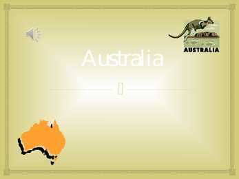
Australia Australia , officially the Commonwealth of Australia, is a country in the Southern Hemisphere comprising the mainland of the Australian continent, the island of Tasmania and numerous smaller islands in the Indian and Pacific Oceans. Australia flag Australia coat of arms. Australia is a cloudless dark blue sky, the bright sun, multikilometer beaches with snowwhite sand and ocean up to horizon. Australia's landmass of 7,617,930 square kilometers is on the IndoAustralian Plate. Surrounded by the Indian and Pacific oceans, it is separated from Asia by the Arafura and Timor seas. It the sixth largest country in area after Russia, Canada,
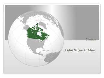
Confederation, Canada was formed as a federal dominion of four provinces this began an accretion of provinces and territories and a process of increasing autonomy from the United Kingdom widening autonomy was highlighted by the Statute of Westminster 1931 culminated in the Canada Act 1982, which severed the vestiges of legal dependence on the British parliament Click to edit Master text styles Second level Third level Fourth level Fifth level Ottawa Capital 45°24N 75°40W / 45.4°N 75.667°W / 45 Largest city Toronto Capital, Largest City Since the end of the last glacial period, Canada has consisted of eight distinct forest regions, including extensive boreal forest on the Canadian Shield Canada has more lakes than any other country, containing much of the world's fresh water Geography
gained popularity during the period of the national movement. Estonians carried the melody in their hearts and souls during Soviet occupation, when it was banned. Another song "My Native Land, My Dearest Love" by Gustav Ernesaks, became an unofficial anthem at that time and enabled the people to express their feelings of national identity. COAT OF ARMS Lions were first used as Estonia's heraldic emblem in the 13 th century when they appeared on the large coat of arms of Tallinn. The originated from Denmark, which was ruling Northern Estonia at that time. A similar motif was later used on the coat if arms of the Province of Estonia under Swedish rule. Estonia changed hands but the three lions remained. In 1925 they were adobted officially. The present large coat of arms is a golden shield charged with a golden oak branch on each side. The small coat of arms is identical but without oak branches. CLIMATE AND WEATHER
Commonwealth of Australia. It’s the official name of the country. Australia is the smallest continent, but one of the largest countries on Earth. It’s 6th largest country. Its area is about 7.6 million sq km. One third of it is occupied by deserts. It’s both the flattest and, except for Antarctica the driest. Neighbouring countries include Indonesia, East Timor and Papua New Guinea in the north, the Solomon Islands, Vanuatu in the northeast, and New Zealand in the southeast. Its capital is Canberra. Other big cities are Melbourne, Sydney, and Brisbane. National language in Australia is English. Monetary unit is Australian dollar. Their national holiday is on the 26th of January. In 1788 on the 26th of January the first fleet arrived at Botany Bay and established a penal colony near modern-day Sydney. Geographical Position Australia is located in the Southern Hemisphere. It’s the
Great Britain Pärnu 2012 Contents Great Britain Great Britain or Britain is an island situated to the northwest of Continental Europe. It is the ninth largest island in the world, the largest European island, and the largest of the British Isles.
It's almost the same size as continental USA, being the sixth largest country in the world. It's also the oldest some of the rocks are more than 3,000 million years old. Australia is often called `Down Under', because it lies in the Southern Hemisphere. As a result, its seasons are the opposite of ours. Australia, Tasmania and a number of smaller islands form the Commonwealth of Australia. Because of the country's great size, the climate in Australia ranges from tropical regions of the Northern Territory to the cool temperate conditions in the southeast and Tasmania, where it often snows in winter. In the north, half the year is `wet' and half is `dry'. From November to April heavy rain fills the rivers and makes enormous lakes where thousands of birds come for the summer. From May to October it is often sunny and dry for weeks, and it is a popular place for winter holidays in the sun. In the hot, flat centre of Australia, there is an area called the `outback'
Estonia is situated in northeastern Europe. Estonia is bounded on the north by the Gulf of Finland, on the east by Russia, on the south by Latvia and on the west by the Baltic Sea. In the north it borders on Finland. The coastline of the Baltic Sea in Estonia is characterized by numerous gulfs and bays, the biggest of them being the Gulf of Finland, the Gulf of Riga and the Gulf of Pärnu. Bays include the Narva Bay, Matsalu Bay, Kolga Bay, Kunda Bay, Tallinn Bay etc. Estonia has over 1500 islands, the largest being Saaremaa and Hiiumaa, Muhu and Vormsi. Saaremaa and Muhumaa are connected to each other with a bridge. The best- known smalles islands are Naissaar, Aegna, Ruhnu, Kihnu, Väike-Pakri, Suur-Pakri etc. 3. Relief Lying in the north-western part of the East-European Plain, Estonia is mostly flat with an average elevation of about 50 metres above sea level. South-eastern and eastern parts of Estonia are higher than the western parts. The relief of the
Western Australia , South Australia, The Australian Capital Territory and the Northern Territory). The Australian people are culturally the same as the Anglo Americans. There also live aborigines. Aborigines are the ancestors of the people. Like the US and Canada, Australia was an English speaking colony of Great Britain. Today Australia is a modern developed country with a diversified economy. Australia is an island continent of 7.7 million square kilometres, which makes it a little smaller than the USA. Located in south of Asia, between The Pacific and Indian Oceans, Australia is the World's driest continent. Although large areas of the centre are desert, Australia has a wide range of climate from tropical in the north to temperate in the south east, where it frequently snows in winter. Geographical position The coasts of Australia are surrounded by the Pacific Ocean, the Indian Ocean and the
May 1988. The national flower is cornflower, the national bird is barn swallow and the national stone is limestone. The Estonian national anthem called "My Native Land, My Pride and Joy" was composed in 1848 by Friedrich Pacius. The Estonian language words were written by J. V. Jannsen. It was officially adopted after the War of Independence in 1920.The same melody with different words is also Finland's national anthem. The current coat of arms of Estonia is a golden shield which includes three slim, blue leopards (or lions) in the middle, with oak branches along the side of the shield. It originates from Denmark. It was officially adopted in 1925. Geography Estonia is the northernmost of the three Baltic States. It is located on the northern hemisphere on the eastern shores of the Baltic Sea in the north-east of Europe. It has land contact with Russia from the east and Latvia from the south. In the north The Gulf of Finland separates Estonia from Finland
Topic Australia Tallinn English College 2006 Australia 1 . Introduction The name Australia is derived from the Latin Australis, meaning of the south. In land area, Australia is the sixth largest nation, its territory is 7,686,850 sq km and its population reaches today over 20,5 million people. It is the only nation to govern an entire continent and its outlying islands. Australia's capital is Canberra, the only city with its own territory. It was built in the early 1900s just to be the capital. The official language is English and the official name of Australia is the Commonwealth of Australia. Australia is located on the Southern Hemisphere (because of that Australia is also called "A land down under"). 2 . Geographical position
and Lake Peipsi. The country is populated by Estonians who belong to the Western Finnish group of nations, a branch of the Finno-Ugric stem, and speak the Estonian language. Estonia is the northernmost of the Baltic States. From west to east the length of the country is 360 kilometres and the width, from north to south, is 255 kilometres. The area is 45,227 square kilometres of which more than 4,000 square kilometres are made up by islands and islets (over 1,000); there are more than 1,400 lakes that form nearly 5% of the total area. More than 40% of the entire area is woodland. The country is flat; the average elevation is 50 metres above sea level. The highest peak, Suur Munamägi rises to only 317 metres. High limestone features characterise the north of the country, while the south has a drumlin terrain. The maritime climate is temperate, summers are warm and winters mildly cold, the average
post-16 (Sixth Form) curriculum in England, Wales and Northern Ireland introduced in September 2000 – Aim: to make all A-level programmes broader, offering greater flexibility whilst maintaining depth – Includes A levels, vocational A levels and a key skills qualification Further education First three years of secondary education (S1-S3) are describd as a "broad general education“ • At the beginning of fourth year, students begin studying for the National 4 and 5 qualifications. – The N4 does not involve formal exams at the end of the course - these courses rely on continuous assessment. – The National 5 is the more academically advanced of the qualifications and students have formal exams. • S5 and S6: Higher and Advanced Higher education courses – five levels: access, intermediate 1, intermediate 2, higher and advanced
9.9 million square kilometers. This includes 755,170 square kilometers of water. Toronto is the largest city in Canada with a population of 4.3 million. Other major cities include Montreal (3.3 million people), Vancouver (1.8 million people). Located in the southeast corner of the nation, Ottawa is the nation's capital. Relief Canada is a vast country comprised of a multitude of very different landscapes: Atlantic provinces, the Appalachians, St. Lawrence and Great Lakes lowlands, Canadian Shield, The Prairies, mountain ranges and high plateaus of the Canadian Cordillera, and northern Canada. Climate Canada's climate varies wildly based on geography, from perma-frost in the north to four distinct seasons towards the equator. In this region the temperature can climb up to 35 degrees Celsius in the summer and descend to a chilly -25 degrees Celsius during winter. Canada's climate and environment are one of the main reasons that Canada is such a succesful country
Ireland is the third largest island in Europe. It lies in between the Atlantic Ocean and the Irish Sea. Politically it is divided into a sovereign state, the Republic of Ireland, that covers about five-sixths of the island (south, east, west and north-west), and Northern Ireland, which is part of the United Kingdom, covering the northeastern sixth of the island.[1] The name 'Ireland' derives from the name Ériu (in modern Irish, Éire) with the addition of the Germanic word 'land'. The population of the island is just under 6 million (2006); just over 4.2 million in the Republic of Ireland[2] (1.6 million in Greater Dublin[3]) and just over 1.7 million in Northern Ireland[4] (0.6 million in Greater Belfast[5])). Politics Politically, Ireland is divided into: · The Republic of Ireland, with its capital Dublin.
Australia Australia is the smallest continent in the world. It is 7.6 million square kilometres big. It is often called the island continent because it is rather small for a continent and very big for an island. There are only five countries bigger than Australia in the World. There are five states in the mainland. Tasmania is also considered as a state so there are six states. The Northern Territory and Canberra are also independent but they are not states. Canberra is the capital of Australia and it is situated between Sydney and Melbourne because both of these cities wanted to be the capital. The population is about 19 million people and growing. New South Wales is
COFF Common Object File Format [Unix] COGO Coordinate Geometry (Programming Language) COL Collision + Computer Oriented Language COLD Computer Output to Laser Disk COLL Collision COM Component Object Model [Microsoft] + Computer Output Microfilm .COM Command (file name extension) + Commercial Business (Domain Name) [Internet] COM1 First serial Port (asynchronous port) COM2 Second serial Port COM3 Third serial Port COM4 Fourth serial Port COMDEX Computer Dealers Exposition COMET Cornell Macintosh Terminal Emulator COMM Communications COMMAT In Morse Code (.--.-.)(dot dash dash dot dash dot), name of the sign to denote the Commercial At symbol "@". (Adopted by the ITU in December 2003) COMP Compare COMP. Computers [USENET Newsgroup Category] COMSAT Communications Satellite Corporation CON Console (includes Keyboard and Screen) COND Condition CONFIG Configuration
Ireland as they existed before 1949. until 1949: anyone who owed allegiance to the British sovereign wherever he was born in the British Empire; all citizens of Commonwealth countries were British subjects until January 1983. Today: those who are not citizens of any Commonwealth country; mostly from British India or the Republic of Ireland as they existed before 1949. 14. British citizen- hold the status through a close connection with the United Kingdom, Channel Islands and Isle of Man ("United Kingdom and Islands"), usually because they were born there. The British Nationality Act 1981 (came into force in 1983) – British citizens = people closely connected with the United Kingdom, the Channel Islands and the Isle of Man – British Overseas Territories citizens = until 2002 (The British Overseas Territories Act) British Dependent Territories citizens – British Overseas citizens = persons connected with former
New Zealand New Zealand is an island country. It is in the south-western Pacific Ocean comprising two main island, North- and the South Island with lots of smaller islands. New Zealand is notable for its geographic isolation. It's about 1,600 kilometers from Australia and its closest neighbours to the north are New Caledonia, Fiji and Tonga. New Zealand's total land area is 268,021 square kilometers. The country extends more than 1600 kilometers along its main,north - north-east axis and has about 15,000 kilometers of coastline. The South Island is the largest land mass of New Zealand and is divided along its
first. The Australian flag symbolises Australia's historical links with Britain, because it has British flag on it, and Australia's location in the southern hemisphere, because it has stars of the Southern Cross on it. The large seven-pointed star represents the six original states and the territories of Commonwealth. There is also the Indigenous Australian flag, which represents the Aboriginal Australians. The flag with its colours of red (representing the land), black (representing the people) and the yellow in the middle (representing the sun) is a source of pride for Indigenous Australians. The present coat of arms was granted by King George V in 1912. It consists of a shield containing the badges of six Australian states, enclosed by an ermine border. The shield is a symbol for the federation of the states, which took place in 1901. The crest, which is above the shield, is a seven-pointed gold star on a blue and gold wreath. The seven points of
Bush. 2. Geographical position The United States of America is located on the continent of North America. It has borders with two countries Mexico and Canada. There are also the Atlantic Ocean, the Pacific Ocean and the Gulf of Mexico surrounding the big country. There are 50 states in America. Most of the people live in towns. The biggest state is Alaska; next by size are California, Alaska and Montana. Six states - Maine, Vermont, New Hampshire, Connecticut, Rhode Island and Massachusetts are called New England. They are all small states in the USA that lie in the north- east. The first colony of immigrants settled down in Virginia, in the eastern part of the USA. 3. Relief The USA is situated in the central part of the North American continent. Its western coast is washed by the Pacific Ocean and its eastern coast is washed by the Atlantic Ocean and in the south its coast is washed by the Gulf of Mexico. The coastline is even. There are no big islands
Its capital city is Melbourne and it was named after the British Prime Minister Lord Melbourne. Melbourne is said to be the heart of Australian finance and the headquarters of industry giants. Victoria is more an industry than a tourist state. Queensland is known for its natural riches like huge coalfields, copper, silver, lead. Its capital city is Brisbane, which is the third largest city in Australia. Because it lies in the Northeast part of Australia, its climate is mainly tropical. South Australia is famous as it is the region of fruit farming, vineyards and olive groves. Only the southern coast is fertile, most of the state is arid. Its capital is Adelaide, which is known for the Adelaide circuit. Western Australia is the biggest state in Australia. It is rich in deserts, as the central part of the state is practically a desert in whole and nearly uninhabited. On the other hand, the desert is important for its resources and mining
Australia Australia is a country and also a continent. If someone wants to make clear, that he is speaking of the country, he may call it by its full name of Commonwealth of Australia. Australia's name means "southland."It is south of the equator. Sometimes it is also called the island continent because it is an island. There are about twenty million people in Australia.It is 1,800 miles from the mainland of Asia and almost half way round the world from Europe. More than 600 miles of ocean separate it from Americas. Since Australia is south of the equator, its seasons are just the opposite of ours. It has summer while we have winter, and the other way round. States and Territories. Australia consists of six states, two territories and eight external territories.
is 7 hours behind Greenwich Time, Pacific Standard Time. Alaska and Hawaii have their own time zones: Alaska Standard Time and Hawaii Standard Time. Geographical Position The USA lies in the Northern Hemisphere in North America. It covers a big part of the continent and is also the third largest country in the world. The country consists of 50 states, but two of them lie separately. One of them is Alaska, which is near the Arctic Circle. And the other state is Hawaii, which is a group of island is the Pacific Ocean. The USA shares the border with Canada in the north and Mexico in the south. In the east the coast is washed by the Atlantic Ocean and in the west by the Pacific Ocean. In the south there is the Gulf of Mexico. The highest mountain in the country is Mount McKinley, which is in Alaska. It's about 6 km high. But the lowest point is in Death Valley and its 89 m below sea level. Relief About half of the United States' territory is covered by plateaus and mountains. The
Rockies. The Rocky Mountains are the youngest and highest mountains in Canada. British Columbia is in the landform region called the Western Cordillera. ('Cordillera' means a system of mountain ranges). Between the mountain ranges are areas of high plateaus and deep trenches. Since the landscape is very rugged, most people live in the south and near the coast. Vancouver and Victoria are the largest cities in British Columbia. The region includes the Queen Charlotte Islands and Vancouver Island. All these islands are peaks of a mountain range that is partly covered by the Pacific Ocean. The St Elias Mountains in the Yukon include Canada's highest peak, Mount Logan. It towers 5,951 metres above sea level. Because the Coast Mountains are on the seashore, the coast of British Columbia has many long, narrow inlets called fiords. The fiords provide a water route to Canada's most valuable forests. These forests consist of red cedars, hemlocks, and other evergreen trees that grow on the
It is now fenced off to protect it from damage. 3. The Roman conquest Julius Caesar's first raid was in 55 BC but the romans left. Ad 43- the Romans came to stay. The army established Roman rule in the south and SW of the country. The Romans started to introduce their laws to a new province of the Roman Empire and started to build good roads. Officials were appointed (governors, procurators to collect taxes, look after the estates and mines and se that the gold, silver, iron and lead were exported back to Rome). Introduced schools,a new language Latin, large farms (villas), baths. In AD 410 they had to leave . roman occupation lasted nearly 400 years. They left behind very little. Roman province of Britannia covered most of present-day England and Wales. 4. Latin influence on English *The influence of Latin is noticeable also in the names of European cities: the Latin noun colonia
throughout the middle regions (French Louisiana) as far as the Gulf of Mexico. The Dutch were in New York (originally New Amsterdam) and the surrounding area. Large numbers of Germans began to arrive at the end of the seventeenth century, settling mainly in Pennsylvania and its hinterland. In addition, there were increasing numbers of Africans entering the south, as a result of the slave trade, and this dramatically increased in the eighteenth century: a population of little more than 2,500 black slaves in 1700 had become about 100,000 by 1775, far out-numbering the southern whites. [3, p.35] The nineteenth century saw a massive increase in American immigration, as people fled the results of revolution, poverty, and famine in Europe. Large numbers of Irish came following the potato famine in Ireland in the 1840s. Germans and Italians came, escaping the consequences of the failed 1848 revolutions. And, as the century wore on, there were
" In the confusion of data with knowledge is a deeper mistake that learning will make us better people. But learning, as Loren Eiseley once said, is endless and "In itself it will never make us ethical [people]." Ultimately, it may be the knowledge of the good that is most threatened by all of our other advances. All things considered, it is possible that we are becoming more ignorant of the things we must know to live well and sustainably on the Earth. A fourth myth of higher education is that we can adequately restore that which we have dismantled. In the modern curriculum we have fragmented the world into bits and pieces called disciplines and subdisciplines. As a result, after 12 or 16 or 20 years of education, most students graduate without any broad integrated sense of the unity of things. The consequences for their personhood and for the planet are large. For example, we routinely produce economists who lack the most rudimentary knowledge of
San Diego, San Jose, and San Francisco. · The area known as Alta California was colonized by the Spanish Empire beginning in the late 18th century. It and the rest of Mexico became an independent republic in 1821. In 1846 California broke away from Mexico, and after the Mexican- American War, Mexico ceded California to the United States. California became the 31st state admitted to the United States on September 9, 1850. · The California Gold Rush (18481855) dramatically changed California with a large influx of people and an economic boom. The early 20th century was marked by Los Angeles becoming the centre of the entertainment industry, in addition to the growth of a large tourism sector in the state. · Along with California's prosperous agricultural industry, other industries include aerospace, petroleum, and computer and information technology. California ranks
arousal directly in some way, e.g. with drugs. In a key experiment by Schachter, participants were told they were in a study on effects of a new vitamin on visual perception. They were injected with 3 different arousal-manipulating drugs increasing arousal, decreasing arousal and the third was a neutral drug with no affects. The experiment was double-blinded. After the injection, the participants were shown a funny black and white movie clip. While they watched the movie, they were observed through a one-way mirror and the number of smiles, grins, slapping legs, laughs and such were counted. The results supported the idea of arousal influencing appraisal. The more aroused participants found the movie to be funnier that the tranquilized ones. Neutral group was in the middle. This shows that arousal cues can affect appraisal. Evaluate one theory of how emotion may affect one cognitive process.
National language in Australia is english and the monetary unit is Australian dollar. Australia is divided into 6 states and 2 territories. Symbols Australia has a British Union flag. It is red, white and blue. Five small stars represent the constellation Southern cross. The big star represents country's states and territories. In 1901 the flag was chosen from about 30000 entries in a public contest. It was officially adopted as Australian flag in 1953. The coat of arms features a kangaroo and an emu (the national animals of Australia), golden wattle (the national floral emblem), a shield with the coats of arms of the six states of Australia and a star for all states and territories. Australia's national anthem is "Advance Australia Fair", which replaced "God Save The Queen" in 1984. the unofficial anthem is "Waltzing Matilda". As said before Australias national animals are kangaroos and emus.
Instead, Gould's refurbished silver mine and the wealth it has generated inspires a new round of revolutions and self-proclaimed warlords, plunging Costaguana into chaos. Among others, the revolutionary Montero invades Sulaco; Gould, adamant that his silver should not become spoil for his enemies, orders Nostromo, the trusted "capataz de los cargadores" (head longshoreman) of Sulaco, to hide it on an offshore island. ,,Heart of darkness"-1902. Conrad's landmark. Novel is highly symbolic. The main events render by Marlow, happened in Congo, the river has the same name, is described as serpentine river (piblical illusion), bears some evil in himself, in the same way like paradise. Congo-one of the darkest places on earth. (Africa-dark continent) Story: white European Charles Marlowe is in charge of a ferry boat on Congo, meets Kurtz, who is
on paper, treaties with annexes, which have maps where the border is shown and the description of the border etc; 2) demarcation establishing the border on the ground since maps and reality can be a bit different sometimes. In addition : 1) subsoil to the centre of the world is part of the territory; 2) airspace over the territory and outer space, until 100-110 km; 3) islands, 4) territorial and internal waters. There's also quasi territory of the states, e.g. 1) territory of embassies, 2) territory of the ships and aircrafts, 3) artificial islands, 4) cables and pipelines (under the sovereignty of the state if they are installed in the international zones), 5) all artificial objects in space (here they are always quasi territory of the state)