Leidsid 33 sarnast õppematerjali, mis on seotud failiga "Weather in England". Need materjalid aitavad sul teemat sügavamalt mõista.
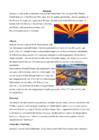
england, month, warm, summers, cooler, months, weather, britain, ocean, there, than, areas, temperatures, rarely, july, february, island, country, surrounding, gives, varied, influence, close, atlantic, throughout, year, such, variable, changing, difficult, know, those, continent, colder, eastern, northern, wetter, southern, highest, 10th, night, drop1. Key features for all studied biomes. Tundra The main seasons are winter and summer. The tundra is the world's coldest and driest biomes. The average annual temperature is -28° C. Nights can last for weeks when the sun barely rises during some months in the winter, and the temperature can drop to -70° C. During the summer the sun shines almost 24 hours a day. Summer are usually warm. Average summer temperatures range from 3° to 16°C. TaigaTaiga is the Russian word for forest and is the largest biome in the world. It stretches over Eurasia and North America. The taiga is located near the top of the world, just below the tundra biome. The winters in the taiga are very cold with only snowfall. The summers are warm, rainy, and humid. Some of the animals in the taiga hibernate in the winter, some fly south if they can, while some just cooperate with the environment.
.......................................................................................... 8 Population and Ethnicity..............................................................................................9 3 Introduction The official name of the country is the United Kingdom. The United Kingdom is an island country. It consists of the island of Great Britain and Northern Ireland. Great Britain can be divided into three parts England, Wales and Scotland. Each of them has their own capital city. Glasgow in Scotland, Cardiff in Wales and London in England. The country is situated in the north-western Europe. The territory of the United Kingdom is about 244,000 square kilometres and about 60 million people live there. The UK contains a number of small islands. The largest islands that belong to the United
2. Where is prairie, pampas, steppe, and veldt situated? EurasiaSteppe, North America-Prairie, South AmericaPampa, South AfricaVeldt 3. Using the climate diagram describe the climate of the region. Temperate deciduous forest -Well-defined seasons with a distinct winter characterize this forest biome. Moderate climate and a growing season of 140-200 days during 4-6 frost-free months distinguish temperate forests. Temperature varies from -15° C to 25° C. Precipitation (750-1500 mm) is distributed evenly throughout the year. Temperate grassland- Semiarid, continental climates of the middle latitudes typically have between 25 cm and 50 cm of precipitation a year. Much of this falls as snow, serving as reservoir of moisture for the beginning of the growing season. Warm to hot summers are experienced, depending on latitude
10 million square kilometres, but is one of the most sparsely populated, with only about 34 million inhabitants. The majority of them live within 300 kilometres of Canada's southern border. Much of the rest of Canada is uninhabited or thinly populated, because the country has a rugged terrain and severe climate. Canada extends across the continent of North America, from Newfoundland on the Atlantic coast to British Columbia on the Pacific coast and northward into the Arctic Ocean. Canada shares land borders with the United States to the south and north-west. Canada is a land of great variety. Towering mountains, crystal-clear lakes, and lush, green forests make Canada's far west a beautiful region. Farther inland, fields of wheat and other grains cover Canada's vast prairies. Thes fertile farmlands contrast vividly with the Arctic wastelands to the north. Most of the largest towns and industrial areas lie near the Great Lakes and the St
The city is a major tourist destination for both domestic and overseas visitors, with annual expenditure by tourists of around £15 billion. London hosted the 1908 and 1948 Summer Olympic Games and will host the 2012 Summer Olympic Games. Samuel Johnson, author of the first complete dictionary, famously wrote about the city, citing "You find no man, at all intellectual, who is willing to leave London. No, Sir, when a man is tired of London, he is tired of life; for there is in London all that life can afford." Greater London contains four World Heritage Sites: the Tower of London; the historic settlement of Greenwich; the Royal Botanic Gardens, Kew; and the site comprising the Palace of Westminster, Westminster Abbey and St. Margaret's Church. London's population draws from a wide range of peoples, cultures, and religions, and over 300 languages are spoken within the city. As of July 2007, it had an
The length of the longest day in summer is over 19 hours, while the shortest winter day lasts only 6 hours. It is not completely dark at night from the beginning of May until the end of July. Estonia, on the coast of the Baltic Sea, is at the same latitude in Europe as central Sweden and the northern tip of Scotland. In North America, the middle latitude of Estonia passes through the Labrador peninsula and southern coast of Alaska. However, due to the influence of the Atlantic Ocean and Gulf Stream, the weather in Estonia is considerably milder than the continental climate characteristic of the same latitude. The temperature in the summer months (June September) is typically 15ºC...18ºC and in winter 4ºC...5ºC. Estonian weather offers many surprises. Temperatures may fluctuate by 20ºC. In the early morning the thermometer might read 12ºC and by afternoon it may already be 10ºC. Although it doestn't always snow in winter, there tends to be about 10cm
Canada 8a Teacher: Merike Sisask Composer: Kärt Kalvet 2010 Canada, Kärt Kalvet 8a Canada General Information Canada is in North America. It's area is 9220970 sq km. Canada's population is 313.612.000 people. Canada is divided into 10 provinces and 3 territories. The capital of Canada is Ottawa. Canada has constitutional monarchy. The head of state in Canada's government is the Queen of England. There are two main languages in Canada: English and French. Canada's curreny is Canadian dollar (1 dollar=100 cents[Can$]). The highest peak of Canada is Mount Logan, 5959 metres. The lowest point is sea level. The longest river is the Mackenzie. The climate and geography of Canada vary greatly from temperate in the south to arctic in the north and from islands and plains in the east to mountains in the west. Location Canada is located in the northern-most region of North America
................................8 Culture..........................................................................................................................9 Materials.................................................................................................................... 11 3 Introduction The United States of America is an enormous country. It is the third largest in the world after Russia and Canada. In the USA there are 50 states of which 48 lie together. The population of The USA is about 300 million people. The territory is about 10 million square kilometers. Its geography is very diverse ranging from moist rainforests to dry deserts and bald mountain peaks. There are two big mountain ranges, one of them is the Rocky Mountains and the other is The Appalachian Mountains. The Capital of The USA is Washington D.C. Other big and famous cities are New York, Los Angeles, Houston, Chicago and Las Vegas.
Australia Australia is a country and also a continent. If someone wants to make clear, that he is speaking of the country, he may call it by its full name of Commonwealth of Australia. Australia's name means "southland."It is south of the equator. Sometimes it is also called the island continent because it is an island. There are about twenty million people in Australia.It is 1,800 miles from the mainland of Asia and almost half way round the world from Europe. More than 600 miles of ocean separate it from Americas. Since Australia is south of the equator, its seasons are just the opposite of ours. It has summer while we have winter, and the other way round. States and Territories. Australia consists of six states, two territories and eight external territories.
THE U.K Different Parts The United Kingdom is a short way of saying the United Kingdom of Great Britain and Northern Ireland. The UK is the political name for those countries which share a parliament in London. All of them were at one time independent kingdoms with their own monarch. Now they are all part of the same kingdom and share the same monarch. The UK consists of Northern Ireland, Scotland, England and Wales. The peoples of these countries are British subjects; they hold British passports and therefore their nationality is British. The british Isles is the geographical name for all the islands off the west coast of Europe. These islands also include The Republic of Ireland, which is politically independent of the Britsh government. Many people refer to the inhabitants of the British isles as 'the English', but England is only one of the countries
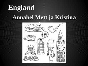
England Annabel Mett ja Kristina Smirnova 8.b Englands Geography · England is a part of the United Kingdom of Great Britain, its an island situated off the North West coast of Europe. · Bordered by Scotland in the north, the North Sea in the east, the England Channel in the south and Wales in the west. · Most of England is rolling hills. · Scafell Pike is the highest mountain in England with an elevation of 978 meters. Key Facts on England · Major Cities: London-Leeds-Liverpool-Manchester. · Capital: London with a population of 7,556,900. · Population: 51,446,000 inhabitants. · Geographic size: 130,395km². · National Anthem: None. God Save the Queen, Land of Hope and Glory. · Currency: Pound sterling (GBP). · Distribution: Males: 48,7% Females: 51,3% Climate of England · England has a temperate climate, with mild winters with temperatures not much lower than 0 C,
Gümnaasium Prague referaat Autor: Klass: Juhendaja: 2010 CONTENTS 1. Contents 2. Introduction 3. Compendium about Prague 4. Important about Czech Republic and Prague 5.-7. History 8. Independence 9. Main sights 10. the Czech Republic 11. List of famous people from Prague 12. Geography 13. Weather and climate 14. Population 15. Culture 2 INTRODUCTION The Czech Republic lies at the heart of Central Europe and at its center is the beautiful and historic city of Prague. With a population of some 1.3 million residents, the city lies on either side of the Vltava River in the middle of Bohemia that is one of the three
Northwest Territories. The largest lake which is at least partly in Canadian territory is Lake Superior Climate Canada's climate is as diverse as its landscape. Generally, Canadians enjoy four very distinct seasons, particularly in the more populated regions along the US border. Daytime summer temperatures can rise to 35°C and higher, while lows of -25°C are not uncommon in winter. More moderate temperatures are the norm in spring and fall. Summers can be hot and dry on the prairies, humid in central Canada, and milder on the coasts. Spring is generally pleasant across the country. Autumns are often crisp and cool, but brightened by rich orange and red leaves on trees. Winters are generally cold with periods of snow, although southern Alberta enjoys the occasional "Chinook", a warm dry wind from the Rocky Mountains that gusts through and melts the snow. Winters are mild and wet on the west coast, in cities such as Vancouver and
Sonoran, Mojave and Great Basin. Others outside the U.S. include the Southern Asian realm, Neotropical (South and Central America), Ethiopian (Africa) and Australian. The major deserts of semiarid deserts include the sagebrush of Utah, Montana and Great Basin. They also include the Nearctic realm (North America, Newfoundland, Greenland, Russia, Europe and northern Asia). Coastal deserts occur in moderately cool to warm areas such as the Nearctic and Neotropical realm. A good example is the Atacama of Chile. Cold deserts occur in the Antarctic, Greenland and the Nearctic realm. Climate In hot and dry deserts temperatures exhibit daily extremes because the atmosphere contains little humidity to block the Sun's rays. Many mean annual temperatures range from 20-25° C. The extreme maximum ranges from 43.5-49° C. Minimum temperatures sometimes drop to -18° C. Rainfall is usually very low and/or
It is also part of the Western United States and of the Mountain West states. It is the sixth largest and the 14th most populous of the 50 states. Its capital and largest city is Phoenix. Arizona is one of the Four Corners states. It borders with New Mexiko, Utah, Nevada, California, and Mexico, and one point in common with the southwestern corner of Colorado. Climate Southern Arizona is known for its desert climate, with very hot summers and mild winters. Northern Arizonafeatures forests of pine, Douglas fir, and spruce trees; the Colorado Plateau; some mountain ranges (such as the San Francisco Mountains); as well as large, deep canyons, with much more moderate summer temperatures and significant winter snowfalls. There are ski resorts in the areas of Flagstaff, Alpine, and Tucson. In addition to the Grand Canyon National Park, there are several national forest, national parks, and nation monuments.
years ago, and the first villages around 6,000 years ago. The well-preserved village of Skara Brae on the Mainland of Orkney dates from this period. Neolithic habitation, burial and ritual sites are particularly common and well-preserved in the Northern Isles and Western Isles, where lack of trees led to most structures being built of local stone. Roman influence The written protohistory of Scotland began with the arrival of the Roman Empire in southern and central Great Britain, when the Romans occupied what is now England and Wales, administering it as a province called Britannia. Roman invasions and occupations of southern Scotland were a series of brief interludes. In 834 AD the general Gnaeus Julius Agricola defeated the Caledonians at the battle of Mons Graupius, and Roman forts were briefly set along the Gask Ridge close to the Highland line (none are known to have been constructed beyond that line)
Its name means ,,Southland". The official name of the country is the Commonwealth of Australia. It's capital is Canberra. Australia is the sixth largest country in the world but the smallest continent. Australia has 6 states and 2 territories (New South Wales, Victoria, Tasmania, Queensland, Western Australia , South Australia, The Australian Capital Territory and the Northern Territory). The Australian people are culturally the same as the Anglo Americans. There also live aborigines. Aborigines are the ancestors of the people. Like the US and Canada, Australia was an English speaking colony of Great Britain. Today Australia is a modern developed country with a diversified economy. Australia is an island continent of 7.7 million square kilometres, which makes it a little smaller than the USA. Located in south of Asia, between The Pacific and Indian Oceans, Australia is the World's driest continent
The United States of America (The U.S.A) Geography The main part of the United states extends from the Atlantic Ocean in the east to the Pacific Ocean in the west. It covers the middle of the North American continent. This area is called ,,the continental United states". The continental United States is bounded to the North by Canada and to the South by Mexico. The border with Canada is often called ,,the longest unguarded border in the world". The United States and Canada are good friends and they have very few problems in managing the border. The borded with Mexico is different. Immigrants are constantly crossing the border illegally
Scotland ! Scotland (Gaelic: Alba) is a country in northwest Europe that occupies the northern third of the island of Great Britain. It is part of the United Kingdom, and shares a land border to the south with England. It is bounded by the North Sea to the east, the Atlantic Ocean to the north and west, and the North Channel and Irish Sea to the southwest. In addition to the mainland, Scotland consists of over 790 islands including the Northern Isles and the Hebrides. Edinburgh, the country's capital and second largest city, is one of Europe's largest financial centres. It was the hub of the Scottish Enlightenment of the 18th century, which saw Scotland become one of the commercial, intellectual and industrial powerhouses of Europe
the Northern Territory to the cool temperate conditions in the southeast and Tasmania, where it often snows in winter. In the north, half the year is `wet' and half is `dry'. From November to April heavy rain fills the rivers and makes enormous lakes where thousands of birds come for the summer. From May to October it is often sunny and dry for weeks, and it is a popular place for winter holidays in the sun. In the hot, flat centre of Australia, there is an area called the `outback'. It covers more than two-thirds of Australia, but its population is less than 100,000. In some places, it doesn't rain for years. There are hills and big dry salt lakes, and it is very difficult to grow anything there. Many people live on sheep or cattle stations, a few of which are as large as the country of England. The nearest neighbour can be a hundred kilometres away and the nearest city 1,500 kilometres away.
The old farmhouses and mansions can still be seen in many places in Southern Viljandimaa. As a result of the hard work and the tenacity of the local inhabitants, Mulgimaa developed into an area known as prosperous and rich by its cultural heritage. The masters working in the villages played an important role in the development. The local foods such as sauerkraut stew, curd cake and ,,kama" (a meal made with sour milk and a mixture of ground grains) are popular even nowadays. There is even a song that says: "It is good to live in Mulgimaa / The nature is beautiful and the land is fructuous/ There are glorious groves and large wealthy Estonian farms". As for now, the large-scale industry has become more and more dominating in agriculture. After thorough reforms in Estonian economy the people living in villages and small towns are searching for new possibilities for self-realisation and one of the outputs is tourism. This
Nitrogen is created by biological fixation, and phosphorus is created by precipitation. The most distinctive characteristic of tundra soil is its permafrost, a permanently frozen layer of ground. The average winter temperature is -28°C, but the average summer temperature is 3-16°C. During the brief summers, the top section of the soil may thaw out allowing plants and microorganisms to grow and reproduce. However, these plants and microorganisms become dormant during the cold winter months. Soil is formed slowly. The constant freezing and thawing in the tundra helps to break the rocks into smaller pieces. Permafrost consists mostly of gravel and finer material. The arctic tundra is also a windy place and winds can blow between 48 to 97 kilometres. The tundra is basically like a desert when it comes to precipitation. Only about 150-250 millimetres of precipitation (mostly snow) fall each year. When water
The Haanja and Otepää Uplands are particularly rich in Hills. It is here that You find Big Egg Hill, the highest point in the Baltic states with 318 metres above sea level. 4. Land regions The northern coast features a steep limestone bank, the Baltic glint, which is one of the world's most important denudations of Ordovician sedimentary rocks. The glint rises to its highest point (56m) at Ontika. Estonia has over 1,500 islands. The largest of them are Saaremaa, Hiiumaa, Muhu and Vormsi. There are over 1,400 lakes in Estonia, biggest being Lake Peipsi and Lake Võrtsjärv, while the deepest is Rõuge Suurjärv. The two longest rivers are the Võhandu and the Pärnu and the widest is Emajõgi. About 50% of the country is covered by forests while wetlands cover 30%. The landscape of Estonia, through covering a small area, is varied and unique. Lake Peipsi is Estonia's largest lake and Europe's fourth largest freshwater lake. 5. Symbols
Since then the Song Festivals have become a national tradition, being held every 4-5 years. This all lead to Estonia's independence on 24 February 1918. In June 1940 Estonia became a part of the Soviet Union. On 20 August 1991 the Republic of Estonia was restored without any bloodshed. CULTURE? National emblems. The Estonian blue-black-and-white national flag was originally the flag of the Estonian Students' Society, consecrated in Otepää Church in 1884. Today there is a memorial plaque on the church wall commemorating the event. The Flag Museum was opened in 1996. During the Soviet time the flag was prohibited. But many people hided their flags somewhere and the flag was seen again in 1988 in public. A meeting was held in Tartu and elderly people were carrying the flags, nationalistic speeches were told and patriotic songs were sung. Tears were rolling down people's cheeks.
..............7 6. References .....................................................................................................8 Introduction New Zealand is an island country in the southwest of Oceania. The Tasman sea separates New Zealand from Australia. The basic parts of New Zealand are the North Island and the South Island. Wellington - which is located on the South Island - is the most southern capital city in the world, but the biggest city in New Zealand is Auckland. There are three official languages in New Zealand: English, Maori and the New Zealand's Sign Language. In Maori language the island is also called Aotearoa (which means "Pika Valge Pilve Maa" in Estonian). The Cook Islands and Niue - which are both independent as free accociations - also belong to New Zealand domains. According to antropologists' statements New Zealand, Hawaii and Easter Island constitute the Polynesian Triangle. The currency used in New Zealand is dollar (NZD)
Ireland Position Ireland is the third largest island in Europe, and the twentieth largest island in the world. It lies to the northwest of Continental Europe and is surrounded by hundreds of islands. To the east of Ireland, separated by the Irish Sea, is the island of Great Britain. Politically, the Republic of Ireland (also known simply as Ireland) covers five sixths of the island, with Northern Ireland, part of the United Kingdom, covering the remainder in the northeast. Climate Overall, Ireland has a mild, but changeable, Oceanic climate with few extremes. The warmest recorded air temperature was 33.3 °C at Kilkenny Castle, County Kilkenny on 26 June 1887, where as the lowest recorded temperature was 19.1 °C at Markree Castle, County Sligo on 16 January 1881
Tallinn English College Topic Great Britain 2007 1. Introduction The official name of Great Britain is `the United Kingdom of Great Britain and Northern Ireland (or short United Kingdom)' The population is about 60.4 million. The capital is London. Other biggest cities include Birmingham, Bristol, Portsmouth, Glasgow and Swansea. English is the main language of Great Britain, but Welsh is officially recognized in Wales and Gaelic in Scotland. 2. Geographical position The British Isles is the geographical term for a group of about 5000 islands off the coast of mainland Europe. The largest island is Great Britain, which is also the largest island in Europe. It consists of England, Wales and Scotland. The next largest island is Ireland, which is made up of Northern Ireland and the Irish Republic. Britain and Northern Island together form the United Kingdom
Mujahed. Geography Ibiza is a part of a group of the western Balearic archipelago called the Pitiusas or "Pine Islands" composed of itself and Formentera. The Balearic island chain includes over fifty islands, many of them uninhabited. Climate The climate of Ibiza is Mediterranean and has milder winters but slightly cooler summers than Majorca. The winters are generally mild with temperatures around 15°C (60°F) during the day and 8°C (46°F) at night. The hottest time of the year is July and August with temperatures reaching 30°C (90 °F) most afternoons. The lowest recorded temperature in Ibiza is -5°C (20°F), the highest is 37 °C (100 °F). People Demographically, Ibiza display a very peculiar configuration, as census agencies diverge on exact figures
Other ethnic groups have arrived from Polynesia (Tonga, Samoa, Cook Islands) with Auckland now being the Polynesia capital of the South Pacific. People from China, Taiwan, Korea, Vietnam, etc have also settled in New Zealand making for a diverse population mix. History : New Zealand was one of the last corners of the planet to be inhabited by people. Around 950AD the Maori arrived from Polynesia (Tonga and Hawaii) to the northern part of the North Island. There is however evidence of earlier settlement by other more peaceful Polynesian people. After the dutch sailor Abel Tasman visited New Zealand and named it Zeeland, more and more settlers arrived, conflicts over land led to several wars between the British and Maori in the North Island. The South island remained rather peaceful until gold was found there and thousand of people hurried there to look for gold.
The landscapes differ greatly from rolling plains and mountains to the cold tundra in the northern part of the country. Geographically, the country's split into 5 major regions the Pacific, the Prairie Provinces, Central Canada, the Atlantic Provinces and the North. The Pacific Region is known for its mild coastal climate, its forests and its spectacular mountains. The three Prairie Provinces are known for their rolling plains and their extreme climate with long, cold winters and hot, dry summers. Part of the Rocky Mountains are in the there. A lot of the Prairie Provinces' area is covered with farms producing wheat and other grains. The region is rich in oil and natural gas. In fact, Canada is the second largest oil reserve holder in the world, after Saudi Arabia. Central Canada which includes Ontario and Quebec is not the geographical centre of Canada. It is called that because it has historically been the political and economic centre of the country
The population of Canada is about 31 million people. About 77% of the people live in cities which lie in a band about 100 miles wide above the border of the United States. The capital of Canada is Ottawa. Other large cities are Montreal, Toronto, Vancouver, Winnipeg and Quebec. 2. Geographical position Canada is a huge country in the continent of North America. It is bordered with the Atlantic Ocean in the east, the Pacific Ocean in the west, the United States of America in the south and the Arctic Ocean in the north. Canada is a vast country, with a territory of 3.8 million square miles of land and fresh water it is the second biggest country in the world after Russia. Canada covers most of the northern part of North America. Canada has over 151,480 miles of coastline. Most of Canada's human population lives along its southern border.
.............3.lk 2.Geography.....................................4.lk 3.Natural features......................5.lk 4.Climate...........................................6.lk 5.Pictures.........................................7.lk 6.Used Sources..............................8.lk Alaska info Alaska is the largest state in the United States by area. It is situated in the northwest extremity of the North American continent, with Canada to the east, the Arctic Ocean to the north, and the Pacific Ocean to the west and south, with Russia further west across the Bering Strait. Alaska is the least densely populated state of the U.S. 2 Alaska was purchased from Russia on March 30, 1867, for $7.2 million at approximately two cents per acre. The land went through several administrative changes before becoming an organized territory on May 11, 1912, and the 49th state of the U.S. on January 3, 1959.
between maritime and continental climate. Because Estonia is continuously warmed by the Gulf Stream it has a milder climate despite its northern latitude. Northern latitude means long summer daylight hours (the longest summer day stretches to 19 hours), and dark winters when daylight lasts sometimes only six hours. Being on the Baltic Sea the country is subjected to sea breezes and humidity. Estonia has a temperate climate, with four seasons of near-equal length. Summer is warm, while spring and autumn can be mild. Winter, which lasts from November to middel March, 4 can be very cold. The cold winter does not necessarily mean constant snow; in fact snowfalls are few and far between. When it falls it stays though, and there tends to be a layer of snow on the ground constantly. The deepest snow cover is usually in the south-eastern part of Estonia.