Leidsid 33 sarnast õppematerjali, mis on seotud failiga "Presentation in english: Italy". Need materjalid aitavad sul teemat sügavamalt mõista.
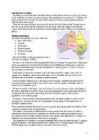
italy, summer, winter, highest, blanc, north, summers, volcano, europe, italia, hostel, size, marino, vatican, alps, center, cold, difference, between, south, warm, mild, fourth, biggest, italian, island, landscapes, nature, sites, tell, 3330, meters, active, sources, deathwhite and represent the Thirteen Colonies. The 50 small, white stars represent the 50 U.S. states. The U.S. flag is commonly called ,,the Stars and Stripes". The Statue of Liberty, that is locatd in New York,is a gift from the France. The Libety Bell, that is a bronze bell that symbolizes freedom in the United States of America. It is located in Pennsylvania,U.S. Capital: Washington D.C Biggest city: New York National language: English Location U.S is located in North America, bordering both the North Atlantic Ocean and the North Pacific Ocean. United States neighbour countries are Canada and Mexico. The USA has the 8th longest coastline in the world at ~20 000 km. 62% of the perimeter of the USA is coastline. The USA's coastline is made up of beaches, cliffs, mangroves, and urban and developed areas, which make America very versatile country. Political division United States of America distributes into 50 states
NEW ZEALAND Geography: New Zealand is situated midway between the Equator and the South pole in the southern Pacific Ocean. It consists of two large islands, North Island and South Island, plus several smaller ones of which Stewart Island is the largest. North and South Islands are separated by the 32km wide Cook Strait. The total land area is 270,535 sq Km, about the size of Italy, the United Kingdom or the US state of Colorado. North Island is volcanically active with three active volcanoes. South Island has the high snow covered mountain peaks and glaciers of the Southern Alps, a range running almost 500Km along the Island. The longest river is the Waikato on North Island (425 Km), the largest inland stretch of water is Lake Taupo also on North Island (607 sq Km) and the highest point is Mount Cook on South Island (3754 m). Over 75% of New Zealand is above 200m.
written in 1814 by Francis Scott Key. There are 6 time zones. From east to west they are: Eastern Standard Time, which is 5 hours behind Greenwich Time, Central Standard Time, Mountain Standard Time, which is 7 hours behind Greenwich Time, Pacific Standard Time. Alaska and Hawaii have their own time zones: Alaska Standard Time and Hawaii Standard Time. Geographical Position The USA lies in the Northern Hemisphere in North America. It covers a big part of the continent and is also the third largest country in the world. The country consists of 50 states, but two of them lie separately. One of them is Alaska, which is near the Arctic Circle. And the other state is Hawaii, which is a group of island is the Pacific Ocean. The USA shares the border with Canada in the north and Mexico in the south. In the east the coast is washed by the Atlantic Ocean and in the west by the Pacific Ocean
Tallinn English College Report of Canada 8a Teacher: Merike Sisask Composer: Kärt Kalvet 2010 Canada, Kärt Kalvet 8a Canada General Information Canada is in North America. It's area is 9220970 sq km. Canada's population is 313.612.000 people. Canada is divided into 10 provinces and 3 territories. The capital of Canada is Ottawa. Canada has constitutional monarchy. The head of state in Canada's government is the Queen of England. There are two main languages in Canada: English and French. Canada's curreny is Canadian dollar (1 dollar=100 cents[Can$]). The highest peak of Canada is Mount Logan, 5959 metres. The lowest point is sea level
Geography Canada is the world's second largest country in total area after Russia , since it covers nearly 10 million square kilometres, but is one of the most sparsely populated, with only about 34 million inhabitants. The majority of them live within 300 kilometres of Canada's southern border. Much of the rest of Canada is uninhabited or thinly populated, because the country has a rugged terrain and severe climate. Canada extends across the continent of North America, from Newfoundland on the Atlantic coast to British Columbia on the Pacific coast and northward into the Arctic Ocean. Canada shares land borders with the United States to the south and north-west. Canada is a land of great variety. Towering mountains, crystal-clear lakes, and lush, green forests make Canada's far west a beautiful region. Farther inland, fields of wheat and other grains cover Canada's vast prairies
Other large cities are Montreal, Toronto, Vancouver, Winnipeg and Quebec. Canada has two official languages English and French. It's interesting to know that about 61% of Canadians name English and 24% French their mother tongue. There are also many other languages spoken in Canada such as: Italian, Chinese, German, Polish, Ukrainian, Greek and Dutch. There are also many native languages such as Algonquian. The British and the French as the main settlers from Europe fought for hundreds of years before they managed to build up a country which was based on recognizing the cultural diversity of different nations in Canada. All the communities living in the country are encouraged to remember their origins and hold their own ethnic events and national festivals. Cultural diversity makes Canada even more interesting. In spite of this, in recent years there is a strong movement in French-speaking Quebec to become an independent country.
The United States of America (The U.S.A) Geography The main part of the United states extends from the Atlantic Ocean in the east to the Pacific Ocean in the west. It covers the middle of the North American continent. This area is called ,,the continental United states". The continental United States is bounded to the North by Canada and to the South by Mexico. The border with Canada is often called ,,the longest unguarded border in the world". The United States and Canada are good friends and they have very few problems in managing the border. The borded with Mexico is different. Immigrants are constantly crossing the border illegally. Every day about 2,000 of them are captured and sent back, but may others get through. There are also two states that are not connected to the continental United States
Australia is a country and also a continent. If someone wants to make clear, that he is speaking of the country, he may call it by its full name of Commonwealth of Australia. Australia's name means "southland."It is south of the equator. Sometimes it is also called the island continent because it is an island. There are about twenty million people in Australia.It is 1,800 miles from the mainland of Asia and almost half way round the world from Europe. More than 600 miles of ocean separate it from Americas. Since Australia is south of the equator, its seasons are just the opposite of ours. It has summer while we have winter, and the other way round. States and Territories. Australia consists of six states, two territories and eight external territories. The six states are: Western Australia (capital Perth), South Australia (capital Adelaide), Queenslnd (capital Brisbane), New South Wales (capital Sydney), Victoria (capital
ENGLAND General overview England is part of the United Kingdom Land borders with Scotland to the north and Wales on to the west The English Channel on south separates it form continental Europe The country includes over 100 smaller islands Capital and largest city is London Its has consitutional monarchy Monarch is Elizabeth II Total area is 130,395 km2 Population is 51,446,000 million, around 84% of the population of the UK Currency is Pound stearling(GBP) Has left-hand traffic Patron saint is ST. George Geography England comprises the central and southern two-thirds of the island of Great
CANADA Canada is a vast country, second largest country of the world after Russia. It stretches from the Atlantic Ocean in the east to the Pacific Ocean in the west and to the Arctic Ocean in the North. Canada Covers most of the northern part of North America and its geography is very diverse. Canada's area is about 10 million square kilometers and its population is 31 000 000. Its capital is Ottowa and other main cities are Toronto, Montreal and Vancouver. Almost 75 % of canadians lives within 300 kilometer of the USA border, because the climate is softer in the South. 89 % of Canada is almost unhabited. Its official languages are English and French, but many other languages are spoken too
If you want to make clear that you are speaking about the country, you may call it the Commonwealth of Australia. It’s the official name of the country. Australia is the smallest continent, but one of the largest countries on Earth. It’s 6th largest country. Its area is about 7.6 million sq km. One third of it is occupied by deserts. It’s both the flattest and, except for Antarctica the driest. Neighbouring countries include Indonesia, East Timor and Papua New Guinea in the north, the Solomon Islands, Vanuatu in the northeast, and New Zealand in the southeast. Its capital is Canberra. Other big cities are Melbourne, Sydney, and Brisbane. National language in Australia is English. Monetary unit is Australian dollar. Their national holiday is on the 26th of January. In 1788 on the 26th of January the first fleet arrived at Botany Bay and established a penal colony near modern-day Sydney. Geographical Position Australia is located in the Southern Hemisphere. It’s the
The United Kingdom The United Kingdom consists of England, Scotland, Wales and North Ireland and it is situated in the Atlantic Ocean near the mainland of Europe. The population of the UK is 58.6 million and area is 244,110 sq km. Britain has a temperate humid climate. Its characteristic features are mild winters, warm summer, no temperature extremes, abundant rain all year round and frequent changes of weather. The mild climate is partly due to the warm Gulf Stream and partly to the south westerly winds. Occasional winds from the east in winter may bring cold and dry weather. The distribution of rainfall is influenced by the Atlantic Stream. The mountainous areas of the north and west have more rain than the lowlands of the south and east. Wales is located on a peninsula in central-west Britain
Like the US and Canada, Australia was an English speaking colony of Great Britain. Today Australia is a modern developed country with a diversified economy. Australia is an island continent of 7.7 million square kilometres, which makes it a little smaller than the USA. Located in south of Asia, between The Pacific and Indian Oceans, Australia is the World's driest continent. Although large areas of the centre are desert, Australia has a wide range of climate from tropical in the north to temperate in the south east, where it frequently snows in winter. Geographical position The coasts of Australia are surrounded by the Pacific Ocean, the Indian Ocean and the Southern Ocean. Four seas are surrounding Australia, which are the Timor Sea and Arafura Sea in the north of Australia, the Coral Sea in the north-east of Australia and the Tasman Sea, near the island of Tasmania, in the south-east of Australia. Government
Representatives. There are a hundred people in the Senate (two from each state) and 435 people in the House of Representatives. At the head of the Judicial branch is the Supreme Court, which has nine judges. The leading parties in America are the Democrats and the Republicans but there are also other parties. Location The United States of America is situated in the central part of the North American continent. Its western coast is washed by the Pacific Ocean and its eastern coast is washed by the Atlantic Ocean and in the south its coast is washed by the Gulf of Mexico. The coastline is even. There are no big islands belonging to the U.S. except the Hawaiian Islands which lie halfway the continents of America and Asia. The biggest peninsulas are the Florida Peninsula and Alaska. The United States of America has got three neighbours Mexico in the south, Canada in
The same melody with different words is also Finland's national anthem. The current coat of arms of Estonia is a golden shield which includes three slim, blue leopards (or lions) in the middle, with oak branches along the side of the shield. It originates from Denmark. It was officially adopted in 1925. Geography Estonia is the northernmost of the three Baltic States. It is located on the northern hemisphere on the eastern shores of the Baltic Sea in the north-east of Europe. It has land contact with Russia from the east and Latvia from the south. In the north The Gulf of Finland separates Estonia from Finland. The Gulf of Riga is situated to the south-west. Estonia has more than 1500 islands. The biggest ones are located to the west. The four biggest islands are Saaremaa, Hiiumaa, Vormsi and Muhu. The highest point in Estonia and also in the Baltic region is Suur Munamägi. It is 318. above sea level. Estonia is a country of a thousand lakes
Australia's landmass of 7,617,930 square kilometers is on the IndoAustralian Plate. Surrounded by the Indian and Pacific oceans, it is separated from Asia by the Arafura and Timor seas. It the sixth largest country in area after Russia, Canada, China, the United States and Brazil. It is the flattest and (after Antarctica) the driest of continents, yet it has extremes of There are rainforests and vast plains in the north, snowfields in the south east, desert in the center and fertile croplands in the east, south and south west. About one third of the country lies in the tropics. Mountain ranges run from north to south along the east coast, reaching their highest point in Mount Kosciusko (2,228 m). The western half of the continent is occupied by a desert plateau that rises into barren, rolling hills near the west coast.
FACTFILE Area: 45 228 sq km Poplulation: under 1.4 million Capital: Tallinn Language: Estonian Currency: Eesti kroon (EEK) Main religion: Lutheran National holiday: 24 February (anniversary of the republic) National flower: Cornflower National bird: Barn Swallow National stone: Limestone LOCATION The Republic of Estonia is the northernmost and smallest of the three Baltic States. It is located on the eastern shores of the Baltic Sea in the north east of Europe. To the east the country borders Russia. Latvia is the countries neighbour to the south. From the west the coast of Estonia is washed by the Baltic Sea and from the north by the Gulf of Finland. The length of the coastline is approximately 3 800 km. The longest distance from east to west is 350 km, while north to south Estonia stretches 240 km. THE NAME The name EESTI was apparently derived from the word AISTI, the
Area: 28,410,000 sq. mi . Area: 63,838,00 0 sq. m i. Coas tli ne: 4 1,346 m i. Coas tl ine : 84,315 m i. Average Depth: 12,598 ft Average De p th: 12,925 ft. Highest Elevations M o untain Peak Name Place Height (ft.) Con tinen t Kilimanja ro Tanzani a 19,340 Africa Vinson Massif Antarctica 16,864 An tarctica
Canada. Canada is a very big country in the continent of North America. It is about 10 million square kilometres and that makes it the second largest country in the world after Russia. Quebec (the province) is six times as big as the UK. Canada borders the Atlantic Ocean, the Pacific Ocean, the Arctic Ocean and the USA. The capital of Canada is Ottawa and other main cities are Toronto, Montreal and Vancouver. It is a very developed country. Montreal is the largest city and it is called the Paris of North America because most of the people there speak French
Senators are elected for six year terms. The Executive power in Australia is in the hands of the Commonwealth Government lead by the Prime Minister. Today the Prime Minister is John Howard, the leader of the Liberal Party. History Australia was once a part of the giant continent Gondwana. It included Africa, South America and Antarctica. First Australia and Antarctica split from Gondwana, then Australia broke away from Antarctica and began to move north. Aborigines arrived there about 50 000 years ago. They had occupied the whole continent by 30 000 years ago. At that time Tasmania was still part of the mainland. About 20 000 years ago the ice began to melt and the rising water level cut Tasmania off from the mainland. Traders from what is now Indonesia are thought to have been visiting Australia well before the 17th century. Chinese, Malaysian and Arab sea
Juhendaja: 2010 CONTENTS 1. Contents 2. Introduction 3. Compendium about Prague 4. Important about Czech Republic and Prague 5.-7. History 8. Independence 9. Main sights 10. the Czech Republic 11. List of famous people from Prague 12. Geography 13. Weather and climate 14. Population 15. Culture 2 INTRODUCTION The Czech Republic lies at the heart of Central Europe and at its center is the beautiful and historic city of Prague. With a population of some 1.3 million residents, the city lies on either side of the Vltava River in the middle of Bohemia that is one of the three historic Czech territories; the others being Moravia and Silesia. The city has seven "Chapter Divisions" or districts. 3
The state flag and the state seal are similar. Passed in 1923, Washington state law describes the flag as having dark green bunting with a state seal in the center. It is the only state flag that is green. It is also the only state flag with a picture of a president. Oregon · Oregon is a state in the Pacific Northwest region of the United States. Oregon is located on the Pacific coast between Washington to the north, California to the south, Nevada on the southeast and Idaho to the east. The area was inhabited by many indigenous tribes before the arrival of traders, explorers and settlers. · The Oregon Territory was created in 1848 after American settlement began in earnest in the 1840s. Oregon became a state (33rd) on February 14, 1859. · Oregon enjoys a diverse landscape including a scenic and windswept Pacific coastline,
The capital city is Washington D.C. Although the United States has no official language at the federal level, English is the de facto national language. English is the most common language for daily interaction among both native and non-native speakers. Spanish is the second language. The largest city is the New York City. The Government is Federal constitutional republic and the president is George W. Bush. 2. Geographical position The United States of America is located on the continent of North America. It has borders with two countries Mexico and Canada. There are also the Atlantic Ocean, the Pacific Ocean and the Gulf of Mexico surrounding the big country. There are 50 states in America. Most of the people live in towns. The biggest state is Alaska; next by size are California, Alaska and Montana. Six states - Maine, Vermont, New Hampshire, Connecticut, Rhode Island and Massachusetts are called New England. They are all small states in the USA that lie in the north- east
6. Towns, economy, agriculture 7. Climate 8. Animals, plantlife 9. Population 10. Sports 11. Culture 12. History 13. Political system, symbols 14. Conclusion 15. Materials 1. Introduction If you had to use two words to describe Canada, they might be large and diverse. Canada is the second largest country in the world, bordered by three oceans, and across the country, Canadians experience many different landscapes from rolling plains and mountains to the cold tundra of the north. Despite Canada's great size, it is one of the world's most sparsely populated countries. This fact, coupled with the grandeur of the landscape, has been central to the sense of Canadian national identity. 2. Geographical position Canada is the second largest country in the world after Russia. In the Arctic, Canada reaches almost as far north as Greenland. To the south it extends to the same latitude as southern France. The distance from Canada's west coast, the Pacific Ocean, to its
..........8 11. Conclusion....................................................................................................9 12. References....................................................................................................10 Introduction I chose finland because there are friendly people and beautiful nature. Finland is bigger than Estonia. There lives over 5 milj. people. Finland capital is Helsingi and there lives about 2 milj. people. Highest top is 1328m. Finland is bordersed with Sweden to the west, Russia to the east and Norway to the north. It is the eight largest city in Europe. Most Finns speak Finnish. The second language is Swedish. Finland is rated the sixth most peaceful country in the World. In Finland there are more than 60000 lakes. Capital: Helsinki Area: 338145km2 Population: 5200000
and it is bordered by three oceans: the Arctic, the Pacific and the Atlantic Oceans. The population of Canada is about 31 million people. About 77% of the people live in cities which lie in a band about 100 miles wide above the border of the United States. The capital of Canada is Ottawa. Other large cities are Montreal, Toronto, Vancouver, Winnipeg and Quebec. 2. Geographical position Canada is a huge country in the continent of North America. It is bordered with the Atlantic Ocean in the east, the Pacific Ocean in the west, the United States of America in the south and the Arctic Ocean in the north. Canada is a vast country, with a territory of 3.8 million square miles of land and fresh water it is the second biggest country in the world after Russia. Canada covers most of the northern part of North America. Canada has over 151,480 miles of coastline
Canada Geography The geography of Canada is vast and diverse. Occupying most of the northern portion of North America, Canada is the world's second largest country in total area. The highest point in Canada is Mount Logan 6,050 m, which is in the Yukon. The two principal river systems are the Mackenzie and the St. Lawrence. The St. Lawrence, with its tributaries, is navigable for over 3,058 km. The largest lake situated entirely in Canada is Great Bear Lake at 31,328 km2 in the Northwest Territories. The largest lake which is at least partly in Canadian territory is Lake Superior Climate Canada's climate is as diverse as its landscape
London. All of them were at one time independent kingdoms with their own monarch. Now they are all part of the same kingdom and share the same monarch. The UK consists of Northern Ireland, Scotland, England and Wales. The peoples of these countries are British subjects; they hold British passports and therefore their nationality is British. The british Isles is the geographical name for all the islands off the west coast of Europe. These islands also include The Republic of Ireland, which is politically independent of the Britsh government. Many people refer to the inhabitants of the British isles as 'the English', but England is only one of the countries. The other countries are Scotland, Wales and Northern Ireland. Great britan is the name of the one island which is made up of Scotland, England and Wales. It is calles Great because in some languages the word for Britain is the same as the
Topic Estonia Tallinn 2008 1. Introduction Estonia is a small country about the size of Switzerland, or New Hampshire and Massachussetts combined. Estonia is named after the people called "Ests" who lived in the region in the 1 st century AD. The Republic of Estonia is one of the three countries commonly known as the "Baltic States". The other Baltic States are Latvia and Lithuania. 2. Geographical position Estonia is situated in northeastern Europe. Estonia is bounded on the north by the Gulf of Finland, on the east by Russia, on the south by Latvia and on the west by the Baltic Sea. In the north it borders on Finland. The coastline of the Baltic Sea in Estonia is characterized by numerous gulfs and bays, the biggest of them being the Gulf of Finland, the Gulf of Riga and the Gulf of Pärnu. Bays include the Narva Bay, Matsalu Bay, Kolga Bay, Kunda Bay, Tallinn Bay etc. Estonia has over
the MoMa or the Met. While new Visitors regularly return to the sites, like the National September mainland singing praise for Maui, but 11 Memorial, are always popping the smart few just put down new roots up, the classics, like the Empire and pick up a Mai Tai. State Building, never get old. Montreal and Vancouver Why go: Here, it's as Why go: While it may not be as if Paris migrated to North grand as New York City or as America. Montreal boasts historic asMontreal, why Vancouver caught the attention of the elements of French culture with International Olympic Committee is a friendly Canadian feel. no mystery. This coastal Canadian Travelers adore the quaint city boasts a vast amount of outdoor cafés,bustling marketplaces an activities that beckon to adrenaline
and an autonomous grand duchy of Russia after 1809. It won its complete independence in 1917. During World War II, it was able to successfully defend its freedom and resist invasions by the Soviet Union albeit with some loss of territory. In the subsequent half century, the Finns made a remarkable transformation from a farm/forest economy to a diversified modern industrial economy; per capita income is now among the highest in Western Europe. A member of the European Union since 1995, Finland was the only Nordic state to join the euro system at its initiation in January 1999. In the 21st century, the key features of Finland's modern welfare state are a high standard of education, equality promotion, and national social security system currently challenged by an aging population and the fluctuations of an exportdriven economy (Central Intelligence Agency, 2012, ISSN 15538133). 2.1.2 Geography
It was built in the early 1900s just to be the capital. The official language is English and the official name of Australia is the Commonwealth of Australia. Australia is located on the Southern Hemisphere (because of that Australia is also called "A land down under"). 2 . Geographical position Australia is an island continent and it is located between the Indian and South Pacific oceans south east of Asia. From the north it is bordered by the Timor Sea and the Torres Strait. From the east by the Coral Sea and the Tasman Sea. Australia's coastline is about 37,000 km long. The Great Australian Bight washes the southern coast. The Gulf of Carpenteria and the Cape York Peninsula surround it in the south. 3. Relief Australia is the smallest continent in the world It is often called the island continent because is too big for an island but rather small for a continent
Introduction, Location Australia is a country between the Indian Ocean and the Pacific Ocean. It is the only country in the world that occupies an entire continent. The mainland covers an area of 7.7 million km² and it is about 3700 km from the most northern point to its most southern point and about 4000 km from east to west. There are also many different seas around Australia, like the Coral and the Tasman Seas in the west or the Timor and the Arafura Seas in the north, where the Indian and the Pacific Oceans meet. Because all seas and oceans near Australia are warm, surfing is a very popular hobby. Political subdivision Australia is divided into six states, which are: · New South Wales · Victoria · Queensland · South Australia · Western Australia · Tasmania New South Wales is the most populous state in Australia. Its capital is Sydney. Victoria is one of the most densely populated states in Australia. Its capital city is Melbourne