Leidsid 33 sarnast õppematerjali, mis on seotud failiga "Arizona". Need materjalid aitavad sul teemat sügavamalt mõista.
arizona, nation, states, canyon, west, south, western, known, grand, near, southwestern, mountain, mexico, summer, temperatures, through, miles, north, river, region, california, corner, southern, desert, northern, pine, plateau, winter, there, forest, origin, land, portion, lion, earthquakes, other, monument, sixth, phoenix, four, nevada, summers, mildUSA: West Coast Kristiina Sekljutskaja 11A West Coast · The "West Coast", "Western Seaboard", or "Pacific Coastline" are terms for the westernmost coastal states of the United States. · It most often comprises California, Oregon and Washington. Arizona and Nevada, while not coastal states, are often included due to their proximity to the Pacific Coast and their economic and cultural ties to California · As of 2007, the estimated population of the West Coast ranged from approximately 5060 million, depending on which states are included in the estimate. · Major coastal cities on the West Coast include San Diego, Los Angeles, San Francisco, Seattle, Las Vegas. ·West Coast includes: ·Washington ·Oregon ·Arizona ·Nevada ·California Washington · Named after George Washington, the first President of the United States · Capital: Olympia · Largest city: Seattle
Tallinna Inglise Kolledz Topic United States of America Mari-Liis Pakats Tallinn 2007 2 Introduction..................................................................................................................4 Geographical Position..................................................................................................4 Geographical Regions..................................................................................................5 Climate ......................................
Tallinn English College Topic The United States of America Form Tallinn 2005 Introduction The United States of America is a very big country. Its territory is about 9.4 million square kilometres and its population is more than 260 million people, 12% of them are the Afro-Americans. It is the world's third-largest country by size and by population. The population density is about 27 people per square kilometre. Most of the people live in towns. There are 50 states in America. The biggest of the state is Texas, next by size are California, Alaska and Montana. Six states - Maine, Vermont, New Hampshire,
Tallinn English College Topic The United States of America Tallinn 2007 1. Introduction The United States of America's territory is over 3.7 million square miles (over 9.6 million km²) and population more than 300 million people. The capital city is Washington D.C. Although the United States has no official language at the federal level, English is the de facto national language. English is the most common language for daily interaction among both native and non-native speakers. Spanish is the second language. The largest city is the New York City. The Government is Federal constitutional republic and the president is George W. Bush. 2. Geographical position The United States of America is located on the continent of North America. It has borders with
6 stops in the USA Annika Allik 10A Põltsamaa Co-Educational Gymnasium Las Vegas ... is the largest city in Nevada state ... is the largest center for adult entertainment in the entire world The major attractions in Las Vegas are the casinos and the hotels The most famous hotel casinos are located on Las Vegas Boulevard on the portion of that road known as the Las Vegas Strip Fremont street in 1920s and today New York City ... is the most populous city in the United States ... is famous for the Statue of Liberty, Empire State building, United Nations, museums, Broadway theaters, restaurants, Times Square, nightlife and shopping In 2010, New York City had a record number of tourists with 48.7 million Time square in 1922 and 2010 San Francisco ..
The United States of America The United States of America is situated mostly in central North America, where it lies between the Pacific and Atlantic Oceans, bordered by Canada to the north and Mexico to the south. The state of Alaska, which is located northwest from the continent, and Hawaii Islands, which are located in the mid-Pacific, are also part of the United States. The country also possesses several territories in the Caribbean and Pacific. It consists of 50 states. United States is the third largest country with the territory of 9.83 million km2. It's population is about 309 million. USA became an independent country on July 4, 1776. The capital of the country is Washington DC (District of Columbia). The land area of the United States is approximately 1.9 billion acres, which makes a total of 770 million in hectares
inhabitants. The majority of them live within 300 kilometres of Canada's southern border. Much of the rest of Canada is uninhabited or thinly populated, because the country has a rugged terrain and severe climate. Canada extends across the continent of North America, from Newfoundland on the Atlantic coast to British Columbia on the Pacific coast and northward into the Arctic Ocean. Canada shares land borders with the United States to the south and north-west. Canada is a land of great variety. Towering mountains, crystal-clear lakes, and lush, green forests make Canada's far west a beautiful region. Farther inland, fields of wheat and other grains cover Canada's vast prairies. Thes fertile farmlands contrast vividly with the Arctic wastelands to the north. Most of the largest towns and industrial areas lie near the Great Lakes and the St Lawrence River in central Canada
A half- or full-day fishing trip with a guide, which end up with cooking a meal from the catch, has recently become popular. In one word Canada is a vast country with many diversities and tourist attractions. With its spectacular nature Canada is wonderful. Location. Canada is a huge country in the continent of North America. It is bordered with the Atlantic Ocean in the east, the Pacific Ocean in the west, the United States of America in the south and the Arctic Ocean in the north. Canada is a vast country, with a territory of 3.8 million square miles of land and fresh water it is the second biggest country in the world after Russia. Canada covers most of the northern part of North America. Canada has over 151,480 miles of coastline. Most of Canada's human population lives along its southern border. Geographical facts. Canada's geography is very diverse
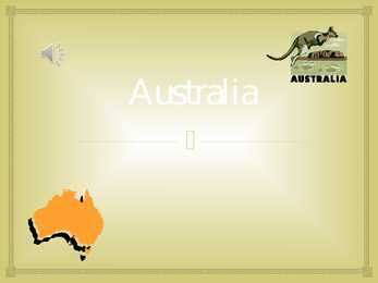
Topic Australia Tallinn English College 2006 Australia 1 . Introduction The name Australia is derived from the Latin Australis, meaning of the south. In land area, Australia is the sixth largest nation, its territory is 7,686,850 sq km and its population reaches today over 20,5 million people. It is the only nation to govern an entire continent and its outlying islands. Australia's capital is Canberra, the only city with its own territory. It was built in the early 1900s just to be the capital. The official language is English and the official name of Australia is the Commonwealth of Australia. Australia is located on the Southern Hemisphere (because of that Australia is also called "A land down under"). 2 . Geographical position
Usa 1. Gross Domestic Products Gross Domestic Products of USA United States of America has the highest Gross Domestic Products nominal about 14.624 trillion US dollars according to World Bank. 2. Rhode Island Rhode Island is actually named Rhode Island and Providence Plantations and it makes the smallest state in the United States has the longest name. 3. Califrnia never rains It is believed that California is the state with the lowest rainfall in the world. For two years, California never rains. For those amazing and unique facts, California has been attracting so many tourists. Many people also adore this fact and this facts is often included in a song lyric. 4. President Grover Cleveland Grover Cleveland is the only USA president who married in office. It becomes more unusual
The capital of Canada is Ottawa. Canada has constitutional monarchy. The head of state in Canada's government is the Queen of England. There are two main languages in Canada: English and French. Canada's curreny is Canadian dollar (1 dollar=100 cents[Can$]). The highest peak of Canada is Mount Logan, 5959 metres. The lowest point is sea level. The longest river is the Mackenzie. The climate and geography of Canada vary greatly from temperate in the south to arctic in the north and from islands and plains in the east to mountains in the west. Location Canada is located in the northern-most region of North America. It's geographical position in co- ordinates is 83°N north, 42°N south, 53°W east, 141°W west. Canada borders with United States of America by land; Pacific Ocean, Arctic Ocean and Atlantic Ocean by coastline. Canada is one of the largest countries in the world, second only to Russia in territorial size. It has a total area of 9
The United States of America (The U.S.A) Geography The main part of the United states extends from the Atlantic Ocean in the east to the Pacific Ocean in the west. It covers the middle of the North American continent. This area is called ,,the continental United states". The continental United States is bounded to the North by Canada and to the South by Mexico. The border with Canada is often called ,,the longest unguarded border in the world". The United States and Canada are good friends and they have very few problems in managing the border. The borded with Mexico is different. Immigrants are constantly crossing the border illegally. Every day about 2,000 of them are captured and sent back, but may others get through. There are also two states that are not connected to the continental United States. They are Alaska and Hawaii.
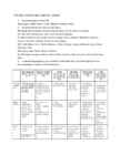
USA ajaloo konspekt (algus-Mayflower Compact) 1. Name the regions of the USA New England, Middle Atlantic, South, Midwest, Southwest, West. 2. Name the states that make up each region. NE: Maine, New Hampshire, Vermont, Massachutsess, Rhode Island, Connecticut. MA: New York, Pennsylvania, New Jersey, Maryland, Delaware. S: Virginia, North Carolina, South Carolina, Georgia, Florida, Alabama, Mississippi, Louisiana, Missouri, Arkansas, Kentucky, Tennessee, West Virginia. MW: North Dakota, South Dakota, Nebraska, Illinois, Michigan, Kansas, Minnesota, Iowa, Indiana, Wisconsin, Ohio. SW: Arizona, New Mexico, Texas, Oklahoma. W: Washington, Oregon, California, Hawaii, Alaska, Montana, Idaho, Nevada, Colorado, Wyoming, Utah. 3. Compare the geography and population / settlement and cultural background in the following regions: (any two of the 6 regions)
The United States of America Geography The United States of America is situated in the central part of the North American continent. Its western coast is washed by the Pacific Ocean, and its eastern coast by the Atlantic Ocean and the Gulf of Mexico. It borders on Canada in the north and on Mexico in the South. The U.S.A. consists of 51 states and the District of Columbia. The state of Alaska is separated from the rest of the U.S.A. by Canada. Hawaii, which became the fiftieth state in 1959, is in the Pacific Ocean, halfway between the continents of America and Asia. The area of the United States of America is over nine million square kilometres. The continental part of the U.S.A. consists of two highland regions and two lowland regions. The
Indeed, all the Canadians except the Indians and Eskimos, are really immigrants or their descendants. Canada is politically a young country. In 1967 the people celebrated its first century of independence. It was on the first of July, 1967, that four provinces of British North America joined together and formed the Dominion of Canada. Geographical facts. Canada occupies the northern portion of North America. It shares land borders with the United States to the south and with Alaska to the northwest. It shares territorial water boundaries with the United States, Greenland to the northeast, and Saint-Pierre and Miquelon (an overseas community of France) to the southeast. Canada stretches from the Atlantic Ocean in the east to the Pacific Ocean in the west. To the north lies the Arctic Ocean. The most densely populated part of the country is the Quebec City-Windsor Corridor in the east
Australia Australia is a country and also a continent. If someone wants to make clear, that he is speaking of the country, he may call it by its full name of Commonwealth of Australia. Australia's name means "southland."It is south of the equator. Sometimes it is also called the island continent because it is an island. There are about twenty million people in Australia.It is 1,800 miles from the mainland of Asia and almost half way round the world from Europe. More than 600 miles of ocean separate it from Americas. Since Australia is south of the equator, its seasons are just the opposite of ours. It has summer while we have winter, and the other way round. States and Territories.
2006 1. Introduction If you had to use two words to describe Canada, they might be large and diverse. Canada is the second largest country in the world with a territory of about 10 million square kilometers and it is bordered by three oceans: the Arctic, the Pacific and the Atlantic Oceans. The population of Canada is about 31 million people. About 77% of the people live in cities which lie in a band about 100 miles wide above the border of the United States. The capital of Canada is Ottawa. Other large cities are Montreal, Toronto, Vancouver, Winnipeg and Quebec. 2. Geographical position Canada is a huge country in the continent of North America. It is bordered with the Atlantic Ocean in the east, the Pacific Ocean in the west, the United States of America in the south and the Arctic Ocean in the north. Canada is a vast country, with a territory of 3.8 million
Australia Fact file: Australia comprises a land area of 7 686 850 square kilometres. Its population is about 21,3 million people. Australia's capital is Canberra. The national language is English. The official name of it is the Commonwealth of Australia. It's divided into six states and two territories: New South Wales, Queensland, South Australia, Western Australia, Tasmania, Victoria, Australian Capital Territory (ACT) and Northern Territory. Symbols: Australia had the British flag as their official flag until 1901, when the Commonwealth of Australia was formed. Over 30 000 entries attracted the official competition. Five of them, which contained almost identical designs, were placed equally first. The Australian flag symbolises Australia's historical links with Britain, because it has
nationalities. Besides English and French there are also immigrants from Scotland, Ireland, Wales, Germany, Ukraine and Scandinavia. In Edmonton and Calgary there are also historic Chinatowns, and Calgary has Canada's third largest Chinese community. Geographical features Alberta covers an area of 661,848 square kilometres, an area about 5% smaller than Texas or 20% larger than France. This makes it the fourth largest province after Quebec, Ontario, and British Columbia. To the south, the province borders on the 49th parallel north, separating it from the U.S. state of Montana, while on the north the 60th parallel north divides it from the Northwest Territories. To the east the 110th meridian west separates it from the province of Saskatchewan, while on the west its boundary with British Columbia follows the 120th meridian west south from the Northwest Territories at 60°N until it reaches the Continental Divide at the Rocky Mountains.
across the country, Canadians experience many different landscapes from rolling plains and mountains to the cold tundra of the north. Despite Canada's great size, it is one of the world's most sparsely populated countries. This fact, coupled with the grandeur of the landscape, has been central to the sense of Canadian national identity. 2. Geographical position Canada is the second largest country in the world after Russia. In the Arctic, Canada reaches almost as far north as Greenland. To the south it extends to the same latitude as southern France. The distance from Canada's west coast, the Pacific Ocean, to its east coast, the Atlantic Ocean, is farther than from North America to Europe. Canada's total land area includes thousands of adjacent islands, notably Newfoundland in the east and those of the Arctic Archipelago in the north. In longitude Canada extends from approximately 52° to 141° W, a distance that spans six time zones
Australia Australia is the smallest continent in the world. It is 7.6 million square kilometres big. It is often called the island continent because it is rather small for a continent and very big for an island. There are only five countries bigger than Australia in the World. There are five states in the mainland. Tasmania is also considered as a state so there are six states. The Northern Territory and Canberra are also independent but they are not states. Canberra is the capital of Australia and it is situated between Sydney and Melbourne because both of these cities wanted to be the capital. The population is about 19 million people and growing. New South Wales is the most populated state and Victoria is the most densely populated state. The national language is English. It is English because British settlers came to live in Australia in
Tallinn English College CANADA Report Karin Kristen Tapupere 8.b Instructor: Tiiu Martma Intro: Canada is a country occupying most of northern North America, extending from the Atlantic Ocean in the east to the Pacific Ocean in the west and northward into the Arctic Ocean. It is the world's second largest country by total area and its common border with the United States to the south and northwest is the longest in the world. The land occupied by Canada was inhabited for millennia by various groups of Aboriginal people. Beginning in the late 15th century, British and French expeditions explored, and later settled along, the Atlantic coast. France ceded nearly all of its colonies in North America in 1763 after the Seven Years' War. In 1867, with the union of three British North American colonies through Confederation, Canada was formed as a federal dominion of four provinces
officially the Portuguese Republic, Portuguese: República Portuguesa) is a country located in Southwestern Europe, on the Iberian Peninsula. It is the westernmost country of mainland Europe, and is bordered by the Atlantic Ocean to the west and south and by Spain to the north and east. The Atlantic archipelagos of the Azores and Madeira are Portuguese territory as well. The country is named after its second largest city, Porto, whose Latin name was Portus Cale. SETTLEMENT The land within the borders of the current Portuguese Republic has been continuously settled since prehistoric times
Topic Australia Introduction Many people know Australia as the land down under because it is the only continent except for Antarctica that is all on the southern hemisphere. Its name means ,,Southland". The official name of the country is the Commonwealth of Australia. It's capital is Canberra. Australia is the sixth largest country in the world but the smallest continent. Australia has 6 states and 2 territories (New South Wales, Victoria, Tasmania, Queensland, Western Australia , South Australia, The Australian Capital Territory and the Northern Territory). The Australian people are culturally the same as the Anglo Americans. There also live aborigines. Aborigines are the ancestors of the people. Like the US and Canada, Australia was an English speaking colony of Great Britain. Today Australia is a modern developed country with a diversified economy. Australia is an island continent of 7.7 million square kilometres, which makes it a little smaller than the USA.
United States of America Table of Contents 1. Facts 2. Geography 3. Nature 4. History 5. Population 6. Government 7. Industry, economy 8. America's pop culture Facts Official Name: United States of America Capital City: Washington, D.C. Largest city: New York City Official languages: None at federal level National language: English Government: Federal constitutional republic President: Barack Obama ( Barack Hussein Obama II) Vice President: Joe Biden (Joseph Robinette "Joe" Biden, Jr) Population: 2009 estimate 306,108,000 people Area: Total 9,826,630 km2 (by CIA World Factbook) Currency: United States dollar ($) Motto: In God We Trust Anthem: "The Star-Spangled Banner"
In Northern Finland, particularly in the Province of Lapland, a subarctic climate dominates, characterised by cold, occasionally severe, winters and relatively warm summers. The main factor influencing Finland's climate is the country's geographical position between the 60th and 70th northern parallels in the Eurasian continent's coastal zone, which shows characteristics of both a maritime and a continental climate, depending on the direction of air flow. Finland is near enough to the Atlantic Ocean to be continuously warmed by the Gulf Stream, which explains the unusually warm climate considering the absolute latitude. A quarter of Finland's territory lies above the Arctic Circle, and as a consequence the midnight sun can be experienced for more days, the farther north one travels. At Finland's northernmost point, the sun does not set for 73 consecutive days during summer, and does not rise at all for 51 days during winter.(www.wikipedia.org)
It covers more than two-thirds of Australia, but its population is less than 100,000. In some places, it doesn't rain for years. There are hills and big dry salt lakes, and it is very difficult to grow anything there. Many people live on sheep or cattle stations, a few of which are as large as the country of England. The nearest neighbour can be a hundred kilometres away and the nearest city 1,500 kilometres away. Australia has a population of about 23 million people, most of whom live in the south and east of the country, where the summers are warm and the winters not too cold. The highest mountain in Australia is Mount Kosciuszko, at 2,228 metres. Australia's longest river, the Murray-Darling, is 2,700 kilometres long. The only large permanent lakes in Australia have been artificially created, as most of the natural lakes there are dry for months or years at a time. Lake Eyre is the largest lake in Australia and also the lowest point.
The Estonian language words were written by J. V. Jannsen. It was officially adopted after the War of Independence in 1920.The same melody with different words is also Finland's national anthem. The current coat of arms of Estonia is a golden shield which includes three slim, blue leopards (or lions) in the middle, with oak branches along the side of the shield. It originates from Denmark. It was officially adopted in 1925. Geography Estonia is the northernmost of the three Baltic States. It is located on the northern hemisphere on the eastern shores of the Baltic Sea in the north-east of Europe. It has land contact with Russia from the east and Latvia from the south. In the north The Gulf of Finland separates Estonia from Finland. The Gulf of Riga is situated to the south-west. Estonia has more than 1500 islands. The biggest ones are located to the west. The four biggest islands are Saaremaa, Hiiumaa, Vormsi and Muhu.
.....................................................................................9 2.5 Industrial and Manufacturing Energy Use..................................................................11 2.6 Transportation Energy Use.........................................................................................12 RENEWABLE ENERGY..................................................................................................14 3.1 What Role Does Renewable Energy Play in the United States?................................ 14 3.2 Why Don't We Use More Renewable Energy?..........................................................15 NONRENEWABLE ENERGY.........................................................................................16 SIGNFICANT EVENTS IN THE HISTORY OF ENERGY BY FUEL.......................16 5.1 Signficant Events in the History of Energy Uses....................................................... 18 SAVING ENERGY ...........................................
Tallinn English College English Anita Kuprijanovits Form 8b THE UNITED STATES OF AMERICA Report Supervisor: Mare Kallas Tallinn 2009 Introduction Name: The United States of America Area: ~10 mln km2 Population: ~300 mln people Symbols: The American Flag- consists of 13 equal horizontal stripes of red alternating with white and represent the Thirteen Colonies. The 50 small, white stars represent the 50 U.S. states. The U.S. flag is commonly called ,,the Stars and Stripes". The Statue of Liberty, that is locatd in New York,is a gift from the France. The Libety Bell, that is a bronze bell that symbolizes freedom in the United States of America. It
Table of Contents 1.Alaska info...................................3.lk 2.Geography.....................................4.lk 3.Natural features......................5.lk 4.Climate...........................................6.lk 5.Pictures.........................................7.lk 6.Used Sources..............................8.lk Alaska info Alaska is the largest state in the United States by area. It is situated in the northwest extremity of the North American continent, with Canada to the east, the Arctic Ocean to the north, and the Pacific Ocean to the west and south, with Russia further west across the Bering Strait. Alaska is the least densely populated state of the U.S. 2 Alaska was purchased from Russia on March 30, 1867, for $7.2 million at approximately two cents per acre. The land went through several administrative changes before becoming
Neighbouring countries include Indonesia, East Timor and Papua New Guinea in the north, the Solomon Islands, Vanuatu in the northeast, and New Zealand in the southeast. Its capital is Canberra. Other big cities are Melbourne, Sydney, and Brisbane. National language in Australia is English. Monetary unit is Australian dollar. Their national holiday is on the 26th of January. In 1788 on the 26th of January the first fleet arrived at Botany Bay and established a penal colony near modern-day Sydney. Geographical Position Australia is located in the Southern Hemisphere. It’s the only continent except for Antarctica that is all south of equator. Sometimes Australia is called the island continent. There is a great reason why. It really is an island. It is 2880 km from the mainland of Asia and is almost half way round the world from Europe. More than 9 600 km separates it from America. Australia lies between the Pacific and Indian oceans.
Australia is a cloudless dark blue sky, the bright sun, multikilometer beaches with snowwhite sand and ocean up to horizon. Australia's landmass of 7,617,930 square kilometers is on the IndoAustralian Plate. Surrounded by the Indian and Pacific oceans, it is separated from Asia by the Arafura and Timor seas. It the sixth largest country in area after Russia, Canada, China, the United States and Brazil. It is the flattest and (after Antarctica) the driest of continents, yet it has extremes of There are rainforests and vast plains in the north, snowfields in the south east, desert in the center and fertile croplands in the east, south and south west. About one third of the country lies in the tropics. Mountain ranges run from north to south along the east coast, reaching their highest point in Mount Kosciusko (2,228 m).