Leidsid 33 sarnast õppematerjali, mis on seotud failiga "Taiga". Need materjalid aitavad sul teemat sügavamalt mõista.
taiga, biome, northern, summer, inland, forest, between, winter, months, temperatures, while, throughout, part, animals, living, black, bear, wolf, canadian, lynx, river, otter, birds, least, bald, eagle, average, ravens, below, vary, summers, warm, forests, alaska, canada, sweden, finland, norway, russia, extreme, states, there, major, japan, types2. Where is prairie, pampas, steppe, and veldt situated? EurasiaSteppe, North America-Prairie, South AmericaPampa, South AfricaVeldt 3. Using the climate diagram describe the climate of the region. Temperate deciduous forest -Well-defined seasons with a distinct winter characterize this forest biome. Moderate climate and a growing season of 140-200 days during 4-6 frost-free months distinguish temperate forests. Temperature varies from -15° C to 25° C. Precipitation (750-1500 mm) is distributed evenly throughout the year. Temperate grassland- Semiarid, continental climates of the middle latitudes typically have between 25 cm and 50 cm of precipitation a year. Much of this falls as snow, serving as reservoir of moisture for the beginning of the growing season. Warm to hot summers are experienced, depending on latitude
1. Key features for all studied biomes. Tundra The main seasons are winter and summer. The tundra is the world's coldest and driest biomes. The average annual temperature is -28° C. Nights can last for weeks when the sun barely rises during some months in the winter, and the temperature can drop to -70° C. During the summer the sun shines almost 24 hours a day. Summer are usually warm. Average summer temperatures range from 3° to 16°C. TaigaTaiga is the Russian word for forest and is the largest biome in the world. It stretches over Eurasia and North America. The taiga is located near the top of the world, just below the tundra biome. The winters in the taiga are very cold with only snowfall. The summers are warm, rainy, and humid. Some of the animals in the taiga hibernate in the winter, some fly south if they can, while some just cooperate with the environment. GrasslandsGrassland biomes can be found in the middle latitudes
Tundra Tundra is the world's youngest biome. It was formed 10 000 years ago. Located at latitudes 55° to 70° North. Almost all tundras are located in the Northern Hemisphere, encircling arctic desert and extending south to the coniferous forests of the taiga. The ecotone (ecological boundary region) between the tundra and the forest is known as the tree line or timberline. Tundra comes from the Finnish word tunturi, meaning treeless plain. It is noted for its frost-moulded landscapes, extremely low temperatures, little precipitation, poor nutrients, and short growing seasons. Dead organic material functions as a nutrient pool. The two major nutrients are nitrogen and phosphorus. Nitrogen is created by biological fixation, and phosphorus is created by precipitation.
Different types of forests and their forms of usage TARTU 2010 Forest A forest (also called a wood, woodland, wold, weald, holt, frith) is an area with a high density of trees. Forests cover approximately 30% of land and 9.4% of all the planet earth. They are also responsible for regulating our planet's climate and act as large purifiers of airs, by absorbing carbon dioxide, and giving out oxygen. Different types of forests Forests are divided into following main types: o Tropical forest o Subtropical forest o
Quebec. 2. Geographical position Canada is a huge country in the continent of North America. It is bordered with the Atlantic Ocean in the east, the Pacific Ocean in the west, the United States of America in the south and the Arctic Ocean in the north. Canada is a vast country, with a territory of 3.8 million square miles of land and fresh water it is the second biggest country in the world after Russia. Canada covers most of the northern part of North America. Canada has over 151,480 miles of coastline. Most of Canada's human population lives along its southern border. 3. Relief Canada's geography is very diverse. It has huge lakes, evergreen forests, prairies, meadows and beautiful mountains. There are thousands of miles of coastline with beaches, fjords and wild rivers flowing to the oceans. Canada is a country of wide open spaces and beautiful
Location. Canada is a huge country in the continent of North America. It is bordered with the Atlantic Ocean in the east, the Pacific Ocean in the west, the United States of America in the south and the Arctic Ocean in the north. Canada is a vast country, with a territory of 3.8 million square miles of land and fresh water it is the second biggest country in the world after Russia. Canada covers most of the northern part of North America. Canada has over 151,480 miles of coastline. Most of Canada's human population lives along its southern border. Geographical facts. Canada's geography is very diverse. It has huge lakes, evergreen forests, prairies, meadows and beautiful mountains. There are thousands of miles of coastline with beaches, fjords and wild rivers flowing to the oceans.
Temperate deciduous forests, woodlands and shrub Tartu 2008 Location: Temperate forests are typical of all European continent, the Eastern region of Asia (in special, Chinese and Japan) and North America. Also are finded in tempered areas of South America. Climate: The average temperature in temperate forests is 50° F. Summers are mild, and average about 70° F, while winter temperatures are often well blow freezing. The average yearly precipitation is 30-60 inches. This precipitation falls throughout the year, but in the winter it falls as snow. There are four seasons in this biome, with warm summers and cold winters, often snowy. In autumn, the leaves change color and fall from the trees. The leaves decay on the forest floor, so the soil is very rich. Because of this, and because of the long growing season, many deciduous forests have been cut down for farming purposes.
1 Nature and geography Finland is a country of thousands of lakes and islands; 187,888 lakes (larger than 500 m²) and 179,584 islands to be precise. One of these lakes, Saimaa, is the fifth largest in Europe. The Finnish landscape is mostly flat with few hills and its highest point, the Halti at 1,324 metres, is found in the extreme north of Lapland at the border between Finland and Norway. The landscape is covered mostly (seventy-five percent of land area) by coniferous taiga forests and fens, with little arable land. The most common type of rock is granite. It is a ubiquitous part of the scenery, visible wherever there is no soil cover. Moraine or till is the most common type of soil, covered by a thin layer of humus of biological origin. The greater part of the islands are found in southwest in the Archipelago Sea, part of the archipelago of
In longitude Canada extends from approximately 52° to 141° W, a distance that spans six time zones. In latitude it extends from approximately 42° to 83° N. With its vast Arctic and subarctic territories, Canada is often considered a country only of the far north; however, the peninsula of southern Ontario juts deeply south into the heartland of the United States, and its southernmost point, Middle Island in Lake Erie, is at the same latitude as northern California. The country also includes several major islands, including Baffin, Ellesmere, Victoria, Newfoundland, and Melville, and many small ones. Its border with the U.S., the longest border in the world not patrolled by military forces, extends 8,890 km. 3. Mountains, lowlands Canada's vast area means it has many varying types of terrain, much of which is mountainous. The Cordillera in the west, the Appalachians in the southeast, the
waters every year. The Horseshoe Falls are much bigger and have more strength that the American Falls. People can enjoy the noise and the sight of the waters from the boats which take them right next to the falls. In the evenings, when the falls are illuminated by colorful spotlights, they are magnificent. There are five major biomes in Canada: Arctic Biomes, Tundras, Taigas, Prairies and Decidious Forests. The Arctic Biome is very cold and windy. There are long periods of darkness and the growing season is very short so there are almost no plants. Some of the typical animals are the Arctic fox, ermines, polar bears, Arctic terns, walruses and seals. The Tundra is located near the Arctic region. It's permafrost and desertlike. Some of the plants that can survive are lichens and mosses. Typical animals are musk oxen, elks, moose, lemmings, wolves and foxes. The taiga biome, also known
largest city in Canada with a population of 4.3 million. Other major cities include Montreal (3.3 million people), Vancouver (1.8 million people). Located in the southeast corner of the nation, Ottawa is the nation's capital. Relief Canada is a vast country comprised of a multitude of very different landscapes: Atlantic provinces, the Appalachians, St. Lawrence and Great Lakes lowlands, Canadian Shield, The Prairies, mountain ranges and high plateaus of the Canadian Cordillera, and northern Canada. Climate Canada's climate varies wildly based on geography, from perma-frost in the north to four distinct seasons towards the equator. In this region the temperature can climb up to 35 degrees Celsius in the summer and descend to a chilly -25 degrees Celsius during winter. Canada's climate and environment are one of the main reasons that Canada is such a succesful country. The blend of natural resources and climate sustains us. The seasons dictate the look of
· Coastal · Cold Location The four major North American deserts of hot and dry deserts are the Chihuahuan, Sonoran, Mojave and Great Basin. Others outside the U.S. include the Southern Asian realm, Neotropical (South and Central America), Ethiopian (Africa) and Australian. The major deserts of semiarid deserts include the sagebrush of Utah, Montana and Great Basin. They also include the Nearctic realm (North America, Newfoundland, Greenland, Russia, Europe and northern Asia). Coastal deserts occur in moderately cool to warm areas such as the Nearctic and Neotropical realm. A good example is the Atacama of Chile. Cold deserts occur in the Antarctic, Greenland and the Nearctic realm. Climate In hot and dry deserts temperatures exhibit daily extremes because the atmosphere contains little humidity to block the Sun's rays. Many mean annual temperatures range from 20-25° C. The extreme maximum ranges from 43.5-49° C. Minimum
any other country and has a large amount of the world's freshwater. You can see more lakes in the south eastern part, on the U.S.A's border, including the famous waterfall Niagara Falls. The eastern areas of Canada are occupied by the Saint Lowrence Lowlands. The Saint Lawrence River widens into the world's largest estuary before flowing into the Gulf of Saint Lawrence. In northwestern Canada, the Mackenzie River flows from the Great Slave Lake to the Arctic Ocean. Northern Canadian vegetation tapers from coniferous forests to tundra and finally to Arctic barrens in the far north. The northern Canadian mainland is ringed with a vast archipelago containing some of the world's largest islands. Population Canada is one of the most sparsely populated, with only about 30 million inhabitants. The two biggest ethnic groups are those of British and French extraction. Quebec has a large French speaking majority
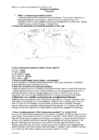
There are six large areas of temperate grassland: the Pampas in South America, the Veld in Africa, the Canterbury Plains in New Zealand, the Murray-Darling Basin in Australia, the Prairies in North America and the Steppes in Central Asia. 2. Colour the distribution of temperate grassland on the map. 3. How is temperate grassland called in these regions? Eurasia - steppe Hungary - puzda North America - prarie South America - pampa South Africa - veldt 4. What is forest steppe (forest steppe – metsastepp)? A forest steppe is a temperate-climate ecotone and habitat type composed of grassland interspersed with areas of woodland or forest. 5. Describe the climate of temperate grassland. Temperate grasslands have a temperate continental climate, which is cooler than savannas. Temperate grasslands have warm, humid summers with an average temperature of 18° C and cool, dry winters with an average temperature of 10° C. Most of the rain falls as
and severe climate. Canada extends across the continent of North America, from Newfoundland on the Atlantic coast to British Columbia on the Pacific coast and northward into the Arctic Ocean. Canada shares land borders with the United States to the south and north-west. Canada is a land of great variety. Towering mountains, crystal-clear lakes, and lush, green forests make Canada's far west a beautiful region. Farther inland, fields of wheat and other grains cover Canada's vast prairies. Thes fertile farmlands contrast vividly with the Arctic wastelands to the north. Most of the largest towns and industrial areas lie near the Great Lakes and the St Lawrence River in central Canada. In the east, fishing villages and sandy beaches dot the Atlantic coast. Across the country, Canadians experience many different landscapes from rolling plains and mountains to the cold tundra of the north.
Estonia. Estonia, officially the Republic of Estonia is a country in Northern Europe. It is the smallest of the three Baltic countries. Estonia has land borders with Latvia (339 km) to the south and Russia (229 km) to the east. It is separated from Finland in the north by the narrow Gulf of Finland and from Sweden in the west by the Baltic Sea. Estonia has been a member of the European Union since May 1, 2004 and of the NATO since March 29, 2004. The area of Estonia is about 45000 square kilometres and the population is about 1.4 million people
Estonia was also shaped by the continental ice and the melting water. The land is rising 25 cm every one hundred years. In folklore, many features of the relief are explained by the activities of giants such as the legendary national hero Kalevipoeg. The Haanja and Otepää Uplands are particularly rich in Hills. It is here that You find Big Egg Hill, the highest point in the Baltic states with 318 metres above sea level. 4. Land regions The northern coast features a steep limestone bank, the Baltic glint, which is one of the world's most important denudations of Ordovician sedimentary rocks. The glint rises to its highest point (56m) at Ontika. Estonia has over 1,500 islands. The largest of them are Saaremaa, Hiiumaa, Muhu and Vormsi. There are over 1,400 lakes in Estonia, biggest being Lake Peipsi and Lake Võrtsjärv, while the deepest is Rõuge Suurjärv. The two longest rivers are the Võhandu and the Pärnu and the widest is Emajõgi
Ireland Position Ireland is the third largest island in Europe, and the twentieth largest island in the world. It lies to the northwest of Continental Europe and is surrounded by hundreds of islands. To the east of Ireland, separated by the Irish Sea, is the island of Great Britain. Politically, the Republic of Ireland (also known simply as Ireland) covers five sixths of the island, with Northern Ireland, part of the United Kingdom, covering the remainder in the northeast. Climate Overall, Ireland has a mild, but changeable, Oceanic climate with few extremes. The warmest recorded air temperature was 33.3 °C at Kilkenny Castle, County Kilkenny on 26 June 1887, where as the lowest recorded temperature was 19.1 °C at Markree Castle, County Sligo on 16 January 1881. Inland areas are warmer in summer, and colder in winter there are usually around 40 days of below freezing
V. Jannsen. It was officially adopted after the War of Independence in 1920.The same melody with different words is also Finland's national anthem. The current coat of arms of Estonia is a golden shield which includes three slim, blue leopards (or lions) in the middle, with oak branches along the side of the shield. It originates from Denmark. It was officially adopted in 1925. Geography Estonia is the northernmost of the three Baltic States. It is located on the northern hemisphere on the eastern shores of the Baltic Sea in the north-east of Europe. It has land contact with Russia from the east and Latvia from the south. In the north The Gulf of Finland separates Estonia from Finland. The Gulf of Riga is situated to the south-west. Estonia has more than 1500 islands. The biggest ones are located to the west. The four biggest islands are Saaremaa, Hiiumaa, Vormsi and Muhu. The highest point in Estonia and also in the Baltic region is Suur Munamägi. It is 318
The national anthem of the United States is "The Star-Spangled Banner", with lyrics written in 1814 by Francis Scott Key. There are 6 time zones. From east to west they are: Eastern Standard Time, which is 5 hours behind Greenwich Time, Central Standard Time, Mountain Standard Time, which is 7 hours behind Greenwich Time, Pacific Standard Time. Alaska and Hawaii have their own time zones: Alaska Standard Time and Hawaii Standard Time. Geographical Position The USA lies in the Northern Hemisphere in North America. It covers a big part of the continent and is also the third largest country in the world. The country consists of 50 states, but two of them lie separately. One of them is Alaska, which is near the Arctic Circle. And the other state is Hawaii, which is a group of island is the Pacific Ocean. The USA shares the border with Canada in the north and Mexico in the south. In the east the coast is washed by the Atlantic Ocean and in the west by the Pacific Ocean
Introduction Estonia, officially the Republic of Estonia (Estonian: Eesti or Eesti Vabariik) is a country in the Baltic region of Northern Europe. It is bordered to the north by Finland across the Gulf of Finland, to the west by Sweden across the Baltic Sea, to the south by Latvia (343 km), and to the east by the Russian Federation (338,6 km). The territory of Estonia covers 45,227 km² and is influenced by a temperate seasonal climate. The Estonians are a Finnic people closely related to the Finns, with the Estonian language sharing many similarities to Finnish. The modern name of Estonia is
It is also part of the Western United States and of the Mountain West states. It is the sixth largest and the 14th most populous of the 50 states. Its capital and largest city is Phoenix. Arizona is one of the Four Corners states. It borders with New Mexiko, Utah, Nevada, California, and Mexico, and one point in common with the southwestern corner of Colorado. Climate Southern Arizona is known for its desert climate, with very hot summers and mild winters. Northern Arizonafeatures forests of pine, Douglas fir, and spruce trees; the Colorado Plateau; some mountain ranges (such as the San Francisco Mountains); as well as large, deep canyons, with much more moderate summer temperatures and significant winter snowfalls. There are ski resorts in the areas of Flagstaff, Alpine, and Tucson. In addition to the Grand Canyon National Park, there are several national forest, national parks, and nation monuments.
The Prime Minister is really the head of government in Canada. Stephen Harper is currently the PM. National symbols. The use of the maple leaf as a Canadian symbol dates back to the early 18th century, and is on its current and previous flags, the penny, and on the coat of arms. The national colours are red and white which also appear on the flag. The national animal is the beaver and it is because the fur trade. Maple syrup is very important for Canadians also. Hockey is the official winter sport. Canada's official colours are red and white. The colours appear on the flag. History. Almost a thousand years ago men from Norway sailed across the Atlantic Ocean and "discovered" America about 4 centuries before Columbus. In 985 AD Vikings who wanted to go to Greenland from Iceland were blown off their course and they reached Canada. It is thought that they reached Labrador. They saw forested areas there and further exploration were encouraged by this discovery because the
for Antarctica that is all on the southern hemisphere. Its name means ,,Southland". The official name of the country is the Commonwealth of Australia. It's capital is Canberra. Australia is the sixth largest country in the world but the smallest continent. Australia has 6 states and 2 territories (New South Wales, Victoria, Tasmania, Queensland, Western Australia , South Australia, The Australian Capital Territory and the Northern Territory). The Australian people are culturally the same as the Anglo Americans. There also live aborigines. Aborigines are the ancestors of the people. Like the US and Canada, Australia was an English speaking colony of Great Britain. Today Australia is a modern developed country with a diversified economy. Australia is an island continent of 7.7 million square kilometres, which makes it a little smaller than the USA.
Scotland ! Scotland (Gaelic: Alba) is a country in northwest Europe that occupies the northern third of the island of Great Britain. It is part of the United Kingdom, and shares a land border to the south with England. It is bounded by the North Sea to the east, the Atlantic Ocean to the north and west, and the North Channel and Irish Sea to the southwest. In addition to the mainland, Scotland consists of over 790 islands including the Northern Isles and the Hebrides. Edinburgh, the country's capital and second largest city, is one of Europe's largest financial centres. It was the hub of the Scottish Enlightenment of the 18th century, which saw Scotland become one of the commercial, intellectual and industrial powerhouses of Europe. Scotland's largest city is Glasgow, which was once one of the world's leading industrial metropolises, and now lies at the centre of the Greater Glasgow conurbation which
Immigrants are constantly crossing the border illegally. Every day about 2,000 of them are captured and sent back, but may others get through. There are also two states that are not connected to the continental United States. They are Alaska and Hawaii. There are two mountain ranges in the continental Unitet States: the Appalachians in the east and the Rockies in the west. In the very middle of the continent is the Mississippi River. Almost all the rivers between the mountains flow into the Mississippi. Along the border with Canada, there are five big lakes, called ,,the Geat Lakes". Climate Pacific Ocean moderates west coast temperatures. Mild summers, cool winters, much rain on northwest coast. Warm and dry in summer, mild with some rain rest of the year on California coast. Inland Southwest mostly dry with warm summers and cold winters. Warm summers, cold winters, moderate precipitation on northeast and north-central but warmer.
.............................................................................. 8 Population and Ethnicity..............................................................................................9 3 Introduction The official name of the country is the United Kingdom. The United Kingdom is an island country. It consists of the island of Great Britain and Northern Ireland. Great Britain can be divided into three parts England, Wales and Scotland. Each of them has their own capital city. Glasgow in Scotland, Cardiff in Wales and London in England. The country is situated in the north-western Europe. The territory of the United Kingdom is about 244,000 square kilometres and about 60 million people live there. The UK contains a number of small islands. The largest islands that belong to the United
range of other water sports. There are three large lakes and a multitude of smaller lakes less than 260 square kilometres each. Lesser Slave Lake (1,168 square kilometres) is northwest of Edmonton. The longest river in Alberta is the Athabasca River which travels 1,538 kilometres from the Columbia Icefield in the Rocky Mountains to Lake Athabasca. Edmonton is the most northerly major city in Canada, and serves as a gateway and hub for resource development in northern Canada. Alberta's other major city, Calgary is surrounded by extensive ranching country. Almost 75% of the province's population lives in the Calgary- Edmonton Corridor, in and between the two major cities. The Rocky Mountains along the southwestern boundary are largely forested. The southern quarter of the province is prairie, ranging from shortgrass prairie in the southeastern corner to mixed grass prairie in an arc to the west and north of it. The central aspen parkland region
Ireland is the third largest island in Europe. It lies in between the Atlantic Ocean and the Irish Sea. Politically it is divided into a sovereign state, the Republic of Ireland, that covers about five-sixths of the island (south, east, west and north-west), and Northern Ireland, which is part of the United Kingdom, covering the northeastern sixth of the island.[1] The name 'Ireland' derives from the name Ériu (in modern Irish, Éire) with the addition of the Germanic word 'land'. The population of the island is just under 6 million (2006); just over 4.2 million in the Republic of Ireland[2] (1.6 million in Greater Dublin[3]) and just over 1.7 million in Northern Ireland[4] (0.6 million in Greater Belfast[5])). Politics Politically, Ireland is divided into:
centres and its influence in politics, education, entertainment, media, fashion and the arts contributes to its status as a major global city. Central London is the headquarters of more than half of the UK's top 100 listed companies (the FTSE 100) and over 100 of Europe's 500 largest companies. The city is a major tourist destination for both domestic and overseas visitors, with annual expenditure by tourists of around £15 billion. London hosted the 1908 and 1948 Summer Olympic Games and will host the 2012 Summer Olympic Games. Samuel Johnson, author of the first complete dictionary, famously wrote about the city, citing "You find no man, at all intellectual, who is willing to leave London. No, Sir, when a man is tired of London, he is tired of life; for there is in London all that life can afford." Greater London contains four World Heritage Sites: the Tower of London; the historic settlement of Greenwich; the Royal Botanic Gardens, Kew; and the site
Võnnu Keskkool ESTONIA Referaat Autor: Klass : 9 Juhendaja: Võnnu 2013 Estonia officially the Republic of Estonia, is a state in the Baltic region of Northern Europe It is bordered to the north by the Gulf of Finland, to the west by the Baltic Sea, to the south by Latvia and to the east by Lake Peipus and Russia.Across the Baltic Sealies Sweden in the west and Finland in the north. The territory of Estonia covers 45,227km2 The Estonian climate resembles that of other countries on the Baltic littoral. On account of the country's proximity to the sea, the skies are often cloudy, and rain often falls in the spring and
however many Inuit find this term offensive. The word "Inuit" means "the people" in the Inuktitut language. Inuit Homes In the tundra, where Inuit communities are found, there are not many building materials. No trees grow in the tundra so houses can not be made from wood unless it is transported from elsewhere. However, during a large part of the year, the cold part, there is a lot of snow in the tundra. And it turns out that snow can be a very good construction material. In the winter, Inuit lived in round houses made from blocks of snow called "igloos". In the summer, when the snow melted, Inuit lived in tent-like huts made of animal skins stretched over a frame. Although most Inuit people today live in the same community year-round, and live in homes built of other construction materials that have to be imported, in the past Inuit would migrate between a summer and winter camp which was shared by several families. Getting Around
found in Alenquer, Coimbra and even Lisbon. THE PRE-ROMAN TRIBES OF ANCIENT PORTUGAL AND THEIR EXPANSION PATTERNS. The region of present-day Portugal was inhabited by Neanderthals and then by Homo sapiens, who roamed the border-less region of the northern Iberian peninsula. These were subsistence societies that, although they did not establish prosperous settlements, did establish organized societies. Neolithic Portugal experimented with domestication of herding animals, the raising of some cereal crops and pluvial or marine fishing. Early in the first millennium BC, several waves of Celts invaded Portugal from central
 annaabi.ee