Leidsid 33 sarnast õppematerjali, mis on seotud failiga "Lake Võrtsjärv". Need materjalid aitavad sul teemat sügavamalt mõista.
võrtsjärv, fishhore, riverouthern, part, rural, flows, algae, emajõgi, eastern, islandand, year, animal, fishes, animals, other, countyurface, place, thick, total, rise, average, reed, yellow, greenpecies, catchhallow, peipsi, located, different, border, islands, mostly, tondisaar, permanent, while, duringandy, lies, between, alongTallinn 2007 FACTFILE Area: 45 228 sq km Poplulation: under 1.4 million Capital: Tallinn Language: Estonian Currency: Eesti kroon (EEK) Main religion: Lutheran National holiday: 24 February (anniversary of the republic) National flower: Cornflower National bird: Barn Swallow National stone: Limestone LOCATION The Republic of Estonia is the northernmost and smallest of the three Baltic States. It is located on the eastern shores of the Baltic Sea in the north east of Europe. To the east the country borders Russia. Latvia is the countries neighbour to the south. From the west the coast of Estonia is washed by the Baltic Sea and from the north by the Gulf of Finland. The length of the coastline is approximately 3 800 km. The longest distance from east to west is 350 km, while north to south Estonia stretches 240 km. THE NAME The name EESTI was apparently derived from the word AISTI, the
V. Jannsen. It was officially adopted after the War of Independence in 1920.The same melody with different words is also Finland's national anthem. The current coat of arms of Estonia is a golden shield which includes three slim, blue leopards (or lions) in the middle, with oak branches along the side of the shield. It originates from Denmark. It was officially adopted in 1925. Geography Estonia is the northernmost of the three Baltic States. It is located on the northern hemisphere on the eastern shores of the Baltic Sea in the north-east of Europe. It has land contact with Russia from the east and Latvia from the south. In the north The Gulf of Finland separates Estonia from Finland. The Gulf of Riga is situated to the south-west. Estonia has more than 1500 islands. The biggest ones are located to the west. The four biggest islands are Saaremaa, Hiiumaa, Vormsi and Muhu. The highest point in Estonia and also in the Baltic region is Suur Munamägi. It is 318. above sea level.
of nature. Since the Northern Crusades Estonia became a battleground for centuries where Denmark, Germany, Russia, Sweden and Poland fought their many wars over controlling the important geographical position of the country as a gateway between East and West. Being conquered by Danes and Germans in 1227, Estonia was ruled initially by Denmark in the north, by the Livonian Order, an autonomous part of the Monastic state of the Teutonic Knights and Baltic German ecclesiastical states of the Holy Roman Empire. From 1418–1562 the whole of Estonia was part of the Livonian Confederation. After the Livonian War, Estonia became part of the Swedish Empire from the 16th century to 1710/1721, when it was ceded to the Russian Empire as the result of the Great Northern War. Throughout this period the Baltic German nobility enjoyed autonomy,
County and Poruni in Ida- Virumaa County. Meadows in Estonia are rich in different species much more so than in Western Europe. Estonia is a country of thousand of lakes. In the Estonian territory there are about 1200 natural lakes. The largest of these is Lake Peipsi, which is the fourth largest freshwater lake in Europe. Most of Estonia's lakes are small and are found in the south of the country. Larger lakes such as Lake Peipsi and Lake Võrtsjärv are rich in fish. One can find rare species of fish such as the lake whitefish and the Peipsi smelt in Lake Peipsi. Võrtsjärv is famous for its catches of pike-perch and eel, which are regarded as a delicacy. There are also many rivers in Estonia, but only ten of them are longer than 100 kilometres. The most important rivers are the Pärnu River and the Emajõgi River. Estonia has more than 1 500islands. The largest of these is Saaremaa,. Saaremaa is followed
Estonia is a small country in Northern Europe with an area of about 45 000 sq km. The country's climate is determined by the proximity of the Atlantic Ocean. The summer temperatures are a little lower than the average of that latitude, but the winters are considerably warmer. As a part of the East-European Plain, the country has a rather flat surface. The highest and most topographically variagated region in Estonia is in the south-eastern part of the country. The Sakala Upland plains offer contrast to the hills of Ottepää, Karula and Haanja. At 318 metres, Suur Munamägi ('Great Egg Hill') is not only the highest point in Estonia, but of all the Baltic countries. The country has 3974 km of coastline, while the land border, in comparison, is only a mere 633 km. The coast varies from limestone cliff in the north to sandy beaches in the west. Most of Estonia's many islands belong to the West Estonian archipelago. The largest islands
Quebec. 2. Geographical position Canada is a huge country in the continent of North America. It is bordered with the Atlantic Ocean in the east, the Pacific Ocean in the west, the United States of America in the south and the Arctic Ocean in the north. Canada is a vast country, with a territory of 3.8 million square miles of land and fresh water it is the second biggest country in the world after Russia. Canada covers most of the northern part of North America. Canada has over 151,480 miles of coastline. Most of Canada's human population lives along its southern border. 3. Relief Canada's geography is very diverse. It has huge lakes, evergreen forests, prairies, meadows and beautiful mountains. There are thousands of miles of coastline with beaches, fjords and wild rivers flowing to the oceans. Canada is a country of wide open spaces and beautiful
as polyp. There are more than 300 varieties of coral, which is a ultimate dream of every shell- collector. There are undersea observations, glass-bottomed boats and water scopes for undersea viewing, as well as skin-diving equipment. The Great Barrier Reef is and ideal place for a sunny holiday. The relief: Australia is an old and low continent with simple relief. Plains cover the greater part of the land. Most of the rocks have turned into sand and there are big sand deserts on the Western Plateau. In the centre of Australia are lowlands which are covered with sedimentary rocks. Deserts cover most of the land in Australia. Most of the deserts lie in the central and north-western part of the country. The deserts in Australia occupy 18% of the continent. The biggest deserts are the Great Victory Desert, the Great Sandy Desert, the Tanami Desert, the
Much of the area is covered with farms producing large quantities of wheat and other grains. The region is also rich in oil and natural gas. Northern Saskatchewan and Manitoba are covered by the Great Canadian Shield a rocky landscape with lakes, rivers and forests. The Canadian Shield is a vast horseshoe-shaped region. It curves round Hudson Bay from the Arctic coast of the Northwest Territories to the coast of Labrador, the mainland part of Newfoundland. The Canadian Shield covers about half of Canada and is made up of extremely ancient rock. The Canadian Shield mostly consists of eroded hilly terrain and contains thousands of lakes. These lakes are the sources of rivers that break into great rapids and waterfalls used for hydroelectric production, providing power for pulp and paper mills, and a variety of other industries. Relatively few people live in the Canadian Shield because of its poor soil and cold climate
Estonia lies on the eastern shores of the Baltic Sea on the level northwestern part of the rising east European platform. Estonia is a flat country covering 46 226 square kilometers.Estonian's neighbours are Finland, Sweden, Latvia and Russia. Estonia is rich in islands. The two largest are Saaremaa and Hiiumaa . Saaremaa is famous for its big meteorite crater called Kaali and Hiiumaa is famous for its nature and plants. The countries highest point Big Egg hill ( Suur- Munamägi) reaches 318 meters above sea level. Estonia has many uplands too
Recently a black coral was found. Tourists visit it because it is beautiful, relaxing and interesting. Lakes The big lakes of the desert area are dry most of the time. Enormous Lake Eyre (70km wide, 130km long) was dry for a hundred years until 1950. Lake Eyre is the lowest place in Australia. It is 16 meters below sea level. Other bigger lakes are Lake Disappointment, Lake Mackay, and Lake Carnegie in the western part. Lake Torrens, Lake Gairdner and Lake Eyre in the southern part. Rivers The biggest river is the Murray. The other biggest rivers are the Mitchel and the Flinders. Other rivers are short and have water only after rains. The Climate Australia stretches from the tropics to the temperature region. It is a hot and dry country. The northern part has a hot tropical climate with heavy rainfall. It has two seasons - wet summer and dry winter. The south and the east of Australia have warm summers and winters. The southeastern coast gets rains all year around
Canada is also the most tolerant societies in the world because only 13% of Canadians say that they would object their children marrying somebody of a different race, compared with 32% in the USA. Canada's political structure is independent constitutional monarchy and head of state is Elizabeth ll. The prime minister is Stephen Harpen. The important historical dates are: In 1608 Frenchman Chaplain established New France in Quebec. In 1759 Canada became part of the British Empire. In 1867 the Confederation of Canada was set up. In 1931 Canada became independent from Britain. Canada has a very high standard of living. It is also ranked number one on the UN ´Human Development Index´. The country is particularly advanced in areas of health, education, social protection and human rights. There are also many things that make Canada attractive for tourists. Many visitors to the country come for activity holidays
The Prime Minister is John Howard. Currency- Australian dollar. Relief Australia has a variety of landscapes. The Great Australian Bight lies in the south of Australia. The Gulf of Carpentaria is between the Arafura Sea and Cape York. The Bass Strait separates the island of Tasmania from the mainland of Australia. The Great Barrier Reef is in the north-east of Australia, between the Coral Sea and the mainland. The western part of Australia is covered with deserts. Most of the rocks have turned into sand. The biggest of them is the Great Sandy Desert, which lies in the north of Western Australia. The Gibson Desert is in the middle of Western Australia. The Victoria Desert is in the south of Western and South Australia. The Tanami Desert is in the west of the Northern Territory. The Simpson Desert is in the south-east of the Northern Territory. The Great Dividing Range runs along the eastern coast of Australia.
Tallinn Tallinn is the capital of Estonia. Toompea is the historical heart of the city. Tallinn was inscribed in the UNESCO World Heritage List in 1997. The Kadriorg Palace It was built by Italian architect Niccolo Michetti. For Peter the Great of Russia in 1718. the Office of the President. Top ten places to visit in Estonia Lake Peipsi It is the forth largest lake in Europe Its in the border of Estonia, Russia and Eastern Europe. It is ideal for fishing and recreation. Suur Munamägi Is the highest peak in Estonia (and the Baltic states), reaching 318 meters above sea level. The tower is 29.1 metres (95 ft) high. The landscape around the peak the Haanja Upland. Top ten places to visit in Estonia Soomaa National Park It is a large park in Estonia (400 km2) Water from the nearby Sakala uplands can during the spring time melting
mountain peaks. There are two big mountain ranges, one of them is the Rocky Mountains and the other is The Appalachian Mountains. The Capital of The USA is Washington D.C. Other big and famous cities are New York, Los Angeles, Houston, Chicago and Las Vegas. The national anthem of the United States is "The Star-Spangled Banner", with lyrics written in 1814 by Francis Scott Key. There are 6 time zones. From east to west they are: Eastern Standard Time, which is 5 hours behind Greenwich Time, Central Standard Time, Mountain Standard Time, which is 7 hours behind Greenwich Time, Pacific Standard Time. Alaska and Hawaii have their own time zones: Alaska Standard Time and Hawaii Standard Time. Geographical Position The USA lies in the Northern Hemisphere in North America. It covers a big part of the continent and is also the third largest country in the world. The country consists of 50 states, but two of them lie separately
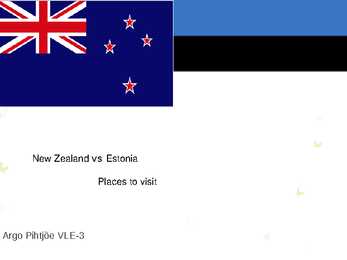
Other ethnic groups have arrived from Polynesia (Tonga, Samoa, Cook Islands) with Auckland now being the Polynesia capital of the South Pacific. People from China, Taiwan, Korea, Vietnam, etc have also settled in New Zealand making for a diverse population mix. History : New Zealand was one of the last corners of the planet to be inhabited by people. Around 950AD the Maori arrived from Polynesia (Tonga and Hawaii) to the northern part of the North Island. There is however evidence of earlier settlement by other more peaceful Polynesian people. After the dutch sailor Abel Tasman visited New Zealand and named it Zeeland, more and more settlers arrived, conflicts over land led to several wars between the British and Maori in the North Island. The South island remained rather peaceful until gold was found there and thousand of people hurried there to look for gold.
being the Gulf of Finland, the Gulf of Riga and the Gulf of Pärnu. Bays include the Narva Bay, Matsalu Bay, Kolga Bay, Kunda Bay, Tallinn Bay etc. Estonia has over 1500 islands, the largest being Saaremaa and Hiiumaa, Muhu and Vormsi. Saaremaa and Muhumaa are connected to each other with a bridge. The best- known smalles islands are Naissaar, Aegna, Ruhnu, Kihnu, Väike-Pakri, Suur-Pakri etc. 3. Relief Lying in the north-western part of the East-European Plain, Estonia is mostly flat with an average elevation of about 50 metres above sea level. South-eastern and eastern parts of Estonia are higher than the western parts. The relief of the present-day landscape was shaped during the Ice Age. Ice sheet has carried large boulders and limestone blocks here, not to mention that the hilly terrain in Estonia was also shaped by the continental ice and the melting water. The land is rising 25 cm every one hundred years
m²) and 179,584 islands to be precise. One of these lakes, Saimaa, is the fifth largest in Europe. The Finnish landscape is mostly flat with few hills and its highest point, the Halti at 1,324 metres, is found in the extreme north of Lapland at the border between Finland and Norway. The landscape is covered mostly (seventy-five percent of land area) by coniferous taiga forests and fens, with little arable land. The most common type of rock is granite. It is a ubiquitous part of the scenery, visible wherever there is no soil cover. Moraine or till is the most common type of soil, covered by a thin layer of humus of biological origin. The greater part of the islands are found in southwest in the Archipelago Sea, part of the archipelago of the Åland Islands, and along the southern coast in the Gulf of Finland. Finland is one of the few countries in the world whose surface area is still growing.
Project ESTONIA MAP OF ESTONIA Southern Viljandimaa The southern part of Viljandi county catches the eye with its sublime scenery. The area today lies in the very heart of the historical Mulgimaa the home of hills, deep valleys and lakes brought together by a beauty spot Halliste primeval valley. According to several folk tales, it is also in these valleys, woods and bogs that Old Nick found refuge.The great variety displayed in the nature is also reflected in the local cultural heritage
There are also the Atlantic Ocean, the Pacific Ocean and the Gulf of Mexico surrounding the big country. There are 50 states in America. Most of the people live in towns. The biggest state is Alaska; next by size are California, Alaska and Montana. Six states - Maine, Vermont, New Hampshire, Connecticut, Rhode Island and Massachusetts are called New England. They are all small states in the USA that lie in the north- east. The first colony of immigrants settled down in Virginia, in the eastern part of the USA. 3. Relief The USA is situated in the central part of the North American continent. Its western coast is washed by the Pacific Ocean and its eastern coast is washed by the Atlantic Ocean and in the south its coast is washed by the Gulf of Mexico. The coastline is even. There are no big islands belonging to the USA except the Hawaiian Islands which lie halfway the continents of America and Asia. The biggest peninsulas are the Florida Peninsula and Alaska. 4. Land Regions Mountains
region, because there is enough food. The savannas which are grasslands with some trees are mostly in the west. Farther west are the bushlands. The real deserts occupy the centre of the Western Plateau. In the very south west there are thin forests of evergreens trees. Australia is the driest inhabited continent, the flattest, and has the oldest and least fertile soils. Only the south-east and south-west corners of the continent have a temperate climate. The northern part of the country, with a tropical climate, has vegetation consisting of rainforest, woodland, grassland, mangrove swamps and desert. Climate is highly influenced by ocean currents, including the El Niño southern oscillation. 4. Land regions Mountains The Great Dividing Range runs along the Pacific ocean. These mountains are very old and much of worn down but the Australian Alps are the highest of them. The highest top Mount Kosciusko is 2228 metres above sea level
The folk have divided Setomaa into twelve parts, or communities (nulk). Names for the communities have been derived either from the central village or settlement: e.g. Irboska nulk or from the peculiarity of location. Names were also based on other features: e.g. Kohopiimänulk - implying at the local tradition of making cottage cheese ( kohopiim is a sort of cottage cheese). In the autumn of 1921 Seto people were for the first time ever given surnames. Since 1944,the western part of Setomaa belongs to the Republic of Estonia and the eastern part to the Russian Federation. This kind of division is the source of the Setos' burning problems: the split-up congregations, location of properties and relatives on the other side of the state border. The Setos have preserved their original dialect, skills of cooking their traditional food, their beautiful and peculiar folk costumes. The most attractive decoration to go with the folk costume is
coast is washed by Great Australian Bight and the Indian Ocean. In the northeast the Coral Sea washes the coasts and in the southeast there is the Tasman Sea which also separates Australia from New Zealand. The biggest island is Tasmania which is located to the south of the country. 3 Relief Australia is a flat and old continent. Its average height is 274 m above sea level. Its relief is pretty simple – plains cover the greater part of it. Basically one third of its area is covered by deserts and plains. Biggest deserts and plains are: the Great Sandy Desert, the Gibson Desert, the Great Victoria Desert and the Nullarbor Plain. They are also called as the Western Australian Shield. The Nullarbor Plain is an uninhabited limestone plateau. It is characterized by amazing cave and tunnel systems, which contain valuable information about ancient Australia. The east is the mountainous part of the country
ENGLAND General overview England is part of the United Kingdom Land borders with Scotland to the north and Wales on to the west The English Channel on south separates it form continental Europe The country includes over 100 smaller islands Capital and largest city is London Its has consitutional monarchy Monarch is Elizabeth II Total area is 130,395 km2 Population is 51,446,000 million, around 84% of the population of the UK Currency is Pound stearling(GBP) Has left-hand traffic Patron saint is ST. George
the world's supply of accessible fresh water. Much of this water is stored in lakes and wetlands that cover about one-fifth of Canada's total area. The Great Lakes--the world's largest surface of fresh water--are shared with the United States and form part of the international border. Other large lakes include Great Bear and Great Slave lakes in the Northwest Territories and Lakes Manitoba and Winnipeg in Manitoba. Mackenzie River is Canada's longest river, which flows 4,241 km from its source to its mouth. With its many tributaries, it drains 1,800,000 square km. The St. Lawrence is the largest river flowing into the Atlantic Ocean. Its drainage basin includes the Great Lakes, forming an inland navigable waterway extending some 3,765 km into the heart of the continent. The longest Pacific-draining river that is wholly within Canada is the Fraser. The Yukon and Columbia rivers, which both rise in Canada,
dialect, dressing, folk songs and wedding customs. Saaremaa is the largest island in Estonia and is characterized by rare plants, windmills, thatched roofs, stone fenches and the hospitality of the local people. The islanders hold on to old traditions and take pride in their folklore. A road spans the strait between Saaremaa and Muhumaa. The biggest city on Saaremaa, Kuressaare, is a quiet green town with friendly unpolluted environment and it has been the biggest port trade centre. The old part of the town has been well restored in Baroque architecture style. Its sights include the Town Hall, the Episcopal castle and a Town Park with a wide variety of plants, trees and bushes. Lake Kaali is one of the best-preserved meteorite craters in Europe, formed 3,500 years ago. Vilsandi National Park protects the ecosystem with its seabirds and coastal plant communities. The Viidumäe Nature Reserve has some carefully protected rare plant species.
General facts Tennessee is a state located in the Southern United States. In 1796, it became the sixteenth state to join the Union. The capital city is Nashville, and the largest city is Memphis. Tennessee has 95 counties. The earliest variant of the name that became Tennessee was recorded by Captain Juan Pardo, the Spanish explorer, in 1567 while traveling inland from South Carolina. History The area now known as Tennessee was first settled by Paleo-Indians nearly 11,000 years ago. When Spanish explorers first visited the area (led by Hernando de Soto) in 15391543, it was inhabited by several tribes (Muscogee, Yuchi people). As European colonists spread into the area, the native populations were displaced to the south and west. Many battles were fought in the state, for example in 1862 and 1863. Symbols The official state flag of Tennessee was adopted on the 17th of April in 1905. The three white stars in the center symbolize the three different geographical regions of Tennessee. Th
occasional "Chinook", a warm dry wind from the Rocky Mountains that gusts through and melts the snow. Winters are mild and wet on the west coast, in cities such as Vancouver and Victoria. Territories and provinces Canada consists of 3 territories and 10 provinces. Very few people live in the territories, but it has more power on deciding important questions. Newest territoy is Nunawut, it became a territory in 1999. It was created from the eastern part od North- West territories. Quebec and Ontario are the biggest provinces. In the central part of Canada there are prairies and agriculture is very common. Alberta is rich in natural resources such as oil and natural gas. In Quebec and Ontario are many manufactories and industries. In the west there is maritime climate and so they fish and ship there. Toronto is the biggest city in Canada, with a population of 5,1 million people. It is
The southern quarter of the province is prairie, ranging from shortgrass prairie in the southeastern corner to mixed grass prairie in an arc to the west and north of it. The central aspen parkland region extending in a broad arc between the prairies and the forests, from Calgary, north to Edmonton, and then east to Lloydminster, contains the most fertile soil in the province and most of the population. Much of the unforested part of Alberta is given over either to grain or to dairy farming, with mixed farming more common in the north and centre, while ranching and irrigated agriculture predominate in the south. The Alberta badlands are located in southeastern Alberta, where the Red Deer River crosses the flat prairie and farmland, and features deep gorges and striking landforms. Dinosaur Provincial Park, near Brooks, Alberta, showcases the badlands terrain, desert flora, and remnants from
The United States of America Geography The United States of America is situated in the central part of the North American continent. Its western coast is washed by the Pacific Ocean, and its eastern coast by the Atlantic Ocean and the Gulf of Mexico. It borders on Canada in the north and on Mexico in the South. The U.S.A. consists of 51 states and the District of Columbia. The state of Alaska is separated from the rest of the U.S.A. by Canada. Hawaii, which became the fiftieth state in 1959, is in the Pacific Ocean, halfway between the continents of America and Asia. The area of the United States of America is over nine million square kilometres. The
wood-burning. Hydroelectricity was the next largest renewable source, providing 3% (15% of global electricity generation),followed by solar hot water/heating, which contributed 1.3%. Modern technologies, such as geothermal energy, wind power, solar power, and ocean energy together provided some 0.8% of final energy consumption. While there are many large-scale renewable energy projects and production, renewable technologies are also suited to small off-grid applications, sometimes in rural and remote areas, where energy is often crucial in human development.Kenya has the world's highest household solar ownership rate with roughly 30,000 small (20100 watt) solar power systems sold per year. Some renewable energy technologies are criticised for being intermittent or unsightly, yet the market is growing for many forms of renewable energy. Climate change concerns coupled with high oil prices, peak oil and increasing government support are driving increasing renewable energy
Geography The name Australia means ,,southland". It is both a country and a continent, with an area of 7,617,930 square kilometres and it is also an island, separated from Asia by the Arafura and Timor seas. But Australia is also surrounded by the Indian and Pacific oceans. The Great Barrier Reef is the world's largest coral reef. It lies off the north-eastern coast and extends for over 2000 kilometres. The famous mountain range in the eastern part of Australia is the Great Diving Range and it's highest peak is Mount Kasciusco's 2230m. In the continental part, there are the Macdonnell ranges. Other smaller mountain ranges are the Musgrave Mountains, the Hammessley Mountains and the Darling Mountains. The continental part of Australia is mostly covered with deserts and these deserts are the Great Sandy Desert in the north-western part, the Great Victoria dessert in the southern part and Gibson desert and the Simpson desert
CANADA Canada is a vast country, second largest country of the world after Russia. It stretches from the Atlantic Ocean in the east to the Pacific Ocean in the west and to the Arctic Ocean in the North. Canada Covers most of the northern part of North America and its geography is very diverse. Canada's area is about 10 million square kilometers and its population is 31 000 000. Its capital is Ottowa and other main cities are Toronto, Montreal and Vancouver. Almost 75 % of canadians lives within 300 kilometer of the USA border, because the climate is softer in the South. 89 % of Canada is almost unhabited. Its official languages are English and French, but many other languages are spoken too
explored, and later settled along, the Atlantic coast. France ceded nearly all of its colonies in North America in 1763 after the Seven Years' War. In 1867, with the union of three British North American colonies through Confederation, Canada was formed as a federal dominion of four provinces. It is a bilingual and multicultural country, with both English and French as official languages. Geography: Covering most of the northern part of the North American continent and with an area larger than that of the United States, Canada has an extremely varied topography. In the east, the mountainous maritime provinces have an irregular coastline on the Gulf of St. Lawrence and the Atlantic. The St. Lawrence plain, covering most of southern Quebec and Ontario, and the interior continental plain, covering southern Manitoba and Saskatchewan and most of Alberta, are the principal cultivable areas. They are