Leidsid 33 sarnast õppematerjali, mis on seotud failiga "Kanada preeria provintsid". Need materjalid aitavad sul teemat sügavamalt mõista.
prairies, different, black, grass, trees, comprise, states, alberta, covers, square, live, region, known, north, names, year, summers, cold, humans, almost, biggest, calgary, winnipeg, wheat, barely, rich, fauna, bear, badger, mule, deer, flora, mostly, tall, bushes, spruce, extinction, widespread, thanksTallinna Inglise Kolledz Canada. The land of diversity. Tallinn 2006 Canada. If you had to use two words to describe Canada, they might be large and diverse. Canada is the second largest country in the world with a territory of about 10 million square kilometers and it is bordered by three oceans: the Arctic, the Pacific and the Atlantic Oceans. The population of Canada is about 31 million people. About 77% of the people live in cities which lie in a band about 100 miles wide above the border of the United States. The capital of Canada is Ottawa. Other large cities are Montreal, Toronto, Vancouver, Winnipeg and Quebec. Canada has two official languages English and French
Regions in Canada Canada is divided into five major regions. The Pacific Region The Pacific Region consists of only one province - British Columbia. It is known for its mild coastal climate, forests and the Rocky Mountains. The Rocky Mountains are the youngest and the highest mountains in Canada. Largest cities are Vancouver and Victoria. Only 5% of The Pacific Region is inhabitable. The Prairie Provinces The Prairie Provinces consists of Alberta, Saskatchewan and Manitoba provinces. Population in that region is about 5.7 million people. The precipitation in The Prairie Provinces is very low only 400 mm per year. The biggest cities are Calgary, Winnipeg and Saskatoon. The Prairie Provinces focus on farming. 95% of the land in that region has been converted into farmland. Mostly wheat and other grains are produced. Cattle and sheep ranching is also part of the agriculture. The
CANADA Canada is a vast country, second largest country of the world after Russia. It stretches from the Atlantic Ocean in the east to the Pacific Ocean in the west and to the Arctic Ocean in the North. Canada Covers most of the northern part of North America and its geography is very diverse. Canada's area is about 10 million square kilometers and its population is 31 000 000. Its capital is Ottowa and other main cities are Toronto, Montreal and Vancouver. Almost 75 % of canadians lives within 300 kilometer of the USA border, because the climate is softer in the South. 89 % of Canada is almost unhabited. Its official languages are English and French, but many other languages are spoken too. Like Italian, Chinese, German, Polish, Ukrainian, Dutch and Creek
The highest peak of Canada is Mount Logan, 5959 metres. The lowest point is sea level. The longest river is the Mackenzie. The climate and geography of Canada vary greatly from temperate in the south to arctic in the north and from islands and plains in the east to mountains in the west. Location Canada is located in the northern-most region of North America. It's geographical position in co- ordinates is 83°N north, 42°N south, 53°W east, 141°W west. Canada borders with United States of America by land; Pacific Ocean, Arctic Ocean and Atlantic Ocean by coastline. Canada is one of the largest countries in the world, second only to Russia in territorial size. It has a total area of 9.9 million square kilometers. This includes 755,170 square kilometers of water. Toronto is the largest city in Canada with a population of 4.3 million. Other major cities include Montreal (3.3 million people), Vancouver (1.8 million people). Located in the southeast corner of the nation,
Topic Canada Tallinn English College 2006 1. Introduction If you had to use two words to describe Canada, they might be large and diverse. Canada is the second largest country in the world with a territory of about 10 million square kilometers and it is bordered by three oceans: the Arctic, the Pacific and the Atlantic Oceans. The population of Canada is about 31 million people. About 77% of the people live in cities which lie in a band about 100 miles wide above the border of the United States. The capital of Canada is Ottawa. Other large cities are Montreal, Toronto, Vancouver, Winnipeg and Quebec. 2. Geographical position
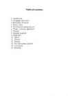
2. Geographical position 3. Mountains, lowlands 4. Rivers, lakes 5. The territories and provinces 6. Towns, economy, agriculture 7. Climate 8. Animals, plantlife 9. Population 10. Sports 11. Culture 12. History 13. Political system, symbols 14. Conclusion 15. Materials 1. Introduction If you had to use two words to describe Canada, they might be large and diverse. Canada is the second largest country in the world, bordered by three oceans, and across the country, Canadians experience many different landscapes from rolling plains and mountains to the cold tundra of the north. Despite Canada's great size, it is one of the world's most sparsely populated countries. This fact, coupled with the grandeur of the landscape, has been central to the sense of Canadian national identity. 2. Geographical position Canada is the second largest country in the world after Russia. In the Arctic, Canada reaches almost as far north as Greenland. To the south it extends to the same latitude
Canada. Canada is a very big country in the continent of North America. It is about 10 million square kilometres and that makes it the second largest country in the world after Russia. Quebec (the province) is six times as big as the UK. Canada borders the Atlantic Ocean, the Pacific Ocean, the Arctic Ocean and the USA. The capital of Canada is Ottawa and other main cities are Toronto, Montreal and Vancouver. It is a very developed country. Montreal is the largest city and it is called the Paris of North America because most of the people there speak French.
CANADA Geography Canada is the world's second largest country in total area after Russia , since it covers nearly 10 million square kilometres, but is one of the most sparsely populated, with only about 34 million inhabitants. The majority of them live within 300 kilometres of Canada's southern border. Much of the rest of Canada is uninhabited or thinly populated, because the country has a rugged terrain and severe climate. Canada extends across the continent of North America, from Newfoundland on the Atlantic coast to British Columbia on the Pacific coast and northward into the Arctic Ocean. Canada
Territory and landscape Canada is one of the largest countries in the world. It covers nearly 4 million square miles. It is dividend into ten provinces( British Columbia, Manitoba, New Brunswick, Alberta, Nova Scotia, Ontario, Prince Edward Island, Quebec, Saskatchewan, Newfoundland ) along with two territories( the Yukon, the Northwest territories ). The capital city is Ottawa. Canada is a country rich in forests. It borders in the south with The United States and it's surrounded in the west by the Pacific Ocean, in the east by the Atlantic Ocean and above by many smaller bays, but is also borderedd with Alaska in the north-west. To the north of
Tallinna Inglise Kolledz Topic United States of America Mari-Liis Pakats Tallinn 2007 2 Introduction..................................................................................................................4 Geographical Position..................................................................................................4 Geographical Regions..................................................................................................5 Climate ......................................
Alberta The capital of Alberta is Edmonton. The population is 3.7 million people and there are many nationalities. Besides English and French there are also immigrants from Scotland, Ireland, Wales, Germany, Ukraine and Scandinavia. In Edmonton and Calgary there are also historic Chinatowns, and Calgary has Canada's third largest Chinese community. Geographical features Alberta covers an area of 661,848 square kilometres, an area about 5% smaller than Texas or 20% larger than France. This makes it the fourth largest province after Quebec, Ontario, and British Columbia. To the south, the province borders on the 49th parallel north, separating it from the U.S. state of Montana, while on the north the 60th parallel north divides it from the Northwest Territories. To the east the 110th meridian west separates it from the province of
The largest lake which is at least partly in Canadian territory is Lake Superior Climate Canada's climate is as diverse as its landscape. Generally, Canadians enjoy four very distinct seasons, particularly in the more populated regions along the US border. Daytime summer temperatures can rise to 35°C and higher, while lows of -25°C are not uncommon in winter. More moderate temperatures are the norm in spring and fall. Summers can be hot and dry on the prairies, humid in central Canada, and milder on the coasts. Spring is generally pleasant across the country. Autumns are often crisp and cool, but brightened by rich orange and red leaves on trees. Winters are generally cold with periods of snow, although southern Alberta enjoys the occasional "Chinook", a warm dry wind from the Rocky Mountains that gusts through and melts the snow. Winters are mild and wet on the west coast, in cities such as Vancouver and Victoria. Territories and provinces
humid. They are also very short with about 50 to 100 frost free days. The total precipitation in a year is 300 - 850 mm 4. Connect the climate diagram and biome. Temperate grassland- vähe vihma, temp 20 ; Taiga- 20-15°C, kesk vihm. Rainforest: VÄGA PALJU VIHMA, temp 4-12 °C. ; Temperate deciduous forest: temp 20, kesk. vihm 5. Describe the soils of the. Temperate deciduous forest: Brown forest soils develop under the trees. Broadleaf trees tend to be nutrient-demanding and their leaves bind the major nutrient bases. The autumn leaf fall provides for an abundant and rich humus which begins to decay rapidly in spring just as the growing season begins. The humus content gives soil horizons a brown colour. Temperate rainforest: This forest has nutrient-rich soil because there is a lot of dead organic matter on the ground. This dead material is being slowly digested by the fungi, insects, and bacteria that live here
a colony in eastern Canada in the early 1600's. Great Britain gained control of the country in 1763 and thousands of British immigrants began to join the French who remained in Canada. Canada gained its independence from Britain in 1931. Position/area Canada is the second largest country in the world. Canada extends across the continent of North America, from Newfoundland to British Columbia. Over 5000 km of border separate Canada and the United States. Climate/Land The northern part of Canada has very long, cold winters. Over most of the rest of Canada the winter are longer and colder than in the United States. Only in the southern part and on the west coast is the climate as mild as in the western part of the United States. Towering mountains, crystal-clear lakes and green forests make Canada's far west a beautiful region. Fields of wheat and other grains cover Canada's vast prairies. Much of Canada is covered with forests
Tallinn English College CANADA Report Karin Kristen Tapupere 8.b Instructor: Tiiu Martma Intro: Canada is a country occupying most of northern North America, extending from the Atlantic Ocean in the east to the Pacific Ocean in the west and northward into the Arctic Ocean. It is the world's second largest country by total area and its common border with the United States to the south and northwest is the longest in the world. The land occupied by Canada was inhabited for millennia by various groups of Aboriginal people. Beginning in the late 15th century, British and French expeditions explored, and later settled along, the Atlantic coast. France ceded nearly all of its colonies in North America in 1763 after the Seven Years' War. In 1867, with the union of three British North American colonies through Confederation, Canada was
More than 6,000 miles of ocean separate in from the America. Australia is the only continent except for Antarctica that lies all south of the equator. The natural zones of Australia are very various. There are deserts, semi deserts, grasslands, savannas, bushlands and rainforests. The wet forests occupy the narrow region in the east. Most of the animals, birds and insects live in that region, because there is enough food. The savannas which are grasslands with some trees are mostly in the west. Farther west are the bushlands. The real deserts occupy the centre of the Western Plateau. In the very south west there are thin forests of evergreens trees. Australia is the driest inhabited continent, the flattest, and has the oldest and least fertile soils. Only the south-east and south-west corners of the continent have a temperate climate. The northern part of the country, with a tropical climate, has vegetation consisting of rainforest,
The taiga is located near the top of the world, just below the tundra biome. The winters in the taiga are very cold with only snowfall. The summers are warm, rainy, and humid. Some of the animals in the taiga hibernate in the winter, some fly south if they can, while some just cooperate with the environment. GrasslandsGrassland biomes can be found in the middle latitudes. They can have either moist continental climates or dry subtropical climates. There are two different types of grasslands; tall-grass, which are humid and very wet, and short-grass, which are dry, with hotter summers and colder winters than the tall-grass prairie. In the winter, grassland temperatures can be as low as -40° F, and in the summer it can be as high 70° F. There are two real seasons: a growing season and a dormant season. Deciduos forest The average annual temperature in a deciduous forest is 50° F. The average rainfall is 30 to 60 inches a year. In deciduous forests
Introduction The official name of the country is the United Kingdom. The United Kingdom is an island country. It consists of the island of Great Britain and Northern Ireland. Great Britain can be divided into three parts England, Wales and Scotland. Each of them has their own capital city. Glasgow in Scotland, Cardiff in Wales and London in England. The country is situated in the north-western Europe. The territory of the United Kingdom is about 244,000 square kilometres and about 60 million people live there. The UK contains a number of small islands. The largest islands that belong to the United Kingdom are the Isle of Man in the Irish Sea and the Isle of Wight which lies off of England's southern coast. The largest groups of islands are the Shetland Islands, the Orkney Islands and the Hebrides. Geographical Position The UK is situated in the Northern Hemisphere. The United Kingdom is bordered by the Atlantic Ocean in the west, the North
Tallinn English College Topic The United States of America Tallinn 2007 1. Introduction The United States of America's territory is over 3.7 million square miles (over 9.6 million km²) and population more than 300 million people. The capital city is Washington D.C. Although the United States has no official language at the federal level, English is the de facto national language. English is the most common language for daily interaction among both native and non-native speakers. Spanish is the second language. The largest city is the New York City. The Government is Federal constitutional republic and the president is George W. Bush. 2. Geographical position The United States of America is located on the continent of North America. It has borders with
Tallinn English College Topic The United States of America Form Tallinn 2005 Introduction The United States of America is a very big country. Its territory is about 9.4 million square kilometres and its population is more than 260 million people, 12% of them are the Afro-Americans. It is the world's third-largest country by size and by population. The population density is about 27 people per square kilometre. Most of the people live in towns. There are 50 states in America. The biggest of the state is Texas, next by size are California, Alaska and Montana. Six states - Maine, Vermont, New Hampshire, Connecticut ,Rhode Island and Massachusetts are called New England
Estonia, officially the Republic of Estonia is a country in Northern Europe. It is the smallest of the three Baltic countries. Estonia has land borders with Latvia (339 km) to the south and Russia (229 km) to the east. It is separated from Finland in the north by the narrow Gulf of Finland and from Sweden in the west by the Baltic Sea. Estonia has been a member of the European Union since May 1, 2004 and of the NATO since March 29, 2004. The area of Estonia is about 45000 square kilometres and the population is about 1.4 million people. The capital of Estonia is Tallinn and the official language is Estonian. The currency is Eesti kroon. The main religion is Lutheran. Anniversary of the republic is celebrated on February 20. The national flower is cornflower, national bird is barn swallow and national stone is limestone. It is a land of great natural beauty with a long and varied history and rich culture
For a while, during the Soviet occupation, the flag was banned but it was again seen in public in Tartu in May 1988. The national flower is cornflower, the national bird is barn swallow and the national stone is limestone. The Estonian national anthem called "My Native Land, My Pride and Joy" was composed in 1848 by Friedrich Pacius. The Estonian language words were written by J. V. Jannsen. It was officially adopted after the War of Independence in 1920.The same melody with different words is also Finland's national anthem. The current coat of arms of Estonia is a golden shield which includes three slim, blue leopards (or lions) in the middle, with oak branches along the side of the shield. It originates from Denmark. It was officially adopted in 1925. Geography Estonia is the northernmost of the three Baltic States. It is located on the northern hemisphere on the eastern shores of the Baltic Sea in the north-east of Europe. It has land contact with
Australia Australia is the smallest continent in the world. It is 7.6 million square kilometres big. It is often called the island continent because it is rather small for a continent and very big for an island. There are only five countries bigger than Australia in the World. There are five states in the mainland. Tasmania is also considered as a state so there are six states. The Northern Territory and Canberra are also independent but they are not states. Canberra is the capital of Australia and it is situated between Sydney and Melbourne because both of these cities wanted to be the capital. The population is about 19 million people and growing. New South Wales is the most populated state and Victoria is the most densely populated state. The national language is English. It is English because British settlers came to live in Australia in
Canada is the second largest country in the world. Situated to the north of the United States, in North America, it has both English and French as its official languages. Even though its area is bigger than that of the United States, its population is only about 11% of that of the USA some 35 million. Because of that, Canada has one of the lowest population densities in the world. The capital of Canada is Ottawa the name of whose comes from the old Algonquin language, with the original word meaning `to trade'. Due to the country's huge size and position, it is very diverse. It is bordered by the Pacific Ocean to the west, the Atlantic to the east, and the Arctic to the north. The landscapes differ
"It is south of the equator. Sometimes it is also called the island continent because it is an island. There are about twenty million people in Australia.It is 1,800 miles from the mainland of Asia and almost half way round the world from Europe. More than 600 miles of ocean separate it from Americas. Since Australia is south of the equator, its seasons are just the opposite of ours. It has summer while we have winter, and the other way round. States and Territories. Australia consists of six states, two territories and eight external territories. The six states are: Western Australia (capital Perth), South Australia (capital Adelaide), Queenslnd (capital Brisbane), New South Wales (capital Sydney), Victoria (capital Melbourne) and Tasmania (capital Hobert). The two territories are the Northern territory (capital Darwin) and the Capital territory (capital Canberra). Politics The head of the state is the queen of the United Kingdom. She is represented by governor general
Topic Australia Introduction Many people know Australia as the land down under because it is the only continent except for Antarctica that is all on the southern hemisphere. Its name means ,,Southland". The official name of the country is the Commonwealth of Australia. It's capital is Canberra. Australia is the sixth largest country in the world but the smallest continent. Australia has 6 states and 2 territories (New South Wales, Victoria, Tasmania, Queensland, Western Australia , South Australia, The Australian Capital Territory and the Northern Territory). The Australian people are culturally the same as the Anglo Americans. There also live aborigines. Aborigines are the ancestors of the people. Like the US and Canada, Australia was an English speaking colony of Great Britain. Today Australia is a modern developed country with a diversified economy. Australia is an island
The average rainfall measures 8-13 cm in many areas. The maximum annual precipitation over a long period of years has been 37 cm with a minimum of 5 cm. In cold deserts the mean winter temperature is between -2 to 4° C and the mean summer temperature is between 21-26° C. The winters receive quite a bit of snow. The mean annual precipitation ranges from 15-26 cm. Vegetation Canopy in most deserts is very rare. Plants are mainly ground-hugging shrubs and short woody trees. Leaves are "replete" (fully supported with nutrients) with water- conserving characteristics. They tend to be small, thick and covered with a thick cuticle (outer layer). These plants include: yuccas, ocotillo, turpentine bush, prickly pears, false mesquite, sotol, ephedras, agaves and brittlebush. The spiny nature of many plants in semiarid deserts provides protection in a hazardous environment. Many plants have silvery or glossy leaves, allowing them to reflect more radiant energy
Tallinn English College Topic Estonia Tallinn 2008 1. Introduction Estonia is a small country about the size of Switzerland, or New Hampshire and Massachussetts combined. Estonia is named after the people called "Ests" who lived in the region in the 1 st century AD. The Republic of Estonia is one of the three countries commonly known as the "Baltic States". The other Baltic States are Latvia and Lithuania. 2. Geographical position Estonia is situated in northeastern Europe. Estonia is bounded on the north by the Gulf of Finland, on the east by Russia, on the south by Latvia and on the west by the Baltic Sea. In the north it borders on Finland. The coastline of the Baltic Sea in Estonia is characterized by numerous gulfs and bays, the biggest of them being the Gulf of Finland, the Gulf of Riga and the Gulf of Pärnu. Bays include the
Australia is the world's smallest, flattest and driest continent. It is also the oldest some of the rocks are more than 3,000 million years old. It is the 6th largest country. Its territory is 7 700 000 km2. Australia is an island continent, washed by the South Pacific Ocean, The Australia Sea, the Timor Sea, the Indian Ocean, the Southern Ocean and the Tasman Sea. As a result, its seasons are the opposite of ours. Australia consists of six states, two major mainland territories, and other minor territories. The states are New South Wales, Queensland, South Australia, Tasmania, Victoria and Western Australia. The two major mainland territories are the Northern Territory and the Australian Capital Territory. English is the offical language, and is spoken and written in a distinct variety known as Australian English. It is the only language in the home for around 80% of the population
most common type of soil, covered by a thin layer of humus of biological origin. The greater part of the islands are found in southwest in the Archipelago Sea, part of the archipelago of the Åland Islands, and along the southern coast in the Gulf of Finland. Finland is one of the few countries in the world whose surface area is still growing. Owing to the post-glacial rebound that has been taking place since the last ice age, the surface area of the country is growing by about 7 square kilometres (2.7 square miles) a year. The distance from the most Southern point Hanko to the most northern point of Finland Nuorgam is 1,445 kilometres (898 miles) (driving distance), which would take approximately 18.5 hours to drive. This is very similar to Great Britain (Land's End to John o' Groats 1,404 kilometres (872 miles) and 16.5 h) Finland is a land of all seasons. Its blue and white flag is said to represent the white snow of winter and the blue lakes of summer
The fauna is also diverse. Animals such as mammals and birds also have additional insulation from fat. Many animals hibernate during the winter because food is not abundant. Another alternative is to migrate south in the winter, like birds do. Reptiles and amphibians are few or absent because of the extremely cold temperatures. Because of constant migration, the population continually oscillates. Alpine tundra is located on mountains throughout the world at high altitude where trees cannot grow. The growing season is approximately 180 days. The nighttime temperature is usually below freezing. Unlike the arctic tundra, the soil in the alpine is well drained. The plants are very similar to those of the arctic ones. Animals living in the alpine tundra are also well adapted. There is barely any vegetation in the tundra, only about 1700 different species. These are mostly shrubs, sedges, mosses, lichens and grasses. There are about 400 varieties of flowers
Commonwealth of Australia. Australia is the smallest continent, but one of the largest countries in the world. Its area is about 7,6 million sq kilometers. Its population is about 20,0 million and most of the people live in bigger cities: Sydney (4.2 million), Melbourne (3.7 million), Brisbane (2 million) and in Canberra, Which is also the capital of Australia. National language in Australia is english and the monetary unit is Australian dollar. Australia is divided into 6 states and 2 territories. Symbols Australia has a British Union flag. It is red, white and blue. Five small stars represent the constellation Southern cross. The big star represents country's states and territories. In 1901 the flag was chosen from about 30000 entries in a public contest. It was officially adopted as Australian flag in 1953. The coat of arms features a kangaroo and an emu (the national
Different types of forests and their forms of usage TARTU 2010 Forest A forest (also called a wood, woodland, wold, weald, holt, frith) is an area with a high density of trees. Forests cover approximately 30% of land and 9.4% of all the planet earth. They are also responsible for regulating our planet's climate and act as large purifiers of airs, by absorbing carbon dioxide, and giving out oxygen. Different types of forests Forests are divided into following main types: o Tropical forest o Subtropical forest o Plantations o Boreal forest o Temperate forest o Seasonal or monsoon forest Tropical and Subtropical Forests Tropical and subtropical forests, also known as rainforests or tropical rainforests, are lavish and ample forests with broad leave tree. They are mostly found at lowlands near the equator - Asia, Africa, South & Central America
 annaabi.ee