Leidsid 33 sarnast õppematerjali, mis on seotud failiga "Inglise keelne presentatsioon Norrast". Need materjalid aitavad sul teemat sügavamalt mõista.
mountain, norway, mountains, highest, bergen, reason, band, location, lies, sweden, finland, denmark, country, total, square, 2000m, glittertind, citys, oslo, known, black, metal, bands, religion, pagan, odin, around, church, burning, muslims, attacks, village, kristianProject ESTONIA MAP OF ESTONIA Southern Viljandimaa The southern part of Viljandi county catches the eye with its sublime scenery. The area today lies in the very heart of the historical Mulgimaa the home of hills, deep valleys and lakes brought together by a beauty spot Halliste primeval valley. According to several folk tales, it is also in these valleys, woods and bogs that Old Nick found refuge.The great variety displayed in the nature is also reflected in the local cultural heritage. At the beginning of the 19th century growing linen spread and became the basis of the legendary wealth of Mulgi farms
..........8 11. Conclusion....................................................................................................9 12. References....................................................................................................10 Introduction I chose finland because there are friendly people and beautiful nature. Finland is bigger than Estonia. There lives over 5 milj. people. Finland capital is Helsingi and there lives about 2 milj. people. Highest top is 1328m. Finland is bordersed with Sweden to the west, Russia to the east and Norway to the north. It is the eight largest city in Europe. Most Finns speak Finnish. The second language is Swedish. Finland is rated the sixth most peaceful country in the World. In Finland there are more than 60000 lakes. Capital: Helsinki Area: 338145km2 Population: 5200000
to the early 18th century, and is on its current and previous flags, the penny, and on the coat of arms. The national colours are red and white which also appear on the flag. The national animal is the beaver and it is because the fur trade. Maple syrup is very important for Canadians also. Hockey is the official winter sport. Canada's official colours are red and white. The colours appear on the flag. History. Almost a thousand years ago men from Norway sailed across the Atlantic Ocean and "discovered" America about 4 centuries before Columbus. In 985 AD Vikings who wanted to go to Greenland from Iceland were blown off their course and they reached Canada. It is thought that they reached Labrador. They saw forested areas there and further exploration were encouraged by this discovery because the Norse colonists from Greenland lacked lumber which was found in Canada.
There are many bays, peninsulas, cliffs and beaches, together Wales has almost 2000 km of coastline. There are several islands off the Welsh mainland, the largest being Anglesey in the northwest. About 3 million people live in Wales. The main population and industrial areas are in South Wales, consisting of the cities of Cardiff (also the capital), Swansea and Newport and surrounding areas. Much of Wales' beautiful and diverse landscape is mountainous. It has two major mountain systems: the Black Mountains and the Brecon Beacon in the south and the mountains of Snowdonia in the south. The highest mountains in Wales are in Snowdonia and include Snowdon, which at 1085 m (3,560 ft) is the highest peak in Wales. Welsh flag has a red dragon on a white and green background. It is not represented on the Union Jack. England is 130 000 square kilometres. Its capital is London. The population is about 50 million people and growing because of immigration.
British Columbia. To the south, the province borders on the 49th parallel north, separating it from the U.S. state of Montana, while on the north the 60th parallel north divides it from the Northwest Territories. To the east the 110th meridian west separates it from the province of Saskatchewan, while on the west its boundary with British Columbia follows the 120th meridian west south from the Northwest Territories at 60°N until it reaches the Continental Divide at the Rocky Mountains. The province extends 1,223 kilometres north to south and 660 kilometres east to west at its maximum width. Its highest point is 3,747 metres at the summit of Mount Columbia in the Rocky Mountains along the southwest border, while its lowest point is 152 metres on the Slave River in Wood Buffalo National Park in the northeast. Alberta contains numerous rivers and lakes used for swimming, water skiing, fishing and a full range of other water sports
C. while he holds office. The Legislative branch Congress consists of the Senate and the House of Representatives. There are a hundred people in the Senate (two from each state) and 435 people in the House of Representatives. At the head of the Judicial branch is the Supreme Court, which has nine judges. The leading parties in America are the Democrats and the Republicans but there are also other parties. Location The United States of America is situated in the central part of the North American continent. Its western coast is washed by the Pacific Ocean and its eastern coast is washed by the Atlantic Ocean and in the south its coast is washed by the Gulf of Mexico. The coastline is even. There are no big islands belonging to the U.S. except the Hawaiian Islands which lie halfway the continents of America and Asia. The biggest peninsulas are the Florida Peninsula and Alaska.
Estonia Where it is? Republic of Estonia is a state in the Baltic region of Northern Europe .It is bordered to the north by the Finland, to the west by the Baltic Sea, to the south by Latvia (343 km), and to the east by lake Peipus and Russia (338.6 km). Across the Baltic Sea lies Sweden in the west and Finland in the north. Towns Tallinn is the capital and the largest city of Estonia. It lies on the northern coast of Estonia, along the Gulf of Finland. There are 33 cities and several town-parish towns in the country. In total, there are 47 linna, with "linn" in English meaning both "cities" and "towns". More than 70% of the population lives in towns. History • Estonia was settled near the end of the last glacial era, beginning from around 8500 BC. Before the
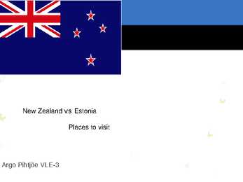
($NZ) = 100 cents products Main exports: Wool, food and dairy GNI per capita: US $14,060 (World products, wood and paper products Bank, 2009) GNI per capita: US $26,830 (World Bank, 2009) Top ten places to visit in New Zealand Fiordland National Park It is New Zealand's largest national park. The scenery in Fiordland is nothing short of stunning, with deep fiords, steep mountains, raging waterfalls, and lush rain forests. Amazing diving, dolphins, seals, and rare bird life. Abel Tasman National Park New Zealand's smallest national park. One of New Zealand's sunniest spots. The beaches have a range of coloured sand from gold to white that look out onto the clear waters of the Tasman Sea. Top ten places to visit in New Zealand Queenstown Beautiful lake side town is surrounded by mountains and is one of New
Estonia is the northernmost of the three Baltic States. It is located on the northern hemisphere on the eastern shores of the Baltic Sea in the north-east of Europe. It has land contact with Russia from the east and Latvia from the south. In the north The Gulf of Finland separates Estonia from Finland. The Gulf of Riga is situated to the south-west. Estonia has more than 1500 islands. The biggest ones are located to the west. The four biggest islands are Saaremaa, Hiiumaa, Vormsi and Muhu. The highest point in Estonia and also in the Baltic region is Suur Munamägi. It is 318. above sea level. Estonia is a country of a thousand lakes. The Largest one is Lake Peipsi which is also the fourth biggest freshwater lake in Europe. Lake Peipsi and Lake Võrtsjärv are rich in fish. Estonia has many rivers but only nine of them are longer than 100km. The most important ones are Pärnu River and Emajõgi River Climate
The Pennine Chain runs from the north to south, splitting northern England into western and eastern parts. The Lake District in situated in the north-west of England and there are the most beautiful landscapes and the highest peak in England is Scafell Pike (978 m). The warmest part in England is the Peninsula of Cornwall in summer. Scotland Densely / 'densl / tihedasti Scotland features very wild landscapes, large areas of untouched land, mountains and lochs. Scotland can be divided into two parts: the Lowlands and the Northern Highlands. The highest peak in Scotland is Ben Nevis (1343 m) Wales Earthwork / :w:k / mullavall Beacon / 'bi:kn / tuletorn, majakas Peninsula / p'nnsjl / poolsaar Wales is surrounded by the sea on three sides and has two major mountain systems: the Black Mountains and the Brecon Beacons. The rivers offer a wide variety of fish.
the southern coast. The Gulf of Carpenteria and the Cape York Peninsula surround it in the south. 3. Relief Australia is the smallest continent in the world It is often called the island continent because is too big for an island but rather small for a continent. Australia is 1,800 miles from the mainland of Asia and almost half way round the world from Europe. More than 6,000 miles of ocean separate in from the America. Australia is the only continent except for Antarctica that lies all south of the equator. The natural zones of Australia are very various. There are deserts, semi deserts, grasslands, savannas, bushlands and rainforests. The wet forests occupy the narrow region in the east. Most of the animals, birds and insects live in that region, because there is enough food. The savannas which are grasslands with some trees are mostly in the west. Farther west are the bushlands. The real deserts occupy the centre of the Western Plateau. In the
Ice sheet has carried large boulders and limestone blocks here, not to mention that the hilly terrain in Estonia was also shaped by the continental ice and the melting water. The land is rising 25 cm every one hundred years. In folklore, many features of the relief are explained by the activities of giants such as the legendary national hero Kalevipoeg. The Haanja and Otepää Uplands are particularly rich in Hills. It is here that You find Big Egg Hill, the highest point in the Baltic states with 318 metres above sea level. 4. Land regions The northern coast features a steep limestone bank, the Baltic glint, which is one of the world's most important denudations of Ordovician sedimentary rocks. The glint rises to its highest point (56m) at Ontika. Estonia has over 1,500 islands. The largest of them are Saaremaa, Hiiumaa, Muhu and Vormsi. There are over 1,400 lakes in Estonia, biggest being Lake Peipsi and Lake Võrtsjärv, while the
Canada. The land of diversity. Tallinn 2006 Canada. If you had to use two words to describe Canada, they might be large and diverse. Canada is the second largest country in the world with a territory of about 10 million square kilometers and it is bordered by three oceans: the Arctic, the Pacific and the Atlantic Oceans. The population of Canada is about 31 million people. About 77% of the people live in cities which lie in a band about 100 miles wide above the border of the United States. The capital of Canada is Ottawa. Other large cities are Montreal, Toronto, Vancouver, Winnipeg and Quebec. Canada has two official languages English and French. It's interesting to know that about 61% of Canadians name English and 24% French their mother tongue. There are also many other languages spoken in Canada such as: Italian, Chinese, German, Polish, Ukrainian, Greek and Dutch. There are also many
Much of the rest of Canada is uninhabited or thinly populated, because the country has a rugged terrain and severe climate. Canada extends across the continent of North America, from Newfoundland on the Atlantic coast to British Columbia on the Pacific coast and northward into the Arctic Ocean. Canada shares land borders with the United States to the south and north-west. Canada is a land of great variety. Towering mountains, crystal-clear lakes, and lush, green forests make Canada's far west a beautiful region. Farther inland, fields of wheat and other grains cover Canada's vast prairies. Thes fertile farmlands contrast vividly with the Arctic wastelands to the north. Most of the largest towns and industrial areas lie near the Great Lakes and the St Lawrence River in central Canada. In the east, fishing villages and sandy beaches dot the Atlantic coast
3. Relief The USA is situated in the central part of the North American continent. Its western coast is washed by the Pacific Ocean and its eastern coast is washed by the Atlantic Ocean and in the south its coast is washed by the Gulf of Mexico. The coastline is even. There are no big islands belonging to the USA except the Hawaiian Islands which lie halfway the continents of America and Asia. The biggest peninsulas are the Florida Peninsula and Alaska. 4. Land Regions Mountains The Appalachian Mountains are a vast system of North American mountains, partly in Canada, but mostly in the United States, forming a zone, from 100 to 300 miles wide, running from the island of Newfoundland some 150 miles south-westward to central Alabama in the United States. The Rocky Mountains, often called the Rockies, are a broad mountain range in western North America. The Rocky Mountains stretch more than 4800 km. The Rocky Mountain System within the United States is a United States physiographic region
Topic Canada Tallinn English College 2006 1. Introduction If you had to use two words to describe Canada, they might be large and diverse. Canada is the second largest country in the world with a territory of about 10 million square kilometers and it is bordered by three oceans: the Arctic, the Pacific and the Atlantic Oceans. The population of Canada is about 31 million people. About 77% of the people live in cities which lie in a band about 100 miles wide above the border of the United States. The capital of Canada is Ottawa. Other large cities are Montreal, Toronto, Vancouver, Winnipeg and Quebec. 2. Geographical position Canada is a huge country in the continent of North America. It is bordered with the Atlantic Ocean in the east, the Pacific Ocean in the west, the United States of America in the south and the Arctic Ocean in the north. Canada is a vast country, with a territory of 3
Transportation of convicts to New South Wales ceased in 1840, but continued to Western Australia in 1868. About 160 000 convicts arrived in over 80 years. The convicts were mostly poor townspeople. Only few of them were from wealthier classes. The building of a new society based on these people was an outrageous challenge. The most cunning and skilful of the convicts became later the founders of prominent colonial families. Until 1830s the convicts were harshly punished for almost no reason, flogging being the most common penalty. During the 1850s, the settlement was boosted by gold rushes. Gold was first found at Bayhurst in 1851. Scarcity of labour (tööjõupuudus), the vastness of the bush, and new wealth based on farming, mining and trade all contributed to the development of uniquely Australian social institutions and sensibilities. The idea of unifying all the states first came to Earl Grey in 1847. It was only
Britain can be divided into three parts England, Wales and Scotland. Each of them has their own capital city. Glasgow in Scotland, Cardiff in Wales and London in England. The country is situated in the north-western Europe. The territory of the United Kingdom is about 244,000 square kilometres and about 60 million people live there. The UK contains a number of small islands. The largest islands that belong to the United Kingdom are the Isle of Man in the Irish Sea and the Isle of Wight which lies off of England's southern coast. The largest groups of islands are the Shetland Islands, the Orkney Islands and the Hebrides. Geographical Position The UK is situated in the Northern Hemisphere. The United Kingdom is bordered by the Atlantic Ocean in the west, the North Sea in the east, the Norwegian Sea in the north, and the English Channel, also known as La Manche, in the south and it also separates the country from the continent of Europe.
................. 11 3 Introduction The United States of America is an enormous country. It is the third largest in the world after Russia and Canada. In the USA there are 50 states of which 48 lie together. The population of The USA is about 300 million people. The territory is about 10 million square kilometers. Its geography is very diverse ranging from moist rainforests to dry deserts and bald mountain peaks. There are two big mountain ranges, one of them is the Rocky Mountains and the other is The Appalachian Mountains. The Capital of The USA is Washington D.C. Other big and famous cities are New York, Los Angeles, Houston, Chicago and Las Vegas. The national anthem of the United States is "The Star-Spangled Banner", with lyrics written in 1814 by Francis Scott Key. There are 6 time zones. From east to west they are: Eastern Standard Time, which is 5
England has 383 people per sq km, Scotland has 65, Wales 142 and Northern Ireland 125. 3. Towns. Most people in Britain live in towns or cities (92%) that is most of the population is urban. Population of the main urban areas in 2001: London 7,172,091 Edinburgh 430,082 Belfast 276,459 Birmingham 970,892 Manchester 394,269 Glasgow 629,501 Cardiff 292,150 The highest densities are to be found in conurbations, which are groups of once separate towns that have grown together. Although Britain is short of housing, planners like to keep a belt of undeveloped land around cities known as a green belt to reduce pollution and provide open spaces for leisure. This has meant that the only alternative to the redevelopment of slum areas in the conurbations (such as the Docklands development in London) has been the creation of New Towns such as Harlow in Essex
Insect-Baltimore checkerspot butterfly Reptile-Diamondback terrapin SYMBOLS Song-"Maryland! My Maryland!" Sport-Jousting Team sport-Lacrosse Tree- White oak Cat- Calico Crustacean- Maryland blue crab Motto- Fatti maschil, Parole femine (loosely translated as "Manly deeds, Womanly words" GEOGRAPHY 250 miles long 90 miles wide Border States: Regional List, Delaware,Pennsylvania Virginia ,West Virginia Highest point: Hoye-Crest on Backbone Mountain Lowest point: Sea level at the Atlantic Ocean Major Rivers: Patapsco River, Patuxent River, Potomac River, Susquehanna River. Major Lakes:Deep Creek Lake, Loch Raven Reservoir, Prettyboy Reservoir. CLIMATE Wide array of climates Vulnerable to tropical cyclones 89110 mm per month of rain 23 cm to over 250 cm snow Average temperature 14,75°C 3040 days of thunderstorms a year
Mines, Ltd. Left the Jamaican industry. Jamaican Prime Minister Michael Manley and his wife with US president Jimmy Carter in 1977. Geography Jamaica is the third largest island and the fourth largest country in the Caribbean. The island is home to the Blue Mountains indland and is surrounded by a narrow coastal plain. Most major towns and cities are located on the coast. The Kingston Harbour is one of the largest natural harbours in the world. The climate in Jamaica is tropical, with hot and humid weather, although higher inland regions are more temperate. Some regions on the south coast, such as the Liguanea Plain, are relatively dry rain-shadow areas. Jamaica lies in the hurricane
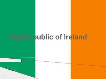
Irish, Éire) with the addition of the Germanic word 'land'. The population of the island is just under 6 million (2006); just over 4.2 million in the Republic of Ireland[2] (1.6 million in Greater Dublin[3]) and just over 1.7 million in Northern Ireland[4] (0.6 million in Greater Belfast[5])). Politics Politically, Ireland is divided into: · The Republic of Ireland, with its capital Dublin. · Northern Ireland, which is part of the United Kingdom, Geography A ring of coastal mountains surrounds low central plains. The highest peak is Carrauntuohill , which is 1,041 m. The island is bisected by the River Shannon, at 386 km (240 miles) the longest river in Ireland. The island's lush vegetation, a product of its mild climate and frequent but soft rainfall, earns it the sobriquet "Emerald Isle". The island's area is 84,412 km². Ireland is divided into four provinces: Connacht, Leinster, Munster and Ulster.
The originated from Denmark, which was ruling Northern Estonia at that time. A similar motif was later used on the coat if arms of the Province of Estonia under Swedish rule. Estonia changed hands but the three lions remained. In 1925 they were adobted officially. The present large coat of arms is a golden shield charged with a golden oak branch on each side. The small coat of arms is identical but without oak branches. CLIMATE AND WEATHER Estonia lies in a transitional zone, varying from maritime to continental climate. Though Estonia is a small country, the climate on the coast differs noticeably from that in the southeastern part. The average in July, which is the warmest month, is about +17 degrees and the coldest month is usually February with 5 degrees as the average. The lowest temperature ever measured is 43,5 ºC and the highest recorded figure is +35,6 ºC. The prevailing winds blow from southwest and west
National language in Australia is English. Monetary unit is Australian dollar. Their national holiday is on the 26th of January. In 1788 on the 26th of January the first fleet arrived at Botany Bay and established a penal colony near modern-day Sydney. Geographical Position Australia is located in the Southern Hemisphere. It’s the only continent except for Antarctica that is all south of equator. Sometimes Australia is called the island continent. There is a great reason why. It really is an island. It is 2880 km from the mainland of Asia and is almost half way round the world from Europe. More than 9 600 km separates it from America. Australia lies between the Pacific and Indian oceans. The Timor Sea and the Arafura Sea separate Australia from Indonesia. In the north the coast is washed by Great Australian Bight and the Indian Ocean. In the northeast the Coral Sea washes the coasts and in the southeast there is the Tasman Sea which also separates
democracy. The head of state is the Queen of the United Kingdom. Governor-General Michael Jeffery, performs her functions in Queen's absence. The parliament consists the Senate and the House of the Reprentativer. The head of the government is the prime minister. The Prime Minister is elected by the House of Representatives and the Cabinet. The Prime Minister is John Howard. Currency- Australian dollar. Relief Australia has a variety of landscapes. The Great Australian Bight lies in the south of Australia. The Gulf of Carpentaria is between the Arafura Sea and Cape York. The Bass Strait separates the island of Tasmania from the mainland of Australia. The Great Barrier Reef is in the north-east of Australia, between the Coral Sea and the mainland. The western part of Australia is covered with deserts. Most of the rocks have turned into sand. The biggest of them is the Great Sandy Desert, which lies in the north of Western Australia.
The Republic of Ireland General overview Territory: 27,097 sq miles Population: 4 million Capital: Dublin Patron Saint: St Patrick The second largest of the British Isles 60 million people outside Ireland claim Irish ancestry Landscape and climate Ireland is low in the middle and high at its edges. Not very high mountains; highest is Carrantuohill (1,040 m) in the southwest At Moher, you can look 200m straight down into the sea Green fields, full of flowers, wide and empty beaches All landscape types are represented Climate is damp Ireland is one of the wettest countries in Europe History St Patrick converted the Irish to Christianity In mid16th century Henry VIII declared himself King of Ireland and broke away from the Roman Catholic Church In 1601, Queen Elizabeth I defeated the Irish army at the battle
AUSTRALIA Tallinn 2008 Only one country in the world fills a whole continent. That country is Australia. The continent it fills is Australia, too. Australia, then, is both a country and a continent. Australia is one only continent except Antartctica that is all south of the equator. Since it is south of the equator, its seasons are just the opposite of ours. It has summer while we have winter, and the other way round. Sometimes Australia is called the island continent. There is a good reason why. It is an island. It is 1800 miles from the mainland of Asia and almost half way round the world from Europe. More than 6000 miles of ocean separate it from the America. Australia is the world's smallest, flattest and driest continent. It is also the oldest some of the rocks are more than 3,000 million years old. It is the 6th largest country. Its territory is 7 700 000 km2.
Võnnu Keskkool ESTONIA Referaat Autor: Klass : 9 Juhendaja: Võnnu 2013 Estonia officially the Republic of Estonia, is a state in the Baltic region of Northern Europe It is bordered to the north by the Gulf of Finland, to the west by the Baltic Sea, to the south by Latvia and to the east by Lake Peipus and Russia.Across the Baltic Sealies Sweden in the west and Finland in the north. The territory of Estonia covers 45,227km2 The Estonian climate resembles that of other countries on the Baltic littoral. On account of the country's proximity to the sea, the skies are often cloudy, and rain often falls in the spring and autumn, in the winter the rain turns to snow. The highest point in Estonia is Suur Munamäg It is in fact the highest point in the Baltic region Forest cover over one half of Estonia
2010 Canada, Kärt Kalvet 8a Canada General Information Canada is in North America. It's area is 9220970 sq km. Canada's population is 313.612.000 people. Canada is divided into 10 provinces and 3 territories. The capital of Canada is Ottawa. Canada has constitutional monarchy. The head of state in Canada's government is the Queen of England. There are two main languages in Canada: English and French. Canada's curreny is Canadian dollar (1 dollar=100 cents[Can$]). The highest peak of Canada is Mount Logan, 5959 metres. The lowest point is sea level. The longest river is the Mackenzie. The climate and geography of Canada vary greatly from temperate in the south to arctic in the north and from islands and plains in the east to mountains in the west. Location Canada is located in the northern-most region of North America. It's geographical position in co- ordinates is 83°N north, 42°N south, 53°W east, 141°W west. Canada borders with United States
there for slavery. 6. Most West Indian countries gained independence during the 1960s-1980s. 7. The main branches of economy are tourism and companies kept offshore (tax haven). 8. Reggae, limbo dancing and salsa have originated from the West Indies. 9. Religions: Catholicism, various forms of Protestantism, Hindus and Muslims, Rastafarians; many worship the Christian god and African gods at the same time (witchcraft, voodoo). The reason why there are so many religions is because Europeans brought their own when they colonized and slaves from Africa practiced their own religions, which often combined. Rastafarians are people who practice Rastafari, which is Christianity, combined with Carribbean style. It is pro-African religion, which is against slavery. Canada 1. Canada occupies the 2nd place in the world by its area (after Russia). 2
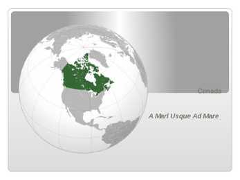
Canada A Mari Usque Ad Mare Official language(s) English, French Inuktitut, Inuinnaqtun, Cree, Recognised regional languages Dëne Sliné, Gwich'in, Inuvialuktun, Slavey, Tlch Yatiì Languages in Canada North American country consisting of ten provinces and three territories located in the northern part of the continent, it extends from the Atlantic Ocean in the east to the Pacific Ocean in the west, and northward into the Arctic Ocean spanning over 9.9 million square kilometers, Canada is the world's second largest country by total area its common border with the United States is the longest land border in the world. Some facts The land that is now Canada was inhabited for millennia by various groups of Aboriginal peoples beginning in the late 15th century, British and French France ceded nearly all of its colonies in North Amer
newly acquired south-east, English-speaking, while the rest of the country retained the Gaelic language, apart from the Northern Isles of Orkney and Shetland, which remained under Norse rule until 1468. The Wallace Monument commemorates William Wallace, the 13th-century Scottish hero. The death of Alexander III in March 1286, followed by the death of his granddaughter Margaret, Maid of Norway, broke the succession line of Scotland's kings. This led to the intervention of Edward I of England, who manipulated this period of confusion to have himself recognised as feudal overlord of Scotland. Edward organised a process to identify the person with the best claim to the vacant crown, which became known as the Great Cause, and this resulted in the enthronement of John Balliol as king. The Scots were resentful of Edward's meddling in their affairs and this relationship quickly broke down