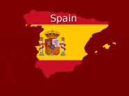
Spain General Data ► Area: 504 782 km ² ► Population: 46.12 million ► Capital: Madrid ► Capital Population: 4 million ► Language: Spanish ► Currency: EUR ► Symbols: Anthem - La Marcha Real, flag, coat of arms, the national flower-the red carnation, animal-ox, national bird-Short-toed Eagle ► The King : Juan Carlos I Symbols ► Anthem http://www.youtube.com/watch?v=0 S19dt7JWQs Geographical position ► In Southwestern Europe on the Iberian Peninsula ► Neighboring countries: France, Andorra and Portugal (in the west) ► Between Spain and Morocco is narrow Strait of Gibraltar ► Territory of the country includes the Balearic Islands in the Mediterranean, and 13 Canary Island (the largest of which is Tenerife and Gran Canaria) in the Atlantic Ocean Map Location in Europe Natural conditions ► Subtropical climatic zone (2 seasons)
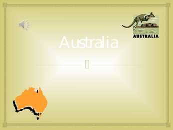
Gold was first found at Bayhurst in 1851. The idea of unifying all the states first came to Earl Grey in 1847. On the 1st of January, in1901, Australian colonies federated to become the Commonwealth of Australia. Australia had declared independence from the federation of UK colonies. As neither Sydney nor Melbourne was an acceptable new capital, a new city Canberra was built as a result of an architectural competition. Geographical position: Australia is located in the Southern Hemisphere and it's the smallest continent in the world. It's the only continent except for Antarctica that lies all south of the equator. It is surrounded by the Indian Ocean and the Pacific Ocean; the Gulf of Carpentaria, the Coral Sea, the Tasman Sea, the Australian Bight, the Timor Sea and Shark Bay. The Great Barrier Reef is one of the natural wonders of the modern world. It is located off the northeast coast of Australia
Tallinn University TURKEY AND THE EUROPEAN UNION Tallinn 2013 INTRODUCTION The accession negotiations and the forthcoming Turkish accession present challenges to both Turkey and the EU. It is widely accepted that Turkey's accession would be different from previous enlargements because of the combined impact of Turkey's population, size, geographical location, economic, security and military potential. The case of Turkey will be different and more challenging from previous accessions for a number of reasons, some of them are presented below. Turkey is a country with a large population and geographic area. With a population of 74 million today, it is projected that it could be the largest member state at the time of accession. As a Moslem secular country, Turkey will also add a new demographic and religious dimension to the EU
Conclusions The company has good knowledge about export business from previous experiences on Swedish and Finish markets. The financial situation depends on company's own resources. Production output is depending on active sales work which is currently modest in the Norwegian market. There is also need for expansion of machinery park in order to be able to offer combined packing solutions in bigger volumes. The importance of transport is directly related to the geographical and political position of the company. There is a time and planning issue when shipping goods to Norway because of geographical localization of Estonia as well as compliance with customs laws since Norway is not a member of The European Union. However, the company is familiar with these matters as they have done some packing work for Norwegian clients in past. Still, the on-site information is weak; contacts are insufficient and needs to be developed.
oceans, streams, straits: the Danube; the Suez Kennedy Airport, Hyde Park, Trafalgar Canal; the Baltic Sea; the Pacific Ocean; the Square, Buckingham Palace, Victoria Station, Bering Strait French Boutique etc. · Names of points of the compass: the North etc. * Names of a single island or mountain / hill Great Britain, Ben Nevis etc. · Geographical names, consisting of a countable noun: union, republic, state, sea, ocean, moun- * Names of continents, geographikal areas, tain, stream, channel, gulf, bay, cape and a states, countries, cities, capes, lakes without modifer, either a nõun or an adjective: the Eu- a modifer. Europe, Siberia, Ohio, York, Lon- ropean Union, the Estonian Republic, the Or don, Cape Hom, Erie etc. ange Free, the Bay of Bengal etc.
by Russia. From St. John`s to Victoria Canada stretches about 7000km. In fact, Canada`s east coast is closer to Europe than it is to Canada`s west coast. It also extends southward from the North Pole to the US border. Canada`s northen coast is washed by Arctic Ocean, eastern coast by the Atlantic Ocean and western coast by the Pacific Ocean. Canada is so big that it contains six time zones. This huge land mass has been divided by nature into 6 distinct geographical regions. Stretching across the north is the Artic region. On the east there is another geographical unit called the Applachian Region after the range of mountains which run through the New England states north into Canada. Moving west, we come to the largest region of all, the Canadian Shield. This extends like a huge semi-circular ring around Hudson Bay. It is rugged, stony and with thin soil. Southeast of the Shield is the Valley of the St. Lawrence River which embraces the parts
Tingimuseks on, et tooraine saadakse määratletud piirkonnast ning toote tootmine, töötlemine ja müügiks ettevalmistamine toimuvad nimetatud geograafilises piirkonnas. Kaitstud päritolunimetust kandva toote puhul on toote omadused otseselt tulenevad geograafilise piirkonna inim- ja keskkonnafaktoritest. 2. Kaitstud geograafiline tähis-tunnusmärk (Protected Geographical Indication, PGI)- päritolunimetusega sarnane, kuid tingimused on vabamad. Toote tootmine ja/või töötlemine ja/või müügiks ettevalmistamine toimuvad nimetatud geograafilises piirkonnas. Piisab, kui üks tootmisetapp toimub määratletud geograafilises piirkonnas. Kaitstud geograafilise tähise puhul võib seos geograafilise piirkonnaga põhineda erilistel omadustel, või reputatsioonil. 12
India India is a country in South Asia. It is the seventh-largest county by geographical area. 1210193422 people lives there. India' s capital city is New Delhi. Official languages are hindi and english. The name India is derived from Indus. Jana Gana Mana is the national anthem of India. India national emblem is Sarnath Lion Capital. India national flower is Lotus and national fruit is mango. National tree is Banyan. National bird is Indian Peafowl. India land animal is Royal Bengal Tiger. The longest river in India is Ganges. It's lenght is 2511 km.
NEWFOUNDLAND AND LABRADOR TRIINU PRANTS GUSTAV ADOLFI GÜMNAASIUM 8. C KLASS GEOGRAPHICAL LOCATION · Country's atlantic region · Most easterly province · Island of Newfoundland and mainland Labrador · Area of 405,212 square kilometres · Capital St. John's http://en.wikipedia.org/wiki/Newfoundland_and_Labrador#/me dia/File:Newfoundland_and_Labrador_in_Canada.svg FLAG http://en.wikipedia.org/wiki/List_of_premiers_of_Newfoundland_and_Labrador POPULATION · In 2013 526 702 people
POVERTY, SOCIAL INSIGNIFICANCE ATTACKS THE GREED AND LACK OF CULTURE OF THE BOURGEOISIE JANE EYRE SOCIETY CAN BE REFORMED BY MEANS OF EDUCATION INHUMAN EDUCATION SYSTEM OF CHARITY SCHOOLS FIGHT FOR WOMEN'S EMANCIPATION EMILY 1818 - 1848 WUTHERING HEIGHTS (1847) PLOT FULL OF MYSTERY REALISTISC THE TIME, PLACE, CLIMATE, GEOGRAPHICAL FEATURES WUTHERING HEIGHTS MANY SUPERNATUREAL ELEMENTS THE STORY OF THE EARNSHAWS AND THE LINTONS THRUSHCROSS PARK, LOCKWOOD, YORKSHIRE MOORS HEATHCLIFF AND CATHERINE THE STORY OF LOVE AND REVENGE WUTHERING HEIGHTS 1. CATHERINE'S AND HEATHCLIFF'S LOVE, SOCIAL INJUSTICE 2. HEATHCLIFF AS THE REVENGER 3. THEIR CHILDREN MAKE PEACE
Loch Ness Mariann Kolk 9d Geographical particulars · large, deep freshwater · 37 km long · southwest from Inverness · surface area 56.4 km² · deepest point 230 m · about 10,000 years old Urquhart Castle · beside Loch Ness · the largest strongholds · majority of Loch Ness Monster sightings Cherry Island · only island on Loch Ness · artificial island · from the Iron Age The Loch Ness Marathon · an annual marathon race · along Loch Ness to Inverness · $2,500 · supports several charities · over 1,500 participants Loch Ness monster · an alleged animal · bestknown mysteries · Nessie · 60 feet long · a long tail with 4 fins and a big head · the water horse · categorized: 1. unknown species of large animals 2. mystic or paranormal 3. misidentification of known animals 4. inanimate objects or effects 5. hoaxes Plesiosaur · a longnecked aquatic reptile · a coldb...
19 The seat of Estonian government Eesti valitsuse asukoht 20 University town Ülikooli linn 21 Holidaymakers Puhkajad 22 Characteristic features Iseloomulikud jooned 23 Submerged in greenery Uppunud rohelusse 24 Hilly landscape Künklik maastik 25 Determined by the geographical position Määratud geograafilise asukohaga 26 As a rule Reeglina 27 Changeable Muutlik 28 Flat Tasane 29 Rich in hills Küngaste poolest rikas 30 The second largest Suuruselt teine 31 The deepest Kõige sügavam
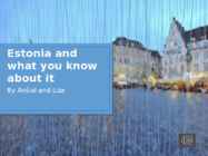
Estonia is small but beautiful country in the east of Europe. Estonia area is about 45 thousand km2 and there is living about 1,4 million people. Estonia is very developed country in IT clime. Example in our country you can choose parliament through the internet. Estonia has a lot of forest. Almost half of Estonia terrestrial has capped with forest. Estonia is washed and influenced by the Baltic sea from west and the Gulf of Finland in the North. Estonia has very good geographical location. This gorgeous country is European union east border (since May 2004). Estonia is quite low country. The highest peak is 316 meter high. It is called Munamägi, and it lies in east of Estonia. Estonia has over the thousand lakes. The biggest lake is Peipsi, which separates Estonia from Russia. The biggest rivers are the river Pärnu and the river Võhandu. The main lowland areas are in west Estonia. Estonia has over 1500 islands. In western coast have two biggest island- Saaremaa
another country. Some of the countries (or some parts of it) are so big or hardly reachable that half of the locals wont access these parts of the country never in their whole lifetime. I am certain that no one should waste their life on acting like someone has said to be right instead of acting by your own desires. Furthermore, if you have lived in your homeland for your entire lifetime, you should be wise enough to know about the culture, nature and geographical aspects even if you have not been in every part of the country. That is an another reason why travelling to other countries without knowing your whole homeland should be very welcome.
Revolutionary period literature 17661799 Geographical lines were now forgotten, the literature of this period is no longer local. Literature presents the vivid reflection of that momentous struggle for independence upon which the American colonies had entered. Fiery speeches, able arguments set forth in newspapers and in pamphlets, sharp and bitter satire. From the beginning of the conflict to the end, there was a copious flow of verse which sprang naturally enough from the turbulence of
INDIA name 9.kl India country · India is a country in South Asia. · It is the seventhlargest country by geographical area. · The most populous democracy in the world. · Country with over 1.18 billion people. · The capital of India is New Delhi. The symbols of India: to edit Master text styles Second level Third level Fourth level Fifth level
outlook. Tallinn is the right place for tourists who want to get know about the medieval life in Europe. Here are such attractions as the Medieval Old Town, Kadriorg Park and Rusalka monument. These are the main places people usually want to visit. So, we must develop our tourism system. For example, make up some journey programmes with elements of the Estonian tales. That certainly attracts much more tourists in Tallinn. Moreover, Tallinn has the good benefit in its geographical location. Estonia is like a bridge or gate between Europe and Russia. And Tallinn is the heart of Estonia its capital. Estonians could get some profits from such situation, but for some unknown reasons they did not do that still. The only thing we need to solve this question - is to get on well with Russia. Our two countries, as we are neighbours, could sign an agreement, which would let youngsters to go to study abroad as the exchange students. This point can improve not only tourism, but
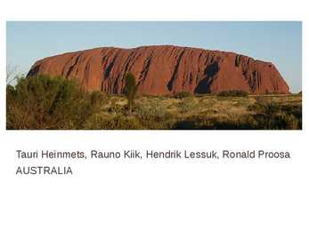
Tauri Heinmets, Rauno Kiik, Hendrik Lessuk, Ronald Proosa AUSTRALIA Geographical position Australia is a country in the Southern Hemisphere comprising the mainland of the Australian continent as well as the island of Tasmania and numerous smaller islands in the Indian and Pacific Oceans. world's sixth-largest country by total area. The lowest point in the country is lake of Eyre (15m below sea level) and the highest point is Mount Kosciuszko (2229m) Economy Mixed economic system Division of labor Agriculture 3,6%; Industry 21,1%; Tendance 75% Units of labor 11,45 mlj
Tabasalu ühisgümnaasium Robin Nurk Tennessee presentation Information : Wikipedia Google Tabasalu 2012 Geographical location and features. Tennessee is located in the Southeastern United States. Tennessee is bordered by Kentucky and Virginia to the north, North Carolina to the east, Georgia, Alabama, and Mississippi to the south, and Arkansas and Missouri to the west. Tennessee's capital and second largest city is Nashville, which has a population of 626,144 people. Memphis is the state's largest city, with a population of 670,902 people.
Britain forms the greater part of the British Isles, which lie off the north-west coast of mainland Europe.The geographical name for all the islands is the British Isles. They also include Eire, the Republic of Ireland, which has been politically independent of the British government since 1921. The largest of the islands is called Great Britain and it comprises England, Wales, snd Scotland. The full political name for the countries sharing a parliament in London is the United Kingdom of Great Britain and Northern Ireland. Covering an area of some 242, 500 sq km. The longest river,
Brazil, officially the Federative Republic of Brazil, is a country in South America. It is the fifth largest country by geographical area, occupying nearly half of South America. Bounded by the Atlantic Ocean on the east, Brazil has a coastline of over 7,491 kilometers. It is bordered on the north by Venezuela, Suriname, Guyana and the overseas department of French Guiana; on the northwest by Colombia; on the west by Bolivia and Peru; on the southwest by Argentina and Paraguay and on the south by Uruguay. Population of Brazil is made up of many racial and ethnic groups. The last National Research for
Australia's national emblems, states and territories, largest cities and politics Australia's national flag The Australian National Flag consists of three parts set on a blue field. The first part is the Union Jack, acknowledging the historical link with Britain. The second part is the Southern Cross, representing Australia's geographical location in the world. Finally, the Commonwealth Star represents Australia's federal system of government. Australia's national anthem Advance Australia Fair was one of many Australian nationalistic songs written in the late-nineteenth century as it talks about the creation of the new nation were taking place in the different colonies. This is the national anthem of Australia. Australia's national emblems Floral - Sturt's Desert Rose
To the north was territory not governed by the Romans -- Caledonia, by name. Its people were the Picts. From a classical historical viewpoint Scotland seemed a peripheral country, slow to gain advances filtering out from the Mediterranean fount of civilisation, but as knowledge of the past increases it has become apparent that some developments were earlier and more advanced than previously thought, and that the seaways were very important to Scottish history. Because of the geographical orientation of Scotland and its strong reliance on trade routes by sea, the kingdom held close links in the south and east with the Baltic countries, and through Ireland with France and the continent of Europe. Following the Acts of Union which united Scotland with England into the Kingdom of Great Britain, and the subsequent Scottish Enlightenment and Industrial Revolution, Scotland became one of the commercial, intellectual and industrial powerhouses of Europe. Its industrial decline
Tallinna Inglise Kolledz Topic United States of America Mari-Liis Pakats Tallinn 2007 2 Introduction..................................................................................................................4 Geographical Position..................................................................................................4 Geographical Regions..................................................................................................5 Climate ........................................................................................................................6 Natural Resources........................................................................................................ 7 History..........................................................................................................................8 Culture
Biggest celebration is National day Nature There are five species of lizard in the nature reserve. 33 species of butterfly have been observed, including the Cleopatra, two- tailed pasha, swallowtail, Spanish festoon and striped grayling. The Caves of Nerja (Spanish: Cueva de Nerja) are a series of caverns close to the town of Nerja in the Province of Málaga, Spain. Stretching for almost 5 kilometres. Gibraltar rock´s height is 426 meters. Gibraltar rock´s name is calpe. Pictures Geographical location Located on the southern end of the Iberian Peninsula. It has an area of 6.7 km2 and shares its northern border with Spain. Sea border of Gibraltar Spain Gibraltar main languge is English but, they speak Spanish and llanito too Judaism, Christianity, Atheism religions Gibraltar has provided the community with a radio and Culture television service since 1963.
päiksevaesel ajal piisavalt palju toodaks- või siis piisavalt suurt akupanka omama -kuhu suvekuudel ülejäänud elekter salvestada 7 Keskmine elektri tarbimine Eesti kodumajapidamistes jääb 4500 kw/h ringi. Seega tuleks vaadata omale süsteem mis ideaalis kuus keskmiselt 375 kw/h elektrit toodaks. Kui suure võimsusega süsteem tuleks sellise soovi korral aga luua? Siin tuleb appi „Photovoltaic Geographical Information System“ [3]- see on selline interneti kalkulaator kuhu saab sisestada oma geograafilise asukoha ning mõningad planeeritava nö. päikeseenergiajaama parameetrid: asukoht, päikesepaneeli süsteemi võimsus, süsteemi kadude protsent (eestis mõõdetud tulemuste põhjal 5%), paigaldatav koht (maapinnale või hoone külge), kaldenurk ja asimuut (optimaalne lõuna suund ehk 0 0). Antud kalkulaator
Introduction English is spoken on all five continents. With regard to the numbers of speakers it is only exceeded by Chinese and Spanish. But in terms of geographical spread it stands at the top of the league. The varieties of English in the modern world are divided into four geographical groups as follows. British Isles America United States (with African American England English) Wales Canada Ireland The Caribbean Africa Asia, Pacific
Immediately after the World War II , the 1948 Summer Olympics were held at the original Wembley Stadium, at a time when the city had barely recovered from the war. The Thames Barrier was completed in the 1980s to protect London against tidal surges from the North Sea. In 2000, Londonwide government was restored, with the creation of the Greater London Authority. Geography: Greater London covers an area of 607 square miles. Its primary geographical feature is the Thames, a navigable river which crosses the city from the southwest to the east. The Thames Valley is a floodplain surrounded by gently rolling hills including Parliament Hill, Addington Hills, and Primrose Hill. London has a temperate marine climate, like much of the British Isles, so the city rarely sees extremely high or low temperatures. London is a relatively dry city with regular but generally light precipitation throughout the year, with an average of 583
Ursula Potivar Geography of Madagascar Topography Madagascar is an island in the Indian Ocean off the eastern coast of southern Africa, east of Mozambique. At 587,000 square kilometres, Madagascar is the world's 46th-largest country and the fourth- largest island. Madagascar can be divided into five geographical regions: the east coast, the Tsaratanana Massif, the central highlands, the west coast, and the southwest. The east coast The east coast consists of a narrow band of lowlands, formed from the sedimentation of alluvial soils and zone, composed of steep bluffs, alternating with ravines bordering an escarpment of about 500 meters in elevation. The coastline is straight, with the exception of the bay. The east coast is considered dangerous for
to Finnish The history of Estonia is a part of the history of Europe. Estonia was settled near the end of the last glacial era, beginning from around 8500 BC. Before the Germans invaded in the 13th century proto-Estonians of the Ancient Estonia worshipped the spirits of nature Starting with the Northern Crusades Estonia became a battleground for centuries where Denmark, Germany, Russia, Sweden and Poland fought their many wars over controlling the important geographical position of the country as a gateway between East and West. Estonia is often seen as the world’s leading innovator against the backdrop of untouched nature and rich medieval heritage.One of the most popular things Estonians have invented is Skype. The story goes deeper, and it might just be that Estonia with its diverse background and Nordic temperament ends up being your next holiday destination. Estonia has its own song festival The Estonian Song Festival is
CANADA Pavel Zubarev 8.a Geographical position Canada is the second largest country in the world. Only Russia has a greater land area. Canada is situated in North America. Canada is a federation of 10 provinces and 2 territories. The population Canada is slightly larger than the United States, but has only about a tenth as many people. About 28 million of people live in Canada. About 80% of the population live within 320 km of the southern border. Much of the rest of Canada is uninhabited or thinly populated because of severe natural conditions. Canada's people are varied. About 57% of all Canadians have some English ancestry and about 32% have some French ancestry. Native people American Indians and Eskimos make up about 2% of the country's population. 77% of Canada's people live in cites or towns. The Capital of Canada Ottawa is the capit...
Estonia The history of Estonia The history of Estonia is a part of the history of Europe. Estonia was settled near the end of the last glacial era, beginning from around 8500 BC. Before the Germans invaded in the 13th century proto-Estonians of the Ancient Estonia worshipped the spirits of nature. Since the Northern Crusades Estonia became a battleground for centuries where Denmark, Germany, Russia, Sweden and Poland fought their many wars over controlling the important geographical position of the country as a gateway between East and West. Being conquered by Danes and Germans in 1227, Estonia was ruled initially by Denmark in the north, by the Livonian Order, an autonomous part of the Monastic state of the Teutonic Knights and Baltic German ecclesiastical states of the Holy Roman Empire. From 1418–1562 the whole of Estonia was part of the Livonian Confederation. After the Livonian War, Estonia became part of the Sweden from the 16th
When Spanish explorers first visited the area (led by Hernando de Soto) in 15391543, it was inhabited by several tribes (Muscogee, Yuchi people). As European colonists spread into the area, the native populations were displaced to the south and west. Many battles were fought in the state, for example in 1862 and 1863. Symbols The official state flag of Tennessee was adopted on the 17th of April in 1905. The three white stars in the center symbolize the three different geographical regions of Tennessee. The white circle binds them together. The blue stripe along the margin was added for distinction when the flag is hanging; with the stripe, not only the red shows while the flag is hanging. In 1796, the Constitution of the State of Tennessee provided for an official Great Seal. Although the style of the present seal has changed, the basic elements remain similar to the 1796 provisions Mockingbird, Tuliptree, Iris, Limestone. Geography
when Great Britain started founding colonies. Empire growed from the 17'th century up to 1920's. It was said that the sun never sets on British empire. It had expanded all over the world. In the colonies, English started to change, it had spread all around the world, just like the empire. It was leading country in the world for a very long time. It had strong economy and the strongest navy that any one had ever seen, so it was till the world wars. The British Isles, because of their good geographical position have been conqured only twice. And both occasions had a great influence on the language. First came Latin with the conquest of Roman Empire. Latin gave some terms to English and now it is a scientific language. Romans stayed for half a century, when they left, different Germanic tribes came and estabilished new kingdoms. They brought a new language with them. The Old English is developed from their Germanic dialects. After that, came Christians and brought new words
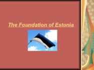
History • The first settelments in Estonia came by supposedly about 11 000 years ago. • In the past most Estonians worshipped spirits of nature and their beliefs were seen as unholy by christian crusaders. Taara is believed to have been the name of the old Estonian god. • Starting with the Northern Crusades in the Middle Ages, Estonia became a battleground for centuries where many countries fought their wars over controlling the important geographical position of the country as a gateway between East and West, despite this the country has survived. • Estonia first got it’s independence in 1918 wich lasted 22 years. • The first president of Estonia during this period was Konstantin Päts. • Metsavennad( the forest brothers) were freedom fighters who fought in Estonia, Latvia and Lithuania during World War II and later even after the Soviet invasion. • The current independence of Estonia has lasted for 26 years since 1991
the Mona Lisa · Is used with the names of rivers, groups of islands,seas , mountain ranges, canals and oceans. Examples: the Suez Canal, the Pacific Ocean, the Alps, the Bahamas · Is used when countries include words such as States, Kingdom, Republic, Union , but there are some exceptions: the Netherlands, the Philippines, the Vatican Examples: the United Kingdom, the United States · Is used in geographical terms such as the Antartic/equator, the North/East/South/West Examples: the Middle East, the north of England · Is used with the names or nouns with of . Examples: the Houses of Parliament · Is used with the names of musical instruments and dances. Examples: the guitar, the salsa · Is used with the words: day, morning, afternoon, evening, station, theatre, cinema, library, shop, coast, sea(side), beach, country(side), city, jungle, world, ground, weather.
The first epics are known as primary, or original, epics. One such epic is the Old English story Beowulf. Epic Conventions, or characteristics common to both types include: 1. The hero is a figure of great national or even cosmic importance, usually the ideal man of his culture. He often has superhuman or divine traits. He has an imposing physical stature and is greater in all ways than the common man. 2. The setting is vast in scope. It covers great geographical distances, perhaps even visiting the underworld, other wortlds, other times. 3. The action consists of deeds of valor or superhuman courage (especially in battle). 4. Supernatural forces interest themselves in the action and intervene at times. The intervention of the gods is called "machinery." 5. The style of writing is elevated, even ceremonial. 6. Additional conventions: certainly all are not always present) 1
Moreover, it is the part of the population who is not interested in their own roots and who do not excel at work, who tends to emigrate the most. Therefore, the immigrants from the developing countries have become a major problem in many European states. Furthermore, xenophobia has started to spread in the areas as a reaction to the problems caused by the immigrants. The third reason for the development of xenophobia in certain small countries is their strategically significant geographical location that might be of interest for the big world states. As a rule, the big ones are interested in gaining more power in the world. Likewise, the three Baltic countries are situated in the area which has been frequented by hostile conquerors in several hundreds of years. During the past centuries the indigenous nations of the Baltic States have developed deep distrust against their neighbours no matter how well-intentioned they try to appear. As we know, quite a few empires have
INDIA COUNTRY · India is a country in South Asia. · It is the seventh-largest country by geographical area. · The most populous democracy in the world. · Country with over 1.18 billion people. · The capital of India is New Delhi. · India has a coastline of 7,517 kilometres. Mainland India is bounded by the Indian Ocean on the south, the Arabian Sea on the west, and the Bay of Bengal on the east; and it is bordered by Pakistan to the west Bhutan, the People's Republic of China and Nepal to the north; and Bangladesh and Burma to the east.
CONCLUSION: 1) Management is a job. 2) It requires various special skills. 3) A leader no = a manager. True leaders are not born, but they are made. Lecture 2: Mission, vision and strategy. Mission why are we here on earth? For whom do we solve which problems and how? How do we wish to interact with our staff, customers? A description of the activities of the organization in terms of branches, degree of vertical integration and geographical boundaries of markets to be covered. Horisontal integration ( ) Vision where are we going? What do we want to achieve in the distant future? Strategy how we get there? How do we want to achieve our vision, given our current mission`? Steps: 1. Situation appraisal 2. Choice of the best strategy 3. Operationalisation 4. Organisation, budgets and control Internal analysis: strengths and weaknesses
To the north was territory not governed by the Romans -- Caledonia, by name. Its people were the Picts. From a classical historical viewpoint Scotland seemed a peripheral country, slow to gain advances filtering out from the Mediterranean fount of civilisation, but as knowledge of the past increases it has become apparent that some developments were earlier and more advanced than previously thought, and that the seaways were very important to Scottish history. Because of the geographical orientation of Scotland and its strong reliance on trade routes by sea, the kingdom held close links in the south and east with the Baltic countries, and through Ireland with France and the continent of Europe. Following the Acts of Union which united Scotland with England into the Kingdom of Great Britain, and the subsequent Scottish Enlightenment and Industrial Revolution, Scotland became one of the commercial, intellectual and industrial powerhouses of Europe
Alberta The capital of Alberta is Edmonton. The population is 3.7 million people and there are many nationalities. Besides English and French there are also immigrants from Scotland, Ireland, Wales, Germany, Ukraine and Scandinavia. In Edmonton and Calgary there are also historic Chinatowns, and Calgary has Canada's third largest Chinese community. Geographical features Alberta covers an area of 661,848 square kilometres, an area about 5% smaller than Texas or 20% larger than France. This makes it the fourth largest province after Quebec, Ontario, and British Columbia. To the south, the province borders on the 49th parallel north, separating it from the U.S. state of Montana, while on the north the 60th parallel north divides it from the Northwest Territories. To the east the 110th meridian west separates it from the province of
crossed the 100 - 160 kilometres stretches of water between the islands to the north; and reach the southern continent. This sea voyage is the earliest evidence of sea travel by prehistoric man. Religion The Aborigonal religion is based heavily on the Dreaming. The Dreaming is the Aboriginal creation story. Aborigines believe that at the beginning of time the world was a shapless mass of nothing, waitng to be transformed into what we see today. Every major geographical feature in australia has an aboriginal story to explain it. The Dreaming gets very abstract, it turns almost into another dimension. Aborigines beleive that they are constantly living in the Dreaming and that every time they do something they leave an impression on the other reality that is the Dreaming . Present Day Today the Aborigines are in trouble. Many have left the their traditional lifestyle, and have moved to suburbs
degrees. If you live in a climate where the pond will completely freeze over (even at the edges) you will need to create a hole in the ice for the fish to remain alive. · Will the winter cold kill my plants? Yes, if it goes below freezing in your area. Bring plants inside for the winter months. · Do I need to filter the water? That will depend on your climate and the design of your system. Ask a local dealer his recommendations for your geographical area concerning filtration. (look up in the Yellow Pages under ponds or water gardening) The action of water moving provides some natural filtration, so sometimes you can get away with only a fountain or waterfall. There are biological filters and cartridge filters available from pond supply outlets. We have provided links below to 3 sites that offer products, services and advice for building backyard water gardens. Water Gardening and Pond Supply :
More than 70% of the population lives in towns. History • Estonia was settled near the end of the last glacial era, beginning from around 8500 BC. Before the German invasions in the 13th century proto-Estonians of the Ancient Estonia worshipped the spirits of nature. Since the Northern Crusades Estonia became a battleground for centuries where Denmark, Germany, Russia, Sweden and Poland fought their many wars over controlling the important geographical position of the country as a gateway between East and West. Being conquered by Danes and Germans in 1227, Estonia was ruled initially by Denmark in the north, by the Livonian Order, an autonomous part of the Monastic state of the Teutonic Knights and Baltic German ecclesiastical states of the Holy Roman Empire. From 1418–1562 the whole of Estonia was part of the Livonian Confederation. After the Livonian War, Estonia became part of the Swedish
(Received 24 July 2011; final version received 16 March 2012) Downloaded by [KU Leuven University Library] at 06:11 02 June 2015 It is, in a sense, paradoxical to translate travel narratives for the target readers who actually inhabit the cultural and geographical spaces that these books deal with. However, through the analysis of two such accounts on Romania, Dervla Murphy's Transylvania and Beyond (1992) and Eva Hoffman's (ample chapter on Romania in) Exit into History (1999) this paper aims to show that such
khTallinn English College The United Kingdom Topic Mari-Liis Pakats Tallinn 2008 2 Table of Contents Introduction..................................................................................................................4 Geographical Position .................................................................................................4 History .........................................................................................................................4 Government..................................................................................................................5 Queen Victoria.............................................................................................................5
Topic Great Britain 2007 1. Introduction The official name of Great Britain is `the United Kingdom of Great Britain and Northern Ireland (or short United Kingdom)' The population is about 60.4 million. The capital is London. Other biggest cities include Birmingham, Bristol, Portsmouth, Glasgow and Swansea. English is the main language of Great Britain, but Welsh is officially recognized in Wales and Gaelic in Scotland. 2. Geographical position The British Isles is the geographical term for a group of about 5000 islands off the coast of mainland Europe. The largest island is Great Britain, which is also the largest island in Europe. It consists of England, Wales and Scotland. The next largest island is Ireland, which is made up of Northern Ireland and the Irish Republic. Britain and Northern Island together form the United Kingdom. When referring to Britain or Great
There are two main languages in Canada: English and French. Canada's curreny is Canadian dollar (1 dollar=100 cents[Can$]). The highest peak of Canada is Mount Logan, 5959 metres. The lowest point is sea level. The longest river is the Mackenzie. The climate and geography of Canada vary greatly from temperate in the south to arctic in the north and from islands and plains in the east to mountains in the west. Location Canada is located in the northern-most region of North America. It's geographical position in co- ordinates is 83°N north, 42°N south, 53°W east, 141°W west. Canada borders with United States of America by land; Pacific Ocean, Arctic Ocean and Atlantic Ocean by coastline. Canada is one of the largest countries in the world, second only to Russia in territorial size. It has a total area of 9.9 million square kilometers. This includes 755,170 square kilometers of water. Toronto is the largest city in Canada with a population of 4.3 million
The Sydney Opera House is a multivenue performing arts centre in Sydney, New South Wales, Australia. It was conceived and largely built by Danish architect Jørn Utzon, who, in 2003, received the Pritzker Prize, architecture's highest honour. Melbour ne Melbourne is the capital and most populous city in the state of Victoria, and the second most populous city in Australia. The Melbourne City Centre is the hub of the greater geographical area and the Census statistical division--of which "Melbourne" is the common name. Brisbane Brisbane is the capital and most populous city in the Australian state of Queensland and the third most populous city in Australia. Brisbane's metropolitan area has an approximate population of 2 million.A resident of Brisbane is commonly known as a "Brisbanite". Perth