Leidsid 33 sarnast õppematerjali, mis on seotud failiga "New Zealand vs Estonia - Places to visit!". Need materjalid aitavad sul teemat sügavamalt mõista.
land, zealand, place, places, visit, year, round, capita, beach, years, volcano, major, sand, mountain, waterfall, know, full, products, bank, mountains, diving, tasman, beaches, volcanic, islands, cook, europe, known, miles, languages, religion, christianity, women, unit, wood, fiordland, scenery, forests, dolphins, look, surrounded, premier, famousNew Zealand New Zealand is an island country. It is in the south-western Pacific Ocean comprising two main island, North- and the South Island with lots of smaller islands. New Zealand is notable for its geographic isolation. It's about 1,600 kilometers from Australia and its closest neighbours to the north are New Caledonia, Fiji and Tonga. New Zealand's total land area is 268,021 square kilometers. The country extends more than 1600 kilometers along its main,north - north-east axis and has about 15,000 kilometers of coastline. The South Island is the largest land mass of New Zealand and is divided along its lenght by the Southern Alps and the highest mountain Mount Cook is 3,754 meters high. There are 18 peaks over 3000 meters in the South Island. The highest North Island mountain is Mount Ruapehu and it is an active cone volcano
New Zealand has an exceptionally long coastline compared to the size of the country (over 15,000 km) which makes it almost the same size as the mainland USA's coastline. Even though New Zealand is only about the same size as Colorado, the large coastline is possible because it is extremely iregular and indented. New Zealand's coastline is packed with deep coves, bays, intricate harbours, long sounds, and steep fiords. Its territorial waters stretch from the sub-tropical through to the sub-antarctic. Both islands tend to have better swimming beaches on their eastern coasts and the further north you go. The west coasts of both islands are quite rugged with cliffs and more unsettled
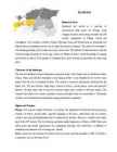
NEW ZEALAND Geography: New Zealand is situated midway between the Equator and the South pole in the southern Pacific Ocean. It consists of two large islands, North Island and South Island, plus several smaller ones of which Stewart Island is the largest. North and South Islands are separated by the 32km wide Cook Strait. The total land area is 270,535 sq Km, about the size of Italy, the United Kingdom or the US state of Colorado. North Island is volcanically active with three active volcanoes. South Island has the high snow covered mountain peaks and glaciers of the Southern Alps, a range running almost 500Km along the Island. The longest river is the Waikato on North Island (425 Km), the largest inland stretch of water is Lake Taupo also on North Island (607 sq Km) and the highest point is Mount Cook on South Island (3754 m)
Misso Keskkool New Zealand Precis Compiler: Maiki Joakit Instructor: Mailis Teppo Misso 2011 New Zealand is an island country in the south-western Pacific Ocean comprising two main landmasses (the North Island and the South Island), and numerous smaller islands, most notably Stewart Island/Rakiura and the Chatham Islands. The indigenous Mori language name for New Zealand is Aotearoa, commonly translated as land of the long white cloud. Population (1998): 3,801,000.New Zealand is notable for its geographic isolation; it is
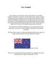
coastline is approximately 3 800 km. The longest distance from east to west is 350 km, while north to south Estonia stretches 240 km. THE NAME The name EESTI was apparently derived from the word AISTI, the name given by ancient Germans to the peoples living northeast of the Vistula River. Tacitius, the Roman historian, was the first one to mention it (AESTI), while the Arab scholar alIdrisi was the first one to mark it on a map (as ASTLANDA). To the ancient Scandinavians the land was known as EISTLAND; to modern Scandinavians it is known as ESTLAND. Most contemporary languages use the Latin name ESTONIA. FLAG The Estonian blueblackandwhite national flag was originally the flag of the Estonian Student's Society, consecrated in Otepää Church in 1884. today there is a memorial plaque on the church wall commemorating the event. The Flag Museum attracts tourists who take an interest in the history of the flag.
Kihnu, Ruhnu and Abruka. Straitland is low-lying and flat. It was flooded by the sea for much longer than the rest of mainland Estonia. The climate is maritime and greatly influenced by the Baltic Sea. The area features large bogs, extensive forests, coastal plains, warm and peaceful beaches, the lake Kaali with its mystical meteorite flight and a number of offshore islands. The islanders have their own customs, national costumes and speak their own local dialects. Thousands of birds visit Straitland areas during their spring and autumn migrations. Sights and Tourism Pärnu is the summer capital of Estonia. In summer, the population of forty-four thousand grows tenfold. Its beach, seaside parks, squirrels hopping in the trees, sanatoriums and rest homes, curative sea-mud and holidaymakers are its characteristic features. Pärnu as a summer resort dates back to the 19th century. The first bathing institution started operations in Pärnu in 1838. Pärnu also
Topic Australia Tallinn English College 2006 Australia 1 . Introduction The name Australia is derived from the Latin Australis, meaning of the south. In land area, Australia is the sixth largest nation, its territory is 7,686,850 sq km and its population reaches today over 20,5 million people. It is the only nation to govern an entire continent and its outlying islands. Australia's capital is Canberra, the only city with its own territory. It was built in the early 1900s just to be the capital. The official language is English and the official name of Australia is the Commonwealth of Australia.
Tartu Secondary School of Business New Zealand Report Kati-Liis Karu 10.A - I group TARTU 2009 Contents 1. Introduction ...................................................................................................3 2. Area. Population. Climate.........................................................................................4 3. Economy. Largest Cities..................................
The currency used in Estonia is Eesti kroon. The Estonian national flag is blue-black-white. It was originally the flag of the Estonian Students' Society. The flag was first consecrated in Otepää Church in 1884. For a while, during the Soviet occupation, the flag was banned but it was again seen in public in Tartu in May 1988. The national flower is cornflower, the national bird is barn swallow and the national stone is limestone. The Estonian national anthem called "My Native Land, My Pride and Joy" was composed in 1848 by Friedrich Pacius. The Estonian language words were written by J. V. Jannsen. It was officially adopted after the War of Independence in 1920.The same melody with different words is also Finland's national anthem. The current coat of arms of Estonia is a golden shield which includes three slim, blue leopards (or lions) in the middle, with oak branches along the side of the shield. It originates from Denmark. It was officially adopted in 1925.
Geography New Zealand is an island country in the Southwest Pacific Ocean. It lies about 1600 kilometres southeast of Australia, its nearest continental neighbour. New Zealand belongs to Polynesia, a large island group. The country consists of two main islands The North Island and the South Island and several dozen much smaller islands. The population is 4.1 million. New Zealand is a beautiful country of snowcapped mountains, green lowlands, beaches and many lakes and waterfalls. No place is more than 130 kilometres from the coast. Lakes, rivers, and waterfalls are found throughout New Zealand. Most of the lakes lie in the volcanic plateu of the North Island and in glacial valleys near the Southern Alps of the South Isaland. On both islands the rivers rise in the mountains and flow down to the sea
automobiles, trains and airplanes. Etymology The term "travel" originates from the Old French word travail. The term also covers all the activites performed during a travel (movement). A person who travels is spelled "traveler" in the United states, and "traveller" in the United Kingdom. Purpose and motivation Reason for traveling include recreation, tourism or vacationing, research travel for gathering information, for holiday to visit people, volunteer travel for charity, migration to begin life somewhere else, religious pilgrimages and mission trips, business travel, trade, commuting, and other reason, such as to obtain health care or fleeing war or for the enjoyment of traveling. World's best places to visit: Paris and Barcelona Why go: Year after year, the Why go: Known around the world magnetic City of Lights draws new for its legendary football team,
Australia Australia is a country and also a continent. If someone wants to make clear, that he is speaking of the country, he may call it by its full name of Commonwealth of Australia. Australia's name means "southland."It is south of the equator. Sometimes it is also called the island continent because it is an island. There are about twenty million people in Australia.It is 1,800 miles from the mainland of Asia and almost half way round the world from Europe. More than 600 miles of ocean separate it from Americas. Since Australia is south of the equator, its seasons are just the opposite of ours. It has summer while we have winter, and the other way round. States and Territories. Australia consists of six states, two territories and eight external territories. The six states are: Western Australia (capital Perth), South Australia (capital Adelaide),
New Zealand New Zealand is on of the first countries in the world. It to be located southeast of australia.It consists of two main islands and a number of smaller outlying islands. New Zealand's two main components are the North Island and the South Island.The North Island is only half as big as the South Island, but nearly 75% of the population live on the North Island. About two-thirds of the south Island is covered with mountains. More than 220 mountains are higher than 2000 meters
Capital city is Wellington Total area 268,680 km² Population of 4,252,000 Official languages: English (98%) Mori (4.2%) NZ Sign Language (0.6%) History The first settlers were Eastern Polynesians somewhere around 800 and 1300 AD These settlers developed into a distinct culture known as Mori First European Abel Janszoon Tasman in 1642 British explorer James Cook in 176871 Culture and sports Large festivals are held in celebration of Diwali and Chinese New Year. The world's largest Polynesian festival, Pasifika, is an annual event in Auckland. Diwaliis a major Indian and Nepalese holiday. Popular sports are rugby, cricket, bowls, netball, soccer, golf , swimming and tennis. New Zealand has won more Olympic gold medals than any other country. Main tourist attractions Mount Cook Mount Ruapehu and Lake Taupo White Island Bay of Islands Things to do in New Zealand Birdwatching Black Water rafting Bungee Jump in
(over 30 000 designs were submitted). In the upper left corner there is the Union Jack that is the national flag of England. It denotes Australia's historical links with Great Britain. Under the flag there is the Commonwealth star which has seven tips. Six of them represent the states and the last one is for the Commonwealth of Australia. The Southern Cross is in the right. It consists of five stars. The group of stars on the flag shows the geographical place of Australia which is in the southern hemisphere. The coat of arms was created in 1912. Before that coat of arms there was another that did not have so many things on it. On the coat of arms there is the national animal kangaroo. Emu is also there because it is a bird that is very interesting and it is only in Australia. They are standing on the golden wattle that is the national flower. In the top there is the star of the Commonwealth. Under it there is a shield
Commonwealth of Australia. It’s the official name of the country. Australia is the smallest continent, but one of the largest countries on Earth. It’s 6th largest country. Its area is about 7.6 million sq km. One third of it is occupied by deserts. It’s both the flattest and, except for Antarctica the driest. Neighbouring countries include Indonesia, East Timor and Papua New Guinea in the north, the Solomon Islands, Vanuatu in the northeast, and New Zealand in the southeast. Its capital is Canberra. Other big cities are Melbourne, Sydney, and Brisbane. National language in Australia is English. Monetary unit is Australian dollar. Their national holiday is on the 26th of January. In 1788 on the 26th of January the first fleet arrived at Botany Bay and established a penal colony near modern-day Sydney. Geographical Position Australia is located in the Southern Hemisphere. It’s the only continent except for Antarctica that is all south of
as steam assisted gravity drainage, which was developed in Alberta, bitumen and synthetic crude oil can be produced at costs close to those of conventional crude. Many companies employ both conventional strip mining and non-conventional methods to extract the bitumen from the oil sands. With current technology and at current prices, about 315 billion barrels of bitumen are recoverable. Fort McMurray, one of Canada's fastest growing cities, has grown enormously in recent years because of the large corporations which have taken on the task of oil production. As of late 2006 there were over $100 billion in oil sands projects under construction or in the planning stages in northeastern Alberta. Another factor determining the viability of oil extraction from the Tar Sands is the price of oil. The oil price increases since 2003 have made it more than profitable to extract this oil, which in the past would give little profit or even a loss. Culture
The southwest part of the Great Plains is the hottest and driest region of the U.S. The Pacific coast is almost rainless in the summer, but having often fog. IN the winter there is frequent drizzle, but the climate is still, warm. The eastern part of the county is moderately rainy and the summers are extremely humid. History The first known inhabitants of modern-day United States territory are believed to have arrived over a period of several thousand years by crossing Beringa into Alaska. Research has revealed much about the early Native American settlers of North America who are also called Indians. Columbus' men were the first documented Old Worlders to land in the territory of what is now the United States. In its beginnings, the United States of America consisted only of the Thirteen Colonies. American colonists fought off the British army in the American Revolutionary War of the 1770s and issued a Declaration of Independence in 1776
SOCIETY AND CULTURE OF ENGLISH-SPEAKING COUNTRIES Introduction 1. Nowadays, English is so widely spoken that it can hardly be considered "a one nation's" language. The main countries where English is spoken are: the U.K, the U.S, Canada, Australia, the Republic of Ireland, New Zealand, West Indies 2. There are approx. 300-400 million speakers of English in the world. English occupies the 3rd place by its number of speakers; it is right behind Mandarin and Spanish. 3. ESL (English as a Second Language) used in your own country (e.g. India) EFL (English as a Foreign Language) used in a foreign country ESP (English for Specific Purposes) used in business, airlines, hotels etc. 4. Settlement colonies people migrated into them from Britain and started their own communities, they are the present English-speaking countries (USA, Australia,
Parliament is consists of The House Of Representatives and The Senat. The House of Representatives consists of 150 members. The party with the majority provides the Prime Minister, who also forms the Government. Today the power is divided by three parties: The Australian Labour Party, the Liberal Party and National Party. The Senat's membership is wider, it comprises 12 senators from each state and 2 from each territory. Senators are elected for six year terms. The Executive power in Australia is in the hands of the Commonwealth Government lead by the Prime Minister. Today the Prime Minister is John Howard, the leader of the Liberal Party. History Australia was once a part of the giant continent Gondwana. It included Africa, South America and Antarctica. First Australia and Antarctica split from Gondwana, then Australia broke away from Antarctica and began to move north. Aborigines arrived there about 50 000 years ago
called Niagara Falls of the Baltic. Jägala Falls are about 8 meters high. Valaste Waterfall is the highest waterfall in Estonia, located on Valaste stream near the Baltic coast. Waterfall Valaste is 30.5m high since 1996, declared as a cultural heritage and national symbol of Estonia. Valaste Waterfall is a popular tourist destination in the summer but also in winter, when nature creates the ice kingdom. Sights If you are coming to Estonia, you need to visit: Old Town of Tallinn Kaali Meteorite Craters Jägala waterfall Kumu art museum Kadriorg palace People Estonians are a Finnic people closely related to the Finns and inhabiting, primarily, the country of Estonia. They speak a Finnic language known as Estonian. Although Estonia is traditionally grouped as one of the Baltic countries, Estonians are ethnically and linguistically unrelated to the Baltic peoples of Latvia and Lithuania. Things to do
Vancouver, Winnipeg and Quebec. Canada has two official languages English and French. It's interesting to know that about 61% of Canadians name English and 24% French their mother tongue. There are also many other languages spoken in Canada such as: Italian, Chinese, German, Polish, Ukrainian, Greek and Dutch. There are also many native languages such as Algonquian. The British and the French as the main settlers from Europe fought for hundreds of years before they managed to build up a country which was based on recognizing the cultural diversity of different nations in Canada. All the communities living in the country are encouraged to remember their origins and hold their own ethnic events and national festivals. Cultural diversity makes Canada even more interesting. In spite of this, in recent years there is a strong movement in French-speaking Quebec to become an independent country.
The riches and cultural heritage of Mulgimaa owe to the diligence and tenacity of the local people. Village handicraftsmen and masters have always been honoured. Mulgikapsad (stewed sauerkraut with barley groats), Estonian cheesecakes and kama (a roasted meal-mixture) have not lost their popularity. However, linen growers have now been replaced by cereal grains growers and many farms have specialised on raising sheep or horses. And as the song goes: "Mulgimaa it's a place where life is good. It's a land of vast woods, fertile fields and nature's charms, the home of prosperous Estonian farms..." Tourism and handicraft in Lõuna-Viljandimaa Lõuna- Viljandimaa captivates senses with its beautiful landscapes. Lõuna- Viljandimaa as we know it today stays in the heart of the historic Mulgimaa. Mulgimaa is the home of mountains, deep valleys and lakes, its natural axis is the beautiful old valley of Halliste.
Society and culture of english-sspeaking countries Introduction 1. The countries of the world where the English language is spoken. 2. Approximate number of mother tongue speakers of English approximately 350-400 million native speakers. Which place does English occupy in the world by its number of speakers?After which language? English occupies second place by its number of speakers after Mandarin Chinese. 3. What is the difference between English as a Second Language, English as a Foreign Language and English for Specific Purposes? Give examples of situations where they are used. English as a Second Language (ESL or TESL) is a traditional term for the use or study of the English language by non-native speakers in an English-speaking environment. That environment may be a country in which English is the mother tongue (e.g., Australia, the U.S
Bora Some of the bigger industries on the island include deep-sea fishing, with exports going mainly to Japan, as well as mother-of-pearl and pearl production. Agricultural practices produce sugar, vanilla, rum, and copra (used to extract coconut oil). Despite all of these activities, tourism is by far the leading economic contributor. The island has several hotels to cater to tourists, including twelve 4 and 5-store places like Club Med, for example. 3 Bora Bora experiences a tropical, humid climate with relatively stable temperatures year- round. The island is characterized by its volcanic rock mountains and raised coral beds found at high elevations. Coconut palms, pandanus trees, and breadfruit trees cover the landscape. Like most islands, animal life is not found in abundance although, wild pigs, rats, and lizards can be seen from time to time. The ocean waters surrounding the island
background. Red means courage, blue justice and white innocence. There is a star for every state of the USA. The official language of the USA is English; Spanish is also widely spoken. The currency of the USA is the United States Dollar. The government of the USA is composed of three coordinate branches: the executive, legislative and the judicial. All the three branches are equal. The executive power is vested in the president, who holds office for a term of four year. At the moment George W. Bush is the president. The president is elected together with a vice-president and will take his place when the president dies or resigns in office. The president of the USA lives in the White House (at 1600 Pennsylvania Avenue) Washington, D.C. while he holds office. The Legislative branch Congress consists of the Senate and the House of Representatives. There are a hundred people in the Senate (two from each state) and 435
Covent Garden site, the previous two being destroyed by fire. The new building opened in May 1858 becoming known as the Royal Opera House in 1892. Restoration work began again in 1996 and was completed in December 1999. Thousands of visitors each year are welcomed through the doors not only for performances but to marvel at the views from the Amphitheatre Terrace, to enjoy lunch, shop or wander round the exhibitions and appreciate the `wow´ factor on entering the Floral Hall. With the addition of lifts and escalators, this is one of the most accessible theatres in Britain today.
Nature and geography Finland is a country of thousands of lakes and islands; 187,888 lakes (larger than 500 m²) and 179,584 islands to be precise. One of these lakes, Saimaa, is the fifth largest in Europe. The Finnish landscape is mostly flat with few hills and its highest point, the Halti at 1,324 metres, is found in the extreme north of Lapland at the border between Finland and Norway. The landscape is covered mostly (seventy-five percent of land area) by coniferous taiga forests and fens, with little arable land. The most common type of rock is granite. It is a ubiquitous part of the scenery, visible wherever there is no soil cover. Moraine or till is the most common type of soil, covered by a thin layer of humus of biological origin. The greater part of the islands are found in southwest in the Archipelago Sea, part of the archipelago of the Åland Islands, and along the southern coast in the Gulf of Finland.
Climate Canada's climate varies wildly based on geography, from perma-frost in the north to four distinct seasons towards the equator. In this region the temperature can climb up to 35 degrees Celsius in the summer and descend to a chilly -25 degrees Celsius during winter. Canada's climate and environment are one of the main reasons that Canada is such a succesful country. The blend of natural resources and climate sustains us. The seasons dictate the look of the land: according to whether the natural environment is in a state of dormancy or growth. Canada's climate is characterized by its diversity, as temperature and precipitation differ depending on where you are and what time of year it is. Other than the North where it's above freezing for only a few months a year, most Canadian cities are within 300 km of the southern border, where mild springs, hot summers and pleasantly crisp autumns are common during the majority of the year.
as Zizkov, Vinohrady, Smíchov and Holesovice. You'll be guaranteed cheaper prices, a more local ambience, and an assured escape from any more feelings of doubt.. Instead of summer practice i would like to go on trip to Prague. I think it would be more educational then sita t school and trantslate story or doing exercises. Because students can use language in their real life and they will get experiences. We can see beautiful and attractive Prague city and visit famous places. I think it rare opportunity to write an essay and to get trip with your classmates. If i have chance to go to Prague i would definitely vist an Old Town, Charles University Botanical Garden, Praguage COMPENDIUM ABOUT PRAGUE Prague is the capital and largest city of the Czech Republic. Nicknames for Prague have included Praga mater urbium/Praha matka mst ("Prague Mother of Cities") in Latin/Czech,
Pre-Intermediate (Opportunities) Questions about Auckland 1. Where's A. situated? Auckland is situated in the Nort Island of New Zealand. 2. What's the population of A? It's the home of more than 400,000 people in Auckland City, that's 32.4% of the national population. 3. What kind of city is it? It is the biggest city of New Zealand, and it's waterside location has fostered the locals love affair with the sea, earning this place the nickname "City of Sails". 4. Who inhabited the city first? The first sailors to settle here were the Maori, and in later years migrants from the Pacific Islands have contributed to the Polynesian population. 5. When did the Europeans come? Europeans setteled in Auckland in 1840, a thousand years after Maori's did. 6. What kind of centre is Auckland? Auckland is the center of sails. 7. What are its most famous sights? Describe them.
Australia is surrounded by the Indian and Pacific oceans, it is separated from Asia by the Arafura and Timor seas. Australia presents an enormous range of climatic conditions, since it covers thirty degrees of latitude. It is mostly temperate, but one third of the continent is tropical, and there are large desert areas. The two largest cities are Sydney and Melbourne. The capital of Australia is Canberra. It is a small city and was built in the early 1900s. History. Two hundred years ago there were no white people in Australia. The only inhabitants were dark-skinned people who were still living in a Stone Age. Their only weapons were stone knives and boomerangs. But their tribes had very well-worked- out customs. A few aborigines still live in the emptier part of the continent. In 1770, the British explorer Captain Cook raised the British flag. Cook found there a pleasant climate and beautiful forests. The British initially used Australia as a gigantic prison camp for
Australia Fact file: Australia comprises a land area of 7 686 850 square kilometres. Its population is about 21,3 million people. Australia's capital is Canberra. The national language is English. The official name of it is the Commonwealth of Australia. It's divided into six states and two territories: New South Wales, Queensland, South Australia, Western Australia, Tasmania, Victoria, Australian Capital Territory (ACT) and Northern Territory. Symbols: