Leidsid 33 sarnast õppematerjali, mis on seotud failiga "Kuressaare PowerPoint Inglise keeles". Need materjalid aitavad sul teemat sügavamalt mõista.
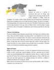
castle, museum, municipality, first, mary, taaler, island, county, located, situated, riga, oldest, founded, biggest, museums, thousand, year, heart, built, during, 14th, received, charter, 1563, rule, appeared, around, 1154, literature, vocabulary, omavalitsusinternational trade routes for Vikings. Long struggle of power with foreign intruders has left ancient strongholds in Valjala, Lihula and Soontagana. The churches in Muhu, Valjala, Mustjala, Karja and Kihelkonna are honorable and elderly because Straitland was the one to bring Christianity to Estonia. The castle of Kuressaare is still standing proudly, but in Lihula only ruins can be seen. The patterns of national dresses and the churches bring memories of secret sign cultures of Medieval Times. Good knowledge of singing and facility of speech of the people of Straitland have given Estonia a big number of writers and poets. Character of the landscape The area of Straitland contains Pärnumaa county and some of the islands such as Saaremaa, Muhu, Kihnu, Ruhnu and Abruka
Toompea Toompea is the oldest and the most respectable part of the city. For centuries there was only one means of access to Toompea Pikk Jalg Street. In the middle of the 15th century the Lower Town fenced itself off with these walls from the Upper Town because of the permanent contradictions between the noblemen of Toompea and the citizens of Down Town. At the end of the street there used to be a wooden gate, in place of this a gate-tower was built at the end of the 14th century. At present Pikk Jalg Street is only for pedestrians. There still exists another gate to Toompea Short Leg. It was laid in the 15th century. The massive wooden gate with ironworks dates from the 17th century. Long Leg was used by vehicles. Until the 20th century there was no way down form the western side of Toompea except for a foot-path. The stairs were built in 1903 and are called Patkul Stairs. The name Patkul itself comes from Johann Patkul
Tallinn The place is believed to have been settled by Finno-Ugric peoples about 2500 BC. The Danes, led by King Valdemar II, conquered northern Estonia in 1219. Legend has it that one day, when the Danes were about to lose a bloody battle, the sky suddenly opened and a red flag with a white cross on it dropped down upon them from the heavens. This is allegedly how the Danes obtained their national flag, the Dannebrog in a battle against the Estonians. In the middle of the 14th century Denmark sold its possessions in Estonia to the German Teutonic Order. Toompea became the seat of the German-born gentry. A wall was built to separate the Upper Town and the Lower Town. In 1285 Tallinn joined the Hanseatic league and became a junction of trade between East and West. Tallinn is said to be built on salt, as it was an important trading commodity. In the 16th century Tallinn had a population of about 7,000 8,000 making it one of the biggest cities in northern Europe
ASTLANDA). To the ancient Scandinavians the land was known as EISTLAND; to modern Scandinavians it is known as ESTLAND. Most contemporary languages use the Latin name ESTONIA. FLAG The Estonian blueblackandwhite national flag was originally the flag of the Estonian Student's Society, consecrated in Otepää Church in 1884. today there is a memorial plaque on the church wall commemorating the event. The Flag Museum attracts tourists who take an interest in the history of the flag. After about half a century, during which it was prohibited by the Soviet authorities, the flag was sen again in public for the first time in Tartu. Many elderly people were carrying the flags they had kept in secret hiding places durin the Soviet years; tears were rolling down their cheeks. On 24 February 1989, Estonia, still part of the Soviet Union, hoisted its tricolour on the tower of Pikk Hermann in Tallinn
Kildu Basic School Viljandi by Eisi Kõiv Supervisor: Margit Kirss Kildu 2008 Our 700 years old Viljandi Viljandi is a town (24,000 inhabitants) in Estonia, 160 km south of the capital Tallinn. The town is the administrative capital of the county with the same name as the town. In Viljandi there is theater Ugala, cinema Rubiin, museum, art gallery. Give a concert in Culture centre, Jaani- and Pauluse church, but in Cultureacatemy, too. Folk Summer in Viljandi culminates with the annual folk music festival. The Viljandi Folk Music Festival is a music festival in Estonia with a central focus on European folk music.In the year 2006, over 24,000 people attended the concerts, but many more just came to take part in the festivities. As such, it is the largest annual music festival in
Estonian cities Tallinn is the capital and largest city of Estonia. It occupies an area of 159.2 square kilometers with a population of 413,000. It is situated on the northern coast of the country, on the banks of the Gulf of Finland, 80 km south of Helsinki, east of Stockholm and west of Saint Petersburg. Tallinn was founded in the 12th century and has been under the rule of Denmark, Sweden, and Germany as well as Russia, and all left their mark on the city's architecture. It is one of the best preserved medieval towns in northern Europe, and makes a beautiful impression from
nature and a lot of sights Saaremaa has retained its uniqueness due to its location and insulation Junipers, dolomite, windmills and the famous local home-brewed beer are considered the symbols of Saaremaa A lot of sights Among the numerous sights of Saaremaa, several are worth calling special attention to, e.g. Angla windmill hill, Mustjala cliff, manor house at Loona, ruins of Maasi castle of order, and Mihkli Farm Museum at Viki. The most important tourist sight in the only town of the county, Kuressaare (up to 1917 Arensburg) is the bishopric castle dating from the 13lh century Kuressaare is also known for its beautiful and well preserved old town. A lot of sights The meteorite crater at Kaali is the biggest in Europe and easily accessible to visitors Events Cultural events bring thousands of visitors to
· Suuremõisa Castle. Suuremõisa Castle was built in the second half of the 18th century on the initiative of Countess EbbaMargaretha Stenbock (17041776). The wings are erected in 1772. There are 64 rooms in the Castle. 6 ponds were dug in the grounds of the Castle and a park and a garden established. In 1796 the Castle was sold to Baron UngernSternberg. The attic of the Castle has doubleceiling, where the Baron used to hide the treasures stolen from ships that had sunk in the Näkimadalad. On 19 October 1802 the Baron killed Karl Johannes Malm, the Captain (of Swedish origin) of his ship "Brig Morian", in this Castle. For this the baron was deported to Siberia. There are currently two schools in the Castle: Suuremõisa Gymnasium and Suuremõisa Technical School. In the latter one can also study how to become a ship's captain.
two hundred single nature objects under protection - parks, high cliffs, large trees, erratic boulders and unique marshy lowlands. The meteorite crater at Kaali is the biggest in Europe and easily approachable for visitors A lot of sights. Among the numerous sights of Saaremaa, several are worth calling special attention to, e.g. Angla windmill hill, Mustjala cliff, bell tower built in the 17Ih century at Kihelkonna, manor house at Loona, ruins of Maasi castle of order, and Mihkli Farm Museum at Viki. The medieval churches of Saaremaa have remarkable archaic architecture, e.g. churches of Poide and Karja. The oldest of them - the church of Valjala - was built in the 13th century. The most important tourist sight in the only town of the county, Kuressaare (up to 1917 Arensburg) is the bishopric castle dating from the 13lh century. This castle is unique in the Baltic countries. Kuressaare is also
the Gulf of Riga. The city is served by Pärnu Airport. Pärnu is a health resort of international stature. In addition to guests arriving from around fifty countries, it is also proved by its membership in the European Spas Association (since 2000) and the European Flag that has been flying at the beach of Pärnu since 2000. Many tourists in Pärnu are Finns and Estonians. Since 1996 Pärnu has been known as Estonia's Summer Capital. Viljandi Viljandi is a town and municipality in southern Estonia with a population of 19,870 (2007). It is the capital of Viljandi County. The town was first mentioned in 1283, upon being granted its town charter by Wilhelm von Endorpe.The city is situated on the north-western shore of Lake Viljandi, which lies in the primeval valley. Green zones cover 27% of the city area. Since 1920, Viljandi has had the Ugala drama theatre. The tradition of open-air performances dates back to the same year
wetlands cover 30%. The landscape of Estonia, through covering a small area, is varied and unique. Lake Peipsi is Estonia's largest lake and Europe's fourth largest freshwater lake. 5. Symbols The flag The Estonian blue-black and white national flag was originally the flag of the Estonian Students' Society and was consecrated in Otepää Church in 1884. Today there is a memorial plaque on the church wall commemorating the event. The Flag Museum, opened in an annex in 1996, attracts tourists who take an interest in the history of the flag. After about half a century, during which it was prohibited by the Soviet authorities, the flag was seen again in public for the first time in Tartu in May 1988. 24 February 1989, Estonia, still part of the Soviet Union, hoisted its tricolor on the tower of Pikk Hermann in Tallinn. Since then the flag has always been hoisted with ceremony on that day, which is the national
It was first marked on a map of the world by the Arab geographer al-Idrisi in 1154, its name then being Kolyvan. In the 13 th- century chronicle of Henricus de Lettis the town was called Lyndanise. Then it was called Reval for some time and finally Estonians started to call the town Tallinn from Taanilinn (Danish town) after the Danish conquest in the 13th century. The Knights of the Sword took Tallinn from the Danes in 1227 and made Toompea their fortress. In the middle of the 14th century Denmark sold its possessions in Estonia to the German Teutonic Order; Toompea became the seat of German-born gentry. A fortified wall was built between the Toompea (the Upper Town) and the Lower Town (inhabited by people of a lower social standing), as there were conflicts between the two. The doors and the gates of the wall were locked at night, a procedure which carried on until the end of the 19th century.
top 10 digital cities in the world.The city was a European Capital of Culture for 2011, along with urku, Finland.Tallinn is the oldest capital inNorthern Europe. The city was known as Reval from the 13th century until the 1920s. http://en.wikipedia.org/wiki/Tallinn Old Tallinn The Old Town can historically be divided into two distinct areas: Toompea Hill and the Lower Old Town, which were separated by a dividing wall since medieval times. The elevated area of Toompea Hill with its castle was occupied by the residences of Tallinn's rulers and gentry. The Lower Old Town meanwhile developed as an autonomous merchantile centre, flourishing during the 13th-16th centuries, when the city enjoyed membership of the powerful Hanseatic Trading League. Generally speaking these two districts are now collectively referred as the Old Town. The Town wall and towers Medieval fortresses, which emerged during the development of the medieval town at the end of the
Tallinn - the word origins from estonian language, could mean “taani-linn”, “tali-linn” or “talu- linn”; Reval was replaced when Estonia became independent Symbols Flag - blue black white tricolor; blue represents sky, black the soil, and white our freedom. Danneborg - red flag with a white cross fell from the sky during the battle in 1219. It is also set into the small coat of arms of Tallinn. Great coat of arms - three lions, a knight, and Danish queen; leaves around Old Thomas - quardian of Tallinn, put on top of the spire of Tallinn Town Hall in 1530; boy that excelled springtime contests thrown by Baltic German elite, because of his low-born status was unable to receive a prize, therefore was granted the position of town guard. Right now there’s third Old Thomas, first one can be seen at Tallinn City Museum. Toompea as a symbol of power Toompea palace - wooden fortification was originally built in the 9th century, Danes made the
At various times in history, the city has been given different names. In 1219 Henricus de Lettis wrote about the Lyndanise stronghold of the Rävala people. On 13 June that year King Waldemar II of Denmark came to conquer north Estonia. The Estonians lost the battle and the Danse renamed the town Reval, as it was the centre of the ancient Estonian province of Rävala. The Estonian, however, rejected the name and began to call the city Taani linn, the Estonian for Danish castle. Tallinn’s economy started to boom in the 19 th century with the emergence of machine-building, woodworking and textile industries. A railroad was built in 1870, linking the city to St. Petersburg. From that time Estonia maintained close ties with Russia. From 1918 to 1940 Tallinn was the capital of the Republic of Estonia. It was then that Tallinn became the official name of the town. Toomas Hendrik Ilves (born 26 December 1953) is the fourth President of Estonia, in office since 2006.
at Pirita. At various times in history, the city has been given different names. In 1219 Henricus de Lettis wrote about the Lyndanise stronghold of the Rävala people. On 13 June that year King Waldemar II of Denmark came to conquer north Estonia. The Estonians lost the battle and the Danse renamed the town Reval, as it was the centre of the ancient Estonian province of Rävala. The Estonian, however, rejected the name and began to call the city Taani linn, the Estonian for Danish castle. Tallinn's economy started to boom in the 19th century with the emergence of machine- building, woodworking and textile industries. A railroad was built in 1870, linking the city to St. Petersburg. From that time Estonia maintained close ties with Russia. From 1918 to 1940 Tallinn was the capital of the Republic of Estonia. It was then that Tallinn became the official name of the town.
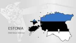
Facts and figures The Republic of Estonia is a small country. Covering only 45, 228 sq km it is slightly bigger than Denmark, Belgium or Switzerland. Estonia's population is under 1.4 million. The official language is Estonian but since very many Russians live here Russian is also wide spread. The capital of Estonia is Tallinn. The currency used in Estonia is Eesti kroon. The Estonian national flag is blue-black-white. It was originally the flag of the Estonian Students' Society. The flag was first consecrated in Otepää Church in 1884. For a while, during the Soviet occupation, the flag was banned but it was again seen in public in Tartu in May 1988. The national flower is cornflower, the national bird is barn swallow and the national stone is limestone. The Estonian national anthem called "My Native Land, My Pride and Joy" was composed in 1848 by Friedrich Pacius. The Estonian language words were written by J. V. Jannsen. It was officially adopted after the War of Independence in 1920
are Lake Peipsi and Lake Võrtsjärv. • Highest point: Suur Munamägi (Great Egg Hill), 318 m • The capital of Estonia is Tallinn (439 517 inhabitants (01.01.2016) or approx. 32% of the total population). Other large cities and population (thousands): Tartu - 103 300 Narva - 65 900 Kohtla-Järve - 44 500 Pärnu - 44 000 PAIDE TOWN IS THE HEART OF ESTONIA Paide town is located right in the centre of Estonia, earning it the nickname of “the Heart of Estonia”. A long historic background, beautiful surroundings, a colourful fair and festival life and an unique relationship with the limestone – come and experience the cosy feel of Paide. Paide town was named after the limestone (“paekivi”
There used to be Harju gate, which can now be seen through glass. ● The statue of Liberty, 2009; represents freedom, Estonia has been under many foreign powers, starting with Danes, Sweden, German and Russia. The clock of liberty, 2004. Kiek in de Kök ● The cannon tower, founded in 1475-1483. Kiika kööki, peek into the kitchen, from up there it was possible to peek into the enemy’s kitchen. The walls are 4 m thick, can see the cannons stuck in there. Tallinn City Museum. ● Town Wall (Unesco) - one of the greatest towers of Tallinn’s Town Wall, Old Town declared the UNESCO World Heritage Site in 1997 Toompea ● Toompea is a limestone hill in the central of Tallinn. It towers about 30-40 metres above the surrounding areas. According to the legend, its the tumulus moundn over the grave of the national hero Kalev, erected stone by stone by his grieving wife Linda
countryside charm to create a comprehensive experience of Estonia beyond the big cities. But the legend of the White Lady of Haapsalu, which is at the heart of the festival, is perhaps the most famous tall tale of the many that are so abundant in Estonia's folklore. It is the story of a poor girl who falls in love with the son of the village elder, and disguises herself as a choirboy in order to sneak into the castle. But, alas, the lord of the manor's son discovers the deception. He is overcome by jealous rage and orders his men to seal the girl inside the thick stone walls while still alive. Turned into an incarnation of undying love, the White Lady now appears every August, on the night of the full moon, in the Dome Church chapel window. Haapsalu is seven-and-a- quarter centuries old this year, and the townsfolk intend to make it a celebration to remember
This all lead to Estonia's independence on 24 February 1918. In June 1940 Estonia became a part of the Soviet Union. On 20 August 1991 the Republic of Estonia was restored without any bloodshed. CULTURE? National emblems. The Estonian blue-black-and-white national flag was originally the flag of the Estonian Students' Society, consecrated in Otepää Church in 1884. Today there is a memorial plaque on the church wall commemorating the event. The Flag Museum was opened in 1996. During the Soviet time the flag was prohibited. But many people hided their flags somewhere and the flag was seen again in 1988 in public. A meeting was held in Tartu and elderly people were carrying the flags, nationalistic speeches were told and patriotic songs were sung. Tears were rolling down people's cheeks. The Estonian flag is hoisted every morning at sunrise and lowered at sunset.
The Romans finally invaded Britain in AD 43 from Kent. The Romans lead by Julius Caesar attempted to invade Britain twice before that in 55 and 54 BC but the invasions were unsuccessful. They made their way to the river Thames and sailed up it. The Romans knew it was important to control a crossing point at the river Thames, so they decided to build a settlement on the north bank. Although small settlements had been built on the banks of the Thames, the Romans were the ones who built the first city. They called their city Londinium. The Roman engineers noticed that the point where the swampy river narrowed would make an ideal crossing point, they built London Bridge. Less than 20 years later the native Iceni tribe, led by Queen Boudicca, rose up against the Romans in revenge for mistreatment and burnt Londinium to the ground. The well disciplined Roman army defeated her forces and Londinium was rebuilt. By AD 100 it had also become the capital of the Roman province. A
Economic development Transport costs are high due to its location Low inflation and tax breaks attract foreign investors to the Republic The economy is heavily dependent on agriculture Tourism is a flourishing branch of the economy All the major cities lie on the coast or near the sea. They are Dublin, Galway, Limerick, Cork and Waterford Where to go? Ireland features wild coastlines, sandy beaches, lush valleys, dark peat lands and unruffled lakes. The island may be divided into the following parts: * Southeast Ireland * Cork and Kerry * the Lower Shannon * the West of Ireland * Northwest Ireland * the Midlands * Northern Ireland Southeast Ireland Kilkenny the country's loveliest inland city Kilkenny castle The Irish parliament often met in the castle in the 13th century. It was in the possession of the AngloNorman Butler family for 500 years The Irish National Heritage Park an openair museum.
Tallinn was first mentioned in written sources of the 1154th, when the Arabian geographer Al Idris took a world map the city 'Kaleveny "/ Kolõvan. Through the years, the city of Tallinn had several names: Lindanisa, Kolõvan, Reval and eventually Tallinn. Tallinn was granted the Lübeck law in 1248 and became the member of the Hanseatic League in 1285. General Data l Country - Estonia l County - Harju County l First appeared on map - 1154 l Town rights - 1248 l Mayor - Edgar Savisaar l Aera - Total 159.2 km2 (61.5 sq mi) l Population - (1 Mar 2012) Total - 416,470 Denisty - 2,614.0/km2(6,766.6/sq mi) Tallinn Coat of arms Flag Top 5 Attractions 1. Kiek in de Kök Visitors to the museum will see examples of Medieval firepower, displays detailing how the city's system of walls and towers developed through the centuries and an exhibit on crime and punishment in Old Tallinn. 2
Toompea (from German Domberg – Cathedral Hill ) is a limestone hill with an area of about 7 hectares in the central part of Tallinn. It towers about 30-40 m above the surrounding areas. According to the legend it´s the tumulus mound over the grave of the national hero Kalev, erected stone by stone in his memory by his grieving wife Linda. It is the birthplace of Tallinn - a place where in 1229 the Knights of the Sword built a fortress instead of the wooden Estonian stronghold. Toompea Castle is also one of the most potent symbols of the reigning power. Today Toompea is the seat of the Government of Estonia as well as the Riigikogu, both of which are often simply colloquially referred to as Toompea. For centuries there was only one access to Toompea - Pikk Jalg - but there is also another way leading up to Toompea - Lühike Jalg, which was made in the 14th century. At present Pikk Jalg and Lühike Jalg are used only by pedestrians. Until
and tacky commercialism. Packed in among thousands of other visitors, trying like crazy to see the city in three days and worrying about getting ripped off, it's not surprising, may think the city is overrated. Just relax, take a deep breath. While the city centre is a mélange of stunning architecture, from Gothic, Renaissance and baroque to neoclassical, art nouveau and cubist, beyond the medieval lanes of the Old Town and the Castle District, there's an entire other cosmopolitan city to explore. Search out the riverside parks, lively bars and beer gardens, music clubs, museums and art galleries. Harness Prague's excellent public-transport system to explore emerging suburbs such as Zizkov, Vinohrady, Smíchov and Holesovice. You'll be guaranteed cheaper prices, a more local ambience, and an assured escape from any more feelings of doubt..
Project ESTONIA MAP OF ESTONIA Southern Viljandimaa The southern part of Viljandi county catches the eye with its sublime scenery. The area today lies in the very heart of the historical Mulgimaa the home of hills, deep valleys and lakes brought together by a beauty spot Halliste primeval valley. According to several folk tales, it is also in these valleys, woods and bogs that Old Nick found refuge.The great variety displayed in the nature is also reflected in the local cultural heritage. At the beginning of the 19th century growing linen spread and became the basis
in 1346. The Swedes came next in 1561. Tallinn weathered plague and the Great Northern War and became part of Russia in 1710. In 1918, Estonia declared independence from Russia and fought a bitter war against Bolshevik Russia. Independence didn’t last long, however, and the fledgling nation fell first to the Nazis and then the Soviets during World War II. Despite all this conquering, Tallinn’s historic core has survived remarkably intact. Much of the 14th century city wall still stands, including a couple of stretches where you can climb the narrow spiral staircases of the towers and end up on the medieval catwalk. The Viru Gates, flanked by thin pointed towers from the 14th century, makes a nice entrance into Old Town. Dominating the town atop Toompea Hill is Toompea Castle and Pikk Hermann Tower. It was used as the center of government since 1229 and is now the site of Estonia’s parliament
Tallinn is a small port town in which the population is 371 000 people, and the area is only 159,2 km².( square kilometers). Tallinn, the capital of Estonia, is named after taani linnus, which means Danish castle. The Castle in question was built by King Waldemar of Denmark in the 13th century. The settlement quickly developed itself into a busy port. -The Old Town In medieval age Tallinn was called Reval and it was as big as the Tallinns Old Town is now. Uniqueness of Tallinn is that it is one of very few European cities, where the historical lay-out is kept in it's original form , and has a lot of monuments of that time. Thanks to that in 1997 Old
Tallinn is the capital of Estonia and also the largest city in the country. It occupies an area of 159.2 km2 (61.5 sq mi) with a population of 411,196. During different periods, the city has been known under several different names. In 1154 a town called Qlwn or Qalaven (possible derivations of Kalevan or Kolyvan) was put on the world map of the Almoravid by cartographer Muhammad al-Idrisi who described it as a small town like a large castle among the towns of Astlanda. It has been suggested that the Quwri in Astlanda may have denoted the predecessor town of today's Tallinn. The earliest name Kolyvan may be derived from the mythical Estonian hero Kalev. Up to the 13th century the Scandinavians and Henry of Livonia in his chronicle called the town Lindanisa: Lyndanisse in Danish, Lindanäs in Swedish, also mentioned as Ledenets in Old East Slavic. According to some theories the name derived from
politics, education, entertainment and even fashion contribute to its status as a major global city. London is a major tourist attraction with four world heritage sites, several royal parks and numerous iconic landmarks such as the Houses of Parliament, Towe Bridge, the Tower of London, Westminster Abbey and the London Eye. 2. History Although there is some evidence of a permanent settlement before the Romans came in 43 A.D., it is more accepted by historians that the Romans were the first. The settlement was called Londinium. The first London lasted for just seventeen years, for around AD 61, a tribe of Celts led by Queen Boudica stormed London, burning it to the ground. The next heavily-planned London prospered and surpassed Colchester (another major city at the time) as the capital of the Roman province of Britannia. At its height in the 2nd century, Roman London had a population of about 60,000. However, by the 3 rd century, the city fell into a decline due to trouble in the
.......... Harjumaa 2011 1 1. Steamer-icebreaker Suur Tõll The ship was built in 1914 in Stettin (Szczecin) by Vulkan-Werke A. G. Suur Tll is the only pre-war steam ship of the Republic of Estonia remained up to now and, at the same time, the biggest icebreaker in the world preserved through two world wars. All the 3 original steam engines as well as most of the original arrangement of space and late Jugendstil interior of the officers' rooms are preserved. In 1914 the first home port of the ship was Tallinn. The ship ensured a regular winter sea navigation for Tallinn up to the end of the independency period. 2. The Tallinn Song Festival Grounds The Tallinn Song Stage was built in 1959 for arranging the Song Festivals. The stage was meant to hold over 15 000 singers. Indoor rooms can be used as a backstage area during the concerts but those are also suitable for all kind of events, parties, concerts, 2
Western Australia , South Australia, The Australian Capital Territory and the Northern Territory). The Australian people are culturally the same as the Anglo Americans. There also live aborigines. Aborigines are the ancestors of the people. Like the US and Canada, Australia was an English speaking colony of Great Britain. Today Australia is a modern developed country with a diversified economy. Australia is an island continent of 7.7 million square kilometres, which makes it a little smaller than the USA. Located in south of Asia, between The Pacific and Indian Oceans, Australia is the World's driest continent. Although large areas of the centre are desert, Australia has a wide range of climate from tropical in the north to temperate in the south east, where it frequently snows in winter. Geographical position The coasts of Australia are surrounded by the Pacific Ocean, the Indian Ocean and the