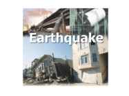
EARTHQUAKES What is earthquake? • the result of a sudden release of energy in the Earth's crust that creates seismic waves. • the earthquakes are measured by magnitudes • caused mostly by rupture of geological faults, but also by other events • such as volcanic activity, landslides, mine blasts, and nuclear tests • earthquakes manifest themselves by shaking and sometimes displacement of the ground Japan earthquake 2011 • 9.03 magnitude undersea megathrust earthquake • Triggered powerful tsunami waves • After the World War ll the most difficult crisis for Japan Luzon earthquake 1990 • 7.8 magnitude earthquake in Philippines How to be Prepared
mudeldamine on raskendatud kahe sündmuste mõne erinevuse ja andmete puuduse tõttu. 8 7. Kasutatud kirjandus Dickens, G. R., O'Neil, D., Rea, D. K. & Owen, R. M. 1995 Dissociation of oceanic methane hydrate as a cause of the carbon isotope excursion at the end of the Paleocene. Paleoceanography 10, 965971. Haywood, A.M., Ridgwell, A., lunt, D.J. 2011. Are there pre-Quaternary geological analogues for a future greenhouse warming? Phil Trans R Soc A, March 13, 2011, v. 369, p. 933-956. Koch, P.L.; Zachos, J.C.; Gingerich, P.D. (1992). "Correlation between isotope records in marine and continental carbon reservoirs near the Palaeocene/Eocene boundary". Nature 358: 319322. Kelly, D.C., Nielsen, T.M.J., McCarren, H.K., Zachos, J.C., & Röhl, U., 2010: Spatiotemporal patterns of carbonate sedimentation in the South Atlantic: Implications for carbon cycling during
Full height 171 m 1000 elephants Most expensive gemstones About 735,000 euro Tourism 2-4 million tourists every year, 200,000 of them foreigners Busiest months October, November and February Interesting facts The emperor cut off the hands of the workers Perfectly symmetrical 28 types of stones Map Grand Canyon In Arizona, formed by the Colorado River One of the Seven Natural Wonders Of The World Length, width, depth 2 billion years of geological history Tourism Trips on the Colorado river Hiking Phantom Ranch Mule riding 5 million visitors every year Interesting facts The snakes are pink Became a national park in 1919 17th national park in the US A Native American tribe still lives there You can't buy bottled water Map Used literature http://www.tucantravel.com/travel-highlights/10-interesting-facts-about-taj-mahal http://simple.wikipedia
Ethnography. This collection is so vast that only a very small percentage of it is on show to the public. There's also a department of prints and drawings. There're departments devoted to maps, coins, medals and philately. Those who come to the British museum can see a fascinating array of clocks and watches. Cultural life of London would be impossible without the Royal Albert hall, the Royal Festival hall, the National theatre and a great number of museums: the Victoria and Albert museum, the Geological Museum, the Museum of Mankind, Natural history museum and others.
The central highlands The central highlands contain a wide variety of topographies: rounded and eroded hills, massive . granite outcrops and alluvial plains and marshes. The central highlands include the Anjafy High Plateaux and the Ankaratra Massif. A prominent feature of the central highlands is a rift valley, the largest body of water on the island, having a length of forty kilometers. This region has experienced geological subsidence, and earth tremors are frequent here. The west coast The west coast, composed of sedimentary formations deposited in several layers over time, is more indented than the east coast. Deep bays and well-protected harbors have attracted explorers, traders, and pirates from Europe, Africa, and the Middle East. The area has served as an important bridge between Madagascar and the outside world. The southwest
Fourth level Fifth level Attractions 1.One of the largest sandstone rock formation lying in the Northern territory of central Australia is Uluru alais Ayers Rock. 2. Sydney Opera House (1957 - 1973) is a masterpiece of late modern architecture. 3. Kangaroo Island. It is a sanctuary for endangered species and home to a few geological phenomena. 4. The Great Barrier Reef is the world's largest coral reef system composed of over 2,900 individual reefs and 900 islands. Uluru Click to edit Master text styles Second level Third level Fourth level Fifth level Sydney Opera House Click to edit Master text styles
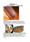
The oldest of them - the church of Valjala - was built in the 13th century. The most important tourist sight in the only town of the county, Kuressaare (up to 1917 Arensburg) is the bishopric castle dating from the 13lh century. This castle is unique in the Baltic countries. Kuressaare is also known for its beautiful and well preserved old town. Kaali meteorite crater Eighteen kilometers from Kuressaare towards Kuivastu is the location of Estonia's most unique geological object, Kaali lake. The meteoric origin of the lake basin was first suggested by J. Kalkun-Kaljuvee in 1922. The crater walls are covered with trees and vegetation. A path around the rim of the crater allows you to observe it from all sides. The water level of the lake changes with the seasons, as you can see from the photos below. When the lake is nearly dry a small elevated central mound appears in the lake, distinctive of impact craters. Symbols of Saaremaa Bread.
Separated by the North Channel, the island of Ireland lies 30 kilometres (20 mi) from the southwest tip of the Scottish mainland. Norway is located 305 kilometres (190 mi) to the northeast of Scotland across the North Sea. The Atlantic Ocean, which fringes the coastline of western and northern Scotland and its islands, influences the temperate, maritime climate of the country. The topography of Scotland is distinguished by the Highland Boundary Fault a geological rock fracture which traverses the Scottish mainland from Helensburgh to Stonehaven. The faultline separates two distinctively different physiographic regions; namely the Highlands to the north and west and the lowlands to the south and east. The more rugged Highland region contains the majority of Scotland's mountainous terrain, including the highest peak , Ben Nevis. Lowland areas, in the southern part of Scotland, are flatter and home to
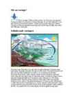
Lõige online-pildist kus on toodud välja hilisemad maavärinad. Punane-viimase tunni aja jooksul, sinine-viimase ühe päeva jooksul, kollane-viimase ühe nädala jooksul. Yosemite Valley Hollywood Golden Gate Bridge Veel üks pilk põllumajandus piirkonnale, The Central Valley Kasutatud kirjandus http://www.conservation.ca.gov/cgs/EarthquakeDOC/Pages/EarthquakeDOC.aspx http://search.ca.gov/search? q=geological+survey&submit.x=0&submit.y=0&site=ca_all&client=ca_x&output=xml_ no_dtd&proxystylesheet=ca_x http://www.wikipedia.org/ http://www.miksike.ee/documents/main/referaadid/maavarinad.htm http://www.sacvalleycnps.org/Conservation/vernalpools/mather3.htm http://quake.usgs.gov/recenteqs/ http://www.esa.int/esaEO/SEM9703Z28F_index_0.html ENE 1 A-CENT
aastal Cornwallis. Ta märkas uue elemendi olemasolu ilmeniidis (raudtitaanoksiidis), kui ta leidis lähevalasuvast jõekalda liiva seest musta liiva, mis tõmbus magneti külge. Analüüs tõestas, et seal on kaks metalloksiidi raudoksiid (mis seletas liiva magneti poole tõmbuvust) ja 45.25% mingit valget metalset oksiidi, mida Gregor ei suutnud tuvastada. Taibates, et tundmatu oksiid ei klapi ühegi teadaoleva elemendi omadustega, teatas ta oma leiust ühingusse nimega Royal Geological Society of Cornwall ning saksa teadusajakirja "Crell's Annalen". Samal ajal avastas ka Franz Jopseph Muller sarnase aine, kuid ei suutnud seda tuvastada. Saksa keemik Martin Heinrich Klaproth Ungarist avastas sama oksiidi iseseisvalt 1795. aastal. Klaproth leidis oksiidis olevat uue elemendi ning nimetas selle Titaanide järgi Greeka mütoloogiast. Algul ei osatud titaani puhtal kujul (99.9%) toota, sest seda ei saanud teha
train, has also been restored. Haapsalu's main festival however is are the White Lady Days, held at the time of the August full moon. Top ten places to visit in Estonia The Kaali meteorite craters The most probable age of the Kaali crates is 75007600 years. There is archaeological evidence that it was a place of offering for many centuries. Kaali lake is considered to be the most unique geological object in Estonia. Valaste waterfall The Valaste River, feeds the waterfall, is also known as "the big ditch" by locals. 30.5 metres During winter the waterfall freezes and forms fairytale like ice sculptures. Top ten places to visit in Estonia Pärnu Long, white sanded beaches are the trademark of Pärnu. Pärnu is know for it's historic mud and SPA treatments. Pärnu a title of Estonian Summer Capital. Nõva
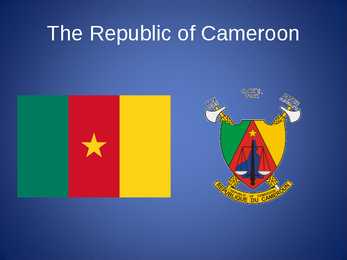
The Republic of Cameroon Cameroon · A unitary republic of central and western Africa · Bordered by Nigeria to the west; Chad to the northeast; the Central African Republic to the east; and Equatorial Guinea, Gabon, and the Republic of the Congo to the south. · Cameroon's coastline lies on the Bight of Bonny, part of the Gulf of Guinea and the Atlantic Ocean. · The country is called "Africa in miniature" for its geological and cultural diversity. History · The territory of present day Cameroon was first settled during the Neolithic · Portuguese sailors reached the coast in 1472 · The German Empire claimed the territory as the colony of Kamerun in 1884 and began a steady push inland. · An economic crisis took effect in the mid-1980s to late 1990s as a result of international economic conditions, drought, falling petroleum prices, and years of corruption,
The geographical centre of Scotland lies a few miles from the village of Newtonmore in Badenoch. Rising to 1,344 metres (4,406 ft) above sea level, Scotland's highest point is the summit of Ben Nevis, in Lochaber, while Scotland's longest river, the River Tay, flows for a distance of 190 km (120 miles). Geology and geomorphology The whole of Scotland was covered by ice sheets during the Pleistocene ice ages and the landscape is much affected by glaciation. From a geological perspective the country has three main sub-divisions. The The climate of Scotland is temperate and oceanic, and tends to be very changeable. It is warmed by the Gulf Stream from the Atlantic, and as such has much milder winters (but cooler, wetter summers) than areas on similar latitudes, for example Copenhagen, Moscow, or the Kamchatka Peninsula on the opposite side of Eurasia. However, temperatures are generally lower than in the rest of the UK, with the coldest ever UK temperature of -27
Avaldatud Creative Commonsi litsentsi „Autorile viitamine + jagamine samadel tingimustel 3.0 Eesti (CC BY-SA 3.0)“ alusel, vt Koostaja: Ülle http://creativecommons.org/licenses/by-sa/3.0/ee/ Liiber Avaldatud Creative Commons litsensi „Autorile viitamine+ jagamine samadel tingimustel 3.0 Eesti (CC BY-SA 3.0) alusel vt http://creativecommons.org/licenses/by-sa/3.0/ee Terry Sohl , U.S. Geological Survey Turistide arv kasvab väga • kiiresti Turism on viimase 50 aasta jooksul tohutult laienenud ning muutunud ülemaailmseks tööstuseks. • Rahvusvaheliste turistide arv kasvab 2020. aastaks 1,6 miljardini, millest 1,2 miljardit on regioonisisesed ja 0,4 miljardit on kaugreisijad. mlr Lähis-
keskkonnale Koostaja: Ülle Liiber Avaldatud Creative Commonsi litsentsi „Autorile viitamine + jagamine samadel tingimustel 3.0 Eesti (CC BY-SA 3.0)“ alusel, vt http://creativecommons.org/licenses/by-sa/3.0/ee/ Avaldatud Creative Commons litsensi „Autorile viitamine+ jagamine samadel tingimustel 3.0 Eesti (CC BY-SA 3.0) alusel vt http://creativecommons.org/licenses/by-sa/3.0/ee Terry Sohl , U.S. Geological Survey Põllumajandusliku maa suurenemine – loodusliku mitmekesisuse vähenemine • Linnastumise, teedeehituse ja metsade lageraie kõrval on põllumajandus üks peamisi maastike muutjaid. • Põllumaade laienemisega kaasneb loodusliku mitmekesisuse vähenemine. • Selle tagajärjel halvenevad ökoloogilised tingimused. • Looduslik taimkate säilib vaid majanduslikult vähekasulikel aladel
pdf (07.12.2017) Suurna, R., Sisas, E. (2010). GIS ja kartograafia alused. – Riiklik Eksami- ja Kvalifikatsioonikeskus. Kättesaadav: http://www.innove.ee/UserFiles/Kutseharidus/ %C3%95ppe-%20ja%20juhendmaterjalid/GIS_loeng-ilovepdf-compressed.pdf (02.12.2017) Umwelt und Informationstechnologie Zentrum (UIZ). (2017). Use of GIS in Natural Resource Managment. Kättesaadav: http://uizentrum.de/en/use-of-gis-in-natural-resource-management- 2/ (08.12.2017) Joonis 1. U. S. Geological Survey (USGS). Mineral Resources Online Spatial Data. Kättesaadav: https://mrdata.usgs.gov/general/map-global.html#settings (08.12.2017) 10
Ühest küljest on kaadmium näide tööstuslikult kasutatavast ainest, millel on negatiivne mõju inimese tervisele, kuid teisest küljest on see näide laborite ja ülikoolide rahvusvahelise koostöö kasumlikust potensiaalist. KASUTATUD KIRJANDUS Agency for Toxic Substances and Disease Registry. (2012). Toxicological Profile for Cadmium. (10.04.2016) http://www.atsdr.cdc.gov/toxfaqs/tfacts5.pdf 12 Butterman, W. C., Plachy, J. U.S. Geological survey. Mineral Commodity Profiles. Cadmium. (10.04.2016) http://pubs.usgs.gov/of/2002/of02-238/of02-238.pdf Dartmouth Toxic Metals. (17.04.2016) http://www.dartmouth.edu/~toxmetal/toxic- metals/more-metals/cadmium-faq.html Karik, H. (2000). Anorgaaniline keemia. Tallinn: AS Koolibri Karik, H., Truus, K. (2003). Elementide keemia. Tallinn: Kirjastus Ilo Maanteeamet. (2009). Raskemetallid pinnases. (10.04.2016) http://www.mnt.ee/index.php? id=12362 New Jersey Department of Health. (2007)
Museums There are more than 20 museums in Tallinn. The oldest of them is the History Museum. It was founded in 1842. The museum is situated in the Gothic guildhall in Pikk Street built for the Great Merchants` Guild in the 15th century. The Town Museum has a permanent exhibition on the history of Tallinn from the 13th century. The museum is situated in a 14th century dwelling house in Vene Street. The Museum of Natural History in Lai Street offers a survey of Estonian geological past, mineral resources, plants and animal life. The Maritime Museum lies in the 16th century defence tower Stout Margaret in Pikk Street. There are displayed old nautical instruments, models of ships, maps and charts. The Museum of Applied Art stands on the corner of Lai and Aida Street. It offers collections of pottery, leatherwork, metalwork, glasswork, carpets and jewellery. The Theatre and Music Museum in Müürivahe Street has a display of old musical instruments.
hingamisteede- ja südamehaiguste põdejail võib mõjuda surmavalt. EL-s on osoon igal aastal rohkem kui 20000 inimesele surma päästikuks. Suurimad ühe tunni vältel mõõdetud osooni kontsentratsioonid 2004 aasta suvel (04.-09.) Geoloogiline aineringe Geoloogilise aineringe puhul eristatakse väikest ja suurt tsüklit. Väike tsükkel on settekivimite ring murenemine, edasikandumine, settimine, tihenemine ja taas settekivimeiks kivistumine. Geological or rock cycle the series of events in which a rock of one type is converted to one or more other types and then back to the original type. : . . Geoloogiline aineringe Suures geoloogilises tsüklis satuvad Maa pinnal murenenud tard- ja moondekivimeist moodustunud settekivimid maakoore liikuvais osades suurde sügavusse ja moonduvad seal. Edasi võib moondekivim kas jõuda hiljem jälle Maa pinnale ja mureneda või sulada ning sattuda magma koostisesse
Väga mürgise saaste võivad tekitada fosfororgaanilised ühendid, mida kasutatakse mitmesugustes mürkides, pesu- ja taimekaitsevahendites.Põhilised fosforisaaste allikad on kodumajapidamised, tööstused ja aasta-aastalt aina vähem põllumajandus. Ingliskeelsete sõnade tähendused: Plants - taimed Animals loomad Decomporsers - lagundajad Runoff - äravool, ärakanne Phosphate in soil - pinnases olev fosfaat Geological uplifting geoloogiline kerkimine Weathering of phosphate from rocks kivimite murenemisel vabanev fosfaat Leaching- välja imbumine Phosphate in solution lahustunud fosfaat Chemical precipitation keemilised reaktsioonid, sadestumised Detritus settling to bottom sademete põhjasettimine Sedimentation settimine New rock uued kivimid Kasutatud kirjandus. 1) Hergi Karik, Kalle Truus ,,Elementide keemia," Ilo, 2003 2) Hergi Karik ,,Hämmastavad ained," Valgus, 1991
üsna ruttu pinnaveekogudesse pääseda või maapinna ja taimede kaudu auruda (evapotranspiratsioon). Osa maasseimbunud veest vajub sügavamale maasse ning täiendab põhjaveekihtide (veega küllastunud kivimite) mageveevaru pikaks ajaks. Ka see vesi liigub ja võib leida mageveeallikatena tee maapinnale ning lõpuks tagasi ookeani jõuda, kus veeringe "lõpeb" ... ja algab uuesti. Veeringe osad USA Geoloogiatalitus (U.S. Geological Survey, USGS) jagab veeringe kuueteistkümneks osaks: Mereveevaru Aurumine Evapotranspiratsioon Sublimatsioon Veevaru atmosfääris Kondensatsioon Sademed Veevaru jääs ja lumes Sulaveeäravool jõgedesse Pindmine äravool Jõeäravool Mageveevaru; Maasseimbumine Põhjaveevaru Põhjaveeäravool Allikad Mereveevaru Ookean on veeladu Ookeanides on
electricity or propulsion. In 2007, 14% of the world's electricity came from nuclear power. More than 150 nuclear-powered naval vessels have been built, and a few radioisotope rockets have been produced. Nuclear life cycle The Nuclear Fuel Cycle begins when uranium is mined, enriched, and manufactured into nuclear fuel, which is delivered to a nuclear power plant. After usage in the power plant, the spent fuel is delivered to a reprocessing plant or to a final repository for geological disposition. In reprocessing 95% of spent fuel can be recycled to be returned to usage in a power plant. What is nuclear energy? Nuclear energy was first discovered by French physicist Henri Becquerel in 1896, when he found that photographic plates stored in the dark near uranium were blackened like X-ray plates, which had been just recently discovered at the time 1895. It is energy released by the splitting (fission) or merging together (fusion) of the nuclei of atoms
vähem põllumajandus. (Skeemi allikas: http://io.uwinnipeg.ca/~simmons/Chap5498/sld025.htm ) Koostanud: Janno Puks Tallinna Arte ja Kristiine Gümnaasium 15 Ingliskeelsete sõnade tähendused: Rain vihm Plants - taimed Animals loomad Decomporsers - lagundajad Runoff - äravool, ärakanne Phosphate in soil - pinnases olev fosfaat Geological uplifting geoloogiline kerkimine Weathering of phosphate from rocks kivimite murenemisel vabanev fosfaat Leaching- välja imbumine Phosphate in solution lahustunud fosfaat Chemical precipitation keemilised reaktsioonid, sadestumised Detritus settling to bottom sademete põhjasettimine Sedimentation settimine New rock uued kivimid KASUTATUD KIRJANDUS 1) Hergi Karik, Kalle Truus ,,Elementide keemia," Ilo, 2003
konnaopetus_2008.pdf Elken, J. 2009. Merehoovuste trikid. - Horisont, nr 1. http://www.horisont.ee/node/846 Hieb, M. 2009. Climate and the Carboniferous Period. http://www.geocraft.com/WVFossils/Carboniferous_climat e.html Illarionov, A. 2004. The Kyoto Protocol: an Assault on Science, Economic Growth, and Human Freedoms. http://www.iea.ru/article/kioto_order/kyoto.ppt Jutras, P. 2007. Alarmist Global Warming Models vs the Geological Record. http://www.smu.ca/academic/science/geology/bios/documen ts/ALARMISTGLOBALWARMINGMODELSVSTHEGE OLOGICALRECORDHongKong2007.pdf Kallaste, T. 2001. Eesti kui ÜRO kliimamuutuste raamkonventsiooni liikmesriik. SEI. Tallinn. Labitzke, K. 1987. Sunspots, the QBO, and the stratospheric temperature in the North Polar region. Geophysical Research Letters, 14, 535. McKitrick, R.R., Michaels, P.J. 2007. Quantifying the
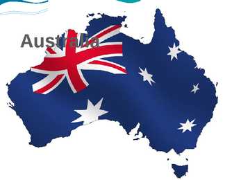
Nowadays Australian culture is strongly influenced by western culture. Australia is one of the most urbanised countries in the world. 70 per cent of its population lives in the biggest cities. Australian Aboriginal culture is complicated and very diverse. It is one of the world's longest surviving cultures which goes back at least 50, 000 years (but some think it's closer to 150,000 years). Different oral histories have been backed up by geological data such as the flooding of Port Philip Bay which happened about 10,000 years ago. 11 . Sports Australians are wellknown sportsmen. They have achieved much recognition in diving, golf, skiing, surfing, boating and especially in swimming. They've won numerous Olympic medals in that category. Some of Australia's traditional sporting events receive worldwide attention. Probably the most famous
EPSF Encapsulated PostScript Files ERA Extended Registry Attributes ERAS Electronic Routing and Approval System [Hughes Aircraft] ERD Emergency Repair Disk + Entity Relationship Diagram ERIC Educational Resources Information Center [Internet] ERLL Enhanced Run Length Limited ERMA * Electronic Recording Method, Accounting [General Electric] EROM Erasable Read Only Memory EROS Earth Resources Observation System [U.S. Geological Survey] ERP Effective Radiated Power + Enterprise Resource Planning ERR Error ER/RC Extended Result/Response Code ERU Emergency Recovery Utility [Microsoft] ES Extra Segment ESA Enterprise Systems Architecture [IBM] + European Space Agency ESB Enterprise Service Bus ESC EISA System Component + Escape ESCD Extended System Configuration Data ESCM Extended Services Communications Manager [IBM] ESCO Extemded Synchronous Connections
Kuna suur osa veest aurustub ookeanidelt ja langeb sinna ka tagasi, nimetatakse seda väikeseks veeringeks. Suure veeringe moodustab aga ookeanidelt aurunud veehulk, mis jõuab maismaale. Ehkki üldiselt võib Maa veehulka lugeda konstantseks, hajub kosmosesse pidevalt veemolekule, mis põhimõtteliselt asendatakse Maa geoloogiliste protsesside tagajärjel (vulkaanid), mil maapinnale jõuab juveniilne vesi. Ameerika Ühendriikide Geoloogiatalituse (U.S. Geological Survey (USGS)) järgi võib veeringe jaotada kuueteistkümneks osaks: 1. Mereveevaru 2. Aurumine 3. Evapotranspiratsioon 4. Sublimatsioon 5. Veevaru atmosfääris 6. Kondensatsioon 7. Sademed 8. Veevaru jääs ja lumes 9. Sulaveeäravool jõgedesse 10.Pindmine äravool 11.Jõeäravool 12.Mageveevaru 13.Maasseimbumine 14.Põhjaveevaru 15.Põhjaveeäravool 16.Allikad 19. Aurumine. Kondenseerumine.
The revenues of these four companies almost outstripped the revenues of all the 50 Black Africa countries south of the Sahara combined. Let’s take a country like Nigeria for instance. It is the so-called giant of Africa, the leader of the Black world. Nigeria is the seventh largest oil producing country in the world. Nigerians pride themselves as one of the most educated people in the world. It has all kinds of engineers, including petroleum and geological engineers. Oil was discovered in Nigeria in1948. But you know what? Nigeria still imports refined oil at exorbitant rates. It does not have engineers who prospect for the oil; it does not have engineers who drill for the oil; it does not have engineers who refine the oil. It imports the oil. Nigeria has two oil refineries – all built by foreigners. To maintain these refineries they must import the experts (whites) who built the refineries to repair any minor problems
These include: a) Exploration of minerals; b) Mining of minerals; b1) Handling a mineral deposit or processing minerals; c) Utilization of the remains of mining enterprises; d) Use of underground spaces, as well as building and exploitation of such underground facilities (including facilities for storage of industrial wastes from oil and natural gas pro- duction and wastewater) that are not related to extraction of useful minerals; e) Gathering geological, mineralogical, paleontological collections for museum exhibits. (The Law on Minerals, Article 6, Paragraph 1) A license for the use of minerals does not cover oil and natural gas resources. Usually, an application for a mineral use license is issued for a definite term, specifically for a period of 5 to 45 years. The terms are specified in accordance with the types of use: a) For minerals used for energy purposes up to 45 years;