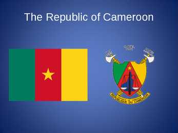
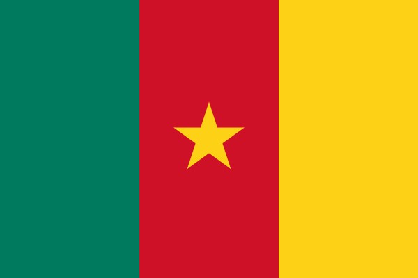
The Republic of Cameroon (0)
The Republic of Cameroon
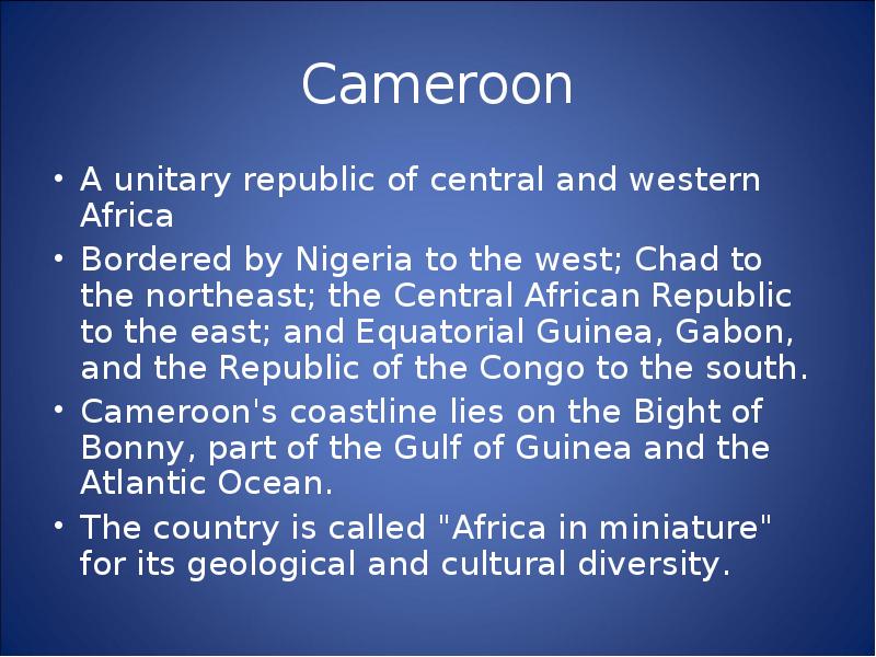
Cameroon
· A unitary republic of central and western Africa
· Bordered by Nigeria to the west; Chad to the northeast;
the Central African Republic to the east; and
Equatorial Guinea, Gabon, and the Republic of the
Congo to the south.
· Cameroon's coastline lies on the Bight of Bonny, part
of the Gulf of Guinea and the Atlantic Ocean.
· The country is called "Africa in miniature" for its
geological and cultural diversity.
History
· The territory of present day Cameroon was first settled
during the Neolithic
· Portuguese sailors reached the coast in 1472
· The German Empire claimed the territory as the colony of
Kamerun in 1884 and began a steady push inland.
· An economic crisis took effect in the mid-1980s to late
1990s as a result of international economic conditions,
drought, falling petroleum prices, and years of corruption,
mismanagement, and cronyism.
Politics and Government
· The President of Cameroon has broad, unilateral powers to
create policy, administer government agencies, command
the armed forces, negotiate and ratify treaties, and declare a
state of emergency
· The president appoints government officials at all levels,
from the prime minister (considered the official head of
government), to the provincial governors, divisional
officers, and urban-council members in large cities)
· Cameroon's legal system is largely based on French civil
law with common law influences
· The judiciary is officially divided into tribunals, the court
of appeal, and the supreme court.
Politics and Government
· Human rights organisations accuse police and military forces
of mistreating and even torturing criminal suspects, ethnic
minorities, homosexuals, and political activists
· The National Assembly makes legislation. The body consists of
180 members who are elected for five-year terms and meet
three times per year. Laws are passed on a majority vote.
Rarely has the assembly changed or blocked legislation
proposed by the president.
· President Paul Biya's Cameroon People's Democratic
Movement (CPDM) was the only legal political party until
December 1990. Numerous ethnic and regional political groups
have since formed
· The last parliamentary elections were held on 22 July 2007.
Education
· Most children have access to free, state-run schools or
private and religious facilities. The educational system is a
mixture of British and French precedentswith most
instruction in English or French.
· Seven state-run universities serve Cameroon's student
population. More than 60,000 students were enrolled for the
19981999 school year.
· Since 1990, private institutions have sprung up in at least
five regions. These schools charge fees that are five to ten
times those levied by state schools. Nevertheless, they offer
short professional-training programmes in areas such as
accounting, management, journalism, and Internet
technologies, so they are popular with students.
Health
· The quality of health care is generally low
· Outside the major cities, facilities are often dirty
and poorly equipped.
· Endemic diseases include dengue fever, filariasis,
leishmaniasis, malaria, meningitis,
schistosomiasis, and sleeping sickness
· The HIV/AIDS seroprevalencerate is estimated at
5.4% for those aged 1549, although a strong
stigma against the illness keeps the number of
reported cases artificially low
Geography and climate
· At 475,442 square kilometers, Cameroon is the world's 53rd-largest
country.It is comparable in size to Papua New Guinea and
somewhat larger than the U.S. state of California
· Cameroon is divided into five major geographic zones distinguished
by dominant physical, climatic, and vegetative features. The coastal
plain extends 15 to 150 kilometerrs inland from the Gulf of Guinea
and has an average elevation of 90 meters
· An irregular chain of mountains, hills, and plateaus known as the
Cameroon range extends from Mount Cameroon on the coast--
Cameroon's highest point at 4,095 meters
· Cameroon has four patterns of drainage. In the south, the principal
rivers are the Ntem, Nyong, Sanaga, and Wouri.
· The Logone flows northward into Lake Chad, which Cameroon
shares with three neighbouring countries.
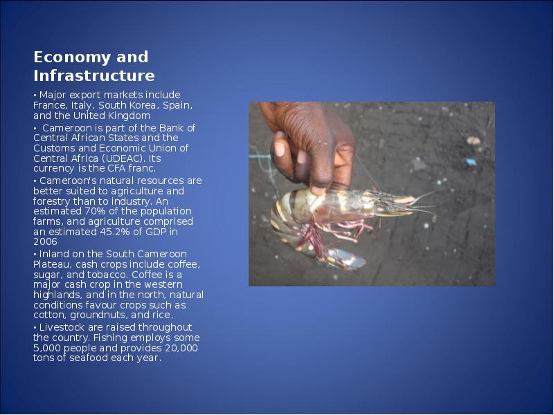
Economy and
Infrastructure
· Major export markets include France,
Italy, South Korea, Spain, and the
United Kingdom
· Cameroon is part of the Bank of
Central African States and the Customs
and Economic Union of Central Africa
(UDEAC). Its currency is the CFA
franc.
· Cameroon's natural resources are
better suited to agriculture and forestry
than to industry. An estimated 70% of
the population farms, and agriculture
comprised an estimated 45.2% of GDP
in 2006
· Inland on the South Cameroon
Plateau, cash crops include coffee,
sugar, and tobacco. Coffee is a major
cash crop in the western highlands, and
in the north, natural conditions favour
crops such as cotton, groundnuts, and
rice.
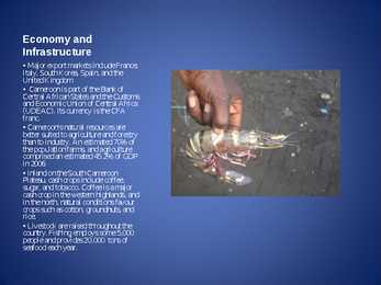
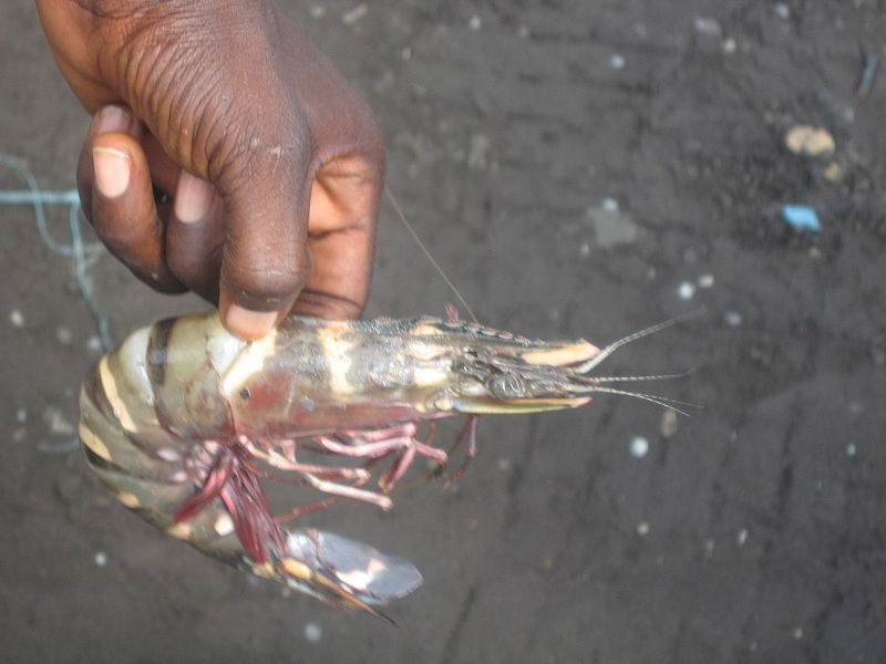
· Livestock are raised throughout the
country. Fishing employs some 5,000
people and provides 20,000 tons of
seafood each year.
Economy and infrastructure
· Transport in Cameroon is often difficult. Roads are
poorly maintained and subject to inclement weather,
since only 10% of the roadways are tarred.
· Rail service runs from Kumba in the west to Bélabo
in the east and north to Ngaoundéré. International
airports are located in Douala and Garoua with a
smaller facility at Y aoundé.
· The major radio and television stations are state-run,
and other communications, such as land-based
telephones and telegraphs, are largely under
government control
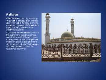
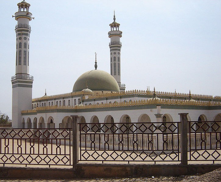
Religion
· The Christian community, makes up 40 percent of the
population. There is also 40 percent of the population
who maintain Indigenous beliefs, and Islam is practiced
by 20 percent of the country's population.
· Christians are concentrated chiefly in the southern and
western provinces and Muslims reside in large numbers
in every province. There is significant internal migration.
Large cities have significant populations of both groups,
with mosques and churches often located near each other.
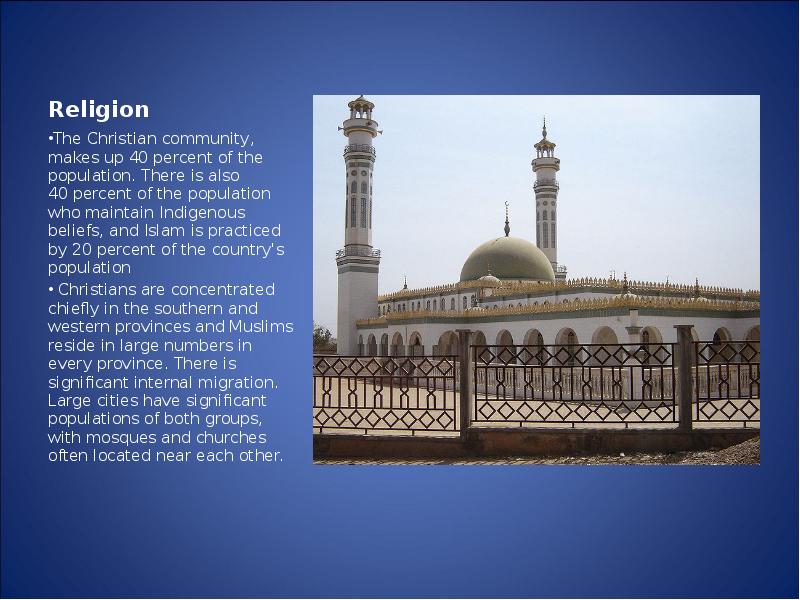
Religion
·The Christian community, makes up
40 percent of the population. There is
also 40 percent of the population who
maintain Indigenous beliefs, and Islam
is practiced by 20 percent of the
country's population
· Christians are concentrated chiefly in
the southern and western provinces
and Muslims reside in large numbers
in every province. There is significant
internal migration. Large cities have
significant populations of both groups,
with mosques and churches often
located near each other.
Culture
· Each of Cameroon's ethnic groups has its own unique cultural forms. Typical
celebrations include births, deaths, plantings, harvests, and religious rituals
· Seven national holidays are observed throughout the year, and movable
holidays include the Christian holy days of Good Friday, Easter Sunday, Easter
Monday, and Ascension; and the Muslim holy days of 'Id al-Fitr, 'Id al-Adha,
and Eid Miladun Nabi.
· Music and dance are an integral part of Cameroonian ceremonies, festivals,
social gatherings, and storytelling. Traditional dances are highly choreographed
and separate men and women or forbid participation by one sex altogether.
· Cuisine varies by region, but a large, one-course, evening meal is common
throughout the country. A typical dish is based on cocoyams, maize, manioc,
millet, plantains, potatoes, rice, or yams, often pounded into dough-like fufu
(cous-cous)
· Traditional arts and crafts are practiced throughout the country for commercial,
decorative, and religious purposes. Woodcarvings and sculptures are especially
common
Culture
· National policy strongly advocates sport in all forms.
Traditional sports include canoe racing and wrestling, and
several hundred runners participate in the 40 km Mount
Cameroon Race of Hope each year
· Cameroon is one of the few tropical countries to have
competed in the Winter Olympics. However, sport in
Cameroon is dominated by association football (soccer)
· The Cameroon national football team has been one of the
most successful in the world since its strong showing in
the 1990 FIFA World Cup. Cameroon has won four
African Cup of Nations titles and the gold medal at the
2000 Olympics
14 slaidist koosnev Powerpointi esitlus Kamerunist
Sarnased õppematerjalid
![Syria-Helimun-]()
8
doc
Syria (Helimun)
must take into account national sovereignty as well as global needs.
The organization won the 2001 Nobel Peace Prize, and a number of its
officers and agencies have also been awarded the prize. Other
evaluations of the UN's effectiveness have been mixed. Some
commentators believe the organization to be an important force for
peace and human development, while others have called the
�organization ineffective, corrupt, or biased.
2. General knowledge on your delegation
COUNTRY: Syrian Arab Republic
POPULATION: Over 13 million
LANGUAGE: Arabic (official); French; English
RELIGION: Islam, Christianity, Druze, Judaism, Baha'i
Syrian Arab Republic, more commonly known as Syria. The fertile land
of Syria lies at the crossroads of great trade routes between the East
and West. It is also the site of many holy places in Judaism,
Christianity, and Islam. Because of these advantages, it has been
invaded, conquered, and occupied by many different peoples over its
long history
![Topic - USA]()
11
doc
Topic - USA
7 million square miles (over 9.6 million km²)
and population more than 300 million people. The capital city is Washington D.C. Although the
United States has no official language at the federal level, English is the de facto national
language. English is the most common language for daily interaction among both native and
non-native speakers. Spanish is the second language. The largest city is the New York City. The
Government is Federal constitutional republic and the president is George W. Bush.
2. Geographical position
The United States of America is located on the continent of North America. It has borders with
two countries Mexico and Canada. There are also the Atlantic Ocean, the Pacific Ocean and
the Gulf of Mexico surrounding the big country. There are 50 states in America. Most of the
people live in towns. The biggest state is Alaska; next by size are California, Alaska and
Montana
![Report Of Canada]()
7
docx
Report Of Canada
Tallinn English College
Report of
Canada
8a
Teacher: Merike Sisask
Composer: Kärt Kalvet
2010
�Canada, Kärt Kalvet 8a
Canada
General Information
Canada is in North America. It's area is 9220970 sq km. Canada's population is 313.612.000
people. Canada is divided into 10 provinces and 3 territories. The capital of Canada is Ottawa.
Canada has constitutional monarchy. The head of state in Canada's government is the Queen of
England. There are two main languages in Canada: English and French. Canada's curreny is
Canadian dollar (1 dollar=100 cents[Can$]). The highest peak of Canada is Mount Logan, 5959
metres. The lowest point is sea level. The longest river is the Mackenzie. The climate and
geography of Canada vary greatly from temperate in the south to arctic in the north and from
islands and plains in the east to mountains in the west.
Location
Canada is located in the northern-most region o
![Kodutöö word variant 9 teema 19]()
18
docx
Kodutöö word variant 9 teema 19
� I. Portugal
ABOUT
Photo Location of Portugal (dark green)
Portugal (Portuguese: Portugal, IPA: [putua];
officially the Portuguese Republic, Portuguese:
República Portuguesa) is a country located in
Southwestern Europe, on the Iberian Peninsula. It is
the westernmost country of mainland Europe, and is
bordered by the Atlantic Ocean to the west and south
and by Spain to the north and east. The Atlantic
![Topic - Estonia]()
8
doc
Topic - Estonia
Tallinn English College
Topic
Estonia
Tallinn
2008
� 1. Introduction
Estonia is a small country about the size of Switzerland, or New Hampshire and
Massachussetts combined. Estonia is named after the people called "Ests" who
lived in the region in the 1 st century AD. The Republic of Estonia is one of the
three countries commonly known as the "Baltic States". The other Baltic States
are Latvia and Lithuania.
2. Geographical position
Estonia is situated in northeastern Europe. Estonia is bounded on the north by
the Gulf of Finland, on the east by Russia, on the south by Latvia and on the west
by the Baltic Sea. In the north it borders on Finland. The coastline of the Baltic
Sea in Estonia is characterized by numerous gulfs and bays, the biggest of them
![Canada]()
7
doc
Canada
Table of contents
1. Introduction
2. Geographical position
3. Mountains, lowlands
4. Rivers, lakes
5. The territories and provinces
6. Towns, economy, agriculture
7. Climate
8. Animals, plantlife
9. Population
10. Sports
11. Culture
12. History
13. Political system, symbols
14. Conclusion
15. Materials
�1. Introduction
If you had to use two words to describe Canada, they might be large and diverse.
Canada is the second largest country in the world, bordered by three oceans, and
across the country, Canadians experience many different landscapes from rolling
plains and mountains to the cold tundra of the north. Despite Canada's great size, it is
one of the world's most sparsely populated countries. This fact, coupled with the
grandeur of the landscape, has been central to the sense of Canadian national identity.
2. Geographical position
Canada is the second largest country in the world after Russia. In the Arctic, Canada
reaches almost as far north as Greenland.
![Maailmausundite statistika 3 - prognoos]()
26
pdf
Maailmausundite statistika 3 - prognoos
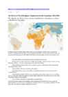
both in absolute number and percentage terms, rising from about 45 million people (8%) in 2010 to 65 million (9%) in 2050.11
�Changing Religious Majorities
Several countries are projected to have a different religious majority in 2050 than they did in 2010. The number of countries with Christian
majorities is expected to decline from 159 to 151, as Christians are projected to drop below 50% of the population in Australia, Benin,
Bosnia-Herzegovina, France, the Netherlands, New Zealand, the Republic of Macedonia and the United Kingdom.
Muslims in 2050 are expected to make up more than 50% of the population in 51 countries, two more than in 2010, as both the Republic of
Macedonia and Nigeria are projected to gain Muslim majorities. But Nigeria also will continue to have a very large Christian population.
Indeed, Nigeria is projected to have the third-largest Christian population in the world by 2050, after the United States and Brazil.
![Newfoundland & Labrador and Alberta]()
4
docx
Newfoundland & Labrador and Alberta
Alberta
The capital of Alberta is Edmonton. The population is 3.7 million people and there are many
nationalities. Besides English and French there are also immigrants from Scotland, Ireland,
Wales, Germany, Ukraine and Scandinavia. In Edmonton and Calgary there are also historic
Chinatowns, and Calgary has Canada's third largest Chinese community.
Geographical features
Alberta covers an area of 661,848 square kilometres, an area about 5% smaller than Texas or
20% larger than France. This makes it the fourth largest province after Quebec, Ontario, and
British Columbia. To the south, the province borders on the 49th parallel north, separating it
from the U.S. state of Montana, while on the north the 60th parallel north divides it from the
Northwest Territories. To the east the 110th meridian west separates it from the province of
Saskatchewan, while on the west its boundary with British Columbia follows the 120th meridian
west south from the Northwest Territories at 60°N until it reac
Meedia
Kommentaarid (0)


Kõik kommentaarid