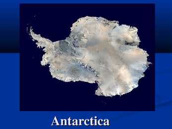
Antarctica Antarctica is Earth's southernmost continent, overlying the South Pole. It is situated in the southern hemisphere, almost entirely south of the Antarctic Circle, and is surrounded by the Southern Ocean. Antarctica area is 14,000,000 km² , icefree area is about 280,000 km² and icecovered is about 13,720,000 km² that means about 98% of Antarctica is covered by ice. Climate of Antarctica Antarctica is the coldest, driest and windiest continent, and has the highest average elevation of all the continents. The coldest natural temperature ever recorded on Earth was -89
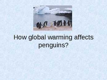
· Scientists suspect that the rising temperatures affect the small fish and other marine animals on which penguins feed. · The sea ice necessary to the survival of krill larvae is disappearing earlier and taking with it 80 percent of the krill population. Climate changes · The emperor penguins are starving to death because the warming air and water is drastically changing the environment to which they have adapted. · Two giant icebergs have broken off the Antarctic ice sheet and are blocking the way from their breeding colonies to their feeding areas. As a result they have to walk 30 miles further to get food.
1998 levels and to recycle or compost at least 25% of household waste, increasing to 33% by 2015; between 1998-99 and 1999- 2000, household recycling increased from 8.8% to 10.3% Major party to: Air Pollution, Air Pollution-Nitrogen Oxides, Air Environmental Pollution-Sulfur 94, Air Pollution-Volatile Organic Compounds, Agreements Antarctic-Environmental Protocol, Antarctic-Marine Living Resources, Antarctic Seals, Antarctic Treaty, Biodiversity, Climate Change, Climate Change-Kyoto Protocol, Desertification, Endangered Species, Environmental Modification, Hazardous Wastes, Law of the Sea, Marine Dumping, Marine Life Conservation, Ozone Layer Protection, Ship Pollution, Tropical Timber 83, Tropical Timber 94,
Scott was a hero in England because he made a trip to Antarctica but no one had yet reached the South Pole so Scott was ready to be first. When Scott was 25 years old, he purchased a whaling ship with name on it Terra Nova. For the trip to South Pole, they packed the ship tightly. For the South Pole expedition British had in their ship many animals like Siberian dogs and ponies. They bring 10 ponies to the Pole but they didn`t know that they going to die. When they bring them, to the Antarctic they helped British but in South Pole not. Scott followed the route mapped by Ernest Shackleton in 1909. This means that it involved several modes of transport and team division into four groups. They had 24 dogs, 10 ponies, 12 sledges, 2 motorized and many men. They needed to reach 900 miles to South Pole. Scott, Brower and Wilson died in the end of March 1912. They died because they were pinned in their tent by a long, fierce blizzard.
7.The total 20th-century rise is estimated to be 0.17 [0.12 to 0.22] m. 8.Arctic has seen twice the increase of global temperature rate. 9.Increased precipitation has been observed in eastern parts of North and South America, northern Europe and northern and central Asia. 10.Decreased precipitation has been observed in the Sahel, the Mediterranean, southern Africa and parts of southern Asia. 11.There is no clear trend in the annual numbers of tropical cyclones. 12.Antarctic sea ice extent continues to show inter annual variability and localized changes but no statistically significant average trends. 13.Because it is consistent with the lack of warming reflected in atmospheric temperatures averaged across the region. 14.The last time the polar regions were significantly warmer than present was about 125,000 years ago. 15.The sea level was probably 4 to 6 m higher during the last interglacial period. 16.It would change at a rate of about 0.1°C per decade. 17
diverse than in trf. 13. Using the picture describe how an animal is adapted to the life in tropical rainforest? 14. Why are rainforests so important for people? Farming, homes for people, mining for gold, oil etc., logging for trees firewood, paper products. 15. Which human activities endanger the biome (tropical rainforest/tropical deciduous forest)? Collecting and killing wild animals and plants 16. Put the major circles of latitude (the Arctic circle, the Antarctic circle, the Tropic of Capricorn, the Tropic of Cancer, the Equator) in the picture. 17. What are summer solstice, winter solstice and equinox? 18. What are polar night and polar day? 19. Where is the Sun at its zenith in winter, spring, summer and autumn? 20. Why do seasons occur?
the Tower of London the Houses of Parliament the Isle of Man the north of France Geograafilised piirkonnad: the mainland the Antarctic the North of Germany the Midwest NB! geograaf. nimed, mis koosnevad pärisnimest ja täiendist, on ilma artiklita: Northern Ireland South-Estonia Great Britain
Energiatarve inimese kohta näitab vägagi selgelt riigi arengutaset, sest suurem tarbimine tähendab, et inimestel on rohkem elektrilisi seadmeid, tööstus on rohkem arenenud jne, näidates seeläbi ka inimkonna ja riigi jõukust tervikuna ning ka arengutaset. USA süsinikdioksiidi emissioon inimese kohta on 19,74 tonni. Aastal 2005 tootis USA 15,74% kogu maailma süsinikdioksiidist. USA on liitunud järgmiste lepetega: Air Pollution, Air Pollution-Nitrogen Oxides, Antarctic-Environmental Protocol, Antarctic-Marine Living Resources, Antarctic Seals, Antarctic Treaty, Climate Change, Desertification, Endangered Species, Environmental Modification, Marine Dumping, Marine Life Conservation, Ozone Layer Protection, Ship Pollution, Tropical Timber 83, Tropical Timber 94, Wetlands, Whaling. Metsamajandus ja kalandus USA-s kasvab metsa veidi üle 300 miljoni hektari, mis kogupindalast moodustab 33,1%
New Zealand has an exceptionally long coastline compared to the size of the country (over 15,000 km) which makes it almost the same size as the mainland USA's coastline. Even though New Zealand is only about the same size as Colorado, the large coastline is possible because it is extremely iregular and indented. New Zealand's coastline is packed with deep coves, bays, intricate harbours, long sounds, and steep fiords. Its territorial waters stretch from the sub-tropical through to the sub-antarctic. Both islands tend to have better swimming beaches on their eastern coasts and the further north you go. The west coasts of both islands are quite rugged with cliffs and more unsettled weather. There are however some suitable swimming and bathing beaches here, with iron (volcanic) sand beaches (black sand) being common on the North Island. The longest beach in New Zealand is the 90 mile beach, which is actually about 60 miles long
png Mere taseme muutused Holotseenis ja viimasel sajandil Mere tase on viimasel sajandil tõusnud 200 mm ehk 2 mm/aastas Millest on tingitud meretaseme muutused? http://upload.wikimedia.org/wikipedia/commons/0/0f/Recent_Sea_Level_Rise.png http://en.wikipedia.org/wiki/File:Holocene_Sea_Level.png Millised tagajärjed on sellel, kui ennustused lähevad täide? http://maps.grida.no/go/graphic/temperature-increases-in-the-antarctic-due-to- climate-change-2090-ncar-ccm3-sres-a2-experiment http://www.grida.no/graphic.aspx?f=series/vg-arctic/large/fig23.jpg Kuidas mõjutab jää sulamine elustikku? • Millised muutused toimuksid polaaralade ökosüsteemis?
vahel Austraalia ja Okeaania maailmajaos, Austraalia mandril. Austraalial pole maismaapiire st naabrid on mere taga. Lähimad naabrid on Indoneesia, Ida- Timor ja Paapua Uus-Guinea põhjas. Uus-Meremaa asub Austraaliast kagus. Lisaks kuuluvad Austraaliale mõned ülemereterritooriumid: Norfolk Island, Christmas Island, Cocos (Keeling) Islands ning asustamata alad: Ashmore ja Cartier Islands, Coral Sea Islands, Heard Island, McDonald Islands ja Australian Antarctic Territory. Austraalia koosneb kuuest osariigist ja kahest territooriumist: New South Wales (Uus-Lõuna-Wales) Victoria (Victoria) Queensland (Queensland) Western Australia (Lääne-Austraalia) Southern Australia (Lõuna-Austraalia) Tasmania (Tasmaania) Australian Capital Territory (Austraalia Pealinnaterritoorium) Northern Territory (Põhjaterritoorium) Pealinn on Canberra, mille koordinaadid on 35° 18' lõuna pikkust ja 149° 08` ida laiust
2005 Sedimentary trace element constraints on the role of North Atlantic Igneous Province volcanism in late Paleoceneearly Eocene environmental change. Mar. Geol. 217, 233254. Rodríguez-Tovar F.J., Uchman A., Alegret L., Molina E., 2011. Impact of the PaleoceneEocene Thermal Maximum on the macrobenthic community: Ichnological record from the Zumaia section, northern Spain. Marine geology 282, 178-187. Zachos, J. C.; Kump, L. R. (2005). "Carbon cycle feedbacks and the initiation of Antarctic glaciation in the earliest Oligocene". Global and Planetary Change 47 (1): 5166. Zachos, J.C.; Dickens, G.R.; Zeebe, R.E. (2008). "An early Cenozoic perspective on greenhouse warming and carbon-cycle dynamics" (PDF).Nature (journal) 451 (7176): 27983. Winguth A.M.E., 2011.The Paleocene-Eocene Thermal Maximum: Feedbacks Between Climate Change and Biogeochemical Cycles. University of Texas at Arlington, USA. 10
S. include the Southern Asian realm, Neotropical (South and Central America), Ethiopian (Africa) and Australian. The major deserts of semiarid deserts include the sagebrush of Utah, Montana and Great Basin. They also include the Nearctic realm (North America, Newfoundland, Greenland, Russia, Europe and northern Asia). Coastal deserts occur in moderately cool to warm areas such as the Nearctic and Neotropical realm. A good example is the Atacama of Chile. Cold deserts occur in the Antarctic, Greenland and the Nearctic realm. Climate In hot and dry deserts temperatures exhibit daily extremes because the atmosphere contains little humidity to block the Sun's rays. Many mean annual temperatures range from 20-25° C. The extreme maximum ranges from 43.5-49° C. Minimum temperatures sometimes drop to -18° C. Rainfall is usually very low and/or concentrated in short bursts between long rainless periods. In semiarid deserts summer temperatures usually average between 21-27° C
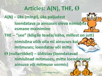
More names with articles · Ka määratletud koolide (kolledzite, ülikoolide) nimedes: The University of California; the School for the Blind BUT: Kooli initsiaalide ja ilma määratleva fraasita: Columbia University; Harvard; U.C.L.A. · Kõik veekogud peale järve ja jugade/kärestike, kõrbed, poolsaared, tunnelid, sillad, (looma) aiad, regioonid: The Sahara; the Red Sea; the Middle East; the English Channel; the west of Canada; the Antarctic (the whole region!) BUT: Lake Baikal is the deepest lake in the world. Do you know where you can see Whiskey Rapids? · Saarestikud, järvistud, mäeahelikud vmt. nimed mitmuse vormis: The Phillipines; the Great Lakes; the Everglades; Aari Juhanson, MA 2009 DIRECTIONS · Üksikul kujul määrsõnana NO ARTICLE!: He tested the wind and decided to continue south. California is west of Nevada and south of Washington.
the Arctic crocus, help to trap heat near the plant and act as protection from the wind. Plants adapted to the tundra have small waxy leaves to prevent the loss of precious water in this dry environment. Quick-Developing, Cup-Shaped Flowers Soil Not Needed for Growth Polar Desert- Plants that grow in the Arctic regions must be very hardy and adapted to the extreme winter cold of these environments. Polar desert plants have a summertime growing season, but in the Arctic and Antarctic that season is short---often wildflowers and the other plants that manage to survive here are active only from June to July Alphine biome- Because of the blustery weather, most plants are small groundcover plants, which grow and reproduce slowly. They protect themselves from the cold and wind by hugging close to the ground. When plants die the cold weather makes it hard for them to decompose quickly. This makes for poor soil conditions. Most
" The Torrens River flows through the city. Hobart is the state capital and most populous city of the Australian island state of Tasmania. Founded in 1804 as a penal colony, it is Australia's second oldest and twelfth largest city, with a metropolitan population of 206,000. The city is the financial and administrative heart of Tasmania, and also serves as the home port for both Australian and French Antarctic operations. Hobart is a busy seaport, notably serving as the home port for the Antarctic activities of Australia and France. It supports several other industries, including a highspeed catamaran factory and a zinc smelter, as well as a vibrant tourist industry. Visitors come to the city to explore its historic inner suburbs, to visit the weekly craft market in Salamanca Place, as well as to use the town as a base from which to explore the rest of Tasmania
addition there are international straits, channels and rivers (this is where many have disputes). The idea is that all of them are regulated by international treaties, coastal states don't necessarily have a say. E.g. Panama channel, Suess channel, Bosporus and Dardanelles straits, straits between Sweden and Denmark, Danube river, river Nile Lecture 4 Antarctica Antarctica's unique regime was established by the Antarctic Treaty (Washington, 1 December 1959). Originally signed by 12 countries which were not far from Antarctica or had some explorations there (UK, Japan, South-Africa etc). Initially concluded for 30 years, then prolonged. Some scholars consider the treaty's principles as norms of customary international law. The unique feature of Antarctic is that it comprises of all territories that go under the south
· Barbados · Guernsey · St Lucia · Belarus · Honduras · Suriname · Belgium · Hong Kong · Swaziland · Belize · Hungary · Sweden · Bermuda · Iceland · Switzerland · Bosnia & · India · Tonga Herzegovina · Ireland · Trinidad & · Botswana · Isle of Man Tobago · British · Israel · Turkey Antarctic · Italy · Turks & Caicos Territory · Japan · Tuvalu · British Guyana · Jersey · Ukraine · British Virgin · Kazakhstan · United Islands · Kiribati Kingdom & · Brunei · Korea Northern · Bulgaria (Republic of) Ireland · Comoros · Latvia · United States · Islands · Lesotho of America
perekonda, neist pooled on nende 2 regiooni jaoks endeemid. Lisaks kuuluvad Lähis-Antarktikasse: S-Ameerika, S- Aafrika, S-Austraalia ja Uus- Meremaa. Kõigis regioonides on hulk endeeme. Näiteks Uus Meremaa vetikaflooras 650 liiki, millest ainult 28% on ühised S-Austraalia ja Tasmaaniaga, endeeme on 3%. See näitab,et Uus- Meremaa on eraldunud Austraaliast väga kauges geoloogilises minevikus. Domineerib tsirkumpolaarne Antarktika Hoovus (Antarctic Circumpolar Current), mis kannab ühtlasi nimetust Läänetuulte hoovus (West Wind Drift). See hoovus liigub 4 aastaga ümber Antarktika. Sellel hoovusel on suurim tähtsus vetikate levikule. Ta võimaldab vetikate (näiteks ujuvate Macrocystis pyrifera ja Durvillea antarctica) ja neile kinnituva fauna ja floora transporti kauge maa taha. Vetikafloorad lõunapoolkera parasvöötmes ja polaarvöötmes näitavad ilmekalt
Using a B-50Abomber, they traveled 23,452 miles hours 30 minutes. (37,742 kilometers) in 3 days 22 hours 1 minute, 1929 1992 Richard E. Byrd estab lishedan Antarctic base at Little French pilotsflew the supersonic Concorde around the America. On November 28 and 29, Byrd and his pilot, Bernt world, east-to-west, in a record setting 32 hours 49 minutes Passengers at Balchen, left the base and flew to the South Pole. 3 seconds. +10 M ajor Airports 2001