Leidsid 33 sarnast õppematerjali, mis on seotud failiga "Toompea lossi inglisekeelne kirjeldus". Need materjalid aitavad sul teemat sügavamalt mõista.
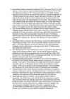
toompea, build, power, castle, building, here, wall, government, centre, first, republic, walls, protected, even, best, worked, century, estonians, foreign, hill, stone, linda, ancient, times, changed, built, place, needs, taste, today, find, mostly, dating, medieval, order, western, towers, known, tall, herman, russian, facade, classical, onto, squareTOOMPEA CASTLE Toompea Castle is a castle on Toompea hill Perched on a limestone cliff and towering over the rest of the city Time has been generous to Toompea castle -the well-protected fortress has been almost impregnable Location History Story of rulers and power in Estonia As times and rulers changed so did power and mentalities Today, we can find here buildings mostly dating from 3 periods: - the medieval order's stronghold with its impressive western wall and towers - the Russian-era government administration building with a facade representing classical styles and opening onto Castle Square - the building of the Riigikogu, which originates from the time of the First Republic of Estonia and is hidden behind the walls of the castle. Beginning
TOOMPEA Toompea (from German Domberg – Cathedral Hill ) is a limestone hill with an area of about 7 hectares in the central part of Tallinn. It towers about 30-40 m above the surrounding areas. According to the legend it´s the tumulus mound over the grave of the national hero Kalev, erected stone by stone in his memory by his grieving wife Linda. It is the birthplace of Tallinn - a place where in 1229 the Knights of the Sword built a fortress instead of the wooden Estonian stronghold. Toompea Castle is also one of the most potent symbols of the reigning power. Today Toompea is the seat of the Government of Estonia as well as the Riigikogu, both of which are often simply colloquially referred to as Toompea. For centuries there was only one access to Toompea - Pikk Jalg - but there is also another way leading up to Toompea - Lühike Jalg, which was made in the 14th century. At present Pikk Jalg and Lühike Jalg are used only by pedestrians. Until
Names of town ● Lindanise - it was first used in 1219, derived from mythical Linda, the wife of Kalev and the mother of Kalevipoeg, national hero. ● Koluvan - found in old Russian chronicles, the name possibly deriving from the Estonian mythical hero Kalev ● Reval - used after 1219; comes from two german words ‘reh’ and ‘fall’, meaning the falling of the deer - as they fall down the Toompea hill, probably when escaping from the Danish occupation or just the hunters. ● Tallinn - used after Estonia gained its independence in 1918, origin is definitely estonian; meaning Taani-linn, tali- linn. Liberty Square ● The central square of Tallinn, it was renovated in 2008. There used to be Harju gate, which can now be seen through glass. ● The statue of Liberty, 2009; represents freedom, Estonia has been under many foreign powers, starting with Danes,
contrast to the ancient town-walls and towers, Tallinn of today offers modern hotels, restaurants, sport and cultural centres. Every five years national song and folk dance festivals take place in Tallinn. The yachting regatta of the 1980 Moscow Olympic Games was held at Pirita. History Tallinn means in English "Danish town". The place is believed to have been settled by Finno-Ugric people about 2500 BC. It was first marked on a map of the world by the Arab geographer al-Idrisi in 1154. The Estonians were the first to build a stronghold on the spot of the Toompea Hill, but the real Tallinn was built by the Danes who conquered the north of Estonia in 1219. Legend has it that one day, when the Danes were about to lose a bloody battle, the sky suddenly opened and a red flag with a white cross on it dropped down upon them from the heaven. This is how the Danes obtained their national flag. In 1346 the Danish king sold his Estonian lands to the Teutonic Order, who a year later
Tallinn was first marked on a map of the world by the Arab geographer al-Idrisi in 1154, its name then being Kolyvan (probably derived from the name Kalev). In the 13th-century Chronicle of Henricus de Lettis the town was called Lyndanise. Later came Reval (presumably after the old county of Rävala), the name used by the Germans who ruled the country for seven centuries. Russians then modified Reval to Revel. For Estonians, the town came to be called Tallinn from Taanilinn (Danish town) after Danish conquest in the 13th century. Over the course of time, Taanilinn was shortened to Tallinn The place is believed to have been settled by Finno-Ugric peoples about 2500 BC. The Danes, led by King Valdemar II, conquered northern Estonia in 1219. Legend has it that one day, when the Danes were about to lose a bloody battle, the sky suddenly opened and a red flag with a
My Town I live in Tallinn. It's the capital and main seaport of Estonia. Tallinn is a very beautiful city that lies on the Baltic Sea. It covers 158 square kilometres. The Mayor of Tallinn is Jüri Ratas. The population of our capital is about 400000 people. About 55% of them are Estonian, 37% Russians and the other 8% are from different nations. The people here are mostly engaged in industry- mainly the food industry (23%), trade (16%) and transport and communication (14%). History. Tallinn has a great history. It was first marked on a map of the world by the Arab geographer al-Idrisi in 1154, its name then being Kolyvan. In the 13 th- century chronicle of Henricus de Lettis the town was called Lyndanise. Then it was called Reval for some time and finally Estonians started to call the town Tallinn from
2 Towns (Upper & Lower Town) Tallinn used to be divided into 2 parts - Upper Town where lived the aristocracy, gentry and the clergy; and Lower Town with traders, craftsmen and merchants. Legend says the Toompea Hill is actually the tumulus mound of the great Kalev. Linda carried rocks to his grave. It is a naturally- formed limestone hill. Lower Town was a merchantile centre, Tallinn also belonged to the Hansaetic League (1285). It is often referred to as the town of citizens. Any grown-up, married and economically independent person, born in a legal marriage between two free people and having lived in the town for at least 3 months, could apply to the Magistracy for citizenship. Serfs could escape from serdom after having successfully hidden in town for a year and a day. Two parts remained separated until the end of the 19th century. Four Names
Old Tallinn The history of Tallinn has been long and dignified and up to the end of the medieval times connected with the area forming the foundation of current Old Town.The frist settlements on the coast of Northern Estonia appeared at the end of the 10th century,when the Estonians established a stronghold in the neighborhood of a favorable port- on the hill of Toompea. The dominants of that time are preserved in their medieval from : churches, public buildings,the Town Hall with the square in of it and the order castle on the hill of Toompea. The O ld Town is the spiritual centre of Estonia with the most important shrines,museums and its historical heritage. The Old Town has surprise for the one-day tourist as well as for its own citizens who have walked the streets of the medieval city for decates. Ten face of the Old Town Vibrant old town
on Latvia. The area of Estonia is 45 100km2, its coastline is 774km long. The geography of the land is surprisingly varied. Islands make up 9,2 per cent of Estonian's total territory, the largest islands are Saaremaa, Hiiumaa and Vormsi. The highest point is Suur Munamägi, which is 317m high. Estonia has a surprisingly mild climate for an area so far north. Sea winds keep the weather from becoming very cold or hot. The population of Estonia is 1.5 million. Of this number 62 per cent are Estonians. Estonians speak the Estonian language, which is closely related to Finnish. Estonia's flag has three horizontal stripes. The blue stripe at the top of the flag represents the sky. The middle stripe of black stands for the land. The white stripe at the bottom symbolizes hope in the future. The president is the most powerful official in Estonia's government. The country's parliament elects the president to a five-year term. The parliament has 101 members, who are elected by the people
the east by Lake Peipus and Russia. Across the Baltic Sea lies Sweden in the west and Finland in the north. The territory of Estonia covers 45,227 km 2, and is influenced by a humid continental climate. The Estonians are a Finnic people, and the official language, Estonian, is a Finno-Ugric language closely related to Finnish, and distantly to Hungarian and to the Sami languages. The population of Estonia is 1.5 million. Of this number 62 per cent are Estonians. The geography of the land is surprisingly varied. Islands make up 9,2 per cent of Estonian’s total territory, the largest islands are Saaremaa, Hiiumaa and Vormsi. The highest point is Suur Munamägi, which is 317m high. Estonia has a surprisingly mild climate for an area so far north. Sea winds keep the weather from becoming very cold or hot. Estonia’s flag has three horizontal stripes. The blue stripe at the top of the flag represents the sky. The
Tallinn Mustamäe College G2K Jaana-Kristiina Jõgevest The Four oldest churches of Tallinn Report Supervisor: Ingrid Teigar Tallinn 2009 The Dome Church The Danes began fortification of Toompea after the conquest of Tallinn in 1219 and probably also built the first church there. It was presumably a wooden building located at the site of the present cathedral. However, a serious conflict with the Order of the Brothers of the Sword broke out soon as the latter wanted to gain control of the entire Estonia. The order succeeded in subordinating Tallinn and the whole of North Estonia to its rule in 1227. The monks of the Dominican Order began the construction of a stone church in Toompea in 1229. The first written data on the cathedral date back to 1233, the date of a
Edinburgh Castle is an ancient stronghold which dominates the sky-line of the city of Edinburgh from its position atop Castle Rock. It is Scotland's second most visited tourist attraction. Human habitation of the site is dated back as far as the 9th century BC. As it stands today though, few of the castle's structures pre-date the Lang Siege of the 16th century, with the notable exception of St Margaret's Chapel, the oldest surviving building in Edinburgh, which dates from the early 12th century.As with all castles, Edinburgh's fortress has been a centre of military activity. As an ancient fortress Edinburgh Castle is one of the few that still has a military garrison, albeit for largely ceremonial and administrative purposes. The New Barrack Block is now home to the official headquarters of the Royal Regiment of Scotland and 52 Infantry Brigade, as well as home to the regimental museum of the Royal
· Suuremõisa Castle. Suuremõisa Castle was built in the second half of the 18th century on the initiative of Countess EbbaMargaretha Stenbock (17041776). The wings are erected in 1772. There are 64 rooms in the Castle. 6 ponds were dug in the grounds of the Castle and a park and a garden established. In 1796 the Castle was sold to Baron UngernSternberg. The attic of the Castle has doubleceiling, where the Baron used to hide the treasures stolen from ships that had sunk in the Näkimadalad. On 19 October 1802 the Baron killed Karl Johannes Malm, the Captain (of Swedish origin) of his ship "Brig Morian", in this Castle. For this the baron was deported to Siberia. There are currently two schools in the Castle: Suuremõisa Gymnasium and Suuremõisa Technical School. In the latter one can also study how to become a ship's captain.
Tallinn's Old Town is in the list of UNESCO World Heritage Sites. It is ranked as a global city and has been listed among the top 10 digital cities in the world.The city was a European Capital of Culture for 2011, along with urku, Finland.Tallinn is the oldest capital inNorthern Europe. The city was known as Reval from the 13th century until the 1920s. http://en.wikipedia.org/wiki/Tallinn Old Tallinn The Old Town can historically be divided into two distinct areas: Toompea Hill and the Lower Old Town, which were separated by a dividing wall since medieval times. The elevated area of Toompea Hill with its castle was occupied by the residences of Tallinn's rulers and gentry. The Lower Old Town meanwhile developed as an autonomous merchantile centre, flourishing during the 13th-16th centuries, when the city enjoyed membership of the powerful Hanseatic Trading League. Generally speaking these two districts are now collectively referred as the Old Town.
while the Arab scholar alIdrisi was the first one to mark it on a map (as ASTLANDA). To the ancient Scandinavians the land was known as EISTLAND; to modern Scandinavians it is known as ESTLAND. Most contemporary languages use the Latin name ESTONIA. FLAG The Estonian blueblackandwhite national flag was originally the flag of the Estonian Student's Society, consecrated in Otepää Church in 1884. today there is a memorial plaque on the church wall commemorating the event. The Flag Museum attracts tourists who take an interest in the history of the flag. After about half a century, during which it was prohibited by the Soviet authorities, the flag was sen again in public for the first time in Tartu. Many elderly people were carrying the flags they had kept in secret hiding places durin the Soviet years; tears were rolling down their cheeks. On 24 February
Art Museum of Estonia Art Museum of Estonia was founded on November 17th, 1919, but it was not until 1921 that it got its first permanent building the Kadriorg Palace, built in the 18th century. In 1929 the palace was expropriated from the Art Museum in order to rebuild it as the residence of the President of Estonia. The Art Museum of Estonia was housed in several different temporary spaces, until it moved back to the palace in 1946. In September, 1991 the Kadriorg Palace was closed, because it had totally deteriorated by then. At the end of the year the Supreme Council
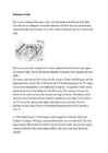
The best- known smalles islands are Naissaar, Aegna, Ruhnu, Kihnu, Väike-Pakri, Suur-Pakri etc. 3. Relief Lying in the north-western part of the East-European Plain, Estonia is mostly flat with an average elevation of about 50 metres above sea level. South-eastern and eastern parts of Estonia are higher than the western parts. The relief of the present-day landscape was shaped during the Ice Age. Ice sheet has carried large boulders and limestone blocks here, not to mention that the hilly terrain in Estonia was also shaped by the continental ice and the melting water. The land is rising 25 cm every one hundred years. In folklore, many features of the relief are explained by the activities of giants such as the legendary national hero Kalevipoeg. The Haanja and Otepää Uplands are particularly rich in Hills. It is here that You find Big Egg Hill, the highest point in the Baltic states with 318 metres above sea level. 4. Land regions
information about Lai Street, as they need to pass the guide practice exam in form eleven. The report is divided into chapters so that each chapter deals with one of the important houses in Lai Street. In the beginning there are also two introductory chapters about Lai Street in general and the origin of the name "Lai". 3 Lai Street in general Lai Street is 520 m long and begins at a small green patch below the Toompea slope, where a graceful bronze statue of a Roe Deer by Jaan Koort (1883-1935), one of the best-known Estonian sculptors, has been standing for several decades. Lai Street stretches from Nunne Street to Pikk Street. Parallel with Pikk Street, Lai Street, too, ends at the Great Coast Gate (first mentioned 1359). Lai Street is very wide considering that it was laid out in the Middle Ages. This is because it sprang up on both sides of former city wall. Lai is quite a peaceful street with few shops
Tallinn is the capital of Estonia and also the largest city in the country. It occupies an area of 159.2 km2 (61.5 sq mi) with a population of 411,196. During different periods, the city has been known under several different names. In 1154 a town called Qlwn or Qalaven (possible derivations of Kalevan or Kolyvan) was put on the world map of the Almoravid by cartographer Muhammad al-Idrisi who described it as a small town like a large castle among the towns of Astlanda. It has been suggested that the Quwri in Astlanda may have denoted the predecessor town of today's Tallinn. The earliest name Kolyvan may be derived from the mythical Estonian hero Kalev. Up to the 13th century the Scandinavians and Henry of Livonia in his chronicle called the town Lindanisa: Lyndanisse in Danish, Lindanäs in Swedish, also mentioned as Ledenets in Old East Slavic. According to some theories the name derived from
1894 and 1900, during the period when the country was part of theRussian Empire. The Alexander Nevsky Cathedral is Tallinn's largest and grandest orthodox cupola cathedral. It is dedicated to Saint Alexander Nevsky who in 1242 won the Battle of the Ice on Lake Peipus, in the territorial waters of present-day Estonia. The late Russian patriarch, Alexis II, started his priestly ministry in the church. Interior of the Cathedral. The Alexander Nevsky Cathedral crowns the hill of Toompea where the Estonian folk hero Kalevipoeg is said to have been buried according to a legend. (There are many such legendary burial places of him in Estonia.) The cathedral was built during the period of late 19th century Russification and was so disliked by many Estonians as a symbol of oppression that the Estonian authorities scheduled the cathedral for demolition in 1924, but the decision was never implemented due to lack of funds and the building's massive construction. As
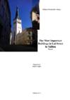
established the relationships between Estonia, Livonia and the Russian Empire. The Baltic Landesstaat reached its full development. The freedom of action in the new provinces was naturally granted to one of the most firm ideological pillars of the tsarist empire -- the Russian orthodox church; though as the Landeskirche in the Estonian and Livonian territories, the Lutheran church long maintained a de facto predominance. The most important organ of Baltic German local government was the Diet, consisting of all the noble families who had been `selected' in a list of the eligible. Although jealously guarding their privileges, the knighthoods still never became entirely closed. Between sessions of a Diet, the legislative power of the knighthoods belonged to the Council of the Diet. The towns were governed by the Town Councils, which supplemented their ranks from among the representatives of merchants and lawyers. The citizens and the inhabitants of a
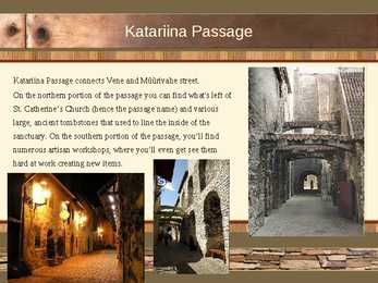
Katariina Passage connects Vene and Müürivahe street. On the northern portion of the passage you can find what's left of St. Catherine's Church (hence the passage name) and various large, ancient tombstones that used to line the inside of the sanctuary. On the southern portion of the passage, you'll find numerous artisan workshops, where you'll even get see them hard at work creating new items. City wall Tallinn's medieval city wall is a sub-facility that was built to protect the lower Tallinn and upper Tallinn (Toompea). The building of the city wall began in 1310th years, and by improving over time it formed the city wall with defensive buildings (towers). It was finished by the end of the 1561. Then it was 2.35-kilometer-long circular wall, which had 27 wall gate, 8 tower gate and 21 other stone fortifications. Many parts of the town wall have survived until today
town and the lake, start right from beside the Town Hall. There are five flights and 158 steps. Water Tower The old water-tower of Viljandi between the museum and Town Hall has been reconstructed now into an observation tower. Church spires and the Old Water Tower form a silhouette on the lake surface. The Water Tower offers a magnificent view of the whole town. Hanseatic merchants settled here as long ago as the 14th century. Due to its good location, varied nature and good connecting roads, Viljandi is an excellent place for trade, stopovers and living. Bridge When you walking along a footpath you will soon get to the famous suspension bridge. The first bridge in 1931 was a contribution to the town by the landlord of Tarvastu, Karl von Mensenkampff. The bridge is over 50 m long
Estonian cities Tallinn is the capital and largest city of Estonia. It occupies an area of 159.2 square kilometers with a population of 413,000. It is situated on the northern coast of the country, on the banks of the Gulf of Finland, 80 km south of Helsinki, east of Stockholm and west of Saint Petersburg. Tallinn was founded in the 12th century and has been under the rule of Denmark, Sweden, and Germany as well as Russia, and all left their mark on the city's architecture. It is one of the best preserved medieval towns in northern Europe, and makes a beautiful impression from the sea, with its ancient city walls, church spires, and red-tile roofed homes. Tallinn has previously been named as Kolõvan, Lindanise and Reval. Most well-known sights in Tallinn are Freedom Square, Kadriorg Palace, Rotermann Quarter, Tallinn Song Festival Grounds, Toompea Castle and Town Hall Square, the Old Town of Tallinn and many more. Tallinn's Old Town is in the list of UNESCO World Heritage Sites.
Introduction I did this choice, because I thought, I could find a lot of materials for this subject. I hope, this is not hard subject for me and I can do this report finely. 3 Beginning of 20th century Estonian literates participated in the fight for local power mainly with the help of the newspaper "Teataja" created in 1901. The 1904 elections were won by an Estonian-Russian block of 5 Russians and 38 Estonians. The first Estonian mayor was Voldemar Lender and assistant major Konstantin Päts. In 1905 was bloody Sunday in St. Petersburg and this influenced estonian workers: mass meeting, had conflicts with police. 17.10.1905 was made first estonian party Eesti Rahvameelne Eduerankond created by newspaper ,,Postimees" supporters
Tallinn is one of the oldest cities in the Baltic Sea region. Tallinn was first mentioned in written sources of the 1154th, when the Arabian geographer Al Idris took a world map the city 'Kaleveny "/ Kolõvan. Through the years, the city of Tallinn had several names: Lindanisa, Kolõvan, Reval and eventually Tallinn. Tallinn was granted the Lübeck law in 1248 and became the member of the Hanseatic League in 1285. General Data l Country - Estonia l County - Harju County l First appeared on map - 1154 l Town rights - 1248 l Mayor - Edgar Savisaar l Aera - Total 159.2 km2 (61.5 sq mi) l Population - (1 Mar 2012) Total - 416,470 Denisty - 2,614.0/km2(6,766.6/sq mi) Tallinn Coat of arms Flag Top 5 Attractions 1. Kiek in de Kök Visitors to the museum will see examples of Medieval firepower, displays detailing how the city's system of walls and towers developed through the centuries and an exhibit on crime and punishment in Old Tallinn. 2
The Haapsalu Bishop's Castle The Haapsalu Bishop's Castle and Cathedral, which was established in the 13th century as the centre of the SaareLääne Diocese, is one of the best preserved castles in Estonia. It is located on the western coast of Estonia in Haapsalu. The Haapsalu Castle is one of the most remarkable examples of Estonian MiddleAge fortress architecture. The stronghold construction, widening and reconstruction went on throughout several centuries, with architecture changing according to the development of weapons. The fortress achieved its final dimensions area of more than 3 hectares, thickness of the wall between 1.2 and 1.8 meters, and maximum height over 10 metres under the reign of Bishop Johannes IV(fourth).
London History The Romans AD 43- AD 410 The Romans finally invaded Britain in AD 43 from Kent. The Romans lead by Julius Caesar attempted to invade Britain twice before that in 55 and 54 BC but the invasions were unsuccessful. They made their way to the river Thames and sailed up it. The Romans knew it was important to control a crossing point at the river Thames, so they decided to build a settlement on the north bank. Although small settlements had been built on the banks of the Thames, the Romans were the ones who built the first city. They called their city Londinium. The Roman engineers noticed that the point where the swampy river narrowed would make an ideal crossing point, they built London Bridge. Less than 20 years later the native Iceni tribe, led by Queen Boudicca, rose up against the Romans in revenge for mistreatment and burnt Londinium to the ground
The City of London History The City of London occupies one square mile in the middle of the capital. It once made up the entire town of London, surrounded by the wall first built by the Romans. The Roman Londinium grew up on the northern side of the "London Bridge" in the past. Products such as olive oil, wines and fruit were brought by ships from different parts of the Roman Empire and unloaded onto wooden quays along the river. In AD 61 the native Celtic Iceni tribe, led by Queen Boudicca, rose up against The Romans. They burnt Londinium to the ground but Roman armies eventually defeated Boudicca. The city was rebuilt and was gradually surrounded with a wall
THE CITY OF LONDON History The City of London occupies one square mile in the middle of the capital. It once made up entire town of London, surrounded by the wall first built by Romans. The Romans also built a bridge over the Thames and there has been one in the same area ever since. The Roman Londinium grew up on the northern side of the bridge. In AD 61 the native Celtic tribe, led by Queen Boudicca, rose up against the Romans. They burnt down Londinium to the ground and killed most of its inhabitants. Roman armies eventually defeated Boudicca and Londinium was rebuilt.
Kuressaare Castle The convent building of Kuressaare castle is the only medieval fortification in the Baltic States that has not undergone considerable alterations and due to that is an internationally important architectural monument. This castle is built of limestone. The roof is made of red stone. The construction of the stronghold was closely connected with the Estonians fight against the German feudals. The first documented data about Kuressaare castle originate only from 1380s. Kuressaare castle remained the residence for the bishops of Saare-Lääne Bishopric until the beginning of the Livonian War. At the end of the XIV and the beginning of the XV century the castle was surrounded by a new mighty 625 m long and 7 m high belt of walls, erected around the old belt of walls dating from the XIII century. The necessity to improve the defence of the castle was due to the invention and usage of firearms. The old parts of the
Union. The first country to diplomatically recognize Estonia's reclaimed independence was Iceland closely followed by Denmark. The last Russian troops left on August 31, 1994, and Estonia joined NATO on March 29, 2004 and the European Union on May 1, 2004. Karksi - Nuia Karksi Nuia is small town located in south of Viljandimaa. It has population of 2200 people. In Karksi Nuia is on gymnasium , kindergarten, few shops and big cultural centre. In culture centre there are café, library, parish government etc. There take places acting lessons, theatres, parties and other activities. There is music school also. This is for children's, but older people can learn there too. Karksi Nuia has many interesting places to visit and look. One of them is Maies farm, few kilometers from city centre. There you can visit the birth place of A. Kitzberg, famous Estonian writer. There is skiing mountain too, it is opened in winter when there is a lot of snow
She talked about her adventures. When i was reading that it seemed so real, that i was there to. The city's charms can occasionally be obscured by too many tourists, congested traffic and tacky commercialism. Packed in among thousands of other visitors, trying like crazy to see the city in three days and worrying about getting ripped off, it's not surprising, may think the city is overrated. Just relax, take a deep breath. While the city centre is a mélange of stunning architecture, from Gothic, Renaissance and baroque to neoclassical, art nouveau and cubist, beyond the medieval lanes of the Old Town and the Castle District, there's an entire other cosmopolitan city to explore. Search out the riverside parks, lively bars and beer gardens, music clubs, museums and art galleries. Harness Prague's excellent public-transport system to explore emerging suburbs such as Zizkov, Vinohrady, Smíchov and Holesovice