JAMAICA The english speaking country · Jamaica is an island country situated in the Caribbean Sea, consisting of the third-largest island of the Greater Antilles (*The Greater Antilles is a grouping of the larger islands in the Caribbean Sea). · The flag consists of a gold saltire, which divides the flag into four sections: two of them green (top and bottom) and two black (hoist and fly). · black representing the strength and creativity of the people which has allowed them to overcome the odds, gold for the wealth of the country and the golden sunshine, and green for the lush vegetation of the island. · Coat of arms: On the dexter side a West Indian Native Woman holding in the exterior hand a Basket of Fruits and on the sinister side a West Indian Native Man supporting by the exterior hand a Bow all proper. · The motto : "Out of Many, One People" - as tribute to the unity of the different cultural min...
Great Britain Great Britain is an island situated to the north-west of Continental Europe. It is the ninth largest island in the world, the largest European island and the largest of the British Isles. With a population of about 60.0 million people in mid-2009, it is the third most populous island in the world, after Java and Honsh. Great Britain is surrounded by over 1,000 smaller islands and islets. The island of Ireland lies to its west. The capital of England is London and its official language is English. The island was first inhabited by people who crossed over the land bridge from the European mainland. Traces of early humans have been found from about 500,000 years ago. Until about 10,000 years ago, Great Britain was joined to Ireland. When visiting the capital London a tourist should go sightseeing around the city. There are lots of attractions to look out. For example the famous Big Ben is...
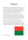
Madagascar Madagascar is an island country in the Indian Ocean, of the coast of Southeast Africa. The nation comprises the island of Madagascar (the fourth-largest island in the world), as well as numerous smaller islands.At 592,800 square kilometres Madagascar is the world's 47th largest country and the fourth-largest island. Madagascar is home to an abundance of plants and animals found nowhere else on Earth. More than 80 percent of Madagascar's 14,883 plant species are found nowhere else in the world, including five plant families. The island is home to around 170 palm species, three times as many as on all of mainland Africa. Madagascar`s offical languages are Malangasy and French.It`s population was on 2012 22 million people.It`s president is Hery Rajaonarimampianina and prime minister Jean Ravelonarivo.Madagascar´s athem is called Ry Tanindraza nay malala ô(Oh, Beloved Land of our Ancestors). Materials u...
Tartu Secondary School of Business New Zealand Report Kati-Liis Karu 10.A - I group TARTU 2009 Contents 1. Introduction ...................................................................................................3 2. Area. Population. Climate.........................................................................................4 3. Economy. Largest Cities........................................................................................5 4. Culture...........................................................................................................6 5. Conclusion .....................................................................................................7 6. References ..................................................................
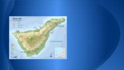
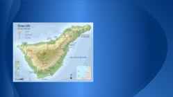
Tenerife Andres Mällo 7.a Tartu Raatuse Kool About Tenerife Largest and most populaous island of the seven Canary Islands lot of tourists World largest carnivals Two airports Santa Cruz capital of island University La Laguna El Teide Mountain Volcano Highest point Third Highest volcano Tenth highest island It remains active Teide National Park Most visited National Parks Loro Parque Located Puerto de la Cruz Paradise for parrots Opened 1972 World largest parrots collection Showes Large animal collection Orchid garden Siam Park Water park Construction Thai theme First green water park Used Sites http://en.wikipedia.org/wiki/Tenerife http://et.wikipedia.org/wiki/Tenerife http://en.wikipedia.org/wiki/Teide http://en.wikipedia.org/wiki/Loro_Parque http://en.wikipedia.org/wiki/Siam_Park_(Tenerife) http://www.bing.com/images/search?q=loro%20park&qs= n&form=QBIR&pq=loro%20park&sc=7-9&sp=-1&sk=&ajf=10
Tenerife Andres Mällo 7.a Tartu Raatuse Kool About Tenerife Largest and most populaous island of the seven Canary Islands lot of tourists World largest carnivals Two airports Santa Cruz capital of island University La Laguna El Teide Mountain Volcano Highest point Third Highest volcano Tenth highest island It remains active Teide National Park Most visited National Parks Loro Parque Located Puerto de la Cruz Paradise for parrots Opened 1972 World largest parrots collection Showes Large animal collection Orchid garden Siam Park Water park Construction Thai theme First green water park Used Sites http://en.wikipedia.org/wiki/Tenerife http://et.wikipedia.org/wiki/Tenerife http://en.wikipedia.org/wiki/Teide http://en.wikipedia.org/wiki/Loro_Parque http://en.wikipedia.org/wiki/Siam_Park_(Tenerife) http://www.bing.com/images/search?q=loro%20park&qs= n&form=QBIR&pq=loro%20park&sc=7-9&sp=-1&sk=&ajf=10
Essee Great Britain or Britain (Welsh: Prydain Fawr, Scottish Gaelic: Breatainn Mhòr, Cornish: Breten Veur) is an island situated to the northwest of Continental Europe. It is the ninth largest island in the world, and the largest European island, as well as the largest of the British Isles. With a population of about 60.0 million people in mid-2009, it is the third most populous island in the world, after Java and Honsh. Great Britain is surrounded by over 1,000 smaller islands and islets. The island of Ireland lies to its west. Politically, Great Britain may also refer to the island itself together with a number of surrounding islands which comprise the territory of England, Scotland and Wales. All of the island is territory of the sovereign state of the United Kingdom of Great Britain and Northern Ireland, and most of the United Kingdom's territory is in Great Britain. Most of Eng...
Ursula Potivar Geography of Madagascar Topography Madagascar is an island in the Indian Ocean off the eastern coast of southern Africa, east of Mozambique. At 587,000 square kilometres, Madagascar is the world's 46th-largest country and the fourth- largest island. Madagascar can be divided into five geographical regions: the east coast, the Tsaratanana Massif, the central highlands, the west coast, and the southwest. The east coast The east coast consists of a narrow band of lowlands, formed from the sedimentation of alluvial soils and zone, composed of steep bluffs, alternating with ravines bordering an escarpment of about 500 meters in elevation. The coastline is straight, with the exception of the bay. The east coast is considered dangerous for swimmers and sailors because of the large number of sharks that frequent the shoreline. The Tsaratanana Massif region The is...
NEW ZEALAND Geography: New Zealand is situated midway between the Equator and the South pole in the southern Pacific Ocean. It consists of two large islands, North Island and South Island, plus several smaller ones of which Stewart Island is the largest. North and South Islands are separated by the 32km wide Cook Strait. The total land area is 270,535 sq Km, about the size of Italy, the United Kingdom or the US state of Colorado. North Island is volcanically active with three active volcanoes. South Island has the high snow covered mountain peaks and glaciers of the Southern Alps, a range running almost 500Km along the Island. The longest river is the Waikato on North Island (425 Km), the largest inland stretch of water is Lake Taupo also on North Island (607 sq Km) and the highest point is Mount Cook on South Island (3754 m). Over 75% of New Zealand is above 200m. Land use is broken down to about: forested 30% - meadows and pastures...
Gran Canaria Gran Canaria is the second most populous island of the Canary Islands after Tenerife, and the third largest in area after Tenerife and Fuerteventura. Gran Canaria is located southeast of Tenerife and west of Fuerteventura. The island is of volcanic origin, mostly made of fissure vents. Gran Canaria is the second most populous island of the Canary Islands after Tenerife. Gran Canaria's surface area is 1,560 km² and its maximum altitude is 1,949 meters (Pico de Las Nieves). It has a round shape, with a diameter of approximately 50 km. About 80% of the volume of the island was formed during the Miocene period, between 14 and 9 million years ago. This is called the "Old Cycle" and is estimated to have lasted some 200,000 years and have emitted about 1000 km3, mostly of fissural alkali basalt. This cycle continued with the emission oftrachytes, phonolites and peralkaline rocks. This period was...
Jamaica Lehasalu Andres AT112 Jamaica Jamaica is an island country situated in the Caribbean Sea, comprising the third- largest island of the Greater Antilles. The island, 10,990 square kilometres in area, lies about 145 kilometres south of Cuba, and 191 kilometres west of Hispaniola, the island containing the nation-states of Haiti and the Dominican Republic. Jamaica is the fifth- largest island country in the Caribbean. The indigenous people, the Taíno, called it Xaymacain Arawakan. meaning the "Land of Wood and Water" or the "Land of Springs". Jamaica Marcus Garvey, Father of the Back to Africa Movement and Jamaica's first National Hero. Language The official language of Jamaica is English. Jamaicans primarily speak an English- African Creole language known as Jamaican Patois, which has become known widely through the spread of Reggae music. Jamaican Patois was formed from a bas...
Usa 1. Gross Domestic Products Gross Domestic Products of USA United States of America has the highest Gross Domestic Products nominal about 14.624 trillion US dollars according to World Bank. 2. Rhode Island Rhode Island is actually named Rhode Island and Providence Plantations and it makes the smallest state in the United States has the longest name. 3. Califrnia never rains It is believed that California is the state with the lowest rainfall in the world. For two years, California never rains. For those amazing and unique facts, California has been attracting so many tourists. Many people also adore this fact and this facts is often included in a song lyric. 4. President Grover Cleveland Grover Cleveland is the only USA president who married in office. It becomes more unusual because he married 21 years old bride when he was 49. 5. National Holidays There are ten official nationa...
Kiili Gümnaasium Referaat Hiiumaa Kairo parts 8b klass Kiili 2011 Contents 1. Hiiumaa 2. Name 3. History 4. Transport 5. Kõpu lighthouse Hiiumaa Hiiumaa (Finnish, Hiidenmaa, German Dagö, Swedish Dagö, Danish Dagø) is the second largest island (989 km²) belonging to Estonia. It is located in the Baltic Sea .north of the island of Saaremaa ,a part of the West Estonian archipelago. Its largest town is Kärdla. Name Hiiumaa is the main island of Hiiu County, called Hiiumaa or Hiiu maakond in Estonian. The Swedish and German name of the island is Dagö (day isl...
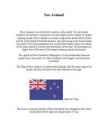
New Zealand New Zealand is on of the first countries in the world. It to be located southeast of australia.It consists of two main islands and a number of smaller outlying islands. New Zealand's two main components are the North Island and the South Island.The North Island is only half as big as the South Island, but nearly 75% of the population live on the North Island. About two-thirds of the south Island is covered with mountains. More than 220 mountains are higher than 2000 meters.The largest outlying island is Auckland. The capital of New Zealand is Wellington, it is the southermost national capital city in the world. It is New Zealand's sixth largest city behind the Auckland. The Flag of New zealand is a defaced blue Ensign with the union flag in the canton, and four red stars with white borders to the right. ...
Ireland Ireland is the third-largest island in Europe and the twentieth-largest island in the world. It lies to the north-west of continental Europe and is surrounded by hundreds of islands and islets. To the east of Ireland is the island of Great Britain. The Republic of Ireland covers five- sixths of the island. It is a parliamentary democracy and a republic. It is bordered to the northeast by Northern Ireland, which is a part of the United Kingdom, and is otherwise surrounded by the Atlantic Ocean: particularly, the Irish Sea to the east, St George's Channel to the southeast, and the Celtic Sea to the south. The population of Ireland is estimated to be 6.2 million. Thick woodlands covered the island until the 1600s. Today, it is the most deforested area in Europe. Twenty-six mammal species are native to Ireland, with some, such as the red fox, hedgehog and badger, being very common. Others, lik...
Presentation about three popular sights in Estonia Pärnu Beach · Capital of summer . · Beach and spa city . · 1 kilometer long . · The best and the most popular beach in Estonia · The beach is way of living . · Water is shallow and safe . · Priced guarded parking and bicycle parking . You can find at Pärnu Beach : - First aid - Cabanas - Toilets - Shop - Bar - Nightclub - Rental of beach chairs and towels - Water attractions - Children playground It is not allowed (prohibited) to bring pets to the beach !!! Some pictures ... Lahemaa National Park Lahemaa National Park is 70 km east of Tallinn and covers 725 km . The largest . Has a diverse (mitmekülgne) landscape . Home to numerous birds and animals . Rich variety of fauna . There are permanent communities of bear, wolf and lynx in the park so keep your camera on standby . It's also home to ... mi...
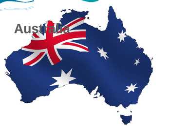
Australia Basic Knowledge Capital city: Canberra States: New South Wales, Queensland, South Australia, Tasmania, Victoria and Western Australia National Language: English Demonym: Australian, Aussie Goverment: Federal parliamentary constitutional monarchy Monarch: Elizabeth II Area: 7, 617, 930km2 Population: 22, 822, 641 Currency: Australian Dollar Flag and Coat of arms Flag Coat of arms Click to edit Master text styles Second level Click to edit Master text styles Third level Second level Fourth level Third level Fifth level Fourth level Fifth level Location It's located on the Southern Hemisphere. Surrounded by the New-Ze...
Jamaica Geograafia Jamaica Kati tsirk ja Janika Kübard Flag Coat of arms Location Jamaica is a country in the Caribbean Sea. Is the largest island of the Commonwealth Caribbean and the third largest of the Greater Antilles, after Cuba and Hispaniola. Jamaica lies in the hurricane belt of the Atlantic Ocean. Capital city The City of Kingston is the capital and largest city of Jamaica. Kingston is located on the southeastern coast of the island. Languages The official language of Jamaica is English. Informally Jamaican Patois is more commonly spoken by a majority of the population. Ethnic origins Jamaica's population consists mainly of people of West-African descent. East Indian 1.3%, White 0.2%, Chinese 0.2%, Lebanese 0.1%, Multiracial 7.3%. Immigration from regions such as Chi...
The USA In my essay I am going to talk about the United States of America. The USA was discovered by Christopher Columbus in 1492. It is situated between the Atlantic and the Pacific Oceans. It is the world's fourth largest country by size (after Russia, Canada and China) and the third by population (after China and India). The third largest citys in the US is: New York (NY) with a population of 8,175,133 and nicknames like The Big Apple, The City That Never Sleeps. It is composed of five boroughs: Manhattanthe home to Central Park and most of the city's skyscrapers, The Bronx, Brooklyn with a distinct downtown neighborhood, Queens the only large county in the United States where the median income among African Americans is higher than that of White Americans and Staten Island The Staten Island Ferry where you can see The Statue of Liberty ( a colossal neoclassical sculpture on...
Australia Katrin Aibast General · Australia is the sixth largest country in the world after Russia, Canada, China, USA and Brazil. · The mainland is the largest island and the smallest, flattest and driest continent on Earth. · The Australian federation consists of six States and two Territories. · The largest State, Western Australia, is about the same size as Western Europe. · Australia was the second country to give women the vote. Great victoria desert Click to edit Master text styles Second level Third level Fourth level Fifth level Highest peak Click to edit Master text styles Second level Third level Fourth level Fifth...
Jamaica report FORM: 10A 2009 Contents 1.Introduction........................................................ ....3 2.History................................................................ .....4 3.Geography......................................................... ......6 4.Economy............................................................ .....7 5.Crime................................................................. ......8 6.Sport.................................................................. ......9 7.Language........................................................... ....10 8.Conclusion......................................................... ....11 9.New words............................................................12 10.References...................................................... .....13 Introduction Jamaica is an island nation of the Great...
Bora Bora Today the island is almost entirely dependent on tourism. Bora Bora, as you know is a paradise for honeymooners. This island offers blue skies, blue sea, golden sands and green flora. Vaitape is the largest city of island Bora Bora Some of the bigger industries on the island include deep-sea fishing, with exports going mainly to Japan, as well as mother-of-pearl and pearl production. Agricultural practices produce sugar, vanilla, rum, and copra (used to extract coconut oil). Despite all of these activities, tourism is by far the leading economic contributor. The island has several hotels to cater to tourists, including twelve 4 and 5-store places like Club Med, for example. 3 Bora Bora experiences a tropical, humid climate with relatively stable temperatures year- round. The island is characterized by its vol...
New Zealand New Zealand is an island country. It is in the south-western Pacific Ocean comprising two main island, North- and the South Island with lots of smaller islands. New Zealand is notable for its geographic isolation. It's about 1,600 kilometers from Australia and its closest neighbours to the north are New Caledonia, Fiji and Tonga. New Zealand's total land area is 268,021 square kilometers. The country extends more than 1600 kilometers along its main,north - north-east axis and has about 15,000 kilometers of coastline. The South Island is the largest land mass of New Zealand and is divided along its lenght by the Southern Alps and the highest mountain Mount Cook is 3,754 meters high. There are 18 peaks over 3000 meters in the South Island. The highest North Island mountain is Mount Ruapehu and it is an active cone volcano. There are also two oth...
Trindidad and Tobago 14Meh Kaur Ülejõe Official name of the country • Official name of the country is Republic of Trinidad and Tobago Motto • "Together we aspire, Together we achieve" National anthem • "Forged from the Love of Liberty" https://www.youtube.com/watch?v=7au6DJfG7zY Independence day • 1 August 1976 Polity/ Government/Head of state • Trinidad and Tobago is a republic with a two-party system and a bicameral parliamentary system based on the Westminster System. The head of state of Trinidad and Tobago is the President, currently Anthony Carmona. The head of government is the Prime Minister, currently Keith Rowley. The President is elected by an Electoral college consisting of the full membership of both houses of Parliament. Capital city • Port of Spain Largest city • Chaguanas Official language • Official language is English Top10 non-English languages spoken • Trinidadian Creole 1m...
Hiiumaa and Saaremaa Hiiumaa is the second biggest island belonging to Estonia. Its largest town is kärdla. Hiiumaa arose from the water about 455 million years ago as a result of a meteorite impact. It is one of the oldest islands in the world. Around the island there are more than 200 islands and islets that have just risen from the water. Hiiumaa is a very beautiful place with kind and friendly people. The landscape on one end of the island is completely different from the landscape the other. In many languages the island is called ,,Day island". The best known sight on Hiiumaa is the Kõpu lighthouse. It's located on the Kõpu peninsula. It is the oldest lighthouse in the Baltics and the second or third oldest lighthouse in the world that has had the light continuously burning. The other big island that belongs to Estonia is Saaremaa. Saaremaa is approximately as big as Tenerife in Spain. The ...
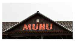
Muhu • Muhu (German: Mohn/Moon; in Estonian also called Muhumaa), is an island in the Baltic Sea. With an area of 198 km2 it is the third largest island belonging to Estonia, after Saaremaa and Hiiumaa. Together with neighbouring smaller islands of Kesselaid, Viirelaid, Võilaid and Suurlaid it forms Muhu Parish. The island has a population of 1,697 (as of 19 April 2010) and covers an area of 206.12 km2. The population density is 8.8/km2. Geography • The most important villages in Muhu are Kuivastu, Liiva and Koguva. It is linked by ferry to Virtsu in the mainland, and to Saaremaa by a causeway, the Väinatamm. In winter an ice road connects the island to the mainland. The same waters saw the Battle of Moon Sound in September–October 1917 between Russian and German naval forces. Muhu is also famous for having the only still-working traditional windmills in Estonia. Muhu is the home of Estonia's first wi...
Australia History & Geography Rakke Gymnasium X class Katre Pohlak, Alari Uudla April 2011 Key Facts Australia is the sixth largest country in the world. Australia is an island, surrounded by water. It is located on the smallest continent in the world. Key Facts Population: 17.5 million Geographic size: 2.97 million square miles Capital: Canberra Major cities and population: Brisbane, Sydney, Perth, Melbourne and Adelaide. Geographic Landmarks Australia has a very dramatic landscape. Australia is famous for its "outback," the remote lands of the interior. The desert outback covers most of the interior. It is too hot, dry and barren to support many people. Geographic Landmarks Australia also has some ...
Australia and New Zealand Triin Tens Tartu Veeriku School 2016 General facts about Australia · Commonwealth of Australia · Capital: Canberra · Population: 21 507 717 (2011) · Area: 7 692 024 km² · Anthem: Advance Australia Fair · Currency: Australian dollar · Language: English Location · Bigger cities: Sydney, Melbourne, Brisbane · Regions · Geography History of Australia · Aborigines: 50 000 years ago · Dutch explorers: 1600s · Captain James Cook: 1770 · The British settlers: 1788 · 26 January Australia day · Free settles from Europe (19 th century) Gold Rush · Edward Hammond Hargraves · 1851 · Blue Mountains, New South Wales · Rushing to Australia · Population growth · The end of the prison Natural sites in Australia · Kangaroo Island Third-largest island Many animals · Bungle Bungles Purnululu National Park Last unexplored lands · Simpson Desert Red sand Largest sand dune desert C...
Ireland Position Ireland is the third largest island in Europe, and the twentieth largest island in the world. It lies to the northwest of Continental Europe and is surrounded by hundreds of islands. To the east of Ireland, separated by the Irish Sea, is the island of Great Britain. Politically, the Republic of Ireland (also known simply as Ireland) covers five sixths of the island, with Northern Ireland, part of the United Kingdom, covering the remainder in the northeast. Climate Overall, Ireland has a mild, but changeable, Oceanic climate with few extremes. The warmest recorded air temperature was 33.3 °C at Kilkenny Castle, County Kilkenny on 26 June 1887, where as the lowest recorded temperature was 19.1 °C at Markree Castle, County Sligo on 16 January 1881. Inland areas are warmer in summer, and colder in winter there are usually around 40 days of below freezing temperatur...
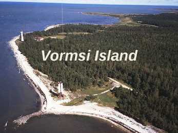
Vormsi Island Location Located between Hiiumaa and the mainland Fourth largest Estonian island Covering 92 square kilometres The meaning of "Vormsi" Known as "snake island" Derived from the German name "Worms" or it's Swedish name "Ormsö", both meaning snake island History Vormsi was inhabited by coastal Swedes 2500 people lived there before WWII During the Soviet occupation Vormsi was a closed border-zone Blend of Soviet and Swedish history mixed with unspoilt nature Nowadays Celtic crosses from the 13th century in Vormsi cemetery Vormsi is for people interested in mixed Soviet and Swedish history and rare nature Landscape Juniper fields Seaside meadows Erratic borders Lighthouses Forests Bays Lagoons To get to Vormsi You have to take a ferry (12 km, 45 min.) from Rohuküla port Public transportation bet...
Ibiza Independed work Enelin Paistu LM08 Ibiza Ibiza is an island in the Mediterranean Sea 79km off the coast of the city of Valencia in Iberian Peninsula Spain. It is the third largest of the Balearic Islands, an autonomous community of Spain. With Formentera, it is one of the two Pine Islands or Pityuses. Its largest cities are Ibiza Town (Catalan:Vila d'Eivissa or simply Vila), Santa Eulària des Riu and Sant Antoni de Portmany. Eivissa is the official Catalan name (Catalan pronunciation:, locally. The name in Spanish is Ibiza . In British English, the name is usually pronounced in an approximation of the Spanish while in American English the pronunciation is more anglicized The island is well-known for its summer club parties which attract large numbers of tourists, but the island and the Spanish Tourist Office...
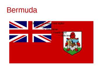
Bermuda Click to edit Master text styles Second level Third level Fourth level Fifth level Bermuda (officially, the Bermuda Islands or the Somers Isles) is a British overseas territory in the North Atlantic Ocean Located off the east coast of the United States, it is situated around 1,770 kilometres northeast of Miami, Florida, and 1,350 kilometres south of Halifax , Nova Scotia, Canada. The nearest landmass is Cape Hatteras, North Carolina, about 1,030 kilometres west-northwest. It is the oldest and most populous remaining British overseas territory, settled by England a century before the Acts of Union created the United Kingdom of Great Britain. Bermuda's first capital, St. George's, was settled in 1612 and is the oldest continuously inhabited English t...
Straitland Historical Facts Straitland has served as a junction of international trade routes for Vikings. Long struggle of power with foreign intruders has left ancient strongholds in Valjala, Lihula and Soontagana. The churches in Muhu, Valjala, Mustjala, Karja and Kihelkonna are honorable and elderly because Straitland was the one to bring Christianity to Estonia. The castle of Kuressaare is still standing proudly, but in Lihula only ruins can be seen. The patterns of national dresses and the churches bring memories of secret sign cultures of Medieval Times. Good knowledge of singing and facilit...
Harjumaa Harju County is situated in northern Estonia. Harju County, bordered by the south- westcounty, Rapla County in the south, south-east and east Järva county Lääne- Viru county. County, bounded on the north Gulf of Finland. Harju is composed of many islands, the largest of these is the Women's Island and the islands Pakri. Harju county has six self-governing city, a municipal city, 2 towns, 31 small towns and 395 villages. Harju county has 21 bigger cities Loksa, Nissi, Vasalemma, Paldiski, Kernu, Keila, Saue, Harku, Saku, Tallinn, Viimsi, Ostrava, Rae, Kose Kõue, Raasiku, Jõelähtme, Maardu, Anja, Kuusalu, Loksa, Aegviidu. 34 rivers flowing into the sea within the county and other watercourses, the drainage basin is the largest and tallest Jägala, Keila and the Pirita River and White River. Harjumaa Ülemiste Lake is the largest, and the Kahala Harku lake, too. Tallinn's surface w...
New York Jan Verner Pulles Hanna-Lisett Lubi Secondary School of Tartu 9B New York • Population: ≈ 19,5 million (2011) • Largest City: New York City • Spoken Languages: English (only) ≈ 72% Spanish ≈ 14% Others ≈ 14% Geography • New York covers 141,300 square miles and ranks as the 27th largest state by size. • New York is the only state that touches both the Great Lakes and the Atlantic Ocean, and is the second-largest of the original Thirteen Colonies. Statue of Liberty • The Statue of Liberty is a colossal neoclassical sculpture on Liberty Island in New York Harbor. • The statue, a gift to the United States from the people of France. • The statue is an icon of freedom and of the United States. New York State Capitol • The New York State Capitol is the capitol building of the U.S. state of New York • The building, com...
Bahamas Lisbeth Vinter 10b Location of Bahamas The country lies between latitudes20° and 28°N, and longitudes 72°and 80°W. Bimini, Abaco, Inagua, Andros Island, Eleuthera, Cat Island, Long Island,San Salvador Island, Acklins,Crooked Island, Exuma andMayaguana. Nassau capital city of The Bahamas, lies on the island of New Providence. Mount Alvernia(Como Hill) 63 metres (207 ft) on Cat Island. Population: 309,156 Religions: Baptist 35.4%, Anglican 15.1%, Roman Catholic 13.5%, Pentecostal 8.1%, Church of God 4.8%, Methodist 4.2%, other Christian 15.2%, other Protestant 12%, none or unknown 3%, other 2% The 'other' category includes Jews, Muslims, Baha'is, Hindus, Rastafarians, and practitioners of Obeah Languages: English (official), Bahamian dialect Climate subtropical to tropical moderated significantly by the waters of the Gulf Stream the temperature ca...
Loch Ness Mariann Kolk 9d Geographical particulars · large, deep freshwater · 37 km long · southwest from Inverness · surface area 56.4 km² · deepest point 230 m · about 10,000 years old Urquhart Castle · beside Loch Ness · the largest strongholds · majority of Loch Ness Monster sightings Cherry Island · only island on Loch Ness · artificial island · from the Iron Age The Loch Ness Marathon · an annual marathon race · along Loch Ness to Inverness · $2,500 · supports several charities · over 1,500 participants Loch Ness monster · an alleged animal · bestknown mysteries · Nessie · 60 feet long · a long tail with 4 fins and a big head · the water horse · categorized: 1. unknown species of large animals 2. mystic or paranormal 3. misidentification of known animals 4. inanimate objects or effects 5. hoaxes Plesiosaur · a longnecked aquatic reptile · a coldb...
The New York 1. The Empire State Building. The Empire State Building is a 102-story landmark Art Deco skyscraper in New York City at the intersection of Fifth Avenue and West 34th Street. Its name is derived from the nickname for the state of New York, The Empire State. It stood as the world's tallest building for more than forty years, from its completion in 1931 until construction of the World Trad Center's North Tower was completed in 1972. 2. Central Park. Central Park is an urban park that occupies about 1.2 square miles (341 hectares, or 843 acres) in the heart of Manhattan in New York City. It is host to approximately twenty-five million visitors each year. Central Park was opened in 1859, completed in 1873 and designated a National Historic Landmark in 1963. 3. The statue of Liberty. The Statue of Liberty officially titled Liberty Enlightening the World, dedicated on October 28, 18...
Scotland Overview Flag-Saltire Royal Standard of Scotland Edinburgh, Glasgow First Minister Alex Salmond 78,387km² 5,222,100 St Andrew History Picts (Celtic tribe) Romans named scotland Caledonia The Scots Queen Mary was forced to abdicate the Scottish throne in 1567. National Symbols Thistle Declaration of Arbroath Tartan Bagpipes Kilt Honours of Scotland Crown, Sword and sceptre are from late fifteenth and early sixteenth century. Crown was made in 1540. Pope Julius II presented the sword to King James IV in 1507. The sceptre was made in 1494 and was presented to King James IV by Pope Alexander VI Honours of Scotland Language Have spoken Pictish, Scottish Gaelic similar Norse, Norman- to Irish, it is French and Brythonic recognised a...
Irish History Tallinn 2009 Ireland is the third-largest island in Europe, and the twentieth-largest island in the world. It lies to the north-west of continental Europe and is surrounded by hundreds of islands and islets. To the east of Ireland, separated by the Irish Sea, is the island of Great Britain. Politically, the state Ireland (described as the Republic of Ireland) covers five-sixths of the island, with Northern Ireland, part of the United Kingdom, covering the remainder in the north-east. The first settlements in Ireland date from 8000 BC. By 200 BC Celtic migration and influence had come to dominate the island. Relatively small scale settlement by both the Vikings and Normans in the Middle Ages gave way to complete English domination by the 1600s. Protestant English rule resulted in the marginalisation of the Catholic majority, although in the north-east, Protestants were in the majority. A famine in the mid-1800s...
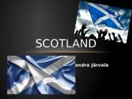
SCOTLAND Sandra Järvala GEOGRAPHY & POPULATION · Scotland is a country that is part of the United Kingdom and coers the northern third of the Island of Great Britain. · The Scotland capital city is Edinburgh. MAJOR CITIES · The largest city is Glasgow. Glasgow has a population of 598,830. The city has an area of 175.5 km ². · Aberdeen, Dundee, Paisley, East Kilbride and Livingston are are also large cities. · There is a Glasgow bus tours for tourists SCOTLAND FLAG · The Flag of Scotland, also known as Saint Andrew's Cross or the Saltire, is the national flag of Scotland. · Scottish flag is blue · On the flag is a white X-shaped cross. NATIONAL SYMBOLS · The national flower of Scotland is the thistle. · Scotland's national animal is the unicorn. · The Scots Pine is the national tree of Scotland. · Scotland's national bird is the golden eagle. HERALDRY · The Royal Arms of Scotland is a coat of arms symbolising S...
Ireland Ireland is a beautiful island that is washed and influenced by the Atlantic Ocean in the west.It is known for its gorgeous landscape, the green hillsides and the rocky coastline. Film-makers from all over the world have used the beautiful landscape of the island. Ireland is the third-largest island in Europe. It lies to the north-west of continental Europe. The population of Ireland is 6.2 million and there are two official languages English and Gaelic. Ireland `s capital is Dublin. The area of Ireland is 84,421 km2 Ireland is separated into two parts. The north is part of the United Kingdom, while four fifths of the island make up the Republic of Ireland, which has been an independent country since 1921. The Irish are fun-loving and friendly. They like music and humour and they are also good storytellers. There are many legends in Ireland in which the leprechaun, the shoemaker of the Irish ...
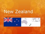
New Zealand English speaking countries Where? o It is in the southwestern Pacific Ocean o Next to the Australia About Capital-Wellington Largest city-Auckland Government-Unitary parliamentary constitutional monarchy • Monarch - Queen Elizabeth II • Governor-general - Jerry Mateparae • Prime minister - John Key About Area-268,021 km2 Population-4,509,461 ( January 2014 ) Anthem-"God Defend New Zealand„ New Zealanders are calling their country Aotearoa. History o Māori were the first to arrive in New Zealand, journeying in canoes from Hawaiki about 1,000 years ago. A Dutchman, Abel Tasman, was the first European to sight the country In 1840, the Treaty of Waitangi was signed, an agreement between the British Crown and Maori Nature New Zealand is made up of two main islands and a number of smaller islands The South Island is the largest landmass of New Zealand New Zealand has a...
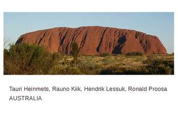
Tauri Heinmets, Rauno Kiik, Hendrik Lessuk, Ronald Proosa AUSTRALIA Geographical position Australia is a country in the Southern Hemisphere comprising the mainland of the Australian continent as well as the island of Tasmania and numerous smaller islands in the Indian and Pacific Oceans. world's sixth-largest country by total area. The lowest point in the country is lake of Eyre (15m below sea level) and the highest point is Mount Kosciuszko (2229m) Economy Mixed economic system Division of labor Agriculture 3,6%; Industry 21,1%; Tendance 75% Units of labor 11,45 mlj. 2009. Unemployment 5,6% Most important export articles: coal, iron,gold Most important import articles: machinery and transport equipment Australia is one of the most important mining industry countries Politics Capital: Canberra Largest city: Sydney National language: English (de facto) Demonym:Australian, Aussie Government: Federal parliamentary c...
English speaking countries Ingrid Kaups X class Ireland The "Titanic'' made in Belfast Ireland Flag Orange- Irish Protestants Green- Irish Catholics White- peace Ireland No snakes in Ireland Wales Llanfairpwllgwyngyllgogerychwyrndrobwllllantysiliogogogoch Click to edit Master text styles Second level Third level Fourth level Fifth level New Zealand The southernmost capital. 11 sheep per citizen . England Shortest war in 1896 Less than 38 minutes Scotland Scotland prints its own banknotes which are accepted all over the UK The Usa Alaskan purchase check Canada ...
Tallinn English College Topic Great Britain 2007 1. Introduction The official name of Great Britain is `the United Kingdom of Great Britain and Northern Ireland (or short United Kingdom)' The population is about 60.4 million. The capital is London. Other biggest cities include Birmingham, Bristol, Portsmouth, Glasgow and Swansea. English is the main language of Great Britain, but Welsh is officially recognized in Wales and Gaelic in Scotland. 2. Geographical position The British Isles is the geographical term for a group of about 5000 islands off the coast of mainland Europe. The largest island is Great Britain, which is also the largest island in Europe. It consists of England, Wales and Scotland. The next largest island is Ireland, which is made up of Northern Ireland and the Irish Republic. Britain and Northern Island together form the United Kingdom. When referring to Britain ...
AUSTRALIA Tallinn 2008 Only one country in the world fills a whole continent. That country is Australia. The continent it fills is Australia, too. Australia, then, is both a country and a continent. Australia is one only continent except Antartctica that is all south of the equator. Since it is south of the equator, its seasons are just the opposite of ours. It has summer while we have winter, and the other way round. Sometimes Australia is called the island continent. There is a good reason why. It is an island. It is 1800 miles from the mainland of Asia and almost half way round the world from Europe. More than 6000 miles of ocean separate it from the America. Australia is the world's smallest, flattest and driest continent. It is also the oldest some of the rocks are more than 3,000 million years old. It is the 6th largest country. Its territory is 7 700 000 km2. Australia is...
6 stops in the USA Annika Allik 10A Põltsamaa Co-Educational Gymnasium Las Vegas ... is the largest city in Nevada state ... is the largest center for adult entertainment in the entire world The major attractions in Las Vegas are the casinos and the hotels The most famous hotel casinos are located on Las Vegas Boulevard on the portion of that road known as the Las Vegas Strip Fremont street in 1920s and today New York City ... is the most populous city in the United States ... is famous for the Statue of Liberty, Empire State building, United Nations, museums, Broadway theaters, restaurants, Times Square, nightlife and shopping In 2010, New York City had a record number of tourists with 48.7 million Time square in 1922 and 2010 San Francisco ... is the financial, cultural, and transportation center of the San ...
Thylacine AKA the Tasmanian Tiger/Wolf • The Tasmanian Tiger was the largest known carnivorous marsupial of modern times. • Native to continental Australia, Tasmania and New Guinea. • Believed to have become extinct in the 20th century. • Became extremely rare or extinct on the Australian mainland before British settlement of the continent, but it survived to the 1930s on the island of Tasmania. https://www.youtube.com/watch?v=6vqCCI1ZF7o • The thylacine was able to open its jaws to an unusual extent: up to 120 degrees. This capability can be seen in part in David Fleay's short black-and- white film sequence of a captive thylacine from 1933. The jaws were muscular but weak and had 46 teeth. • The thylacine held the title of Australia's largest predator until about 3500 years ago. • The thylacine resembled a large, short-haired dog w...
Strange and mysticals places on Earth Eye of africa - Mauritania Eye of africa- Mauritania · The Richat structure (Sahara, Mauritania) appears as a large dome at least 40 km in diameter within a Late Proterozoic to Or- dovician sequence. · This natural phenomenon is actually a Richat structure caused by the dome shaped symmetrical uplifting of underlying geology now made visible by millennia of erosion. Socotra island · is a small archipelago of four islands in the India Ocean. The largest island, also called Socotra, is about 95% of the landmass of the archipelago. It lies some 240 kilometres (150 mi) east of the Horn of Africa and 380 kilometres (240 mi) south of the Arabian Peninsula. The island is very isolated and through the process of speciation, a third of its plant life is found nowhere else on the planet. It has been described as the most alien- looking place on Earth. So...
 annaabi.ee