rising east European platform. Estonia is a flat country covering 46 226 square kilometers.Estonian's neighbours are Finland, Sweden, Latvia and Russia. Estonia is rich in islands. The two largest are Saaremaa and Hiiumaa . Saaremaa is famous for its big meteorite crater called Kaali and Hiiumaa is famous for its nature and plants. The countries highest point Big Egg hill ( Suur- Munamägi) reaches 318 meters above sea level. Estonia has many uplands too. The uplands are: Pandivere upland, Otepää upland, Vooremaa upland, Karula upland Haanja upland, Sakala upland. Estonia is covered by about 18 000 square kilometers of forest. Estonia is also rich in lakes and rivers The largest lake is Peipsi and the second-largest lake is Võrtsjärv. The largest river is Võhandu whinch is 162 meters long. Estonia has many national parks. A national park is a protected area. They are good to protect animals, birds, insects and other natural resources
includes three lions in the middle, with oak branches along the side of the shield. Estonia has 1521 islands and the biggest of them are Saaremaa and Hiiumaa. Estonia is divided in to 15 different counties. The biggest cities in Estonia are Tallinn, Tartu , Pärnu, Narva In Tartu there is the biggest and oldest University in Estonia Suur Munamägi is the highest peak of Estonia and also in the Baltic States. It is located near the Haanja upland and its total height is 318 m above sea level . The Estonian Song Festival is one of the largest choral events in the world. It’s held every four years on the Tallinn Song Festival Grounds. Thousans of dancers wear national costumes as they dance around the pitch. Dance Festival usually takes place at the same weekend as the Song Festival. Festive procession is from the Center of Tallinn to the Song Festival Grounds http://et.wikipedia.org/wiki/Esileht www.google.ee
When I think about the UK I think about London and its sights. the second thing that pops into my mind the weather and how they talk and complain that the weather is bad and it is raining, The weather in the UK is actually changeable and it doesn't rain all the time They are in the Temperate climate zone and the Gulf stream affect their weather. so there are no extreme weather conditions Much of the land in England is low lying. forming meadows and pastures Upland areas are generally confined to northern England The Pennines are a range of mountains and hills in Northern England The Midlands' largest city is Burmingan.. It is one of England’s principal industrial and commercial areas. The highest point of the UK is Ben Nevis which is located in Scotland and the longest river in the UK is the Severn which begins in Wales. Scotland and Wales are the most mountainous parts of the UK. Other major river is the Thames, which flows through Oxford and London
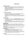
Sightseeing *Haanja Nature Park Haanja Nature Park (area about 17,000 ha) is situated on the Upland of Haanja and was established for the protection of the highest region of Estonia and the Baltic States In addition to the beautiful domed hills, deep valleys and picturesque small lakes old villages, customs and cultural traditions have been preserved * Timmas Nature Reserve Timmas Nature Reserve(the Reserve) is taken under the protection of natural forest and meadow colonies of protected species
ENGLAND England is a country that is part of the United Kingdom. It shares land borders with Scotland to the north and Wales to the west; it is surrounded by the Irish Sea, the Celtic Sea, the North Sea and the English Channel, it's linked to Frane by the Channel Tunnel. The total area of the country is more than 130000 sq km. Most of England is lowland, but there are upland regions in the north, south and south west. The climate is temperate, subject to frequent changes, with plentiful rainfall all year round, although the seasons are quite variable in temperature, it rarely falls below -5 or rises above +30 degrees. The longest river, the Severn, flows for 354km. England's capital London, is the largest metropolitan area in the United Kingdom, drawing from a wide range of people, cultures and religions, speaking over 300 different languages, mixing
Estonia is a small country in Northern Europe with an area of about 45 000 sq km. The country's climate is determined by the proximity of the Atlantic Ocean. The summer temperatures are a little lower than the average of that latitude, but the winters are considerably warmer. As a part of the East-European Plain, the country has a rather flat surface. The highest and most topographically variagated region in Estonia is in the south-eastern part of the country. The Sakala Upland plains offer contrast to the hills of Ottepää, Karula and Haanja. At 318 metres, Suur Munamägi ('Great Egg Hill') is not only the highest point in Estonia, but of all the Baltic countries. The country has 3974 km of coastline, while the land border, in comparison, is only a mere 633 km. The coast varies from limestone cliff in the north to sandy beaches in the west. Most of Estonia's many islands belong to the West Estonian archipelago. The largest islands
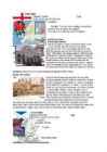
ENGLAND Capital: London Flag: Area: 50351 sq (130410 km) Location: Symbol: The red rose is widely recognised as the national flower of England. The oak is the national tree of England. Interesting plases: Royal Opera House The Royal Opera House is the third theatre on the Covent Garden site, the previous two being destroyed by fire. The new building opened in May 1858 becoming known as the Royal Opera House in ...
nature remembrance in Estonia, being at the same time also the most impressive field of craters in Eurasia. The biggest crater has a diameter of 110m and is 16 meters deep. There are eight craters found in the surrounding area. The Kaali Meteorite is the last (ca 7500 yrs ago) giant meteorite fallen to the densely inhabited area in the world. · he River Võhandu is the longest river in Estonia 156km, with its source in the Otepää Upland, near the Village of Sirvaste. The oldest part of the River from the Leevi Mill Dam to the Bridge of Reo is under natural protection. The protection area is 12km long and covers 300 meters of the landscape from each bank. Of the 38 outcrops in the protection area the biggest and most fascinating are Põdramüür (16.2m of height), Viira veskimüür (16.5m), Sojatare, Kalmate rnüür and the highest of all Tsirgu müür (17.1m). Of the
A number of animal species also found in these forests which includes bears, bats, woodpecker, fox etc. Human uses of boreal forests: o Wood products - One of the most important human uses of these forests for example wood for house construction and paper pulp. o Animal products - Most valuable animal products of the cold forests and mountains are animal pelts for clothing and beaver for hats. o Grazing & agriculture - Upland forests are often cleared for grazing and lowland forests for agriculture. o Habitation Population is not dense, but many people live there. Temperate forests Temperate forests can be found on both hemispheres on latitude approximately 25 to 50 in regions of northeastern Asia, North America, western and central Europe. They can be categorized as deciduous as well as evergreen. These forests are include: o Temperate deciduous forest o
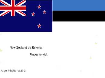
the Office of the President. Top ten places to visit in Estonia Lake Peipsi It is the forth largest lake in Europe Its in the border of Estonia, Russia and Eastern Europe. It is ideal for fishing and recreation. Suur Munamägi Is the highest peak in Estonia (and the Baltic states), reaching 318 meters above sea level. The tower is 29.1 metres (95 ft) high. The landscape around the peak the Haanja Upland. Top ten places to visit in Estonia Soomaa National Park It is a large park in Estonia (400 km2) Water from the nearby Sakala uplands can during the spring time melting or rain season unleash such an avalancehe of water that rivers break out of their banks. Flood is the name of the fifth season. Haapsalu It was founded in the 13th century and has been wellknown for centuries
waters. The land still rises 25 cm in every 100 years. Kalevipoeg, the national hero, is related to many features of the relief. The Baltic Glint is one of the world's most important denudations of Ordovician sedimetary rocks. Half of Estonia is covered with forests and 30 % is covered with wetlands. The areas which are higher and particularly rich in hills are the Haanja and Otepää Uplands in the southeastern part of Estonia. In Haanja Upland there is the highest top of Estonia, Big Egg Hill (318 m), which is the highest top of the Baltic states. There are over 1400 lakes in Estonia. Lake Peipsi, lying between Estonia and Russia, covers 3 555 sq km. It is the biggest in Estonia and the fourth biggest in Europe. The second largest lake is Lake Võrtsjärv (270 sq km), while the deepest id Rõuge Suurjärv (38 m). The longest rivers are the Võhandu (162 km) and Pärnu (144 km). The Emajõgi flows for 101 km and its
tree kangaroos and birds of paradise. Close to 10% of the world's vertebrates are concentrated here, while 7% of the world's higher (vascular) plants grow on the island's productive soils. 3 Geography Papua New Guinea consists of over 600 islands and lies in the middle of the long chain of islands stretching from mainland South-East Asia. The mainland and larger islands are mountainous and rugged, divided by large fertile upland valleys. Fast- flowing rivers from the highlands descend to the coastal plains. A line of active volcanoes stretches along the north coast of the mainland and continues on the island of New Britain. To the north and south of this central mountain range on the main island lie vast stretches of mangrove swamps and coastal river deltas. /1/ Volcanoes and thermal pools are also found in the southeast of other islands. Papua New Guinea offers the greatest variety of terrestrial
Edinburgh, the country's capital and second largest city, is one of Europe's largest financial centres. The biggest city is Glasgow. There is a fierce rivalry between the most important football clubs of Glasgow and entire Scotland Glasgow Celtic and Glasgow Rangers. Scotland has a very picturesque landscape. It may be divided into two parts: the Lowlands (an are of gentle hills, fields and woodlands, more densely populated than other parts, they also include plenty of wild upland country) and the Northern Highland (which are considered by many people, especially mountain-lovers, to be the most beautiful part of Scotland and a real tourist Mecca; they say that there may even be small patches of land on which nobody has ever set foot). Britain's highest peak, Ben Nevis (1343 m) lies not far from Fort Williams. The Scottish flag has a white cross on a blue background. It is also on the Union Jack.
Although Australia is a low continent, there are a few mountain rangers there, too. The biggest is the Great Dividing Range. It stretches more than 3500 km from the north-eastern tip of Queensland, running the entire length of the eastern coastline through New South Wales, then into Victoria and turning west, before finally fading into the central plain at the Grampians in western Victoria. It consists of a complex of mountain ranges, plateaus, upland areas and escarpments. One part of the Great Dividing Range is the Australian Alps. It's highest point is Mount Kosciuszko, which is 2,228 metres high. The Snowy Mountains in New South Wales are also part of the Alps. The most famous land mark of Australia is the Uluru. It's a large sandstone rock formation in the southern part of the Northern Territory. It lies 335 km south west of the nearest large town, Alice Springs; 450 km by road
54 20'oo'N ISS'OO'W
-.::Kut.state, IJ S 51 42' oo'N 13' OOW Dnieper. flvel 85 4I' OO'N 33'OO'E Fe narantsoa. Madagascar. 90 21'2 7'5 41' 04'E Gold Coast, region 91 S' oo'N roow Hawaii, state, US . SO 2I'OO' N IS8'OOW
36'OO'E --.ce,L., lake .. 85 48' oo'N 9' OO'E Dnieper Upland, highlands 85 49°00'N 32'OO'E FiJI, country 102 19'00'5 118' OO'E Gonder, Ethiopia. 90 12' 34'N 37'26'E Hawauan Is.. ,slands . 54 2I'OO'N ISI "OOW
l'OO'W mtta , Romanl
[http://www.envir.ee/orb.aw/class=file/action=preview/id=90658/SE21_est_we b.pdf]. 01.08.2007. Farell, T.A., Marion, J.L. 2002. The Protected Area Visitor Impact Management (PAVIM) Framework: A Simplified Process for Making Management Decisions. Journal of Sustainable Tourism, 10(1), pp. 31-51. Finney, S.K., Pearce-Higgins, J.W., Yalden, D.W. 2005. The effect of recreational disturbance on an upland breeding bird, the golden plover Pluvialis apricaria. Biological Conservation, 121 (1), 53-63. Gallet, S., Roze, F. 2002. Long-term effects of trampling on Atlantic Heathland in Brittany (France): Resilience and tolerance in relation to season and meteorological conditions. Biological Conservation, 103 (3), 267-275. Gill, J.A., Norris, K., Sutherland, W.J. 2001. Why behavioural responses may not reflect the