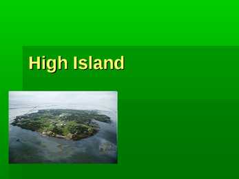
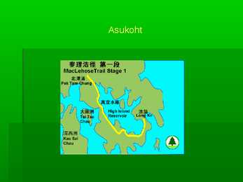
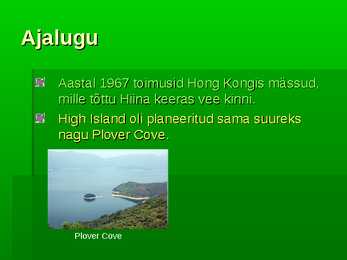
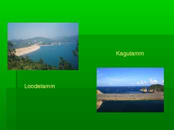
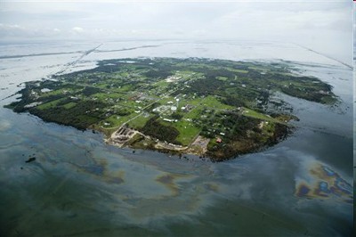
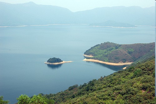
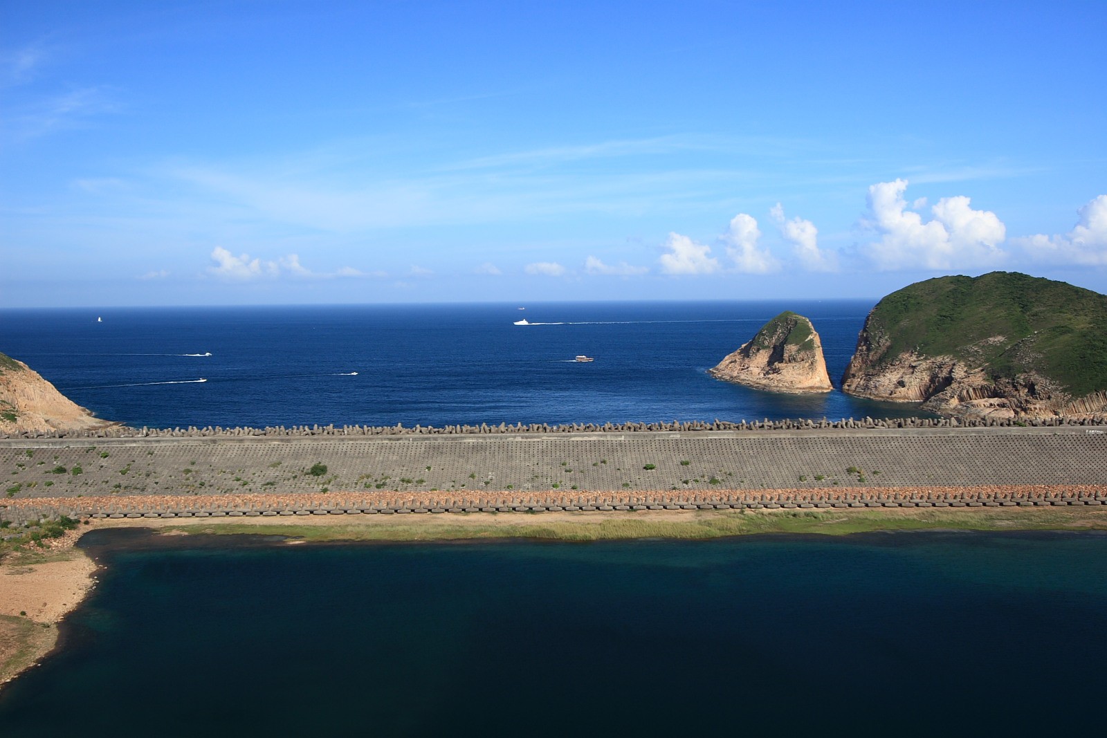
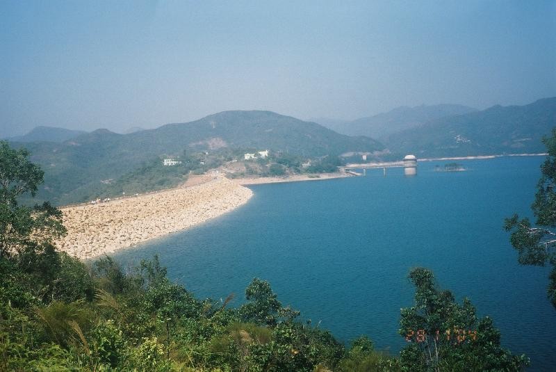
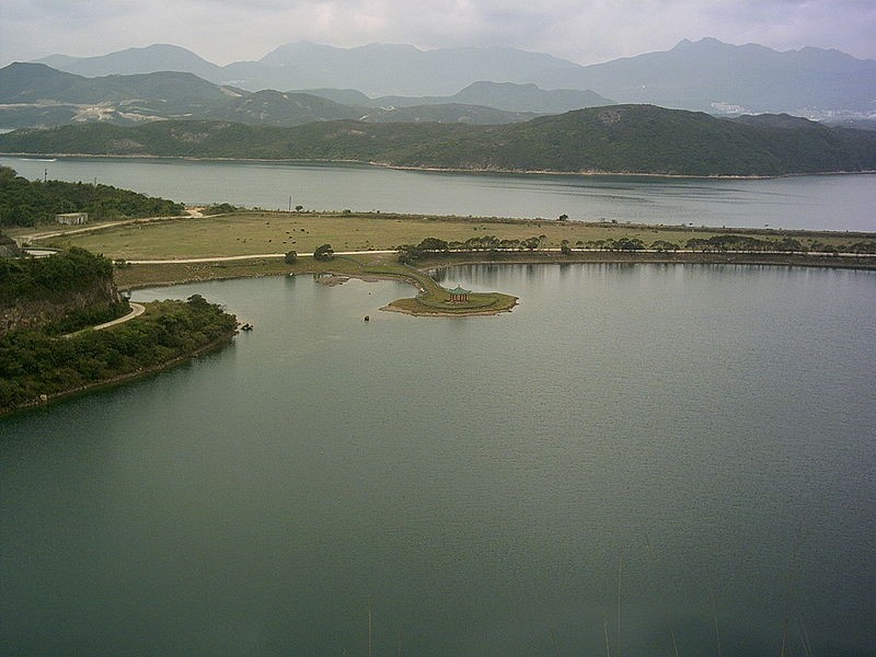
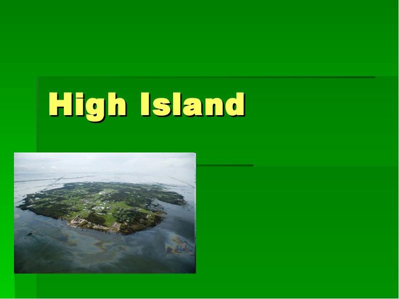
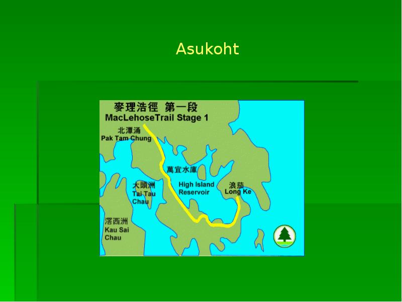
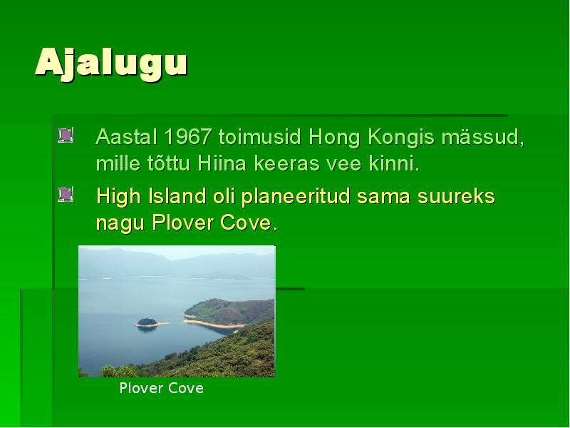
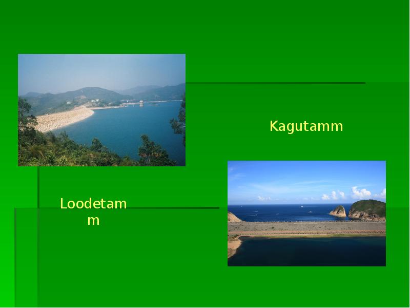
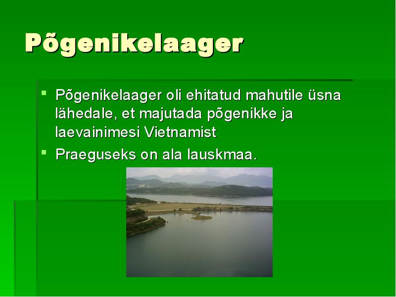
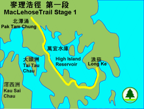
High Island ja Po Pin Chau Merilyn Raiend Triinu Vreimann Üldine informatsioon Saare ametlik nimi on High Island Reservoir, mis tõlkes tähendaks "Kõrgsaare mahuti" Asukoht: Sai Kung Peninsula, New Territories, Hong Kong, Hiina High Island avati aastal 1978, et leevendada veepuudust Hong Kongis Veemahutavus on umbes 273 miljonit kuupmeetrit Algselt oli ala Kwun Mun Channel, mis eraldas High Islandi Sai Kung Peninsulast Asukoht Ajalugu Aastal 1967 toimusid Hong Kongis mässud, mille tõttu Hiina keeras vee kinni. Vastuseks veepuudusele lasi valitsus asutada "Kõrgsaare veemahuti". High Island oli planeeritud sama suureks nagu Plover Cove. Ehitus läks maksma rohkem kui 400 miljonit Hong Kongi dollarit Plover Cove Disain Mahuti oli ehitatud kui osa High Island'i veeskeemist
TARTU ÜLIKOOL LOODUS- JA TEHNOLOOGIATEADUSKOND Ökoloogia ja maateaduste instituut Geograafia osakond Referaat aines transpordigeograafia Rippsild Kaiti Vasiljeva Juhendaja: Tiia Rõivas Tartu 2014 Sisukord Sissejuhatus........................................................................................................... 3 1.Rippsild................................................................................................................ 4 1.1 Akashi Kaikyo rippsild.........................................................
Kuulsaimad vangid olid Al "Arminägu" Capone, George ``Machine Gun`` Kelly, Alvin"Creepy Karpis"Karpowicz ja Robert Stroud. Saarel oli vange üldjuhul 260-275. Võib öelda, et saarelt õnnestus põgeneda, aga kinnitust ei ole, et põgenenud oleksid elus. 25 Kasutatud kirjandus Alcatraz, http://www.history.com/topics/alcatraz, 10.03.2017 [1]. Alcatraz, https://www.bop.gov/about/history/alcatraz.jsp 10.03.2017 [2]. Alcatraz Island, https://en.wikipedia.org/wiki/Alcatraz_Island, (10.03.2017) [6]. Did anyone ever escape from Alcatraz, http://www.history.com/news/ask- history/did-anyone-ever-escape-from-alcatraz, (10.03.2017) [3]. A.G. Poulsen, 2013 Põgenemine Alcatrazist 2014 - Imeline Ajalugu, nr 8/2013 [4]. Alcatrazi vangla, http://et.raamaturott.wikia.com/wiki/Alcatrazi_vangla, (10.03.2017) [5]. 26 Lisa 1
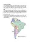
GEOGRAAFILINE ASEND Tsiili on riik Ameerika maailmajaos, Lõuna-Ameerika mandril, mis hõlmab pikka ja kitsast rannikuala Andide mäestiku ja Vaikse ookeani vahel. Tsiili asub Lõuna-Ameerika läänerannikul. See ulatub mandri lõunapoolseimast otsast umbes mandri keskpaigani. Läänest piirneb Tsiili Vaikse ookeaniga. Idast piirneb Tsiili suuremas osas Argentinaga. Kirdesse jääb Boliivia ning põhjas on Tsiili naaberriigiks Peruu. KUJU Tsiili pindala on 756 950 km²(maismaad 748 800 km²). Rannikujoone pikkus on 6435 km. Riik on kitsas ja pikliku kujuga, võttes põhjast lõuna suunas enda alla ligikaudu 4200 km pikkuse maa-ala. See on maailma pikim riik. Idast läände on Tsiili kõige laiema koha pealt aga kõigest 180 km laiune. Lisaks on riigil veel mõned saared: Lihavõttesaar, Juan Fernandeze saared ja Sala y Gomeze ahelik (San Felixi saar ja San Ambrosio saar). KOORDINAADID, AEG Tsiili asub koordinaatidel 18°-56°ll, 67°-75°lp. Tsiili pealinn on Santiago, mis paikneb ko
Sisukord: Kuu kui põhjus lk 3 Kraatrid lk. 4 Kuu pind lk. 6 Kuu siseehitus lk. 7 Kuu tekkimine lk. 7 Tähtsamad Apollo lennud lk. 9 Apollo 11 lk. 10 Apollo 12 lk. 12 Apollo 13 lk. 20 Kuul käinud inimesed lk. 24 Kasutatud kirjandus lk. 25 1 2 Kuu kui põhjus Kuu on meile lähim taevakeha. Ta asub nii lähedal, keskmiselt vaid 384 400 km kaugusel, et iga inimene võib sealt palja silmaga näha sama palju detaile kui astronoom maapealse teleskoobiga Marsil. Kuna Kuu orbiit on küllalt piklik, siis muutub tema kaugus Maast piirides 356 410 km kuni 406 700 km. Sellega kaasnevat Kuu näiva suuruse muutumist oleks isegi silmaga m
Avinurme Gümnaasium Geograafia Hiina Uurimustöö Juhendaja: Ene Lüüs SISSEJUHATUS Autor valis teha uurimustöö Hiinast, sest Hiina on suur ja kaunis riik, millest on palju materjali ning samuti tahtis autor rohkem teada selle riigi kohta. Uurimistöös räägin Hiina vaatamisväärsustest loodusest ning üldandmetest. RIIGI ÜLDANDMED Üldandmed Hiina rahvaarv aastal 2006 oli 1 314 480 000, rahvastikutihedus on aga 137 in/km2. Hiina pealinn on Peking, kus elab üle 17 miljoni inimese. Rahaühikuid on Hinas mitmeid: Jüaan, Macau pataca, Hongkongi dollar. Pindala on 9 596 960 km2 millega on Hiina Kaug-Idas suurim ja maailmas pindalalt neljas. Hiina piirneb 14 riigiga. Need on Afganistan, Bhutan, India, Kasahstan, Kõrgõzstan, Laos, Mongoolia, Myanmar, Nepal, Pakistan, Põhja-Korea, Tadzikistan, Venemaa ja Vietnam. Hiina asub Euraasias, täpsemalt Ida- Aasias ning Hiinat ümbritsevad Lõuna?
AUSTRAALIA geograafia referaat Juhendaja: Sisukord: 1. ÜLDANDMED 2. AJALUGU 3. KLIIMA 4. PINNAMOOD 5. LOODUSVARAD 6. RAHVASTIK 7. LOODUS 8. HARIDUS 9. TERVIS NING SURMAD 10.KULTUUR 11.MAJANDUS 12.ENERGIAMAJANDUS 13.PÕLLUMAJANDUS 14.VEONDUS 15.EKSPORT/IMPORT 16.TURISM 17.SPORT 18.STATISTIKA 19.KASUTATUD MATERJAL/VIITED 1. ÜLDANDMED Austraalia on maailmajagu ja manner lõunapoolkeral. Põhjast lõunasse on mandri ulatus 3200, läänest itta 4100 km. Läänes ja lõunas piirneb Austraalia India ookeaniga, idas ja põhjas Vaikse ookeani meredega- Tasmani, Koralli-, Timori ja Arafura merega. Rannajoon on vähe liigestunud: põhjas sopistub Arnhemi maa ja Cape Yorki poolsaare vahel mandrisse Carpentaria laht, lõunarannikut uhub suur Austraalia laht. Tasmaania saart eraldab mandrist 224 km laiune Bassi väin. Kirderannikut ääristab 2300 km pikkune Suur Vallrahu Pealinn: Canberra Riigikord: Rahvaste Ühendusse kuuluv Föderatiivne parla
TALLINNA TEHNIKAKÕRGKOOL GRUUSIA KUI EUROOPA LIIDU PARTNERRIIK Õppeaines: EUROOPA LIIDU MAJANDUS teaduskond Õpperühm: Üliõpilane: Juhendaja: Lembo Tanning Tallinn 2009 Sisukord Sissejuhatus................................................................................................................................................................. 3 1.Euroopa ja Euroopa Liit, mis see on ja selle saamislugu..........................................................................................4 2.EL ja tema põhilised tegevusvaldkonnad..................................................................................................................6 3.EL ja tema põhilised partnerriigid ja majanduslikud näitajad...................................................................................8 4.Gruusia ja tema taust...........................................................


Kõik kommentaarid