z Art’’ kontserdil. Kontsert toimus Võru kultuurimajas Kannel. Esinejad olid Geoffrey Baptiste ja Andre Roe. Esinejatel olid püksid nabani ja värvilised triisärgid seljas. Kontsert kestis ligi kaks tundi ja oli kaheosaline. Esimesse osas oli 3 teost: Children’s games op.22 helilooja Georges Bizet, Pupazzetti op.27 helilooja Alfreda Casella ja Mother Goose heliloojaks Maurice Ravel. Teises osas oli samuti 3 teost: 5 Ungari tantsu helilooja Johannes Brahms, Simple gifts from appalachian spring heliloojaks Aaron Copland ja Souvenirs op.28 Samuel Barber. Kokku esitati 6 teost. Mulle ei meeldinud kõige esimene teose valik Children’s games op.22, see kõlas mulle natukene igavana, tavalise ja lapsikuna. Teose esitamise ajal vallandusid saalis köhahood. Teose lõppedes esinejad vahetasid kohad. Pupazzetti op.27 seda võib iseloomustada kui rahulik, mõtlik ja salakaval. Teos oli lühem kui esimene. Mother Goose meeldis mulle kontserdi esimesest
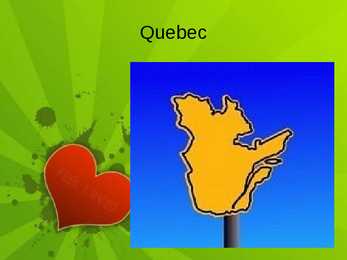
Capital - Quebec City Largest city Montreal Official language French Population 7, 6 mln Emblems Coat of arms Flag Motto "Je Me Souviens" Flower blue flag iris Bird snowy owl Mineral asbestos Tree yellow birch Quebec's National Holiday 24 June Geography Situated in eastern part of Canada Highest point Mont D'lberville Largest river the St. Lawrence River Canadian Shield 90% of the territory Appalachian Mountains History First inhabitants were the indigenous people First French explorer Jacques Cartier 1534 First it was called New France In 16. 17. century population grew massively The Seven Year's War in 1756-1763, New France was renamed the Province of Quebec Act of Union in 1840 Economy The St. Lawrence River Valley is a agricultural region The nothern coniferous forests, lakes and rivers have many resources
The U.S.A. consists of 51 states and the District of Columbia. The state of Alaska is separated from the rest of the U.S.A. by Canada. Hawaii, which became the fiftieth state in 1959, is in the Pacific Ocean, halfway between the continents of America and Asia. The area of the United States of America is over nine million square kilometres. The continental part of the U.S.A. consists of two highland regions and two lowland regions. The highland regions are the Appalachian Mountains in the east and the Cordilleras in the west. The Appalachian Mountains run parallel to the Atlantic coast almost from the Gulf of Mexico into Canada. The highest peak is 2000 metres high. The Cordilleras stretch along the Pacific coast with the Sierra Nevada in the south and the Rocky mountains continuing into Canada and Alaska in the north. Their highest point in the U.S.A. is 4540 metres in Sierra Nevada. The five Great lakes, between U.S.A
English spoken in the Upper Peninsula of Michigan and in some neighboring areas) Midland American English North Midlands English (thin swath from Nebraska to Ohio) St. Louis dialect South Midland (thin swath from Oklahoma to Pennsylvania) Appalachian English Southern English Coastal Southeastern (Charleston, South Carolina, Savannah, Georgia area) Cajun English Harkers Island English (North Carolina) Ozark English Piedmont Dialect Southern Highland English Florida Cracker Dialect Gullah or Geechee
Tal on suured silmad ning esi ja tagajäsemete vahel paikneb nahakurd. Suured silmad on talle kasulikud öösel pimedas nägemiseks, sest lendorav on aktiivne peamiselt öösiti. A.Popov, 2008 Pruunkaru Karu on kõigile hästi tuntud loom. Ta on suur, massiivne, hele kuni tumepruuni karvaga. Saba on tal lühike ja karvade sisse peitunud. Poegadel on kaela ümber valge krae. Karule on iseloomulik see, et ta kõnnib talla peal. Selle poolest sarnaneb ta inimesega. Appalachian Encounters, 2010 Toiduahel nr. 1 Toiduaher nr. 2 Kaitse Kaitseeeskirjaga kehtestatakse rahvuspargi tsoneering, mille alusel on rahvuspark jagatud erinevatesse vöönditesse. Need vööndid on loodusreservaat, sihtkaitsevööndid ja piiranguvöönd. Kõigis erinevates vööndites on kaitsekord mõnevõrra erinev. Kasutatud materjalid http://commons.wikimedia.org/wiki/File:%22Cinnamon%22_Black_Bear.jpg http://commons.wikimedia.org/wiki/File:Pteromysvolans.jpg?uselang=et http://commons
director 15.2.15 Form 8, Greta-Maria Kivi, 9 National Parks of USA National Parks: today 1 Great Smoky Mountains National is the most visited Park in U.S. Appalachian trail 20 million visitors Hiking, historical attractions, fishing, horseback riding, bicycling 15.2.15 Form 8, Greta-Maria Kivi, 10 National Parks of USA National Parks: today 2
Largest province by area. second-largest administrative division. Bordes West by the province of Ontario, James Bay and Hudson Bay. North by Hudson Strait and Ungava Bay. East by the Gulf of Saint Lawrence, Newfoundland and Labrador and New Brunswick. South the U.S.A. Geography 90% of Quebec's territory lies within the Canadian Shield The Eastern Canadian forests cover the Appalachian Mountains Climate Most of central Quebec has a subarctic climate. Winters are long, very cold, and snowy. Summers are warm but very short. History At the time of first European contact and later colonization, Algonquian, Iroquoian and Inuit tribes were the peoples who inhabited what is now Quebec. Hélène Desportes, born July 7, 1620, to the French habitants (settlers) Pierre Desportes and his wife
Introduction The United States of America is an enormous country. It is the third largest in the world after Russia and Canada. In the USA there are 50 states of which 48 lie together. The population of The USA is about 300 million people. The territory is about 10 million square kilometers. Its geography is very diverse ranging from moist rainforests to dry deserts and bald mountain peaks. There are two big mountain ranges, one of them is the Rocky Mountains and the other is The Appalachian Mountains. The Capital of The USA is Washington D.C. Other big and famous cities are New York, Los Angeles, Houston, Chicago and Las Vegas. The national anthem of the United States is "The Star-Spangled Banner", with lyrics written in 1814 by Francis Scott Key. There are 6 time zones. From east to west they are: Eastern Standard Time, which is 5 hours behind Greenwich Time, Central Standard Time, Mountain Standard Time, which is 7 hours behind Greenwich Time, Pacific Standard Time.
such important crops as barley, maize, soybeans, oats, fuits and vegetables. The region also has a large number of dairy farms. The Atlantic Provinces of the country include the Maritime provinces of New Brunswick, Prince Edward Island, and Nova Scotia, as well as Newfoundland and Labrador. Fishing, shipping, and farming are important activities for the people of this area. Along the coast, bays and inlets provide excellent harbours for fishing fleets. The Appalachian mountain range extends from Alabama in the southern United States through the Atlantic Provinces, creating rolling hills indented by river valleys. The Appalachian Mountains in this region are old, rounded mountains. Valleys in the region, are important farming areas producing fruit, vegetables, and dairy products. The North includes the Yukon Territory and the Northwest territories, along with all of Canada's Arctic islands. Much of the North is treeless tundra
It is called that because it has historically been the political and economic centre of the country. Central Canada is the most heavily populated and industrialised area. In there lie the Great Lakes the largest body of fresh water in the world. Some of the first settlements in Canada were, naturally, built around those areas. In the Atlantic Provinces, the most important activities include fishing and farming of all sorts. Also in the Atlantic Provinces are the Appalachian Mountains old and rounded mountains. The North is also comprised of three territories. The area has a varied landscape including mountains and plains. The climate there is extremely cold with long winters and a lot of snow. Much of the area is treeless tundra. In the summer months, the sun stays up for the whole day, never setting. The permanent frozen layer of earth there makes construction a real challenge. Perhaps Canada's most famous animal is the moose
The vast majority of mountains in Canada lie in the western provinces of British Columbia and Alberta and the Yukon territory. Mountains can be found all over British Columbia while those in Alberta are mainly concentrated on the eastern side of the Canadian Rockies. The Saint Elias Mountains in the Yukon hold some of country's highest mountains, including the highest, Mount Logan at 5,959 metres. The Appalachian mountain range extends from Alabama in the southern United States through the Gaspe Peninsula and the Atlantic provinces, creating rolling hills indented by river valleys. It also runs through parts of southern Quebec. The Appalachian mountains are an old range of mountains about 380 million years old. Notable mountains in the Appalachians include Mount JacquesCartier and Mount Carleton.
Lands drained by rivers that flow into the Atlantic Ocean are part of Labrador, the rest belong to Quebec. Labrador's extreme northern tip, at 60°22'N, shares a short border with Nunavut. Labrador's area (including associated small islands) is 294,330 km2. Labrador is the easternmost part of the Canadian Shield, a vast area of ancient metamorphic rock comprising much of northeastern North America. The Long Range Mountains on Newfoundland's west coast are the northeasternmost extension of the Appalachian Mountains. The north-south extent of the province (46°36'N to 60°22'N), prevalent westerly winds, cold ocean currents and local factors such as mountains and coastline combine to create the various climates of the province. Northern Labrador is classified as a polar tundra climate, southern Labrador is considered to be a subarctic climate while most of Newfoundland would be considered to have a humid continental climate. Agriculture Agriculture in Newfoundland is limited to areas south of St
Shield. In the far north we may find the Hudson Bay Lowlands that are swampy, cold and flat and with very few towns or cities. This easternmost region includes New Brunswick, Prince Edward Island, Nova Scotia, Newfoundland and Labrador. Fishing, shipping and farming are important activities in this area. The region has many small coastal communities, although there are also major industrial centers such as Halifax and Sydney in Nova Scotia. There are the Appalachian Mountains in this region but they are not at all like the grand, rugged mountains of the Pacific Region. The Appalachians are old, rounded mountains. Valleys in the region, such as the Annapolis Valley are important farming areas producing fruit, vegetables and dairy products. The Atlantic Provinces are also called the "Orchard" of Canada. Canada's North includes the Yukon Territory and the Northwest Territories, along with all Canada's Arctic Islands
The constitutions of the various states differ in some details, but generally follow the general laws. The government. Relief The country naturally presents a tremendous variety in physical features. The highest peak of US is Mt. McKinley in Alaska at ~6000 metrs, while part of Death Valley in California is 89 metres below sea level. At the western edge of the Atlantic coast plain, are almost unbroken mountains, stretching from the Maine into Alabama, called the Appalachian Mountains. These mountains contain coal and iron. The heart of the U.S is a vas plain named interior plains and are divided into two major parts: the wetter, eastern part is called the Central Plains and the western part the Great Plains, both with very good soil. To the west of the Great Plains is the Cordillera. It is a region of tremendous variety, which can be subdivided into various other regions. On the eastern
The reason why there are so many religions is because Europeans brought their own when they colonized and slaves from Africa practiced their own religions, which often combined. Rastafarians are people who practice Rastafari, which is Christianity, combined with Carribbean style. It is pro-African religion, which is against slavery. Canada 1. Canada occupies the 2nd place in the world by its area (after Russia). 2. The main geographic landforms are: Mountains (Appalachian Mountains, Rocky Mountains, and Coast Mountains). Longest coastline. Huge area of forest and tundra. 3. There is a great contrast between the size of the land and the number of people. South- East (Ontario, Quebec) densely populated South and South-West less densely, rest of the country sparsely. 4. The native peoples of Canada are: - Indians (The First Nations) - Metis (North American Indian and European descent) - Inuit (Formerly called Eskimos)
expanses of lakes Erie and Ontario extend the number of frost-free days, permitting the cultivation of grapes, peaches, pears and other fruits. The Great Lakes and St. Lawrence region is sugar maple country. In the autumn, the tree's leaves, Canada's national symbol, are ablaze in red, orange and gold. The sap is collected in Canada, Kärt Kalvet 8a spring and evaporated to make maple syrup and sugar, a culinary delicacy first prepared and used by the Aboriginal North American peoples. Appalachian Region - The Atlantic Provinces New Brunswick, Nova Scotia, Prince Edward Island and Newfoundland are the smallest Canadian provinces, and were the first to be settled by Europeans. Evidence of contact as far back as AD 1000 has been found at a Norse settlement at l'Anse aux Meadows, in Newfoundland. The Grand Banks have been called the "wheat fields" of Newfoundland. This hallow continental shelf extends 400 km off the east coast, where the mixing of ocean currents has created one of
many people came with their beliefs Who are Rastafarians? The Rastafari use marijuana for spiritual and ritual purposes. Dreadlocks were inspired by biblical admonitions against cutting hair and the Rastafari are likewise forbidden to cut their hair. Canada 1. Which place does it occupy in the world by its area? Canada is the second-biggest country in the world, after Rusiia, so second place. Its area is 9.9M km2 2. The main geographic landforms Significant landforms include the Appalachian Mountains; St. Lawrence River; Canadian Shield; Canadian Arctic Archipelago; Great Lakes; Hudson Bay; Great Plains; Lake Winnipeg; Columbia, Fraser, Mackenzie and Yukon Rivers; Great Bear Lake; Great Slave Lake; Rocky Mountains; Canadian Cordillera and the dozens of volcanoes along the Pacific Ring of Fire. 3.How is the population distributed on the territory of Canada? Population density: 4 residents/km2 Densely and sparsely populated areas
8 billion short tons. This is enough coal to last approximately 225 years at today's level of use. Coal production is the amount of coal that is mined and sent to market. In 2006, the amount of coal produced at U.S. coal mines reached an all time high of 1,162.5 million short tons. Coal is mined in 27 states. Wyoming mines the most coal, followed by West Virginia, Kentucky, Pennsylvania, and Texas.Coal is mainly found in three large regions, the Appalachian Coal Region, the Interior Coal Region, and Western Coal Region (includes the Powder River Basin). Picture 15.4. Coal production in three regions, 2006, millions of short tons 1,162.8 millon short tons Appalachian Coal Region: · More than one-third of the coal produced in the U.S. is produced in the Appalachian Coal Region. · West Virginia is the largest coal-producing state in the region, and the second
CANADA REVISION QUESTIONS 2010 1. The main physiographic regions of Canada. Canada may be divided into seven physiographic regions: Arctic Lowlands, Cordilleran Region, Interior Plains, Hudson Bay Lowlands, Canadian Shield (Forest Lands), St Lawrence Lowlands and Appalachian Region. Divisions are based on each area's relatively similar physical geography and landforms. Physiographic regionalization is defined here as the process by which regions with relatively homogeneous physical geography are determined 2. Who are the native people of Canada? Into which three groups can they be divided? Canada's constitution specifies three categories of aboriginal peoples: Indian (First Nations), Métis, Inuit.
3. Relief The USA is situated in the central part of the North American continent. Its western coast is washed by the Pacific Ocean and its eastern coast is washed by the Atlantic Ocean and in the south its coast is washed by the Gulf of Mexico. The coastline is even. There are no big islands belonging to the USA except the Hawaiian Islands which lie halfway the continents of America and Asia. The biggest peninsulas are the Florida Peninsula and Alaska. 4. Land Regions Mountains The Appalachian Mountains are a vast system of North American mountains, partly in Canada, but mostly in the United States, forming a zone, from 100 to 300 miles wide, running from the island of Newfoundland some 150 miles south-westward to central Alabama in the United States. The Rocky Mountains, often called the Rockies, are a broad mountain range in western North America. The Rocky Mountains stretch more than 4800 km. The Rocky Mountain System within
· .. I 95'W 9WW ~River d Hills ATLANTIC OCEAN -eat Plains Appalachian Mountains ________j -_c_h_e~fr~~k e De~~~---_ _ _ _ __ _ ~ - -------L---J-----F- -- ---s _C.. _ Temperature of Annual Precipitation