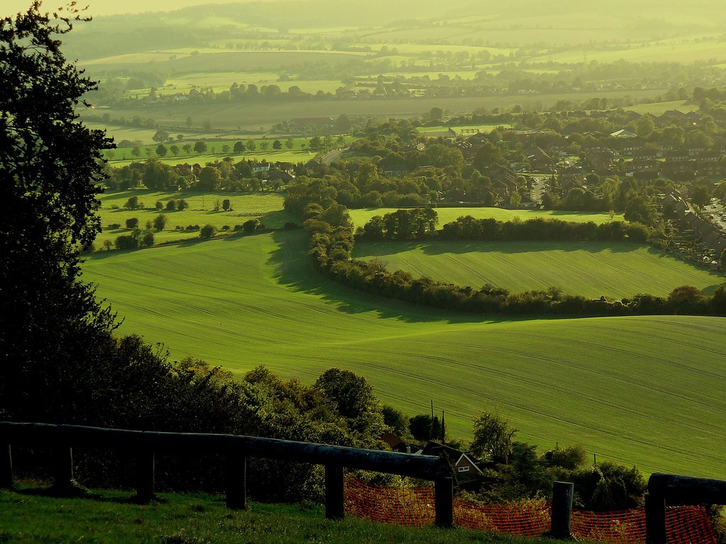
the European mainland. The English/French border is halfway along the tunnel. London is by far the largest English city and one of the largest and busiest cities in the world. Birmingham is the second largest. A number of other cities, mainly in central and northern England, are of substantial size and influence. These include: Manchester, Leeds, Liverpool, Newcastle, Sheffield, Bristol, Coventry, Leicester, Nottingham and Hull. England features mostly low hills and plains. the Lake District in the north- west features some of England's most beautiful landscapes, and includes Scafell Pike at 978 m, the highest point of England. There are also some important rivers in England and the most significant ones are Thames, Severn (the longest river in Great Britain) and Avon. The flag of England is a red cross on a white background. It is also on the Union Jack. Scotland is in the northern part of Britain. It covers a little less than 80000
Ice Age. The hilly terrain was also shaped by the continental ice and melting waters. The land still rises 25 cm in every 100 years. Kalevipoeg, the national hero, is related to many features of the relief. The Baltic Glint is one of the world's most important denudations of Ordovician sedimetary rocks. Half of Estonia is covered with forests and 30 % is covered with wetlands. The areas which are higher and particularly rich in hills are the Haanja and Otepää Uplands in the southeastern part of Estonia. In Haanja Upland there is the highest top of Estonia, Big Egg Hill (318 m), which is the highest top of the Baltic states. There are over 1400 lakes in Estonia. Lake Peipsi, lying between Estonia and Russia, covers 3 555 sq km. It is the biggest in Estonia and the fourth biggest in Europe. The second largest lake is Lake Võrtsjärv (270 sq km), while the deepest id Rõuge Suurjärv (38 m)
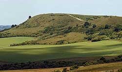
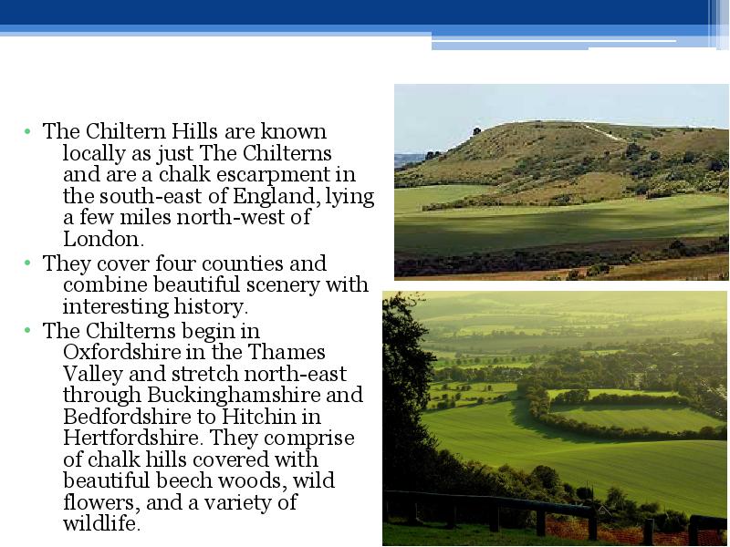
England Indented / n'dentd / sakiline Estuary / 'estjr / suudmelaht Watershed / 'w:td /veelahe Pike / pak / haug Rugged / 'rgd / konarlik, karm Meadow / 'med / aas, heinamaa England features mostly low hills and plains. The Pennine Chain runs from the north to south, splitting northern England into western and eastern parts. The Lake District in situated in the north-west of England and there are the most beautiful landscapes and the highest peak in England is Scafell Pike (978 m). The warmest part in England is the Peninsula of Cornwall in summer. Scotland Densely / 'densl / tihedasti
Rainfall varies widely across Scotland. The western highlands of Scotland are the wettest place, with annual rainfall exceeding 3,000 mm (120 in). In comparison, much of lowland Scotland receives less than 800 mm (31 in) annually. Heavy snowfall is not common in the lowlands, but becomes more common with altitude. Braemar experiences an average of 59 snow days per year, while coastal areas have an average of fewer than 10 days. The Southern Uplands are a range of hills almost 200 kilometres (125 mi) long, interspersed with broad valleys. They lie south of a second fault line (the Southern Uplands fault) that runs from the Rhinns of Galloway to Dunbar. The geological foundations largely comprise Silurian deposits laid down some 4500 million years ago. The high point of the Southern Uplands is Merrick with an elevation of 843 m (2,766 ft). The Central Lowlands is a rift valley mainly comprising Paleozoic formations. Many of these sediments have
16. Which languages have influenced English most? Latin (technical and biological words, like butter, wine, sponsor), German (angst, kindergarten), French(cricket, blonde), Greek(crisis, ) 17. Describe England.- England is the biggest country in the UK English is the official language of the UK.. Nearly 84% of the population of the UK lives in England, mainly in the major cities and metropolitan areas. The south of England is mostly low-lying land, with hills and the north of England is mostly covered in moorland and mountains. Flag- Cross of St George; Anthem God save the Queen; Longest river- Thames, Official animal- lion 18. What was Shakespeare famous for? Plays, poems. Shakespeare influenced the English language greatly, he introduced more than 2000 new words ,making it more colourful and expressive. He helped develop the style and structure of the language. 19
Main Sights England is known for its many world-famous sightseeings and people all around the world come to see them. Some of them are even like symbols of England. The most famous ones are: Stonehenge is one of the greatest national icons of Britain. That prehistoric monument is located in the plain of Salisbury, in the county of Wiltshire in the south-west of England. It is built of 150 enormous stones which are set in a purposive circular pattern. Stonehenge was probably built to mark the longest and shortest day of the year because it lies on the line of the midsummer sunrise and the midsummer sunset. That would have enabled people to keep a record of changing of seasons. Although it is still unclear who built it. Hadrian’s Wall is an ancient wall which was built in 2nd century by Hadrian, the emperor of Rome from AD 117 to 138, and it marked the northern border of the Roman Empire in Britain. The wall was 80 Roman miles (117 kilometres) long and it is situated in northern Great
Project ESTONIA MAP OF ESTONIA Southern Viljandimaa The southern part of Viljandi county catches the eye with its sublime scenery. The area today lies in the very heart of the historical Mulgimaa the home of hills, deep valleys and lakes brought together by a beauty spot Halliste primeval valley. According to several folk tales, it is also in these valleys, woods and bogs that Old Nick found refuge.The great variety displayed in the nature is also reflected in the local cultural heritage. At the beginning of the 19th century growing linen spread and became the basis of the legendary wealth of Mulgi farms. The ancient barn-dwellings and decaying manor houses are the mute witnesses of those times
The Atlantic Provinces of the country include the Maritime provinces of New Brunswick, Prince Edward Island, and Nova Scotia, as well as Newfoundland and Labrador. Fishing, shipping, and farming are important activities for the people of this area. Along the coast, bays and inlets provide excellent harbours for fishing fleets. The Appalachian mountain range extends from Alabama in the southern United States through the Atlantic Provinces, creating rolling hills indented by river valleys. The Appalachian Mountains in this region are old, rounded mountains. Valleys in the region, are important farming areas producing fruit, vegetables, and dairy products. The North includes the Yukon Territory and the Northwest territories, along with all of Canada's Arctic islands. Much of the North is treeless tundra. In the summer months, there is no darkness; the sun never sets. In winter it is so cold that the earth is frozen for most of the year and


Kõik kommentaarid