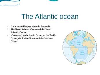
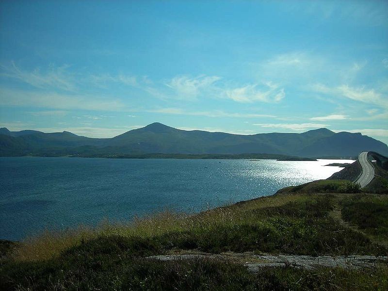
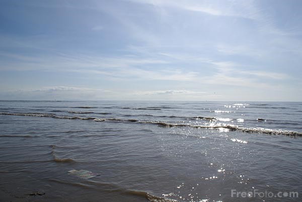
The United Kingdom The United Kingdom consists of England, Scotland, Wales and North Ireland and it is situated in the Atlantic Ocean near the mainland of Europe. The population of the UK is 58.6 million and area is 244,110 sq km. Britain has a temperate humid climate. Its characteristic features are mild winters, warm summer, no temperature extremes, abundant rain all year round and frequent changes of weather. The mild climate is partly due to the warm Gulf Stream and partly to the south westerly winds. Occasional winds from the east in winter may bring cold and dry weather
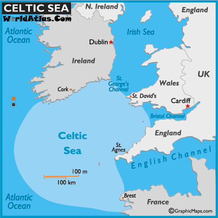
The book is intended for university and school students as well as other English learners wishing to acquire more knowledge about the country whose tongue became the world’s leading language, and which is considered as the Mother of Parliaments. 7 UNIT 1 THE ISLAND Pre-reading questions What is the name of the island group Britain belongs to? Where is it situated? What seas surround it? What kind of climate do you think Britain has? What is its surface like? What countries are situated on the islands? Which country are we going to study? Why? Location Land and climate affect life in every country. Britain is no exception. Britain is the largest island of the British Isles 1. It is just under 1,000 km long and just under 500 km across in its widest part. Britain is separated from the
International boundary = Perennial lake or: -7~~'"-:---t-- Tundra (pol iti cal map) Intermitt ent lake Internati onal bou ndary in Oceans and Perennial river seas --'=+~+-f-- Forests d ispute/und efined (polit ical map) Falls State or provincial boundary .~£-..:..~__;=.",.:r_---+- Grassl ands
1. Ancient Britain: the Celtic tribes. 2000 years ago there was an Iron Age Celtic culture throughout the Br Isles. It seems that the Celts, who had been arriving from Europe from the 8th cent BC onward, intermingled with the peoples who were already there. The Celts were extremely talented people, creative and artistic. More than 1 Celtic tribe invaded Br. The descendants of ancient Celts live in Wales, Scotland, Cornwall and Ireland. They lived in primitive society. Druids priests, more powerful than chiefs. Acted like prophets. 2. Stonehenge From prehistoric period. Was built on Salisbury plain between 2500 and 1500 bc. One of the most famous and mysterious archaeological sites in the world. One of the mysteries is how it was built at all with the technology of the time. Another is its purpose. It appears to function as a kind on
*The Picts, Caledonia The Romans called Scotland 'Caledonia' because the dominant tribe of Picts they encountered was the Calidonii. Romans thought they were barbarian savages, but actually they had an advanced, cultured society. There was no slavery amongst them and women for instance had a higher standing than in Roman society. The Picts fought the Romans. The Picts- ,,The Painted Ones"- spoke Pict-Celtic. *The Scots, Hibernia In early medieval times Ireland was known by the name "Hibernia". In Hadrian's time the ancient race called the Scots inhabited Hibernia (now called Ireland). Irish and Scottish missionaries were spreading Christianity in Anglo-Saxon England during the 6th centurie. The Latin term Scotti refers to the Gaelic-speaking people of Ireland and the Irish who settled in western Scotland. *The Venerable Bede Bede was a Christian monk, he was the most learned man in Europe at that time
Make a flash card for each of the prefixes. On this card write the prefix and a word containing the prefix. Write the meaning of the prefix and a synonym for the example word on the back of the card. As you practice with the cards, first identify the Prefix Meaning Example ante before anterior anti against, not in favor anticipate auto self autonomous hi two bisect circum circle, around circumvent co with, together coherent col with, together collect corn with, together complex con with, together condense de down, reverse decline dis no, not disregard e out, from emit ex out, from export im no, not improper in not inactive inter between, among interact
I.S. while he was on his rounds. Its import crashed in upon him at once. It called for the rupture of Japan's negotiations with the United States by a certain deadline. The hour set for the Japanese ambassadors to deliver the notification—1 p.m. on a Sunday—was highly unusual. And, as Kramer had quickly ascertained by drawing a navigator's time circle, 1 p.m. in Washington meant 7:30 a.m. in Hawaii and a couple of hours before dawn in the tense Far East around Malaya, which Japan had been threatening with ships and troops. Kramer immediately directed Bryant to insert the one o'clock message into the reddish-brown looseleaf cardboard folders in which the MAGIC intercepts were bound. He included several other intercepts, adding one at the last minute, then slipped the folders into the leather briefcases, zipped these shut, and snapped their padlocks. Within ten minutes he was on his way.
Moreover, I had to set limits in the treatment of the historical-cultural status forming an integral part of the whole. A book on this subject may be conceived in two different ways: 1) Laying the main emphasis on symphonism as the creative method and demonstrating how different composers in different periods have applied it individually. In this case the creative method would be the “axis” with the composer “spinning” around it. This is a deductive form of research. 2) Observing Estonian symphonic output both in an exact and broad sense and connecting these aspects. Both the individuality of the creative method with the concomitant typical features are taken into account, thus the orchestral music would illustrate, to advantage, the “axis”. This is the inductive form of research. The latter approach seems more expedient to the author.


Kõik kommentaarid