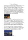
with strong sense of community and duty Canadians invented basketball baseball glove lacrosse Lacrosse mix between soccer and hockey 10 players 3 attackmen, 3 midfielde, 3 defensemen and 1 goalkeeper Canada has worlds longest coastline onetenth of the worlds forests longest national highway in the world Great Slave Lake deepest lake in North America in the 1930s, there was discovered gold max depth of 614 m Canadian Rockies highest point is Mount Robson second highest point is Mount Columbia Toronto largest and most important city financial centre in Canada have only real castle in all of North America Ottawa capital of Canada one of the nation's youngest cities have three universities Canada timeline Thank you for listening !
A great deal of the wood from the forests in Quebec is used for making paper. Western forests produce much timber. The farms of eastern Canada are rather small. Potatoes are an important crop. Near the Great Lakes there are many orchards. Stretching west from the Great Lakes and Hudson Bay, there are great prairies. Spring wheat is the chief crop but other crops are important, too. West of the prairies there is a mountain wonderland. The Canadian Rockies are higher than the Rockies in the United States. British Columbia has a climate much like the climate of southern England. The capital is the charming city of Victoria on Vancouver Island. More than three-fourths of all the manufacturing that goes on in Canada is carried on in the provinces of Quebec and Ontario, much of it in the cities of Montreal and Toronto. Montreal is Canada's biggest city. Toronto is next in size.
Much of Canada is covered with forests. Western forests produce much timber. Much of Canada's soil is thin and rather poor. During the Ice Age almost all of Canada was covered with sheets of ice. These ice sheets moved southward. As they did so, the carried away much soil from Canada and pushed it down into the United States. Stretching west from the Great Lakes and Hudson Bay there are great prairies. West of the prairies there is a mountain Wonderland. The Canadian Rockies are higher than the Rockies in the United States. Industry Furs, farms, forests, and fisheries make up much of Canada's wealth. But the Country is also rich in minerals. Canada has copper, lead, silver, gold and other minerals. Thousands of Canadians earn their living as fishermen. The farms of eastern Canada are rather small. Potatoes are an important crop. Population About 27 million people live in Canada. About 80% of them live within 300 kilometres of Canada's southern border
business and government. Ottawa also has a high standard of living reflected in a multitude of accessible services, vibrant entertainment, exciting recreational activities, and thriving businesses. Canada's Great Lakes Canada's Great Lakes are some of the largest and most beautiful in the world. The alpine towns sprinkled along the Rockies on the Alberta side are an unspoiled mountain playground where each season has its own unique beauty and selection of activities. FIAG The red and white Canadian flag shows a leaf of the maple tree, which grows in North America. The maple leaf is the official emblem of Canada. The official ceremony inaugurating the new Canadian flag was held on Parliament Hill in
(St. John's), Northwest Territories (Yellowknife) and Yukon Territory (Whitehorse). Geographically, Canada can be divided into five major regions: the Pacific Region, the Prairie Provinces, Central Canada, the Atlantic Provinces and the North. The Pacific Region includes Canada's westernmost province, British Columbia. The region is known for it's mild coastal climate, its forests and its spectacular mountains, including the famous Rockies. Alberta, Saskatchewan and Manitoba are Canada's Prairie Provinces. They are known for their rolling plains and extreme climate with long, cold winters and hot, dry summers. Much of the area is covered with farms producing wheat and other grains. The region is also rich in oil and natural gas. Central Canada includes Ontario and Quebec. It is not geographically the centre of Canada. The region gets its name because, historically, it has been the centre
for development, Halifax Peninsula and Mainland Halifax. It forms a significant part of the Halifax urban area. Residents of the former city are referred to as "Haligonians Halifax Calgary is the largest city in the Province of Alberta, Canada. It is located in the south of the province, in an area of foothills and high plains, approximately 80 km (50 mi) east of the front ranges of the Canadian Rockies. The city is located in the Grassland region of Alberta. Calgary is the third largest civic municipality, by population in Canada. In the Canada 2006 Census, the city had a population of 988,193[2] and the CMA had a population of 1,079,310.[3] As of the 2009 civic census, Calgary's population was 1,065,455 and the CMA had a population of 1,182,446.[4] Greater Calgary is estimated to be the fourth largest metropolitan in the country after Toronto, Montreal, and Vancouver according to
The (River) Amazon The (River) Thames The Nile We use the with plural names of people and places: People the Taylors (=the Taylor family), the Johnsons Countries the Netherlands, the Philippines, the United States Groups of islands the Canaries / the Canary Islands, the Bahamas, the British Isles Mountain ranges the Rocky Mountains / the Rockies, the Andes, the Alps · The highest mountain in the Alps is Mont Blanc. North / norhtern etc: We say: the north (of France) but northern France the south-east (of Spain) but south-eastern Spain Compare: · Sweden is in northern Europe but Spain is in the south. Also: the middle east the Far East You can also use north / south etc. + a place name (without the): North America West Africa South-East Spain
including fire, ambulance, police, parks, roads, sidewalks, public transit, drinking water, stormwater, sanitary sewage and solid waste. Calgary Calgary is the largest city in the Province of Alberta, Canada.It's population is about 1 065 000 people. It is located in the south of the province, in an area of foothills and high plains, approximately 80 km east of the front ranges of the Canadian Rockies. The city is located in the Grassland region of Alberta. Calgary is the third largest civic municipality, by population in Canada. Located 300 km due south of Edmonton, statisticians define the narrow populated area between these cities as the "Calgary-Edmonton Corridor." Calgary is the largest Canadian metropolitan area between Toronto and Vancouver. Calgary is well-known as a destination for winter sports and ecotourism with a number of
The St. Lawrence is Canada's most important river, providing a seaway for ships from the Great Lakes to the Atlantic Ocean. The longest Canadian river is the Mackenzie, which flows 4 241 kilometres through the Northwest Territories. Canada is quite mountainous. The highest point is Mount Logan with 5.959 m. It is the second-highest peak in North America. Mt. Logan is located within Kluane National Park and Reserve in southwestern Yukon. The Rocky Mountains, often called the Rockies, are a broad mountain range in western North America. The Rocky Mountains stretch more than 3,000 miles (4,800 kilometres) from British Columbia, in Canada, to New Mexico, in the United States. Mount Robson, at 12,972 feet (3,954 meters) is the highest peak in the Canadian Rockies Canada has many different biomes. For instance: The Arctic. It is a very cold, windy, and often snowy biome located around the North Pole. Long periods of
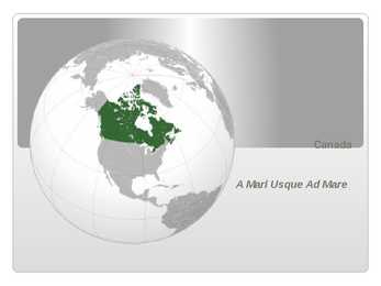
Ottawa Capital 45°24N 75°40W / 45.4°N 75.667°W / 45 Largest city Toronto Capital, Largest City Since the end of the last glacial period, Canada has consisted of eight distinct forest regions, including extensive boreal forest on the Canadian Shield Canada has more lakes than any other country, containing much of the world's fresh water Geography There are also freshwater glaciers in the Canadian Rockies and the Coast Mountains Canada is geologically active, having many earthquakes and potentially active volcanoes, notably Mount Meager, Mount Garibaldi, Mount Cayley, and the Mount Edziza volcanic complex The volcanic eruption of the Tseax Cone in 1775 was among Canada's worst natural disasters, killing 2,000 Nisga'a people and destroying their village in the Nass River valley of northern British Columbia The eruption produced a 22.5kilometre (14
The U.S.A. is situated in the central part of the North American continent. The area of the U.S.A. is over nine million square kilometres. Its western coast is washed by Pacific Ocean and its eastern coast by the Atlantic ocean and the Gulf of Mexico. The continental United States is bounded to the North by Canada and to the South by Mexico. There are two mountain ranges in the continental United States: the Appalachians in the east and the Rockies in the west. In the very middle of the continent is the Mississippi river. The five Great lakes, between the U.S.A. and Canada, are joined together by short rivers or canals. They are connected with the Atlantic Ocean by the St. Lawrence River, and with the Hudson River by a canal. In the west of the U.S.A. there is another big lake called the Great Salt Lake. Hawaii, a chain of islands in the Pacific Ocean, has a tropical climate. Alaska
of St. Lawrence and the Atlantic. The St. Lawrence plain, covering most of southern Quebec and Ontario, and the interior continental plain, covering southern Manitoba and Saskatchewan and most of Alberta, are the principal cultivable areas. They are separated by a forested plateau rising from Lakes Superior and Huron. Westward toward the Pacific, most of British Columbia, the Yukon, and part of western Alberta are covered by parallel mountain ranges, including the Rockies. The Pacific border of the coast range is ragged with fjords and channels. The highest point in Canada is Mount Logan (6,050 m), which is in the Yukon. The two principal river systems are the Mackenzie and the St. Lawrence. The St. Lawrence, with its tributaries, is navigable for over 1,900 miles (3,058 km). Government: Canada is a federation of ten provinces (Alberta, British Columbia, Manitoba, New Brunswick, Newfoundland and Labrador, Nova Scotia, Ontario, Prince Edward
very few problems in managing the border. The borded with Mexico is different. Immigrants are constantly crossing the border illegally. Every day about 2,000 of them are captured and sent back, but may others get through. There are also two states that are not connected to the continental United States. They are Alaska and Hawaii. There are two mountain ranges in the continental Unitet States: the Appalachians in the east and the Rockies in the west. In the very middle of the continent is the Mississippi River. Almost all the rivers between the mountains flow into the Mississippi. Along the border with Canada, there are five big lakes, called ,,the Geat Lakes". Climate Pacific Ocean moderates west coast temperatures. Mild summers, cool winters, much rain on northwest coast. Warm and dry in summer, mild with some rain rest of the year on California coast. Inland Southwest mostly dry with warm summers and cold winters
and mountains to the cold tundra of the north. Geographically, Canada can be divided into five major regions: the Pacific Region, the Prairie Provinces, Central Canada, the Atlantic Provinces and the North. The Pacific Region includes Canada's westernmost province British Columbia. The region is known for its mild coastal climate, its forests and its spectacular mountains, including the famous Rockies which are also the youngest and highest mountains in Canada. British Columbia is in the landform region called the Western Cordillera (system of mountain ranges). Between the mountain ranges are areas of high plateaus and deep trenches. Since the landscape is very rugged, most people live in the south and near the coast. Vancouver and Victoria are the largest cities in British Columbia. Alberta, Saskatchewan, and Manitoba are Canada's Prairie Provinces. They are known
Across the country, Canadians experience many different landscapes from rolling plains and mountains to the cold tundra of the north. Geographically, Canada can be divided into five major regions : the Pacific Region, the Prairie Provinces, Central Canada, the Atlantic Provinces, and the North. The Pacific Region includes Canada's westernmost province, British Columbia. The region is known for its mild coastal climate, its forests, and its spectacular mountains, including the famous Rockies. The Rocky Mountains are the youngest and highest mountains in Canada. British Columbia is in the landform region called the Western Cordillera. ('Cordillera' means a system of mountain ranges). Between the mountain ranges are areas of high plateaus and deep trenches. Since the landscape is very rugged, most people live in the south and near the coast. Vancouver and Victoria are the largest cities in British Columbia. The region includes the Queen Charlotte Islands and Vancouver Island
and Asia. The biggest peninsulas are the Florida Peninsula and Alaska. 4. Land Regions Mountains The Appalachian Mountains are a vast system of North American mountains, partly in Canada, but mostly in the United States, forming a zone, from 100 to 300 miles wide, running from the island of Newfoundland some 150 miles south-westward to central Alabama in the United States. The Rocky Mountains, often called the Rockies, are a broad mountain range in western North America. The Rocky Mountains stretch more than 4800 km. The Rocky Mountain System within the United States is a United States physiographic region. Though part of the Pacific Cordillera, they are not to be confused with the Pacific Coast Ranges which are located immediately adjacent to the Pacific coast. The Rocky Mountains are a great place for holidays for walking, climbing, fishing, hunting or skiing. The only big city in the Rockies is Denver
west. The flat Mexican Lowland, with the height of up to 150 m, is swampy along the Gulf coast and surrounded by a strip of marshes. The Cordilleras consist of rows of mountain ranges with the heights of up to 3000-5000 m. In Alaska the mountain ranges stretch in the west-east direction. 4 On the territory of the USA the mountain ranges stretch in the north-south direction. The first from the east are the Rocky Mountains. West of the Rockies lie vast plateaus and tablelands: the volcanic Columbia Plateau, the Great Basin, the Colorado Plateau. Further west is a narrow belt of the Cascade Mountains, and the Sierra Nevada Range Still further west lies an area of valleys. The forests cover 30% of the US. In the southern part of Alaska grow coniferous trees, notably spruces and firs. Around the Great Lakes and New England are mixed forests of pines, maples, elms, birches, oaks and beeches. Along the Gulf of Mexico grow
From British Columbia to just east of the Alberta border the land is young, with rugged mountains and high plateaus. Signs of geologically recent volcanic activity can be seen in Garibaldi Provincial Park in southern British Columbia and at Mount Edziza in the north. The Rocky Mountains, the Coast Mountains and other ranges, running north to south, posed major engineering problems for the builders of the transcontinental railways and highways. Canada's highest peaks, however, are not in the Rockies, but in the St. Elias Mountains, an extension of the Cordillera stretching north into the Yukon and Alaska. The highest point in Canada, mount Logan, rises amid a huge icefield in the southwest corner of Yukon, the largest icecap south of the Arctic Circle. The British Columbia interior varies from alpine snowfields to deep valleys where desert-like conditions prevail. On the leeward side of the mountains, for example, a rain-shadow effect is
In the western region there are the Rocky, Coastal and Mackenzie ranges and Mount St. Elias and the Pelly Mountains in the northern regions. The vast majority of mountains in Canada lie in the western provinces of British Columbia and Alberta and the Yukon territory. Mountains can be found all over British Columbia while those in Alberta are mainly concentrated on the eastern side of the Canadian Rockies. The Saint Elias Mountains in the Yukon hold some of country's highest mountains, including the highest, Mount Logan at 5,959 metres. The Appalachian mountain range extends from Alabama in the southern United States through the Gaspe Peninsula and the Atlantic provinces, creating rolling hills indented by river valleys. It also runs through parts of southern Quebec. The Appalachian
. itslocation natural . SIZC . details historical r whatyoucando/seethere . recommen0atlon !!'' : 5s lookat the picturesand answerthe questions S,tggested AnswerKey ::. ,^theseplaces arenaturalwonders. --: ,,t/hite --: Cliffs of Doverarein England. Rockies arein NorthAmerica. '" -xplainthe task Readout the list of wordsand the exampleAsk Ssto express theiropinions. Suggested AnswerKey -ext A ' TheWhiteCliffsof Doverarewhitebecause theyaremade of chalk. ihe White Cliffsof Dover make the Englishcoastline . Elicit useful languageto expresscontrast (whereos, nemorable
. itslocation natural . SIZC . details historical r whatyoucando/seethere . recommen0atlon !!'' : 5s lookat the picturesand answerthe questions S,tggested AnswerKey ::. ,^theseplaces arenaturalwonders. --: ,,t/hite --: Cliffs of Doverarein England. Rockies arein NorthAmerica. '" -xplainthe task Readout the list of wordsand the exampleAsk Ssto express theiropinions. Suggested AnswerKey -ext A ' TheWhiteCliffsof Doverarewhitebecause theyaremade of chalk. ihe White Cliffsof Dover make the Englishcoastline . Elicit useful languageto expresscontrast (whereos, nemorable
. itslocation natural . SIZC . details historical r whatyoucando/seethere . recommen0atlon !!'' : 5s lookat the picturesand answerthe questions S,tggested AnswerKey ::. ,^theseplaces arenaturalwonders. --: ,,t/hite --: Cliffs of Doverarein England. Rockies arein NorthAmerica. '" -xplainthe task Readout the list of wordsand the exampleAsk Ssto express theiropinions. Suggested AnswerKey -ext A ' TheWhiteCliffsof Doverarewhitebecause theyaremade of chalk. ihe White Cliffsof Dover make the Englishcoastline . Elicit useful languageto expresscontrast (whereos, nemorable
. itslocation natural . SIZC . details historical r whatyoucando/seethere . recommen0atlon !!'' : 5s lookat the picturesand answerthe questions S,tggested AnswerKey ::. ,^theseplaces arenaturalwonders. --: ,,t/hite --: Cliffs of Doverarein England. Rockies arein NorthAmerica. '" -xplainthe task Readout the list of wordsand the exampleAsk Ssto express theiropinions. Suggested AnswerKey -ext A ' TheWhiteCliffsof Doverarewhitebecause theyaremade of chalk. ihe White Cliffsof Dover make the Englishcoastline . Elicit useful languageto expresscontrast (whereos, nemorable