Wight Much of England consists of rolling hills, but it is generally more mountainous in the north with a chain of mountains, the Pennines, dividing east and west Other hilly areas in the north and Midlands are the Lake District, the North York Moors, and the Peak District The largest natural harbour in England is at Poole, on the south-central coast. Some regard it as the second largest harbour in the world, after Sydney Coast England has 3200 km of coastline, much smaller than the deeply indented Scottish coastline, but still a considerable length The North Sea coast of England is mainly flat and sandy The English North Sea coast is an important area of bird life and is a habitat for many shore and wading birds (one of the most important ares for bird watching) Into Devon and Cornwall the coastline becomes more rocky and steep, with numerous cliffs and tiny fishing villages along the coastline Click to edit Master text styles Second level
New Zealand has an exceptionally long coastline compared to the size of the country (over 15,000 km) which makes it almost the same size as the mainland USA's coastline. Even though New Zealand is only about the same size as Colorado, the large coastline is possible because it is extremely iregular and indented. New Zealand's coastline is packed with deep coves, bays, intricate harbours, long sounds, and steep fiords. Its territorial waters stretch from the sub-tropical through to the sub-antarctic. Both islands tend to have better swimming beaches on their eastern coasts and the further north you go. The west coasts of both islands are quite rugged with cliffs and more unsettled weather. There are however some suitable swimming and bathing beaches here, with iron
Independence Day, President's Day, Labor Day, Veterans Day and also Columbus Day. 6. 50 state in one country America has so many states in their country. There are 50 states in The USA. All 50 states in America share sovereignty with federal government. However, there are four states are called commonwealth rather than state. The smallest state in America is Rhode Island and the largest state is Alaska. Both have area about 1545 square miles and 663268 square miles respectively. 7. Longest coastline Alaksa coastline America is very famous with its coast. If you love hip hop you know two mainstream of hip hop culture in America which are East Coast and West Coast. Talking about coast, the longest coastline in the United States is situated in Alaska. The length of the coastline is about 6640 miles long. 8. 44 Presidents Perhaps United States of America is a country with the most number of Presidents. From
the world's 46th-largest country and the fourth- largest island. Madagascar can be divided into five geographical regions: the east coast, the Tsaratanana Massif, the central highlands, the west coast, and the southwest. The east coast The east coast consists of a narrow band of lowlands, formed from the sedimentation of alluvial soils and zone, composed of steep bluffs, alternating with ravines bordering an escarpment of about 500 meters in elevation. The coastline is straight, with the exception of the bay. The east coast is considered dangerous for swimmers and sailors because of the large number of sharks that frequent the shoreline. The Tsaratanana Massif region The island's highest peak, Maromokotro, at 2,876 metres is found in the Tsaratanana Massif, located in the far north of the country. The coastline is deeply indented; two prominent features are the excellent natural harbor at Antsiranana and the large island of Nosy-Be.
Aliis Uudelt Eritrea State of Eritrea Horn of Africa Sudan, Ethiopia, Djibouti, Red Sea Asmara 117,600 km2 6 million inhabitants Politics and government People's Front for Democracy and Justice The National Assembly Periodically scheduled Regions and districts 6 regions Control over agricultural capacity Historical intra-regional conflicts geography Virtually bisected Fertile lands West Desert East Sandy, arid coastline Highlands economy Agricultural Farming and herding GDP is growing Languages No official language Arabic and Tigrinya English and Italian The End
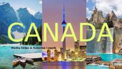
10 facts about Canada Canada is the second largest country in the world, surpassed only by the Russia. The capital city of Canada is Ottawa. Population of Canada is about 33.2 million people. Most of the people live in the southern part of Canada. Canada's two official languages are English and French. Canada has the world's longest coastline. Nearly one-fourth of all the fresh water in the world is in Canada. Canada has 10% of the world's forests. Currency of Canada the Canadian dollar. It's about 2 million lakes in Canada. Made by Mihkel Kohava
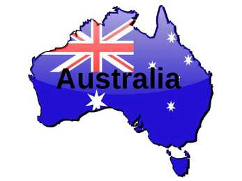
Australia Geography Location: between the Pacific and Indian Ocean Total area: 7,7 million sq km Coastline: 25,760 km Climate: varies widely Nature: extremely diverse Political system Capital: Canberra Government type: federal parliamentary democracy Independence: 1 January 1901 National holiday: Australia Day Monarch Queen Elizabeth II Prime Minister Julia Gillard Governor-General Quentin Bryce Economy Currency: Australian Dollar The main industry: agriculture Low rate of
Roaming- ränne Due to-tõttu,-tänu,-põhjusel Defend-kaitse Invasion-invasioon Shipwrecks-laevavrakid Stretch-veniv,-venitus Shipping lanes-laevateed Stop over-peatuma Feature-tunnusjoon Extends-laiendab Peaks- Wild-metsik Slopes-nõlvadel Spruces-kuused Reach-jõudma Established-asutatud Hampered-takistab Settlers-asunike Runs-jookseb Emit-kiirgama Run out-välja jooksma Contribute to-kaasa Entire-kogu Damaging-lõhkuma Drawbacks-puudusi Take advantage of-ära kasutama Coastline-rannajoon Arrays-massiivi Rotor blades-rootori labad Take up-võtma Unoccupied sites-sisustama saidid Objections-vastuväited Significant-märkimisväärne Demands-nõudmisi Overpopulation-ülerahvastus Lack of resources-vahendite puudumine Global warming-globaalne soojenemine Deforestation-raie Endangered species-ohustatud liigid Ozone layer-osoonikiht Oil spills-õlireostus Fossil fuels-fossiilsed kütused Grateful-tänulik Guilty-süüdi Hopeless-lootusetu In need-vaja Capable-võimeline
INDIA COUNTRY · India is a country in South Asia. · It is the seventh-largest country by geographical area. · The most populous democracy in the world. · Country with over 1.18 billion people. · The capital of India is New Delhi. · India has a coastline of 7,517 kilometres. Mainland India is bounded by the Indian Ocean on the south, the Arabian Sea on the west, and the Bay of Bengal on the east; and it is bordered by Pakistan to the west Bhutan, the People's Republic of China and Nepal to the north; and Bangladesh and Burma to the east. In the Indian Ocean, mainland India and the Lakshadweep Islands are in the vicinity of Sri Lanka and the Maldives. India has a coastline of 7,517 kilometres. THE SYMBOLS OF INDIA
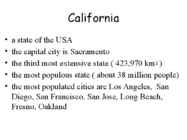
Pacific Ocean • bordered by Pacific Ocean in the west, Oregon in the north, Nevada and Arizona in the east, Mexico in the south Symbols • state animal: California grizzly bear • state bird: California • state flower Geography • about 45% is covered by forests • the highest point is Mount Whitney at 4421 m • the lowest point is Death Valley ( -86 m ) • the largest lake is Lake Tahoe • the third longest coastline in the USA • About 37000 earthquakes are recorded every year
1881 first longdistance telephone call 1927 first radio broadcast 1958 television network 1980 "O Canada" Avarage Canadian is... hospitable tolerant following a live and let live philosophy with strong sense of community and duty Canadians invented basketball baseball glove lacrosse Lacrosse mix between soccer and hockey 10 players 3 attackmen, 3 midfielde, 3 defensemen and 1 goalkeeper Canada has worlds longest coastline onetenth of the worlds forests longest national highway in the world Great Slave Lake deepest lake in North America in the 1930s, there was discovered gold max depth of 614 m Canadian Rockies highest point is Mount Robson second highest point is Mount Columbia Toronto largest and most important city financial centre in Canada have only real castle in all of North America Ottawa capital of Canada
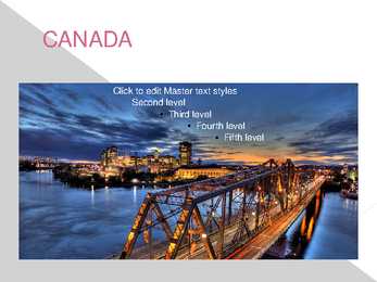
Canada is a big country. It’s covering 9.9 million square kilometrs, making it the world’s second-largest country by land area. Canada stretches nearly a quarter of the way around the globe and covers six of the world’s 24 time zones. Canada has the longest coastline in the world, so it meets three oceans: the Pacific, the Atlantic and the Arctic. Canadians are multicultural. They are proud of the many cultures that exist side by side in their country. It has two official languages, English and French. The Canadian population is made up mainly of British and French origins. However Canada is not like Britain, or France, or the USA. The way of life there is very varied. It has influenced by immigrants from all over the world.
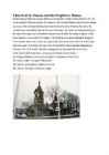
Church of St. Simeon and the Prophetess Hanna Nestled along a street near Tallinn Harbour is this fairytale, wooden church built in 1752 - 55 on the initiative of Russian sailors. St. Simeon's is the second Orthodox church to have sprung up as part of the suburban building boom that followed the Great Northern War. Since the coastline was considerably closer to the city in those days, the church was built practically on the edge of the water, and its foundation required some landfill. According to legend, rubble from shipwrecks was used for this purpose. The building was seriously damaged during the Soviet period, when it was turned into a sports hall. During this time it also lost its bell tower and onion dome. Fortunately the church was restored after Estonia regained independence,
Traveling red wooden farm houses World leader in number of fields Kingdom of Norway Capital Oslo Language Norwegian Size 323,802 square kilometers Population 4.9 million Flag red, indigo blue Scandinavian cross outlined in white Symbols elk, purple heather flower, dipper Biggest rivers Glomma, Otra Famous for - 19th century, Hendrik Ibsen made Norway famous for plays Landscape rugged coastline, mountains, fjords Republic of Iceland Capital - Reykjavik Language Icelandic, fluent English Size 103,000 square kilometers Population 299,000 Flag - blue, red Scandinavian cross outlined in white Iceland is a volcanic island in the North Atlantic Ocean Nature volcanoes, lava fields, waterfalls, geysers and hot pools Kingdom of Denmark Capital - Copenhagen Language - Danish Size 43,094 square kilometers
IRELAND Ireland is a very beautiful island in the Atlantic Ocean. That lays next to Great Britain. This island is gorgeous landscape, the green hillsides and the rocky coastline. Ireland weather is influence of the Gulf Stream, there is warm and rainy through the year. The Celts inhabited the land. Ireland is separated into two parts. The north part (smaller) is part of the United Kingdom, bigger part of island makes up Republic of Ireland (independent country). The population of the Republic of Ireland is about three and half million people. There are two official language- English and Gaelic. Mostly there is used English
National Anthem of India " Jana Gana Mana" Bollywood: Bollywood made films in India and films is have Hindi languages. Bollywood is biggest producer of films in India. Bollywood make action,comedy, and love films. Nature in India Images of India are exotic and magical. In India is have beauty landscape and nature. In India is have excotic plants and animals India has a coastline of 7,517 kilometres. Taj Mahal It is widely considered as one of the most beautiful buildings in the world and stands as a symbol of eternal love. Tourist like that building. Taj Mahal Used material: http://www.indif.com/india/patriotic/national_anthem.asp http://en.wikipedia.org/wiki/India Thanks for hearing! Writer: name 2010
Ireland and Scotland. 3.Rock of Dunamase · The Rock of Dunamase is one of the most historic sites in Ireland. (view form Rock of Dunamase) 4.Trinity College · Trinity College formally known as the College of Dublin is the sole constituent college of the University of Dublin in Ireland. 5.Cliffs of Moher · The most famous and breathtaking parts of Ireland's craggy west coastline are the Cliffs of Moher, which feature some of the most breathtaking views on the entire island. Kasutatud kirjandus · http://en.wikipedia.org/wiki/Guinness_Storehouse · http://en.wikipedia.org/wiki/Giant's_Causeway · http://en.wikipedia.org/wiki/Rock_of_Dunamase · http://en.wikipedia.org/wiki/Trinity_College,_Dublin · http://en.wikipedia.org/wiki/Cliffs_of_Moher · Pildid · https://www.google.ee/
Minister is Kevin Rudd. Climate: Most part of Australia is located in tropics zone. Equatorial climate rules in Queenslands north, and tropical monsoonclimate rules West-Australia and north territory, and queenlands north-western. Subtropical climate remains South- Australia south and New-South-Wales. Temperate zone rules in South-Victoria and in Tasmanite. Midland, west- and south are very dry. Moderate climate is only in east and south-east 400 km coastline and in south-west. Sightseen: Sydney Tower tallest independent tower in sydney Opera in Sydney a symbol for not only a city, but a whole country and continent. Tjuta national park in the desert Great Barrier Reef longest coralpeace Languages that are spoken: The most spoken language is australian english, about 79% of citizens speak that. Yet there are also spoken chinese and italian.
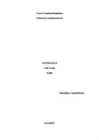
Cook Islands Kendra Location Capital: Avarua South Pacific Ocean 15 islands, 9 main islands Rarotonga Area: 240 square km Time zone: 12h behind Associated: New Zealand Geography Capital: Avarua Divided into two Coastline: 120km Natural resources: coconuts Climate: Tropical Mountainous, volcanoes, palms, soils, caves, People European, Chineese, African settlers Polynesian roots 2 polynesian languages: Pukapuka and other islands Official language Cook Islands Maori, English Population: 14,974 Villages, farms Politics Left: Henry Puna, right: John Key Self-governing state In international treaties Head of state: British monarch Parliamentary elections: 4 years Independence: 4th August 1965
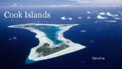
Russians - 17th century Name origin Alaska (Russian) Alakshak (Aleutan) Peninsula Nicknames The Last Frontier Land of the Midnight Sun State of Alaska 1959 Symbols Flag - Seal - Symbols 2 Bird - Willow Ptarmigan Dog - Alaskan Malamute Sport Dog Mushing Head of state Governor Sean Parnell (2009..) Republican Geography Coastline 800km East Canada West the Bering Sea North Arctic Ocean South Pacific Ocean Mountains 50 peaks higher than 3.6km Mount McKinley 6.2km Mount Saint Elias 5.5km Lakes Lakes 3197 Lake Iliamna - 2,600 km², 301m deep Climate Highest temperature - 37.8 °C (1915) Lowest temperature - -62.2 °C (1971) Summers short, winters - cold and long
Position: Ireland has two parts, one or loughs. Ireland is known for its features in Ireland date back or them is the part on UK. The ohter gorgeous landscape, the green hillsides to the prehistoric period, and the rocky coastline. including standing part make up the Republic of Ireland. stones and tombs. The best known example is the World
Ireland Ireland is a beautiful island that is washed and influenced by the Atlantic Ocean in the west.It is known for its gorgeous landscape, the green hillsides and the rocky coastline. Film-makers from all over the world have used the beautiful landscape of the island. Ireland is the third-largest island in Europe. It lies to the north-west of continental Europe. The population of Ireland is 6.2 million and there are two official languages English and Gaelic. Ireland `s capital is Dublin. The area of Ireland is 84,421 km2 Ireland is separated into two parts. The north is part of the United Kingdom, while four fifths of the island make up the Republic of
v 20 per cent of Second level Australians are Third level Fourth level Fifth level foreign born v Since 1945 more than six million people from across the world have come to Australia to live GEOGRAPHY v Sixth largest country in the world v Australia's coastline stretches almost 50,000 kilometres and is linked by over 10,000 beaches v The mainland is the largest island and the world's smallest, flattest continent v Australia is located between the Indian and South Pacific Oceans PLACES WHERE I WENT IN AUS Click to edit Master text style v PERTH Second level Third level ALBANY v
The Easter Island Made by: Käty Kivirand Studygroup: MY08 Supervisor: Lugina Olga Easter Island(Rapa Nui, Spanish: Isla de Pascua) is a Polynesian island in the southeastern Pacific Ocean, at the southeastern most point of the Polynesian triangle. Easter Island is one of the most remote islands on Earth. Easter Island is only 15 miles long and 10 miles wide. The Polynesian Triangle is a region of the Pacific Ocean anchored by three island groups: Hawaii, Easter Island and New Zealand, often used as a simple way to define what constitutes Polynesia. The island has an area of 163.6 km2. Population is about 3791 (3304 people living in the capital of Hanga Roa). On July 11, 2010 at 18:15:15 a total solar eclipse occurred for the first time in Easter Island in over 1,300 years. Lan Chile flies to Easter Island, with flights operating between Santiago, Chile and Papeete,Tahiti. Airfa...
Facts about Wales Pictures about Wales Wales is a generally mountainous country on the western side of central southern Great Britain, between the Irish Sea to the north and the Bristol Channel to the south. It is part of the United Kingdom, and is bordered by England to its east and the Atlantic Ocean, St George's Channel and Irish Sea to its west. It is about 274 km from north to south and at least 97 km wide, with a total area of 20,779 km2. It has over 1,200 km of coastline, and includes offshore islands of which the largest is Anglesey. Wales geography and environment The Economy of Wales. In 2010, according to ONS provisional data, headline gross value added (GVA) in Wales was £44,517m, making the Welsh economy the tenth largest of the UK's twelve regions (counting Wales, Scotland and Northern Ireland alongside the nine English Government Office Regions) ahead of only Northern Ireland and the North East of England
Construction completed has spanned thoughout Estonia in 1980 Geography Mainly a lowland Bordered by the Baltic sea,Latvia & Russia Moderate winters and cool summers Oil shale and limestone deposits Forests covers over 47% of the land Hiiumaa The second largest island Territory: 989 km² In the Baltic Sea, north of the island of Saaremaa Coastline: 310 km Population: 8400 people Kärdla Kõpu Lighthouse One of the best known symbols and tourist sights. One of the oldest lighthouses in the world (1531). At the top of the highest hillock - Tornimägi (English: Tower Hill). Height : 36 meters. Other Sightseeings Reigi Church Tahkuna lighthouse Other Sightseeings
MT-09A Pärnu is a West-Estonian resort with well-established traditions that has held the title of summer capital and heart-warming town for over ten years. Pärnu is also a former Hanseatic town and it host the 30th International Hanseatic Days medieval festival in 2010. During the sunny summer period, the beautiful, sandy beaches invite people to come to Pärnu. Amazing nature, as attractive as the beach, can also be found throughout Pärnu County, which boasts a 242 km coastline. Tallinn Gate The so called Tallinn Gate used to mark the beginning of the postal road from Pärnu to Tallinn and was built during the Swedish period in the 17th century. The medieval fortification system of Pärnu was almost fully destroyed in the preceding Livonian War. Ammende Villa Villa Ammende is one of the best examples of early art nouveau style in Estonia. The grand villa with a large garden was built in 1905 and belonged to the Ammende
Brazil, officially the Federative Republic of Brazil, is a country in South America. It is the fifth largest country by geographical area, occupying nearly half of South America. Bounded by the Atlantic Ocean on the east, Brazil has a coastline of over 7,491 kilometers. It is bordered on the north by Venezuela, Suriname, Guyana and the overseas department of French Guiana; on the northwest by Colombia; on the west by Bolivia and Peru; on the southwest by Argentina and Paraguay and on the south by Uruguay. Population of Brazil is made up of many racial and ethnic groups. The last National Research for Sample of Domiciles (PNAD) census revealed the following: 49.4% of the population are White, about 93 million; 42
Baltic Sea. Average elevation reaches only 50 meters and the country's highest peak is the Suur Munamägi in the southeast at 318 meters.Estonia boasts over 1,400 lakes. Most are very small, with the largest, Lake Peipus, (Peipsi in Estonian) being 3555 km². There are many rivers in the country. The largest are the Võhandu (162 km), Pärnu (144 km), and Põltsamaa (135 km). Estonia also boasts numerous bogs, and 3794 kilometers of coastline marked by numerous bays, straits, and inlets. The number of islands and islets is estimated at some 1,500. Two are large enough to constitute their own counties: Saaremaa and Hiiumaa. Estonia lies in the northern part of the temperate climate zone and in the transition zone between maritime and continental climate. Because Estonia is continuously warmed by the Gulf Stream it has a milder climate despite its northern latitude. The Baltic Sea causes differences
Report about Estonia Introduction The purpose of this report is to describe Estonia's. I'm going to write little about the geography, culture, Geography of Estonia Estonia has 4 neighbours Latvia, Sweden, Finland and Russia. Estonian land border with Latvia is 267 km, with Russia its 290 km. Estonia lies on the east of the Baltic Sea. Estonian highest point is the Suur Munamägi winces height is 318 m. Estonia has 3794 km of coastline. The number of islands is estimated around 1500 and two of the largest are called Saaremaa and Hiiumaa. Estonia is situated in the northern part of the temperate climate zone and in the transition zone between maritime and continental climate. Estonia has four seasons of near-equal length. Estonia has over 1,400 lakes. Most are very small, with the largest, Lake Peipus being 3,555 km2. Culture of Estonia The culture of Estonia incorporates indigenous heritage, as represented by the
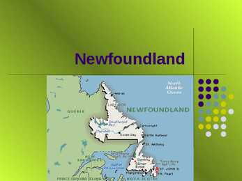
provides rich nesting grounds for millions of seabirds. To put things in perspective, Newfoundland and Labrador is a little smaller than California, slightly bigger than Japan, and twice the size of the entire United Kingdom. Geography The island of Newfoundland covers 111,390 square kilometres. With the addition of the vast territory of Labrador, the province covers a total area of 405,212 square kilometres, and has more than 29,000 kilometres of unspoiled coastline. Nature Newfoundland and Labrador is one of the best places to see nature in all its glory. Coastlines, thick forests, ancient rock formations, seabird colonies, tiny alpine blossoms, and rich marine life are all part of diverse natural heritage. Nature The provincial flower the pitcher plant can be found, among other wildflowers like rare orchids and plants, in bogs and marshland. Landscape holds, the most delightful just might be sweet, fresh berries(blueberries,
Estonia lies on the shores of the Baltic Sea. Its nearest neighbours are Finland, Sweden, Latvia and Russia. The total are of Estonia is 45,215 square kilometres. Estonia is one of the most sparsely populated countries in Europe. It has population neraly 1.4 million. There are lot of bays and peninsulas along the coast of Estonia.It has about 1,200 islands, the largest of which are Saaremaa and Hiiumaa. Nort-estonia is relatively flat and low-lying. There is a nice coastline here. Sout- estonia is hilly, but there are no high mountains in Estonia. The highest point is Suur-Munamägi, is only 318 meters above sea level. The largest industrial urban areas are in East-Estonia and there are some beautiful nature reserves in West-Estonia. Estonia is mainly agricultural country. Estonia is famous for its thousands of lakes and beautiful nature. One of the most interesting sights is the Jägala waterfall. The largest lake is Lake Peipus
Ex 4 Kuuldav- audible Räme- raucous Vaikne- silent Kõrvulukustav- deafening Ahistav- harrowing Meeldiv- agreeable Hämmeldus-disconcerting Murettekitav- distressing Keeruline- challenging Kurnav- gruelling Vähenõudlik-undemanding Heidutav- daunting Külmutav- freezy Jahe- chilly Külm- windly Leebe, kerge- mild Ex 6 Mõõdukas; äärmuslik kliima- temberate; extreme climate Õrn: aromaatne õis- delicate; fragrant blossoms Rikkumata; risustatud rannajoon-pristine; littered coastline Õigustamatu; range määrus- unjustified; strict regulations Raske; aeglase liikumisega liiklus- heavy; slow-moving traffic Okslik; mustad oksad gnarled; blackened branches Vahu; looklev oja- sparkling; winding stream Kummaline; sõnasõnaline tõlgendus- fanciful; literal interpretation Ex 7 Bring the house down-give a very successful and amusing speech, performance Read between the lines- understand what really means even ifs not a openly stated
maximum temperatures averaging above 35 °C Low rainfall the sun shines on average 3400 hours per year Architecture In the dense areas, most of the concentration is achieved with medium- and high-rise buildings the tallest building is 382 meters high One of the most important architectural landmarks is the majestic Sheikh Zayed Mosque. Beach and Parks Abu Dhabi has over 2,000 well-maintained parks and gardens and more than 400 km of coastline, of which 10 km are public beaches. Population Immigrants account for 80% of the population 1960- 25,000 1980- 243,257 1995- 398,695 2009- 896,751 Transport Planes Buses Taxis Farries Abu Dhabi International Airport The airport is one of the fastest growing airports in the world in terms of passengers, new airline operators, and infrastructural development. Public transport The first town bus entered service in about 1969
Mt Cook National Park Mt Cook and surrounding area is an alpine park within the South Westland World Heritage area. Mt Cook, Mt Tasman and Mt Sefton. This glacier is New Zealand's longest and it has one of longest ski runs in the world. Top ten places to visit in New Zealand Westland National Park Famous for its two glaciers, Franz Josef and Fox glaciers. They are unique as they are the closest glaciers to the coastline of any in the world outside of the polar regions. Mountain range bigger in area than the European Alps. Tongariro National Park The park contains 3 active volcanos that are situated in a desert like landscape. Mt Ruapehu is the largest volcano and last erupted in 1995 and 1996. A conical volcano called Mt Ngauruhoe is located next to Ruapehu and is the location for the Tongariro Crossing. Top ten places to visit in
Fauna Today there are 24 native land mammal species living in England Some mammals like the wolf, lynx, buffalo and wildcat have become extinct in this country The most common animals are deers, foxes, hedgehogs, mice, otters, polecats, rabbits, rats, squirrels and weasels Landscapes Low hills, mostly flat Less than 1000m above sea level The highest point in England is Scafell Pike, 978m England's best known river is the Thames which flows through London, 346 km England has a long coastline of 3,200 km The Lake District, famous for its lakes and scenic beauty, is one of England's most popular recreation areas. Sources of information http://www.nhm.ac.uk http://www.wildaboutbritain.co.uk http://www.britishnature.co.uk http://www.wildengland.com http://www.woodlands-junior.kent.sch.uk THANK YOU FOR LISTENING!
red. Kingdom of Norway Capital Oslo Language Norwegian The flag of Norway is red with an indigo blue Scandinavian cross outlined in white that extends to the edges of the flag. Symbols - With elk as the National Animal, purple heather being its National Flower and dipper as its national bird. Size 323,802 square kilometres Population - 4,999,800 Biggest rivers Glomma and Otra Landscape Scandinavia mountains, The rugged coastline, broken by huge fjords and thousands of islands Climate - The southern and western parts of Norway experience more precipitation and have milder winters than the southeastern part. The lowlands around Oslo have the warmest and sunniest summers but also cold weather and snow in wintertime (especially inland). Famous for 19th century, Henrik Ibseni made Norway famous for plays Interesting facts Norway is one of the wealrhiest countries in the world.It is a peacful
water carries along objects like houses, bridges, cars, furniture and even people. It can wipe away farms, trees and many more heavy items. Floods occur at irregular intervals and vary in size, duration and the affected area. It is important to note that water naturally flows from high areas to low lying areas. This means low-lying areas may flood quickly before it begins to get to higher ground. Flooding is extremely dangerous and has the potential to wipe away an entire city, coastline or area, and cause extensive damage to life and property. It also has great erosive power and can be extremely destructive, even if it is a foot high. A tsunami (pronounced sue-nahm-ee) is a series of huge waves that can cause great devastation and loss of life when they strike a coast. Tsunamis are caused by an underwater earthquake, a volcanic eruption, an sub-marine rockslide, or, more rarely, by an asteroid or meteoroid crashing into in the water from space. Most tsunamis are caused by
Fifth level South Indian Food In the southern India, the states make great use of spices, fishes and coconuts. The cooking style of Andhra Pradesh is supposed to make excessive use of chilies, which is obviously to improve the taste of the dishes. In the states like Maharashtra, the food is usually a mix of both north as well as south cooking styles. Here people use both the rice and the wheat with same interest. Along the coastline of Mumbai a wide variety of fishes is available. In Goa, that is further down towards south, one can notice Portuguese influence in the cooking style as well as in the dishes.
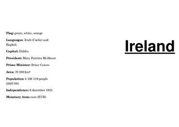
Ireland Geography · LocationWestern Europe · Area 84,421 km2 · Coastline 2,797 km · Highest elevation 1,041 m · Largest city Dublin · Population 6,572,728 Languages · English · Irish · Ulster Scots History · During the last glacial period, and up until about 10,000 BC, most of Ireland was periodically covered in ice. Sea levels were lower and Ireland, like Great Britain, formed part of continental Europe. By 16,000 BC, rising sea levels due to ice melting caused Ireland to become separated from Great Britain
5-th chapter Root asks about the alert that Foaly has given him. Foaly says that Captain Holly Short is missing. Her locator was seen across the ocean and the coastline. It shows that she went to site fifty- seven. They lose the picture from her helmet but Foaly says that they still have the sound. Root can hear a human voice asking Holly to surrender and talking about the secret ritual. Foaly and Root go back to the camera feed and go through it slowly, seeing in slow motion a hypodermic dart fly through the air. They realize that Holly is missing in action, probably dead. They had a locator which had a very strong signal moving to north.
Fourth level vin regions: Western Canada, Central Fifth level ces Canada, Atlantic Canada, and an Northern Canada. Provinces have d more autonomy terr than territories. itor ies Geography Canada occupies a major northern portion of North America. Canada is the secondlargest country in the world, after Russia. Canada has the longest coastline in the world, with a total length of 202,080 kilometres. Border with the United States is the world's longest land border, stretching over 8,890 kilometres. Canada has a strong democratic tradition, upheld through a parliamentary system. The sovereign is Queen Elizabeth II. Click to edit Master text styles The Constitution of Second level Canada is the supreme
vee energia hydropower 20. päikseenergia solarpower 21. mandri euroopa continental Europe 22. vahepeatus call at 23. mäenõlvad mountain slopes 24. tõkestuma hamper 25. sissetung invasion 26. loodus keskkond natural habitat 27. eraldatud separated 28. munakivisillutisega cobblet 29. föön hair- dryer 30. putukatõrje insect repellent 31. esmaabi first- aid 32. tulikuum boiling hot 33. jäiselt külm freezing 34. nõmm moor 35. kaldaäär coastline 36. metsalangetaja lumberjack 37. kõige vajalikuga varustatud fully self-contained 38. kaasaegsed mugavused modern conveniences 39. proovima toitu sample gourmet cousine 40. ringi hulkuma drift 41. sportimis võimalused sporting facilities 42. toiduvalmistusviis cousine 43. lummav fascinating 44. maaliline scenic 45. imetlusväärne spectacual 46. kärestikus parvetamine white- water rafting 47. toru ja maskiga sukelduma snorkeling 48
Estonia is located in the Northern Europe and is a state in the Baltic region It is bordered to the north by the Gulf of Finland, to the west by the Baltic Sea, to the south by Latvia, and to the east by Lake Peipus(Peipsi) and the Russian Federation.Estonia also has a number of islands: Saaremaa and Hiiumaa, which are the most known are also the two biggest ones.The territory of Estonia covers 45,227 km2. There is 3,794 kilometers of coastline marked by numerous bays, straits, and inlets. The Republic of Estonia is divided into fifteen counties: Hiiumaa, Saaremaa, Läänemaa, Harjumaa, Lääne-Virumaa, Ida-Virumaa, Tartumaa, Jõgevamaa, Järvamaa, Raplamaa, Viljandimaa, Pärnumaa, Valgamaa, Põlvamaa and Võrumaa. The capital city of estonia is Tallinn. Estonia is influenced by a temperate seasonal climate. Estonia has four seasons of near-equal length. July is the warmest month, and February is the coldest month
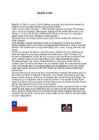
wedged between the Andes mountains and the Pacific Ocean. Chile's unusual, ribbon-like shape -- 4,300 kilometres long and on average 175 kilometres wide -- has given it a hugely varied climate, ranging from the world's driest desert -- the Atacama -- in the north, through a Mediterranean climate in the centre, to a snow-prone Alpine climate in the south, with glaciers, fjords and lakes. The Pacific forms the country's entire western border, with a coastline that stretches over 6,435 kilometres. Chile expanded in the late 19th century, when it incorporated its northern and southern regions. Southern Chile is rich in forests and grazing lands and features a string of volcanoes and lakes. The southern coast is a labyrinth of fjords, inlets, canals, twisting peninsulas, and islands. Prior to the coming of the Spanish in the 16th century, northern Chile was under Inca rule while the indigenous Araucanians inhabited central and southern Chile
5 million . Estonia is one of the most sparsely populated country in Europe. With 35 people per square kilometer. Nearly 1/3 of the nation live in the capital Tallinn. Along the coast of Estonia lies many bays and peninsulas. Lots of islands lie off the west- and north coast. The largest of them are Saaremaa and Hiiumaa. Geographically Estonia can be divided into 4 parts: North-, South-, West-, and East-Estonia. North-Estonia is relatively flat. Here is a nice coastline with coves, capes and a high coast. South-Estonia is more hillier, but there aren't any mountains or mountain ranges. The highest peak in Estonia is Suur Munamägi and its 318m above sealine. The largest industrial areas are situated in East-Estonia. There are beautiful nature parks in West-Estonia. The inland is mainly agricultural. Estonia is known for its 1000 lakes and beautiful nature. One of the most interesting sight is Jägala Waterfall. Lake Peipus separates Estonia from Russia
The Republic of South Africa History The Republic of South Africa is a country located at the southern tip of Africa, with a 2,798 kilometres coastline on the Atlantic and Indian Oceans. Modern humans have inhabited Southern Africa for more than 100,000 years. In 1652 the Dutch East India Company founded a refreshment station at what would become Cape Town. The discovery of diamonds and later gold triggered the conflict known as the Anglo-Boer War, as the Boers and the British fought for the control of the South African mineral wealth. Although the Boers were defeated, the British gave
Northern Europe. It is bordered to the north by the Gulf of Finland, to the west by the Baltic Sea. Its neighbor countries are to the south Latvia, to the east Russia, to the north and over the Gulf of Finland, Finland and to the west and over the Baltic Sea, Sweden. Most of the lowland areas are in the middle of Estonia. Average elevation reaches only 50 meters and the country's highest point is the Suur Munamägi in the southeast at 318 meters. There is 3,794 kilometers of coastline marked by numerous bays, straits, and inlets. The number of islands and islets is estimated at some 1,500. Two of them are large enough to constitute separate counties: Saaremaa and Hiiumaa. A small, recent cluster of meteorite craters, the largest of which is called Kaali is found on Saaremaa, Estonia. Estonia has over 1,400 lakes. Most are very small, with the largest, Lake Peipus, (Peipsi in Estonian) being 3,555 km2. There are many rivers in the country
rabbits, wolverine, squirrels, skunks, porcupines, bobcat, mountain lion, fox, coyotes, wolf But the most important are: BEAVER MOOSE BEAR NIAGARA FALLS Niagara Falls is a set of massive waterfalls located on the Niagara River in eastern North America, on the border between Canada and the United States Niagara Falls is the largest waterfall in the DELLA FALLS The Canada's highest waterfall is Della Falls which is 440 metres high CANADA FACTS Canada's coastline is the longest in the world (244,000 km) The CN Tower was built by the Canadian National Railway stands 181 stories high (553.33 meters tall) Roger Centre capacity ranges from 5,000 to 60,000 for sports events, concerts, family shows, trade shows and conventions. It has the world's first fully retractable roof The Trans-Canada highway is the longest highway in the world It is 8,030 km long and that joins 10 provinces Edmonton (the capital of the province of Alberta, in
USA: West Coast Kristiina Sekljutskaja 11A West Coast · The "West Coast", "Western Seaboard", or "Pacific Coastline" are terms for the westernmost coastal states of the United States. · It most often comprises California, Oregon and Washington. Arizona and Nevada, while not coastal states, are often included due to their proximity to the Pacific Coast and their economic and cultural ties to California · As of 2007, the estimated population of the West Coast ranged from approximately 5060 million, depending on which states are included in the estimate.