Typhoon Why is it different? heavy rains, winds(119 km/h) late summer form over warm seas,27 Inside: strong winds around the eye The strongest winds inside the eyewall Why do they happen? warm air collides with cold air spin in a counter clockwise direction result a storm surge,strong winds Steps of a typhoon windy, rainy (several hours) the eye brings calm weather damage to marine, shoreline, inland ecosystems weaknens, needs warm water The biggest `Tip' Oct 4th, 1979 Highest 260 km/h Damage 99 fatalities Guam, Japan Interesting facts Typhoon from Chinese(tai fung, great wind) China's rain(typhoons) 2 weeks References http://library.thinkquest.org/03oct/01027/cyclones.html http://en.wikipedia.org/wiki/Pacific_typhoon http://agora.ex.nii.ac
west coast, and the southwest. The east coast The east coast consists of a narrow band of lowlands, formed from the sedimentation of alluvial soils and zone, composed of steep bluffs, alternating with ravines bordering an escarpment of about 500 meters in elevation. The coastline is straight, with the exception of the bay. The east coast is considered dangerous for swimmers and sailors because of the large number of sharks that frequent the shoreline. The Tsaratanana Massif region The island's highest peak, Maromokotro, at 2,876 metres is found in the Tsaratanana Massif, located in the far north of the country. The coastline is deeply indented; two prominent features are the excellent natural harbor at Antsiranana and the large island of Nosy-Be. The mountainous topography to the south limits the potential of a port at Antsiranana by impeding the traffic from other parts of the island. The central highlands
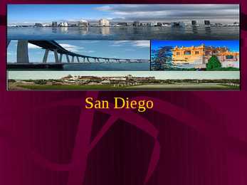
· Hispanic/Latino of any race (25.4%) · Asian (13.6%) · Black/African American (7.6%) · Hawaiian and Pacific Islander alone (0.4%) · American Indian/Alaska Native alone (0.4%) · Other (4.3%) Geography · San Diego is just 20 miles north of Mexico, situated in the rolling hills and mesas that rise from the Pacific shore to join with the Laguna Mountains to the east. The city covers a large area of vastly different terrain: miles of ocean and bay shoreline, densely forested hills, fertile valleys, and mountains, canyons, and desert. · The Coronado and Point Loma peninsulas separate San Diego Bay from the ocean San Diego Museum of Art · Opened on February 28, 1926 · Designed by William Templeton Johnson · The funders turned over ownership of the building to the City of San Diego It is located in Balboa Park · The museum strenght is in Murillo, Zurbarán, Cotán, Ribera and El Greco works. Balboa Park
They may even be launched, as they frequently were in Earth’s ancient past, by the impact of a large meteorite plunging into an ocean. TSUNAMI Can race up to 805 kilometers an hour. At that pace, they can cross the entire expanse of the Pacific Ocean in less than a day. And their long wavelengths mean they lose very little energy along the way. In deep ocean, tsunami waves may appear only a foot or so high. But as they approach shoreline and enter shallower water they slow down and begin to grow in energy and height. WHAT HAPPENS WHEN IT HITS LAND? • A tsunami’s trough, the low point beneath the wave’s crest, often reaches shore first. When it does, it produces a vacuum effect that sucks coastal water seaward and exposes harbor and sea floors. This retreating of sea water is an important warning sign of a tsunami, because
Kõpu lighthouse Kõpu Lighthouse (Estonian : Kõpu tuletorn) is one of the best known symbols and tourist sights on the Estonian island of Hiiumaa. It is one of the oldest lighthouses in the world, having been in continuous use since its completion in 1531. The lighthouse marks the Hiiu sandbank (Estonian : Hiiu madal, Swedish, Neckmansgrund) and warns ships away from the shoreline. Light from Kõpu Lighthouse can be used for navigation as far as 26 nautical miles (48 km; 30 mi) away, although in 1997 a radar lighthouse largely took over its role as navigation aid. Kõpu Lighthouse was previously known under its Swedish name, Upper Dagerort lighthouse. The lighthouse is built at the top of the highest hillock of Hiiumaa island, Tornimägi (English: Tower Hill, 68 metres (223 ft). The height of the building itself is 36 metres (118 ft), and the light is 102
twice the size of Texas, the next largest state. Alaska is larger than all but 18 sovereign countries. Counting territorial waters, Alaska is larger than the combined area of the next three largest states: Texas, California, and Montana. It is also larger than the combined area of the 22 smallest U.S. states. 3 Natural features With its myriad islands, Alaska has nearly 54,720 km of shoreline. Many active volcanoes are found in the Aleutians and in coastal regions. The chain of volcanoes extends to Mount Spurr, west of Anchorage on the mainland. Geologists have identified Alaska as part of Wrangellia, a large region consisting of multiple states and Canadian provinces in the Pacific Northwest which is actively undergoing continent building. One of the world's largest tides occurs in Turnagain Arm, just south of Anchorage tidal differences can be more than 35 feet.
palace into his private domain. 5 9. Kõpu Lighthouse Kõpu Lighthouse is one of the best known symbols and tourist sights on the Estonian island of Hiiumaa. It is one of the oldest lighthouses in the world, having been in continuous use since its completion in 1531. The lighthouse is built at the top of the highest hillock of Hiiumaa island, Tornimägi. The lighthouse marks the Hiiu sandbank and warns ships away from the shoreline. The height of the building itself is 36 metres, and the light is 102.6 metres above sea level, making it the highest coastal light on the Baltic Sea. 10. Kaali crater The meteorite crater field in Kaali, Saaremaa, is the rarest natural monument in Estonia as well as the most impressive crater field of the whole Eurasia. The Kaali meteorite was the last giant meteorite that fell in a densely populated region of the world. Its fall
.................................................................................................... 7 KOKKUVÕTE.......................................................................................................... 9 KASUTATUD KIRJANDUS........................................................................................ 9 SUMMARY WAVE ENERGY VARIATION IN THE FIELD OF STUDY Kristina Samoshenkova Long-term average power of waves per unit length of one of the modeled shoreline varies significantly along the eastern Baltic Sea region (Figure 5). Lithuania and the Russian part of the Curonian Spit has been retained by a public body wave energy flux uniformly average of 1.5-2 kW / m. The same situation is also characterized by a wave of energy flow along the Lithuanian coast. Latvian coast is the southernmost part of the average values of 1-1.5 kW / m. SISSEJUHATUS Pikaajaline lainete keskmine võimsus ühe pikkusühiku kohta modelleeritud rannajoonel
Although the Battle of Largs was indecisive, Haakon's campaign was unsuccessful, and effectively ended Norse influence in western Scotland.The 13th century curtain wall seen from the south-east, across the moat. The bases of the south-east and south-west towers can be seen.The early castle comprised only the roughly circular curtain wall, 3m thick and around 43m across, built on a low mound, with a battlement on top accessed by open stairs. The moat was connected to the sea, the shoreline being some 100m further south than today. The broad crenellations can be made out within the walls, which were later raised. Holes in the upper wall would have supported a timber bretasche, a projecting structure serving as an extended battlement. This curtain wall was built of coursed ashlar, and had only two openings in its length. The main gate was an arched opening with a simple timber door. The second opening was a small postern gate in the west wall, later blocked
Also, Copacabana Beach and Lapa, in its rivalry with Melbourne, Sydney a vibrant neighborhood. And wins the weather battle with its you'll be hard-pressed to find a warm, sunny climate. more riotously fun event than Rio's Carnival. Tel Aviv Why Go: While Jerusalem may be the old city, Tel Aviv is the trendy new one. Sitting along the Mediterranean, Tel Aviv boasts a broad, sun-drenched shoreline that lures both locals and travelers. And once the sun goes down, a pulsating nightlife erupts across the city. Foreign visitors savor the mouth-watering cuisine found at intimate eateries or street carts. Take your time with this metropolis: There's a lot to surprise you. Used internet pages http://travel.usnews.com/Rankings/Worlds_Be http://en.wikipedia.org/wiki/ http://www.google.ee