Aliis Uudelt Eritrea State of Eritrea Horn of Africa Sudan, Ethiopia, Djibouti, Red Sea Asmara 117,600 km2 6 million inhabitants Politics and government People's Front for Democracy and Justice The National Assembly Periodically scheduled Regions and districts 6 regions Control over agricultural capacity Historical intra-regional conflicts geography Virtually bisected Fertile lands West Desert East Sandy, arid coastline Highlands economy Agricultural Farming and herding GDP is growing Languages No official language Arabic and Tigrinya English and Italian The End
Ecuador- Quito Botswana- Gaborone Paraguay- Asuncion Burkina Faso- Ouagadougou Boliivia- La Paz Burundi- Bujumbura Guyana- Georgetown Djibouti- Djibouti Prantsuse Guajaana- Cayenne Egiptus- Kairo Falklandi saared- Port Stanley Ekvatoriaal- Guinea- Malabo Elevandiluurannik- Yamoussoukro Eritrea- Asmara Etioopia- Addis Abeba Gabon- Libreville Gambia- Banjul Ghana- Accra Guinea- Conakry Guinea- Bissau- Bissau Kamerun- Yaounde Kenya- Nairobi Kesk- Aafrika Vabariik- Bangui
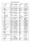
veebruar 1922 km² 9. Ekvatoriaal-Guinea 28 051 km² 523 051 (2004) Malabo 12. oktoober 1968 10. Elevandiluurannik 322 460 km² 17 298 040 (2005) Yamoussoukro 7. august 1960 (Côte d'Ivoire) (Abidjan – tegelik) 11. Eritrea 121 320 km² 4 298 269 (2002) Asmara 24. mai 1993(4) 12. Etioopia 1 127 127 67 673 031 Addis Abeba vanimaid riike km² Aafrikas 13. Gabon 267 667 km² 1 355 246 (2004) Libreville 17. august 1960 14. Gambia 10 380 km² 1 367 124 (2000) Banjul 18. veebruar 1965 15
Botswana .' SEN ' AL ) CHAD ) ' ERITREA Gabor one 186,000 Mauritius Dakar. " _ ~ " Asmara ~" k 8 URKINA Niamey .. J Port Lo uis 128,000 GAMBIAr:;;: B' Bama 0 ,,-FASO ~" - ~ ) I
Toward the end of October, 1943, when it became evident that the Allies would invade Europe and the Wehrmacht had begun to stiffen its defenses, Oshima toured the Westwall and the Siegfried Line. He reported on these preparations in great detail in a long radiogram of between 1,000 and 2,000 words. As a powerful German station pumped it into the ether for the 5,000- mile leap to Tokyo, a new American intercept post at Asmara, in the former Italian colony of Eritrea bordering the Red Sea, picked it up. Back the cryptogram went to the Signal Security Agency. It proved to be in PURPLE, which the American cryptanalysts read with relative ease. The solution went to General Dwight D. Eisenhower's headquarters, where its intelligence helped shape basic strategy for the conquest of Germany. 14. Censors, Scramblers, and Spies CIPHER is the language of spies—and usually they must talk in whispers.