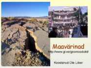
Maavärinad
The same location as in photo 1. The
major scarp of about 300 m in length
formed as a result of ground shaking
and a landslide during the October 4,
1994, earthquake. The major vector of
landslide movement was directed to
the left. View is to the south. Photo
credit: V.K. Gusiakov
�Earthquake of June 16, 1964, Niigata, Japan.
The magnitude 7.4 earthquake killed 26 and destroyed 3,018 houses and
moderately or severely damaged 9,750 in Niigata prefecture.
http://www.ngdc.noaa.gov/seg/hazard/slideset/1/1_slides.shtml
�(Video Clip-Loma Prieta, 1989, i.e. the World Series
Earthquake)
� Animatsioone maavärinate teemal
• Guardian Unlimited
http://www.guardian.co.uk/flash/0,5860,1121610,00.html
http://www.pbs.org/wnet/savageearth/animations/earthquak
es/main.html