Laboratoorne töö nr.3 mõõtmised topograafilisel kaardil II
http://www.ngs.noaa.gov/cgi-bin/Inv_Fwd/inverse2.prl. Tulemused esitada
ühtses tabelis ( ).
Valemid: S= ; x= x2-x1 ; y= y2-y1 ; arctan R= ; ; S= .
a. Punktid 1 ja 2:
x= 1,43 km; y= 2,78 km
S12= 3,13 km
arctanR12= 1,944
sin12= 0,888
cos12= 0,457
S12=
b. Punktid 2 ja 3:
x= 1,65 km; y= -0,58 km
� S23=1,75 km
arctanR23= -0,352
sin23= -0,331
cos23= 0,943
S23=
c. Punktid 3 ja 1:
x= -3,08 km; y= -2,2 km
S31= 3,79 km
arctanR31= 0,714
sin31= -0,580
cos31= -0,813
S31=
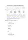
Tabel 3. Arvutustulemuste koondtabel
Plaanilt Ristkoordinaatide Geodeetiliste
Joon mõõdetud järgi arvutatud koordinaatide Smõõd-Sarvut Smõõd-Se