IRELAND Ireland is a very beautiful island in the Atlantic Ocean. That lays next to Great Britain. This island is gorgeous landscape, the green hillsides and the rocky coastline. Ireland weather is influence of the Gulf Stream, there is warm and rainy through the year. The Celts inhabited the land. Ireland is separated into two parts. The north part (smaller) is part of the United Kingdom, bigger part of island makes up Republic of Ireland (independent country). The population of the Republic of Ireland is about three and half million people. There are two official language- English and Gaelic. Mostly there is used English. The Irish are know as friendly and fun-loving people. They like music and humor. In Ireland the most popular legend is about the leprechaun. He is the shoemaker of the Irish fairy kingdom. The leprechaun usually walks alone, is fun-loving and very crafty
title first of all, and I also heard that my favourite actor Leonardo Di Caprio plays in that film. It was directed by Danny Boyle and it stars two young actors, Leonardo Di Caprio and Robert Carlyle. The film is set in Thailand. The main character is a young American man who travels to Thailand in search of the perfect vacation. During a stay in Bangkok, he meets a mysterious man who tells him about a secret beach. Richard then heads for southern Thailand in search of the island. Along the way, he meets a young French couple, Françoise and Étienne and he shares the secret of the island with them. The three then start to find the island and finally they get there. Heading further inland, they find a hidden beach where a small clan of travellers has settled. After their arrival many scary things start to happen. The film was very interesting and it is definitely one of the best movies I have ever seen
Saaremaa Saaremaa biggest island in Estonia located in the Baltic Sea 2673 km2 populatin over 35000 ihabitants density 13 inhabitants/km2 16 municipalities- next year 14 The capital of Saaremaa is Kuressaare Saaremaa - an exciting island Saaremaa - the biggest island of Estonia is known as a good recreation place with unique nature and a lot of sights Saaremaa has retained its uniqueness due to its location and insulation Junipers, dolomite, windmills and the famous local home-brewed beer are considered the symbols of Saaremaa A lot of sights Among the numerous sights of Saaremaa, several are worth calling special attention to, e.g. Angla
Queens Slideshow Alar Nort, Kevin Uueni, Mihkel Vaarmaa Nissi Põhikool 2015 History • Queens was settled in 1635 by dutch and english settlers. • Queens played a minor role in the American Revolution, as compared to Brooklyn, where the Battle of Long Island was largely fought. • It is believed that the county was named after Catherine of Braganza • From 1683 until 1784, Queens County consisted of five towns: Flushing, Hempstead, Jamaica, Newtown, and Oyster Bay. • The New York City Borough of Queens was authorized on May 4, 1897. Geography • Queens is located on the far western portion of Long Island and includes a few smaller islands. • Queens County has a total area of 460 km2, of which
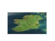
Ireland's nature Katry Mets Ireland Ireland is a country in north- western Europe. Irelands capital is Dublin The highest point being Carrauntoohil (at 1,038 m or 3,406 ft) The longest river in Ireland is the River Shannon. The Roads in Ireland are very narrow and are lined on both sides by stone walls. The Aran islands The Aran Islands comprise three islands (Inis Mór, Inis Meáin and Inis Óirr) located at the mouth of Galway Bay. The names are Irish language for 'the big island', 'the middle island', 'the south island`. The Aran Islands are rich in the language, culture and heritage of Ireland. The islands can be reached by sea by catching a ferry or by plane. The Burren The Burren, from the Gaelic word Boireann is an area of limestone rock covering imposing majestic mountains, and valleys with gently meandering streams. Monuments ar...
Strange and mysticals places on Earth Eye of africa - Mauritania Eye of africa- Mauritania · The Richat structure (Sahara, Mauritania) appears as a large dome at least 40 km in diameter within a Late Proterozoic to Or- dovician sequence. · This natural phenomenon is actually a Richat structure caused by the dome shaped symmetrical uplifting of underlying geology now made visible by millennia of erosion. Socotra island · is a small archipelago of four islands in the India Ocean. The largest island, also called Socotra, is about 95% of the landmass of the archipelago. It lies some 240 kilometres (150 mi) east of the Horn of Africa and 380 kilometres (240 mi) south of the Arabian Peninsula. The island is very isolated and through the process of speciation, a third of its plant life is found nowhere else on the planet. It has been described as the most alien- looking place on Earth.
of continental Europe. By 16,000 BC, rising sea levels due to ice melting caused Ireland to become separated from Great Britain. Later, around 6000 BC, Great Britain itself became separated from continental Europe. The earliest evidence of human presence in Ireland is dated at 10,500 BC, demonstrated by a butchered bear bone found in a cave in County Clare. It is not until about 8000 BC, however, that more sustained occupation of the island has been shown, with evidence for Mesolithic communities around the island. These Mesolithic communities lived as hunter- gatherers across the island until about 4000 BC. Name · The name Ireland derives from Old Irish Eriu. This in turn comes from the Proto-Celtic Iveriu, which is also the source of Latin Hibernia. Iveriu derives from a root meaning 'fat, prosperous'. Economy · Despite the two jurisdictions using two
The Colossus of Rhodes, a wonder of the ancient world Location: At the entrance of the harbor of the Mediterranean island of Rhodes in Greece Throughout most of its history, ancient Greece was comprised of city-states which had limited power beyond their boundary. On the small island of Rhodes were three of these: Ialysos, Kamiros, and Lindos. In 408 BC, the cities united to form one territory, with a unified capital, Rhodes. The city thrived commercially and had strong economic ties with their main ally, Ptolemy I Soter of Egypt. In 305 BC, the Antigonids of Macedonia who were also rivals of the Ptolemies, besieged Rhodes in an attempt to break the Rhodo-Egyptian alliance. They could never penetrate the city. When a peace agreement was reached in 304 BC, the
................................ 8 Pictures........................................................................................................................................8 Used material:............................................................................................................................. 9 2 Introduction Jamaica is an island nation of the Greater Antilles, 234 kilometres (146 mi) in length and as much as 80 kilometres (50 mi) in width situated in the Caribbean Sea. It is about 620 kilometres (385 mi) northeast of the Central American mainland, 145 kilometres (90 mi) south of Cuba, and 190 kilometres (120 mi) west of the island of Hispaniola, on which Haiti and the Dominican Republic are situated. Its indigenous Arawakan-speaking Taíno
committee, and features the scarlet ibis (native to Trinidad), the cocrico (native to Tobago) and hummingbird. The shield bears three ships, representing both the Trinity, and the three ships that Columbus sailed. Population • 2015 estimate 1,349,667 Total area • 5,131 km2 Administrative divisions • Trinidad is split into 14 regional corporations and municipalities, consisting of 9 regions and 5 municipalities, which have a limited level of autonomy. Largest island • Trindidad Higest Point • El Cerro del Aripo, at 940 metres (3,084 ft) Lowest point • Lowest point is the Carribean sea 0m Cultural life • The culture of Trinidad and Tobago reflects the influence of Indian, Amerindian, European, Portuguese, Spanish (Hispanic and Latino), Je wish, and Arab cultures. The histories of Trinidad and Tobago are different, and there are contrasts in the cultural influences which have shaped each island.
Bora Bora C.Karus 2018 Bora Bora • A tropical island in the Pacific Ocean, famous as one of the top beach destinations in the world • Population – 8 800 • Main languages French and Tahitian • Mount Otemanu, the highest point at 727 metres • Was colonized by Polynesians, New Zealander and explorers such as James Cook in 1777 • Interestingly, there is no "B," in the local Tahitian language, so its actual name is Pora Pora, meaning "first born" Vaitape The largest city Population 4 927 Some supermarkets Many fruits are imported from Faaa Weather And Biodiversity Tropical, humid climate with relatively stable temperatures yearround Characterized by it’s volcanic rock mountains and raised coral beds found at high elevations Coconut palms, pandanus trees, and breadfruit trees cover the landscape. Animal life is not found in abundance although, wild pigs, rats, and lizards can be seen from time to...
SÕNAD! täiteaine-aggregate Sideaine-binder Toornafta-crude oil Bituumen(põhja-A)- Bituumen mujal maailmas-bitumen Pressitud killustikkate-macadam Osake-particle Maardla-mineral deposit Puhastatud, rafineeritud jääk- a Regined residue Defineeri sõnad? Asphalt-“Asphalt” is a dark brown to black, highly viscous, hydrocarbon produced from petroleum distillation residue. This distillation can occur naturally, resulting in asphalt lakes, or occur in a petroleum refinery using crude oil. Slurry-Slurry seal involves a creation of mixture of asphalt emulsioon and fine crushed aggregate that is Spread on the surface of a road chip seal-Chip seal involves spraying the road surface with asphal emulsions followed by crushed rocks or gravel Heat island-The term "heat island" describes built up areas that are hotter than nearby rural areas.
Dutch explorers mapped the western coast of Australia. 2 Britannia saatis tuhandeid süüdimõistetuid Austraaliasse. Britain sent thousands of convicts to Australia. 3 Eukalüpt ja akaatsia on kõige tavalisemad taimeliigid. The Eucalyptus and the Acacia are the most common types of flora. 4 Känguru saad on umbes saja kilomeetri kaugusel lõunarannikust. Kangaruu Island is about 100km off the southern coast. 5 Austraalia taimestik on värvirikas. The flora of Australia is colorful. 6 Kängurud ja koaalad on kukkurloomad. The kangaroos and koalas are marsupials. 2 Complete the sentences with the where necessary. 1 - Great Britain is a large island in the Ataltic Ocean.
Fourth level Fifth level New Zealand The southernmost capital. 11 sheep per citizen . England Shortest war in 1896 Less than 38 minutes Scotland Scotland prints its own banknotes which are accepted all over the UK The Usa Alaskan purchase check Canada The largest Island in Canada is Baffin Island Australia Wave Rock http://www.ireland-information.com/articles/titanicandireland.htm http://www.ireland-information.com/articles/titanicandireland.htm http:// nationalzoo.si.edu/Animals/ReptilesAmphibians/NewsEvents/irelandsnakes.cfm http://en.wikipedia.org/wiki/Llanfairpwllgwyngyll http:// www.howderfamily.com/blog/northernmost-and-southernmost-world-capitals/ http://militaryhistory.about.com/od/battleswars1800s/p/anglozanzibar.htm http://www.americaslibrary
A-pangamäestik B-kurdmäestik 6. Osata nimetada üks kurdmäestik ja üks pangasmäestik Euroopas. Kurdmäestik-Juura mäestik Pangasmäestik- madal mäestikud kummalgi pool Reini orgu. 7. Miks on talv Euroopas pehmem kui samadel laiuskraadidel Põhja-Ameerikas? Tänu soojale atlandi hoovusele 8. Mis iseloomustab alpiinset pinnamoodi? teravad mäetipud, ahelike harjad, moreenvallid, järved, järsud ja kaljused nõlvad, teravad ja hambulised veelahkmealad. 9. Miks on Island aktiivne vulkanismipiirkond? Kuna Island asub Atlandi ookeani keskmäestiku kohal uue maakoore tekkevööndis 13. Miks ei esine Rootsi ja Soome jõgedel suuri kevadisi üleujutusi, kuigi nende toitumine on sarnane Eesti jõgede toitumisega? Sest Rootsi ja Soome jõed voolavad kiiremini ja rohkem läbi järvede
Misso Keskkool New Zealand Precis Compiler: Maiki Joakit Instructor: Mailis Teppo Misso 2011 New Zealand is an island country in the south-western Pacific Ocean comprising two main landmasses (the North Island and the South Island), and numerous smaller islands, most notably Stewart Island/Rakiura and the Chatham Islands. The indigenous Mori language name for New Zealand is Aotearoa, commonly translated as land of the long white cloud. Population (1998): 3,801,000.New Zealand is notable for its geographic isolation; it is
V: 1) 2914 meetrine kihtvulkaan Jaaval, purskas viimati 2010 aastal 2) 3456 meetrine kihtvulkaan Venemaal, viimati purskas 2008 aastal 3) Nyiragongo kihtvulkaan Kongo Demokraatlikus Vabariigis Virunga mäestikus 1977 aasta purske tagajärjel hukkus mitusada inimest. 4. Põhjenda laamtektoonikale toetudes : 1) Miks on Jaapanis sagedased maavärinad ? V: Geograafilise asendi tõttu laamade suhtes esineb Jaapanis sageli maavärinaid, 3 laamat liiguvad üksteise poole. 2) Island on noor ja õhuke maa- Island on vulkaaniline saar ookeani kesk ahelikul. 3) Osa Havai saari on nooremad kui teised- osadel saartel on rohkem vulkaane, kui teistel.
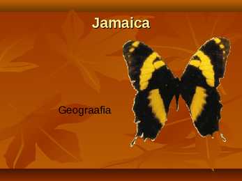
Jamaica Geograafia Jamaica Kati tsirk ja Janika Kübard Flag Coat of arms Location Jamaica is a country in the Caribbean Sea. Is the largest island of the Commonwealth Caribbean and the third largest of the Greater Antilles, after Cuba and Hispaniola. Jamaica lies in the hurricane belt of the Atlantic Ocean. Capital city The City of Kingston is the capital and largest city of Jamaica. Kingston is located on the southeastern coast of the island. Languages The official language of Jamaica is English. Informally Jamaican Patois is more commonly spoken by a majority of the
· Contains mainly 15th for a traditional seaside holiday and 16th century furnishings, tapestries, · Provides an amazing insight into the ancient and works of art which heritage of Ireland capture the mood of those times Sightseeing The Ring of Kerry Bunratty Castle Nature · Ireland is a snake-free island (because it is an island and doesn't have good conditions for snakes to live) · At a height of 688 metres above the Atlantic Ocean, Croaghaun (on Achill Island) are the second highest cliffs in Europe Symbols · In Ireland flag the white · The three most famous in the center of the flag symbols of Ireland are represents the peace the green Shamrock, the between the Irish people
suurem linn riigis. Reykjavík asub Edela-Islandil Atlandi ookeani kaldal, Esja vulkaani lähedal Faxaflói lahe lõunarannal. Kópavogur (30 000 in) on oma suuruselt teine linn, mis asub Atlandi ookeani rannikul Reykjavíkist lõunas. Hafnarfjörur, suuruselt kolmas (26 000), asub Kópavoguri lähe- dal. Energiamajandus Geisritest saadavat energiat kasutatakse vee soojendamiseks majapidamistes ja elektrienergia tootmiseks. Island on maailmas suurim taastuvate energiaallikate kasutamise arendaja. Hellisheii elektrijaam on suurim geotermaalenergiat tootev jaam maailmas. Elektrivarustamine ja tarbimine oli 2008 aastal ühe inimese kohta 53,1 Mwh, samal ajal oli aga Euroopa Liidus keskmine 7,4 MWh. Põllumajandus Kogu maa-alast moodustavad ülesharitud põllumaad 1%(100 000km2 ), karjamaad 20%. Põlluharimise tähtsus seisneb eelkõige kodumaise toidu tootmises. 19.sajandil elasid
Characters Hollis Fremont - 1) main character 2) parents killed 3) grew up in Idaho 4) life in Marseille Sam Crawford - 1) Omega group 2) hunts Handyman 3) meets and helps Hollis Harry Jacoby - 1) Muffin Men 2) helps Sam and Hollis Handyman 1) assassin 2) events in airport 3) pombs in Bedford Hills 4) shooting in Liberty Island Dawson Wylie 1) brought Hollis up 2) kills Paul 3) betrayed Hollis Paul McGann - 1) betrayed Hollis 2) wants to kill Hollis and Sam Timeline Night with Paul Action in Bedford 15 years Hills ago in Later in Meeting
Norra meri Norra meri on Põhja-Jäämere ehk Arktika ookeani osa. See on ääremeri. Norra merd ümbritsevad Teravmäed, Island, Fääri ja Shetlandi saared, Jan Mayeni saar ja Skandinaavia poolsaar. Sügavus on kuni 3960 meetrit. Keskmine sügavus on 1383 meetrit. Mere pindala on 1 380 000 km² ning soolsus 35. Norra mere rannajoont iseloomustavad sügavad kitsad lahed, mida nimetatakse fjordideks, samuti suur hulk saari ja saarestikke. Mandrilava on kitsas. Norra hoovus on hoovus Norra meres, osa Golfi hoovusest. Hoovab kirdesse Suurbritanniast Skandinaavia poolsaareni ja edasi mööda Skandinaavia looderannikut
36.Dzaibatsu Suurettevõtete liit Jaapanis 37.Kuidas algab tööpäev Jaapanis? Jaapanis algab tööpäev sageli rivistuse ja ettevõtte hümni laulmisega 38.Millised riigid olid I MS ajal erapooletud? Rootsi, Norra ja Taani 39.Saksamaa vallutas II MS ajal ära Taani ja Norra.Seda rauamaagi ja hea väljapääsu tõttu Gotlandi ookeanile 40.NSVL ründas II MS ajal Soomet 41.Milline riik jäi ka II MS ajal erapooletuks? Rootsi jäi II MS ajal erapooletuks. 42.Taani, Norra ja Island astusid peale II MS NATOsse 43.Millised riikid on Põhjamaade Nõukogu liikmed? Rootsi, Norra, Taani ja Island, hiljem ka Soome 44.Soome ja Island on vabariigid. 45.Norra, Taani ja Rootsi on kuningriigid. 46.Millised neist riikidest kuuluvad Euroopa Liitu? Rootsi, Soome ja Taani 47.Põhjamaades on 20.saj kõige populaarsem poliitiline vool olnud sotsiaaldemokraatia 48.Rootsi sotsiaaldemokraatide ümberkorraldused enne II MS:
French Joe By W. Somerset Maugham CHARACTERS: • Captain Bartlett – pilot, bald, alcoholic, queer fish • Captain Cook – discovered the Thursday Island on a Thursday. • Woman – a red flannel dressing-gown; holding a paraffin lamp; hair - a little bit over her shoulders, long black wisps, a little stoutish, keen eyes, a red nose. • French Joe aka Josep de Paoli – 93Y, Corsican, a lietutenant of artillery, French army in 1851, later communist, started new life many times, black shining eyes, really thin and old. • Boswell Johnson – really famous author, the ancestor of Joe.
I think they make Estonia very special. Another thing is the climate. It is not too cold in winter or too warm in summer. Winters are usually snowy and you can go skiing and ice skating. In the summer you can enjoy days at the beach. The capital city of Estonia is Tallinn, which has a very beautiful Old Town. Pärnu is the summer capital, which attracts people with its beautiful beach. There are a lot of isalands, lakes and rivers in Estonia. Saaremaa is the biggest island, and it is very beautiful. Saaremaa has a lot of places to visit like Angla's Windmill park, different churches, camping places. Hiiumaa is another island, but it is smaller than Saaremaa. There are also a lot of places to explore. Estonia is a small but beautiful counrty. There are a lot of sightseeings and many places to see. You can enjoy the beautiful and refreshing nature.
The third largest citys in the US is: New York (NY) with a population of 8,175,133 and nicknames like The Big Apple, The City That Never Sleeps. It is composed of five boroughs: Manhattanthe home to Central Park and most of the city's skyscrapers, The Bronx, Brooklyn with a distinct downtown neighborhood, Queens the only large county in the United States where the median income among African Americans is higher than that of White Americans and Staten Island The Staten Island Ferry where you can see The Statue of Liberty ( a colossal neoclassical sculpture on Liberty Island in New York Harbor, designed by Frédéric Bartholdi and dedicated on October 28, 1886. The statue, a gift of friendship to the United States from the people of France, is a robed female figure representing Libertas, it has become an icon of freedom and universal symbol of democracy of the United States), Los Angeles (Calif) because of its nice climate the centre
3. MIX 1. Töö tasustamise vormide areng toimub suunal a. töö tariifisüsteemide arendamine b. ajatöö osakaalu suurendamine c. tükitöö osakaalu suurenemine 2. Ajaliselt kõige pikem töönädal Euroopa riikidest on (Eesti Statistikaameti andmetel): a. Türgi b. Prantsusmaa c. Taani d. Island 3. Eesti töötaja tunnitootlikkuse tase erineb saksa töötaja omast kordades umbes: a. 7 b. 6 c. 5 d. 4 4. Tootlusnormi suurendamisel 10% väheb ajanorm: a. 11,1 % b. 10,1 % c. 9,1 % d. 9,6 % 5. Loomulikuks töötuse määraks on: a. siirde -, tsüklilise - ja struktuurse töötuse summa b. siirde ja tsüklilise töötuse summa c. siirde - ja struktuurse töötuse summa d
Located in Arctic Ocean Also known as Grønland Kalaallit Nunaat Population 60,324 (2000 Estimate) Total area 2,175,600 square kilometres Greenland, a selfgoverning dependency of Denmark, is the largest island in the world. Greenland consists of an interior icecovered plateau surrounded by a mountainous, generally icefree rim. The interior ice cap is thickest near the centre of the island, where the maximum depth is estimated to be about 3,353 metres (11,000 feet). Underneath the ice cover are the ancient rocks of the Greenland Shield, which is geologically related to the Canadian Shield. Drainage is afforded mainly by the so called ice fjords, in which glaciers from the ice caps pass through valleys to the sea, where they form thousands of icebergs each year. The climate is extremely cold, although the south experiences a short summer.
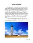
Vilsandi National Park Vilsandi National Park is a national park in Saaremaa, Estonia. It includes The administrative center is located on the largest island, Vilsandi. The area isn't very big 238 km2. The park grew from a bird reserve founded in 1910. The first who found Vilsandi birds interesting was long - time captain of the Vilsandi lighthouse,Artur Toom, who started providing protection for sea birds in 1906. Today, the preserve provides protection not only for sea birds, but for all the landscape, plants and animals present in the islands.Hunting is absolutely prohibited
She took several odd jobs to pay for the flying lessons. Later she organized cross-country air races and famous women pilots organisation the ,,Ninety Nines" One day she recived a an invitation to be the wirst woman to make the flightacross the Atlantic ocean. Amelia made that flight and met her future husband, George Putman, who arranged the flight. In 1937 Amelia took her final flight to fly around the world. Somewhere between New-Guinea and Howland island Amelias plane disappeared. The last message from Amelia was that she couldn't see the island and the fuel was running out. She never arrived and the wreckage or bodies were ever found.
Niagara falls is the collective name for three waterfalls that straddle the international border between Canada and the United States; more specifically, between the province of Ontario and the state of New York. Niagara Falls · From largest to smallest, the three waterfalls are the Horseshoe Falls, the American Falls and the Bridal Veil Falls. The Horseshoe Falls lie mostly on the Canadian side and the American Falls entirely on the American side, separated by Goat Island. The smaller Bridal Veil Falls are also located on the American side, separated from the other waterfalls by Luna Island. Geology · About 10,900 years ago, the Niagara Falls was located between present-day Queenston, Ontario, and Lewiston, New York, but erosion of their crest has caused the waterfalls to retreat approximately 6.8 miles (10.9 km) southward. The Horseshoe Falls, which are approximately 2,600 feet (790 m)
Saksamaa LV poolt, hiljem on automaatselt liitunud kõik Euroopa Liidu liikmesriigid; lõpetas tegevuse 2002. a Euroopa ühendused- 1967. a moodustatud katusorganisatsioon Euroopa Söe- ja Teraseühendusele, Euroopa Majandusühendusele ja Euroopa Aatomienergiaühendusele. Euroopa Vabakaubanduse Assotsiatsioon (EFTA)- 1961. a Austria, Norra, Portugali, Rootsi, Suurbritannia, Sveitsi ja Taani moodustatud vabakaubandusühendus vastukaaluks Euroopa Majandusühendusele; praegu on selle liikmed Island, Liechtenstein, Norra ja Sveits. Fjell- Kõrge mäemassiiv Norras Fjord- Pikk kitsas järskude kallastega sügav laht. Geograafiline ehk territoriaalne tööjaotus- Üksikute riikide või riigi piirkondade orientatsioon teatud majandusharude eelisarendamisele või spetsialiseerumine teatavate toodete valmistamisele. Geotermaalenergia- Maapõues tekkiv soojusenergia. Haguküla- küla, kus majad asuvad ühel või mõlemal pool teed, kuid
Letter Dear Madam, Thank you for writing, I am tryinig to answer your questions. We will leave at 12.15 from pier. To reach the place, you must first go along to get to the roundabout, then turn right at the first opportunity and then go along until you see the pier. We will departure at 12.30. When we arrive, we should walk through Castle Bridge to Tower Island and back, but unfortunately you have no time to take a walk. I would suggest that this time we will only walk to Castle Bridge and get acquainted wiht the sights and then we will come back. We should return to London at 14.30, but the coach arrives at 14.45, then we can get on the island faster or we can wait for the next coach. It can also be decided locally. You asked me about vegetarian option. Of course we also offer vegetatrian food, but for this
.............................. ......8 6.Sport.................................................................. ......9 7.Language........................................................... ....10 8.Conclusion......................................................... ....11 9.New words............................................................12 10.References...................................................... .....13 Introduction Jamaica is an island nation of the Greater Antilles, 234 kilometres in length and as much as 80 kilometres in width, amounting to 11, 100 km 2. It is situated in the Caribbean Sea. With 2.8 million people, it is the third most populous anglophone country in North America, after the United States and Canada. Kingston is the largest city in Jamaica and the country's capital. I am interested in this country and it is my favourite country. History
...............................................6 2.Reisipaketi analüüs..................................................................................................................6 1.3.Reisipaketi sihtgrupp........................................................................................................7 1.4.Paketi mõju kohalikule kogukonnale...............................................................................7 SISSEJUHATUS Valituks osutus kultuurireis nimega Island – põhjaranniku saladused. Reisi korraldab Germalo Reisid. Antud reis kestab 5 päeva. Reisi algusaeg on 3.08.19 ning see lõppeb 07.08.19. Ringiliikumine toimub nii bussiga kui ka osaliselt jala. Sihtriiki reisitakse lennukiga. Majutusasutusteks on hotellid ja külalistemajad. Iga päev on uus ööbimisasutus. Reisipaketi maksumuseks on 1139€. Hinna sisse kuuluvad edasi-tagasi lennupiletid, maksud, bussisõit, ekskursioonid ja eestikeelne giiditeenus ning ööbimine majutusasutustes
Tuuleenergia plussid: 1) Keskkonna säästlik, väike kahjulik toime keskkonnale. 2) Kasutatav resurss(tuul) on tasuta. 3) Eesti seisukohalt praktiliselt piiramatu ressurss, arvestades tuuleparkide rajamise võimalusi rannikumerre 4) Taastuv, puhas ning ammendamatu energialiik. Tuulenergia miinused: 1) Võimalik kahju linnustikule, eriti nende paiknemisel lindudele 2) Negatiivne visuaalne mõju läheduses paiknevatele inimasustustele. 3) Tuuliku labade pöörlemisel tekkiv vibratsioon. Island saab oma elektri ja soojuse maapo ue geotermaalenergiat ära kasutada KASUTAJAD USA ISLAND ITAALIA Geotermaalenergia Geotermaalenergia plussid: 1.Ressurss on praktiliselt piiramatu. 2.Ressurss on tasuta ja ilma töötlemiskuludeta. 3.Maasoojusest toodetava elektri ja küttesooja hind on odav. 4.Koduses majapidamises on ainsad kulud investeering süsteemi ja elektripumba voolutarbimine.
It is the oldest north–south main thoroughfare in New York City, dating to the first New Amsterdam settlement. The name Broadway is the English literal translation of the Dutch name, Breede weg. Broadway is known widely as the heart of the American theatre industry. Broadway was originally the Wickquasgeck Trail, carved into the brush of Manhattan by its Native American inhabitants. This trail originally snaked through swamps and rocks along the length of Manhattan Island. In the 18th century, Broadway ended at the town commons north of Wall Street, where traffic continued up the East Side of the island via Eastern Post Road and the West Side via Bloomingdale Road. The western Bloomingdale Road would be widened and paved during the 19th century, and called "Western Boulevard"or "The Boulevard" north of the Grand Circle, now called Columbus Circle. On February 14, 1899, the name "Broadway" was extended to the entire Broadway/Bloomingdale/Boulevard road.
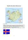
Islandi rahvastiku iseloomustus Joonis 1. Island Island (Islandi Vabariik) asub loode euroopas, parasvöötme merelises kliimas. Islandi pealinn on Reykjavik. Keelena kasutatakse seal islandi keelt, inglise keelt ja saksa keelt. Teda ümbritseb Norra meri ja Atlandi ookean. Põhilised loodusressursid on kala, hüdroenergeetika ja geotermaalenergia. Kõrgeim punkt on Hvannadalshnukur (2,110 m). Islandi pindala on 103,000 km2 , sealhulgas 100,250 km2 maismaad. Rahvaarv on 301,931 (2007 a.). Joonis 2. Islandi lipp
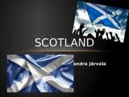
SCOTLAND Sandra Järvala GEOGRAPHY & POPULATION · Scotland is a country that is part of the United Kingdom and coers the northern third of the Island of Great Britain. · The Scotland capital city is Edinburgh. MAJOR CITIES · The largest city is Glasgow. Glasgow has a population of 598,830. The city has an area of 175.5 km ². · Aberdeen, Dundee, Paisley, East Kilbride and Livingston are are also large cities. · There is a Glasgow bus tours for tourists SCOTLAND FLAG · The Flag of Scotland, also known as Saint Andrew's Cross or the Saltire, is the national flag of Scotland. · Scottish flag is blue
Tori is known for the Estonian Tori Horse, bred at a local stud farm founded in 1856. Tori Hell is a sandstone cave on the Pärnu River. Kurgja is the location of the Farm Museum of Carl Robert Jakobson, a leader of the national movement at the end of the 19th century. The Nigula Nature Reserve preserves the peat-bog ecosystem within its territory of 2771 hectares. Häädemeeste is one of the most important yacht-building centers in Estonia and also famous for its mineral water. The Island of Kihnu is the biggest island in the Gulf of Riga. There are some peculiarities in local dialect, dressing, folk songs and wedding customs. Saaremaa is the largest island in Estonia and is characterized by rare plants, windmills, thatched roofs, stone fenches and the hospitality of the local people. The islanders hold on to old traditions and take pride in their folklore. A road spans the strait between Saaremaa and Muhumaa. The
674% aastas(2012), praegu on sellega maailmas 141. kohal. 2.Iseloomusta rahvastiku paiknemist riigis ja lisa juurde ka kaart. a) keskmine rahvastiku tihedus 3,2 in/km² (2010) http://et.wikipedia.org/wiki/Island b) rahvastiku tihedus võrreldes naaberriikide ja Eestiga Kõige sarnasem naaberriik selle tunnuse alusel on Norra, kus ruutkilomeetril elab 16 inimest, Eestis on rahvastiku tihedus kümme korda suurem. Seevastu Taanis elab 127 inimest ruutkilomeetril ning Suurbritannias 254, 7 inimest. Island on väga hõredalt asustatud riik nii maailmamastaabis, kui naaberriikidega võrreldes. http://et.wikipedia.org/wiki/Suurbritannia http://et.wikipedia.org/wiki/Taani http://et.wikipedia.org/wiki/Norra http://et.wikipedia.org/wiki/Eesti c) tihedamini ja hõredamini asustatud piirkonnad; põhjenda, mis võiks olla taolise kujunemise põhjused? Pool rahvastikust elab pealinnas Reykjavikis ja selle ümbruses, sest see on üks väheseid elamiskõlblikke kohti
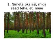
1. Nimeta üks asi, mida saad teha, et meie keskkond säiliks • Pakendite taaskasutamine • Prügi sorteerimine • Veepudeli ostmise asemel kodust vee kaasa võtmine • Kilekottide taaskasutamine • Puude ja taimede istutamine • Liha söömise vähendamine 2. Milliseid neist materjalidest saab taaskasutada? a) Klaaspudel b) Plastpudel c) Plekkpurk d) Piimapakend e) Kõiki e) Kõiki 3. Kui kaua lagunevad plastpudelid? a) 5-10 aastat b) 20-30 aastat c) 50-80 aastat d) 100-120 aastat Plastpudelid lagunevad 50-80 aastat. Kui nad on maa sisse maetud, siis 500- 1000 aastat. 4. Nimeta 2 asja, mida saab plastpudelitest teha • Uusi plastpudeleid • Riidematerjale nt fliispusa, vatiin, jalgpallisärk 5. Kui kaua laguneb (alumiiniumist) plekkpurk? a) 100-200 aastat b) 200-500 aastat c) 600-800 aastat b) 200-500 aastat 6. Mitu korda saab alumiiniumpurki taaskasutada? a) 1 korra b) 10 korda ...
Employee Relations” Demand Media Pavlus J. (2015), “Apple and Google Race to See Who Can Kill the App First” , kättesaadav: http://www.wired.com/2015/06/apple-google-ecosystem/ , (kasutatud 07.10.2015) “Platform Competition: Are Device Ecosystems Expanding?” kättesaadav: http://vertoanalytics.com/2015/03/platform-competition-device-e cosystems-expanding / , (kasutatud 07.10.2015) Spencer G. (2015), “No Ecosystem Is an Island: Google, Microsoft, Facebook & Adobe’s iOS Apps” kättesaadav: https://www.macstories.net/stories/no-ecosystem-is-an-island-goo gle-microsoft-facebook-adobes-ios-apps / , (kasutatud 07.10.2015)
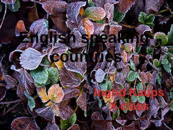
English speaking countries- UK The United Kingdom of Great Britain and Northern Ireland is a sovereing state off the north-western coast of continental Europe. It consist of Great Britain, the north- eastern part of the island of Ireland and many smaller islands. The capital of United Kingdom is London.The flag of the United Kingdom is the Union Flag The United Kingdom is a unitary state governed under a constitutional monarchy and a parliamentary system, with its seat of government in the capital city of London. It is a country in its own right and consists of four countries:: England, Northern Ireland, Scotland and Wales . The United Kingdom is a unitary state under a constitutional monarchy. Queen
taastamatu Venemaa Austraalia Ameerika Saksamaa kaevandused. maastikke traditsiooniline Aafrika Lõu-Aafrika Venemaa Hispaania Vesi Elektri tootmisel Norra Kanada Norra Saasteained ei Ehitmaine on kallis ja Taastav Sveits USA, Hiina Island ____ teki, elektri oma veehoidlad rikuvad alternatiivne Brasiilia Venemaa hind väike/madal maastikke Norra Tuumaenergia Elektri tootmiseks Kanada USA Normaalsel tööl Üliohtlikud jäätmed,
!! Some pictures ... Lahemaa National Park Lahemaa National Park is 70 km east of Tallinn and covers 725 km . The largest . Has a diverse (mitmekülgne) landscape . Home to numerous birds and animals . Rich variety of fauna . There are permanent communities of bear, wolf and lynx in the park so keep your camera on standby . It's also home to ... migratory waterfowl ...and swans . In this Park you will see the deep dark pine (mänd) forest . Hiiumaa The second largest island (989 km²) . It is located in the Baltic Sea . The largest town is Kärdla . Hiiumaa is the main island of Hiiu County . Transport From Estonian mainland to Hiiumaa involves a 90minute (28 km) ferry crossing from Rohuküla to Heltermaa . There are about 10 ferry departures a day. In the summer weekends, getting car space on the ferry usually requires advance booking. There are about 2 scheduled buses a day between Tallinn and Kärdla .
Established in 1919 314m high Orginally based in Kadriorg Palace, but Construction completed has spanned thoughout Estonia in 1980 Geography Mainly a lowland Bordered by the Baltic sea,Latvia & Russia Moderate winters and cool summers Oil shale and limestone deposits Forests covers over 47% of the land Hiiumaa The second largest island Territory: 989 km² In the Baltic Sea, north of the island of Saaremaa Coastline: 310 km Population: 8400 people Kärdla Kõpu Lighthouse One of the best known symbols and tourist sights. One of the oldest lighthouses in the world (1531). At the top of the highest hillock - Tornimägi (English: Tower Hill). Height : 36 meters. Other Sightseeings
evolved(arenes) into the Kingdom of Dublin and became the island's primary city following the Norman invasion(sissetung). Today, it is ranked 23rd (down from 10th in 2008) in the Global Financial Centres Index, has one of the fastest growing populations of any European capital city, and is listed by the GaWC as a global city, with a ranking of Alpha - which places Dublin amongst the top 25 cities in the world. Dublin is a historical and contemporary(kaasaegne) cultural centre for the island of Ireland as well as a modern centre of education, the arts, administrative function, economy and industry. SPORT Gaelic football is the most popular sport in Ireland in terms of match attendance and community involvement, and represents 34% of total sports attendances at events in Ireland and abroad, followed by hurling at 23%, soccer at 16% and rugby at 8% and the All-Ireland Football Final is the most watched event in Ireland's sporting calendar.
Australia History & Geography Rakke Gymnasium X class Katre Pohlak, Alari Uudla April 2011 Key Facts Australia is the sixth largest country in the world. Australia is an island, surrounded by water. It is located on the smallest continent in the world. Key Facts Population: 17.5 million Geographic size: 2.97 million square miles Capital: Canberra Major cities and population: Brisbane, Sydney, Perth, Melbourne and Adelaide. Geographic Landmarks Australia has a very dramatic landscape. Australia is famous for its "outback," the remote lands of the interior.
Kordamine kt. 1.Maa, kui süsteem. Süsteem-omavahel seoses olevate objektide terviklik kogum. Avatud süsteem- toimub energia ja ainevahetus, Nt: järv. Suletud süsteem- toimub ainult energiavahetus, ainevahetus minimaalne, Nt: Maa. 2.Maa sfäärid- atmosfäär- õhk, hüdrosfäär- vesi, pedosfäär- muld, litosfäär- kivimid, biosfäär- elusorganismid. 3.Näiteid maa sfääride seostest. Taimed(biosfäär)saavad vett(hüdrosfäärist) ja toiduaineid mullast(pedosfäärist) ja eritavad õhku(atmosfääri) 4.Maa energiabilanss-maale saabuva ja maalt lahkuva energiavoo vahe. Tervikuna on maa energiabilanss tasakaalus. Tsonaalsus-looduslike korrapärane vaheldumine, ekvaatorist pooluste suunas. Põhjus-päikesekiirguse ebaühtlane jaotumine sõltuvalt koha geograafilisest laiusest. 5.Maa sisejõud ehk endogeensed protsessid. Maa gravitatsioon ja sisesoojus- laamade liikumine, mäestike teke, kivimite moondumine, maavärinad, vulkaanid, võim...