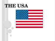
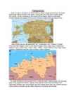
THE USA INTRODUCTION • USA located almost entirely in North America, comprising also a state in Oceania. • The United States of America have 50 states and 14 islands. • The United States of America, the third largest country by size in the world. • The country bordered with Mexico on the South and Canada on the North PRESIDENT AND CURRENCY The president of the US is Barack Obama The currency is the dollar INTRESTING FACTS Population: 296, 483, 000 Capital: Washington D.C Language: English, Spanish Independence day: 4th July 1776 Over 312 million people live in the United States. The most populated state in USA is California, with over 37 million people. TRADITSIONS Thanksgiving Day Christmas Independence Day PLACES TO VISIT The largest mountain: Rocky Mountains The largest river: Mississippi River The ...
Palsameerimine Palsameerimine ehk mumifitseerimine on muumia valmistamine surnukeha õliga ehk palsamiga võides. Aju eemaldati metallinstrumendi abil ninasõõrmete kaudu. Seejärel töödeldi kolpa vastavate rohtudega. Järgnevalt võeti välja kõik siseorganid peale südame ja neerude. Pärast kõhuõõne tühjendamist pesti see hoolikalt. Keha dehüdrateeriti ehk vabastati veest 70 päeva soodalahuses leotades. Seejärel surnukeha pesti ja mähiti osavalt linasesse riidesse. Riie kaeti vaigu või mingi muu kleepuva ainega, mis täitis liimi otstarvet Muumia pandi ohtrasti kaunistatud inimkehakujulisse puukirstu. Mumifitseerimine Tänapäeval võib koolnu palsameerida mõne tunniga. Tavaliselt tehakse seda nii, et veenidesse ja arteritesse, samuti kõhu- ja rindkereõõnde lastakse sobival hulgal palsameerimise vedelikku. Soodsa hinna ja ohutuse tõttu kasutatakse palsameerimiseks enamasti formadelhüüdi. Kim Jong ...
Trafalgar Square is a square in central London, England. With its position in the heart of London, it is a tourist attraction, and one of the most famous squares in the United Kingdom and the world. At its centre is Nelson's Column, which is guarded by four lion statues at its base. Statues and sculptures are on display in the square, including a fourth plinth displaying changing pieces of contemporary art, and it is a site of political demonstrations. The name commemorates the Battle of Trafalgar (1805), a British naval victory of the Napoleonic Wars. The original name was to have been "King William the Fourth's Square", but George Ledwell Taylor suggested the name "Trafalgar Square". The northern area of the square had been the site of the King's Mews since the time of Edward I, while the southern end was the original Charing Cross, where the Strand from the City met Whitehall, coming north from Westminster. As the midpoint between th...
English speaking countries- UK The United Kingdom of Great Britain and Northern Ireland is a sovereing state off the north-western coast of continental Europe. It consist of Great Britain, the north- eastern part of the island of Ireland and many smaller islands. The capital of United Kingdom is London.The flag of the United Kingdom is the Union Flag The United Kingdom is a unitary state governed under a constitutional monarchy and a parliamentary system, with its seat of government in the capital city of London. It is a country in its own right and consists of four countries:: England, Northern Ireland, Scotland and Wales . The United Kingdom is a unitary state under a constitutional monarchy. Queen Elizabeth II is the head of state of the UK as well as of fifteen other independent Commonwealth countries. The English channel is an arm of the Atlantic Ocean that separates Greate Britain from northern France...
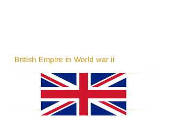
British Empire in World war ii BritISH empire in 1939 -1945 Prime minister: Winston Churchill 1940-1945 Preceded by Neville Chamberlain 1937-1940 King of the United Kingdom and the Dominions of the British Commonwealth: George VI Full name: Edward Albert Christian George Andrew Patrick David Population of Britain: ~47 million Same before and after the war Winston Churchill JOINING the war Britain declared war on Nazi Germany on 3 September 1939 rd British Empire in World war II On May 8, 1945, the Allies formally accepted the unconditional surrender of the armed forces of Nazi Germany. On 30 April Hitler committed suicide. The act of military surrender was signed on 7 May in Reims, France, and ratified on 8 May in Berlin, Germany. On August 15, 1945, the Surrender of Japan occurred, effectively ending World ...
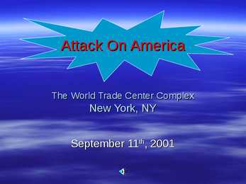
Attack On America The World Trade Center Complex New York, NY September 11th, 2001 Facts - I WTC Complex: Consist of Seven Buildings Owner: Port Authority of New York and New Jersey Architect: Minoru Yamasaki & Associates Engineer: John Skilling & Les Robertson, based in Seattle Contractor: Tishman Construction Company Ground Breaking: August 5th, 1966 Opened: April 4th, 1973 Facts - II Dimensions: 200 feet Tower sides. Total area : 12 million square feet 40,000 sq ft per floor Height: 110 stories high, 1368 and 1362 feet. (417 and 415 meters). Elevators: 239 elevators and 71 escalators Earth work: 1.2 million cubic yards were excavated Facts - III Steel: 200,000 tons Concrete: 425,000 cubic yards Windows: 43,600 windows 600,000 sq ft...
Ireland Ireland is a beautiful island that is washed and influenced by the Atlantic Ocean in the west.It is known for its gorgeous landscape, the green hillsides and the rocky coastline. Film-makers from all over the world have used the beautiful landscape of the island. Ireland is the third-largest island in Europe. It lies to the north-west of continental Europe. The population of Ireland is 6.2 million and there are two official languages English and Gaelic. Ireland `s capital is Dublin. The area of Ireland is 84,421 km2 Ireland is separated into two parts. The north is part of the United Kingdom, while four fifths of the island make up the Republic of Ireland, which has been an independent country since 1921. The Irish are fun-loving and friendly. They like music and humour and they are also good storytellers. There are many legends in Ireland in which the leprechaun, the shoemaker of the Irish ...
Schwitzerland Switzerland is a landlocked alpine country in Western Europe . Switzerland is surrounded by Germany to the north, France to the west, Italy to the south and Austria and Liechtenstein to the east. Switzerland is one of the smallest countries in Europe. With an area of 41285 km² Switzerland is smaller than Estonia, but the population is 7,6 million people. Switzerland is well known for the Alps in the south of the country . Most of the population lives north from Alps, on Swiss plateau Switzerland is one of the richest countries in the world. The capital of the country is Bern. Three biggest cities are Zürich,Geneva and Basel. Zürich and Geneva have respectively been ranked as having the first and second highest quality of life in the world. The country has a long history of neutrality -- it has not been at war since 1815. It is not a member of the European Union. Switze...
Ireland's nature Katry Mets Ireland Ireland is a country in north- western Europe. Irelands capital is Dublin The highest point being Carrauntoohil (at 1,038 m or 3,406 ft) The longest river in Ireland is the River Shannon. The Roads in Ireland are very narrow and are lined on both sides by stone walls. The Aran islands The Aran Islands comprise three islands (Inis Mór, Inis Meáin and Inis Óirr) located at the mouth of Galway Bay. The names are Irish language for 'the big island', 'the middle island', 'the south island`. The Aran Islands are rich in the language, culture and heritage of Ireland. The islands can be reached by sea by catching a ferry or by plane. The Burren The Burren, from the Gaelic word Boireann is an area of limestone rock covering imposing majestic mountains, and valleys with gently meandering streams. Monuments ar...
The Atlantic Ocean St George´s Channel The Irish Sea The English Channel The North Sea The Bristol Channel The Celtic Sea The Isle of Mull The Strait of Dover The Scilly Isles The Wash The Hebrides The North Channel The Isle of Wight Lobster (vähk) Sole (merikeel) Crab (krabi) Salmon (lõhe) Scallops (karbid) Seabass (mereahven) Submarine (allveelaev) It´s a boat that can move under water. It´s often called a sub. Lifeboat (päästepaat) It´s a small boat that is used to save people. Cruise ship (kruiisilaev) It´s like a hotel at sea. There are restaurants, gyms, theatres, shops and even tennis courts on board. Cargo ship (kaubalaev) It´s a large boat that carries goods for trading. Ferry (parvlaev/praam) It´s a boat that carries passengers across a lake, a river, or a sea. It often takes cars on board. Yac...
Tabasalu ühisgümnaasium Robin Nurk Tennessee presentation Information : Wikipedia Google Tabasalu 2012 Geographical location and features. Tennessee is located in the Southeastern United States. Tennessee is bordered by Kentucky and Virginia to the north, North Carolina to the east, Georgia, Alabama, and Mississippi to the south, and Arkansas and Missouri to the west. Tennessee's capital and second largest city is Nashville, which has a population of 626,144 people. Memphis is the state's largest city, with a population of 670,902 people. The state of Tennessee is geographically and constitutionally divided into three Grand Divisions: East Tennessee, Middle Tennessee, and West Tennessee. East tennessee West Tennessee Middle Tennessee ...
Nikotiin Sõltuvust tekitavateks aineteks on tubakasuitsus nikotiini erinevad vormid. Nikotiin tekitab sõltuvuse, seega on ta narkootiline aine. Narkootiline aine on selline, mille kasutamisel tekib inimesel vajadus ikka uut ja uut annust seda uimastavat ainet saada. Antud juhul tekib pidev vajadus uue sigareti järele. Puhas nikotiin on õlitaoline värvuseta mõru vedelik, mis lahustub kergesti vees. Ainuüksi 50 mg nikotiini süstimine verre tapaks inimese. Ühe sigaretiga satub inimorganismi 0,3...1,5 mg nikotiini. Väikeses koguses ergutab nikotiin närvisüsteemi, mistõttu inimene võib muutuda erksamaks, tema enesetunne ja keskendumisvõime võivad mingil määral paraneda. Kuid nikotiini poolt tekitatav pettetunne on lühiaegne, ning peagi on vaja uut annust, et mitte langeda keskmisest kehvemasse meeleolusse. Pikemaajalisel suitsetamisel võib aga tekkida krooniline nikotiinimürgitus, mis avaldub veresoonte kahjustustena, südametalitluse ja s...
Brazil, officially the Federative Republic of Brazil, is a country in South America. It is the fifth largest country by geographical area, occupying nearly half of South America. Bounded by the Atlantic Ocean on the east, Brazil has a coastline of over 7,491 kilometers. It is bordered on the north by Venezuela, Suriname, Guyana and the overseas department of French Guiana; on the northwest by Colombia; on the west by Bolivia and Peru; on the southwest by Argentina and Paraguay and on the south by Uruguay. Population of Brazil is made up of many racial and ethnic groups. The last National Research for Sample of Domiciles (PNAD) census revealed the following: 49.4% of the population are White, about 93 million; 42.3% are Pardo (brown), about 80 million; 7.4% are Black, about 13 million; 0.5% are Asian, about 1 million; and 0.4% are Amerindian, about 519,000. Most native peoples who live and lived within Brazil's cu...
INTRODUCTION Tallinn is the capital and largest city of Estonia. It occupies a surface of 159.2 km2 in which 404,000 inhabitants live. It is situated on the northern coast of the country, on the banks of the Gulf of Finland, in north-western Estonia. Tallinn is the location of many institutions of higher education and science. As an important port for trade between Russia and Scandinavia, it became a target for the expansion of the Teutonic Knights and the Kingdom of Denmark. Historically, the city has been attacked, sacked, razed and pillaged on numerous occasions. Although extensively bombed by Soviet airforces during the latter stages of World War II, much of the medieval Old Town still retains its charm. Since independence, improving air and sea transport links with Western Europe and Estonia's accession to the European Union have made Tallinn easily accessible to tourists. SIGHTSEEING The main attractions are in the two old towns, ...
About Estonia Estonia, officially the Republic of Estonia is a country in Northern Europe. Estonia has land borders to the south with Latvia and to the east with Russia. It is separated from Finland in the north by the Gulf of Finland and from Sweden in the west by the Baltic Sea. Average elevation reaches only 50 meters and the country's highest peak is the Suur Munamägi in the southeast at 318 meters.Estonia boasts over 1,400 lakes. Most are very small, with the largest, Lake Peipus, (Peipsi in Estonian) being 3555 km². There are many rivers in the country. The largest are the Võhandu (162 km), Pärnu (144 km), and Põltsamaa (135 km). Estonia also boasts numerous bogs, and 3794 kilometers of coastline marked by numerous bays, straits, and inlets. The number of islands and islets is estimated at some 1,500. Two are large enough to constitute their own counties: Saaremaa and Hiiumaa. Estonia lies in the...
Trafalgar Square is over 160 years old... By the Middle Ages, it was known as Charing, by now name charing wears only the hotel next to the square Trafalgar Square is the largest square in London, it .is one of Britain's great tourist attractions. it's located at the heart of London, and it has been a central meeting place, place for new year receptions and Demostrations, since the Middle Ages. In the center of the square is the tall Nelson's Column. It was named in honour of Lord Nelson's victory at the Battle of Trafalgar square in 1805. Nelson was a much loved military hero in his day. The square is surrounded by many great buildings. There is also two famous fountains where y ou can take a dip in hot days. On the north side is the National Gallery. It houses a collection of more than 2300 paintings. National Gallery it is in fact one of the first permanent police boxes too. On the east there is Canada House. Opposite the Cana...
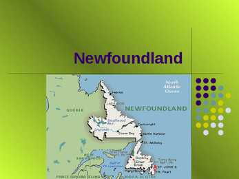
Newfoundland Geography Newfoundland and Labrador is located on the eastern edge of North America. Newfoundland and Labrador is home to Iceberg Alley, one of the best places in the world to view icebergs. Just off the coast, the meeting of the cool Labrador Current and the warm Gulf Stream creates an abundance of marine life that attracts thousands of whales, and provides rich nesting grounds for millions of seabirds. To put things in perspective, Newfoundland and Labrador is a little smaller than California, slightly bigger than Japan, and twice the size of the entire United Kingdom. Geography The island of Newfoundland covers 111,390 square kilometres. With the addition of the vast territory of Labrador, the province covers a total area of 405,212 square kilometres, and has more than 29,000 kilometres of unspoiled coastline. Nature Newfoundland and Labrador is one of the best places to...
Harjumaa Harju County is situated in northern Estonia. Harju County, bordered by the south- westcounty, Rapla County in the south, south-east and east Järva county Lääne- Viru county. County, bounded on the north Gulf of Finland. Harju is composed of many islands, the largest of these is the Women's Island and the islands Pakri. Harju county has six self-governing city, a municipal city, 2 towns, 31 small towns and 395 villages. Harju county has 21 bigger cities Loksa, Nissi, Vasalemma, Paldiski, Kernu, Keila, Saue, Harku, Saku, Tallinn, Viimsi, Ostrava, Rae, Kose Kõue, Raasiku, Jõelähtme, Maardu, Anja, Kuusalu, Loksa, Aegviidu. 34 rivers flowing into the sea within the county and other watercourses, the drainage basin is the largest and tallest Jägala, Keila and the Pirita River and White River. Harjumaa Ülemiste Lake is the largest, and the Kahala Harku lake, too. Tallinn's surface w...
Canada Canada is the second largest country in the world by total area, which is about 10 million sq km. It extends from the Atlantic Ocean in the east to the Pacific Ocean in the west and northwarsd into the Arctic ocean. Canada shares land borders with the USA to the south and north-west. The population of Canada is about 33,3 million and the capital is Ottawa. The first inhabitants of Canada were native Indian peoples, primarily the Inuits. Starting from the late 15th century both British and French expeditions explored and later settled the Atlantic coast. French ceded nearly all of its colonies in North-America in 1763 after the Seven Years War. Canada is a parlamentary democracy and a constitutional Monarch with Queen Elizabeth the Second as a head of state. The federal comprises ten provinces and three territoties. Canada is a bilingueal and multicultural country. Both English and French are official languages at federal level. ...
The history of Scotland begins around 10,000 years ago, when humans first began to inhabit what is now Scotland after the end of the Devensian glaciation, the last ice age. Of the Stone Age, Bronze Age, and Iron Age civilization that existed in the territory, many artifacts remain, but few written records were left behind. The recorded history of Scotland begins with the arrival of the Roman Empire in Britain, when the Romans occupied what is now broadly England, Wales and the Scottish Lowlands, administering it as a Roman province called Britannia. To the north was territory not governed by the Romans -- Caledonia, by name. Its people were the Picts. From a classical historical viewpoint Scotland seemed a peripheral country, slow to gain advances filtering out from the Mediterranean fount of civilisation, but as knowledge of the past increases it has become apparent that some developments were earlier and more advanced than previously ...
Native Americans. ¤ over 500 nations/tribes ¤ closeness to nature ¤ europeans came for the free land ¤ less civilized ¤ they lived in teepee's ¤ they hunted buffalos for food, clothing BERENGIA- Land Bridge connecting Asia (Siberia) to Alaska 1500 km wide North to South 65 000 B.P (before the present) rised out of the sea to 40 000 B.P a wave when people came from west. 36 000-32 000 B.P arrived people CHEROKEE. Southeast U.S- their heartland, not on the ocean. Lanuage + customs + weapons-> related to IROQUIS family of nations (Iroquis lived around Great Lakes) 1300 A.D. established in South East U.S Classical Cherokee Civilization 16th-19th centuries MATERINEAL-(,,mother line") women controlled home, family, children, inheritana, clan membership. Men hunted and made babies. Cherokee Wedding Ceremony- ¤groom brings meat(,,hunter") ¤ bride brings other food (grains, berries etc.) -> prooves that she's ,,homemaker" They step on the Cere...
The foundation stones The Island Britain has a mild climate due to the Gulf Stream which brings warm waters from the Gulf of Mexico. The northern part of the island in average 5'C cooler and it's mountainous or hilly and that's why the south has been more populated.. Britain became an island only 5000 years BC after the Ice Age ended. Britain's prehistory The first evidence of human life on the island are dated back to 250 000 BC. 50 000 BC in a milder Ice Age period Britain became habitable again. People from that time were the ancestors of the modern British. 10 000 BC ige age ended and Britain became inhabited by small groups of hunters who probably followed herds of deer. 5000BC Britain became an island and deer died out. 3000BC the Neolithic people came (probably from Spanish peninsula or even North African ...
Geography The name Australia means ,,southland". It is both a country and a continent, with an area of 7,617,930 square kilometres and it is also an island, separated from Asia by the Arafura and Timor seas. But Australia is also surrounded by the Indian and Pacific oceans. The Great Barrier Reef is the world's largest coral reef. It lies off the north-eastern coast and extends for over 2000 kilometres. The famous mountain range in the eastern part of Australia is the Great Diving Range and it's highest peak is Mount Kasciusco's 2230m. In the continental part, there are the Macdonnell ranges. Other smaller mountain ranges are the Musgrave Mountains, the Hammessley Mountains and the Darling Mountains. The continental part of Australia is mostly covered with deserts and these deserts are the Great Sandy Desert in the north-western part, the Great Victoria dessert in the southern part and Gibson desert and the Simpson desert. The Murr...
Introduction The United States of America is a very big country. Its territory is about 9.4 million square kilometres and its population is more than 260 million people, 12% of them are the Afro-Americans. It is the world's third-largest country by size and by population. The population density is about 27 people per square kilometre. Most of the people live in towns. There are 50 states in America. The biggest of the state is Texas, next by size are California, Alaska and Montana. Six states - Maine, Vermont, New Hampshire, Connecticut ,Rhode Island and Massachusetts are called New England. They are all small states in the U.S. that lie in the north-east. The first colony of immigrants settled down in Virginia, in the eastern part of the U.S.A. The biggest cities are New York, Washington, Chicago, Los Angeles, San Francisco, etc. The official language of the USA is English; Spanish is also...
Ottawa Ottawa is the capital of Canada and a municipality within the Province of Ontario. Located in the Ottawa Valley in the eastern portion of Southern Ontario, the city lies on the southern banks of the Ottawa River, a major waterway forming the local boundary between the Provinces of Ontario and Quebec. The 2006 Census recorded the population at 812,129, making it the fourth largest municipality in the country and second largest in Ontario. Connected by several bridges to its Quebec neighbour , the City of Gatineau on the northern shores of the Ottawa River, the two cities had a combined 2006 population of over 1,130,000, making it the country's fourth largest metropolitan area. On December 31, 1857, Queen Victoria was asked to choose a common capital for the Province of Canada (modern day Ontario and Quebec) and chose Ottawa. While Ottawa is now a major metropolis and Canada's fourth largest ci...
The united kingdom · Britain includes all the islands the republic of ireland, northern ireland, scotland, wales and england, which lie off the north-west coast of mainland europe. · Great britain comprises england, wales and scotland. The full name is the united kingdom · Covering 242,500 sq km, britain nearly 500 kmwide and almost 1,000 km long. The climate is tempererate but subject to frequent changes. Wettest areas- north and west, the warmest- south-east. Longest river, the severn, flows for 354 km and the largest lake is lough neagh 388 sq km. Scotland is the most mountainous part and the highest peak ben nevis 1,343 m high · Britain is relatively densely populated contry with some 57 million people(ranks 16in the world in terms of population )in london thers around 8 million people. England has the highest population density of four lands and scotland teh lowest. · T...
The united kingdom · Britain includes all the islands the republic of ireland, northern ireland, scotland, wales and england, which lie off the north-west coast of mainland europe. · Great britain comprises england, wales and scotland. The full name is the united kingdom · Covering 242,500 sq km, britain nearly 500 kmwide and almost 1,000 km long. The climate is tempererate but subject to frequent changes. Wettest areas- north and west, the warmest- south-east. Longest river, the severn, flows for 354 km and the largest lake is lough neagh 388 sq km. Scotland is the most mountainous part and the highest peak ben nevis 1,343 m high · Britain is relatively densely populated contry with some 57 million people(ranks 16in the world in terms of population )in london thers around 8 million people. England has the highest population density of four lands and scotland teh lowest. · T...
Estonia Location Estonia officially the Republic of Estonia is a state in the Baltic region of Northern Europe. It is bordered to the north by the Gulf of Finland, to the west by the Baltic Sea, to the south by Latvia and to the east by the Lake Peipsi and the Russian Federation. Across the Baltic Sea lies Sweden in the west and Finland in the north. Size and population The territory of Estonia covers 45,227 km2 Estonian population is 1.34 million Largest cities of Estonia 1. Tallinn (Estonian capital city) 2. Tartu 3. Narva 4. Kohtla-Järve Tallinn Tartu Narva Kohtla-Järve Largest islands of Estonia There are 1521 islands. 1. Saaremaa 2. Hiiumaa 3. Muhu 4. Vormsi Hiiumaa Saaremaa Vormsi Muhu Longest river of Estonia 1. Võhandu 2. Pärnu 3. Põltsamaa Võhandu river Põltsamaa river Pärnu river Estonian seasons There are four se...
UK Conservation & Environment 1. What does AONB stand for? 2. What type of environment does the Ramsar Convention protect? 3. Which country has the greatest proportion of its land devoted to National Parks and other countryside conversation areas: England, Scotland, Wales or Northen Ireland? 4. Which is the main contributing gas to the greenhouse effect? 5. Which fortification in Britain dates from the Roman era and is listed in the World Heritage List? 1. Area of outstanding natural beauty 2. Wetlands 3. Northen Ireland 4. Carbon dioxide 5. Hadrian's Wall, in the north of England Physical geography 1. Which of the following countries is the nearest continental neighbour to Great Britain: Denmark, Portugal, France or Greece? 2. Which of these cities are close to the same line of latitude as London: Berlin, Moscow, New Yo...
Topic The United States of America The U.S.A. is situated in the central part of the North American continent. The area of the U.S.A. is over nine million square kilometres. Its western coast is washed by Pacific Ocean and its eastern coast by the Atlantic ocean and the Gulf of Mexico. The continental United States is bounded to the North by Canada and to the South by Mexico. There are two mountain ranges in the continental United States: the Appalachians in the east and the Rockies in the west. In the very middle of the continent is the Mississippi river. The five Great lakes, between the U.S.A. and Canada, are joined together by short rivers or canals. They are connected with the Atlantic Ocean by the St. Lawrence River, and with the Hudson River by a canal. In the west of the U.S.A. there is another big lake called the Great Salt Lake. Hawaii, a...
1) Standard and non-standard varieties of English Standard varieties of English are the varieties of the English language that are considered to be a norm and are spoken and written by the minority (educated people). This is the optimum for educational purposes. The standard varieties of English are: BrEng (British), EngEng (English), NAmEng (North-America), USEng (United States), CanEng (Canada), AusEng (Australia), NZEng (New Zealand). Standard English (British English) is the most widely accepted and understood among native speakers, learned by foreigners. It is used in broadcasting, TV, news etc. It doesn't concern pronounciation (accent), but grammar and vocabulary. It includes formal and informal styles. British Standard English grammar and vocabulary, together with the RP accent should be called English English. RP (Received Pronounciation) is an accent that originates from South-East of England. A social accent, associated o...
Liigendtabel (Pivot Table) Mugav kokkuvõtete tegemiseks tabeli andmetest. Määratakse tabeli väljad ridade ja veergude gruppideks (ja pealkirjadeks) Määratakse väljad kokkuvõtteks. Korraldus TABLE TOOLS, Design, Tools, Summarize with PivotTable või INSERT, Tables, PivotTable Salesperson Region Account Order Amount Month Albertson, Kathy East 29386 $925,00 January Albertson, Kathy East 74830 $875,00 February Albertson, Kathy East 90099 $500,00 February Albertson, Kathy East 74830 $350,00 March Brennan, Michael West 82853 $400,00 January Brennan, Michael West 72949 $850,00 January Brennan, Michael West 90044 $1 500,00 January Brennan, Michael West 82853 $550,00 February Brennan, Michael West 72949 $400,00 March Davis, William South 55223 $235,00...
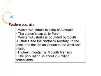
Western australia § Western Australia is state of Australia § The states´s capital is Perth § Western Australia is bounded by South Australia and the Northern Territory to the east, and the Indian Ocean to the west and north. § Highest moutain is Mounth Meharry § The population is about 2,2 miljon inhabitants. History Australian Aboriginal were the original inhabitants of Australia (60000 years ago). The first European visiter was Dutch explorer Dirk Hartog in 1616. On 1 January 1901, Western Australia joined the other Australia states. 1890 the population started to grow due to discovering gold. Coat of arms Flag Australian aboriginal culture According to Australian Aboriginal culture belief, spirit ancestors breathe life and energy into traditional dance, song and design and play a crucial role. Australian Aboriginal culture is widely seen as one of th...
15.04.2012 Report California Tabasalu Gymnasium 7.b class Vivian ruumet California is a state located on the West Coast of the United States. There are many famaous cities like Los Angeles, San Fransisco and many others. California neighbour states are Oregon to the north, Nevada and Arizona to the west and Mexican to the south. The population of California is about 38,000,000 and area is 423,970 square kilometers. California`s climate varies from Mediterranean to subarctic. Much of the state has a climate with cool, rainy winters and dry summers. There are more rain in the southen part of California. The Golden Gate bridge in San Fransisco is one of the most famous landmark in California. The Golden Gate bridge have ...
Seas around Ireland Ly Ridala 2011 Vocabulary v Shipping goods - kaubavedu v Separates -eraldab v Channel -kanal v Equator ekvaator v Radioactively contaminated radioaktiivsust sisaldav v Economic importance majanduslik tähtsus v Wind power- tuuleenergia v Main way peamine tee v Divides- jagab Vocabulary v Seal- hüljes v Area- ala v Channel- kanal v Connected- ühendatud v Cod- tursk v Haddock-kilttursk v Hake- heik v Herring- heeringas v Mackerel- makrell Basic Information Seas around Ireland are: v The Irish Sea v The Atlantic Ocean v The Celtic Sea The Irish Sea v Separates the islands of Ireland and Great Britain v St George's Channel and the North Channel v Whales and dolphins v Radioactively contaminated sea ...
Los Angeles L.A. Ursula Potivar. 8.A klass. About Los Angeles. Los Angeles is the largest city in the state of California and the second largest in the United States. Often abbreviated as L.A. Nickname The City of Angels. Los Angeles was founded September 4, 1781, by Spanish governor Felipe de Neve. The current mayor is Antonio Villaraigosa. Population. By 1900, the population had grown to more than 102,000 people Now Los Angeles has a population of 12,9 million people. The history of Los Angeles. In the 1870s, Los Angeles was still little more than a village of 5,000. By 1900, there were over 100,000 occupants of the city. The first railroad, San Pedro Railroad, in what is today Los Angeles was inaugurated in October 1869 The Los Angeles coastal area was first settled by the Tongva and Chumash Native American tribes thousands of years ago Click to ...
Australia Australia is the world driest continent. More than two-thirds of country is desert or dry bushland. The climate is tensely hot. Australia is relatively flat country with mountainous only in the eastern regions. Most Australians live in the southern part of the country, where winters are wild and the summers are sunny and warm. The Great Barrier Reef is Chain of 500 island and coral reefs 2000 km long, near the coast of the north-east Queensland. It is one of the natural wonders of the world. There are some 150 million sheep in Australia. This is one-fifth of the total number of sheep in the world. Dingers are wild dogs of the outback, believed to have been brought to Australia by the Aboriginats tohusand of years ago. They are expert hunters. In the hot climate of north Australia, most houses are built with verandas which provide shade. The country is divided into six self-governing sta...
Curly Birch in Estonia Ants Nokkur Metsandus Content Introduction Natural distribution Curly birch plantations Why to grow ? Curly Birch society First artificial curly birch Curly birch between 1950 and 1990 Uses of curley birch Conclusion Introduction Curly birch (Betula Klõpsake pendula var. Carelica) is juhtslaidi teksti laadide redigee Teine tase a rarity in the world. Kolmas tase Hard timber. Neljas tase Viies tase Beautiful texture. Natural distribution Klõpsake juhtslaidi teksti laadide redigeeri Very rare in natural Teine tase forests: grows Kolmas tase Neljas tase sporadically only in Viies tase northen and eastern Europe ...
GRÖÖNIMAA Nimi Gröönimaa (taani k. Grønland, grööni k. Kalaallit Nunaat) Pindala: 2 166 086 km² (81% kaetud jääga, 410 449 km² jäävaba) Rahvaarv: 56 648 elanikku (01.01.2007.a.) Rahvastiku 0,03 inimest/km2, 0,14inimest/km2 jäävabal alal tihedus Ametlik keel: taani keel ja eskimo innuttuti murre (grööni keel) laiaulatusliku autonoomiaga parlamentaarne demokraatia Riigikord: konstitutsioonilise monarhia raames Riigipea: Taani kuninganna Margrethe II Valitsusjuht Peaminister Hans Enoksen (alates 14.12.2002.a.) Pealinn: Nuuk (Godthåb), 15 047 elanikku Rahaühik: Taani kroon Loomastik Kõikjal Gröönimaa jäävabadel aladel leidub elu. Maismaaimetajaid on Gröönimaal 9 liiki: hunt, põhjapõder, kärp, ahm, lemming, jänes, jääkaru,jne. Lisaks neile võib Lõuna-Gröönimaal kokku joosta ära karanu...
Tallinn Tallinn, the capital of the republic of Estonia, is situated on the southern coast of the Gulf of Finland, in north Estonia. It has nearly half a milion inhabitants and covers an area of almost 160 sqkm. The largest lake in Tallinn is Lake Ülemiste. It is the main source of the city's drinking water. The first inhabitants are believed to have come here 3500 years ago.Tallinn was first mentioned in 1154. Tallinn wa s found e d in th e 10th c e ntury a s a m e r c h a nt s' s ettl e m e nt c all e d Lind ani s e . But o nly at th e b e ginnin g of th e 1 3th c e ntury t Dan e s e st a blis h e d R e v al (whic h wa s Tallinn's n a m e till 1 91 8 ) a s a fortified city. T h e c urr e nt n a m e Tallinn wa s m o st pr o b a bly d eriv e d fro m th e old E stonian n a m e Taani linn (Dani s h town). T h e s q u ar e in front of th e Town Hall fun ction e d a s a m a rk etpla c e e v e n b e...
Hadrian's Wall Hadrian's Wall was a stone and turf fortification built by the Roman Empire across the width of Great Britain to prevent military raids by the tribes of Scotland to the north, to improve economic stability and provide peaceful conditions in the Roman province of Britannia to the south, to physically mark the frontier of the Empire, and to separate the unruly Selgovae tribe in the north from the Brigantes in the south and discourage them from uniting. The name is also sometimes used jocularly as a synonym for the border between Scotland and England, although for most of its length the wall follows a line well south of the modern border -- and neither the Scoti tribe nor the English lived in Britain at the time of the wall's construction. The wall was the northern border of the Empire in Britain for much of the Roman Empire's rule, and also the most heavily fortified border in the Empire. In addition to its use as a milit...
LANDMARCS HYDE PARK: Hyde Park is one of the largest parks in central London, England and one of the Royal Parks of London, famous for its Speakers' Corner. The park is divided in two by the Serpentine. The park is contiguous with Kensington Gardens; although often still assumed to be part of Hyde Park, Kensington Gardens has been technically separate since 1728, when Queen Caroline made a division between the two. THE TOWER OF LONDON: Her Majesty's Royal Palace and Fortress, more commonly known as the Tower of London (and historically as The Tower), is a historic fortress and scheduled monument in central London, England, on the north bank of the River Thames. It is located within the London Borough of Tower Hamlets and is separated from the eastern edge of the City of London by the open space known as Tower Hill. It is the oldest building used by the British government. [1] TOWER BRIDGE: Tower Br...
Topic Estonia, Tallinn The Republic of Estonia is the northernmost of the three Baltic States on the eastern shore of the Baltic Sea. To the east Estonia borders on Russia and Lake Peipsi and on the south on Latvia. The area of Estonia is 45 100km2, its coastline is 774km long. The geography of the land is surprisingly varied. Islands make up 9,2 per cent of Estonian's total territory, the largest islands are Saaremaa, Hiiumaa and Vormsi. The highest point is Suur Munamägi, which is 317m high. Estonia has a surprisingly mild climate for an area so far north. Sea winds keep the weather from becoming very cold or hot. The population of Estonia is 1.5 million. Of this number 62 per cent are Estonians. Estonians speak the Estonian language, which is closely related to Finnish. Estonia's flag has three horizontal stripes. The blue stripe at the top of the fla...
Topic Canada History The first people to live in what is now Canada arrive from Asia at least 20 000 years ago. They arrived by a way of a land bridge that once connected Asia and North America at what is now Alaska. In 1497, John Capot, an Italian navigator in the service of England found rich fishing grounds off Canada's southeast coast. France took the lead in exploring the country and set up a colony in eastern Canada in the early 1600's. Great Britain gained control of the country in 1763 and thousands of British immigrants began to join the French who remained in Canada. Canada gained its independence from Britain in 1931. Position/area Canada is the second largest country in the world. Canada extends across the continent of North America, from Newfoundland to British Columbia. Over 5000 km of border separate Canada and the United States...
Tundra swans Tundra swans ● Whooper swan, Bewick´s swan and mute swan (laululuik, väikeluik, kühmnokk-luik) Whooper swan ● Large white swan (bigger than bewick) ● Lenght – 140 to 165 cm ● Deep honking call and powerfull fliers ● Require large areas to live in ● Adult birds – feathers entirely white, black feet, mostly black bill ● Pens (females) – slightly smaller than cobs (males) ● Immatures – white mixed with some dull grey feathering; bills – black, large dirty-pink patch ● In Estonia first nesting - 1979 Whooper swan Behaviour of whooper swan ● Pair for life, cygnets stay with them all the winter ● Breffered breeding habitat – wetlands ● Both build the nest ● Male will stand guard over the nest while female incubates ● 4 to 7 eggs Influence of whooper swan ● Much admired in Europe ● National bird ...
WTO Maailma Kaubandusorganisatsioon. World Trade Organisation. Eesmärgiga edendada vabakaubandustja kehtestada ühtsed kaubandusreeglid maailmas, 1995,140. NAFTA Põhja-Ameerika vabakaubanduse Assotsiatsioon. North American Free Trade Agreement.Loomaks kaupade ja teenuste vabakaubanduspiirkond.1994. ASEAN Kagu Aasia Maade Assotsiatsioon. Association of South East Asian Nations. loomaks Aasiasse maailma suurim vabakaubandustsoon. 1967. EL/EU Euroopa Liit. European Union. Hõlbustamaks kaubavahetust euroopasiseselt. 1952, 27 G7/G8 eesmärk genereerida meetmeid, mis tagaksid jäitkuva majanduskasvu.1975. OPEC 1960 Naftat eksportivate riikide organisatsioon. Organization of Petroleum Exporting Countries. Eesmärk kujundada naftahinda ja hoida seda võimalikult kõrgel. NATO Põhja-Atlandi Lepingu Organisat-sioon. North Atlantic Treaty Organization. ÜRO Ühinenud Rahvaste Organisatsioon. United Nations Organization Ülemaailmne rahu-ja ...
WALES . Wales is a country that is part of the United Kingdom , bordered by England to its east , and the Atlantic Ocean and Irish Sea to its west . It is also an elective region of the European Union . Wales has a population estimated at three million . The capital Cardiff is Wales's largest city with 317,500 people . For a period it was the biggest coal port in the world . Cardiff is the largest media centre in the UK outside of London . Wales is located on a peninsula in central-west Great Britain . Its area , the size of Wales , is about 20,779 km² . Wales is bordered by England to the east and by sea in the other three directions : The Bristol Channel to the south , St. George's Channel to the west , and the Irish Sea to the north . The main population and industrial areas are in South Wales ,consisting of the cities of Cardiff , Swansea and Newport and surrounding areas , with another signifi...
The West End Trafalgar Square is called the heart of London because it connects the political area of Westminster to the rest of West London. Lord Nelson's column stands in the center of the beautiful square. Horatio Nelson was a great British commander who defeated Napoleon in the Battle of Trafalgar but unfortunately he himself was killed. To the north and west from the Trafalgar Square is the West End, which is London's main shopping and entertainment area. Most of London's best residential and commercial areas are in the West End. You can find there expensive shops, restaurants, hotels, museums and many art galleries. Great Britain's biggest department store is in Knightsbridge. It was founded in 1834 by Charles Henry Harrod. Harrods is also the world's first building with an escalator. Today Harrods is an amazing place with over 330 shops, which includes twenty-six fine eating places, where you can go eat...
Ursula Potivar Geography of Madagascar Topography Madagascar is an island in the Indian Ocean off the eastern coast of southern Africa, east of Mozambique. At 587,000 square kilometres, Madagascar is the world's 46th-largest country and the fourth- largest island. Madagascar can be divided into five geographical regions: the east coast, the Tsaratanana Massif, the central highlands, the west coast, and the southwest. The east coast The east coast consists of a narrow band of lowlands, formed from the sedimentation of alluvial soils and zone, composed of steep bluffs, alternating with ravines bordering an escarpment of about 500 meters in elevation. The coastline is straight, with the exception of the bay. The east coast is considered dangerous for swimmers and sailors because of the large number of sharks that frequent the shoreline. The Tsaratanana Massif region The is...
The United Kingdom is an island located on the North-Western coast of continental Europe, while the United States of America is situated mostly in central North America where forty-eight states of it's 50 lie, with the exception of Alaska and Hawaii. The population in the UK is about 62 million people whilst in the US that number is about 300 million, making it the third largest country in the world by population. The languages in Britan and America are varieties of english and therefor very similar. The capital of England is London and the capital of America is Wachington D.C., formally the District of Columbia. Whilst the capital of Great Britain is also it's largest city, it is not so in the United States, where the biggest city is New York with a population of over 8 million and about 20 million if you count the metropolitan area (people living in the immediate surrounding area outside of t...