USA General information is a federal constitutional republic comprising fifty states and a federal district The country is situated mostly in central North America, where its forty-eight contiguous states Capital: Washington D.C Largest city: New York City There isn't official language Currency: United States dollar ($) President: Barack Obama ( Barack Hussein Obama II) Flag Names: The Stars and Stripes, Old Glory, The Starry Banner Seal: Great Seal of the United States Motto: In God We Trust 9.83 million km2 and with over 308 million people, the United States is third largest country both by land area and population It is one of the world's most ethnically diverse and multicultural nations The U.S. economy is the world's largest national economy Click to edit Master text styles Second level Third level Fourth level Fifth level
ENGLAND General overview England is part of the United Kingdom Land borders with Scotland to the north and Wales on to the west The English Channel on south separates it form continental Europe The country includes over 100 smaller islands Capital and largest city is London Its has consitutional monarchy Monarch is Elizabeth II Total area is 130,395 km2 Population is 51,446,000 million, around 84% of the population of the UK Currency is Pound stearling(GBP) Has left-hand traffic Patron saint is ST. George Geography England comprises the central and southern two-thirds of the island of Great Britain, in addition to a number of small islands of which the largest is the Isle of Wight Much of England consists of rolling hills, but it is generally more mountainous in the north with a chain of mountains, the Pennines, dividing east and west Other hilly areas in the north and Midlands are the Lake District, the North York Moors, and the Peak Di
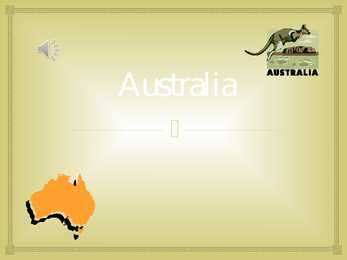
Australia Australia , officially the Commonwealth of Australia, is a country in the Southern Hemisphere comprising the mainland of the Australian continent, the island of Tasmania and numerous smaller islands in the Indian and Pacific Oceans. Australia flag Australia coat of arms. Australia is a cloudless dark blue sky, the bright sun, multikilometer beaches with snowwhite sand and ocean up to horizon. Australia's landmass of 7,617,930 square kilometers is on the IndoAustralian Plate. Surrounded by the Indian and Pacific oceans, it is separated from Asia by the Arafura and Timor seas. It the sixth largest country in area after Russia, Canada, China, the United States and Brazil. It is the flattest and (after Antarctica) the driest of continents, yet it has extremes of There are rainforests and vast plains in the north, snowfield
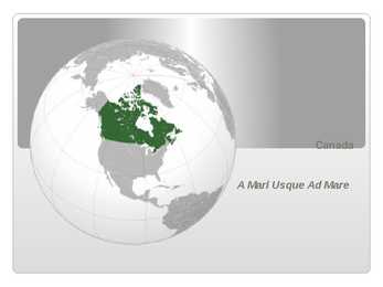
Canada A Mari Usque Ad Mare Official language(s) English, French Inuktitut, Inuinnaqtun, Cree, Recognised regional languages Dëne Sliné, Gwich'in, Inuvialuktun, Slavey, Tlch Yatiì Languages in Canada North American country consisting of ten provinces and three territories located in the northern part of the continent, it extends from the Atlantic Ocean in the east to the Pacific Ocean in the west, and northward into the Arctic Ocean spanning over 9.9 million square kilometers, Canada is the world's second largest country by total area its common border with the United States is the longest land border in the world. Some facts The land that is now Canada was inhabited for millennia by various groups of Aboriginal peoples beginning in the late 15th century, British and French France ceded nearly all of its colonies in North Amer
Võnnu Keskkool ESTONIA Referaat Autor: Klass : 9 Juhendaja: Võnnu 2013 Estonia officially the Republic of Estonia, is a state in the Baltic region of Northern Europe It is bordered to the north by the Gulf of Finland, to the west by the Baltic Sea, to the south by Latvia and to the east by Lake Peipus and Russia.Across the Baltic Sealies Sweden in the west and Finland in the north. The territory of Estonia covers 45,227km2 The Estonian climate resembles that of other countries on the Baltic littoral. On account of the country's proximity to the sea, the skies are often cloudy, and rain often falls in the spring and autumn, in the winter the rain turns to snow. The highest point in Estonia is Suur Munamäg It is in fact the highest point in the Baltic region Forest cover over one half of Estonia. The most common types of tree are pine, spruce and birch. Estonia, along with Finland and Sweden are the countries with
Estonia Topic Tallinn 2007 2 List of Contents page Facts and figures 3 Geography 3 Climate 3 Nature 4 History 5 Economy 6 Culture 6 Biggest towns 7 Language 8 3 Facts and figures The Republic of Estonia is a small country. Covering only 45, 228 sq km it is slightly bigger than Denmark, Belgium or Switzerland. Estonia's population is under 1.4 million. The official language is Estonian but since very many Russians live here Russian is also wide spread. The capital of Estonia is Tallinn. The currency used in Estonia is Eesti kroon. The Estonian national flag is blue-black-white. It was originally the flag of the Estonian Students' Society. The flag was first consecrated in Otepää Church in 1884. For a while, during the Soviet occupation, the flag was banned but it was again seen in public in Tartu in May 1988. The national flower
Tallinna Inglise Kolledz Estonia Topic Alice Tärk, 9b Tallinn 2007 FACTFILE Area: 45 228 sq km Poplulation: under 1.4 million Capital: Tallinn Language: Estonian Currency: Eesti kroon (EEK) Main religion: Lutheran National holiday: 24 February (anniversary of the republic) National flower: Cornflower National bird: Barn Swallow National stone: Limestone LOCATION The Republic of Estonia is the northernmost and smallest of the three Baltic States. It is located on the eastern shores of the Baltic Sea in the north east of Europe. To the east the country borders Russia. Latvia is the countries neighbour to the south. From the west the coast of Estonia is washed by the Baltic Sea and from the north by the Gulf of Finland. The length of the coastline is approximately 3 800 km. The longest distance from east to west is 350 km, while north to south Estonia stretches 240 km. THE NAME
Estonia is a small country in Northern Europe with an area of about 45 000 sq km. The country's climate is determined by the proximity of the Atlantic Ocean. The summer temperatures are a little lower than the average of that latitude, but the winters are considerably warmer. As a part of the East-European Plain, the country has a rather flat surface. The highest and most topographically variagated region in Estonia is in the south-eastern part of the country. The Sakala Upland plains offer contrast to the hills of Ottepää, Karula and Haanja. At 318 metres, Suur Munamägi ('Great Egg Hill') is not only the highest point in Estonia, but of all the Baltic countries. The country has 3974 km of coastline, while the land border, in comparison, is only a mere 633 km. The coast varies from limestone cliff in the north to sandy beaches in the west. Most of Estonia's many islands belong to the West Estonian archipelago. The largest islands are Saaremaa with 2671 sq km, Hiiumaa with 989 sq km


Kõik kommentaarid